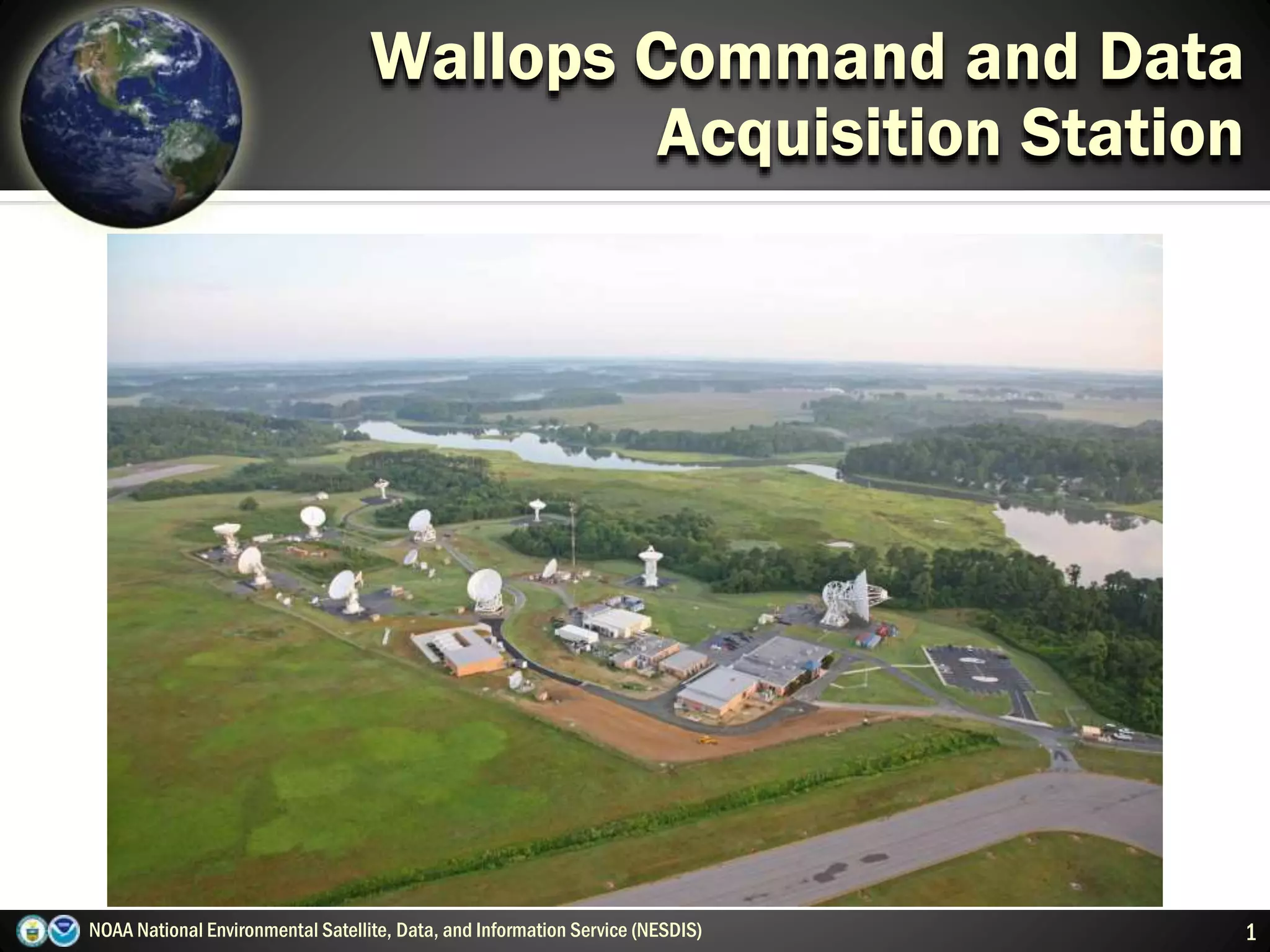
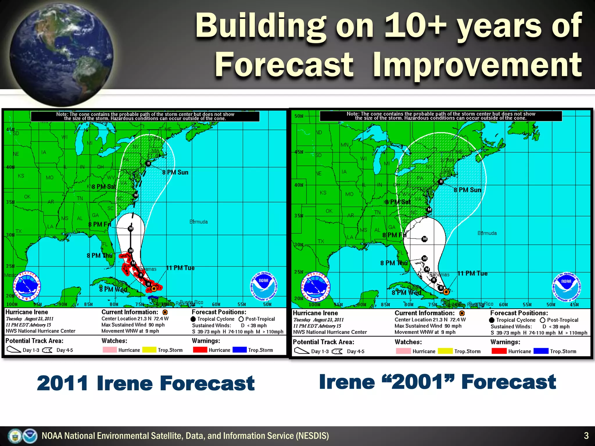
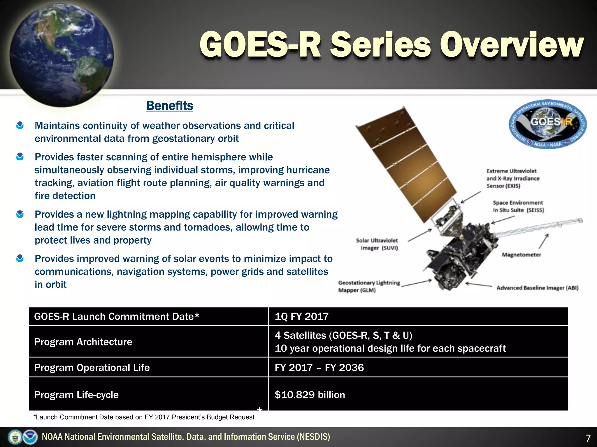
The document discusses NOAA's National Environmental Satellite, Data, and Information Service (NESDIS) and its role in managing environmental satellites. NESDIS operates two types of satellites - polar-orbiting satellites that pass over the same location twice a day and provide global coverage every 12 hours, and geostationary satellites that remain fixed over one position and continuously monitor parts of Earth. The document also provides information about the Wallops Command and Data Acquisition Station, which supports many satellite missions, and gives an overview of the GOES-R series of geostationary satellites, which will provide improved weather monitoring, lightning detection, and space weather observations starting in 2017.


![TCExam 12 [ENG] - Computer-Based Assessment](https://cdn.slidesharecdn.com/ss_thumbnails/tcexam11eng-100923042347-phpapp01-thumbnail.jpg?width=640&height=640&fit=bounds)


