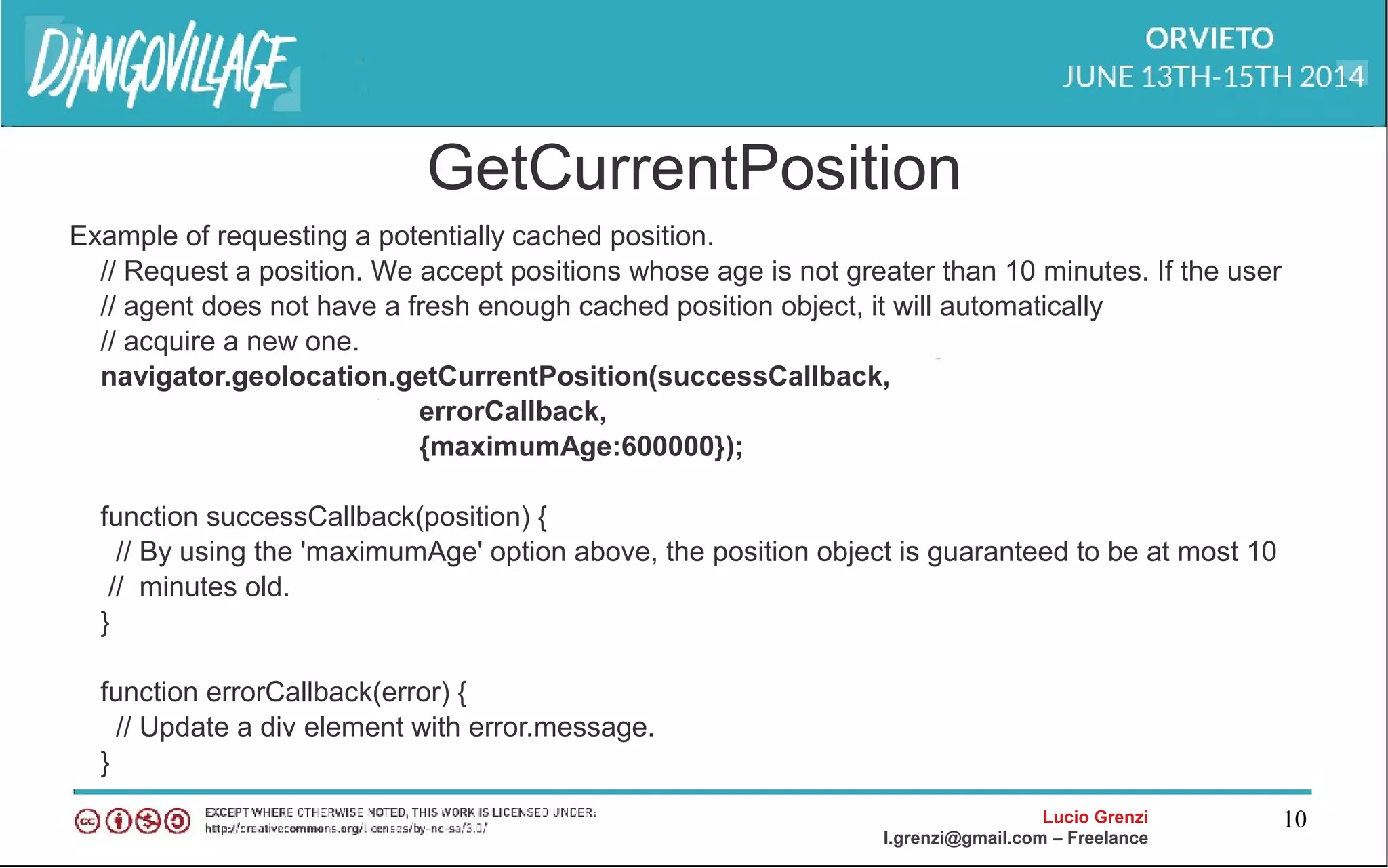
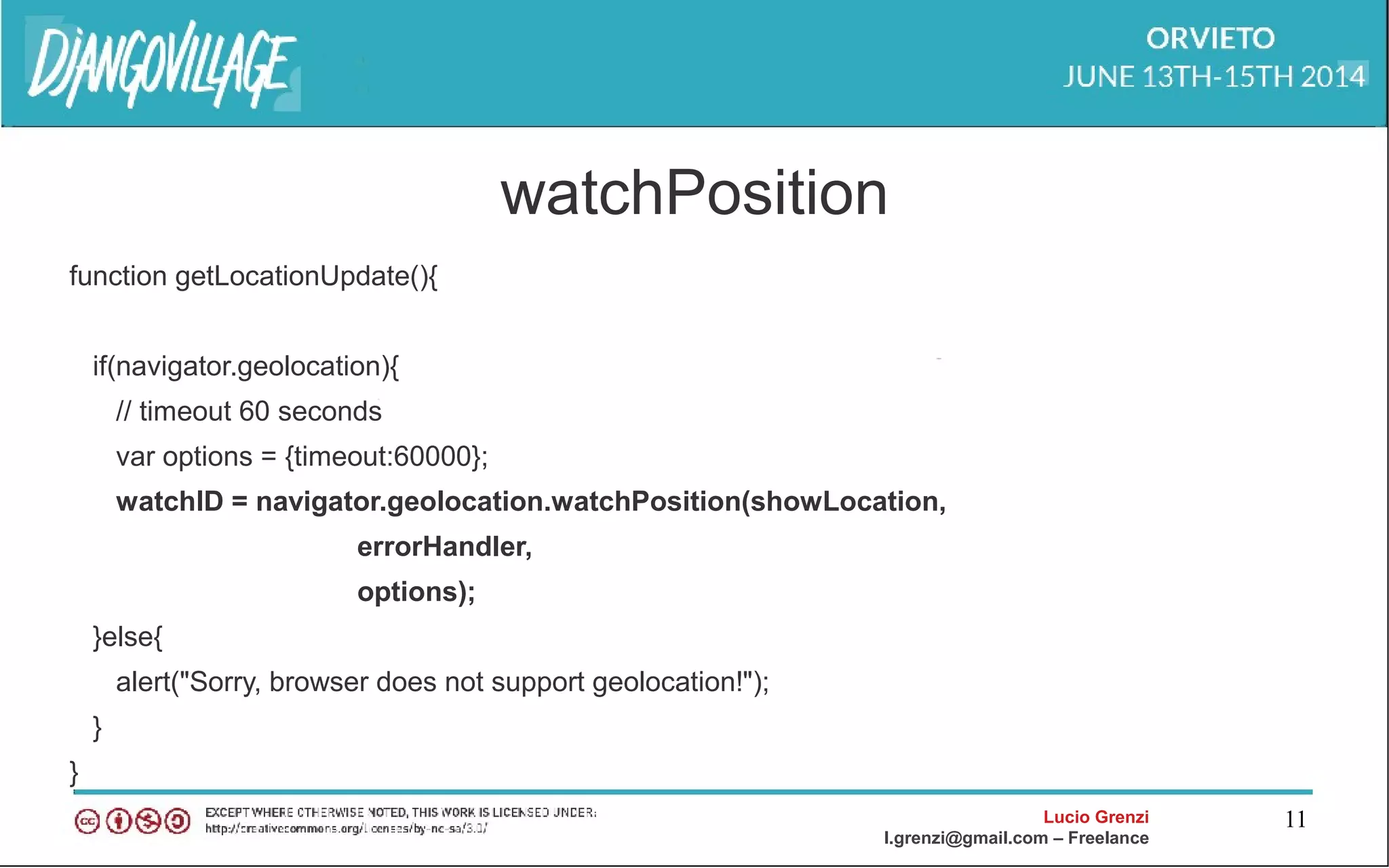
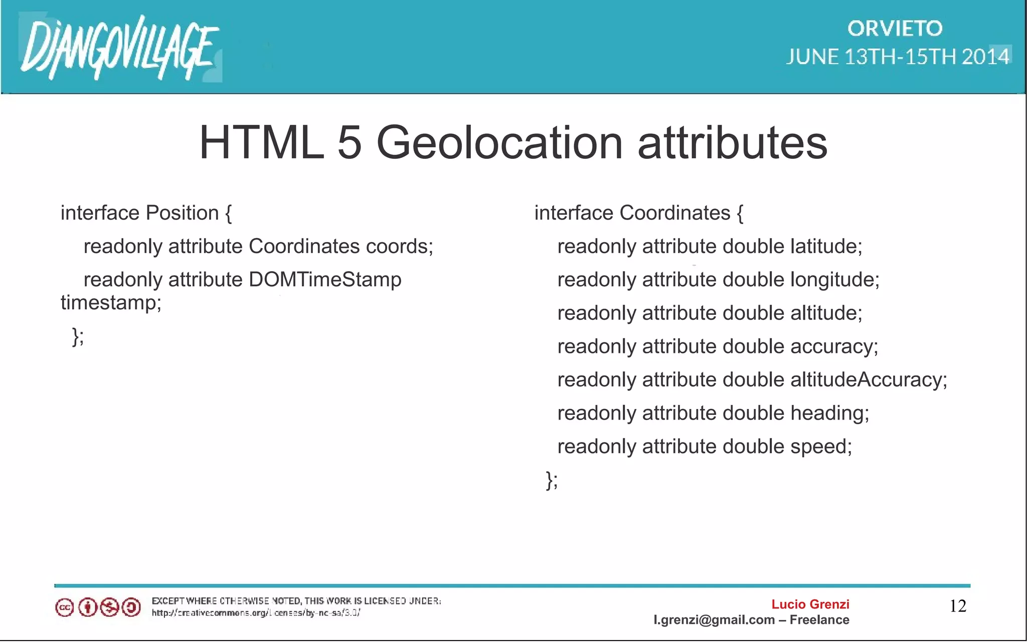
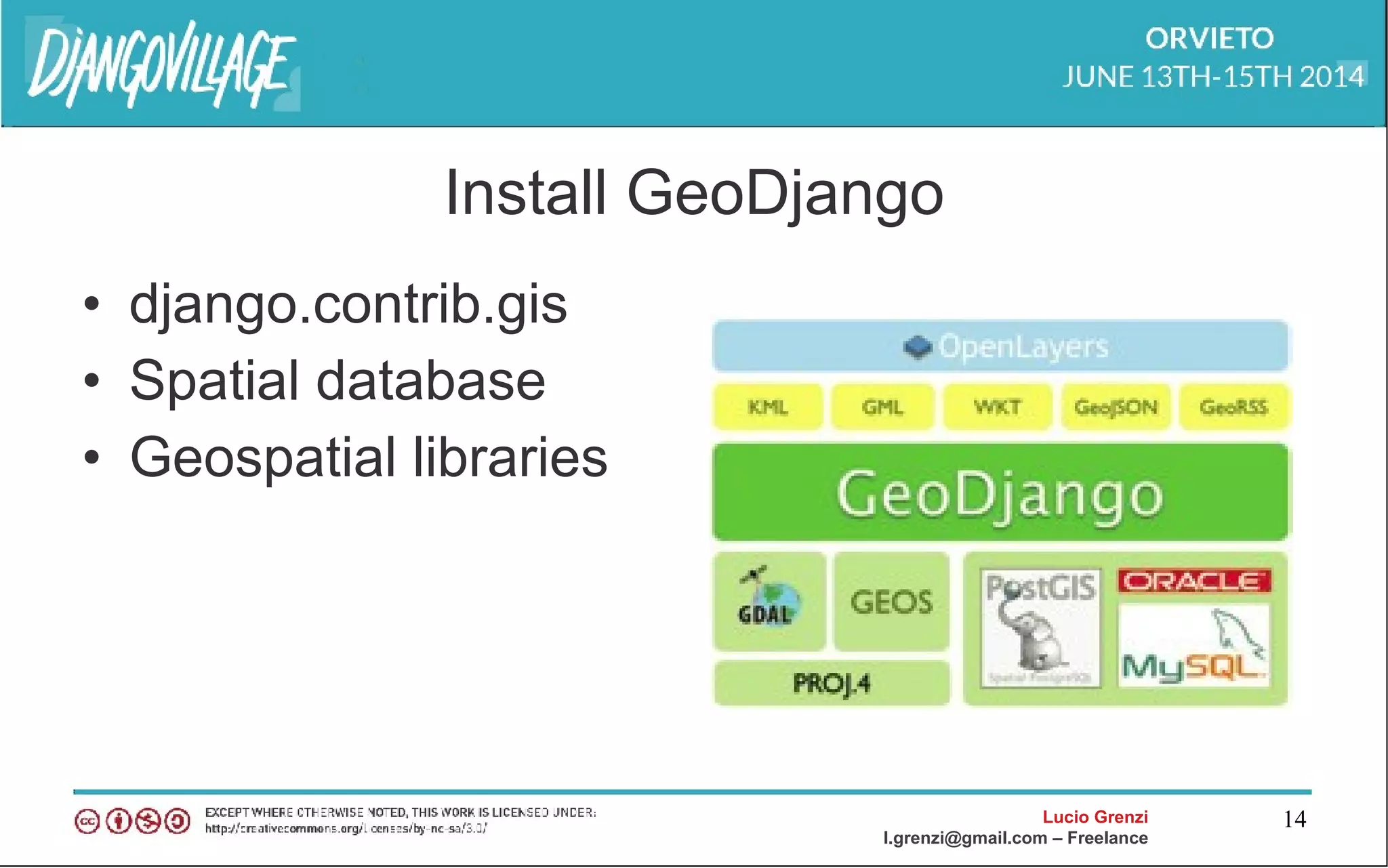
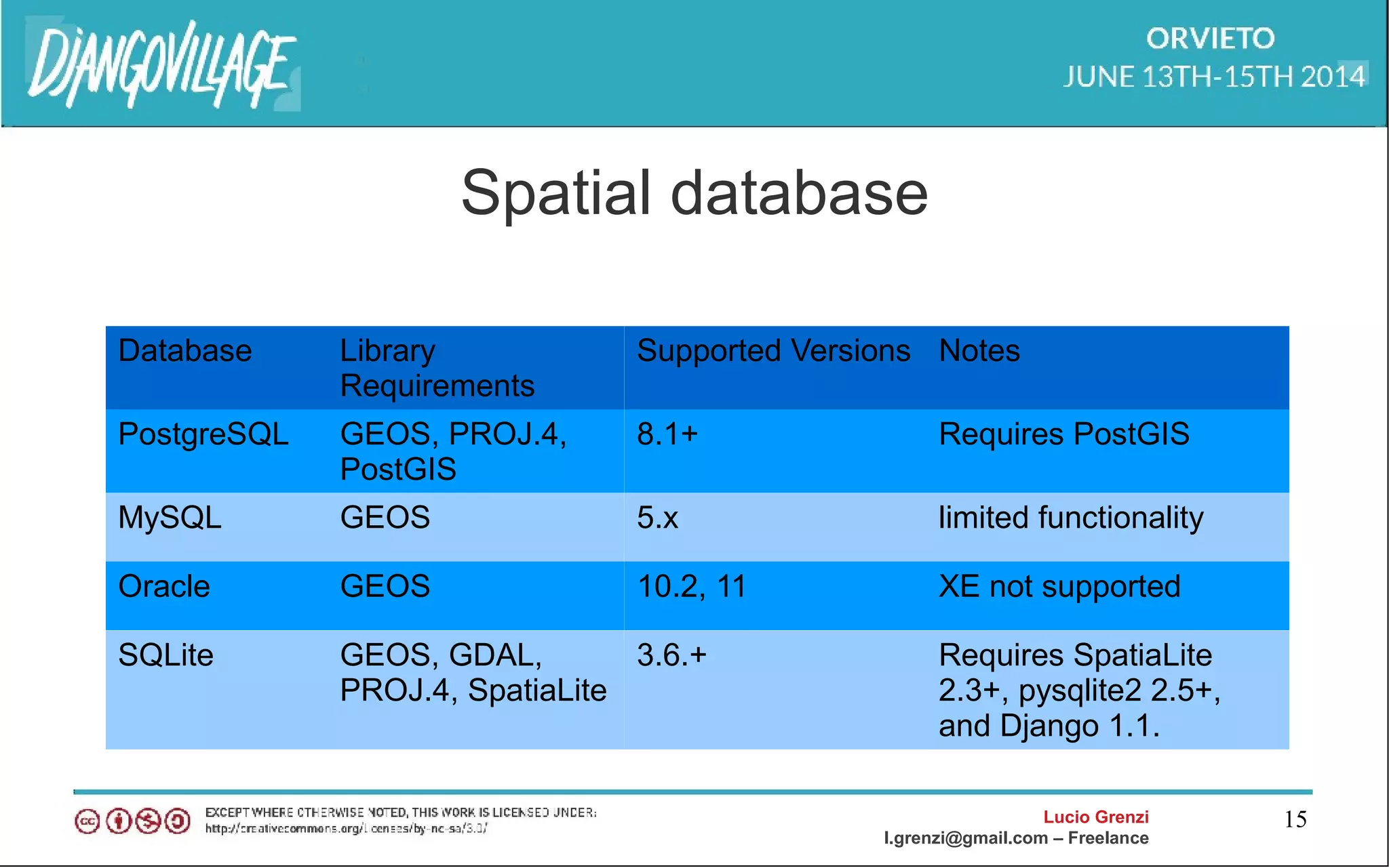
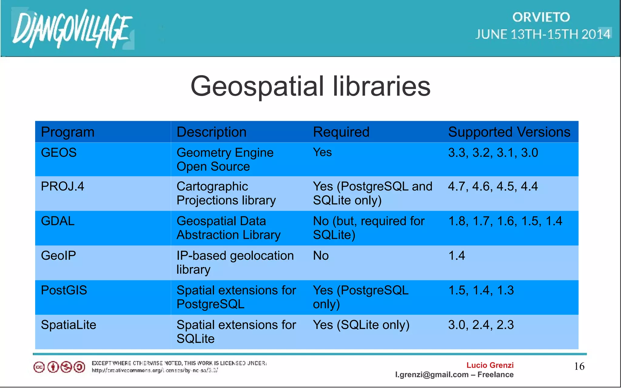
This document discusses GeoDjango and HTML5 geolocation. It begins with an introduction of the presenter and an agenda covering HTML5 geolocation, an introduction to GeoDjango, GIS data format issues, GeoDjango APIs, and using GeoDjango with Google Maps and OpenStreetMaps. It then covers specific topics like HTML5 geolocation APIs, installing and configuring GeoDjango, spatial databases, geospatial libraries, GIS data formats, and building a basic application with GeoDjango and Google Maps. Throughout there are code examples and the document concludes with references for further information.


![Lucio Grenzi
l.grenzi@gmail.com – Freelance
43
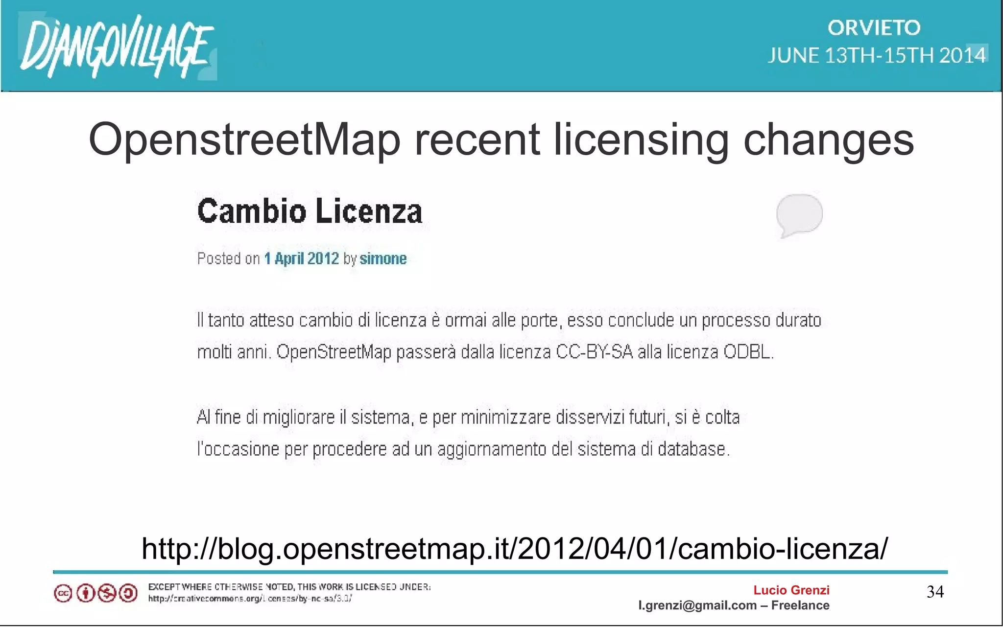
Openlayer
<html>
<head>
<script src="http://openlayers.org/api/OpenLayers.js"></script>
<script> var points = []; </script>
<ul>
{% for point in interesting_points %}
<li>{{ point.name }} -- {{point.interestingness}}</li>
<script>points.push({{point.geometry.geojson|safe}});</script>
{% endfor %}
</ul> </scrpit>
</head>
<body onload="init()">
Intersting Points.<br />
<div id="map"></div>
</body></html>](https://image.slidesharecdn.com/geodjango-djangovillage-140616142647-phpapp02/75/Geodjango-and-HTML-5-43-2048.jpg)
![Lucio Grenzi
l.grenzi@gmail.com – Freelance
44
Openlayer js script
<script type="text/javascript">
var map, base_layer, kml;
function init(){
map = new OpenLayers.Map('map');
base_layer = new OpenLayers.Layer.WMS( "OpenLayers WMS",
"http://labs.metacarta.com/wms/vmap0", {layers: 'basic'} );
var vectorLayer = new OpenLayers.Layer.Vector("Simple Geometry");
var point = new OpenLayers.Geometry.Point(-100.01, 55.78);
var pointFeature = new OpenLayers.Feature.Vector(point,null,null);
map.addLayer(vectorLayer);
map.setCenter(new OpenLayers.LonLat(point.x, point.y), 5);
vectorLayer.addFeatures([pointFeature]);
}
</script>](https://image.slidesharecdn.com/geodjango-djangovillage-140616142647-phpapp02/75/Geodjango-and-HTML-5-44-2048.jpg)
![Lucio Grenzi
l.grenzi@gmail.com – Freelance
45
Openlayer django script
vectors = OpenLayers.Layer.Vector("Simple Geometry");
for (var i = 0; i < points.length; i++) {
point = format.read(points[i])[0];
point.attributes = {'type':'point'};
vectors.addFeatures(point);
}](https://image.slidesharecdn.com/geodjango-djangovillage-140616142647-phpapp02/75/Geodjango-and-HTML-5-45-2048.jpg)