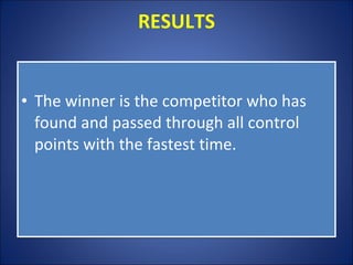
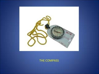
UNIT: ORIENTEERING Tema bilingüe 1º ESO Mª José Barrionuevo Martín
INDICE CONCEPT THE MAP CONTROLS CONTROL CARD RESULTS THE COMPASS
CONCEPT Orienteering is an outdoor sport using maps to find one's way. Participants are given a map, usually a specially prepared orienteering map, which they use to find control points. TYPES OF ORIENTEERING:  Foot orienteering  Mountain bike orienteering  Ski orienteering  Trail orienteering ( in wheelchair)
THE MAP Orienteering maps are topographical maps  They show hills and valleys very detailed.  The orienteering course is marked in purple or red on a map. A triangle is used to indicate the start and a double circle indicates the finish. Circles are used to show the control points.
TOPOGRAPHICAL MAP
CONTROLS Control points are marked in the terrain by white and orange "flags".
CONTROL CARD Each competitor must carry a control card, and has to present it at the Start and hand it in at the Finish.  To show that the competitor has completed the course correctly.
CONTROL CARD
RESULTS The winner is the competitor who has found and passed through all control points with the fastest time.
THE COMPASS It is exactly the same as the ones we use in class.  Here you have an orienteering compass.
THE COMPASS

Orientee(2)

  • 1.
    UNIT: ORIENTEERING Temabilingüe 1º ESO Mª José Barrionuevo Martín
  • 2.
    INDICE CONCEPT THEMAP CONTROLS CONTROL CARD RESULTS THE COMPASS
  • 3.
    CONCEPT Orienteering isan outdoor sport using maps to find one's way. Participants are given a map, usually a specially prepared orienteering map, which they use to find control points. TYPES OF ORIENTEERING:  Foot orienteering  Mountain bike orienteering  Ski orienteering  Trail orienteering ( in wheelchair)
  • 4.
    THE MAP Orienteeringmaps are topographical maps They show hills and valleys very detailed. The orienteering course is marked in purple or red on a map. A triangle is used to indicate the start and a double circle indicates the finish. Circles are used to show the control points.
  • 5.
  • 6.
    CONTROLS Control pointsare marked in the terrain by white and orange "flags".
  • 7.
    CONTROL CARD Eachcompetitor must carry a control card, and has to present it at the Start and hand it in at the Finish. To show that the competitor has completed the course correctly.
  • 8.
  • 9.
    RESULTS The winneris the competitor who has found and passed through all control points with the fastest time.
  • 10.
    THE COMPASS Itis exactly the same as the ones we use in class.  Here you have an orienteering compass.
  • 11.