Download to read offline
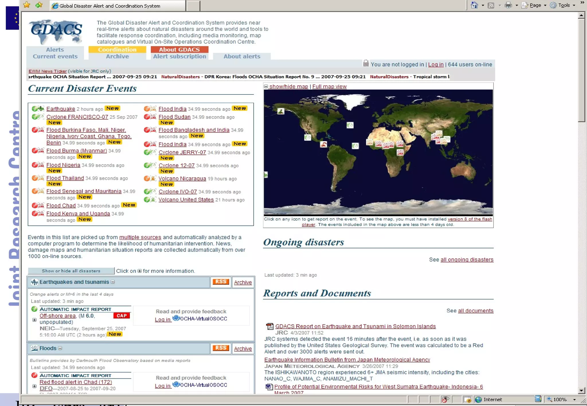
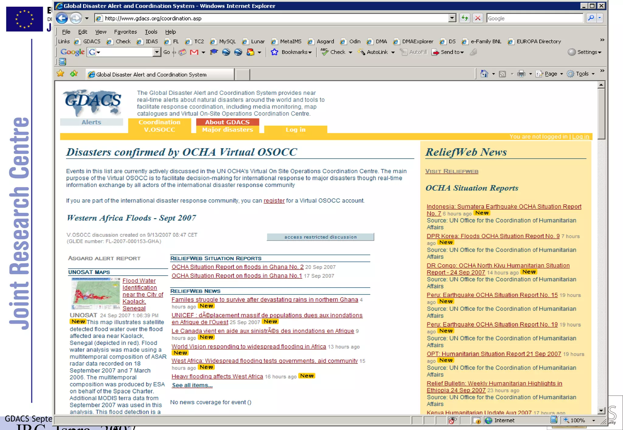
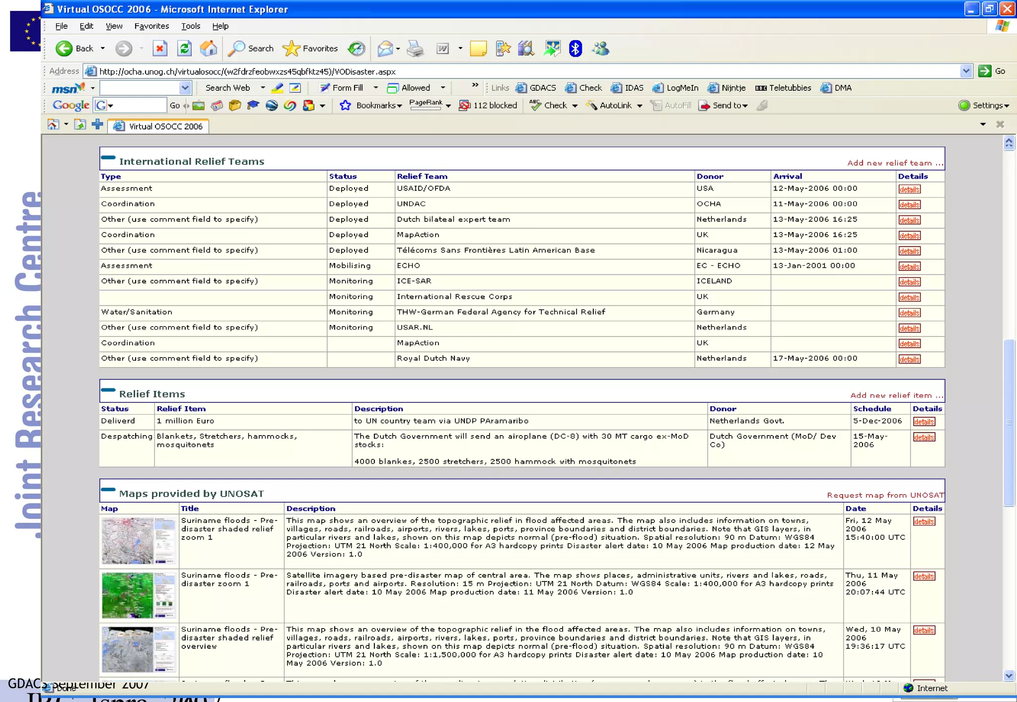
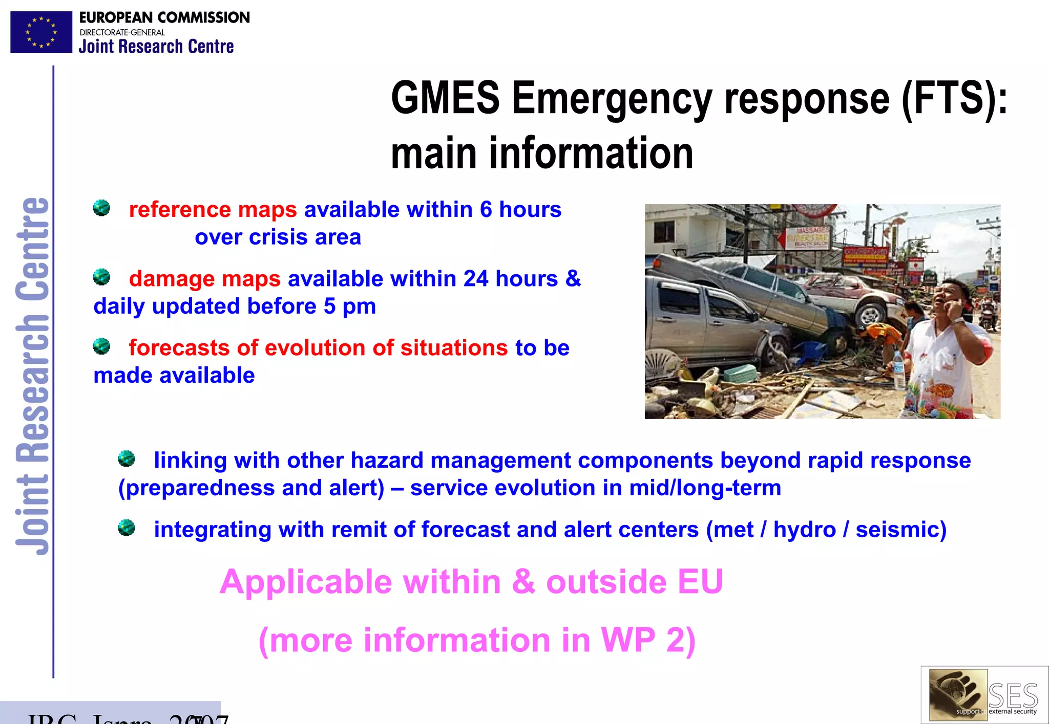
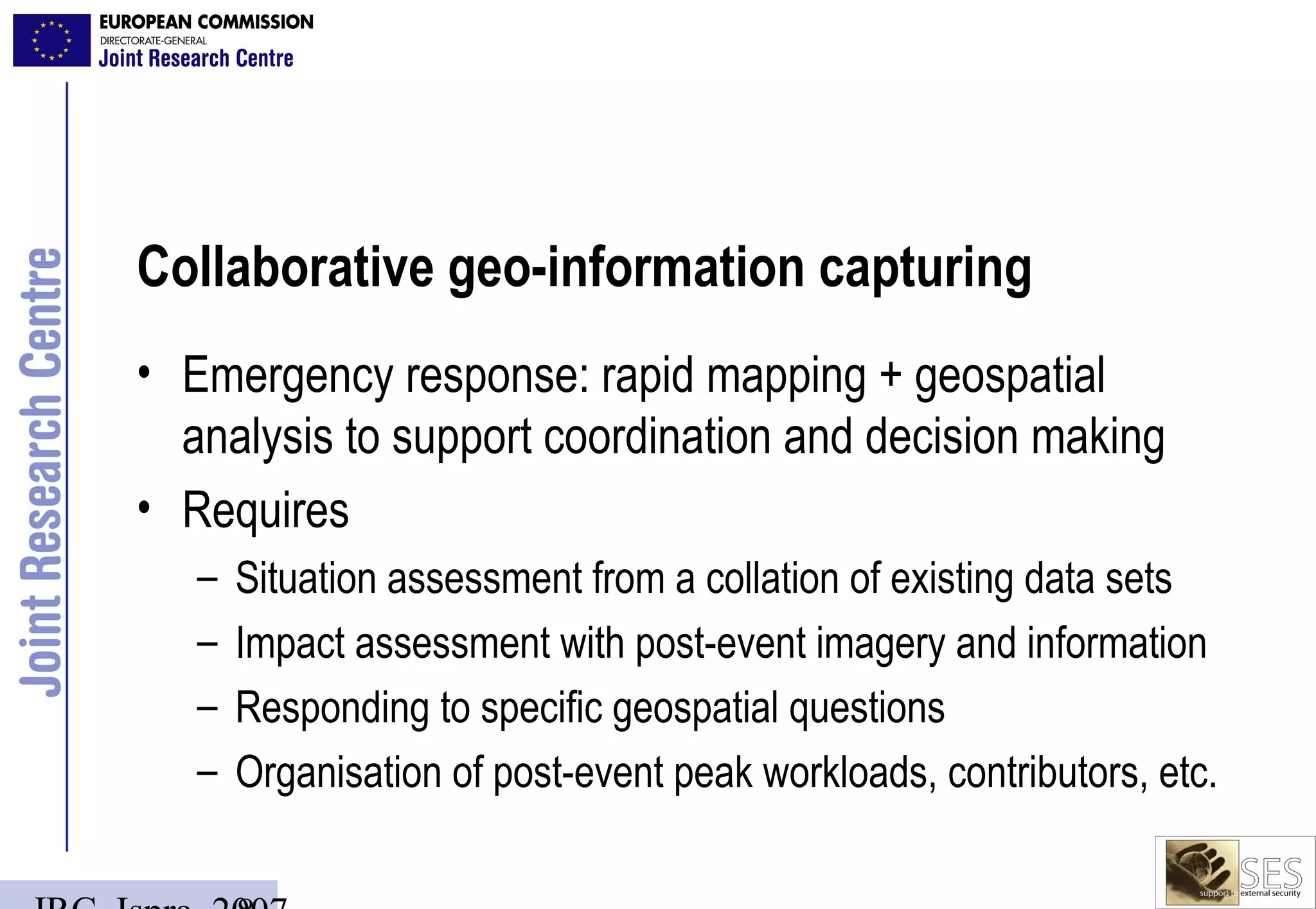
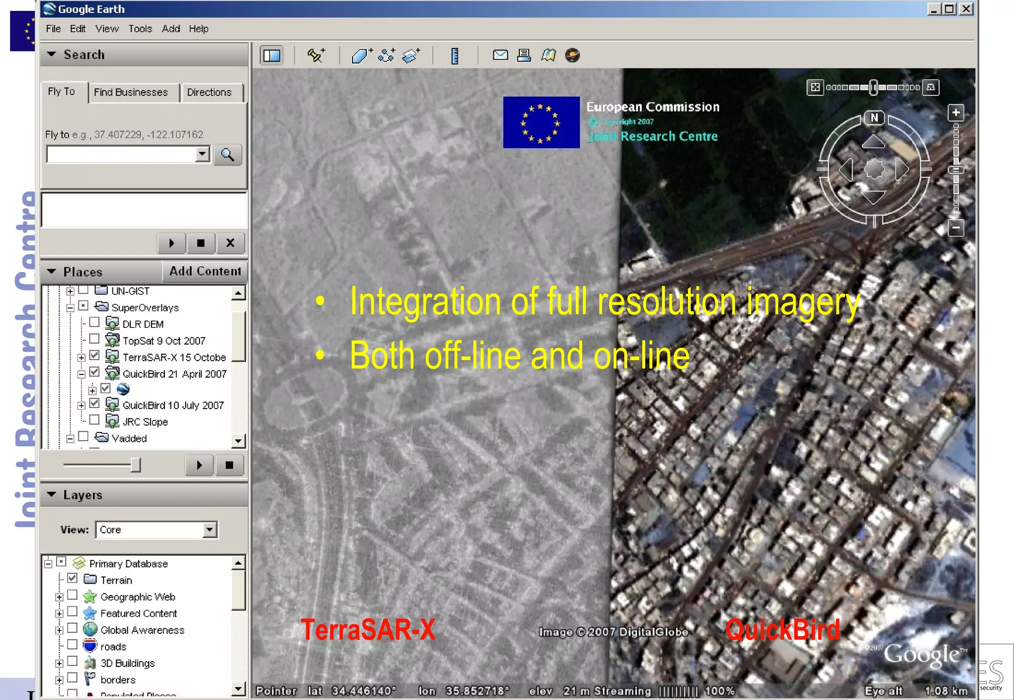
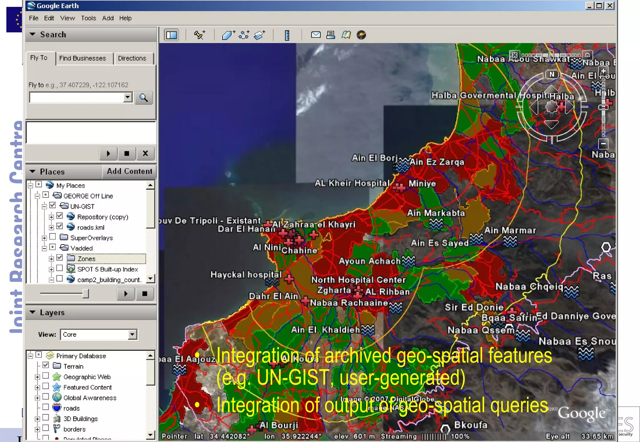
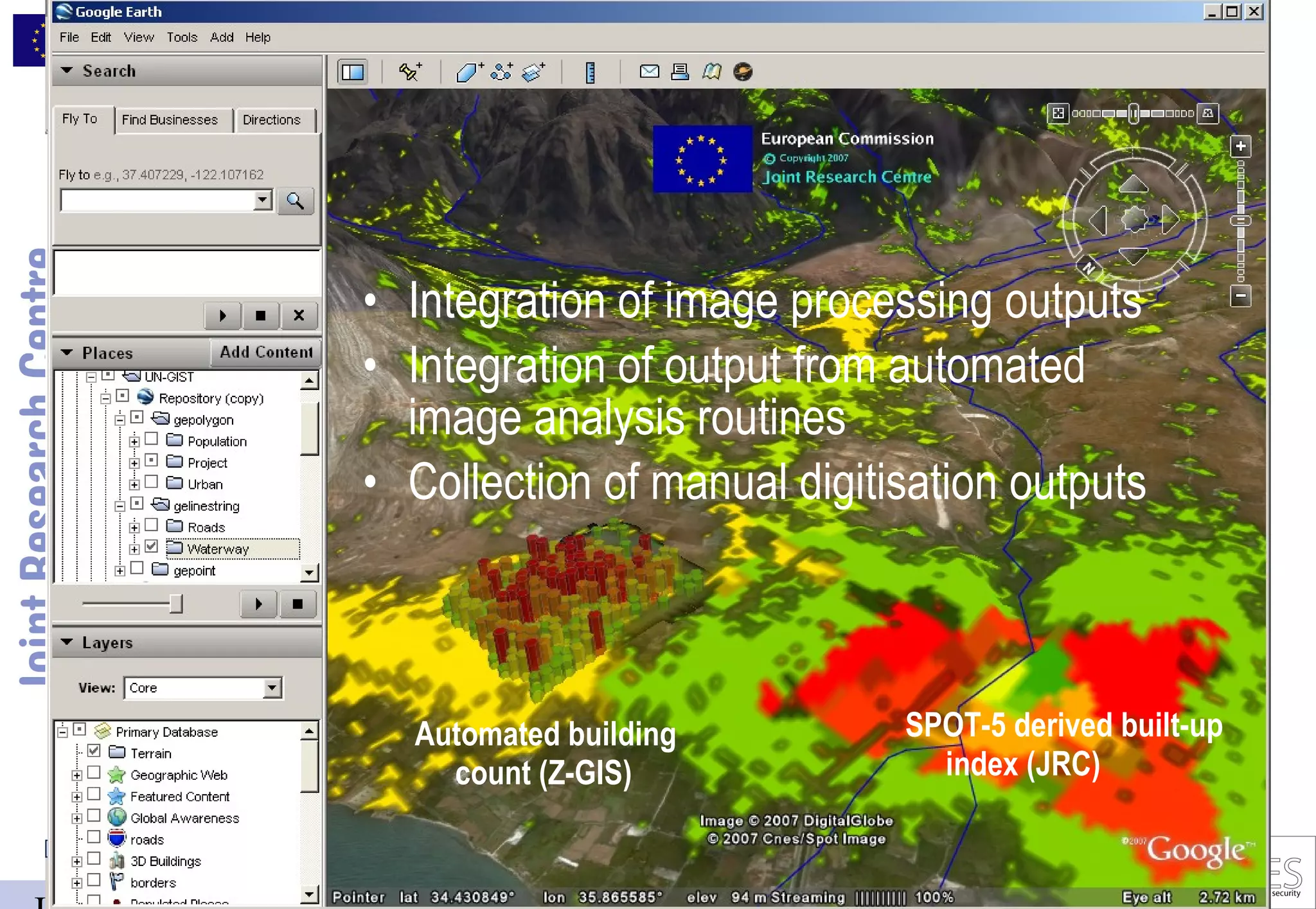
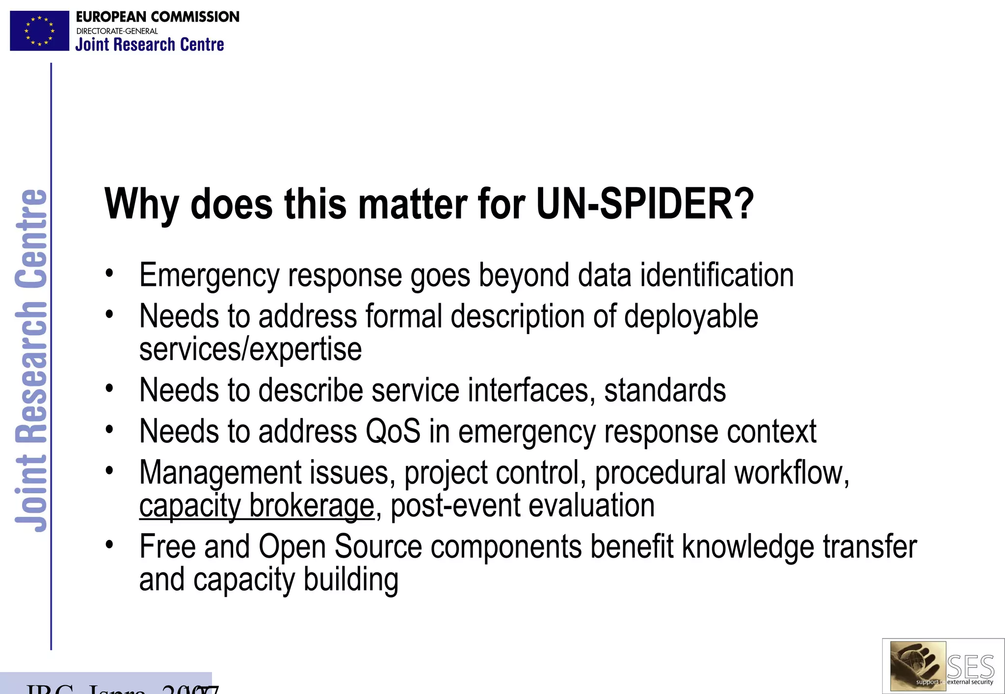

The document discusses the role of the Joint Research Centre (JRC) in providing scientific and technological support for emergency response through collaborative geo-information capturing. It outlines the challenges and components necessary for effective geospatial analysis to enhance decision-making during crises, highlighting tools like Google Earth and various data processing applications. The report emphasizes the importance of a collaborative framework and the potential for free and open-source solutions in improving emergency response capabilities.


