Downloaded 41 times
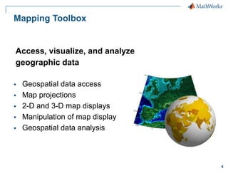
![Web Map Service Example
% Find layers that may contain global temperature data
% and return a WMSLayer array.
layers = wmsfind('global*temperature');
% Display the first layer
layers(1)
WMSLayer
Properties:
Index: 1
ServerTitle: 'WMS for GHRSST Global 1-km Sea Surface Temperature (G1SST),
Global, 0.01 Degree, Daily'
ServerURL: 'http://coastwatch.pfeg.noaa.gov/erddap/wms/jplG1SST/request?'
LayerTitle: 'GHRSST Global 1-km Sea Surface Temperature (G1SST), Global,0.01
Degree, Daily - SST'
LayerName: 'jplG1SST:SST'
Latlim: [-79.9950 79.9950]
Lonlim: [-179.9950 179.9950]
10](https://image.slidesharecdn.com/nxh-140214113846-phpapp02/85/Working-with-Scientific-Data-in-MATLAB-10-320.jpg)
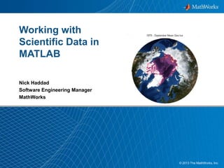
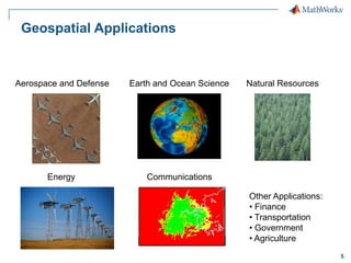
![Web Map Service Example
% Show a map from the first layer
[A,R] = wmsread(layers(1));
geoshow(A,R);
title(layers(1).LayerTitle);
11](https://image.slidesharecdn.com/nxh-140214113846-phpapp02/85/Working-with-Scientific-Data-in-MATLAB-11-320.jpg)
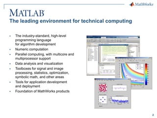
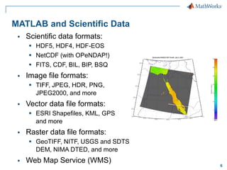
![MATLAB’s MAT File Format
Version 7.3 of MAT file format is HDF5 based
save('bigFile.mat',bigMatrix,'-v7.3');
Support for partial saving and loading of MAT files
% Create a MAT-file
matObj = matfile('myfile.mat’)
% Find the size of a variable in the file
[nrows, ncols]=size(matObj,'bigMatrix');
% Load data from a variable in the file
loadVar = matObj.bigMatrix(nrows-19:nrows, 86:95);
14](https://image.slidesharecdn.com/nxh-140214113846-phpapp02/85/Working-with-Scientific-Data-in-MATLAB-14-320.jpg)

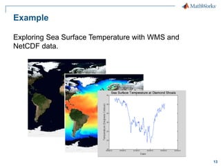
The document outlines the capabilities of MATLAB for scientific computing, including access and analysis of various scientific data formats such as HDF5 and NetCDF. It describes the functionality of the Mapping Toolbox for geospatial data visualization and analysis, as well as the integration with Web Map Services (WMS) for data retrieval. Example applications, such as oil spill simulations and sea surface temperature exploration, demonstrate MATLAB's utility in handling complex scientific datasets.