This document summarizes a staff development day at Compass Montessori School focused on navigating their work using their mission, vision, and values as a compass and the MAP assessment as a map. It discusses the benefits of the MAP assessment for informing instruction, supporting personalized learning, and aiding communication. Teachers will analyze MAP assessment data to fully address students' academic needs and potential. The assessment aligns with the school's student-centered pedagogy by being untimed and adaptive. Next steps include integrating MAP data, preparing to meet all students' potential, and conferencing with students using goals.
Michael Powers has extensive education experience including a Master's in Education from Antioch University Midwest and a Bachelor's in Ancient Greek from Wright State University. He has worked as a student teacher, intervention support teacher, summer school teacher, and substitute teacher. His roles have included creating lesson plans, differentiating instruction, assessing student work, and collaborating with other teachers. Additionally, he has worked as a bookseller, team lead scorer for standardized tests, and tutor.
Unprecedented educational changes led to efforts to fundamentally change teaching practices to better serve diverse learners. PGMS adopted school-wide goals focused on interdisciplinary instruction, critical thinking, writing, engagement, vocabulary, and technology integration. Implementing these goals and UDL principles required balancing initiatives while raising standards and closing achievement gaps. Some teachers resisted changes, seeing them as extra work, but advocates shared successes to increase buy-in for inclusive practices to meet all students' needs.
5th Annual Conf. | Responding to changes in the primary curriculum at The Ful...Wholeeducation
This document summarizes the approach taken by The Fulbridge Academy. It discusses how the school transformed from being in special measures to becoming outstanding. It outlines their curriculum approach which is centered around 8 domains and focuses on life beyond levels. The document also discusses their aspirations for the future which include further developing their primary curriculum and leadership approach.
This document provides an overview of an evaluation of an online professional development course for K-12 teachers called the VTS Basics Course, which trains teachers on how to incorporate Visual Thinking Strategies in their classrooms. The evaluation used a realist evaluation approach to develop and test program theories about how the course achieves outcomes for different teachers in various contexts. The evaluation found 6 final program theories and 5 middle-range theories. Implications are that future evaluations should examine other subjects/grades, different school types, and teachers who did not enroll in the course.
This document explains how to derive six-figure grid references from Ordnance Survey maps. It shows how to split a square into 100 smaller squares to determine the first three and last three figures of the reference. The first three figures are obtained by going along the bottom line, while the last three figures go up the side line. Examples are provided of determining the six-figure grid references for features like a church, bus station, and parking area. A mnemonic is suggested to remember the order of lines to follow.
This document discusses several key concepts for understanding maps, including:
1) Scale refers to the ratio of distance on a map to distance on the ground, such as 1:50,000 where 1cm equals 500m.
2) Location can be specified using grid references or latitude and longitude coordinates.
3) Relief shows elevation and slope using techniques like spot heights, contours, and hill shading. Gradient can also be calculated from contour maps.
4) The key or legend provides information to interpret map symbols which may differ between maps from different countries.
The document summarizes an upcoming orienteering field trip for students. It includes:
1) An overview of the activities which are street orienteering with questions, team orienteering challenges, and using maps to navigate.
2) Instructions for preparing including forming teams and roles, and planning routes between controls.
3) Details of the team challenge course layout and scoring system based on correct answers and timeliness.
4) Safety guidelines and what to do if a team gets lost.
The document provides a revision guide for the mapwork component of geography exams. It outlines key skills needed such as labeling maps, interpreting photographs, and understanding different map types and scales. It emphasizes literacy and being able to describe locations, distributions, and patterns shown on maps. Specific skills are defined for reading ordnance survey maps and using grid references. Examples of exam questions are given focusing on describing settlements, land uses, relief, and drawing sketch maps.
This lesson aims to teach students why maps use symbols and to recognize common symbols. It asks students to complete activities to learn map symbols, including a symbol story, symbols sheet, and online flashcard game. The lesson teaches basic map skills.
Contour lines on a map connect points of equal elevation, with the cartographer connecting elevation points at regular intervals, such as every 5 meters, to create contour lines showing the terrain's elevation and slope.
This document discusses the relationship between land relief and land use. It begins by defining land use as how humans utilize land for settlement, communication, and economic activities. It then examines how relief impacts these land uses, with flat areas generally supporting dense settlement and extensive road networks, while hilly or mountainous areas typically have more dispersed rural populations and less dense road infrastructure. Various economic activities like agriculture are also shown to depend on relief, with large-scale farming usually occurring on flatland. In summary, the document analyzes how relief influences patterns of human occupation and activity on the landscape.
Section A of the exam will contain an Ordnance Survey map at a scale of either 1:25,000 or 1:50,000. Students may be asked to label features on maps, interpret map symbols, calculate distances using four and six-figure grid references, draw and interpret cross-sections and contours, identify landforms and drainage patterns, and understand how physical geography influences human settlement patterns. Good literacy and the ability to interpret photographs are also important skills for this section.
The document provides instructions for two contour line practice exercises. For the first exercise, students are asked to draw contour lines at specific elevation levels and calculate the gradient between points A and B. For the second exercise, students are asked to draw contour lines at different specified elevation levels and calculate the gradients between points X and Y and between points X and C. Students are also asked to draw profile views of the cross sections between points indicated on the two practice maps.
This document describes how to read and interpret contour lines on topographic maps. It contains the following key points:
1. Contour lines connect points of equal elevation and are used to depict the shape and elevation changes of landforms.
2. Cross-sections can be drawn from contour lines to show the side profile of landforms between two points.
3. The spacing and shapes of contour lines indicate different landforms - closely spaced lines indicate steep slopes while widely spaced lines show gentle slopes. Common landforms like hills, valleys, ridges and plateaus each have distinguishing contour patterns.
4. Interpreting contour lines allows describing the overall landscape and calculating elevation changes across an area. The document provides instructions
This document contains instructions and questions for a practice worksheet involving interpreting an elevation contour map. Students are asked to measure distances between points on the map in centimeters and convert to miles using the provided scale. They also determine elevations at different points and calculate elevation gradients between points by dividing the elevation difference by the distance between points. Students are asked to draw elevation profiles across two lines on the map.
This document contains 15 multiple choice questions about interpreting information from various topographic maps. The questions assess identifying map features like elevation, gradient, contour interval, and stream flow direction at different labeled points on each map. An answer key is provided at the end.
This document provides information about topographic maps and how to interpret contour lines and intervals. It explains that contour lines connect points of equal elevation and the contour interval is the distance between lines. It describes how to determine elevations, slope steepness, gradient, and the use of depression contours to show temporary elevation changes. The document uses examples and quizzes to help the reader learn to interpret elevation, slope, and other topographic features from contour maps.
The document discusses measurements and scale concepts in mapping. It covers linear and areal measurement systems including imperial units like inches, feet, yards and miles as well as the metric system. Scale is defined as the ratio between a distance on a map and the corresponding distance in real life. Different methods of specifying scale are reviewed, including the representative fraction, verbal statements and graphic scales. Factors like data accuracy, resolution and detail are also influenced by map scale. Generalization techniques may be needed to simplify data for display at smaller scales.
This document provides an overview of different types of spatial information and maps. It discusses aerial photographs, orthophoto maps, topographic maps, and their key differences. Topographic maps show terrain and elevation using contours, trigonometric stations, spot heights and bench marks. They also use conventional signs and colors to represent natural and human landscape features. The document then covers map scales, latitude and longitude, coordinate systems, and techniques for determining direction and converting distances on maps.
This document provides information about topographic maps, including:
1. Topographic maps show elevation, shape of the earth's surface using contour lines connecting points of equal elevation. Features like water, terrain, and human structures are shown through different colors and patterns.
2. Contour lines indicate elevation changes - closely spaced lines show steep slopes, widely spaced show gentle slopes. Contour lines never cross or branch. When crossing streams, they bend upstream. Closed contours indicate hills and depressions.
3. Topographic profiles show elevation changes along a line, often with vertical exaggeration to emphasize details. Gradient is the steepness of a slope. Constructing profiles involves connecting elevation points along a contour line slice
Topographic maps use contour lines to represent elevation and slope of land. Contour lines connect points of equal elevation and never cross. Closer lines indicate steeper slopes while widely spaced lines show more gentle slopes. Index contours are bold lines labeled with the elevation. A benchmark is a point of known exact elevation marked as B.M. on maps. Map scale relates distances on a map to actual distances on land and can be ratio, graphical, or verbal.
Topographic maps show elevation and surface features of land using contour lines to connect points of equal height. Contour lines never cross and indicate slope - closely spaced lines mean steep slopes while lines far apart indicate flat land. Topographic maps are used to understand the shape and elevation of the land.
Topographic maps use a grid system of eastings and northings to locate features. Grid references specify the grid square and exact location of a feature. Compass directions and bearings are used to determine the orientation between locations. Distances on a map are measured using a ruler and scale, while curved distances use a string. Contours connect areas of equal height and indicate terrain features like hills, mountains, valleys, plateaus and ridges based on their shape and steepness.
The wind directions are:
A. Easterly Light
B. Southerly Moderate
C. Westerly Gentle
D. Northerly Fresh
E. Variable Light and variable
F. Calm Calm
G. Southerly to southwesterly Fresh
The strongest wind is D. Northerly - Fresh
The weakest wind is F. Calm
This document discusses grid references and how they are used to locate features on maps. It explains that topographic maps use a grid system of eastings and northings to specify locations, and that area references use a four-digit code to indicate a specific grid square. It also introduces six-figure grid references which can pinpoint an exact location within a grid square down to the tenth of the easting and northing. Examples are provided to demonstrate how to read and use both area references and more precise grid references.
The document discusses map scales. It defines three types of scales: stated scale, linear scale, and ratio scale. It explains how to convert between ratio scales and stated scales using the metric system and decimal places. It provides examples of calculating distances on maps using cross-multiplication and five steps: find the ratio scale, convert to stated scale, measure map distance, use cross-multiplication, and write a conclusion statement. Finally, it describes the difference between large scale and small scale maps in terms of the level of detail shown and area covered.
1. The document provides instructions and explanations for various mapwork calculations including distance, gradient, area, speed/time, coordinates, bearing, declination, cross sections, scale conversion, and landforms.
2. It explains how to calculate distance, gradient, area, speed, coordinates, bearing, declination, cross sections, and how to convert between word and fractional scales. Diagrams are provided to illustrate concepts like cross sections, declination, and landforms.
3. The document serves as a comprehensive guide for students to learn how to perform various geometric and spatial calculations required for topographic mapwork.
This document outlines a school guidance plan created by Group 3. It defines the principles of tutoring and guidance for different educational stages. It establishes strategies and instruments for orientation and tutoring. It aims to facilitate student transitions, develop student records, create educational alternatives, and help students adapt. It also seeks to facilitate communication between home and school and establish community support. The plan provides for students' academic, social, and emotional needs through crisis intervention, career planning, and helping students cope with stress. It allocates human and material resources and considers diversity and specific student needs through specialized education, curriculum adaptations, and computer use. The plan also focuses on developing resilience and preventing negative emotions through improving understanding of emotions and self-esteem.
Here are some ways my school is providing differentiated instruction:
- Co-teaching in core content classes with general and special education teachers
- Small group instruction for re-teaching, pre-teaching, enrichment
- Use of visual supports, graphic organizers, manipulatives
- Choice boards and menus to allow student choice and interest
- Flexible grouping for instruction
- Technology supports like audio books, text to speech, speech to text
- Preferential seating and environmental accommodations
- Modified assignments and assessments
- Push-in support from special educators, reading specialists, ESL teachers
- After school tutoring and homework help programs
1. The document discusses the achievements and development plan of a middle school. It outlines the school's goals of ensuring students are prepared for their future and developing important academic behaviors.
2. The school's achievements include accreditations earned in recent years. The development plan focuses on providing a creative learning environment, high-quality teaching, and monitoring student performance.
3. The plan also outlines strategies for various subjects including project-based learning, global projects, and integrating technology into lessons. Teachers provide details on their approaches for the current academic year.
This document provides a summary of a product forum presentation by Hobsons about their Naviance software. It discusses accomplishments in the first half of the year including adding over 1,000 new members to the Naviance Network and several platform enhancements. Upcoming priorities are outlined like improving student engagement, classroom implementation, and designing user-driven experiences. The presentation reviews progress on initiatives like measuring student hope and strengths, and previews upcoming features to improve reporting, academic planning, test preparation, and electronic document services.
This document discusses how technology can be used to support effective teaching. It argues that while technology has mainly focused on supporting students, there is a need to develop tools that help teachers as well. Some key areas that could be supported include student self-assessment, providing effective feedback, and monitoring student progress. The document also examines frameworks for understanding classroom dynamics and outlines a potential learning management system called "My Learning" that aims to keep stakeholders informed and help teachers make data-driven decisions to improve instruction.
Using curriculum mapping to assist at risk students finalMike Fisher
The document discusses using curriculum mapping to help "at-risk" students. It begins by laying the foundation, which involves inviting representatives from the school and collaborating social services to collect data on standards, assessments, and student records. This data is then used to research technology options like NovaNET for curriculum delivery and student management. The next steps are to collect and assess the data to create an ongoing action plan. Curriculum mapping provides an opportunity to differentiate instruction and build learning communities to meet students' specific needs through a connected, meaningful learning experience.
This document provides information about Public Administration coaching offered by VVR Research Foundation.
In 3 sentences:
1) VVR Research Foundation is an educational institution that provides coaching for the UPSC Civil Services Examination, with a focus on the subject of Public Administration.
2) They employ analytical and research-based teaching methods, have highly qualified faculty, provide comprehensive study materials, and boast impressive results including many students who have achieved high ranks in the civil services exam.
3) In addition to classroom coaching, they offer special test series, revision classes, compensatory classes for those who miss lessons, and other innovative programs to help students succeed in the competitive exam.
The document provides an overview of King George V School's new Middle School Curriculum for Years 7-9. It introduces the vision and rationale for developing a coherent, skills-based curriculum led by the school rather than an external framework. Key aspects include using the IB's Approaches to Learning (ATLs) to identify 5 generic skills (thinking, social, communication, self-management, research) that all subjects will help develop. Each subject creates a skills profile outlining how it will explicitly teach outcomes related to the generic skills through its content. The curriculum aims to holistically develop students' skills to prepare them for future learning and life.
Educational technology plays important functions in 21st century education including improving teaching and learning, enhancing educational goals, training teachers, developing curricula and teaching materials, establishing teaching strategies, and developing audiovisual aids. It helps analyze the teaching and learning processes, facilitate learning gains, and support the overall improvement of the educational system.
The document discusses learner agency and facilitating it in schools. It defines learner agency as giving students choice, control, challenge and opportunities for collaboration to increase motivation and engagement. The document outlines 10 conditions to support learner agency, including having the learner at the center; building relationships; responsive cultural practices; distributed leadership; teaching as inquiry; appropriate curriculum and pedagogy; assessment for learning; developing assessment capabilities; leveraging technology; and innovative learning environments. Examples of schools facilitating learner agency through practices like must-do/can-do activities, goal setting, learner choice and self-evaluation are also provided.
AHDS Conference November 2014 - Workshop; Poverty, Attainment & LeadershipAHDScotland
AHDS Annual Conference 2014 'Teaching Scotland's Future: Whate you need to know and do. Workshop bt Graeme Young, HT at St Bartholomews Primary School and Susan Hannah, Scottish Government
The School Advisory Council (SAC) aims to improve communication about school issues and design an effective School Improvement Plan (SIP). The SIP focuses on improving achievement in reading, math, and other subjects for all student subgroups. While some goals were met in 2013, reading and math scores need more work. To address this, the school implemented daily 30-minute reading periods, teacher training in reading strategies, and voluntary math tutoring before school. The SAC also distributes climate surveys and shares information at open meetings to better engage with students, parents, and the community.
As the Best International School in Mumbai, SVI School is dedicated to preparing students for a global future. We strive to create global citizens who excel in every aspect of life. Join us at SVI School Mumbai and embark on a journey of academic and personal growth.
https://svischool.com/international-school-in-mumbai/
In the western suburbs of Mumbai, SVI School shines as the Best ICSE School in Kandivali West. Our commitment to quality education, coupled with a holistic approach to development, makes us the top choice for parents seeking the best for their children. At SVI School, we shape young minds to become leaders and achievers in every field.
SVI School in Kandivali is your gateway to an international educational experience. As an International School, we offer a world-class curriculum that combines the best of global and Indian educational practices. Our dedicated faculty, state-of-the-art facilities, and commitment to holistic development make SVI School the preferred choice for parents seeking an International School in Kandivali. We nurture young minds to become global citizens who excel academically and socially.
website: https://svischool.com/international-school-in-kandivali-west/
When it comes to finding the best school in Mumbai, SVI School stands out as a beacon of excellence. Our institution has earned a stellar reputation for delivering top-quality education and holistic development. At SVI School, we go beyond traditional teaching methods to provide an enriching and transformative educational experience.
SVI School in Kandivali is your gateway to an international educational experience. As an International School, we offer a world-class curriculum that combines the best of global and Indian educational practices. Our dedicated faculty, state-of-the-art facilities, and commitment to holistic development make SVI School the preferred choice for parents seeking an International School in Kandivali. We nurture young minds to become global citizens who excel academically and socially.
https://svischool.com/international-school-in-kandivali-west/
WSU-Puyallup EdAd 516 September 25 Class Notesailenebaxter
This document appears to be a syllabus for an educational leadership course titled EDAD 516 at Washington State University Puyallup Campus in fall 2014. It includes:
- Contact information for the course director, Ailene M. Baxter
- Topics that will be covered like leadership, supervision of instruction, culturally responsive teaching
- Course objectives, assignments, expectations
- Readings from authors like Glickman and Ginsberg on related subjects
- Details about assignments like shadowing a student and reflecting on educational beliefs
The syllabus outlines the essential information students need about the course, including the educational frameworks and theories that will be examined related to leadership, adult learning, and culturally responsive
This document contains Marci McKinney's education portfolio from Ivy Tech Community College. The portfolio includes sections on her resume, teaching philosophy, letter of recommendation, endeavors and awards, and descriptions of how she meets the INTASC teaching standards. It provides information on her education, qualifications, coursework, activities and leadership experience, as well as samples of her work from her early childhood education preschool practicum. The portfolio is intended to showcase Marci's experience and abilities as she pursues a degree in early childhood education.
Similar to Navigating Our Work... with a Compass and a MAP (v.li) (20)
Montessori 101 - A Parent Education Evening Seth D. Webb
The document outlines an evening event for new parents to learn about the Montessori method of education. It will include an overview of Maria Montessori's life and philosophy, a discussion of the planes of child development and human tendencies, and explanations of key Montessori concepts like the prepared environment, grace and courtesy, and peace education. The goal is to introduce parents to Montessori's vision of supporting each child's innate drive for learning and independence within a just and peaceful social system.
This document provides an overview of Multi-Tiered Systems of Support (MTSS) for Compass Montessori - Golden Campus. It discusses that MTSS is a framework that highlights student needs, risks, and opportunities to identify next steps to support students. It describes the tiers of support - Tier 1 being core instruction for all students, Tier 2 being targeted interventions for some students, and Tier 3 being intensive interventions for few students. The document gives examples of academic and behavioral supports at each tier and emphasizes frequent progress monitoring to guide intervention design. It also clarifies the differences between accommodations, interventions, and modifications in providing student support.
"Cosmic Education in the Montessori Classroom: A Parent Education Evening" -...Seth D. Webb
This document outlines an evening presentation for parents on cosmic education in the Montessori classroom. It includes an overview of the agenda which covers philosophical principles, the planes of child development, the role of imagination, and the presentation of the First Great Lesson. It also discusses how cosmic education helps children develop morality and character by making connections between themselves, the universe, and their place within it.
"Grace & Courtesy in the Montessori Classroom: A Parent Education Evening" - ...Seth D. Webb
This document outlines an event about Grace & Courtesy in the Montessori classroom. It includes an overview of the agenda which involves staff introductions, a philosophical rationale for Grace & Courtesy given by Maria Montessori, sharing from different classroom levels, and a panel discussion and Q&A. The document provides several quotes from Montessori about the importance of moral education, social integration and development, and allowing children's actions to originate from within as part of their natural social development.
WeavingTheCosmos_ParentEducationEvening_CMS_2015-13-10Seth D. Webb
This document outlines the key concepts of Cosmic Education, an educational philosophy developed by Maria Montessori. It discusses how Cosmic Education aims to fulfill children's fundamental needs and natural human tendencies through purposeful exploration and parallel studies of the universe. The approach emphasizes making connections across disciplines to help children develop a sense of place within the larger world.
Getting Out of The Way- Rethinking Discipline in a Montessori Environment (v....Seth D. Webb
This document summarizes the key topics from a staff development training on student engagement and proactive discipline. It discusses reframing the definition of discipline to focus on instruction rather than punishment. It encourages teachers to look inward when students misbehave and ensure they are meeting the child's needs. Teachers are advised to be flexible, give children more freedom within limits, and focus on building partnerships with students over punishments. The goal is for teachers to represent where they want to go by being stewards of children's spirits. Discipline is reframed as peace education for both children and teachers.
-Dancing on the Compass Rose- Creating and Maintaining Positive Partnerships ...Seth D. Webb
This document outlines topics to be covered in staff development days for Compass Montessori School. It discusses changing education paradigms and key ideas from books on motivation. It introduces Abraham Maslow's hierarchy of needs and Gordon Tredgold's circles of concern, relating them to the fundamental and human needs and tendencies. The importance of student and teacher motivation and knowing why activities are done is emphasized. Qualities like being observant, intentional and mindful are presented as ways to provide authentic opportunities for student autonomy, mastery and purpose. Resources on human tendencies, preventing exclusion, and intrinsic motivation in Montessori students are provided.
-Dancing on the Compass Rose- Creating and Maintaining Positive Partnerships ...
Navigating Our Work... with a Compass and a MAP (v.li)
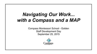
1. Navigating Our Work...
with a Compass and a MAP
Compass Montessori School - Golden
Staff Development Day
September 25, 2015
2. Mission
Utilizing authentic Montessori methods,
the Compass community aims to nurture the whole child
and enrich the life of each student from preschool to twelfth grade.
3. Vision
Our goal is to foster competent, responsible, and independent citizens
who love learning and respect themselves, other people, and their environment.
4. Values / Belief Statement
Compass will provide appropriate challenges and support to enable each
student to prepare for the intellectual, spiritual, emotional, social, physical
and societal transitions appropriate to each student’s inner vocation.
5.
6.
7.
8.
9. Concept by Mihaly Csikszentmihalyi in “Flow: The Psychology of Optimal Experience” (2009)
10. Concept by Mihaly Csikszentmihalyi in “Flow: The Psychology of Optimal Experience” (2009)
12. Value Added Contributions of the MAP Assessment
● TO INFORM OUR PRACTICE
● TO HELP US BE TRULY ANSWERABLE TO THE ACADEMIC NEEDS OF
THE CHILDREN
● TO SUPPORT STUDENTS SETTING DISTINCT LEARNING OBJECTIVES
● TO AID OUR COMMUNICATION TO PARENTS & GUARDIANS
● TO TELL “OUR STORY”
13. Value Added Contributions of the MAP Assessment
● TO INFORM OUR PRACTICE
● TO HELP US BE MORE ANSWERABLE TO THE ACADEMIC NEEDS OF
THE CHILDREN
● TO SUPPORT STUDENTS SETTING DISTINCT LEARNING OBJECTIVES
● TO AID OUR COMMUNICATION TO PARENTS & GUARDIANS
● TO TELL “OUR STORY”
14. Value Added Contributions of the MAP Assessment
● TO INFORM OUR PRACTICE
● TO HELP US BE MORE ANSWERABLE TO ACADEMIC NEEDS OF THE
CHILDREN
● TO SUPPORT STUDENTS SETTING DISTINCT LEARNING OBJECTIVES
● TO AID OUR COMMUNICATION TO PARENTS & GUARDIANS
● TO TELL “OUR STORY”
15. Value Added Contributions of the MAP Assessment
● TO INFORM OUR PRACTICE
● TO HELP US BE MORE ANSWERABLE TO THE ACADEMIC NEEDS OF
THE CHILDREN
● TO SUPPORT STUDENTS SETTING DISTINCT LEARNING OBJECTIVES
● TO AID OUR COMMUNICATION TO PARENTS & GUARDIANS
● TO TELL “OUR STORY”
16. Value Added Contributions of the MAP Assessment
● TO INFORM OUR PRACTICE
● TO HELP US BE MORE ANSWERABLE TO THE ACADEMIC NEEDS OF
THE CHILDREN
● TO SUPPORT STUDENTS SETTING DISTINCT LEARNING OBJECTIVES
● TO AID OUR COMMUNICATION TO PARENTS & GUARDIANS
● TO TELL “OUR STORY”
17. Value Added Contributions of the MAP Assessment
● TO INFORM OUR PRACTICE
● TO HELP US BE MORE ANSWERABLE TO THE ACADEMIC NEEDS OF
THE CHILDREN
● TO SUPPORT STUDENTS SETTING DISTINCT LEARNING OBJECTIVES
● TO AID OUR COMMUNICATION TO PARENTS & GUARDIANS
● TO TELL “OUR STORY”
18. Value Added Contributions of the MAP Assessment
● TO INFORM OUR PRACTICE
● TO HELP US BE MORE ANSWERABLE TO THE ACADEMIC NEEDS OF
THE CHILDREN
● TO SUPPORT STUDENTS SETTING DISTINCT LEARNING OBJECTIVES
● TO AID OUR COMMUNICATION TO PARENTS & GUARDIANS
● TO TELL “OUR STORY”
19. Collective Benefits of the MAP Assessment
EMPOWERS TEACHERS TO MORE FULLY ADDRESS EACH STUDENT’S
ACADEMIC POTENTIAL
SUPPORTS PERSONALIZED LEARNING PATHS
INFORMS INSTRUCTIONAL TIME AND FLEXIBLE GROUPING
AIDS CURRICULUM PLANNING
OFFERS INSIGHTS RELEVANT TO SCHOOL IMPROVEMENT PLANNING
PROVIDES DISCUSSION POINTS FOR PARENT-TEACHER CONFERENCES
20. Collective Benefits of the MAP Assessment
EMPOWERS TEACHERS TO MORE FULLY ADDRESS EACH STUDENT’S
ACADEMIC POTENTIAL
SUPPORTS PERSONALIZED LEARNING PATHS
INFORMS INSTRUCTIONAL TIME AND FLEXIBLE GROUPING
AIDS CURRICULUM PLANNING
OFFERS INSIGHTS RELEVANT TO SCHOOL IMPROVEMENT PLANNING
PROVIDES DISCUSSION POINTS FOR PARENT-TEACHER CONFERENCES
21. Collective Benefits of the MAP Assessment
EMPOWERS TEACHERS TO MORE FULLY ADDRESS EACH STUDENT’S
ACADEMIC POTENTIAL
SUPPORTS PERSONALIZED LEARNING PATHS
INFORMS INSTRUCTIONAL TIME AND FLEXIBLE GROUPING
AIDS CURRICULUM PLANNING
OFFERS INSIGHTS RELEVANT TO SCHOOL IMPROVEMENT PLANNING
PROVIDES DISCUSSION POINTS FOR PARENT-TEACHER CONFERENCES
22. Collective Benefits of the MAP Assessment
EMPOWERS TEACHERS TO MORE FULLY ADDRESS EACH STUDENT’S
ACADEMIC POTENTIAL
SUPPORTS PERSONALIZED LEARNING PATHS
INFORMS INSTRUCTIONAL TIME AND FLEXIBLE GROUPING
AIDS CURRICULUM PLANNING
OFFERS INSIGHTS RELEVANT TO SCHOOL IMPROVEMENT PLANNING
PROVIDES DISCUSSION POINTS FOR PARENT-TEACHER CONFERENCES
23. Collective Benefits of the MAP Assessment
EMPOWERS TEACHERS TO MORE FULLY ADDRESS EACH STUDENT’S
ACADEMIC POTENTIAL
SUPPORTS PERSONALIZED LEARNING PATHS
INFORMS INSTRUCTIONAL TIME AND FLEXIBLE GROUPING
AIDS CURRICULUM PLANNING
OFFERS INSIGHTS RELEVANT TO SCHOOL IMPROVEMENT PLANNING
PROVIDES DISCUSSION POINTS FOR PARENT-TEACHER CONFERENCES
24. Collective Benefits of the MAP Assessment
EMPOWERS TEACHERS TO MORE FULLY ADDRESS EACH STUDENT’S
ACADEMIC POTENTIAL
SUPPORTS PERSONALIZED LEARNING PATHS
INFORMS INSTRUCTIONAL TIME AND FLEXIBLE GROUPING
AIDS CURRICULUM PLANNING
OFFERS INSIGHTS RELEVANT TO SCHOOL IMPROVEMENT PLANNING
PROVIDES DISCUSSION POINTS FOR PARENT-TEACHER CONFERENCES
25. Collective Benefits of the MAP Assessment
EMPOWERS TEACHERS TO MORE FULLY ADDRESS EACH STUDENT’S
ACADEMIC POTENTIAL
SUPPORTS PERSONALIZED LEARNING PATHS
INFORMS INSTRUCTIONAL TIME AND FLEXIBLE GROUPING
AIDS CURRICULUM PLANNING
OFFERS INSIGHTS RELEVANT TO SCHOOL IMPROVEMENT PLANNING
PROVIDES DISCUSSION POINTS FOR PARENT-TEACHER CONFERENCES
26. Collective Benefits of the MAP Assessment
EMPOWERS TEACHERS TO MORE FULLY ADDRESS EACH STUDENT’S
ACADEMIC POTENTIAL
SUPPORTS PERSONALIZED LEARNING PATHS
INFORMS INSTRUCTIONAL TIME AND FLEXIBLE GROUPING
AIDS CURRICULUM PLANNING
OFFERS INSIGHTS RELEVANT TO SCHOOL IMPROVEMENT PLANNING
PROVIDES DISCUSSION POINTS FOR PARENT-TEACHER CONFERENCES
27. Alignment of Pedagogy & the MAP Assessment
UNTIMED
ADAPTS TO EACH INDIVIDUAL STUDENT’S RESPONSES
PROVIDES INSIGHT INTO PRESENT LEARNING SENSITIVITIES
CORRELATED TO SPECIFIC SKILL DEVELOPMENT
EASILY COUPLED WITH MATERIAL-BASED PRESENTATIONS
FUELED BY A GROWTH MINDSET
28. Alignment of Pedagogy & the MAP Assessment
UNTIMED
ADAPTS TO EACH INDIVIDUAL STUDENT’S RESPONSES
PROVIDES INSIGHT INTO PRESENT LEARNING SENSITIVITIES
CORRELATED TO SPECIFIC SKILL DEVELOPMENT
EASILY COUPLED WITH MATERIAL-BASED PRESENTATIONS
FUELED BY A GROWTH MINDSET
29. Alignment of Pedagogy & the MAP Assessment
UNTIMED
ADAPTS TO EACH INDIVIDUAL STUDENT’S RESPONSES
PROVIDES INSIGHT INTO PRESENT LEARNING SENSITIVITIES
CORRELATED TO SPECIFIC SKILL DEVELOPMENT
EASILY COUPLED WITH MATERIAL-BASED PRESENTATIONS
FUELED BY A GROWTH MINDSET
30. Alignment of Pedagogy & the MAP Assessment
UNTIMED
ADAPTS TO EACH INDIVIDUAL STUDENT’S RESPONSES
PROVIDES INSIGHT INTO PRESENT LEARNING SENSITIVITIES
CORRELATED TO SPECIFIC SKILL DEVELOPMENT
EASILY COUPLED WITH MATERIAL-BASED PRESENTATIONS
FUELED BY A GROWTH MINDSET
31. Alignment of Pedagogy & the MAP Assessment
UNTIMED
ADAPTS TO EACH INDIVIDUAL STUDENT’S RESPONSES
PROVIDES INSIGHT INTO PRESENT LEARNING SENSITIVITIES
CORRELATED TO SPECIFIC SKILL DEVELOPMENT
EASILY COUPLED WITH MATERIAL-BASED PRESENTATIONS
FUELED BY A GROWTH MINDSET
32. Alignment of Pedagogy & the MAP Assessment
UNTIMED
ADAPTS TO EACH INDIVIDUAL STUDENT’S RESPONSES
PROVIDES INSIGHT INTO PRESENT LEARNING SENSITIVITIES
CORRELATED TO SPECIFIC SKILL DEVELOPMENT
EASILY COUPLED WITH MATERIAL-BASED PRESENTATIONS
FUELED BY A GROWTH MINDSET
33. Alignment of Pedagogy & the MAP Assessment
UNTIMED
ADAPTS TO EACH INDIVIDUAL STUDENT’S RESPONSES
PROVIDES INSIGHT INTO PRESENT LEARNING SENSITIVITIES
CORRELATED TO SPECIFIC SKILL DEVELOPMENT
EASILY COUPLED WITH MATERIAL-BASED PRESENTATIONS
FUELED BY A GROWTH MINDSET
34. Where We’ve Been
● TEAMING TO DEVELOP ASSESSMENT SCHEDULES
● PROFESSIONAL DEVELOPMENT ON PROCTORING
● FALL TESTING COMPLETE
35. Where We’ve Been
● TEAMING TO DEVELOP ASSESSMENT SCHEDULES
● PROFESSIONAL DEVELOPMENT ON PROCTORING
● FALL TESTING COMPLETE
36. Where We’ve Been
● TEAMING TO DEVELOP ASSESSMENT SCHEDULES
● PROFESSIONAL DEVELOPMENT ON PROCTORING
● FALL TESTING COMPLETE
37. Where We’ve Been
● TEAMING TO DEVELOP ASSESSMENT SCHEDULES
● PROFESSIONAL DEVELOPMENT ON PROCTORING
● FALL TESTING COMPLETE
38. Where We’ve Been
● TEAMING TO DEVELOP ASSESSMENT SCHEDULES
● PROFESSIONAL DEVELOPMENT ON PROCTORING
● FALL TESTING COMPLETE
39. Why We’re Here Today & Where We’re Going
● PLANNING FOR DATA ANALYSIS AND INTEGRATION
● DISCUSSING HOW TO USE THE PARENT-FACING REPORTS
40. Why We’re Here Today & Where We’re Going
● PLANNING FOR DATA ANALYSIS AND INTEGRATION
● DISCUSSING HOW TO USE THE PARENT-FACING REPORTS
41. Why We’re Here Today & Where We’re Going
● PLANNING FOR DATA ANALYSIS AND INTEGRATION
● DISCUSSING HOW TO USE THE PARENT-FACING REPORTS
42. Why We’re Here Today & Where We’re Going
● PLANNING FOR DATA ANALYSIS AND INTEGRATION
● DISCUSSING HOW TO USE THE PARENT-FACING REPORTS
45. Some Critical Take-Aways & Add-Ons
The results from each assessment describe a student’s instructional level, not
their mastery of a concept or content area.
When students complete an assessment, they have answered the questions
correctly 50% of the time. The data that we receive show us what they know half
of, and represents where they are Ready for Instruction Today (RIT).
One’s RIT score is independent of grade level. A RIT of 191 for a 3rd grader is
equal to 191 for a 6th grader; that is, we can say that both students are at the
same instructional level.
46. Some Critical Take-Aways & Add-Ons
The results from each assessment describe a student’s instructional level,
not her of his mastery of a concept or content area.
When students complete an assessment, they have answered the questions
correctly 50% of the time. The data that we receive show us what they know half
of, and represents where they are Ready for Instruction Today (RIT).
One’s RIT score is independent of grade level. A RIT of 191 for a 3rd grader is
equal to 191 for a 6th grader; that is, we can say that both students are at the
same instructional level.
47. Some Critical Take-Aways & Add-Ons
The results from each assessment describe a student’s instructional level, not her
or his mastery of a concept or content area.
When students complete an assessment, they have answered the questions
correctly 50% of the time. The data that we receive show us what they know
half of, and represents where they are Ready for Instruction Today (RIT).
One’s RIT score is independent of grade level. A RIT of 191 for a 3rd grader is
equal to 191 for a 6th grader; that is, we can say that both students are at the
same instructional level.
48. Some Critical Take-Aways & Add-Ons
The results from each assessment describe a student’s instructional level, not her
or his mastery of a concept or content area.
When students complete an assessment, they have answered the questions
correctly 50% of the time. The data that we receive show us what they know half
of, and represents where they are Ready for Instruction Today (RIT).
One’s RIT score is independent of grade level. A RIT of 191 for a 3rd grader
is equal to 191 for a 6th grader; that is, we can say that both students are at
the same instructional level.
49. Some Critical Take-Aways & Add-Ons
The results from each assessment describe a student’s instructional level,
not her or his mastery of a concept or content area.
When students complete an assessment, they have answered the questions
correctly 50% of the time. The data that we receive show us what they know
half of, and represents where they are Ready for Instruction Today (RIT).
One’s RIT score is independent of grade level. A RIT of 191 for a 3rd grader
is equal to 191 for a 6th grader; that is, we can say that both students are at
the same instructional level.
54. Accountability vs. “Answerability”
- externally mandated
- does not foster a sense
of ownership (must do)
- punitive connotation
- invites collaboration
55. Accountability vs. “Answerability”
- externally mandated
- does not foster a sense
of ownership (must do)
- punitive connotation
- invites collaboration
- engenders true ownership
56. Accountability vs. “Answerability”
- externally mandated
- does not foster a sense
of ownership (must do)
- punitive connotation
- invites collaboration
- engenders true ownership
- establishes clear expectation
for all partners
57. Accountability vs. “Answerability”
- externally mandated
- does not foster a sense
of ownership (must do)
- punitive connotation
- invites collaboration
- engenders true ownership
- establishes clear expectation
for all partners
58. With the MAP assessment
we are following our students
with a mindful fidelity
to the full complement
of their unique academic needs.
101. Concept by Mihaly Csikszentmihalyi in “Flow: The Psychology of Optimal Experience” (2009)
102. Next Steps & Challenges
● Integrate the MAP Data into Your Thinking About Your Students’ Needs
● Build a Plan to Fully Meet the Academic Potential of all of Your Students
● Prepare Your Work Environments to Support This New Learning
● Conference with Your Students Using the Goal Setting Worksheet
● Invite Your Students to New Lessons & Lessons Done Differently
● Practice Your Language Around the Sharing of Student Progress Reports