Natural hazards- CSEC Geography
•
5 likes•864 views

This document looks at natural hazards in the Caribbean. Various natural hazards affect the Caribbean but the ones that will be focused on will be: earthquake, volcanoes and hurricanes.

Recommended
Recommended
More Related Content
What's hot
What's hot (20)
Similar to Natural hazards- CSEC Geography
Similar to Natural hazards- CSEC Geography (20)
More from Oral Johnson
More from Oral Johnson (20)
Recently uploaded
Recently uploaded (20)
Natural hazards- CSEC Geography
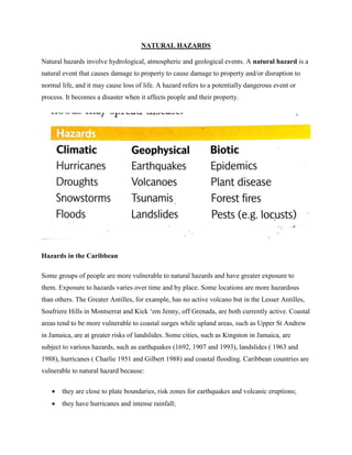
- 1. NATURAL HAZARDS Natural hazards involve hydrological, atmospheric and geological events. A natural hazard is a natural event that causes damage to property to cause damage to property and/or disruption to normal life, and it may cause loss of life. A hazard refers to a potentially dangerous event or process. It becomes a disaster when it affects people and their property. Hazards in the Caribbean Some groups of people are more vulnerable to natural hazards and have greater exposure to them. Exposure to hazards varies over time and by place. Some locations are more hazardous than others. The Greater Antilles, for example, has no active volcano but in the Lesser Antilles, Soufriere Hills in Montserrat and Kick ‘em Jenny, off Grenada, are both currently active. Coastal areas tend to be more vulnerable to coastal surges while upland areas, such as Upper St Andrew in Jamaica, are at greater risks of landslides. Some cities, such as Kingston in Jamaica, are subject to various hazards, such as earthquakes (1692, 1907 and 1993), landslides ( 1963 and 1988), hurricanes ( Charlie 1951 and Gilbert 1988) and coastal flooding. Caribbean countries are vulnerable to natural hazard because: they are close to plate boundaries, risk zones for earthquakes and volcanic eruptions; they have hurricanes and intense rainfall;
- 2. most people live close to the sea; many people live on steep slopes subject to landslides, or on flat land close to sea level; humans greatly altered the Caribbean environment, e.g. forests and coastal mangroves have been removed. Why disaster is increasing Since the 1950s, damage from natural disasters has increased worldwide, because: with economic development, more buildings, roads, industrial plants, airports, and other structures have been constructed; people build in hazardous places- shorelines, steep hillsides, or flat land with a flood risk; most scientist believe that climatic change is increasing the risk of extreme events, such as floods, droughts and hurricanes.
- 3. In 2003, an estimated 700 natural catastrophes worldwide killed more than 50,000 people, and caused US$ 60 billion in damage. Impact of Hazards Volcanoes Lava flows - A river of molten rock 1000 degrees centigrade that can travel at 40mph. lava flows can cause extensive damage or total destruction by burning, crushing, or burying everything in their paths. Lava flows can erupt relatively non-explosively and move very slowly (a few meters to a few hundred meters per hour) or they can move rapidly (typically down steep slopes. Tephra - All materials ejected from a volcano are called Tephra. These occurs when there is an explosive eruption. They are classified according to their sizes. Materials the sizes of a football can be ejected from a volcano. Ash, lapilli and volcanic bombs are tephra. The largest pieces of
- 4. tephra (greater than 64 mm) are called blocks and bombs often fall close to the volcano but smaller size tephra such as ash and lapilli ( lapilli 2-64 mm) and ash (<2 mm) can be carried downwind and affect areas far from the volcano. Millions of tons of ash can bury buildings. Problems associated with tephra - If ash builds up on the tops of roofs, it will often cause collapse. This is especially common on flat topped buildings. Most deaths resulting from the eruption of Mount Pinatubo in 1991 were due to collapsing roofs (Wolfe, 1992). -Ash can disrupt electricity, television, radio, and telephone communication lines, bury roads and other manmade structures, damage machinery, start fires, and clog drainage and sewage systems Ash is also a great hazard to airplanes. Ash from the 1982 eruption of Galunggung Volcano in West Java, Indonesia caused engines in two jet airplanes to fail. Both aircraft dropped 25,000 feet before they could get their engines to start again. -Tephra can also destroy vegetation which can result in famine. Famines are the largest indirect hazard produced by volcanic eruptions. In 1815, after the eruption of Tambora which ejected 151 cubic kilometers of ash into the atmosphere, 80,000 people died due to famine (Bryant, 1991 and Francis, 1993) -Ash can produce poor visibility and cause respiratory problems. Pyroclastic flows - Pyroclastic flows are very hot, fast moving clouds of gases and tephra moving down the side of a volcano after an eruption column collapse. They are also called nuée ardentes. They are extremely dangerous because they can travel up to 500 km/hr, reach distances of 30km and can be over 700 degrees Celsius in temperature. They will burn, knock over or bury anything in their path. A pyroclastic flow from Vesuvius volcano killed about 20,000 people in Pompeii in 79 CE. Lahars ( resembles wet concrete) -A volcanic eruption usually leaves lots of loose
- 5. unconsolidated fragmental debris. When this loose material mixes with water from rainfall, melting of snow or ice, or draining of a crater lake, a mudflow results. Volcanic mudflows are called lahars. These can occur accompanying an eruption or occur long after an eruption. Lahars are very dangerous because they do not require a volcanic eruption yet can travel hundreds of miles. All that is required is loose pyroclastic material on the volcano that mixes with precipitation or melting snow. In general, they destroy anything in their path, carrying away homes, buildings, bridges, and destroying roads, and killing livestock and people. Hurricanes Wind damage Hurricane winds have great physical strength. A 40% increase in wind speed doubles its destructive power, a 140km/h wind is twice as powerful as a 100km/h wind. Even a moderate wind can damage crops such as bananas. Winds blow down trees, which can crush buildings or block roads. Winds topple utility poles. Where electricity and telephone lines are down, it may take weeks or months to restore services. Masts which transmit cellular calls may also be out of action.
- 6. Roofs are vulnerable. Near the eye of a powerful hurricane, most roofs are torn off; some are damaged even in a tropical storm. Flying debris, such as coconuts or sheets of roofing material, may kill or injure people and cause further damage to buildings. Strong winds can demolish walls, particularly those in poor repair or with no reinforcing steel bars. Storm Surge Near the eye of a major hurricane, sea levels are several meters above normal. Low atmospheric pressure allows the water to rise. The storm surge is strengthened as it approaches the shore, and low-lying coastal areas are flooded. Combined with strong winds and heavy rains, the effect is devastating. Flooding Hurricanes bring heavy rain over a wide area, up to a quarter or a third of average annual rainfall. During a hurricane in 1909, more than 2,400mm of rain fell over four days at Silver Hill in Jamaica. Intense rainfall in a short period causes flooding. In flash floods, a torrent rushes down a river valley or narrow gully. The power of the flood may knock down buildings, wash away cars, or drown those in its path. On flat land, wide areas can be flooded by slowly rising water. Furniture may be ruined, vehicles damaged, and crops destroyed. Floodwater also threatens diseases, by spreading sewage and animal waste into the drinking water. Landslides When Hurricane Mitch devastated Honduras and Nicaragua in 1998, most of the damage came from landslides, which killed 9000 people. Up to 500, 000 people were left homeless. Landslides are triggered where steep hillsides are sodden after heavy rain, which increases the weight of the soil and rock; and lubricates the soil and rock particles, so that they can move more easily. The
- 7. danger of landslides is increased where stabilizing forest cover is removed, or where a hillside has been steepened by excavation, for example to construct road. Wave damage Waves may reach 8 meters high (24 ft). There may be severe beach erosion. Marine life can be damaged, and coral broken and killed. In Belize, lobster and conch fisheries took at least a year to recover after hurricane Iris. Coastal structures can be torn down. Hurricane Lenny in 1999 came from the west, battering the sheltered leeward coast of the eastern Caribbean islands, and damaging ports, boats, coastal roads, and hotels. In St Kitts, a new cruise ship facility, Port Zante, had to be rebuilt. Ships and boats are at risk, whether they stay in a sheltered harbour, or choose to ride out a hurricane at sea. In the seas off Belize, an 85- meter cruise ship, the Fantome, disappeared in 1998 during hurricane Mitch. The crew of thirty were killed; the 100 passengers had been left on shore. During Hurricane Iris, seventeen passengers and three crew were killed when a dive boat capsized in port; they had not gone to a hurricane shelter. Earthquakes In the Caribbean, major earthquakes are less common than hurricane, but they can cause devastation and strike without warning. These are the main dangers: Tremors- The ground vibrates during an earthquake. Push waves travel outwards from the focus of the earthquake, and shake waves travel from side to side. Walls may crack, and windows may break. Some buildings could collapse under the strain. Utility poles may fall leaving live wires exposed. Ground fissures- in a powerful earthquake, the ground splits and cracks. Liquefaction- Reclaimed land or loose sediments which are saturated with water may behave like a liquid during an earthquake. Buildings may sink into the ground, or overturn.
- 8. Landslides- Landslides may be triggered on steep slopes, particularly if the ground is already wet or unstable. Floods- Earthquakes may burst a dam, with a rush or raging water down the valley below. Fires- In earthquakes such as Tokyo in 1923 and San Francisco in 1906, cooking fires set wooden buildings alight. This caused more damage than the earthquake itself. Pipes which carry gas may burst, adding to the danger. Tsunamis- a powerful submarine thrust-fault earthquake of magnitude 7.0 or more can produce a giant wave or tsunami, devastating low-lying coastal regions.
- 9. Individual, National and Regional responses to hazards Individual measures/approaches to reduce the impact of hurricanes - To limit damage to houses, owners are now encouraged to fix hurricane straps to roof and put storm shutters over windows. Permanent shutters are the best protection. A lower cost alternative is to put up plywood panels) - Build houses with reinforced concrete ( concrete with steel rods to give added support) - Houses along the coast can be built on stilts so they allow flood waters to pass away safely - Trim tree branches away from your home and cut off all dead or weak branches on any trees on your property - Avoid building homes/houses such as steep slopes or near to river banks ( or the edges of river banks) - Ensure that assets e.g. houses and cars are insured. Ensure that policies are valid and coverage is appropriate - If a hazard seems imminent (e.g. when a hurricane warning is given) evacuate your homes especially if you are living in highly vulnerable areas. E.g. on low lying areas that are at risk from flooding - Make sure you have disaster supplies on hand such as : first aid kit, non-perishable (canned food) and water, flash light and extra batteries, portable battery operated radio and extra batteries, essential medicines - Develop and emergency communication plan-make sure all family members know what to do. Teach family members how and when to turn off gas, electricity and water. - Know your emergency shelter-contact the national disaster office for your closest shelter. National measures to reduce the impact of hurricanes National governments and local agencies can help to prepare for a hurricane in a number of ways - Land use zoning- hurricane damage tends to be focused on low lying coastal areas and alongside rivers where flooding is a major hazard. National governments can devise land use plans so to keep vulnerable groups and expensive land uses away from these areas. The
- 10. most important facilities are placed in the least vulnerable areas and the least important facilities in the more vulnerable areas - Building regulations- new buildings can be constructed with strong walls, doors, windows and roofs to withstand strong winds ( wind and water resistant) - Communications- communication and utility lines for example telephone and utility lines should be located away from the coastal area or installed underground - Planting trees and other vegetation helps to reduce the impact of soil erosion and landslides and enables the absorption of rainfall, which in turn helps to reduce flooding. In addition mangrove trees can be planted along coastal areas to help t break up the power of waves and reduce the impact of storm surges. - Create hazard maps- hazard maps can be used to provide information that can influence people’s behavior and reduce their vulnerability to natural hazards such as flooding, landslides and volcanic eruptions. Based on historic events and scientific surveys, zones of different levels of risk can be identified, Governments may decide to restrict developments in high risk zones or devise detailed evacuation plans. By identifying the areas at greatest risk, actions can be taken to reduce the likely impact of an event OFFICE OF THE DISASTER PREPAREDNESS AND EMERGENCY MANAGEMENT Jamaica has been severely affected by natural hazards, particularly flooding associated with hurricanes. Established in 1973, this permanent disaster management organization is committed to preventing or reducing the impacts of natural hazards in Jamaica Some of the measures used by the ODPEM to reduce the impact of disaster: Public education- The ODPEM believes that public education is key in hazard management. There is public website that educates the citizens on the various hazards that affect the country. There is a public website also dedicated to children. In addition information also includes response tips for each hazard. Information is also shared via radio, television, newspapers and social media. If people know how to prepare and respond to hazards, this can reduce the damage and loss associated with disasters.
- 11. Implementation of activities in public organizations -The ODPEM also implement awareness programs in schools and other organizations. There is an annual earthquake drill program organized by the ODPEM and the education ministry. This initiative prepares students to function effectively when they are impacted by a major earthquake. Relocation of people in high risk zones- There was a law that was passed in 2015 that gives the ODPEM the power to relocate persons in high risk areas if certain hazards such as flooding are imminent. In some cases residents are sometimes reluctant and adamant that they’re not moving. Establishment of disaster shelters- The establishment of disaster shelters also helps to reduce possible injuries or deaths. Most communities are assigned a disaster shelter or shelters, this is usually a church or school). Before a major hurricane people who reside in high risk areas (e.g. flood prone) are move to shelters. There is approximately 900 shelter across Jamaica that are usually inspected before each hurricane season. Each shelter is provided with relief supplies. Coordination of pre and post-disaster activities- Poorly kept and maintained drains are sometimes the major causes of flooding. Some the gullies in Kingston are clogged with debris and garbage. The ODPEM along with the local government conduct drainage/gully cleaning activities on a timely basis to ensure the proper maintenance of the gullies. The ODPEM also helps with clean-up activities after major hazards Establishment of flood warning systems- In some communities there are flood warning systems. Rain gauges are located in rivers which collect precipitation data. This information is then processes by a computer which can tell the likelihood of a flood. This information is then pass on to residents of a community to evacuate if a flood is imminent. A flood warning system was recently installed in fellowship, Portland (Nov 2018) to help community with flood related disasters. Development of disaster management plans and establishment of parish disaster management plans and establishment of parish disaster committees to coordinate activities at the local level- ODPEM also coordinates activities at the parish and community levels. At the parish level, ODPEM works through Parish disaster committees, which operate out of the Parish Council offices. These parish Disaster committees are responsible for disaster management activities at the parish level.
- 12. INDIVUAL AND NATIONAL RESPONSES TO FLOODING INDIVIDUAL MEASURES Make sure you have a battery-operated radio with extra batteries. Follow all instructions. If told to evacuate move out of the house or building to a safe, high ground. Turn off all utilities at main switch if evacuation is necessary. Do not touch any electrical equipment unless it is in a dry area or you are standing on piece of dry wood with rubber footwear and gloves. Remove all valuables. Wrap all important personal items, family documents electrical appliances, pictures and wall hangings in plastic bags. Avoid already flooded areas. Do not attempt to cross any stretch of floodwaters on foot if water is above your knees. Cars can become coffins in floods. DO NOT drive where water is over roads as under those floodwaters the road could already be washed away and rapidly rising water could lift the car and carry it away. Do not go sightseeing in flooded areas. If caught in a house by suddenly rising water move to second floor and or if necessary, to the roof. Take warm clothing and a flashlight with you - as well as battery radio. Wait for help. NATIONAL/GOVERNMENT MEASURES Flood warning systems - In some communities there are flood warning systems. Rain gauges are located in rivers which collect precipitation data. This information is then processes by a computer which can tell the likelihood of a flood. This information is then pass on to residents of a community to evacuate if a flood is imminent. A flood warning system was recently installed in fellowship, Portland (Nov 2018) to help community with flood related disasters. Some technical approaches have been used in the Caribbean including check dams, gabion baskets, levees and paved drains - Check dams- these are small dams usually formed of rock or timber that are built across small channels and gullies to slow down the flow of water - Gabions- wire cages filled with rocks can help to support and strengthen river banks
- 13. - Levees- raised river embankments that can increase the capacity of a river channel, making flooding of adjacent land less likely - Paved drains- wide and deep paved drains are common sights alongside roads in towns. While these may be dry for most of the year, they are capable of containing large volumes of water during heavy rainstorms. Some countries such as Grenada and St Lucia have flood hazard maps. Hazard maps prevent development in areas that are at high risk of flooding. Poorly kept and maintained drains are sometimes the major causes of flooding. Some the gullies in Kingston are clogged with debris and garbage. The ODPEM along with the local government conduct drainage/gully cleaning activities on a timely basis to ensure the proper maintenance of the gullies. The ODPEM also helps with clean-up activities after major hazards INDIVUAL AND NATIONAL RESPONSES TO EARTHQUAKES Especially in small earthquakes, which make up the vast majority of all earthquakes, most injuries and fatalities occur because the ground shaking dislodges loose objects in and on buildings. INDIVIDUAL RESPONSES What-nots, wardrobes, freestanding closets, dressers and bookcases: these may topple over during an earthquake unless they are securely anchored to the wall. These can be bolted directly through the back of the furniture into the wall Hanging plants: these tend to swing widely during earthquakes. Use lightweight, plastic containers or baskets instead of heavy, ceramic ones that may cause serious injuries if they strike someone in the head Mirrors on walls: ensure that mirrors are securely bolted to walls. Heavy objects on wall shelves: ensure that shelves are securely bolted to walls. Hanging lamps or chandeliers: make sure they are securely fastened to the ceiling. Put a mesh or plastic guard around fluorescent bulbs to catch any splinters. Install proper latches on cupboard doors that will not open if the object tilts over or is shaken. Heavy objects inside your cupboards can lean or fall against the inside of the
- 14. doors, so the latches must be strong enough to withstand this pushing. Be careful not to stand directly in front of cupboards as items lying against the doors can come crashing out on you. The primary hazard in the bathroom during an earthquake is broken glass. Mirrors, toiletries, and medicines can fall and break. Most personal care products are now being packaged, but liquid medicines, perfumes and colognes are sometimes supplied in glass containers. Select products in unbreakable containers where possible and make sure the doors of your medicine cabinet can be secured with a latch. Gas stoves with rigid feed lines: use flexible gas lines that will not break during an earthquake and release gas. Anchor the gas cylinder to the wall with chains and if you are cooking, turn off the stove before taking cover. House not bolted to foundation: ensure that houses/buildings are properly attached to their foundations. Make sure you have a fire extinguisher, first air kid, a battery-powered operated radio and extra batteries at home. Learn how to turn off, gas water and electricity NATIONAL RESPONSE TO EARTHQUAKES Earthquakes are unpredictable hazards. Even through different models have been develop none is yet to tell the exact time and place of a hurricane. Governments can educate their citizens on how to respond in the case of an earthquake. Jamaica has developed initiatives such as conducting earthquake drills in public organization such as schools. There is an annual earthquake drill program organized by the ODPEM and the education ministry. This initiative prepares students to function effectively when they are impacted by a major earthquake. Haiti- Much of the loss of life caused by the Haiti earthquake of 2010 resulted from the collapse of poorly built houses. Many of the schools and homes had brittle walls and unreinforced masonry that simply fell apart when ground shaking occurred. As the Haitian capital Port-au-Prince is rebuilt, there is a desire to ‘build back better’. This means constructing new buildings that are built to withstand ground shaking. While
- 15. no building can be 100% earthquake proof, it is possible to build more rigid constructions that are less likely to collapse. Earthquake-resistant features using reinforces concrete (concrete with steel rods to give added support), supporting walls and roofs with diagonal cross beams and buildings to their foundations. LANDSLIDES INDIVIDUAL RESPONES TO LANDSLIDES If you have not yet constructed, find out the history of the area and determine whether you really ought to construct there. If you go ahead with construction, plant trees and shrubs that bind the soil on slopes and build retaining walls. In mudflow areas, build channels or deflection walls to direct the flow around buildings. There may be legal issues if you divert mudflow to your neighbor’s property. Plant or maintain well-rooted vegetation on slope. Plant or maintain well-rooted vegetation on slopes above and below your property. Don’t remove any trees or vegetation – unless the trees are diseased and pose a hazard. Refrain from doing so much paving that you channel storm run-off to where it will collect and saturate the soil. Maintain good drainage Beware of building on steep slopes or cutting into them to level the ground for building. It must be done properly and, in some places, not at all. Always consult an expert in this regard. Putting too much weight on vulnerable areas can contribute to landslide hazards. So can vibrations, such as those caused by jackhammers or heavy trucks. Beware of changing the natural course of water-ways. This can cause problems, if not to you, then to others. NATIONAL/GOVERNMENT RESPONSES TO LANDSLIDES The government of Jamaica has been helping the community of Somerset in Portland to reduce the impact of landslides that have been plaguing the community for years. There
- 16. are plans to the replant about 10 hectares or of 10 (25 acres) of forest. Planting more trees will prevent runoff and allow for water to infiltrate into soil. In addition check dams are also being built along the hillside which restrict the movement of soil downslope and reduce the flow of rainwater. There are also plans to train at least 100 farmers in a number of a sustainable cultivation practices, which take into consideration and incorporate the hilly terrain, with the aim of preserving the valuable topsoil, even while maximizing crop return. RESPONSES TO VOLCANOES Hazard mapping Planning evacuation areas and removing the people most at risk from tectonic hazards is vital in reducing vulnerability. Hazard mapping allows local areas to limit access to the danger zones and prevent buildings near to potential hazards from being built. Exclusion zones can also be created, where no-one is allowed in them before, during or after an event. A hazard map was created by the Montserrat Government. Almost half of the country to the south is an exclusion zone. No activities are not permitted in this section of the island. Warning systems Some countries have proper warning systems that give residents evacuation order when an eruption is imminent. Major volcanoes are monitored using special equipment. REGIONAL RESPONSES In 1981, following severe floods and hurricane damage, the pan Caribbean Disaster Prevention and Preparation Project was established. In 1991, this became the Caribbean Disaster Emergency Response Agency (CDERA). There are currently 16 participating states within the Caribbean. These are organized into four sub-regional groups Jamaica including Belize, the Bahamas, Turks and Caicos Islands Antigua and Barbuda along with the British Virgin Islands, Anguilla, St Kitts and Nevis, Montserrat Barbados including Dominica, St Lucia, St Vincent and the Grenadines
- 17. Trinidad and Tobago with Grenada and Guyana CDERA’s motto is’ Managing Disasters with preparedness’. The institution was reorganized in 2009 and was given a new name. It is now called CDEMA, the Caribbean Disaster Emergency Management Agency. The following are CDEMA’s main functions: Make an immediate and coordinated response to any disastrous event in the participating states. This includes man-made disasters such as oil spills and aircraft accidents as well as natural hazards. Reduce vulnerability of individuals to natural disasters by providing information and guidance Acquiring and channeling comprehensive and reliable information on disasters affecting the region to interested governmental and non-governmental organizations. Provide training for disaster management personnel Maintain a dynamic website to provide up-to-date information, for example, weather forecasts. A participating state may require assistance in responding to any type of disaster as a long as the state has determined that control of the situation is beyond its own capability. Hurricane Ivan (page 149) in 2004 is an example of an event that caused such widespread devastation that those individual countries (particularly Grenada) simply couldn’t cope with the scale of the disaster. CASE STUDY- CDEMA Hazard Maps CDEMA has assisted three Caribbean participating states in creating hazard maps to identify areas most at risk from floods, landslides and storm surges. Grenada- Floods, landslides and coastal erosion. St Lucia- floods, landslides, wind/wave and storm surges Belize- coastal erosion, wind/wave and storm surges.
- 18. The maps will be used by the countries’ Physical Planning Departments to make informed planning decisions in the future that will reduce the likelihood of individuals being affected by natural disasters.