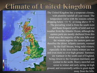
The United Kingdom has a temperate climate,
with plentiful rainfall all year round. The
temperature varies with the seasons seldom
dropping below −11 °C or rising above 35 °C
. The prevailing wind is from the south-west
and bears frequent spells of mild and wet
weather from the Atlantic Ocean, although the
eastern parts are mostly sheltered from this
wind since the majority of the rain falls over
the western regions the eastern parts are
therefore the driest. Atlantic currents, warmed
by the Gulf Stream, bring mild winters;
especially in the west where winters are wet
and even more so over high ground. Summers
are warmest in the south-east of England,
being closest to the European mainland, and
coolest in the north. Heavy snowfall can
occur in winter and early spring on high
ground, and occasionally settles to great depth
away from the hills.
Ben Nevis is the highest mountain in Scotland and the entire British Isles.
Standing at 1,344 metres above sea level, it is located at the western end of
the Grampian Mountains in the Lochaber area of the Scottish Highlands,
close to the town of Fort William.
The mountain is a popular destination, attracting an estimated 100,000
ascents a year, around three-quarters of which use the Pony Track from Glen
Nevis. The 700-metre cliffs of the north face are among the highest in
Scotland, providing classic scrambles and rock climbs of all difficulties for
climbers and mountaineers. They are also the principal locations in Scotland
for ice climbing.
Ben Macdui (Scottish Gaelic: Beinn Mac Duibh) is the second highest mountain in the
United Kingdom after Ben Nevis, and the highest in the Cairngorms. After the defeat of
Domnall mac Uilliam in 1187, Donnchad II, Earl of Fife, acquired Strathavon, territory
stretching from Ballindalloch to Ben Macdui; because the mountain marked the western
boundary of Donnchad territory, historian and place-name scholar Professor G. W. S.
Barrow suggested that the mountain took its name from Donnchad family, the Mac
Duibh.Ben Macdui lies on the southern edge of the Cairn Gorm plateau, on the
boundary between Aberdeenshire and Moray.
Snowdon is the highest mountain in Wales, at an elevation of 1,085 metres above sea
level, and the highest point in the British Isles outside the Scottish Highlands. It is
located in Snowdonia National Park (Parc Cenedlaethol Eryri) in Gwynedd, and has
been described as "probably the busiest mountain in Britain". It is designated as a
national nature reserve for its rare flora and fauna. The rocks that form Snowdon
were produced by volcanoes in the Ordovician period, and the massif has been
extensively sculpted by glaciation, forming the pyramidal peak of Snowdon.
Carnedd Llewelyn is a mountain massif in the Carneddau range in
Snowdonia, north-west Wales. It is the highest point of the
Carneddau and the second highest peak by relative height in Wales,
49th in the British Isles and lies on the border between Gwynedd
and Conwy
Scafell Pike is the highest mountain in England, at an elevation of
978 metres above sea level. It is located in Lake District National
Park, in Cumbria. It is part of the Southern Fells.
Helvellyn (possible meaning: pale yellow moorland) is a mountain in the English Lake
District, the highest point of the Helvellyn range, a north-south line of mountains to the
north of Ambleside, between the lakes of Thirlmere and Ullswater.
Helvellyn is the third-highest point both in England and in the Lake District, and
access to Helvellyn is easier than to the two higher peaks of Scafell Pike and Sca Fell.
The scenery includes three deep glacial coves and two sharp-topped ridges on the
eastern side
Slieve Donard is an 850-metre mountain in County Down, Northern
Ireland. Part of the Mourne Mountains, it is the highest peak in
Northern Ireland and in the wider province of Ulster. It is also the
19th highest peak on the island of Ireland. Slieve Donard sits near the
town of Newcastle on the eastern coast of County Down, only 3 km
from the Irish Sea.
Slieve Commedagh is a 767 m mountain in County Down,
Northern Ireland. It is the second-highest of the Mourne
Mountains, after Slieve Donard, and the second-highest
mountain in Northern Ireland.
Mountains in UK

Mountains in UK

  • 2.
    The United Kingdomhas a temperate climate, with plentiful rainfall all year round. The temperature varies with the seasons seldom dropping below −11 °C or rising above 35 °C . The prevailing wind is from the south-west and bears frequent spells of mild and wet weather from the Atlantic Ocean, although the eastern parts are mostly sheltered from this wind since the majority of the rain falls over the western regions the eastern parts are therefore the driest. Atlantic currents, warmed by the Gulf Stream, bring mild winters; especially in the west where winters are wet and even more so over high ground. Summers are warmest in the south-east of England, being closest to the European mainland, and coolest in the north. Heavy snowfall can occur in winter and early spring on high ground, and occasionally settles to great depth away from the hills.
  • 3.
    Ben Nevis isthe highest mountain in Scotland and the entire British Isles. Standing at 1,344 metres above sea level, it is located at the western end of the Grampian Mountains in the Lochaber area of the Scottish Highlands, close to the town of Fort William. The mountain is a popular destination, attracting an estimated 100,000 ascents a year, around three-quarters of which use the Pony Track from Glen Nevis. The 700-metre cliffs of the north face are among the highest in Scotland, providing classic scrambles and rock climbs of all difficulties for climbers and mountaineers. They are also the principal locations in Scotland for ice climbing.
  • 4.
    Ben Macdui (ScottishGaelic: Beinn Mac Duibh) is the second highest mountain in the United Kingdom after Ben Nevis, and the highest in the Cairngorms. After the defeat of Domnall mac Uilliam in 1187, Donnchad II, Earl of Fife, acquired Strathavon, territory stretching from Ballindalloch to Ben Macdui; because the mountain marked the western boundary of Donnchad territory, historian and place-name scholar Professor G. W. S. Barrow suggested that the mountain took its name from Donnchad family, the Mac Duibh.Ben Macdui lies on the southern edge of the Cairn Gorm plateau, on the boundary between Aberdeenshire and Moray.
  • 5.
    Snowdon is thehighest mountain in Wales, at an elevation of 1,085 metres above sea level, and the highest point in the British Isles outside the Scottish Highlands. It is located in Snowdonia National Park (Parc Cenedlaethol Eryri) in Gwynedd, and has been described as "probably the busiest mountain in Britain". It is designated as a national nature reserve for its rare flora and fauna. The rocks that form Snowdon were produced by volcanoes in the Ordovician period, and the massif has been extensively sculpted by glaciation, forming the pyramidal peak of Snowdon.
  • 6.
    Carnedd Llewelyn isa mountain massif in the Carneddau range in Snowdonia, north-west Wales. It is the highest point of the Carneddau and the second highest peak by relative height in Wales, 49th in the British Isles and lies on the border between Gwynedd and Conwy
  • 7.
    Scafell Pike isthe highest mountain in England, at an elevation of 978 metres above sea level. It is located in Lake District National Park, in Cumbria. It is part of the Southern Fells.
  • 8.
    Helvellyn (possible meaning:pale yellow moorland) is a mountain in the English Lake District, the highest point of the Helvellyn range, a north-south line of mountains to the north of Ambleside, between the lakes of Thirlmere and Ullswater. Helvellyn is the third-highest point both in England and in the Lake District, and access to Helvellyn is easier than to the two higher peaks of Scafell Pike and Sca Fell. The scenery includes three deep glacial coves and two sharp-topped ridges on the eastern side
  • 9.
    Slieve Donard isan 850-metre mountain in County Down, Northern Ireland. Part of the Mourne Mountains, it is the highest peak in Northern Ireland and in the wider province of Ulster. It is also the 19th highest peak on the island of Ireland. Slieve Donard sits near the town of Newcastle on the eastern coast of County Down, only 3 km from the Irish Sea.
  • 10.
    Slieve Commedagh isa 767 m mountain in County Down, Northern Ireland. It is the second-highest of the Mourne Mountains, after Slieve Donard, and the second-highest mountain in Northern Ireland.