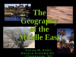
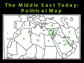
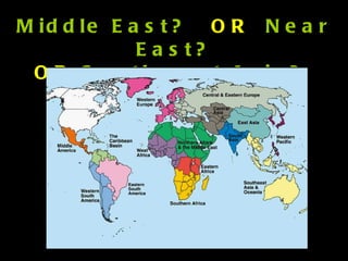
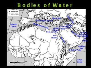
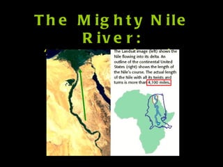
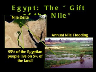
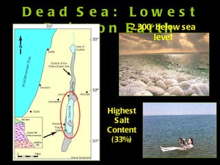
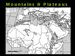
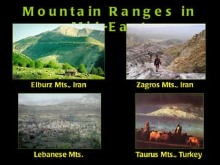
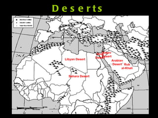
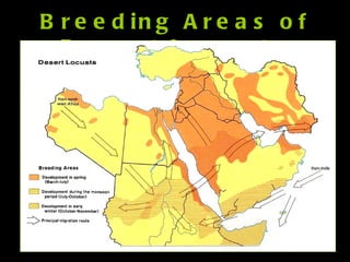
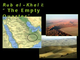
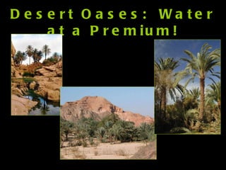
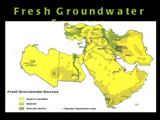
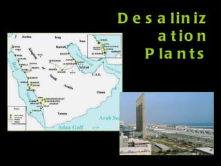
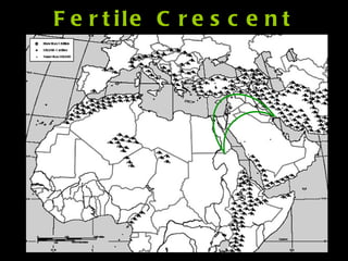
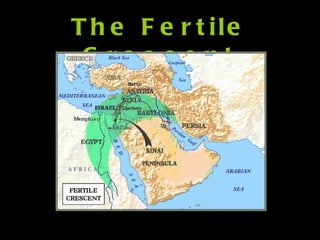
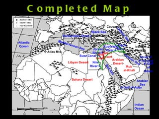
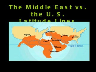
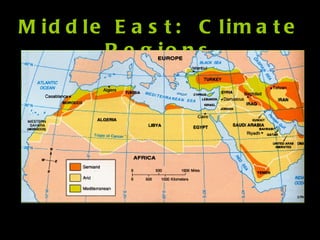
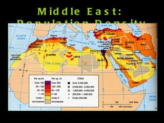
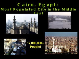
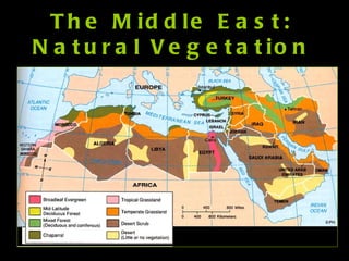
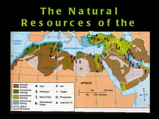
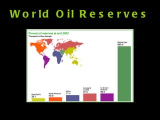
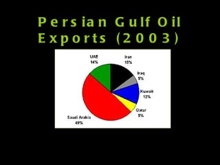
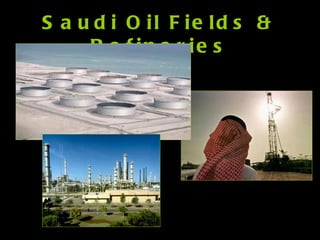
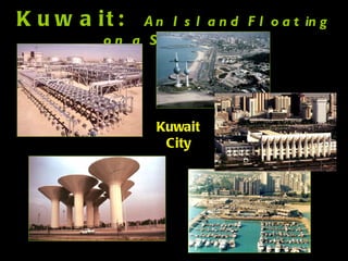
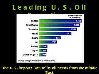
The Geography of the Middle East Susan M. Pojer Horace Greeley HS  Chappaqua, NY
The Middle East Today: Political Map 1 2 3--> 4--> 5 6 7 8--> 11--> 9 <--10 12 13 14 15--> 16 17 18 19 20 21
Middle East?  OR   Near East? OR  Southwest Asia?  OR….?
Bodies of Water  Tigris River Nile River  Euphrates River  Jordan River  Persian Gulf Arabian Sea Mediterranean Sea Indian Ocean Red Sea Black Sea  Gulf of Aden Strait of  Hormuz Suez Canal  Dardanelles Strait  Atlantic Ocean  Gulf of Oman Caspian Sea
The Mighty Nile River: “Longest River in the World”
Egypt:  The “Gift of the Nile” Annual Nile Flooding Nile Delta 95% of the Egyptian people live on 5% of the land!
Aswan High Dam, Egypt Hydroelectric Power Plant
Suez Canal Completed by the British in 1869
The Tigris & Euphrates River System Mesopotamia:  ”Land Between the Two Rivers” Marsh Arabs, So. Iraq
Dust Storms Along the  Tigris-Euphrates Flood Plains
The Jordan River System: Israel &  Jordan--A Fight Over Water Rights ?
Dead Sea:  Lowest Point on Earth Highest Salt Content (33%) 2,300’ below sea level
Wadis  – Instant Springs
Mountains & Plateaus  Atlas Mts.  Elburz Mts. Taurus Mts.  Zagros  Mts. Iranian Plateau Anatolian Plateau Caucasus Mts. Hejaz Mts.
Mountain Ranges in Mid-East Elburz Mts., Iran Zagros Mts., Iran Lebanese Mts. Taurus Mts., Turkey
Deserts Sahara Desert Arabian Desert Negev Desert Sinai Desert Libyan Desert Rub al-Khali
Desert Bedouins
Breeding Areas of Desert Locusts
Swarms of Desert Locusts! Locusts Swarm the Pyramids Complex at Giza! Israel Hit By Worst Locust Plague Since the 1950s!
Rub al-Khali : “The Empty Quarter”
Desert Oases:  Water at a Premium!
Fresh Groundwater Sources
Desalinization Plants
Fertile Crescent
The Fertile Crescent
Completed Map  Tigris River Nile River  Euphrates River  Jordan River  Persian Gulf Arabian Sea Mediterranean Sea Indian Ocean Red Sea Black Sea  Gulf of Aden Strait of  Hormuz Suez Canal  Dardanelles Strait  Atlantic Ocean  Gulf of Oman Caspian Sea Arabian Desert Negev Desert Sinai Desert Rub al-Khali  Atlas Mts.  Elburz Mts. Taurus Mts.  Zagros  Mts. Iranian Plateau Anatolian Plateau Caucasus Mts. Hejaz Mts. Sahara Desert Libyan Desert
The Middle East vs. the U. S. Latitude Lines
Middle East:  Climate Regions
Middle East:  Population Density
Cairo, Egypt:  Most Populated City in the Middle East 17,000,000+ People!
The Middle East: Natural Vegetation
The Natural Resources of the Middle East
World Oil Reserves
Persian Gulf Oil Exports (2003)
Saudi Oil Fields & Refineries
Kuwait:  An Island Floating on a Sea of Oil Kuwait City
Leading U. S. Oil Suppliers The U. S. imports 30% of its oil needs from the Middle East.

Middle east geography