SlideShare a Scribd company logo
1 of 29
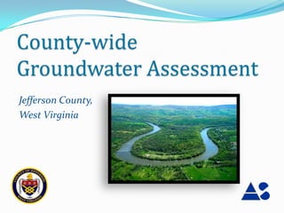
County-wide
Groundwater Assessment
Jefferson County,
West Virginia
Objective
 Assess availability and quality of groundwater and
 provide useful information toward promoting long-
 term management of the County’s Groundwater
 Resources
Groundwater Budget Study
 Focused on identifying the extent of the County’s
 groundwater resources

        Groundwater recharge


        Groundwater usage


        Maintenance of baseflow in streams
Recharge
Groundwater originates as precipitation
 The portion of precipitation that percolates downward through
  the soil and infiltrates into the bedrock aquifer is called
  Recharge:
Recharge Calculation
 Recharge Area (green)


 Discharge Area (red)


 Previously published recharge
 rates were applied to County’s
 total recharge area to determine
 Annual Recharge Volume
Recharge Rates

 Hydrogeologic Unit              Recharge Rate                        Recharge Area
                                 (inches/year)                           (acres)
      Western                             5.9                              36,734
      Central                             5.6                              70,684
      Eastern                             5.5                              12,331

                *recharge rates are representative of drought conditions
Maintenance of Baseflow
 Utilized published data from similar hydrogeologic setting to estimate
  percentage of annual recharge contributing to baseflow


 An estimated 50% of annual recharge is required to maintain baseflow
  in streams and is unavailable for use
Annual Recharge Estimate
Recharge from precipitation:          18,475,000,000 gallons/year

Vol. needed to maintain baseflow:       - 9,237,500,000 gallons


Vol. of groundwater
available for use:                  9,237,500,000 gallons
Groundwater Usage
Considered the following use categories:

      Public Supply        Irrigation

      Domestic Supply      Commercial

      Industrial           Mining
Groundwater Use Estimate
                        1,465,250,000 gallons per year


    Sources of water use information:

    Data Management Unit of the Engineering Division,      2010 U.S. Census Data
     Jefferson County Office of Environmental Health
                                                            West Virginia Office of Miners’ Health, Safety and
    WV Dept. of Environmental Protection, Division of       Training
     Water and Waste Management
                                                            Water-Use Estimates for West Virginia, Atkins, 2004 –
    WVU Agricultural Extension Service – Jefferson          USGS publication
     County Office
Groundwater Use Estimate
Percentage of available groundwater used annually:


                                1.47 bgy
    Groundwater use estimate:
Groundwater deemed available:   9.24 bgy   16%
Groundwater Well Database
 Assistance provided by the
  Jefferson County GIS
  Department

 Utilized available well
  completion reports from Health
  Department

 Database consists of over 1100
  wells with georeferenced
  locations
Internship
• Worked for Jefferson
  County GIS/Addressing
  Office
• Water budget study
• Analytical Services Inc.
The Effect of Bedrock Geology on
Well Yield in Jefferson County, West
               Virginia
          Jeremiah Sanders
         Shepherd University
My Study
• Focus on geology
• How geology affect well yield
• Null Hypothesis: There is no difference in the
  distribution of well yield between the bedrock
  formations
Methods
• Well database
• Clean up
  database
• Create parcel ID
Methods
• Importing to ArcGIS
• 1276 parcel match
• Quality assessment
Methods

• Create new database
• New field entries
• Examined well
  completion reports
• Inconsistent entries
  in well completion
  reports
Methods
• Join new database
  to parcels/address
  Points
• 911 well points
Methods
• State well records and
  USGS study (McCoy et al. 2005)
  wells added
• Total 1124 well points
• Joined bedrock data to
  well points
• Used SPSS 19(IBM, USA)
  to check for normality
  and K-W test
Results
                                                                        (Єa)-Antietam Formation
             300
                                                                        (Єe)- Elbrook Formation

                                                                        (Єh)-Harpers Formation
             250
                                                                        (Єt)-Tomstown Formation

                                                                        (Єw)-Waynesboro Formation
             200
                                                                        (Єwl)-Weverton and
# of Wells


                                                                        Loudoun Formations
                                                                        undivided
             150
                                                                        (OЄc)- Conococheague
                                                                        Limestone
             100                                                        (Om)-Martinsburg
                                                                        Formation

              50                                                        (Omu)-Middle Ordivician
                                                                        limestone

                                                                        (Opr)-Pinesburg Station
               0                                                        Dolomite and Rockdale Run
                                                                        Formation
                   Єa   Єe   Єh   Єt    Єw Єwl OЄc Om Omu Opr Os   Zc
                                                                        (Os)- Stonehenge Limestone
                                       Bedrock Formation                (Zc)-Catoctin Formation
Results
                                                                                 (Єa)-Antietam Formation
                      180
                                                                                 (Єe)- Elbrook Formation
                      160                                                        (Єh)-Harpers Formation

                      140                                                        (Єt)-Tomstown Formation
Average Yield (lpm)


                                                                                 (Єw)-Waynesboro Formation
                      120
                                                                                 (Єwl)-Weverton and
                      100                                                        Loudoun Formations
                                                                                 undivided
                       80                                                        (OЄc)- Conococheague
                                                                                 Limestone
                       60
                                                                                 (Om)-Martinsburg
                                                                                 Formation
                       40
                                                                                 (Omu)-Middle Ordivician
                       20                                                        limestone

                                                                                 (Opr)-Pinesburg Station
                        0                                                        Dolomite and Rockdale Run
                            Єa   Єe   Єh   Єt    Єw Єwl OЄc Om Omu Opr Os   Zc   Formation

                                                                                 (Os)- Stonehenge Limestone
                                                Bedrock Formation
                                                                                 (Zc)-Catoctin Formation
Hydrogeologic Units
Areas possessing unique characteristics


   Western Fault Dominated

   Central Folded Carbonates

   Eastern Metamorphics
Table of Mean Values
Review of well database illustrates uniqueness of each
Hydrogeologic Unit:

  Hydrogeologic   Well Depth   Yield   Depth to Water Casing Length
      Unit          (feet)     (gpm)       (feet)          (feet)
     Western         281        19          46             57
     Central         278        32          66             74
     Eastern         355        14          94             83
Groundwater Development
Potential
The Central Unit has the
greatest number of high
yielding wells


                           Yield (gpm)
Hydrogeologic Conditions Vary
Across County
 Site-specific assessment is
  recommended to understand
  compatibility of groundwater
  development with planned use
Water Quality Review
Common Groundwater Contaminants:


       Hydrogeologic Unit       Common Contaminants

            Western         Sulfate, Nitrate, Bacteria, Hardness
            Central             Nitrate, Bacteria, Hardness
            Eastern          Iron, Manganese, Radionuclides
Contaminant Migration
Influenced by geologic conditions and land use
  Conduits in Karst areas can facilitate direct groundwater
   contamination and rapid contaminant transport
Recommendations
To promote sustainability and long-term protection of
the County’s groundwater resources, ASI recommends:

    Assessment of High-Yield withdrawals


    Incorporating Groundwater Protection into
     long-term planning

More Related Content

More from WV Assocation of Geospatial Professionals

More from WV Assocation of Geospatial Professionals (20)

Conservation Innovation - Tools and Trends in GIS
Conservation Innovation - Tools and Trends in GISConservation Innovation - Tools and Trends in GIS
Conservation Innovation - Tools and Trends in GIS
 
High Accuracy Data Collection with Esri's Collector App
High Accuracy Data Collection with Esri's Collector AppHigh Accuracy Data Collection with Esri's Collector App
High Accuracy Data Collection with Esri's Collector App
 
Integrating Survey Data into a GIS
Integrating Survey Data into a GISIntegrating Survey Data into a GIS
Integrating Survey Data into a GIS
 
Implementation of Parcel Fabric in West Virginia
Implementation of Parcel Fabric in West VirginiaImplementation of Parcel Fabric in West Virginia
Implementation of Parcel Fabric in West Virginia
 
Proceedings for 2016 WV EPAN GIS Users Group Meeting
Proceedings for 2016 WV EPAN GIS Users Group MeetingProceedings for 2016 WV EPAN GIS Users Group Meeting
Proceedings for 2016 WV EPAN GIS Users Group Meeting
 
Evaluating Riparian Buffers of WV Landowners in Chesapeake Bay Drainage
Evaluating Riparian Buffers of WV Landowners in Chesapeake Bay Drainage Evaluating Riparian Buffers of WV Landowners in Chesapeake Bay Drainage
Evaluating Riparian Buffers of WV Landowners in Chesapeake Bay Drainage
 
2016 Agenda for WV EPAN Users Group Meeting
2016 Agenda for WV EPAN Users Group Meeting2016 Agenda for WV EPAN Users Group Meeting
2016 Agenda for WV EPAN Users Group Meeting
 
WV Local GIS Data Contributions to State/Federal Datasets
WV Local GIS Data Contributions to State/Federal DatasetsWV Local GIS Data Contributions to State/Federal Datasets
WV Local GIS Data Contributions to State/Federal Datasets
 
Agenda EPAN 2015
Agenda EPAN 2015Agenda EPAN 2015
Agenda EPAN 2015
 
Transitioning Applications to the Web App Builder
Transitioning Applications to the Web App BuilderTransitioning Applications to the Web App Builder
Transitioning Applications to the Web App Builder
 
Stormwater and GIS
Stormwater and GISStormwater and GIS
Stormwater and GIS
 
Pictometry Imagery for West Virginia
Pictometry Imagery for West VirginiaPictometry Imagery for West Virginia
Pictometry Imagery for West Virginia
 
Device Locational Accuracy
Device Locational AccuracyDevice Locational Accuracy
Device Locational Accuracy
 
WV Statewide Addressing and Mapping Update (SAMS-II)
WV Statewide Addressing and Mapping Update (SAMS-II)WV Statewide Addressing and Mapping Update (SAMS-II)
WV Statewide Addressing and Mapping Update (SAMS-II)
 
Agenda for WVAGP 2015 Annual Meeting
Agenda for WVAGP 2015 Annual MeetingAgenda for WVAGP 2015 Annual Meeting
Agenda for WVAGP 2015 Annual Meeting
 
WV 3D Elevation Program (3DEP) / BAA Overview
WV 3D Elevation Program (3DEP) / BAA OverviewWV 3D Elevation Program (3DEP) / BAA Overview
WV 3D Elevation Program (3DEP) / BAA Overview
 
WV National Hydrography Dataset (NHD) Update
WV National Hydrography Dataset (NHD) UpdateWV National Hydrography Dataset (NHD) Update
WV National Hydrography Dataset (NHD) Update
 
Three Rivers Quest (WV Water Research Institute)
Three Rivers Quest (WV Water Research Institute)Three Rivers Quest (WV Water Research Institute)
Three Rivers Quest (WV Water Research Institute)
 
Geospatial Initiatives: A National Perspective
 Geospatial Initiatives: A National Perspective Geospatial Initiatives: A National Perspective
Geospatial Initiatives: A National Perspective
 
2013 WV Epan GIS Users Group Meeting Agenda
2013 WV Epan GIS Users Group Meeting Agenda2013 WV Epan GIS Users Group Meeting Agenda
2013 WV Epan GIS Users Group Meeting Agenda
 

Recently uploaded

Intro to Passkeys and the State of Passwordless.pptx
Intro to Passkeys and the State of Passwordless.pptxIntro to Passkeys and the State of Passwordless.pptx
Intro to Passkeys and the State of Passwordless.pptxFIDO Alliance
 
"I see eyes in my soup": How Delivery Hero implemented the safety system for ...
"I see eyes in my soup": How Delivery Hero implemented the safety system for ..."I see eyes in my soup": How Delivery Hero implemented the safety system for ...
"I see eyes in my soup": How Delivery Hero implemented the safety system for ...Zilliz
 
Cloud Frontiers: A Deep Dive into Serverless Spatial Data and FME
Cloud Frontiers:  A Deep Dive into Serverless Spatial Data and FMECloud Frontiers:  A Deep Dive into Serverless Spatial Data and FME
Cloud Frontiers: A Deep Dive into Serverless Spatial Data and FMESafe Software
 
AI+A11Y 11MAY2024 HYDERBAD GAAD 2024 - HelloA11Y (11 May 2024)
AI+A11Y 11MAY2024 HYDERBAD GAAD 2024 - HelloA11Y (11 May 2024)AI+A11Y 11MAY2024 HYDERBAD GAAD 2024 - HelloA11Y (11 May 2024)
AI+A11Y 11MAY2024 HYDERBAD GAAD 2024 - HelloA11Y (11 May 2024)Samir Dash
 
Repurposing LNG terminals for Hydrogen Ammonia: Feasibility and Cost Saving
Repurposing LNG terminals for Hydrogen Ammonia: Feasibility and Cost SavingRepurposing LNG terminals for Hydrogen Ammonia: Feasibility and Cost Saving
Repurposing LNG terminals for Hydrogen Ammonia: Feasibility and Cost SavingEdi Saputra
 
ADP Passwordless Journey Case Study.pptx
ADP Passwordless Journey Case Study.pptxADP Passwordless Journey Case Study.pptx
ADP Passwordless Journey Case Study.pptxFIDO Alliance
 
Polkadot JAM Slides - Token2049 - By Dr. Gavin Wood
Polkadot JAM Slides - Token2049 - By Dr. Gavin WoodPolkadot JAM Slides - Token2049 - By Dr. Gavin Wood
Polkadot JAM Slides - Token2049 - By Dr. Gavin WoodJuan lago vázquez
 
AI in Action: Real World Use Cases by Anitaraj
AI in Action: Real World Use Cases by AnitarajAI in Action: Real World Use Cases by Anitaraj
AI in Action: Real World Use Cases by AnitarajAnitaRaj43
 
Exploring Multimodal Embeddings with Milvus
Exploring Multimodal Embeddings with MilvusExploring Multimodal Embeddings with Milvus
Exploring Multimodal Embeddings with MilvusZilliz
 
Vector Search -An Introduction in Oracle Database 23ai.pptx
Vector Search -An Introduction in Oracle Database 23ai.pptxVector Search -An Introduction in Oracle Database 23ai.pptx
Vector Search -An Introduction in Oracle Database 23ai.pptxRemote DBA Services
 
Modernizing Legacy Systems Using Ballerina
Modernizing Legacy Systems Using BallerinaModernizing Legacy Systems Using Ballerina
Modernizing Legacy Systems Using BallerinaWSO2
 
TrustArc Webinar - Unified Trust Center for Privacy, Security, Compliance, an...
TrustArc Webinar - Unified Trust Center for Privacy, Security, Compliance, an...TrustArc Webinar - Unified Trust Center for Privacy, Security, Compliance, an...
TrustArc Webinar - Unified Trust Center for Privacy, Security, Compliance, an...TrustArc
 
MINDCTI Revenue Release Quarter One 2024
MINDCTI Revenue Release Quarter One 2024MINDCTI Revenue Release Quarter One 2024
MINDCTI Revenue Release Quarter One 2024MIND CTI
 
Design and Development of a Provenance Capture Platform for Data Science
Design and Development of a Provenance Capture Platform for Data ScienceDesign and Development of a Provenance Capture Platform for Data Science
Design and Development of a Provenance Capture Platform for Data SciencePaolo Missier
 
الأمن السيبراني - ما لا يسع للمستخدم جهله
الأمن السيبراني - ما لا يسع للمستخدم جهلهالأمن السيبراني - ما لا يسع للمستخدم جهله
الأمن السيبراني - ما لا يسع للمستخدم جهلهMohamed Sweelam
 
The Zero-ETL Approach: Enhancing Data Agility and Insight
The Zero-ETL Approach: Enhancing Data Agility and InsightThe Zero-ETL Approach: Enhancing Data Agility and Insight
The Zero-ETL Approach: Enhancing Data Agility and InsightSafe Software
 
Tales from a Passkey Provider Progress from Awareness to Implementation.pptx
Tales from a Passkey Provider  Progress from Awareness to Implementation.pptxTales from a Passkey Provider  Progress from Awareness to Implementation.pptx
Tales from a Passkey Provider Progress from Awareness to Implementation.pptxFIDO Alliance
 
Web Form Automation for Bonterra Impact Management (fka Social Solutions Apri...
Web Form Automation for Bonterra Impact Management (fka Social Solutions Apri...Web Form Automation for Bonterra Impact Management (fka Social Solutions Apri...
Web Form Automation for Bonterra Impact Management (fka Social Solutions Apri...Jeffrey Haguewood
 
Why Teams call analytics are critical to your entire business
Why Teams call analytics are critical to your entire businessWhy Teams call analytics are critical to your entire business
Why Teams call analytics are critical to your entire businesspanagenda
 
Finding Java's Hidden Performance Traps @ DevoxxUK 2024
Finding Java's Hidden Performance Traps @ DevoxxUK 2024Finding Java's Hidden Performance Traps @ DevoxxUK 2024
Finding Java's Hidden Performance Traps @ DevoxxUK 2024Victor Rentea
 

Recently uploaded (20)

Intro to Passkeys and the State of Passwordless.pptx
Intro to Passkeys and the State of Passwordless.pptxIntro to Passkeys and the State of Passwordless.pptx
Intro to Passkeys and the State of Passwordless.pptx
 
"I see eyes in my soup": How Delivery Hero implemented the safety system for ...
"I see eyes in my soup": How Delivery Hero implemented the safety system for ..."I see eyes in my soup": How Delivery Hero implemented the safety system for ...
"I see eyes in my soup": How Delivery Hero implemented the safety system for ...
 
Cloud Frontiers: A Deep Dive into Serverless Spatial Data and FME
Cloud Frontiers:  A Deep Dive into Serverless Spatial Data and FMECloud Frontiers:  A Deep Dive into Serverless Spatial Data and FME
Cloud Frontiers: A Deep Dive into Serverless Spatial Data and FME
 
AI+A11Y 11MAY2024 HYDERBAD GAAD 2024 - HelloA11Y (11 May 2024)
AI+A11Y 11MAY2024 HYDERBAD GAAD 2024 - HelloA11Y (11 May 2024)AI+A11Y 11MAY2024 HYDERBAD GAAD 2024 - HelloA11Y (11 May 2024)
AI+A11Y 11MAY2024 HYDERBAD GAAD 2024 - HelloA11Y (11 May 2024)
 
Repurposing LNG terminals for Hydrogen Ammonia: Feasibility and Cost Saving
Repurposing LNG terminals for Hydrogen Ammonia: Feasibility and Cost SavingRepurposing LNG terminals for Hydrogen Ammonia: Feasibility and Cost Saving
Repurposing LNG terminals for Hydrogen Ammonia: Feasibility and Cost Saving
 
ADP Passwordless Journey Case Study.pptx
ADP Passwordless Journey Case Study.pptxADP Passwordless Journey Case Study.pptx
ADP Passwordless Journey Case Study.pptx
 
Polkadot JAM Slides - Token2049 - By Dr. Gavin Wood
Polkadot JAM Slides - Token2049 - By Dr. Gavin WoodPolkadot JAM Slides - Token2049 - By Dr. Gavin Wood
Polkadot JAM Slides - Token2049 - By Dr. Gavin Wood
 
AI in Action: Real World Use Cases by Anitaraj
AI in Action: Real World Use Cases by AnitarajAI in Action: Real World Use Cases by Anitaraj
AI in Action: Real World Use Cases by Anitaraj
 
Exploring Multimodal Embeddings with Milvus
Exploring Multimodal Embeddings with MilvusExploring Multimodal Embeddings with Milvus
Exploring Multimodal Embeddings with Milvus
 
Vector Search -An Introduction in Oracle Database 23ai.pptx
Vector Search -An Introduction in Oracle Database 23ai.pptxVector Search -An Introduction in Oracle Database 23ai.pptx
Vector Search -An Introduction in Oracle Database 23ai.pptx
 
Modernizing Legacy Systems Using Ballerina
Modernizing Legacy Systems Using BallerinaModernizing Legacy Systems Using Ballerina
Modernizing Legacy Systems Using Ballerina
 
TrustArc Webinar - Unified Trust Center for Privacy, Security, Compliance, an...
TrustArc Webinar - Unified Trust Center for Privacy, Security, Compliance, an...TrustArc Webinar - Unified Trust Center for Privacy, Security, Compliance, an...
TrustArc Webinar - Unified Trust Center for Privacy, Security, Compliance, an...
 
MINDCTI Revenue Release Quarter One 2024
MINDCTI Revenue Release Quarter One 2024MINDCTI Revenue Release Quarter One 2024
MINDCTI Revenue Release Quarter One 2024
 
Design and Development of a Provenance Capture Platform for Data Science
Design and Development of a Provenance Capture Platform for Data ScienceDesign and Development of a Provenance Capture Platform for Data Science
Design and Development of a Provenance Capture Platform for Data Science
 
الأمن السيبراني - ما لا يسع للمستخدم جهله
الأمن السيبراني - ما لا يسع للمستخدم جهلهالأمن السيبراني - ما لا يسع للمستخدم جهله
الأمن السيبراني - ما لا يسع للمستخدم جهله
 
The Zero-ETL Approach: Enhancing Data Agility and Insight
The Zero-ETL Approach: Enhancing Data Agility and InsightThe Zero-ETL Approach: Enhancing Data Agility and Insight
The Zero-ETL Approach: Enhancing Data Agility and Insight
 
Tales from a Passkey Provider Progress from Awareness to Implementation.pptx
Tales from a Passkey Provider  Progress from Awareness to Implementation.pptxTales from a Passkey Provider  Progress from Awareness to Implementation.pptx
Tales from a Passkey Provider Progress from Awareness to Implementation.pptx
 
Web Form Automation for Bonterra Impact Management (fka Social Solutions Apri...
Web Form Automation for Bonterra Impact Management (fka Social Solutions Apri...Web Form Automation for Bonterra Impact Management (fka Social Solutions Apri...
Web Form Automation for Bonterra Impact Management (fka Social Solutions Apri...
 
Why Teams call analytics are critical to your entire business
Why Teams call analytics are critical to your entire businessWhy Teams call analytics are critical to your entire business
Why Teams call analytics are critical to your entire business
 
Finding Java's Hidden Performance Traps @ DevoxxUK 2024
Finding Java's Hidden Performance Traps @ DevoxxUK 2024Finding Java's Hidden Performance Traps @ DevoxxUK 2024
Finding Java's Hidden Performance Traps @ DevoxxUK 2024
 

GIS User for Countywide Groundwater Assessment, Jefferson County, WV

  • 2. Objective  Assess availability and quality of groundwater and provide useful information toward promoting long- term management of the County’s Groundwater Resources
  • 3. Groundwater Budget Study Focused on identifying the extent of the County’s groundwater resources  Groundwater recharge  Groundwater usage  Maintenance of baseflow in streams
  • 4. Recharge Groundwater originates as precipitation  The portion of precipitation that percolates downward through the soil and infiltrates into the bedrock aquifer is called Recharge:
  • 5. Recharge Calculation  Recharge Area (green)  Discharge Area (red) Previously published recharge rates were applied to County’s total recharge area to determine Annual Recharge Volume
  • 6. Recharge Rates Hydrogeologic Unit Recharge Rate Recharge Area (inches/year) (acres) Western 5.9 36,734 Central 5.6 70,684 Eastern 5.5 12,331 *recharge rates are representative of drought conditions
  • 7. Maintenance of Baseflow  Utilized published data from similar hydrogeologic setting to estimate percentage of annual recharge contributing to baseflow  An estimated 50% of annual recharge is required to maintain baseflow in streams and is unavailable for use
  • 8. Annual Recharge Estimate Recharge from precipitation: 18,475,000,000 gallons/year Vol. needed to maintain baseflow: - 9,237,500,000 gallons Vol. of groundwater available for use: 9,237,500,000 gallons
  • 9. Groundwater Usage Considered the following use categories:  Public Supply  Irrigation  Domestic Supply  Commercial  Industrial  Mining
  • 10. Groundwater Use Estimate 1,465,250,000 gallons per year Sources of water use information:  Data Management Unit of the Engineering Division,  2010 U.S. Census Data Jefferson County Office of Environmental Health  West Virginia Office of Miners’ Health, Safety and  WV Dept. of Environmental Protection, Division of Training Water and Waste Management  Water-Use Estimates for West Virginia, Atkins, 2004 –  WVU Agricultural Extension Service – Jefferson USGS publication County Office
  • 11. Groundwater Use Estimate Percentage of available groundwater used annually: 1.47 bgy Groundwater use estimate: Groundwater deemed available: 9.24 bgy 16%
  • 12. Groundwater Well Database  Assistance provided by the Jefferson County GIS Department  Utilized available well completion reports from Health Department  Database consists of over 1100 wells with georeferenced locations
  • 13. Internship • Worked for Jefferson County GIS/Addressing Office • Water budget study • Analytical Services Inc.
  • 14. The Effect of Bedrock Geology on Well Yield in Jefferson County, West Virginia Jeremiah Sanders Shepherd University
  • 15. My Study • Focus on geology • How geology affect well yield • Null Hypothesis: There is no difference in the distribution of well yield between the bedrock formations
  • 16. Methods • Well database • Clean up database • Create parcel ID
  • 17. Methods • Importing to ArcGIS • 1276 parcel match • Quality assessment
  • 18. Methods • Create new database • New field entries • Examined well completion reports • Inconsistent entries in well completion reports
  • 19. Methods • Join new database to parcels/address Points • 911 well points
  • 20. Methods • State well records and USGS study (McCoy et al. 2005) wells added • Total 1124 well points • Joined bedrock data to well points • Used SPSS 19(IBM, USA) to check for normality and K-W test
  • 21. Results (Єa)-Antietam Formation 300 (Єe)- Elbrook Formation (Єh)-Harpers Formation 250 (Єt)-Tomstown Formation (Єw)-Waynesboro Formation 200 (Єwl)-Weverton and # of Wells Loudoun Formations undivided 150 (OЄc)- Conococheague Limestone 100 (Om)-Martinsburg Formation 50 (Omu)-Middle Ordivician limestone (Opr)-Pinesburg Station 0 Dolomite and Rockdale Run Formation Єa Єe Єh Єt Єw Єwl OЄc Om Omu Opr Os Zc (Os)- Stonehenge Limestone Bedrock Formation (Zc)-Catoctin Formation
  • 22. Results (Єa)-Antietam Formation 180 (Єe)- Elbrook Formation 160 (Єh)-Harpers Formation 140 (Єt)-Tomstown Formation Average Yield (lpm) (Єw)-Waynesboro Formation 120 (Єwl)-Weverton and 100 Loudoun Formations undivided 80 (OЄc)- Conococheague Limestone 60 (Om)-Martinsburg Formation 40 (Omu)-Middle Ordivician 20 limestone (Opr)-Pinesburg Station 0 Dolomite and Rockdale Run Єa Єe Єh Єt Єw Єwl OЄc Om Omu Opr Os Zc Formation (Os)- Stonehenge Limestone Bedrock Formation (Zc)-Catoctin Formation
  • 23. Hydrogeologic Units Areas possessing unique characteristics Western Fault Dominated Central Folded Carbonates Eastern Metamorphics
  • 24. Table of Mean Values Review of well database illustrates uniqueness of each Hydrogeologic Unit: Hydrogeologic Well Depth Yield Depth to Water Casing Length Unit (feet) (gpm) (feet) (feet) Western 281 19 46 57 Central 278 32 66 74 Eastern 355 14 94 83
  • 25. Groundwater Development Potential The Central Unit has the greatest number of high yielding wells Yield (gpm)
  • 26. Hydrogeologic Conditions Vary Across County  Site-specific assessment is recommended to understand compatibility of groundwater development with planned use
  • 27. Water Quality Review Common Groundwater Contaminants: Hydrogeologic Unit Common Contaminants Western Sulfate, Nitrate, Bacteria, Hardness Central Nitrate, Bacteria, Hardness Eastern Iron, Manganese, Radionuclides
  • 28. Contaminant Migration Influenced by geologic conditions and land use  Conduits in Karst areas can facilitate direct groundwater contamination and rapid contaminant transport
  • 29. Recommendations To promote sustainability and long-term protection of the County’s groundwater resources, ASI recommends:  Assessment of High-Yield withdrawals  Incorporating Groundwater Protection into long-term planning