Download to read offline
![Thereweremanysensordata to
monitorEarth in2015
• 333 Earth Observation
satellites in orbit in 2015
[ucsusa.org].
• 10’000 recreational drones
registered in the U.S. by 2020
[FAA].
• 20 Pb of oblique photos in Google
Street View in 2015
[Google Maps].
• 198 millions of geolocated photos
on Flickr in Jan. 2013 [flickr.com].
AI4Copernicus
2023
D.
Tuia
/
May
2023
3](https://image.slidesharecdn.com/machinelearning-230614173004-fad0e42d/75/Machine-learning-for-the-environment-monitoring-the-pulse-of-our-Planet-with-remotely-sensed-data-3-2048.jpg)
![Thereare manysensordata to
monitorEarth in2015 2023
• 333 1’005 Earth Observation
satellites in orbit in 2023
[ucsusa.org].
• 10’000 1’100’000 recreational
drones registered in the U.S in
2023. [FAA].
• 170 billions of oblique photos in
Google Street View in 2020
[Google Maps].
• 198 millions of geolocated photos
on Flickr in Jan. 2013 [flickr.com].
AI4Copernicus
2023
D.
Tuia
/
May
2023
4](https://image.slidesharecdn.com/machinelearning-230614173004-fad0e42d/75/Machine-learning-for-the-environment-monitoring-the-pulse-of-our-Planet-with-remotely-sensed-data-4-2048.jpg)
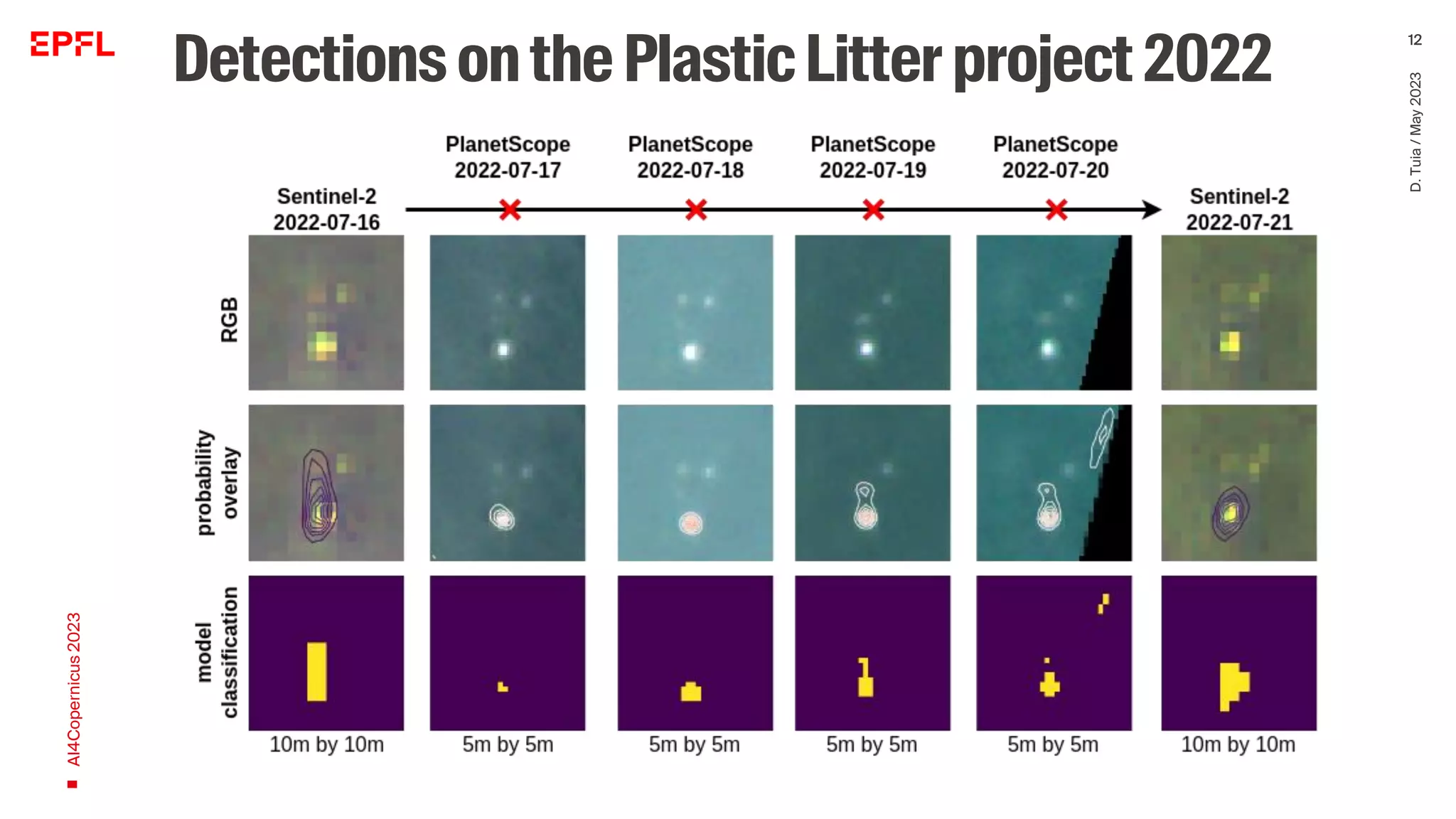
![Buildingenvironmentaldeeplearning
models
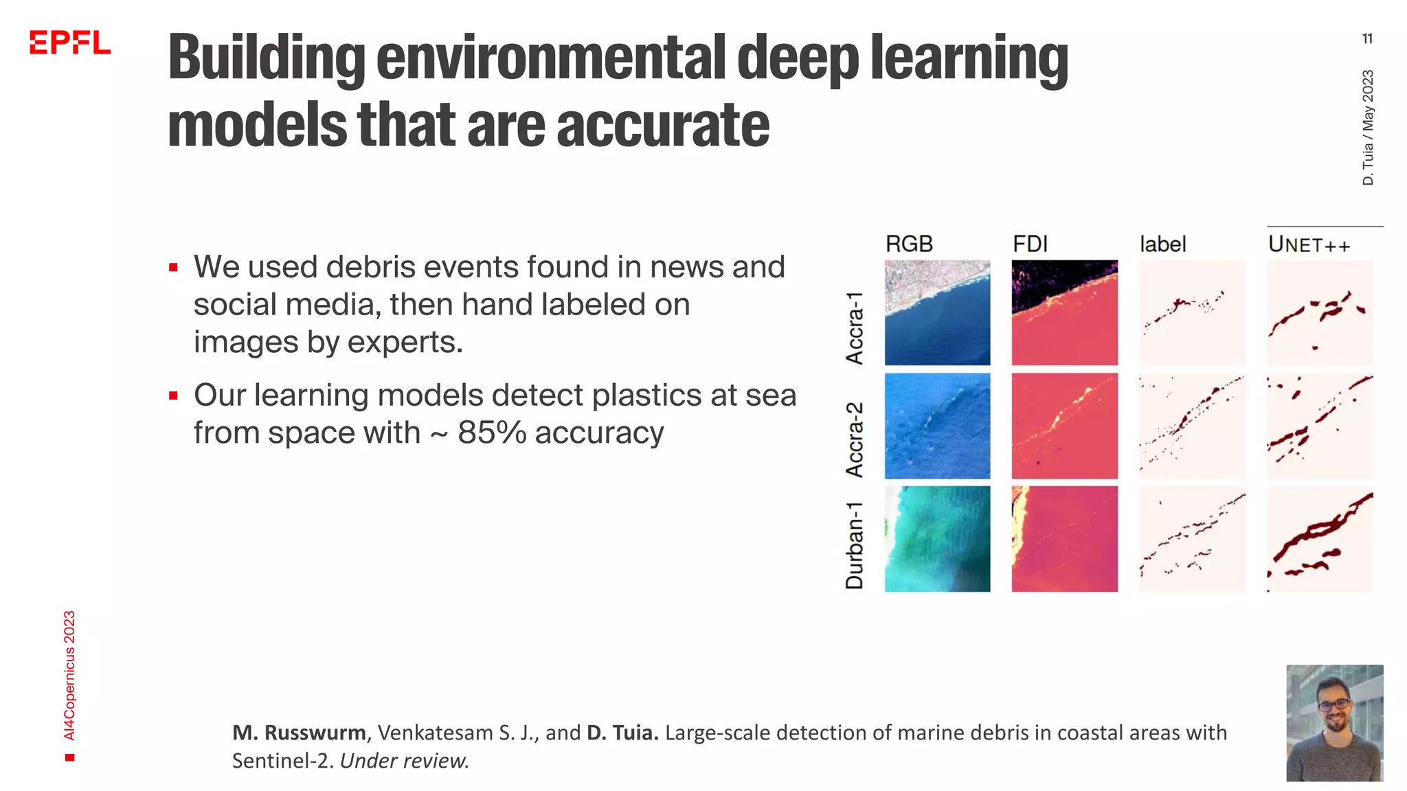
▪ We used debris events found in news and
social media, then hand labeled on
images by experts.
AI4Copernicus
2023
D.
Tuia
/
May
2023
10
[Mifdal et al., 2020]
Mifdal, J., Longépé, N., and Rußwurm, M.: Towards detecting floating objects on a global scale with spatial features
using Sentinel-2, ISPRS Ann. Photogramm. Remote Sens. Spatial Inf. Sci., V-3-2021, 285–293,](https://image.slidesharecdn.com/machinelearning-230614173004-fad0e42d/75/Machine-learning-for-the-environment-monitoring-the-pulse-of-our-Planet-with-remotely-sensed-data-10-2048.jpg)
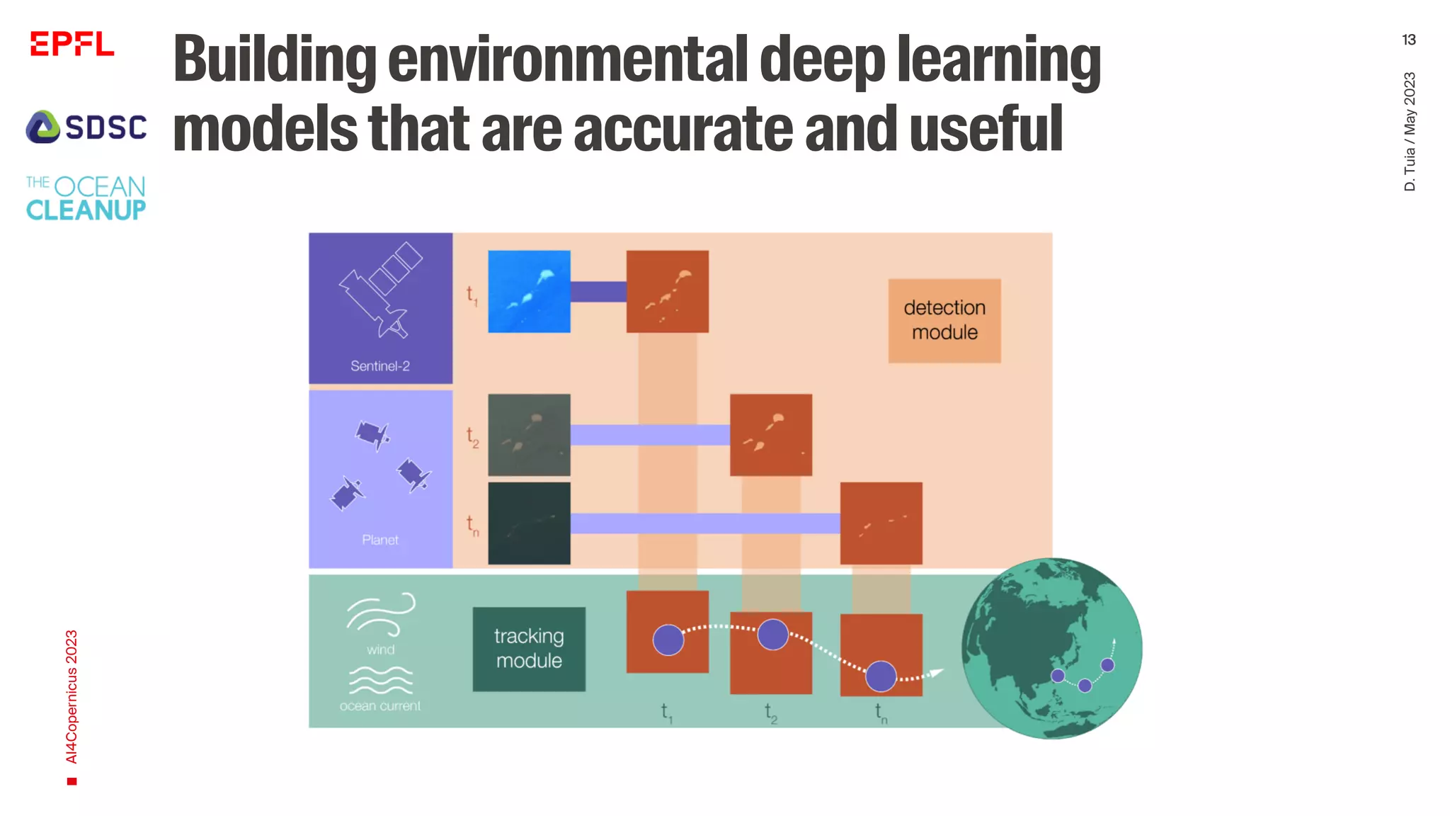
![Scalable
▪ No model should work only on
• one image
• one region of the world
• one task
AI4Copernicus
2023
D.
Tuia
/
May
2023
17
[Mifdal et al., 2020]
Mifdal, J., Longépé, N., and Rußwurm, M.: Towards detecting floating objects on a global scale with spatial features
using Sentinel-2, ISPRS Ann. Photogramm. Remote Sens. Spatial Inf. Sci., V-3-2021, 285–293,](https://image.slidesharecdn.com/machinelearning-230614173004-fad0e42d/75/Machine-learning-for-the-environment-monitoring-the-pulse-of-our-Planet-with-remotely-sensed-data-17-2048.jpg)
![Scalable
▪ No model should work only on
• one image
• one region of the world
• one task
AI4Copernicus
2023
D.
Tuia
/
May
2023
18
D. Tuia, B. Kellenberger, S. Beery, B. Costelloe, S. Zuffi, B. Risse, A. Mathis, M. W. Mathis, F. van Langevelde, T. Burghardt, R. Kays, H. Klinck, M.
Wikelski, I. D. Couzin, G. van Horn, M. C. Crofoot, C. V. Stewart, and T. Berger-Wolf. Perspectives in machine learning for wildlife conservation.
Nature Comm., 13(792), 2022.
[Mifdal et al., 2020]](https://image.slidesharecdn.com/machinelearning-230614173004-fad0e42d/75/Machine-learning-for-the-environment-monitoring-the-pulse-of-our-Planet-with-remotely-sensed-data-18-2048.jpg)
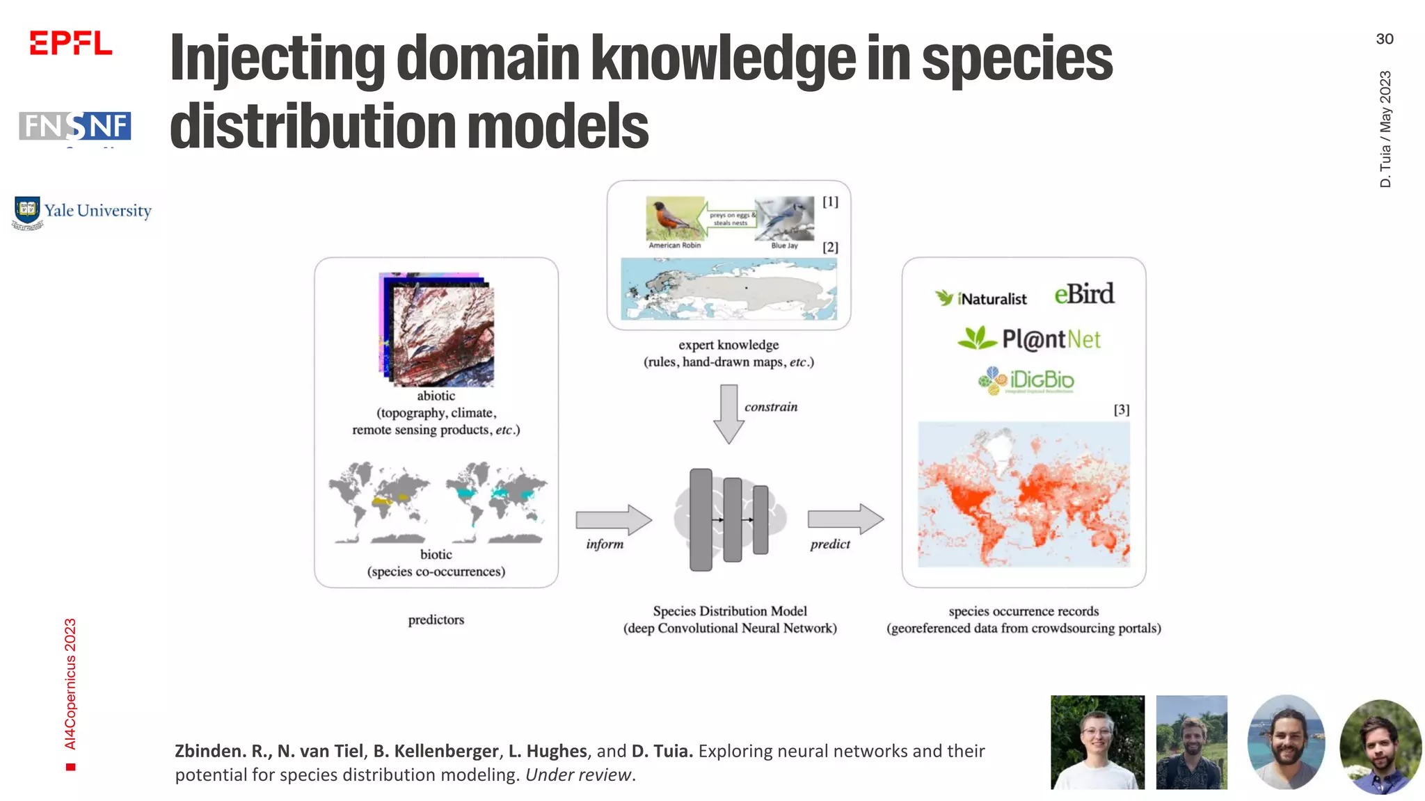


The document discusses the advancements in remote sensing and machine learning for monitoring environmental changes, highlighting the increase in Earth observation satellites and sensor data from 2015 to 2023. It emphasizes the importance of developing accurate, scalable, and domain-knowledge-integrated models that can detect marine debris and assess environmental conditions. The paper also addresses the need for open-access tools in remote sensing to enhance the accessibility of scientific data and methods.


