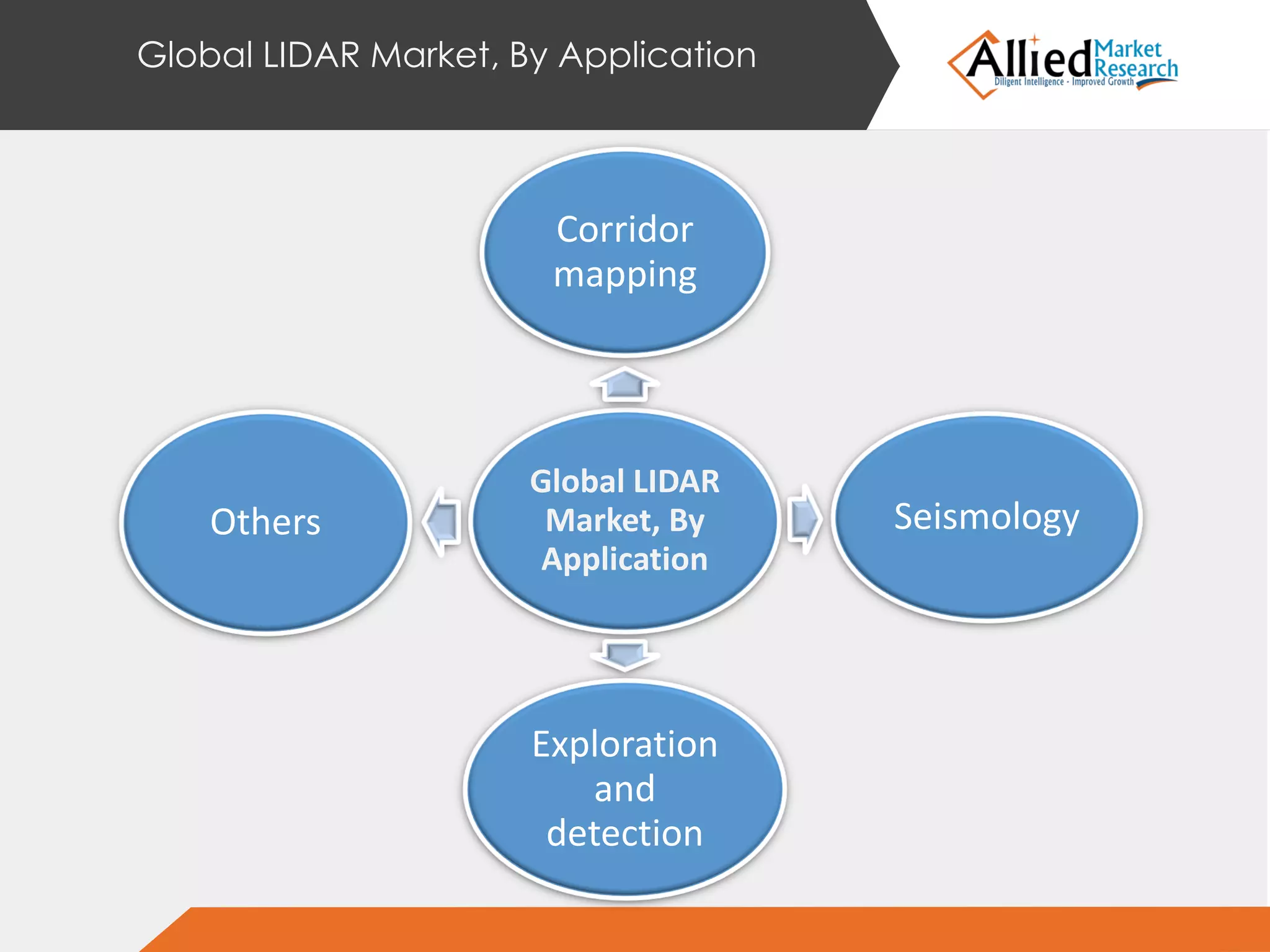
Published Date: 25 February 2015 No. of pages : 128
Global LIDAR
Market Forecast
2013 - 2020
Introduction of Light Detection and Ranging (LIDAR) systems have made the examination, detection
and mapping of objects easier than conventional methods. Use of laser light provides accurate and
precise data points in short time. LIDAR systems are used over conventional surveying methods due
to their ability to provide highly accurate data and 3D images in a shorter time. Improved
automated processing ability of LIDAR systems in terms of image resolutions and data processing
capabilities over other technologies are the major factors that are presently driving the global LIDAR
market.
Other factors that are supplementing the growth of LIDAR market as a whole are rising demand of
3D imaging technology across various application areas, and the increasing adoption of aerial LIDAR
systems to explore and detect places, historic details, etc. On the other hand, low awareness about
the benefits of LiDAR systems and the use of expensive components in LiDAR systems viz., laser
scanner, navigation system, high-resolution 3D cameras, etc. collectively increases the cost of LiDAR
systems.
These factors are restraining adoption of LIDAR technology and restricting the growth of the
market. Players in the market are adopting product launch and collaborations as their key
developmental strategies to meet the customer demands and increase their customer base.
Partnerships would help the players to set a common technology platform and share the
technological requirement. This would ultimately help the market players to enhance their product
portfolio through less investment and increase their market share across various regions.
Introduction to LIDAR Market
The cost cutting in operations would enable the manufacturers to invest into advertisement
activities and increase the awareness about the LIDAR systems across diverse industry verticals and
geographies. Recently, in October 2014, Phoenix Aerial Systems collaborated with Pulse Aerospace
to launch a single-rotor unmanned aerial system for Ranger LIDAR system— The Vapor 55TM.
Eventually, the rise in the use of LIDAR systems across various industries would supplement the
growth of global LIDAR market.
The global LIDAR market is segmented based on type of LIDAR systems, components used, their
application, end user sectors and geography. Static or terrestrial, aerial, mobile and short range are
the various types of LIDAR systems elaborated in the report. The components of LIDAR systems
discussed are laser scanner, inertial navigation system, camera, GPS receiver and micro-electro-
mechanical system. The report also includes corridor mapping, seismology, and exploration and
detection purpose as some of the major application of LIDAR systems. End-user segment consists of
LIDAR systems that are used across various industry verticals viz., defense and aerospace, civil
engineering, archaeology, forestry and agriculture, mining industry and transportation. A study with
respect to region is conducted to perform in-depth analysis if LIDAR technology across various
geographies. The regions examined are North America, Europe, Asia-Pacific and LAMEA.
Introduction to LIDAR Market
Introduction
Scope of the Report
Key Benefits
Key Audiences
KEY BENEFITS
 The study highlights the global LIDAR market with current
market situation and forecast the adoption of LIDAR technology
across varied industry verticals to look for the prominent
investment pockets in the market
 Market analysis unveils the dominant aspects viz., improved
automated processing of data in LIDAR systems, performance of
LIDAR systems as compared to other technologies, rising
demand of 3D imaging, which drives the global LIDAR market
 Trends of the global market are outlined to determine the overall
attractiveness and single out market trends to gain a stronger
foothold in the market
 Microscopic analysis of segments is conducted to gauge the
potential of the market. The segments highlight the major
favorable conditions for the growth of global LIDAR market
 Porters five force’s model helps in analyzing the potential of
buyers & suppliers with a competitive sketch of the market,
which help market players in making better decisions
 The value chain analysis of the industry provides a clear view of
key intermediaries involved and elaborates their roles and value
addition at every stage in the chain
Table of Contents
1. INTRODUCTION
2. EXECUTIVE SUMMARY
3. MARKET OVERVIEW
4. GLOBAL LIGHT DETECTION AND RANGING MAKRET BY PRODUCT TYPE
5. GLOBAL LIDAR MARKET BY COMPONENTS
6. GLOBAL LIDAR MAREKET, BY APPLICATION
7. GLOBAL LIDAR MARKET, BY END USER
8. GLOBAL LIDAR MARKET BY GEOGRAPHY
9. COMPANY PROFILES
Global LIDAR Market Overview
1. Market Definition & Scope
2. Key findings
3. Porter’s five force analysis
4. Value chain analysis
5. Market share analysis, 2013
6. Case studies
7. Market Dynamics
Global Light Detection And Ranging Market By
Product Type
GLOBAL LIGHT
DETECTION AND
RANGING
MAKRET BY
PRODUCT TYPE
Terrestrial
Aerial
Mobile
Short-range
Global LIDAR Market By Components
GLOBAL LIDAR
MARKET BY
COMPONENTS
Lasers
Inertial navigation system
Camera
GPS/GNSS receiver
Micro-electro mechanical system
(MEMS)
Global LIDAR Market, By Application
Global LIDAR
Market, By
Application
Corridor
mapping
Seismology
Exploration
and
detection
Others
GLOBAL LIDAR MARKET BY GEOGRAPHY
North America, Europe, Asia Pacific, LAMEA
Company Profiles
1. Airborne Hydrography Ab (Hexagon)
2. LEOSPHERE
3. Faro Technology
4. Leica Geosystems (Hexagon)
5. 3D Laser Mapping.
6. Firmatek
7. RIEGL Laser Measurement Systems.
8. Aerometric Inc.
9. Mira Solutions
10. Intermap Technologies Inc.
11.Optech Inc. (Teledyne Technologies)
Follow Us On
Thank You!
For More Details
Visit us at
http://www.alliedmarketresearch.com/lidar-market

LIDAR Market Size, Share, Global Trends, segmentation and Forecast, 2013 - 2020

  • 1.
    Published Date: 25February 2015 No. of pages : 128 Global LIDAR Market Forecast 2013 - 2020
  • 2.
    Introduction of LightDetection and Ranging (LIDAR) systems have made the examination, detection and mapping of objects easier than conventional methods. Use of laser light provides accurate and precise data points in short time. LIDAR systems are used over conventional surveying methods due to their ability to provide highly accurate data and 3D images in a shorter time. Improved automated processing ability of LIDAR systems in terms of image resolutions and data processing capabilities over other technologies are the major factors that are presently driving the global LIDAR market. Other factors that are supplementing the growth of LIDAR market as a whole are rising demand of 3D imaging technology across various application areas, and the increasing adoption of aerial LIDAR systems to explore and detect places, historic details, etc. On the other hand, low awareness about the benefits of LiDAR systems and the use of expensive components in LiDAR systems viz., laser scanner, navigation system, high-resolution 3D cameras, etc. collectively increases the cost of LiDAR systems. These factors are restraining adoption of LIDAR technology and restricting the growth of the market. Players in the market are adopting product launch and collaborations as their key developmental strategies to meet the customer demands and increase their customer base. Partnerships would help the players to set a common technology platform and share the technological requirement. This would ultimately help the market players to enhance their product portfolio through less investment and increase their market share across various regions. Introduction to LIDAR Market
  • 3.
    The cost cuttingin operations would enable the manufacturers to invest into advertisement activities and increase the awareness about the LIDAR systems across diverse industry verticals and geographies. Recently, in October 2014, Phoenix Aerial Systems collaborated with Pulse Aerospace to launch a single-rotor unmanned aerial system for Ranger LIDAR system— The Vapor 55TM. Eventually, the rise in the use of LIDAR systems across various industries would supplement the growth of global LIDAR market. The global LIDAR market is segmented based on type of LIDAR systems, components used, their application, end user sectors and geography. Static or terrestrial, aerial, mobile and short range are the various types of LIDAR systems elaborated in the report. The components of LIDAR systems discussed are laser scanner, inertial navigation system, camera, GPS receiver and micro-electro- mechanical system. The report also includes corridor mapping, seismology, and exploration and detection purpose as some of the major application of LIDAR systems. End-user segment consists of LIDAR systems that are used across various industry verticals viz., defense and aerospace, civil engineering, archaeology, forestry and agriculture, mining industry and transportation. A study with respect to region is conducted to perform in-depth analysis if LIDAR technology across various geographies. The regions examined are North America, Europe, Asia-Pacific and LAMEA. Introduction to LIDAR Market
  • 4.
    Introduction Scope of theReport Key Benefits Key Audiences
  • 5.
    KEY BENEFITS  Thestudy highlights the global LIDAR market with current market situation and forecast the adoption of LIDAR technology across varied industry verticals to look for the prominent investment pockets in the market  Market analysis unveils the dominant aspects viz., improved automated processing of data in LIDAR systems, performance of LIDAR systems as compared to other technologies, rising demand of 3D imaging, which drives the global LIDAR market  Trends of the global market are outlined to determine the overall attractiveness and single out market trends to gain a stronger foothold in the market  Microscopic analysis of segments is conducted to gauge the potential of the market. The segments highlight the major favorable conditions for the growth of global LIDAR market  Porters five force’s model helps in analyzing the potential of buyers & suppliers with a competitive sketch of the market, which help market players in making better decisions  The value chain analysis of the industry provides a clear view of key intermediaries involved and elaborates their roles and value addition at every stage in the chain
  • 6.
    Table of Contents 1.INTRODUCTION 2. EXECUTIVE SUMMARY 3. MARKET OVERVIEW 4. GLOBAL LIGHT DETECTION AND RANGING MAKRET BY PRODUCT TYPE 5. GLOBAL LIDAR MARKET BY COMPONENTS 6. GLOBAL LIDAR MAREKET, BY APPLICATION 7. GLOBAL LIDAR MARKET, BY END USER 8. GLOBAL LIDAR MARKET BY GEOGRAPHY 9. COMPANY PROFILES
  • 7.
    Global LIDAR MarketOverview 1. Market Definition & Scope 2. Key findings 3. Porter’s five force analysis 4. Value chain analysis 5. Market share analysis, 2013 6. Case studies 7. Market Dynamics
  • 8.
    Global Light DetectionAnd Ranging Market By Product Type GLOBAL LIGHT DETECTION AND RANGING MAKRET BY PRODUCT TYPE Terrestrial Aerial Mobile Short-range
  • 9.
    Global LIDAR MarketBy Components GLOBAL LIDAR MARKET BY COMPONENTS Lasers Inertial navigation system Camera GPS/GNSS receiver Micro-electro mechanical system (MEMS)
  • 10.
    Global LIDAR Market,By Application Global LIDAR Market, By Application Corridor mapping Seismology Exploration and detection Others
  • 11.
    GLOBAL LIDAR MARKETBY GEOGRAPHY North America, Europe, Asia Pacific, LAMEA
  • 12.
    Company Profiles 1. AirborneHydrography Ab (Hexagon) 2. LEOSPHERE 3. Faro Technology 4. Leica Geosystems (Hexagon) 5. 3D Laser Mapping. 6. Firmatek 7. RIEGL Laser Measurement Systems. 8. Aerometric Inc. 9. Mira Solutions 10. Intermap Technologies Inc. 11.Optech Inc. (Teledyne Technologies)
  • 13.
    Follow Us On ThankYou! For More Details Visit us at http://www.alliedmarketresearch.com/lidar-market