
Recommended
More Related Content
Similar to Land information and Administration systems
Similar to Land information and Administration systems (20)
Recently uploaded
Recently uploaded (20)
Land information and Administration systems
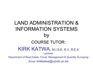
- 1. LAND ADMINISTRATION & INFORMATION SYSTEMS by COURSE TUTOR: KIRK KATWA, M.I.S.K. R.V, R.E.A Lecturer Department of Real Estate, Const. Management & Quantity Surveying Email: kirkkatwa@uonbi.ac.ke
- 2. Land administration Processes 1.Carry out adjudication 2.Undertake spatial planning 3.Survey the land 4.Carry out the valuation 5.Alienate and/or allocate 6.Register and issue titles, 7.Manage and physically develop land
- 3. Land Planning • Land use planning is the allocation of various uses within limited spaces • It is the citing of buildings and communication routes so as to secure maximum practicable degree of economy, order and convenience. It is also the discipline concerned with providing the right site, at the right time in the right place and for the right people. • Helps in reduction of land use conflicts • Land use information records include zoning maps, land use plans, Physical development plans, Part Development Plans, County spatial plans • All these store different information on users, zones, topography, nature of developments allowed
- 4. Importance of land planning ✓ Ensuring consistency of land use/no conflicts. ✓ Putting land resources to the highest and best use. ✓ Ensuring proper physical development hence propagating sustainable development of cities and communities as one of the Sustainable Development Goals (SDGs – No. 11). ✓ Catering for the failures of the free land market economy e.g. Some sectors such as health, education may suffer due to lack of land. ✓ Settling land use conflicts ✓ Ensures environmental preservation
- 5. Development applications as components of planning • What are Development applications( and what is the approval Procedure in Kenya • See the Physical and Land Use Planning Act 2019-On definition of term “development”, development applications and their approval process. • Information outputs and records- Planning briefs, approved scheme plans, Zoning maps, Part Development Plans, development plans…
- 6. Role of physical planners in land administration Relationship between physical/spatial planning, land administration and land information systems
- 7. Land surveying • Land surveying is the determination of relative positions of objects on the surface of the earth. There are various types of surveys-Examples ➢ Engineering surveys ➢ Marine/hydro surveys ➢ Space Surveys Cadastral surveys • Cadastral surveying is key to land administration and LIS • Cadastral surveying refers to the process of establishing boundaries and other data in furtherance of cadastres (land parcel record) production • It provides the basis for future retracing of points and is required for the initial setting out of land parcels, for recording what has been built or for reestablishment of boundaries
- 8. Land Surveying • Cadastral surveys are concerned with geometrical data, especially the size, shape and location of each land parcels. • It also deals with the location of property boundaries and may also include topographical features • Forms the basis for land titling and registration • Cadastral surveying is carried out by the government land surveyors or private licensed surveyors • Techniques used in different countries are provided for in law. In Kenya, Survey Act
- 9. Land surveying and land administration • Surveying of landed properties plays a critical role in land administration – determine parcels of land locations and to provide evidence for their future retracing of boundaries. – setting out of land parcels –to facilitate land development – record the existing features – re-establish boundaries either in the case of dispute or where subdivision is to take place – Settling of boundary disputes
- 10. Role of surveyors in land administration: Ref Mwangi & Nyika,2018 PP 79-82 • Establishment of survey controls • Topographical and cadastral mapping • Delimitation of boundaries • Adjudication, consolidation and subdivisions • Expert witnesses
- 11. Principles guiding cadastral surveying • Based on 5 principles- 1) Accuracy and Consistency 2) Independent Check 3) Control 4) Maintenance 5) Economy In Kenya, cadastral surveying is carried out under the Survey Act Cap 299 and supported by other land laws. • The principles behind cadaster preparation are the same that guide land surveying since cadastral surveying is the basis of cadastre hence LIS – Control, consistency, economy, independent check (self check) and maintenance
- 12. Principles that guide cadastral surveying • Control – it is the traditional principle when known points (marks/controls are used to determine the location of unknown points. Under this principle “the whole to part’(known to unknown) guideline is followed • A framework of points across a whole area is laid out, with points well measured and separated. points may be 50-100 kms apart • From this primary net, we calculate and measure downwards into secondary nets so that the subsequent errors cannot be bigger that in the preceding net • It is from these lower order points that positions for subplots’ boundaries of hedge junctions are fixed
- 13. Principles that guide cadastral surveying • Different methods may be used to achieve controls – Triangulation-establishment of points in a national geodetic framework called triangulation points.Theodolites are used to measure these points to high levels of precision – Traversing-more efficient than triangulation as it gives flexibility of point selection not limiting one to the triangle, it is quicker, adaptable to busy places since the traverse can be run even on busy streets. uses Electronic distance measurement approach
- 14. Principles that guide cadastral surveying • Map projections where the measure of angle and distance is transformed from ground values to those that would be calculated from coordinates – Coordinate systems- based on a rectangular grid, where points are described in form of distances east and north of a given point. allows for use of simple survey methods and computations. work can be easily checked and errors isolated – Electronic positioning fixing such as satellite systems, Global positioning Systems – Photogrametry- use of aerial photographs
- 15. Principles that guide cadastral surveying – Geographical coordinates e.g. latitudes and longitudes – Rectangular Grid coordinates-based on map projection on to a plane surface e.g. Northings and Eastings – Rectangular sections – Where large subdivision parcels are put on quarter-quarter portions
- 16. Principles that guide cadastral surveying • Accuracy and Consistency- aims at reduction of error to as minimal as possible and the surveyor must indicate the estimated error of distance between two points eg 1part in 5000 + or – 5mm.Higher precision is required for engineering surveys. Any error must provide for the method of checking and correction • Economy –Certain standards are set for the choice of method used. cadastral and engineering surveys contracts will often provide for nationally agreed specifications that must be followed. However, the survey must meet these conditions in way that is most economic in time, effort and cost
- 17. Principles that guide cadastral surveying • Independent check-Gross errors caused by human or mechanical failure should be avoided. Such errors may have adverse effects on the survey and they can be identified through independent checks. These include measuring triangles, starting and ending traverse on known points or repeated measurements of points on a photograph • Maintenance- of both the ground marks (beacons) and the land information gathered in maps, photos and plans
- 18. Survey records in land administration Cadastral maps • Topo maps • Aerial photographs • Deed plans • Survey plans • Registry Index Maps • Area lists
- 23. Land Valuation • Valuation is the process of estimating the worth of landed property based on experience and judgment. • The purpose of valuation is to determine “value” a term generally prefaced by some description as market value or benefit value • Accurate valuations are normally determined by qualified land valuers and guide the market towards fair prices and allow informed decisions to be made about the efficiency of land resources • Valuations in land administration are usually done for determination of rates, rents, sale or purchase, stamp duty and capital gains.
- 24. Land Valuation • The methods used in valuation process are: – Comparison Method – The Income Method or the Investment Method – The Cost Method / Contractors Method or the Quantity Survey Approach – The Profit Approach – Residual Approach
- 25. Land Valuation • What guides the valuation standards globally • Purposes of valuation in land administration • How is valuation undertaken and what information/data do you require to carry out a valuation • What does Cap 266 and 267 say as far valuation for rating is concerned in Kenya? • What are the records/registers that emanate from the valuation process? • Information required and challenges • What solutions can one offer?