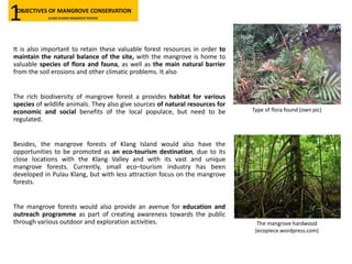
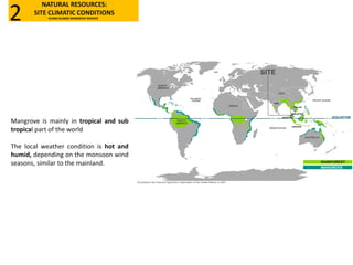
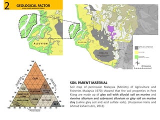
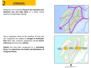
Download as PDF, PPTX


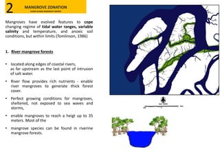
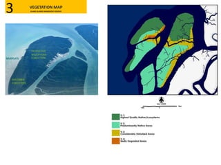
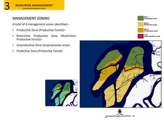


The Klang Islands Mangrove Reserve in Selangor spans approximately 18,088 hectares and is critical for biodiversity, providing habitats for various species while also serving as a natural barrier against soil erosion. The area has faced significant decline due to industrial development and loss of legal protections, prompting conservation efforts to restore the mangrove forests and maintain their ecological health. The reserve's management plan includes zoning for productive and protective areas to balance community use with conservation goals.


