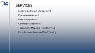
PROFILE
Geo Consultancy Engineering Mining Industry and Trade Inc. is a joint-stock company founded in 2014 by specialized
engineers educated in international disciplines.
Being aware of the “uniqueness” of each and every mineral deposit, we have devoted ourselves to produce real viable
solutions instead of stereotyped models.
The services we provide include geological, geotechnical, and structural analysis, exploration project management, data
management, modeling, and resource estimation during all processes ranging from survey to preliminary feasibility studies.
All activities are carried out in full compliance with NI 43-101 and JORC requirements.
Our services also include the selection of subcontractors possibly needed during field works, preparation of contracts to be
signed with subcontractors, on-site supervision of subcontractor operations with special focus to compliance with
occupational health and safety requirements, paying due respect to environment, and inspection of subcontractor works.
Our expert field force is capable to carry out the topographic measurements and mapping activities with highest precision at
international standards.
Our primary aim with regard to already well staffed companies is to help them take a step further by raising the standards of
their projects and making their staff benefit from international experience.
With regard to companies intending to recruit new staff, we help them to choose the right candidates in line with the
company’s vision and goals and accelerate the integration of chosen candidates into the existing system through short-term
training programs.
SERVICES
• Exploration Project Management
• Property Assessment
• Data Management
• Contract Management
• Topographic Mapping – Field Surveys
• Executive Assistance and StaffTraining
EXPLORATION PROJECT MANAGEMENT
o Budget planning and control of exploration projects
o Data collection, generation of operation models
o Planning and implementation of geochemical sampling programs and
evaluation of analysis results
o Detailed geological survey
o Planning of geophysical studies according to the characteristics of the mineral
deposits and analysis of the results obtained
o Geotechnical surveys
o Generation, management and control of drilling programs
o Determination of alteration minerals in hydrothermal mineral deposits through
spectral analysis and alteration modeling
o Magnetic susceptibility analysis
o Mineral deposit modeling and resource estimation
BUDGET PLANS
• Monthly monitoring of the expenditures
reported by staff
• Monthly monitoring of the time sheets
• Preparation of proposal budgets for exploration
projects
• Budget analysis
DATA COLLECTION
• Compilation of all published documents
• Combination and evaluation of all
data in computer environment
• Preparation of local and regional
geological maps
GEOCHEMICAL SAMPLING
• Selection of adequate
sampling and analysis
methods
• Statistical interpretation of
indicator and trace elements
• Identification of threshold values
• Creation of anomaly maps
• Implementation of quality
assurance/quality control (QA/QC)
protocols
GEOLOGICAL SURVEY
• Geological modeling
• Field works
• Sampling
• Map-section
preparation
• Report writing
PLANNING OF GEOPHYSICAL SURVEYS
• Method selection according to the type of
mineralization
• Selection and on-site supervision of subcontractors
• Field application of survey points
• 2D-3D modeling of geophysical survey results
through GIS programs
• Creation of anomaly maps
• Identification of potential targets
GEOTECHNICAL SURVEYS
• Preparation of soil investigation and
geotechnical maps and reports certified
by the Chamber of Geological Engineers
• Execution of field and laboratory tests
MANAGEMENT OF DRILL PROGRAMS
• Identification and rating of target areas on basis of
geological, geophysical and geochemical data
• Identification of controls over ore deposits
• Identification of drilling locations
• Designing the drilling program according to the
mineralization model
• Management, control and/or audit of the drilling
program
• Preparation of drilling reports
• Preparation and control of drill logs
ALTERATION MODELING
• Spectral analysis of drill and rock samples by
means of an ASDTerraspec device
• Preparation of alteration maps
• Preparation of 2D and 3D alteration models
MAGNETIC SUSCEPTIBILITY ANALYSIS
Magnetic Susceptibilities of rocks are measured,
• During geological and geophysical survey,
• During modelling stage,
• During the monitoring of magnetic alterations
by means of surveys continuously taken
through the drill cores,
• As well as during the classification of rocks
according to their magnetization (diamagnetic,
paramagnetic and ferromagnetic).
MINERAL DEPOSIT MODELINGAND RESOURCE ESTIMATIO
• Creation of a database in accordance with
international protocols through a
combination of surface and drilling data
• Creation of cross and longitudinal sections,
3D or multi-core models
• Geostatistical analyses
• Creation of computer-based 3D ore body
models
• Creation of 3D topographic models
PROPERTY ASSESSMENT
• Literature survey about the property
• Reinforcement of surveyed data through field
works
• Preparation of reports about the potential of the
property
• Evaluation of auction grounds
DATA MANAGEMENT
• Reorganization and supervision of existing
databaseCreation,
• Standardization and verification of a new database model
• Digitizing Data
• Conversion
• Database modeling specific to drilling programs
• Implementation of quality assurance/quality control
(QA/QC) protocols for databases, database models for
data capture, analysis, storage and reporting of geological,
geotechnical and geochemical information.
CONTRACT MANAGEMENT
• Identification of project requirements
• Searching out the subcontractor who will carry out the
work “at best price with best quality” in line with the
project’s budget
• Examination of subcontractor documents
• Preparation of contracts
• Making sure that all regulatory requirements in terms of
quality assessments for all goods and services are met
• Successful execution of negotiations
• On-site inspection
• Ensuring their compliance with occupational health and
safety requirements, paying due respect to environment
and inspection of subcontractor works
TOPOGRAPHIC MAPPING – FIELD SURVEYS
• Topographic mapping
• Outcrop mapping
• Preparation of gallery-trench-pit maps
• Preparation of base maps
• Preparation of production maps
• Field application of drill locations
• Field application of geophysical survey points
• Field application of soil sample points
• Field application of mine-plant zoning plans
EXECUTIVE ASSISTANCE AND STAFFTRAINING
• Executive assistance services
• Comprehensive supervision-monitoring-
commissioning services for all projects
• Flow chart preparation services according
to project requirements
• Provision of local/global experts
• On-site short-term trainings for field staff
• Integration of new hires into the existing
system
Thank You...

Jeo Consultancy Engineering Mining

  • 2.
    PROFILE Geo Consultancy EngineeringMining Industry and Trade Inc. is a joint-stock company founded in 2014 by specialized engineers educated in international disciplines. Being aware of the “uniqueness” of each and every mineral deposit, we have devoted ourselves to produce real viable solutions instead of stereotyped models. The services we provide include geological, geotechnical, and structural analysis, exploration project management, data management, modeling, and resource estimation during all processes ranging from survey to preliminary feasibility studies. All activities are carried out in full compliance with NI 43-101 and JORC requirements. Our services also include the selection of subcontractors possibly needed during field works, preparation of contracts to be signed with subcontractors, on-site supervision of subcontractor operations with special focus to compliance with occupational health and safety requirements, paying due respect to environment, and inspection of subcontractor works. Our expert field force is capable to carry out the topographic measurements and mapping activities with highest precision at international standards. Our primary aim with regard to already well staffed companies is to help them take a step further by raising the standards of their projects and making their staff benefit from international experience. With regard to companies intending to recruit new staff, we help them to choose the right candidates in line with the company’s vision and goals and accelerate the integration of chosen candidates into the existing system through short-term training programs.
  • 3.
    SERVICES • Exploration ProjectManagement • Property Assessment • Data Management • Contract Management • Topographic Mapping – Field Surveys • Executive Assistance and StaffTraining
  • 4.
    EXPLORATION PROJECT MANAGEMENT oBudget planning and control of exploration projects o Data collection, generation of operation models o Planning and implementation of geochemical sampling programs and evaluation of analysis results o Detailed geological survey o Planning of geophysical studies according to the characteristics of the mineral deposits and analysis of the results obtained o Geotechnical surveys o Generation, management and control of drilling programs o Determination of alteration minerals in hydrothermal mineral deposits through spectral analysis and alteration modeling o Magnetic susceptibility analysis o Mineral deposit modeling and resource estimation
  • 5.
    BUDGET PLANS • Monthlymonitoring of the expenditures reported by staff • Monthly monitoring of the time sheets • Preparation of proposal budgets for exploration projects • Budget analysis
  • 6.
    DATA COLLECTION • Compilationof all published documents • Combination and evaluation of all data in computer environment • Preparation of local and regional geological maps
  • 7.
    GEOCHEMICAL SAMPLING • Selectionof adequate sampling and analysis methods • Statistical interpretation of indicator and trace elements • Identification of threshold values • Creation of anomaly maps • Implementation of quality assurance/quality control (QA/QC) protocols
  • 8.
    GEOLOGICAL SURVEY • Geologicalmodeling • Field works • Sampling • Map-section preparation • Report writing
  • 9.
    PLANNING OF GEOPHYSICALSURVEYS • Method selection according to the type of mineralization • Selection and on-site supervision of subcontractors • Field application of survey points • 2D-3D modeling of geophysical survey results through GIS programs • Creation of anomaly maps • Identification of potential targets
  • 10.
    GEOTECHNICAL SURVEYS • Preparationof soil investigation and geotechnical maps and reports certified by the Chamber of Geological Engineers • Execution of field and laboratory tests
  • 11.
    MANAGEMENT OF DRILLPROGRAMS • Identification and rating of target areas on basis of geological, geophysical and geochemical data • Identification of controls over ore deposits • Identification of drilling locations • Designing the drilling program according to the mineralization model • Management, control and/or audit of the drilling program • Preparation of drilling reports • Preparation and control of drill logs
  • 12.
    ALTERATION MODELING • Spectralanalysis of drill and rock samples by means of an ASDTerraspec device • Preparation of alteration maps • Preparation of 2D and 3D alteration models
  • 13.
    MAGNETIC SUSCEPTIBILITY ANALYSIS MagneticSusceptibilities of rocks are measured, • During geological and geophysical survey, • During modelling stage, • During the monitoring of magnetic alterations by means of surveys continuously taken through the drill cores, • As well as during the classification of rocks according to their magnetization (diamagnetic, paramagnetic and ferromagnetic).
  • 14.
    MINERAL DEPOSIT MODELINGANDRESOURCE ESTIMATIO • Creation of a database in accordance with international protocols through a combination of surface and drilling data • Creation of cross and longitudinal sections, 3D or multi-core models • Geostatistical analyses • Creation of computer-based 3D ore body models • Creation of 3D topographic models
  • 15.
    PROPERTY ASSESSMENT • Literaturesurvey about the property • Reinforcement of surveyed data through field works • Preparation of reports about the potential of the property • Evaluation of auction grounds
  • 16.
    DATA MANAGEMENT • Reorganizationand supervision of existing databaseCreation, • Standardization and verification of a new database model • Digitizing Data • Conversion • Database modeling specific to drilling programs • Implementation of quality assurance/quality control (QA/QC) protocols for databases, database models for data capture, analysis, storage and reporting of geological, geotechnical and geochemical information.
  • 17.
    CONTRACT MANAGEMENT • Identificationof project requirements • Searching out the subcontractor who will carry out the work “at best price with best quality” in line with the project’s budget • Examination of subcontractor documents • Preparation of contracts • Making sure that all regulatory requirements in terms of quality assessments for all goods and services are met • Successful execution of negotiations • On-site inspection • Ensuring their compliance with occupational health and safety requirements, paying due respect to environment and inspection of subcontractor works
  • 18.
    TOPOGRAPHIC MAPPING –FIELD SURVEYS • Topographic mapping • Outcrop mapping • Preparation of gallery-trench-pit maps • Preparation of base maps • Preparation of production maps • Field application of drill locations • Field application of geophysical survey points • Field application of soil sample points • Field application of mine-plant zoning plans
  • 19.
    EXECUTIVE ASSISTANCE ANDSTAFFTRAINING • Executive assistance services • Comprehensive supervision-monitoring- commissioning services for all projects • Flow chart preparation services according to project requirements • Provision of local/global experts • On-site short-term trainings for field staff • Integration of new hires into the existing system
  • 20.