
Recommended
More Related Content
What's hot
What's hot (20)
Viewers also liked
Viewers also liked (13)
Similar to Introducing Mass Balance Modeling Using a Controversial Environmental Problem
Similar to Introducing Mass Balance Modeling Using a Controversial Environmental Problem (20)
More from SERC at Carleton College
More from SERC at Carleton College (20)
Introducing Mass Balance Modeling Using a Controversial Environmental Problem
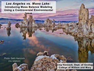
- 1. Los Angeles vs. Mono Lake: Introducing Mass Balance Modeling Using a Controversial Environmental Issue Greg Hancock, Dept. of Geology College of William and Mary Photo: Seth Hancock (no relation)
- 2. Course and Student Context GEOL427: Introduction to Modeling in the Earth Sciences 1) Two-credit hour course, meets once/week for two hours 2) Limit of 11 students 3) Mostly B.S. Geology majors - sophomore to senior 4) Student math is minimal (Calculus I at best); perhaps introductory physics and chemistry 5) Little to no experience with modeling or with MATLAB
- 3. The Mono Lake Assignment 1) Basics of mass conservation thinking 2) Translation from idea to model construction 3) Identifying and evaluating model assumptions 4) Planning and troubleshooting numerical models 5) Calibration and verification of a model 6) Using models for prediction 7) Presentation of modeling results Goal is to introduce students to: Four class sessions (two hours each), plus final presentation
- 4. Los Angeles and Mono Lake LA Mono Lake SF LA Aqueduct
- 5. Los Angeles Aqueduct in Context
- 6. 1941: Los Angeles begins diverting water 1994: Court order reduces diversion Lake level falls nearly 45’ in ~30 years
- 7. Mono Lake levels since 1995
- 8. Constructing a Mass Conservation Model S/ t =Δ Δ i + o change in storage/time = input/time + output/time Water Balance Equation: V/ t =Δ Δ Q + P + ET + SR + G + D Steps to construct of our model: 1) What are the questions? 2) What is the relevant reservoir? 3) What quantity will be conserved? Practice: college enrollment, sodas in a vending machine, carboy volume 4) Construct a stock and flow diagram 5) Translate to numerical expressions 6) Translate to MATLAB expressions
- 9. Calibrating and Verification of the Mass Conservation Model A wealth of data collected from 1937 to present… Annual measurements for: precipitation, stream flow, evapotranspiration, diversions, lake elevation/lake area/lake volume Calibration period: 1937-1985 Verification period: 1985-1995
- 10. Prediction of Future Lake Levels Using Monte Carlo Simulations observed mean – 2 std dev mean – 1 std dev Monte Carlo mean mean + 1 std dev Student: Ben Zhang
- 11. Prediction of Future Lake Levels Student: Ben Zhang
- 12. Prediction of Future Lake Levels Student: Kira Holmes