- Major infrastructure projects require careful integration into existing road networks to avoid traffic issues. Traffic modelling is key to assessing how projects will impact network performance.
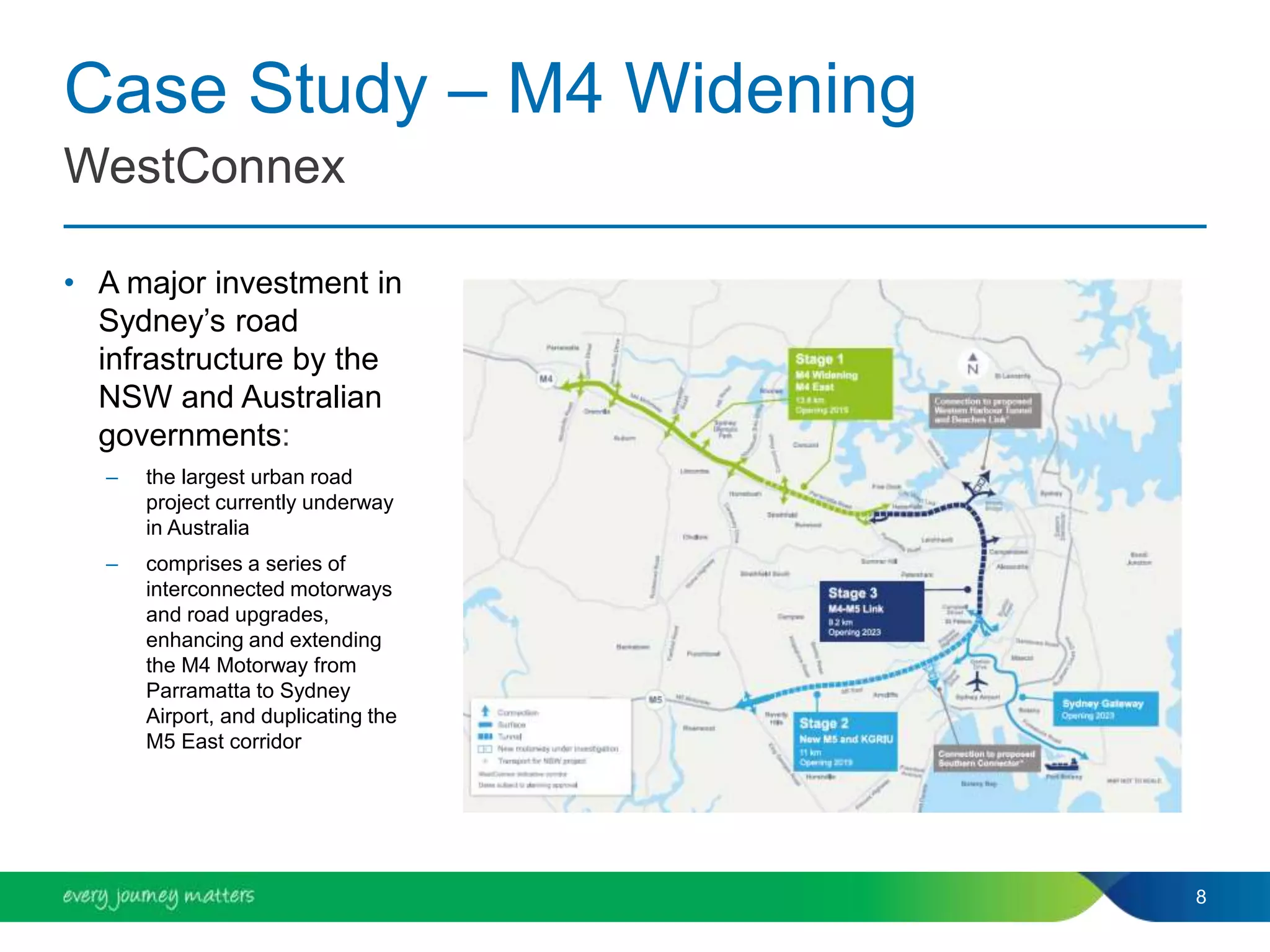
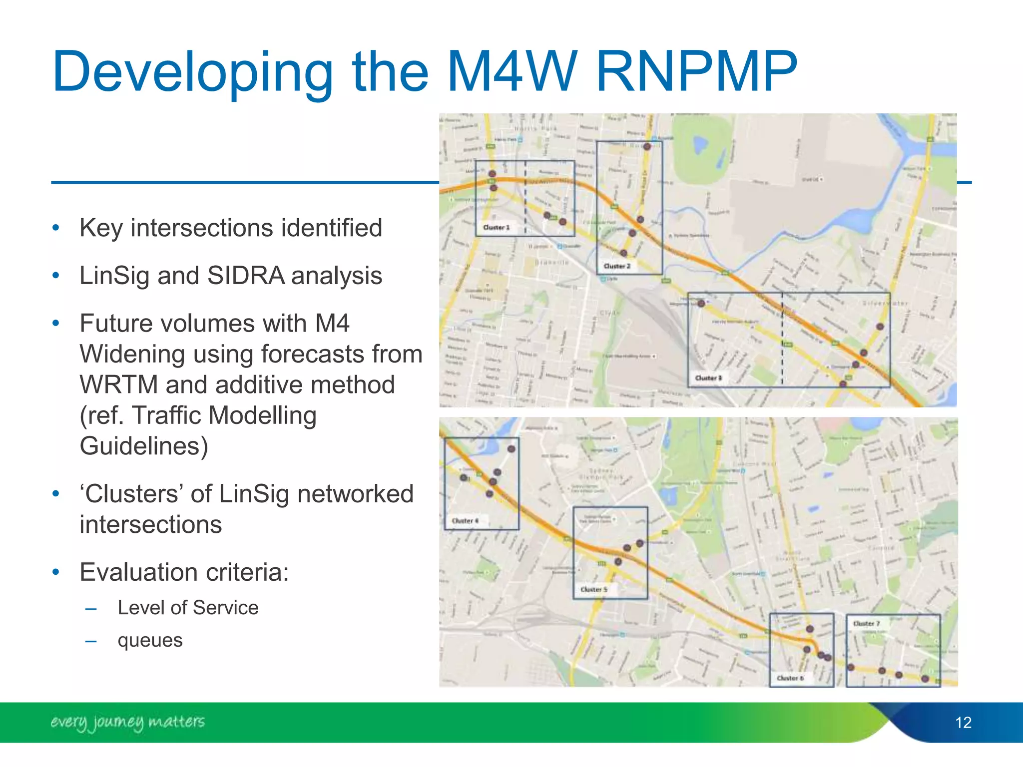
- The M4 Widening project developed a Road Network Performance Mitigation Plan using traffic modelling to identify intersections requiring mitigation before and after opening.
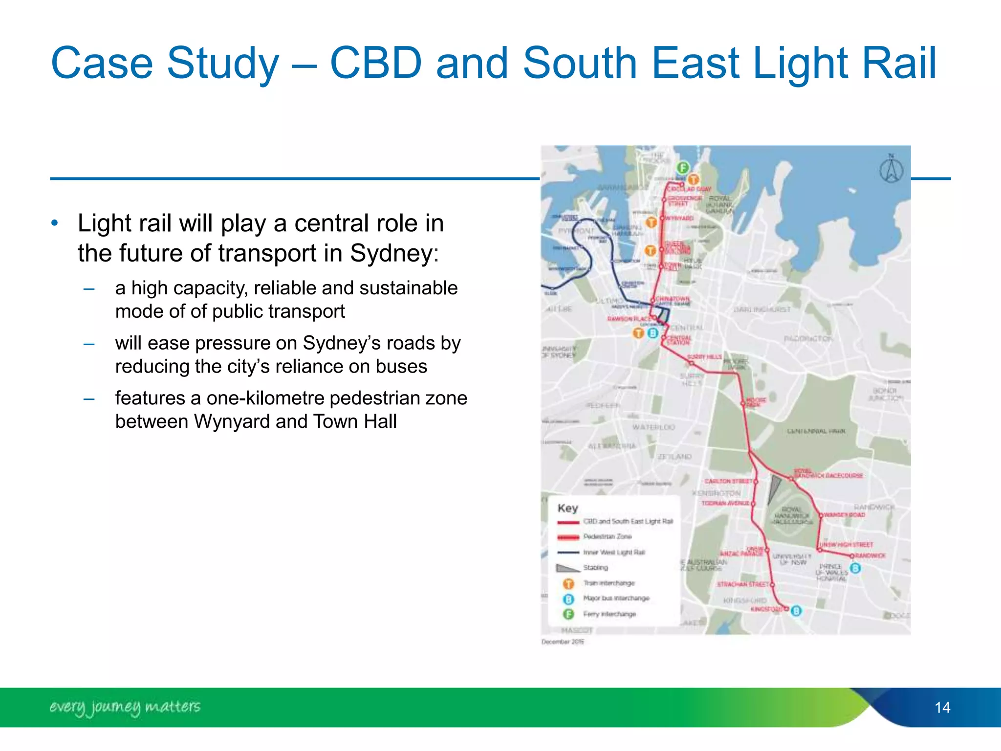
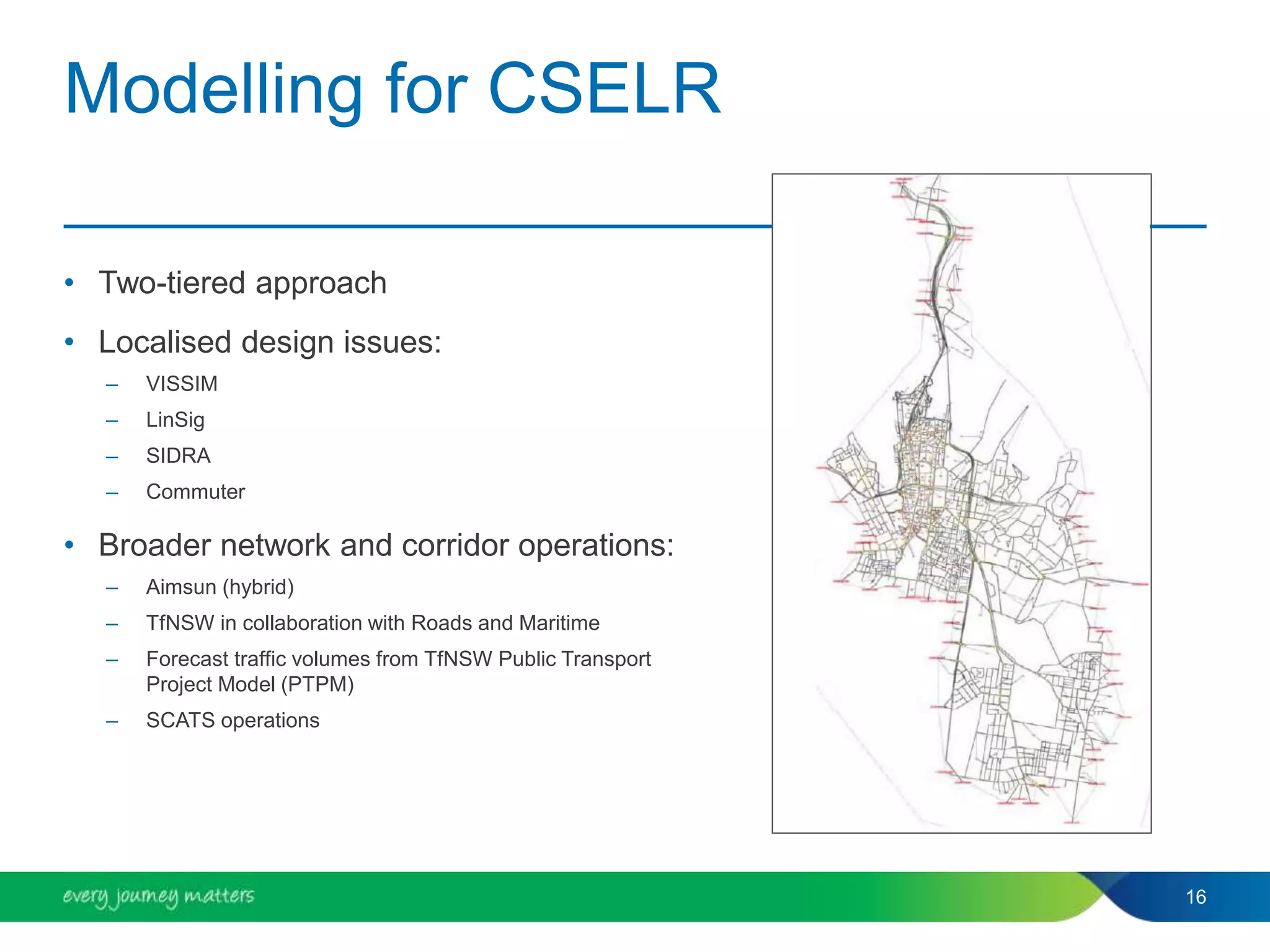
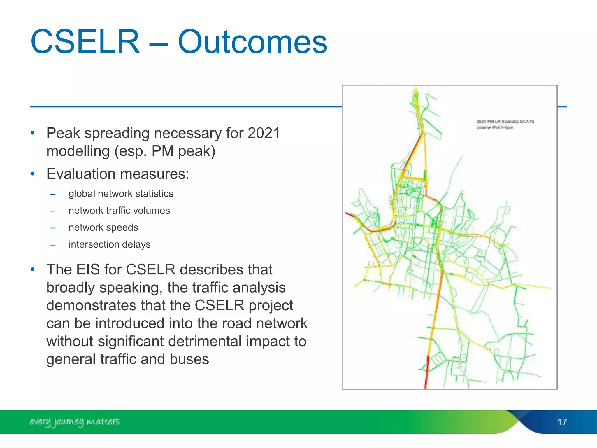
- Traffic modelling of the CBD and South East Light Rail project evaluated the project's impact on traffic volumes, speeds and delays at a network and intersection level to ensure smooth integration.


![PT Modeling in S'pore [Terence Ng]](https://cdn.slidesharecdn.com/ss_thumbnails/d4ba4669-a931-4022-903e-184357df244f-161101143012-thumbnail.jpg?width=640&height=640&fit=bounds)


