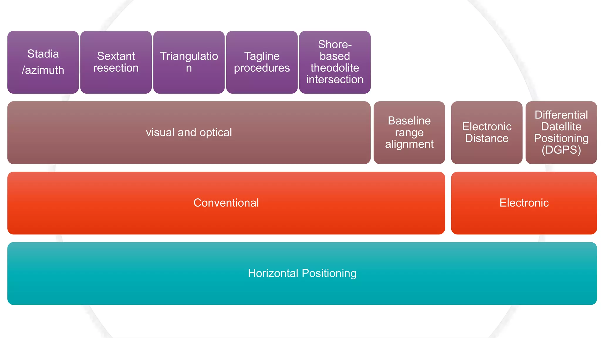
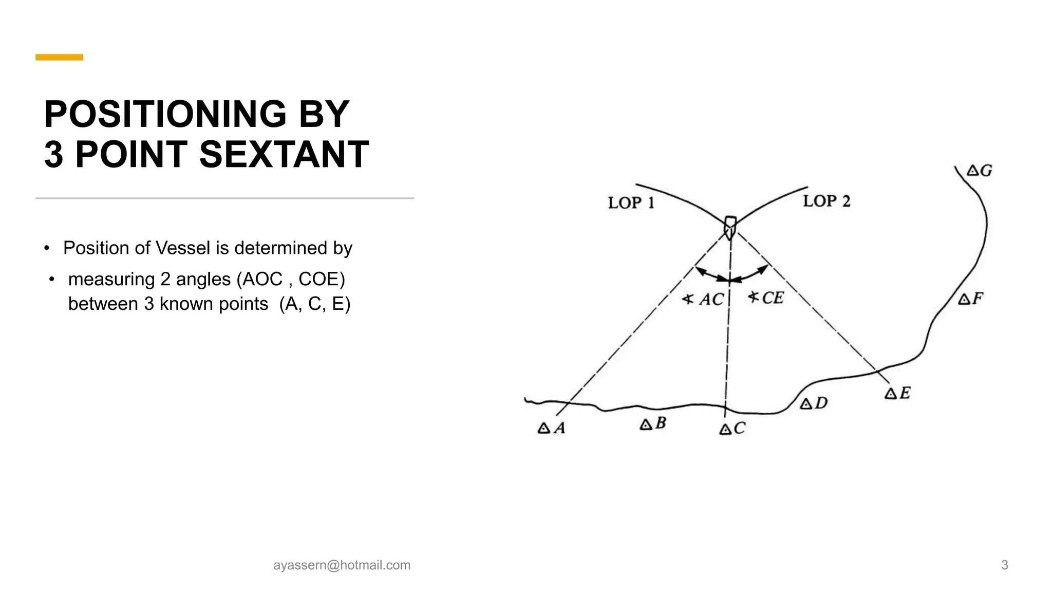
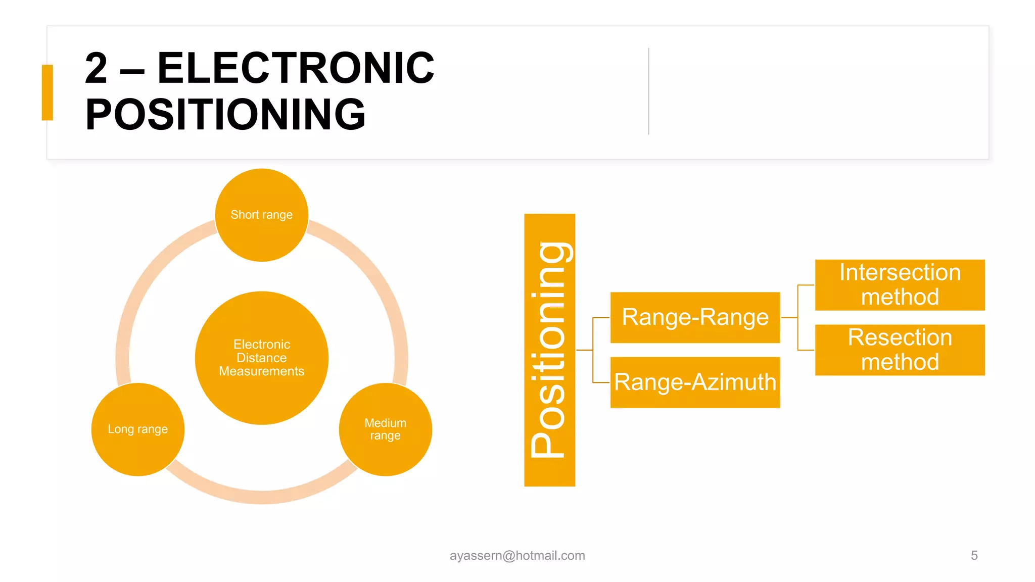
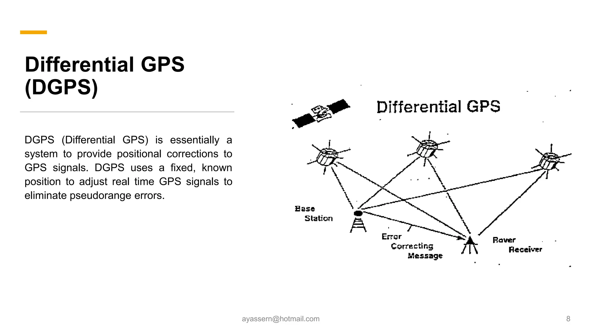
HYDROGRAPHIC
SURVEYING
LECTURE 5:
GEODETIC CONTROL AND TIDAL EFFECTS
BY: AHMED YASSER AHMED MOHAMED NASSAR
SECTION: 1 ID:20
Horizontal Positioning
Conventional
visual and optical
Stadia
/azimuth
Sextant
resection
Triangulatio
n
Tagline
procedures
Shore-
based
theodolite
intersection
Baseline
range
alignment
Electronic
Electronic
Distance
Differential
Datellite
Positioning
(DGPS)
POSITIONING BY
3 POINT SEXTANT
• Position of Vessel is determined by
• measuring 2 angles (AOC , COE)
between 3 known points (A, C, E)
ayassern@hotmail.com 3
BASELINE RANGE
ALIGNMENT
1. Setting baseline along the
shore.
2. Setting stakes at equal
distances to make even
stations along the baseline.
3. Form and offshore grid by
making perpendicular offsets
to the even stations .
4. Position obtained by
intersection of baseline range
alignment
ayassern@hotmail.com 4
inexpensive economical reliable
2 – ELECTRONIC
POSITIONING
ayassern@hotmail.com 5
Electronic
Distance
Measurements
Short range
Medium
range
Long range
Positioning
Range-Range
Intersection
method
Resection
method
Range-Azimuth
POSITIONING BY
RANGE/AZIMUTH
ayassern@hotmail.com 6
POSITIONING
BY
RANGE/RANGE
ayassern@hotmail.com 7
Differential GPS
(DGPS)
DGPS (Differential GPS) is essentially a
system to provide positional corrections to
GPS signals. DGPS uses a fixed, known
position to adjust real time GPS signals to
eliminate pseudorange errors.
ayassern@hotmail.com 8
THANKS
ayassern@hotmail 9

Hydrographic Surveying - Geodetic Control And Tidal Effects

Editor's Notes

  • #2 Measuring the depth of water aboard a frigate, illustration of 1844 صورة توضح قياس الأعماق , 1844