SlideShare a Scribd company logo
  1	
  
Black Holes No More: The
Emergence of Volunteer Geographic
Information
Author: Ron Mahabir
Affiliation: Department of Geography and Geoinformation
Science, George Mason University
Source: GIS Lounge - http://www.gislounge.com/black-holes-no-
more-the-emergence-of-volunteer-geographic-information/
More than one billion people currently live in slums, which are
growing at unprecedented rates leading to the rise of vulnerable
communities. Slums are usually viewed as areas of extreme
poverty and neglect and further, their development as an
impediment to progress. Although slums exist in all areas of the
world, their presence is most noticeable in the less developed
countries of the global south. These countries are among the
poorest worldwide as suggested by the Human Development Index
and the substantial disbursement of and dependence on
international aid. With the added burden of having to absorb the
majority of projected population growth, further challenges can be
expected at these locations if the situation of slum dwellers does
not improve.
Recently, there has been growing awareness of the poor living
conditions and daily hardships experienced by slum dwellers. This
is in part due to the way in which social media and the World Wide
Web have transformed the sharing of information. Users of social
media like Facebook and Twitter generate content about
themselves and their selective interests within and among peers.
  2	
  
Most of this information is provided voluntarily by untrained
private citizens and compared to the traditional top down approach
of collecting geospatial information, represents a new form of
geographic information altogether. In locations where slums are
most pronounced, reliable information on these communities is
often lacking, making this Volunteered Geographic
Information (VGI) an important resource for slum information.
The most well known example of VGI aiding slum dwellers is the
Map Kibera project started by Mikel Maron and Erica Hagen in
2009, with the help of local partners in Kenya. Prior to 2009,
Kibera, a slum with an estimated 250,000 residents, did not exist
on any official maps of Kenya. It was no more than a black hole to
the outside world. In this project, local residents are empowered
into mapping their own community with the resulting digital data
collected and placed onto an online map. Uploaded information is
freely available on a wide rage of themes, including,
transportation, health services, safe paths and the location of water
and sanitation facilities, providing actionable knowledge for local
residents in supporting their daily workflows. Local slum
businesses have also benefited, using information from Map
Kibera to expand their customer base. Map Kibera therefore
provides Kiberans with an informational basis for better
coordination and planning within their community.
KIBERA GEOGRAPHIC DATA COLLECTION VIA OPENSTREETMAP.
  4	
  
Projects such as Map Kibera are also important for improving
government involvement in slums. During the 2013 Kenyan
election, the Map Kibera project provided information on access
routes and the location of polling stations. This information was
used to ensure overall safety during this event. Non-government
and community-based organizations also use VGI to identify and
fill water and sanitation needs in slums. These organizations
further use this information for advocating with government, on
behalf of slum dwellers, for improved conditions within slums.
Such representation is important for improving the situation of
slum dwellers since they are often overlooked in the planning
decisions of the state.
VGI projects also provide empowerment through the development
of new skills and increased involvement on the part of slum
dwellers. Locals use geospatial technology to create maps of their
community. Newly acquired skills can also contributed towards
finding better jobs for improving the situation of slum dwellers.
These projects also encourage innovation among local slum
residents. As an example, local slum residents trained by Map
Kibera in using film media went on to found the Kibera News
Network. Since its inception, Map Kibera continues to be a catalyst
for many similar projects, allowing for a sustainable source of
information on slum communities.
A common attribute in slums is a lack of digital information and
communications technology typically known as the digital divide.
VGI projects that assist in reducing this divide are more likely to
succeed because they do not require any professional expertise and
are more inclusive of local residents. Non-government
organizations including UN Habitat and Slum Dwellers
International are working to make these technologies more
accessible in slums. As an additional benefit, these types of VGI
play a key role in connecting locals as they move through their
communities, developing relationships with residents and forming
  5	
  
lasting networks. Slum residents are also able to connect with
people outside of slums, both locally and internationally, providing
an outlet for voicing their concerns to local government and global
communities.
It is clear that VGI represents an important resource for
information on slums. This is especially the case since many
official sources of information on slums are often limited or are of
a low quality. Given that it may not be at all possible to remove the
existence of slums altogether, there is a need for improving
conditions within existing slums. This is important to ensure that
everyone, both slum dwellers and non-slum dwellers alike, have
the opportunity to live a quality life and not be marginalized, as is
the case of many slum dwellers today.	
  

More Related Content

What's hot

Kanco maping presentation aragi
Kanco maping presentation aragiKanco maping presentation aragi
Kanco maping presentation aragi
3GDR
 
What is a healthy station? DRP
What is a healthy station? DRPWhat is a healthy station? DRP
What is a healthy station? DRP
brightfront
 
Ciitizen Engagement Project Design
Ciitizen Engagement Project DesignCiitizen Engagement Project Design
Ciitizen Engagement Project Design
Bernadeth Salopaso
 
RuralUrbanConnections_FINAL_-7
RuralUrbanConnections_FINAL_-7RuralUrbanConnections_FINAL_-7
RuralUrbanConnections_FINAL_-7
Erin Meyers
 

What's hot (16)

RVN PH2 Press Release
RVN PH2 Press ReleaseRVN PH2 Press Release
RVN PH2 Press Release
 
Bulgarian Miracles: Millenium Development Goals Pursuit
Bulgarian Miracles: Millenium Development Goals PursuitBulgarian Miracles: Millenium Development Goals Pursuit
Bulgarian Miracles: Millenium Development Goals Pursuit
 
Kanco maping presentation aragi
Kanco maping presentation aragiKanco maping presentation aragi
Kanco maping presentation aragi
 
PPI-NAC Scholastic Outreach Program Let's Get Real on Fake News - Bulacan Leg
PPI-NAC Scholastic Outreach Program Let's Get Real on Fake News - Bulacan LegPPI-NAC Scholastic Outreach Program Let's Get Real on Fake News - Bulacan Leg
PPI-NAC Scholastic Outreach Program Let's Get Real on Fake News - Bulacan Leg
 
CVE at the Kenyan Coast
CVE at the Kenyan CoastCVE at the Kenyan Coast
CVE at the Kenyan Coast
 
PPI-NAC Scholastic Outreach Program Let's Get Real on Fake News - PIA Leg
PPI-NAC Scholastic Outreach Program Let's Get Real on Fake News - PIA LegPPI-NAC Scholastic Outreach Program Let's Get Real on Fake News - PIA Leg
PPI-NAC Scholastic Outreach Program Let's Get Real on Fake News - PIA Leg
 
PPI-NAC Scholastic Outreach Program Let's Get Real on Fake News - Batangas Leg
PPI-NAC Scholastic Outreach Program Let's Get Real on Fake News - Batangas Leg PPI-NAC Scholastic Outreach Program Let's Get Real on Fake News - Batangas Leg
PPI-NAC Scholastic Outreach Program Let's Get Real on Fake News - Batangas Leg
 
Nbd Presentation Kigali Media Training Ii
Nbd Presentation Kigali Media Training IiNbd Presentation Kigali Media Training Ii
Nbd Presentation Kigali Media Training Ii
 
Improving Access to NYC Social Services in Response to COVID-19 and Rising De...
Improving Access to NYC Social Services in Response to COVID-19 and Rising De...Improving Access to NYC Social Services in Response to COVID-19 and Rising De...
Improving Access to NYC Social Services in Response to COVID-19 and Rising De...
 
What is a healthy station? DRP
What is a healthy station? DRPWhat is a healthy station? DRP
What is a healthy station? DRP
 
Ciitizen Engagement Project Design
Ciitizen Engagement Project DesignCiitizen Engagement Project Design
Ciitizen Engagement Project Design
 
PPI-NAC Scholastic Outreach Program Let's Get Real on Fake News - Baguio Leg
PPI-NAC Scholastic Outreach Program Let's Get Real on Fake News - Baguio LegPPI-NAC Scholastic Outreach Program Let's Get Real on Fake News - Baguio Leg
PPI-NAC Scholastic Outreach Program Let's Get Real on Fake News - Baguio Leg
 
Community Radio: An Effective Mechanism for Community Education
Community Radio: An Effective Mechanism for Community EducationCommunity Radio: An Effective Mechanism for Community Education
Community Radio: An Effective Mechanism for Community Education
 
RuralUrbanConnections_FINAL_-7
RuralUrbanConnections_FINAL_-7RuralUrbanConnections_FINAL_-7
RuralUrbanConnections_FINAL_-7
 
Irene misoi nomadic community networks-2
Irene misoi nomadic community networks-2Irene misoi nomadic community networks-2
Irene misoi nomadic community networks-2
 
Ignite Session-Citizens Broadband-Ashley Spinks
Ignite Session-Citizens Broadband-Ashley SpinksIgnite Session-Citizens Broadband-Ashley Spinks
Ignite Session-Citizens Broadband-Ashley Spinks
 

Similar to Black holes no more the emergence of volunteer geographic information

Shanty Town Final_BFR
Shanty Town Final_BFRShanty Town Final_BFR
Shanty Town Final_BFR
Breanna Faye
 
Community Futures Mapping Documentation DRAFT
Community Futures Mapping Documentation DRAFTCommunity Futures Mapping Documentation DRAFT
Community Futures Mapping Documentation DRAFT
iBoP Asia
 
Emerging Strategies of Zimbabwe's Urban Poor: The Work of the Zimbabwe Homele...
Emerging Strategies of Zimbabwe's Urban Poor: The Work of the Zimbabwe Homele...Emerging Strategies of Zimbabwe's Urban Poor: The Work of the Zimbabwe Homele...
Emerging Strategies of Zimbabwe's Urban Poor: The Work of the Zimbabwe Homele...
Global Development Institute
 
Capacity Building in Conflict Cities
Capacity Building in Conflict CitiesCapacity Building in Conflict Cities
Capacity Building in Conflict Cities
Daniella Ben-Attar
 
Wikimapa Presentation
Wikimapa PresentationWikimapa Presentation
Wikimapa Presentation
Rede Jovem
 

Similar to Black holes no more the emergence of volunteer geographic information (20)

Shanty Town Final_BFR
Shanty Town Final_BFRShanty Town Final_BFR
Shanty Town Final_BFR
 
Digital Technology - Informal Settlements and Community Empowerment in the Ki...
Digital Technology - Informal Settlements and Community Empowerment in the Ki...Digital Technology - Informal Settlements and Community Empowerment in the Ki...
Digital Technology - Informal Settlements and Community Empowerment in the Ki...
 
Wikimapa 2014 eng-final
Wikimapa   2014 eng-finalWikimapa   2014 eng-final
Wikimapa 2014 eng-final
 
The Unslumming Minna Project: A Path to Sustainable and Inclusive Urbanization
The Unslumming Minna Project: A Path to Sustainable and Inclusive UrbanizationThe Unslumming Minna Project: A Path to Sustainable and Inclusive Urbanization
The Unslumming Minna Project: A Path to Sustainable and Inclusive Urbanization
 
Post Graduate Project
Post Graduate ProjectPost Graduate Project
Post Graduate Project
 
slum upgradation in india
slum upgradation in indiaslum upgradation in india
slum upgradation in india
 
Community Futures Mapping Documentation DRAFT
Community Futures Mapping Documentation DRAFTCommunity Futures Mapping Documentation DRAFT
Community Futures Mapping Documentation DRAFT
 
Emerging Strategies of Zimbabwe's Urban Poor: The Work of the Zimbabwe Homele...
Emerging Strategies of Zimbabwe's Urban Poor: The Work of the Zimbabwe Homele...Emerging Strategies of Zimbabwe's Urban Poor: The Work of the Zimbabwe Homele...
Emerging Strategies of Zimbabwe's Urban Poor: The Work of the Zimbabwe Homele...
 
Presentation wsis forum 2015 Making the Link - C10 for Sustainable Development
Presentation wsis forum 2015 Making the Link - C10 for Sustainable DevelopmentPresentation wsis forum 2015 Making the Link - C10 for Sustainable Development
Presentation wsis forum 2015 Making the Link - C10 for Sustainable Development
 
E governance and urban policy design-e mail
E governance and urban policy design-e mailE governance and urban policy design-e mail
E governance and urban policy design-e mail
 
mr_sathekge.ppt
mr_sathekge.pptmr_sathekge.ppt
mr_sathekge.ppt
 
Capacity Building in Conflict Cities
Capacity Building in Conflict CitiesCapacity Building in Conflict Cities
Capacity Building in Conflict Cities
 
Capacity Building in Conflict Cities
Capacity Building in Conflict CitiesCapacity Building in Conflict Cities
Capacity Building in Conflict Cities
 
Could the Covid-19 crisis be a turning point for youth in agriculture?
Could the Covid-19 crisis be a turning point for youth in agriculture?Could the Covid-19 crisis be a turning point for youth in agriculture?
Could the Covid-19 crisis be a turning point for youth in agriculture?
 
CHAP 5 HOUSING THEORY.pptx
CHAP 5 HOUSING THEORY.pptxCHAP 5 HOUSING THEORY.pptx
CHAP 5 HOUSING THEORY.pptx
 
Wikimapa Presentation
Wikimapa PresentationWikimapa Presentation
Wikimapa Presentation
 
Senior Geography Project
Senior Geography ProjectSenior Geography Project
Senior Geography Project
 
Urban Vulnerability Mapping Toolkit
Urban Vulnerability Mapping ToolkitUrban Vulnerability Mapping Toolkit
Urban Vulnerability Mapping Toolkit
 
Slum Upgrading Process in malawi
Slum Upgrading Process in malawiSlum Upgrading Process in malawi
Slum Upgrading Process in malawi
 
Impact of Urban Planning on Household Poverty Reduction in Uganda A Review.pdf
Impact of Urban Planning on Household Poverty Reduction in Uganda A Review.pdfImpact of Urban Planning on Household Poverty Reduction in Uganda A Review.pdf
Impact of Urban Planning on Household Poverty Reduction in Uganda A Review.pdf
 

More from rsmahabir

Impact of road networks on the distribution of dengue fever cases in Trinidad...
Impact of road networks on the distribution of dengue fever cases in Trinidad...Impact of road networks on the distribution of dengue fever cases in Trinidad...
Impact of road networks on the distribution of dengue fever cases in Trinidad...
rsmahabir
 
The Rabies Epidemic in Trinidad of 1923 to 1937: An Evaluation with a Geograp...
The Rabies Epidemic in Trinidad of 1923 to 1937: An Evaluation with a Geograp...The Rabies Epidemic in Trinidad of 1923 to 1937: An Evaluation with a Geograp...
The Rabies Epidemic in Trinidad of 1923 to 1937: An Evaluation with a Geograp...
rsmahabir
 
The Role of Spatial Data Infrastructure in the Management of Land Degradation...
The Role of Spatial Data Infrastructure in the Management of Land Degradation...The Role of Spatial Data Infrastructure in the Management of Land Degradation...
The Role of Spatial Data Infrastructure in the Management of Land Degradation...
rsmahabir
 
Advancing the Use of Earth Observation Systems for the Assessment of Sustaina...
Advancing the Use of Earth Observation Systems for the Assessment of Sustaina...Advancing the Use of Earth Observation Systems for the Assessment of Sustaina...
Advancing the Use of Earth Observation Systems for the Assessment of Sustaina...
rsmahabir
 
APPLICATIONS OF REMOTE SENSING AND GIS TECHNOLOGIES IN FLOOD RISK MANAGEMENT
APPLICATIONS OF REMOTE SENSING AND GIS TECHNOLOGIES IN FLOOD RISK MANAGEMENTAPPLICATIONS OF REMOTE SENSING AND GIS TECHNOLOGIES IN FLOOD RISK MANAGEMENT
APPLICATIONS OF REMOTE SENSING AND GIS TECHNOLOGIES IN FLOOD RISK MANAGEMENT
rsmahabir
 
Comparison and integration of spaceborne optical and radar data for mapping i...
Comparison and integration of spaceborne optical and radar data for mapping i...Comparison and integration of spaceborne optical and radar data for mapping i...
Comparison and integration of spaceborne optical and radar data for mapping i...
rsmahabir
 
Radar and optical remote sensing data evaluation and fusion; a case study for...
Radar and optical remote sensing data evaluation and fusion; a case study for...Radar and optical remote sensing data evaluation and fusion; a case study for...
Radar and optical remote sensing data evaluation and fusion; a case study for...
rsmahabir
 
Authoritative and Volunteered Geographical Information in a Developing Countr...
Authoritative and Volunteered Geographical Information in a Developing Countr...Authoritative and Volunteered Geographical Information in a Developing Countr...
Authoritative and Volunteered Geographical Information in a Developing Countr...
rsmahabir
 
Separability Analysis of Integrated Spaceborne Radar and Optical Data: Sudan ...
Separability Analysis of Integrated Spaceborne Radar and Optical Data: Sudan ...Separability Analysis of Integrated Spaceborne Radar and Optical Data: Sudan ...
Separability Analysis of Integrated Spaceborne Radar and Optical Data: Sudan ...
rsmahabir
 

More from rsmahabir (20)

A Critical Review of High and Very High-Resolution Remote Sensing Approaches ...
A Critical Review of High and Very High-Resolution Remote Sensing Approaches ...A Critical Review of High and Very High-Resolution Remote Sensing Approaches ...
A Critical Review of High and Very High-Resolution Remote Sensing Approaches ...
 
Impact of road networks on the distribution of dengue fever cases in Trinidad...
Impact of road networks on the distribution of dengue fever cases in Trinidad...Impact of road networks on the distribution of dengue fever cases in Trinidad...
Impact of road networks on the distribution of dengue fever cases in Trinidad...
 
The Rabies Epidemic in Trinidad of 1923 to 1937: An Evaluation with a Geograp...
The Rabies Epidemic in Trinidad of 1923 to 1937: An Evaluation with a Geograp...The Rabies Epidemic in Trinidad of 1923 to 1937: An Evaluation with a Geograp...
The Rabies Epidemic in Trinidad of 1923 to 1937: An Evaluation with a Geograp...
 
The Role of Spatial Data Infrastructure in the Management of Land Degradation...
The Role of Spatial Data Infrastructure in the Management of Land Degradation...The Role of Spatial Data Infrastructure in the Management of Land Degradation...
The Role of Spatial Data Infrastructure in the Management of Land Degradation...
 
Advancing the Use of Earth Observation Systems for the Assessment of Sustaina...
Advancing the Use of Earth Observation Systems for the Assessment of Sustaina...Advancing the Use of Earth Observation Systems for the Assessment of Sustaina...
Advancing the Use of Earth Observation Systems for the Assessment of Sustaina...
 
Dengue Fever Epidemiology and Control in the Caribbean: A Status Report (2012)
Dengue Fever Epidemiology and Control in the Caribbean: A Status Report (2012)Dengue Fever Epidemiology and Control in the Caribbean: A Status Report (2012)
Dengue Fever Epidemiology and Control in the Caribbean: A Status Report (2012)
 
APPLICATIONS OF REMOTE SENSING AND GIS TECHNOLOGIES IN FLOOD RISK MANAGEMENT
APPLICATIONS OF REMOTE SENSING AND GIS TECHNOLOGIES IN FLOOD RISK MANAGEMENTAPPLICATIONS OF REMOTE SENSING AND GIS TECHNOLOGIES IN FLOOD RISK MANAGEMENT
APPLICATIONS OF REMOTE SENSING AND GIS TECHNOLOGIES IN FLOOD RISK MANAGEMENT
 
Healthy Food Accessibility and Obesity: Case Study of Pennsylvania, USA
Healthy Food Accessibility and Obesity: Case Study of Pennsylvania, USAHealthy Food Accessibility and Obesity: Case Study of Pennsylvania, USA
Healthy Food Accessibility and Obesity: Case Study of Pennsylvania, USA
 
Exploratory space-time analysis of dengue incidence in trinidad: a retrospect...
Exploratory space-time analysis of dengue incidence in trinidad: a retrospect...Exploratory space-time analysis of dengue incidence in trinidad: a retrospect...
Exploratory space-time analysis of dengue incidence in trinidad: a retrospect...
 
Remote sensing-derived national land cover land use maps: a comparison for Ma...
Remote sensing-derived national land cover land use maps: a comparison for Ma...Remote sensing-derived national land cover land use maps: a comparison for Ma...
Remote sensing-derived national land cover land use maps: a comparison for Ma...
 
Comparison and integration of spaceborne optical and radar data for mapping i...
Comparison and integration of spaceborne optical and radar data for mapping i...Comparison and integration of spaceborne optical and radar data for mapping i...
Comparison and integration of spaceborne optical and radar data for mapping i...
 
Radar and optical remote sensing data evaluation and fusion; a case study for...
Radar and optical remote sensing data evaluation and fusion; a case study for...Radar and optical remote sensing data evaluation and fusion; a case study for...
Radar and optical remote sensing data evaluation and fusion; a case study for...
 
VDIS: A System for Morphological Detection and Identification of Vehicles in ...
VDIS: A System for Morphological Detection and Identification of Vehicles in ...VDIS: A System for Morphological Detection and Identification of Vehicles in ...
VDIS: A System for Morphological Detection and Identification of Vehicles in ...
 
Climate Change and Forest Management: Adaptation of Geospatial Technologies
Climate Change and Forest Management: Adaptation of Geospatial TechnologiesClimate Change and Forest Management: Adaptation of Geospatial Technologies
Climate Change and Forest Management: Adaptation of Geospatial Technologies
 
An evaluation of Radarsat-2 individual and combined image dates for land use/...
An evaluation of Radarsat-2 individual and combined image dates for land use/...An evaluation of Radarsat-2 individual and combined image dates for land use/...
An evaluation of Radarsat-2 individual and combined image dates for land use/...
 
Radar speckle reduction and derived texture measures for land cover/use class...
Radar speckle reduction and derived texture measures for land cover/use class...Radar speckle reduction and derived texture measures for land cover/use class...
Radar speckle reduction and derived texture measures for land cover/use class...
 
Coral Reefs: Challenges, Opportunities and Evolutionary Strategies for Surviv...
Coral Reefs: Challenges, Opportunities and Evolutionary Strategies for Surviv...Coral Reefs: Challenges, Opportunities and Evolutionary Strategies for Surviv...
Coral Reefs: Challenges, Opportunities and Evolutionary Strategies for Surviv...
 
Authoritative and Volunteered Geographical Information in a Developing Countr...
Authoritative and Volunteered Geographical Information in a Developing Countr...Authoritative and Volunteered Geographical Information in a Developing Countr...
Authoritative and Volunteered Geographical Information in a Developing Countr...
 
Separability Analysis of Integrated Spaceborne Radar and Optical Data: Sudan ...
Separability Analysis of Integrated Spaceborne Radar and Optical Data: Sudan ...Separability Analysis of Integrated Spaceborne Radar and Optical Data: Sudan ...
Separability Analysis of Integrated Spaceborne Radar and Optical Data: Sudan ...
 
Relative value of radar and optical data for land cover/use mapping: Peru exa...
Relative value of radar and optical data for land cover/use mapping: Peru exa...Relative value of radar and optical data for land cover/use mapping: Peru exa...
Relative value of radar and optical data for land cover/use mapping: Peru exa...
 

Recently uploaded

Earliest Galaxies in the JADES Origins Field: Luminosity Function and Cosmic ...
Earliest Galaxies in the JADES Origins Field: Luminosity Function and Cosmic ...Earliest Galaxies in the JADES Origins Field: Luminosity Function and Cosmic ...
Earliest Galaxies in the JADES Origins Field: Luminosity Function and Cosmic ...
Sérgio Sacani
 
Mammalian Pineal Body Structure and Also Functions
Mammalian Pineal Body Structure and Also FunctionsMammalian Pineal Body Structure and Also Functions
Mammalian Pineal Body Structure and Also Functions
YOGESH DOGRA
 
Circulatory system_ Laplace law. Ohms law.reynaults law,baro-chemo-receptors-...
Circulatory system_ Laplace law. Ohms law.reynaults law,baro-chemo-receptors-...Circulatory system_ Laplace law. Ohms law.reynaults law,baro-chemo-receptors-...
Circulatory system_ Laplace law. Ohms law.reynaults law,baro-chemo-receptors-...
muralinath2
 
ESR_factors_affect-clinic significance-Pathysiology.pptx
ESR_factors_affect-clinic significance-Pathysiology.pptxESR_factors_affect-clinic significance-Pathysiology.pptx
ESR_factors_affect-clinic significance-Pathysiology.pptx
muralinath2
 
RNA INTERFERENCE: UNRAVELING GENETIC SILENCING
RNA INTERFERENCE: UNRAVELING GENETIC SILENCINGRNA INTERFERENCE: UNRAVELING GENETIC SILENCING
RNA INTERFERENCE: UNRAVELING GENETIC SILENCING
AADYARAJPANDEY1
 
Pests of sugarcane_Binomics_IPM_Dr.UPR.pdf
Pests of sugarcane_Binomics_IPM_Dr.UPR.pdfPests of sugarcane_Binomics_IPM_Dr.UPR.pdf
Pests of sugarcane_Binomics_IPM_Dr.UPR.pdf
PirithiRaju
 
Anemia_ different types_causes_ conditions
Anemia_ different types_causes_ conditionsAnemia_ different types_causes_ conditions
Anemia_ different types_causes_ conditions
muralinath2
 
FAIR & AI Ready KGs for Explainable Predictions
FAIR & AI Ready KGs for Explainable PredictionsFAIR & AI Ready KGs for Explainable Predictions
FAIR & AI Ready KGs for Explainable Predictions
Michel Dumontier
 

Recently uploaded (20)

Earliest Galaxies in the JADES Origins Field: Luminosity Function and Cosmic ...
Earliest Galaxies in the JADES Origins Field: Luminosity Function and Cosmic ...Earliest Galaxies in the JADES Origins Field: Luminosity Function and Cosmic ...
Earliest Galaxies in the JADES Origins Field: Luminosity Function and Cosmic ...
 
Mammalian Pineal Body Structure and Also Functions
Mammalian Pineal Body Structure and Also FunctionsMammalian Pineal Body Structure and Also Functions
Mammalian Pineal Body Structure and Also Functions
 
Circulatory system_ Laplace law. Ohms law.reynaults law,baro-chemo-receptors-...
Circulatory system_ Laplace law. Ohms law.reynaults law,baro-chemo-receptors-...Circulatory system_ Laplace law. Ohms law.reynaults law,baro-chemo-receptors-...
Circulatory system_ Laplace law. Ohms law.reynaults law,baro-chemo-receptors-...
 
Transport in plants G1.pptx Cambridge IGCSE
Transport in plants G1.pptx Cambridge IGCSETransport in plants G1.pptx Cambridge IGCSE
Transport in plants G1.pptx Cambridge IGCSE
 
THE IMPORTANCE OF MARTIAN ATMOSPHERE SAMPLE RETURN.
THE IMPORTANCE OF MARTIAN ATMOSPHERE SAMPLE RETURN.THE IMPORTANCE OF MARTIAN ATMOSPHERE SAMPLE RETURN.
THE IMPORTANCE OF MARTIAN ATMOSPHERE SAMPLE RETURN.
 
ESR_factors_affect-clinic significance-Pathysiology.pptx
ESR_factors_affect-clinic significance-Pathysiology.pptxESR_factors_affect-clinic significance-Pathysiology.pptx
ESR_factors_affect-clinic significance-Pathysiology.pptx
 
RNA INTERFERENCE: UNRAVELING GENETIC SILENCING
RNA INTERFERENCE: UNRAVELING GENETIC SILENCINGRNA INTERFERENCE: UNRAVELING GENETIC SILENCING
RNA INTERFERENCE: UNRAVELING GENETIC SILENCING
 
Pests of sugarcane_Binomics_IPM_Dr.UPR.pdf
Pests of sugarcane_Binomics_IPM_Dr.UPR.pdfPests of sugarcane_Binomics_IPM_Dr.UPR.pdf
Pests of sugarcane_Binomics_IPM_Dr.UPR.pdf
 
SCHIZOPHRENIA Disorder/ Brain Disorder.pdf
SCHIZOPHRENIA Disorder/ Brain Disorder.pdfSCHIZOPHRENIA Disorder/ Brain Disorder.pdf
SCHIZOPHRENIA Disorder/ Brain Disorder.pdf
 
Lab report on liquid viscosity of glycerin
Lab report on liquid viscosity of glycerinLab report on liquid viscosity of glycerin
Lab report on liquid viscosity of glycerin
 
Shuaib Y-basedComprehensive mahmudj.pptx
Shuaib Y-basedComprehensive mahmudj.pptxShuaib Y-basedComprehensive mahmudj.pptx
Shuaib Y-basedComprehensive mahmudj.pptx
 
insect taxonomy importance systematics and classification
insect taxonomy importance systematics and classificationinsect taxonomy importance systematics and classification
insect taxonomy importance systematics and classification
 
Anemia_ different types_causes_ conditions
Anemia_ different types_causes_ conditionsAnemia_ different types_causes_ conditions
Anemia_ different types_causes_ conditions
 
FAIRSpectra - Towards a common data file format for SIMS images
FAIRSpectra - Towards a common data file format for SIMS imagesFAIRSpectra - Towards a common data file format for SIMS images
FAIRSpectra - Towards a common data file format for SIMS images
 
Structures and textures of metamorphic rocks
Structures and textures of metamorphic rocksStructures and textures of metamorphic rocks
Structures and textures of metamorphic rocks
 
Musical Meetups Knowledge Graph (MMKG): a collection of evidence for historic...
Musical Meetups Knowledge Graph (MMKG): a collection of evidence for historic...Musical Meetups Knowledge Graph (MMKG): a collection of evidence for historic...
Musical Meetups Knowledge Graph (MMKG): a collection of evidence for historic...
 
SAMPLING.pptx for analystical chemistry sample techniques
SAMPLING.pptx for analystical chemistry sample techniquesSAMPLING.pptx for analystical chemistry sample techniques
SAMPLING.pptx for analystical chemistry sample techniques
 
FAIR & AI Ready KGs for Explainable Predictions
FAIR & AI Ready KGs for Explainable PredictionsFAIR & AI Ready KGs for Explainable Predictions
FAIR & AI Ready KGs for Explainable Predictions
 
Astronomy Update- Curiosity’s exploration of Mars _ Local Briefs _ leadertele...
Astronomy Update- Curiosity’s exploration of Mars _ Local Briefs _ leadertele...Astronomy Update- Curiosity’s exploration of Mars _ Local Briefs _ leadertele...
Astronomy Update- Curiosity’s exploration of Mars _ Local Briefs _ leadertele...
 
NuGOweek 2024 Ghent - programme - final version
NuGOweek 2024 Ghent - programme - final versionNuGOweek 2024 Ghent - programme - final version
NuGOweek 2024 Ghent - programme - final version
 

Black holes no more the emergence of volunteer geographic information

  • 1.   1   Black Holes No More: The Emergence of Volunteer Geographic Information Author: Ron Mahabir Affiliation: Department of Geography and Geoinformation Science, George Mason University Source: GIS Lounge - http://www.gislounge.com/black-holes-no- more-the-emergence-of-volunteer-geographic-information/ More than one billion people currently live in slums, which are growing at unprecedented rates leading to the rise of vulnerable communities. Slums are usually viewed as areas of extreme poverty and neglect and further, their development as an impediment to progress. Although slums exist in all areas of the world, their presence is most noticeable in the less developed countries of the global south. These countries are among the poorest worldwide as suggested by the Human Development Index and the substantial disbursement of and dependence on international aid. With the added burden of having to absorb the majority of projected population growth, further challenges can be expected at these locations if the situation of slum dwellers does not improve. Recently, there has been growing awareness of the poor living conditions and daily hardships experienced by slum dwellers. This is in part due to the way in which social media and the World Wide Web have transformed the sharing of information. Users of social media like Facebook and Twitter generate content about themselves and their selective interests within and among peers.
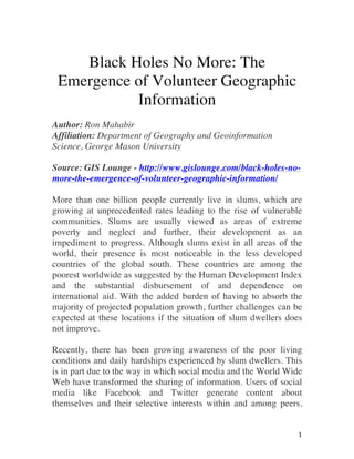
  • 2.   2   Most of this information is provided voluntarily by untrained private citizens and compared to the traditional top down approach of collecting geospatial information, represents a new form of geographic information altogether. In locations where slums are most pronounced, reliable information on these communities is often lacking, making this Volunteered Geographic Information (VGI) an important resource for slum information. The most well known example of VGI aiding slum dwellers is the Map Kibera project started by Mikel Maron and Erica Hagen in 2009, with the help of local partners in Kenya. Prior to 2009, Kibera, a slum with an estimated 250,000 residents, did not exist on any official maps of Kenya. It was no more than a black hole to the outside world. In this project, local residents are empowered into mapping their own community with the resulting digital data collected and placed onto an online map. Uploaded information is freely available on a wide rage of themes, including, transportation, health services, safe paths and the location of water and sanitation facilities, providing actionable knowledge for local residents in supporting their daily workflows. Local slum businesses have also benefited, using information from Map Kibera to expand their customer base. Map Kibera therefore provides Kiberans with an informational basis for better coordination and planning within their community.
  • 3. KIBERA GEOGRAPHIC DATA COLLECTION VIA OPENSTREETMAP.
  • 4.   4   Projects such as Map Kibera are also important for improving government involvement in slums. During the 2013 Kenyan election, the Map Kibera project provided information on access routes and the location of polling stations. This information was used to ensure overall safety during this event. Non-government and community-based organizations also use VGI to identify and fill water and sanitation needs in slums. These organizations further use this information for advocating with government, on behalf of slum dwellers, for improved conditions within slums. Such representation is important for improving the situation of slum dwellers since they are often overlooked in the planning decisions of the state. VGI projects also provide empowerment through the development of new skills and increased involvement on the part of slum dwellers. Locals use geospatial technology to create maps of their community. Newly acquired skills can also contributed towards finding better jobs for improving the situation of slum dwellers. These projects also encourage innovation among local slum residents. As an example, local slum residents trained by Map Kibera in using film media went on to found the Kibera News Network. Since its inception, Map Kibera continues to be a catalyst for many similar projects, allowing for a sustainable source of information on slum communities. A common attribute in slums is a lack of digital information and communications technology typically known as the digital divide. VGI projects that assist in reducing this divide are more likely to succeed because they do not require any professional expertise and are more inclusive of local residents. Non-government organizations including UN Habitat and Slum Dwellers International are working to make these technologies more accessible in slums. As an additional benefit, these types of VGI play a key role in connecting locals as they move through their communities, developing relationships with residents and forming
  • 5.   5   lasting networks. Slum residents are also able to connect with people outside of slums, both locally and internationally, providing an outlet for voicing their concerns to local government and global communities. It is clear that VGI represents an important resource for information on slums. This is especially the case since many official sources of information on slums are often limited or are of a low quality. Given that it may not be at all possible to remove the existence of slums altogether, there is a need for improving conditions within existing slums. This is important to ensure that everyone, both slum dwellers and non-slum dwellers alike, have the opportunity to live a quality life and not be marginalized, as is the case of many slum dwellers today.