Fulton Market Streetscape Public Meeting 12/10/2014
•
1 like•1,327 views

The document summarizes recommendations for improving the Fulton Market Streetscape between Ogden Avenue and Halsted Street in Chicago. It discusses conducting community outreach to understand issues and visions. Proposed improvements include upgrading infrastructure, enhancing pedestrian safety and accessibility, and designing the street to be flexible and accommodate different uses over time and between day and night. The improvements would be implemented in two phases from 2015 to 2017, starting with the section from Carpenter Street to Halsted Street.

Recommended
More Related Content
What's hot
What's hot (20)
Similar to Fulton Market Streetscape Public Meeting 12/10/2014
Similar to Fulton Market Streetscape Public Meeting 12/10/2014 (20)
More from West Central Association
More from West Central Association (16)
Recently uploaded
Recently uploaded (19)
Fulton Market Streetscape Public Meeting 12/10/2014
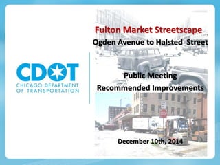
- 1. Fulton Market Streetscape Ogden Avenue to Halsted Street Public Meeting Recommended Improvements December 10th, 2014
- 2. Meeting Purpose and Goals • Present Existing Conditions • Community Input and Charrette • Overview of Recommend Improvements Describe ADA Challenges Street Design Concepts by Typology • Discuss Implementation Plan 2
- 3. 3 Existing Infrastructure - Unseen • Vaulted Sidewalks • Remnants of the Freight Tunnel System • Buried Private Utilities of All Types • City Sewer, Water and Electricity • Cobble Roadway Base
- 4. 4 Existing Infrastructure and Uses - Visible Contemporary • Pavement Type and Condition • Light Poles • Parkway Treatments Sidewalk and Brick Pavers Landscaping and Trees Sculptures • Overhead Wires • Sidewalk Cafés • Loading Zones • Parking Zones Historic • Flush Curbs • Building Canopies • Raised Sidewalks • Steel Curbs
- 5. Getting to Great Streets
- 6. Community/Stakeholder Issues and Concerns • Upgrading existing infrastructure • Parking • Accommodation of existing loading needs • Rationalize curbside uses • Address pedestrian safety and accessibility • Speeding during off-peak hours • Need for flexibility in the street • Rationalize traffic pattern • Increase unique programming and activities • Cultivate culture and community and celebrate unique district identity 6
- 7. Improvement Themes Maintain Market Integrity Corridor may change over time but want flavor of the market infrastructure to stay. Bring logic, clarity, and landscaping to Fulton. Safety Celebrate Technology and Food Market and innovation district should merge, accommodate, and celebrate historic uses with new technologies. Keep Fulton Flexible Transition from day to night / weekday to weekend. Balance curbside uses to reflect changes in use from day to night and weekday to weekend. Demand for flexibility increases toward east end of project. 7
- 8. Improvement Themes Pedestrian Friendly Use design elements to provide quality pedestrian experience while still allowing for other uses. Address pedestrian safety and ADA needs at higher vehicular volume streets • Ogden, • Racine, • Halsted. Street as a Public Open Space The street could become community open space Activities and spaces that support activation, interaction. • Temporal • Flexible Fulton Street as ‘Public Open Space’ 8
- 9. What is the Community’s Vision for Fulton Market? Flexible Street from Green to Morgan Farmers Market Events All uses, including food distribution Treat Intersections as Important Nodes CTA access at Morgan Expressway access using May, Racine, and Ogden Gallery hub at Elizabeth Raise Intersections to Slow Traffic Green Sangamon Enhance Safety Pedestrian Safety Measures Along Fulton and at: • Morgan, Carpenter & Aberdeen Traffic Signals at: • Halsted and Fulton • Ogden and Fulton Design For Changing Land Uses Concentration near Ogden Various parcels Carpenter to Green 9
- 10. 10 Proposed Infrastructure Improvements • Resurface deteriorated pavement • Rebuild sidewalks and parkways • Improve City Sewer and Water • Install Traffic Signals at Fulton and Halsted • Install new street and pedestrian lighting • Provide ADA compliant access Along Fulton At intersections Around raised sidewalks To raised sidewalks • Accommodate pedestrian movements for the entire length of Fulton Street • Organize & Rationalize Loading Zones At active truck docks • Organize & Rationalize Parking Zones • Bury Most Overhead Wires • Maintain/Permit Canopies • Retain Most Steel Curbs • Accommodate Sidewalk Cafés • Fill Vaulted Sidewalks
- 11. Fulton-Randolph Traffic and Curbside Use Study 11 Project Kickoff 10/15/2014 Data Collection Complete 5/1/2015 Study Completion 10/15/2015 Purpose: • Inventory existing curbside uses • Incorporates time of day and traffic • Develop recommendations for curbside changes and improvements to pedestrian, bicycle and motor vehicle accommodations Project Boundaries: Carroll Ave (N), Randolph St. (S), Ogden Ave. (W), Halsted St. (E) • Study Limits include Fulton Market Streetscape • Project Timeline:
- 12. Fulton-Randolph Traffic and Curbside Use Study: PRELIMINARY DATA COLLECTION • Curbside Use Inventory created from field observations 12 Intersection cameras used to determine daily fluctuations in car, truck, bike, and pedestrian traffic Mid-block cameras used to determine parking utilization and turnover rate • 24-hour video footage collected from intersection and mid-block locations along Fulton Market Preliminary Curbside Use Inventory
- 13. Fulton-Randolph Traffic and Curbside Use Study: PRELIMINARY OBSERVATIONS • Frequent in-street loading blocks traffic and creates safety issues • Majority of parking spaces have low turnover rate 13 0 20 40 60 80 100 120 6:00 AM 9:00 AM 12:00 PM 3:00 PM 6:00 PM 9:00 PM 12:00 AM 3:00 AM VolumeofTraffic Volume of Through Traffic at Peoria St & Fulton St (15-minute sample times) Cars Trucks Bikes Pedestrians Video footage from the block between Peoria St and Green St Preliminary data collected from intersection video footage Type Typical Peak Period Pedestrian 11:00 AM – 2:00 PM Car 6:00 PM – 9:00 PM Truck Various • Traffic Trends (5 intersections sample):
- 14. Traditional Streetscape Design Theme 14
- 15. Transition Section – Halsted to Green 15 • Standard Curb & Gutter Both Sides • Halsted Street Recently resurfaced Traffic signal installation (by others) Gateway arch identifier just west • Fill Sidewalk Vaults Issacson-Stein Fish John Morreale meats • ADA Improvements at Stein Fish Curb extension northwest corner Fulton and Halsted to protect diagonal parking Split sidewalk, upper level for forklift and shopper access, lower level for street access Install stairs to door and longitudinal railing Flatten longitudinal slope to 5% Flatten cross slope to 1.5% or less Restore steel curb where possible
- 16. ADA Challenges – Isaacson & Stein Fish 16 Sidewalk conditions include: 5.6% to 8.4% cross slopes (1.5% is ADA standard) 6.4% to 9.8% longitudinal slopes (5% to 7.14% standard)
- 17. ADA Solution – Isaacson & Stein Fish 17 PARKING CHANGES: • Loss of 1 stall on Fulton for Curb extension • Possible loss of 1 stall on Fulton for ADA parking • Gain of 3 to 4 stalls on Halsted due to bus stop relocation Conceptual design of ADA landing zone under development
- 18. Flexible Street Design Theme 18
- 19. Flexible Street – Green to Morgan 19 • Parkway Reconstruction • Street Resurfaced • Flat Gutter - No Curb Both Sides • Pedestrian Safety Enhancements At Green and Sangamon Streets • Raised Intersection At Peoria and Morgan Streets • Raised Intersection • Vertical Identifier • Watermain Improvements Along Sangamon from Randolph Street to Fulton Market • Fill Sidewalk Vault Siam Meats Elsewhere as needed • Bollards & Other Street Furniture to Delineate Pedestrian Zone • ADA Improvements ADA ramps for raised sidewalk at Brooklyn Bowl and Aviary/Moto/Next
- 20. ADA Solution – Brooklyn Bowl 20
- 21. ADA Solutions – Aviary / Moto / Next 21 Concept 1 – Replace stairs with ramps
- 22. ADA Solutions – Aviary / Moto / Next 22 Concept 2 – Keep stairs, ADA route on curb extension, parking loss on Morgan Street
- 23. ADA Solutions – Aviary / Moto / Next 23 Concept 3 – Replace stairs with ramps and corner curb extension, ADA route on raised sidewalk,
- 24. Flexible Street Proposed Cross Sections 24
- 25. Flexible Street Longitudinal Section 25 Green Street Peoria StreetSangamon StreetMorgan Street Halsted StreetPeoria Street
- 26. Rendering – Raised Intersection 26 Looking east on Fulton Street from west of Green Street
- 27. Traditional Streetscape Design Theme 27
- 28. Traditional Streetscape Morgan to Racine 28 • Parkway Reconstruction • Mix of Standard Curb & Gutter and Raised Curb Both Sides Provide ADA improvement at raised curbs Maintain steel curb face where possible • Pedestrian Safety Enhancements At Carpenter, Aberdeen, and Racine Streets • Curb extensions (to calm traffic) At May Street • Curb extensions • Vertical Identifier • Bury Overhead Power Lines • Fill Sidewalk Vault 1154 West Fulton
- 29. Traditional Streetscape Design Theme 29
- 30. Traditional Streetscape Racine to Ogden 30 • Parkway Reconstruction • Standard Curb & Gutter • Pedestrian Safety Enhancements At Elizabeth Street • Curb extensions • Vertical Identifier • Raised Intersection At Ada Street • Consider curb extensions At Ogden Avenue • Curb extensions • Minor Gateway Identifier
- 31. Next Steps in Design Development Historic Elements • Street Lighting Style Victorian Contemporary • Loading Zones Bollards • Raised Sidewalk Railing 31
- 32. Next Steps in Design Development Streetscape Elements • Trees • Planters • Benches • Bicycle Racks • Trash Receptacles 32
- 33. Next Steps in Design Development Traffic, Parking, and Loading Elements • Traffic Flow Options Maintain current configuration Convert to one-way westbound Convert to two-way • Parking Configuration Options Diagonal /Perpendicular/Parallel • More, Less, Keep, Eliminate? • How to provide flex street designated pedestrian way? • Rationalize Loading and Parking Zones Match to building use and layout Permitted needs • Impacts of providing designated pedestrian way 33
- 34. Next Steps in Design Development Safety Elements • Flex Street Ribbed tiles • Intersection Treatment Curb Extensions Crosswalk Markings Center Area • Historic Cobble Paver • Other? 34
- 36. Project Timeline 36 Gateway Arch Fulton Street between Green and Halsted • Foundation Construction - December 2014 • Gateway Arch Construction - January 2015 Phase I (Construction in 2015 - 2016) Fulton Street • Streetscape from Carpenter to Halsted Sangamon Street • Watermain from Randolph to Fulton Randolph Street - Various Intersections • Identifiers Phase II (Construction in 2016 - 2017) Fulton Street • Streetscape from Ogden to Carpenter