
Recommended
Recommended
More Related Content
Similar to Floods are among the most destructive natural disasters, which are highly complex to
Similar to Floods are among the most destructive natural disasters, which are highly complex to (20)
Recently uploaded
Recently uploaded (20)
Floods are among the most destructive natural disasters, which are highly complex to
- 2. Telangana state development planning society (TSDPS) was established by the Planning Department, Government of Telangana to continue the services of existing hydro – meteorological projects in Telangana after AP reorganization act in 2014 . Ongoing Activities: Weather Activities Rainfall, Temperature, Humidity and Wind Data Management – 863 AWS data retrieval & dissemination in real-time. Maintenance of AWS Network Analysis, Reports and Spatial maps of weather parameters Dynamic Real time data dissemination through website Development – Conducted surveys on Perception of Public Distribution System, Agriculture Loan waiver, TS iPASS, Kalyan Lakshmi (Shadi Mubarak) and Skill Gap Assessment in MSME sector of Telangana (On going) Weather Forecasting (WRF model) – regular 72-hours weather forecast generation Convergence Activities: Near Real Time Drought Monitoring in collaboration with TRAC Integration of AWS, DE&S and IMD rainfall through NIC. Monitoring of (SDG)Sustainable Development Goals with DR. MCR HRDI TSDPS Activities
- 3. SMS and Whatsapp service initiated to send daily AWS Rainfall, Maximum/Minimum Temperature and Forecast to all TS Officials, Collectors, CPOs and MPSOs. The same will be extended to registered General Public for Agricultural application. District wise weekly weather outlook for next seven days (Saturday to Friday) for Agriculture operations high lighting the heavy rainfall and dry/wet spells during the monsoon seasons are regularly uploading in the TSDPS web site . Integrated AWS+DES+IMD mandal wise rainfall data generation is started during 2017, mandal wise rainfall status being kept online. Proposed Activities: Urban Flooding, MoU with different National and International Institutions for Research studies – Asset Mapping in the state with NRSC & TRAC, Telangana Heat wave Atlas with UNICEF. Analysis and generation of data from State to village level to asses climate change impacts for preparation of Disaster Mitigation plans.
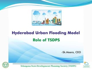
- 4. Development of Urban Flood Model for GHMC Area TSDPS plays a role of facilitator to bring different studies together and the views of different experts so that a operational Urban Flood Early warning system for GHMC area is developed by utilizing the available data and experts. Co-ordination with different Departments i.e., GHMC, HMWS&SB, IMD, Dis.Mgmt, Police, Research Institutions etc. Earlier development of Urban Flood Model was proposed by APSDPS in 2012 with the help of Prof. Sri. Kapil Gupta, IIT, Mumbai. The proposed project included Development of mathematical flood forecasting model (Hydrological and Hydrodynamic) for GHMC area (16 watersheds) including its contributing catchment area using Hydrologic Engineering Center -Hydrologic Modeling System(HEC-HMS) and Hydrologic Engineering Center -River Analysis System(HEC-RAS) incorporating finer resolution GIS datasets and data from 51 AWS already installed by TSDPS, rainfall forecast from WRF and gridded rainfall data from Doppler radar (available with IMD) as input within the modeling framework. The proposed project includes setting up the model for inflow forecast for major tanks in GHMC area and Development of 150 ward wise vulnerability maps for different rainfall scenarios; Further in addition to the above, various other activities to be carried out for development of effective Early warning system for urban flood management in GHMC area need to be discussed today.
- 5. Data Users GHMC & HMDA – Provision of Real Time Data for field level operations of Urban flood Monitoring and Traffic Management, presently which is under operation. Agriculture Department - For crop Management, Planning and Agriculture Insurance. Agriculture Insurance Company - WBCIS : All parameters of weather based insurance for settlement of claims. Agriculture University - All parameters for calculation of MAI (Moisture Aridity Index) and other research activities. Irrigation Department – Sharing of Real Time Data for monitoring of Reservoirs levels, River run off and Water Management. Disaster Management - Weather data to issue alerts to district officials. Universities for Projects - Providing data to Research Scholars for different Research studies. Information Technology - Sharing of data for display at public domain.
- 6. TSDPS web site (www.tsdps.telangana.gov.in)
- 7. Real Time GIS based Rainfall analysis as on 12.07.2018 at 8:30am
- 8. WRF Model based 3-days Rainfall Forecast as on 12.07.2018 Day-1 Day-2 Day-3
- 9. Comparision of Daily Forecast as on 12.07.2018
- 10. Integrated AWS+DES+IMD mandal wise rainfall(mm)
- 11. Integrated AWS+DES+IMD mandal wise rainfall(mm)
- 12. Real time Rainfall Details
- 13. District Mandal Date Highest Rainfall (mm) Recorded Source Hyderabad (IMD) Begumpet 24-08-2000 241.5 IMD Hyderabad Maredpally 18-08-2009 140 TSDPS Medchal-Malkajgiri Balanagar 19-06-2010 136.8 TSDPS Hyderabad Asifnagar 22-08-2011 123.4 TSDPS Rangareddy Saroornagar 21-07-2012 226.8 TSDPS Medchal-Malkajgiri Balanagar 12-07-2013 116.2 TSDPS Hyderabad Maredpally 08-07-2014 86.4 TSDPS Rangareddy Saroornagar 13-06-2015 135.2 TSDPS Medchal-Malkajgiri Qutballapur 21-09-2016 230 TSDPS Medchal-Malkajgiri Kapra 14-09-2017 174.6 TSDPS Highest Rainfall intensity of 87mm/hour recorded on 02.10.2017 at Srinagercolony (Khairatabad) and more than 60mm/hour recorded on the same day at Mondamarket, Shapurnager, Rajendranager, Madhapur. Extreme Rainfall (mm) recorded over GHMC Area
- 16. Thank you