Haii 2017
•
3 likes•316 views

This document summarizes the work of the Hydro and Agro Informatics Institute (HAII) in Thailand. It discusses HAII's vision of developing science and technology for agricultural and water resource management to cope with climate change. It describes HAII's research focuses on real-time monitoring, forecasting, modeling, and decision support systems. It provides examples of HAII's integrated modeling structures, telemetering systems, and use of high performance computing. Finally, it discusses how HAII aims to strengthen community water resource management and local economies through the application of science and technology following Thailand's King's sufficiency economy concept.

Recommended
Recommended
More Related Content
What's hot
What's hot (17)
Similar to Haii 2017
Similar to Haii 2017 (20)
More from Veerachai Tanpipat
More from Veerachai Tanpipat (6)
Recently uploaded
Recently uploaded (20)
Haii 2017
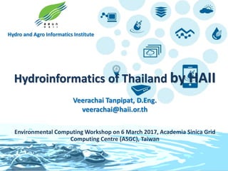
- 1. Hydro and Agro Informatics Institute Hydroinformatics of Thailand by HAII Veerachai Tanpipat, D.Eng. veerachai@haii.or.th Environmental Computing Workshop on 6 March 2017, Academia Sinica Grid Computing Centre (ASGC), Taiwan
- 2. Environmental Computing Workshop on 6 March 2017, Academia Sinica Grid Computing Centre (ASGC), Taiwan Contents • Intro to HAII • Vision and Missions • Activities • In Conclusions
- 3. Hydro and Agro Informatics Institute 3 Hydro and Agro Informatics Institute
- 4. Hydro and Agro Informatics Institute 4 Vision & Missions Developing and applying science and technology knowledge for agricultural and water resource management in order to cope with critical climate change; and expanding the accomplishment through the design and development of strong and effective networking • Developing and applying S&T for agricultural and water resource management • R&D in water management technology and system • Expanding services and disseminating the R&D outcomes • Promoting S&T research and development collaboration Vision Missions
- 5. Hydro and Agro Informatics Institute 5 Research Focuses Real time monitoring, Forecasting & Operating system System Integration Climate change, Adaptation and Good practices • Telemetering system • Precipitation Observation by Satellite • Surveying technology • Weather forecasting system (WRF, WRF-ROMs) • Modeling system (Flood , Water resource, Coastal) • Decision Support System (DSS) • Open architecture / Open source • HPC, GPU, MIC • Big Data • Cloud • New Technology • Climate change scenarios and related effects • Seasonal prediction • Small scale water resource management • Adaptation using S&T • Good practice : Community Water Resource Management
- 6. Hydro and Agro Informatics Institute 6 Telemetering System • 850 stations in operation nationwide • Real time weather and water level monitoring • Automatically links all data through GPRS or satellite • Publicized on www.thaiwater.net Data Transmission Network Weather and Precipitation station Water Level station
- 7. Hydro and Agro Informatics Institute 7 Surveying Technology Unmanned Aerial Vehicle Mobile Mapping System Automatic Boat
- 8. Hydro and Agro Informatics Institute 8 Integrated modeling structure Weather forecast (WRF-ROMs) Flood ModelRiver ModelWater Resources Model Flow in rivers (discharge, water level) Controlled structures Overland flow/inundation (flood level, area, time) Flood management scenarios Reservoir management Water allocation Water balance Hydrological Model Future Climates •Statistical downscaling of CMIP5 •Parameters optimization for CDF of GCMs and observations
- 9. Hydro and Agro Informatics Institute 9 WRF : Weather Research and Forecasting Model Verify with Local weather stations Use NCEP’s Global Forecast System (GFS) inputsRun twice a day : 7-day forecasts (9x9 km) Deploy fine computational grid 3x3 km (3 nested domains)Use a high resolutions topography Source: http://www.thaiwater.net/web/index.php/weatherinfo.html
- 10. Hydro and Agro Informatics Institute 10 WRF-ROMs : 2-Way Coupled Models Exchange modeled field via MCT hourly Weather Research Forecasting Model (WRF) Regional Ocean Modeling System (ROMs) Source: http://www.thaiwater.net/web /index.php/weatherinfo.html
- 11. Hydro and Agro Informatics Institute 11 Statistical Downscaling for Global Climate Models The statistical bias correction of GCM rainfall by Gamma-gamma transformation method is exploited to downscale the global to river basin scale. This method can reduce biases in terms of frequency and quantity at rain gauge station’s position. (b) Bias corrected BCC GCM (a) Observed 27.73 oC 27.74 oC (b) Bias corrected BCC GCM (a) Observed 1,342 mm/yr 1,390 mm/yr Annual Rainfall Annual average temperature
- 12. Hydro and Agro Informatics Institute 12 Water Balance Model Water Balance Model (MIKE Basin/SWAT)Water Balance Model (MIKE Basin/SWAT) IrrigatedIrrigated areaarea Daily and Monthly Precipitation (Pi) Runoff Model Runoff (Ri) Runoff (Ri) Supply (Si = Ri + Upi) Upstream inflow or Reservoir outflow (Upi) Supply (Si = Ri) Si – Di Monthly Water Demand (Di) Monthly Water Demand (Di) Si – Di SurplusDeficit Surplus Deficit UnirrigatedUnirrigated areaarea Balance Bi = Si–Di Balance Bi=Si–Di Balance Bi=Si–Di Balance Bi=Si–Di Downstream Outflow (Dni)
- 13. Hydro and Agro Informatics Institute 13 Flood Forecasting Model 1D 2D Project area covers the entire Chao Phraya river basin Flow & flood conditions can be predicted 7 days in advanceBy coupling these two models with WRF Flood forecasting models combine the use of 1D river model and 2D overland flow model together
- 14. Hydro and Agro Informatics Institute 14 Decision support system National Hydroinformatics and Climate Data Center Multiple Data Sources GIS Water user Base Data WRF Forecast DataReal-time Data Rainfall Discharge Water level Reservoir Data Management Flood Forecasting SystemAnalysis Output Real-time Data Flood Forecast Water Balance Flood Management Multi-user Interfaces DSS
- 15. Hydro and Agro Informatics Institute 15 Decision support system for flood forecasting and water management
- 16. Hydro and Agro Informatics Institute 16 Thailand DEC 2016 – JAN 2017 Southern Flood Flash flood & landslide warning Reservoir networking Data warehouse Early warning and real time decision making Flood sensorweb Forecast & modeling Networking & cluster Integration of technology for data analysis and flood management By Dartmouth Flood Laboratory, Colorado University, UNOOSA, NASA and ESA (International Charter)
- 17. Hydro and Agro Informatics Institute 17 Global Satellite Mapping of Precipitation (GSMaP) http://sharaku.eorc.jaxa.jp/GSMaP/ • GSMaP is a blended Microwave-IR product and has been developed in Japan toward the GPM mission. – GSMaP (v6) data since Mar. 2000 period was reprocessing as reanalysis version (GSMaP_RNL), and was open to the public on Apr. 2016. – New version, GSMaP (v7) was released on 17 Jan. 2017. GSMaP_NRT hourly rain with Himawari-8 cloud (1-12 Jan 2017) Takuji Kubota, JAXA, 2017
- 18. 10days accumulation (1-10 Jan. 2017) Heavy rain over Thailand during early January 2017 Time series of GSMaP_NRT surface rain over heavy rain areas of the Nakhon Si Thammarat Province Nakhon Si Thammarat Province: 10- day-accumulation >1000m 5th -6th Jan 5th -6th Jan Takuji Kubota, JAXA, 2017
- 19. Daily rainfall amount from the GSMaP-NRT 01 Jan 2017 02 Jan 2017 03 Jan 2017 04 Jan 2017 05 Jan 2017 06 Jan 2017 07 Jan 2017 08 Jan 2017 09 Jan 2017 10 Jan 2017 Takuji Kubota, JAXA, 2017
- 20. Hydro and Agro Informatics Institute 20 High Performance Computing CPU (Cores) Memory (GB) Storage (TB) Grid Computing (EUAsiaGrid) 48 192 2 Mobile Data Center 128 512 20 LinuxHPC-Dev1 384 1536 30 LinuxHPC-Live1 512 1536 38 Linux-GPU 12 64 -
- 21. Hydro and Agro Informatics Institute 21 Utilization of Asia Pacific Advanced Network Source: https://ensight.eos.nasa.gov/Organizations/ceos/HAII.shtml
- 22. Hydro and Agro Informatics Institute 22 Science & Technology for Community Water Resource Management The community could coordinate and manage their water resources with partners and to be the ownership InternetComputer Spreadsheet GPS receiversS&T Adaptation for increasing Community’s efficiency Crop Calendar Satellite Images
- 23. Hydro and Agro Informatics Institute 23 Sciences & Technology Adaptation for Strengthening Local Economy • Simple infrastructure design suitable for the socio-geographical condition • Systematically plan the work process, management and maintenance • Local innovation • Apply S&T for community survey • Identify problems and solutions • Water balance analysis • Area-based analysis • 3 forests, 4 benefits • Integrated agriculture • Water quality management • Self-sufficiency • Food security • Expand the success to other communities S&T Application Engineering/ Innovation Sustainable Agriculture Success To prevent economic loss from flood and drought, Thailand needs good water management system at every level, nationally or locally.
- 24. Hydro and Agro Informatics Institute 24 THAIWATER-www.thaiwater.net Water and Weather Situation Monitoring Serve Executive, Government Agencies and Public • Storm • Rainfall • Temperature • Water diagram • Dam water level • Water model and warning system in flood and drought for water management
- 25. Hydro and Agro Informatics Institute 25 Media Box : Automated weather and water tracking tool Broadcast water situation NEWS Serve Local administration and Community
- 26. Hydro and Agro Informatics Institute 26 ThaiWater Mobile Application Rainfall Weather Dam Rainfall Wave Storm Forecast 26 NEWS Report / Water situation monitoring Serve Executive and Public
- 27. “Being a tiger is not important. The important thing is for us to have a sufficient economy. A sufficient economy means to have enough to support ourselves…we have to take a careful step backward…each village or district must be relative self-sufficient.” His Majesty King Bhumibol Adulyadej, The Great King RAMA IV Source: http://www.chaipat.or.th/chaipat_english/
- 28. In Conclusions HAII has been developing, researching, integrating and implementing science and technology for the better and stronger Thai society in a sustainable way following the Great King Rama IV’s “Sufficiency Economy” Concept and the “New Agricultural Theory” Initiative to become the sustainable development kingdom.
- 29. www.haii.or.th ● www.thaiwater.net Hydro and Agro Informatics Institute Ministry of Science and Technology, Thailand Thank You Very Much!!