
Recommended
Recommended
More Related Content
Similar to FEMA Dam Safety Pocket Guide
Similar to FEMA Dam Safety Pocket Guide (20)
More from JA Larson
More from JA Larson (20)
Recently uploaded
Recently uploaded (20)
FEMA Dam Safety Pocket Guide
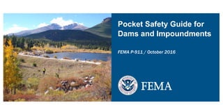
- 1. Pocket Safety Guide for Dams and Impoundments FEMA P-911 / October 2016 FEMA
- 2. This document has been developed from the FEMA P-911 Pocket Safety Guide for Dams and Impoundments developed by the U.S. Forest Service (USFS) and Federal Emergency Management Agency (FEMA). It was revised in cooperation with 6 agencies of the Department of the Interior (Bureau of Indian Affairs, Bureau of Land Management, Bureau of Reclamation, National Park Service, Office of Surface Mining, Reclamation and Enforcement and US Fish and Wildlife Service) as part of the Department of the Interior’s Enterprise Architecture Project “Reduce Dam Safety Risk”. Further review was provided by the National Dam Safety Review Board and the Association of State Dam Safety Officials
- 3. Pocket Safety Guide for Dams and Impoundments October 2016 The Federal Emergency Management Agency (FEMA) has developed this information for the guidance of its employees, its contractors, and its cooperating Federal and State agencies and is not responsible for the interpretation or use of this information by anyone except its own employees. The use of trade, firm, or corporation names in this document is for the information and convenience of the reader and does not constitute an endorsement by FEMA of any product or service to the exclusion of others that may be suitable. FEMA prohibits discrimination in all its programs and activities on the basis of race, color, national origin, age, disability, and where applicable, sex, marital status, familial status, parental status, religion, sexual orientation, genetic information, political beliefs, reprisal, or because all or part of an individual’s income is derived from any public assistance program. (Not all prohibited bases apply to all programs.) FEMA is an equal opportunity provider and employer. Lily Lake Dam, Rocky Mountain National Park, Colorado. Photograph by Kevin Gagner. i
- 4. Acknowledgements ii FEMA would like to thank the following people and organizations for assistance in developing and reviewing this guide: ● Developing the original guide: ○ James Scott Groenier, Project Leader for the USDA Forest Service Pocket Safety Guide for Dams and Impoundments, January 2012, assisted by the following individuals and organizations: ○ Terri Anderson, U.S. Department of Agriculture, Forest Service, Bitterroot National Forest ○ Brad Campbell, U.S. Department of Agriculture, Forest Service, Boise National Forest ○ James Demby, U.S. Department of Homeland Security, Federal Emergency Management Agency, National Dam Safety Program ○ Cliff Denning, U.S. Department of Agriculture, Forest Service, Eastern Region ○ Brad Iarossi, U.S. Department of the Interior, U.S. Fish and Wildlife Service ○ Martin McCann, U.S. Department of Agriculture, Forest Service, Southern Region ○ Sue Peterson, U.S. Department of Agriculture, Forest Service, Eastern Region ○ Steve Romero, U.S. Department of Agriculture, Forest Service, Pacific Southwest Region ○ Charles Showers, U.S. Department of Agriculture, Forest Service, Missoula Technology and Development Center ○ Lori Spragens, Association of State Dam Safety Officials ○ Nate Tatum, U.S. Department of the Interior, National Park Service ○ Association of State Dam Safety Officials ○ U.S. Department of Agriculture, U.S. Forest Service ○ U.S. Department of Homeland Security, Federal Emergency Management Agency, National Dam Safety Program ○ U.S. Department of the Interior, U.S. Fish and Wildlife Service
- 5. ● Revising the guide: ● Members of the 2013 – 2014 U.S. Department of the Interior Reduce Dam Safety Risk team: ○ Mark Baker, National Park Service ○ Jessica Bush, Bureau of Land Management ○ Scott Goss, Bureau of Indian Affairs ○ Dave Hibbs, U.S. Fish and Wildlife Service ○ Stacy Johnson, Bureau of Reclamation ○ Stefanie Self, Office of Surface Mining, Reclamation and Enforcement ○ Jade Soddell, Bureau of Reclamation ○ Jay Stateler, Bureau of Reclamation ○ Mike Vail, Bureau of Indian Affairs ● Figures 1, 2, 14, and 15: Ed Jenne, Missoula, Montana ● Figures 17, 19, 21, 23, 25, 27, 29, 31, 33, 35, 37, 39, 41, 43, 45, 47, 53, and 55 were adapted from the 1986 FEMA publication “Dam Safety: An Owner’s Guidance Manual,” developed by the Colorado Division of Disaster Emergency Services iii
- 6. iv Contents Acknowledgements..............................................................................................ii Contents..............................................................................................................iv Introduction...........................................................................................................1 Responsibilities and Liability.................................................................................2 Embankment Dam Diagram.................................................................................3 Noteworthy Observations at an Embankment Dam............................................4 Concrete Gravity Dam Diagram...........................................................................5 Concrete Arch Dam Diagram...............................................................................7 Concrete Buttress Dam Diagram.........................................................................9 Concrete Masonry Dam....................................................................................11 Noteworthy Observations at a Concrete Dam..................................................12 OutletStructures................................................................................................13 Gate Valve........................................................................................................13 Drop Inlet Riser.................................................................................................14 Spillway Overview.............................................................................................15 Embankment Dam Problems.............................................................................16 Excessive Quantity and/or Muddy Seepage Water Exiting From a Point.............................................................................................16 Seepage Water Exiting From a Point Adjacent to the Outlet Pipe...................18 Seepage Water Exiting as a Boil Downstream of the Dam.............................20 Seepage Water Exiting at the Abutment Contact.............................................22 Sinkholes..........................................................................................................24 Slide, Slump or Slip.........................................................................................26 Transverse Cracking........................................................................................28 Longitudinal Cracking.......................................................................................30 Rodent Activity and Animal Impact...................................................................32 Trees or Obscuring Vegetation.........................................................................34 Surface Erosion................................................................................................36 Deteriorated or Missing Riprap.........................................................................38 Livestock and Cattle Traffic..............................................................................40 Low Area in the Crest of a Dam.......................................................................42 Failure of Concrete or Rock Outfall (Energy Dissipation) Structures...............44 Outlet Releases Eroding the Toe of the Dam .................................................46 Concrete or Masonry Dam Problems..................................................................48 Cracking, Opening/Closing or Offsets at Joints, or Apparent Deformations...................................................................................48 Deterioration of Structural Materials..................................................................50 Spillway Problems...............................................................................................52 Excessive Vegetation or Debris in the Spillway Channel or Around the Inlet...........................................................................................................52 Erosion of Unlined Spillway Channels..............................................................54 Resources.......................................................................................................... 56 Web Sites........................................................................................................... 57 Useful Terms.......................................................................................................58
- 7. Introduction This “Pocket Safety Guide for Dams and Impoundments” was developed for dam owners, inspectors and other people as a quick reference when assessing dams and impoundments. For in-depth discussion, please refer to the technical manuals and guides available from FEMA at: http://www.fema.gov/technical-manuals-and-guides. Dam—Any artificial barrier of at least a minimum size, including appurtenant works, that impounds or diverts water or liquid-borne solids on a temporary or long-term basis (for a full definition see FEMA 93). The information contained in this document is also applicable to impoundments. Hazard potential classification—A system that categorizes dams according to the degree of adverse incremental consequences from their failure or misoperation that does not reflect in any way on their current condition (their safety, structural integrity, or flood routing capacity), and that includes the following categories: • High hazard potential—loss of one or more human life is probable • Significant hazard potential—no probable loss of human life but possible economic loss, environmental damage, disruption of lifeline facilities, or other impacts • Low hazard potential—no probable loss of human life and low economic and/or environmental losses (typically limited to the property of the dam owner). 1
- 8. 2 Various Federal and State agencies may have different definitions for the dams over which they have jurisdiction. Please refer to your agency or State dam regulatory requirements for direction. Responsibilities and Liability The owner is responsible for the operation and maintenance of a safe dam. Maintaining a safe dam is a key element in preventing failure and limiting the liability that an owner could face. The extent of an owner’s liability varies from State to State and depends on statutes and case law precedents. Federally owned and regulated dams are subject to the laws, regulations and guidelines of the owner agency. Owners can be fiscally and criminally liable for any failure of a dam and all damages resulting from its failure. Any uncontrolled release of the reservoir resulting from a dam failure or uncontrolled release can have a devastating effect on persons, property, and the environment. This guide is designed for a wide audience. The recommended action taken by individuals will be determined by their expertise with dam maintenance. Inexperienced individuals should photograph suspected problem(s) and report them promptly to the dam owner or operator. When you become aware of any unusual conditions that seem critical or dangerous to a dam, report them immediately to the appropriate Federal or State agency official.
- 9. Embankment Dam Diagram Figure 1 – Typical dam diagram showing common terms. 3
- 11. Concrete Gravity Dam Diagram Figure 3 – Typical gravity dam views showing common terms (www.simscience.org). 5
- 12. 6 Figure 4 – Gravity dam cross-section showing load transmission to foundation. Figure 5 – Grand Coulee Dam in Washington.
- 13. Concrete Arch Dam Diagram Figure 6 – Typical arch dam views showing common terms (www.simscience.org). 7
- 14. 8 Concrete Arch Dams Figure 7 – Arch dam cross-section showing load transmission into foundation and abutment. Figure 8 – Theodore Roosevelt Dam in Arizona.
- 15. Concrete Buttress Dam Diagram Figure 9 – Typical buttress dam diagram showing common terms (www.simscience.org). 9
- 16. 10 Concrete Buttress Dams Figure 10 – Arch dam cross-section showing load transmission into foundation and abutment. Figure 11 – Lake Tahoe Dam in California.
- 17. Concrete Masonry Dam Figure 12 – Masonry dam on the Cedar River southeast of Seattle, Washington. 11
- 18. Noteworthy Observations at a Concrete Dam Figure 13. 12
- 19. Outlet Structures Gate Valve Figure 14 – Typical gate valve used with a spillway to control water level. 13
- 20. 14 Outlet Structures Drop Inlet Riser Figure 15 – Typical drop inlet riser serving as a principal or service spillway to control water level.
- 21. Outlet Structures Spillway Overview Figure 16 – Spillway Overview with structures identified. 15
- 22. 16 Embankment Dam Problems Excessive Quantity and/or Muddy Seepage Water Exiting From a Point Probable Causes and Possible Consequences • Water has created an open pathway, channel, or pipe through the dam. The water is eroding and carrying embankment material. • Rodents, frost action, or poor construction may allow seepage water to create an open pathway or pipe through the embankment. • Continued flows can further erode embankment and/or foundation materials and lead to dam failure. Recommended Action Report the suspected problem to the appropriate Federal or State agency official and have the situation evaluated by a qualified engineer immediately. • Estimate or measure outflow quantity. Determine whether seepage flows are increasing with time, and whether material transport by the flow is continuing to occur. • Have a qualified engineer inspect the condition and recommend further actions. • Lower the water level in the reservoir. • Search for an opening on the upstream side of the dam. Plug it if possible. • If possible, place filter sand at the seepage exit location to prevent material from being transported along with the seepage. Gravel may need to be placed initially so that the flow velocity is slowed, so the sand is not washed away by fast-flowing water. Once the sand filter is in place, cover it with gravel so it does not get washed away by the seepage flow.
- 23. Figure 17 – Excessive quantity and/or muddy seepage water exiting from a point. Figure 18 – Excessive seepage water exiting at the toe of the embankment. 17
- 24. 18 Seepage Water Exiting From a Point Adjacent to the Outlet Pipe Probable Causes and Possible Consequences • A break or hole in the outlet pipe or poor compaction around the pipe allows water to flow and creates a pathway along the outside of the outlet pipe. • Continued flows can lead to embankment and/or foundation material erosion and dam failure. Recommended Action Report the suspected problem to the appropriate Federal or State agency official and have the situation evaluated by a qualified engineer immediately. • Determine if seepage is carrying soil particles (muddy water). • Determine quantity of flow, and if flow is increasing with time. • Have a qualified engineer inspect the condition and recommend further actions. • If flow increases or is carrying material, the reservoir level should be lowered until seepage flow stops. • Investigate embankment along alignment of pipe to see if there are any signs of settlement or sinkholes.
- 25. Figure 19 – Seepage water exiting from a point adjacent to the outlet pipe. Figure 20 – Embankment erosion adjacent to an outlet pipe. 19
- 26. 20 Seepage Water Exiting as a Boil Downstream of the Dam Probable Causes and Possible Consequences • Some part of the foundation material is supplying a path for reservoir seepage. This could be caused by a sand or gravel layer in the foundation. • Increased flows can lead to high upward gradients and erosion of the foundation materials and dam failure. Recommended Action Report the suspected problem to the appropriate Federal or State agency official and have the situation evaluated by a qualified engineer immediately. • Examine the boil to see if foundation materials are being transported (typically expressed as a ring of material around the exit point). • Have a qualified engineer inspect the condition and recommend further actions. • If soil particles are building up at exit points, use sandbags or earth to create a dike around the boil. The pressures created by the water level may halt the flow and prevent further erosion. • If the situation cannot be controlled using sandbags, and soil materials are being carried by the flow, the reservoir level should be lowered.
- 27. Figure 21 – Seepage water exiting as a boil downstream of the dam. Figure 22 – Sandbags surrounding a boil on the downstream side of the dam (note the mound of material forming in the center of the sand- bagged area.21
- 28. 22 Seepage Water Exiting at the Abutment Contact Probable Causes and Possible Consequences • Water flowing through pathways in the abutment or along embankment abutment contact can result in internal erosion. • Seepage can lead to erosion of the embankment material and dam failure. Recommended Action Report the suspected problem to the appropriate Federal or State agency official and have the situation evaluated by a qualified engineer immediately. • Begin measuring outflow quantity. Determine whether seepage flows are increasing with time, and whether material transport by the flow is continuing to occur. • Have a qualified engineer inspect the condition and recommend further actions. • Lower the water level in the reservoir. • Search for an opening on the upstream side of the dam. Plug it if possible. • If possible, place filter sand at the seepage exit location to prevent material from being transported along with the seepage. Gravel may need to be placed initially so that the flow velocity is slowed, so the sand is not washed away by fast-flowing water. Once the sand filter is in place, cover it with gravel so it does not get washed away by the seepage flow.
- 29. Figure 23 – Seepage exiting at the abutment contact (groin). Seepage Figure 24 – Seepage at the abutment contact (groin) can lead to dam failure. 23
- 30. 24 Sinkholes Probable Causes and Possible Consequences • Internal erosion (piping) of embankment materials or the foundation can cause a sinkhole. • An eroded cavern (cave-in) can result in a sinkhole. • A small hole in the wall of an outlet pipe can develop into a sinkhole. • Seepage with sediment at the seepage exit indicates potential internal erosion of the dam embankment or foundation. • Internal erosion can lead to dam failure as soil pipes develop and erode through the dam embankment and/or foundation. Recommended Action Report the suspected problem to the appropriate Federal or State agency official and have the situation evaluated by a qualified engineer immediately. • Check seepage and leakage outflows for muddy water. • Inspect the dam and appurtenances for other anomalies, such as new seepage areas, depressions, cracks, etc. • Have a qualified engineer inspect the conditions, identify the exact cause of sinkholes, and recommend further actions.
- 31. Figure 25 – Sinkholes. Figure 26 – Whirlpool action in the reservoir (unrelated to an outlet works intake) could be an indication of advanced piping. Dam failure could be imminent. 25
- 32. 26 Slide, Slump or Slip Probable Causes and Possible Consequences • Foundation movement or a too steep slope can cause earthfill to move along a slip plane which can lead to a slump or slip of the embankment. • Slide movements in the reservoir basin can lead to inlet obstruction or dam failure (through instability in the faces of the dam, or through wave action if the slide is along the perimeter of the reservoir). Recommended Action Report the suspected problem to the appropriate Federal or State agency official and have the situation evaluated by a qualified engineer immediately. • Evaluate the extent of the slide. • Inspect for new or changed seepage conditions downstream of the slide area, and for longitudinal and transverse cracks, scarps, etc. near the slide area. • Monitor the slide. • Draw down the reservoir level if the safety of the dam is threatened. • Have a qualified engineer inspect the conditions and recommend further actions.
- 33. Figure 27 – Slide, slump or slip on either face. Figure 28 – Slumping on the downstream face of a dam. 27
- 34. 28 Transverse Cracking Probable Causes and Possible Consequences • Differential settlement between adjacent segments of the embankment may cause transverse cracking. • Deformation caused by differential settlement or slope instability may provide a path for seepage through the embankment cross section, which could initiate a breach of the embankment. Recommended Action Report the suspected problem to the appropriate Federal or State agency official and have the situation evaluated by a qualified engineer immediately. • Inspect the crack and carefully record its location, length, depth, width, and other pertinent physical features. Stake out the crack limits. • Have a qualified engineer determine the cause of cracking and supervise all steps necessary to reduce danger to the dam and correct the condition. • Under the direction of a qualified engineer, excavate the crest along the crack to a point below the bottom of the crack. Backfill the excavation using suitable material and correct construction techniques. This seals the cracks at the crest surface to prevent surface water infiltration. Visually monitor the crest routinely for evidence of future cracking.
- 35. Figure 29 – Transverse cracking. Figure 30 – Transverse cracks may provide open seepage paths through an embankment dam. 29
- 36. 30 Longitudinal Cracking Probable Causes and Possible Consequences • Slope instability can result in longitudinal cracks. • After an earthquake, longitudinal cracks could indicate liquefaction of the foundation and/or embankment materials may have occurred, which resulted in slope movements. • Differential settlement between zones or within the embankment may cause longitudinal cracking. • Cracks create a point for water to enter the embankment, which could result in slope instability. Recommended Action Report the suspected problem to the appropriate Federal or State agency official and have the situation evaluated by a qualified engineer immediately. • Inspect the crack and carefully record the location, length, depth, width, alignment and other pertinent physical features. • Have a qualified engineer determine the cause of cracking and supervise the steps necessary to reduce danger to the dam and correct the condition. • Effectively seal the cracks to prevent surface water infiltration. • Monitor the crest routinely for evidence of further cracking.
- 37. Figure 31 – Longitudinal crack. Figure 32 – Longitudinal cracks can be an indication of dam instability. 31
- 38. 32 Rodent Activity and Animal Impact Probable Causes and Possible Consequences • Cattail-filled areas and areas where trees are close to the reservoir provide ideal habitat and foraging areas for animals. • An overabundance of rodents increases the chance of animal burrowing, which creates holes, tunnels, and caverns within an embankment dam. • Tunnels may significantly reduce the length of the seepage path through the dam embankment which could cause initiation of an internal erosion problem. Recommended Action Report the suspected problem to the appropriate Federal or State agency official and have the situation evaluated by a qualified engineer immediately. • Start a rodent control program to reduce the population and prevent future damage to the dam. • Backfill existing rodent holes with suitable well- compacted material to repair damages. • For large or deep holes, include a zone of filter material when backfilling.
- 39. Figure 33 – Rodent activity. Figure 34 – Rodent holes in the dam face can cause seepage issues that could lead to dam failure. 33
- 40. 34 Trees or Obscuring Vegetation Probable Causes and Possible Consequences • Natural vegetation (bushes) obscures visual inspection and harbors animals. • Large tree roots can create seepage paths. • Large trees can blow over during a storm and damage the dam, which may cause a breach. Recommended Action Report the suspected problem to the appropriate Federal or State agency official and have the situation evaluated by a qualified engineer immediately. • Control vegetation that obscures visual inspection of the embankment. • Under the direction of a qualified engineer, remove all large, deep-rooted trees and shrubs on or near the embankment with care to minimize disturbance to the embankment. • Backfill voids promptly. • Remove trees at the toe and groins of the dam to provide a 25- to 50-foot buffer. • Monitor area after removal of trees, since deterioration of remaining roots from large trees may lead to voids in the embankment and potentially cause sinkholes and/or seepage paths.
- 41. Figure 35 – Trees or obscuring vegetation. Figure 36 – Trees growing on the crest and the faces of a dam. 35
- 42. 36 Surface Erosion Probable Causes and Possible Consequences • Water from intense rainstorms or snowmelt carries surface materials down the slope and results in continuous troughs, rills, gullies, etc. • Erosion can lead to severe deterioration of the downstream slope that can be expensive to repair. It is preferable to catch the problem early, when resolving the issue is much less costly. • Surface erosion can also occur upstream if the face is not protected with riprap. Recommended Action Report the suspected problem to the appropriate Federal or State agency official and have the situation evaluated by a qualified engineer immediately. • If erosion is detected early, add protective grasses that may resolve the problem. • Restore and protect eroded areas; add rock or riprap, where appropriate.
- 43. Figure 37 – Erosion. Figure 38 – Erosion on the downstream face of a dam. 37
- 44. 38 Deteriorated or Missing Riprap Probable Causes and Possible Consequences • Poor quality riprap deteriorates and does not protect the slope. • Wave or ice action can displace riprap allowing erosion or over-steepening of the bank. • Improperly sized riprap may displace and expose the slope. • Wave action against these unprotected areas decreases the embankment width. Recommended Action Report the suspected problem to the appropriate Federal or State agency official and have the situation evaluated by a qualified engineer immediately. • Reestablish the normal slope. • Place bedding material and properly sized riprap to protect against wave action.
- 45. Figure 39 – Broken down or missing riprap. Figure 40 – Wave erosion on the unprotected face of a dam. 39
- 46. 40 Livestock and Cattle Traffic Probable Causes and Possible Consequences • Livestock paths and activities on the downstream dam face can damage slopes, especially when wet. • Livestock activities may reduce erosion protection leading to erosion issues. Recommended Action • Fence the embankment area to keep out livestock. • Repair erosion protection by reestablishing grasses or by placing bedding material and riprap, as applicable.
- 47. Figure 41 – Livestock and cattle traffic. Figure 42 – Livestock paths on dam faces can lead to dam erosion. 41
- 48. 42 Low Area in the Crest of a Dam Probable Causes and Possible Consequences • Excessive settlement of the embankment or internal erosion of embankment material may cause a depression on the crest of a dam. • Foundation spreading upstream and/or downstream, prolonged wind erosion, or improper final grading following construction may cause a low area in the crest of a dam. • Low area may have been intentionally included during original construction. • Low areas can reduce the freeboard available and result in the embankment dam overtopping sooner. Recommended Action Report the suspected problem to the appropriate Federal or State agency official and have the situation evaluated by a qualified engineer immediately. • Establish survey monuments or survey along the length of the crest from abutment to abutment to determine the exact amount, location, and extent of low spots on the crest. • Have a qualified engineer determine the cause of the low area and supervise all necessary steps to reduce any threat to the dam and correct the condition. • Use proper construction techniques to fill in the low area and reestablish the uniform elevation over the length of the crest. • Routinely survey established monuments to routinely survey along the dam crest to detect any unusual settlement along the crest of the dam. • Note: Low areas may be desirable to direct flow over areas of dam less susceptible to damage or having lower consequences from downstream failure.
- 49. Figure 43 – Low area in the crest of a dam. Figure 44 – Low areas in the crest of a dam reduce the freeboard (therefore allowing overtopping at a lower frequency flood). 43
- 50. 44 Failure of Concrete or Rock Outfall (Energy Dissipation) Structures Probable Causes and Possible Consequences • Excessive side pressures on a non-reinforced concrete structure or poor concrete quality can cause failure of the outfall structure. • The embankment may be exposed to erosion by outlet releases because of loss of an outfall structure. • Too steep of a slope can cause rocks to roll down the hill and partially block the outlet, which reduces the flows that can occur through the pipe. Recommended Action • Have a qualified engineer inspect the situation and recommend corrective actions. The corrective actions may involve improving drainage and water pressure relief at the structure, as well as structure repair or replacement. • Repair the slopes and place riprap to stabilize them, where applicable. • Keep outlet free of blockages.
- 51. Figure 45 – Failure of a concrete outfall structure. Figure 46 – Rock blocking discharge of an outlet 45
- 52. 46 Outlet Releases Eroding the Toe of the Dam Probable Causes and Possible Consequences • The outlet pipe may be too short and result in scour at discharge end. • No energy-dissipating pool or structure at the downstream end of the conduit can result in scour damage. • Erosion of the toe of the dam makes the downstream slope too steep and may cause progressive sloughing. Recommended Action • Extend the outlet pipe beyond the toe (use the same size of pipe and material). Form a watertight connection to the existing conduit. • Stabilize the slope. • Use riprap over suitable bedding to protect the embankment. • Construct a stilling basin or energy-dissipating pool. • Involve a qualified engineer if the remedy is not obvious.
- 53. Figure 47 – Outlet releases erode the toe of the dam. Figure 48 – A scour hole at an outlet resulting in erosion of the toe of the slope. 47
- 54. 48 Concrete or Masonry Dam Problems Cracking, Opening/Closing or Offsets at Joints, or Apparent Deformations Probable Causes and Possible Consequences • Structural cracking (longer cracks, not pattern cracks), broken masonry, opening/closing or offsets at joints, and apparent deformation in structures can be indications of foundation problems. • Foundation problems are the leading cause of concrete and masonry dam failures. • Failures of concrete and masonry dams typically are sudden failures that can have catastrophic consequences due to their suddenness. Recommended Action Report the suspected problem to the appropriate Federal or State agency official and have the situation evaluated by a qualified engineer immediately. • Have a qualified engineer assess the situation and supervise the steps necessary to reduce the danger to the dam. • Draw down the reservoir to reduce the risks of dam failure, as warranted.
- 55. Figure 49 – Concrete deterioration, leakage and staining. Figure 50 – Open joints. 49
- 56. 50 Deterioration of Structural Materials Probable Causes and Possible Consequences • Deteriorated concrete or masonry materials may have less strength, and therefore less ability to carry the reservoir loads imposed on the dam. • Failures of concrete and masonry dams typically are sudden failures that can have catastrophic consequences due to their suddenness. Recommended Action Report the suspected problem to the appropriate Federal or State agency official and have the situation evaluated by a qualified engineer immediately. • Have a qualified engineer assess the situation and supervise the steps necessary to reduce danger to the dam. • Draw down the reservoir to reduce the risks of dam failure as warranted.
- 57. Figure 51 – Concrete deterioration on the downstream face of a dam. Figure 52 – Deterioration of a concrete pier. 51
- 58. 52 Spillway Problems Excessive Vegetation or Debris in the Spillway Channel or Around the Inlet Probable Causes and Possible Consequences • An accumulation of slide materials, dead trees, debris, excessive vegetative growth, etc., in the spillway channel can reduce waterway capacity. • Reduced discharge capacity may cause the dam to overtop. Prolonged overtopping can cause dam failure. Recommended Action • Clean out debris regularly as necessary to maintain an open waterway and control vegetative growth in the spillway channel. • Install a log boom in front of the spillway entrance to intercept debris.
- 59. Figure 53 – Excessive vegetation or debris in a spillway channel. Figure 54 – A blocked spillway channel may cause overtopping of the dam due to the loss of the spillway discharge capability. 53
- 60. 54 Erosion of Unlined Spillway Channels Probable Causes and Possible Consequences • Surface runoff from intense rainstorms or flow through the spillway erodes spillway flow surfaces. • Livestock traffic creates gullies where runoff flow can concentrate and cause erosion. • Irregularities in concrete structure flow surfaces can lead to damage and loss of structure due to cavitation, stagnation pressures, etc. • Unabated erosion can result in headcutting, erosional spillway failure, and unintended, uncontrolled, large releases at the spillway location. • Spillway damage can result in reduced spillway capacity. Inadequate spillway capacity can lead to embankment overtopping and result in dam failure. Recommended Action • Have a qualified engineer inspect the conditions and recommend remedial actions. • Photograph the condition. • Replace eroded material with compacted fill to repair damaged areas, if appropriate. • Revegetate the areas if appropriate. • Install suitable rock riprap to protect against future erosion., if appropriate. • Closely monitor spillway performance during flood events.
- 61. Figure 55 – Erosion channels. Figure 56 – Erosion of the spillway channel may lead to slumps or slides of the spillway sides, or large, uncontrolled, unintended releases in the event erosional headcutting in the spillway channel breaches the 5 spillway crest.5
- 62. 56 Resources Dam Operation, Maintenance, and Inspection Manual, 1985, revised 2007. North Carolina Department of Environmental and Natural Resources, Division of Land Resources, Land Quality Section. Dam Safety: An Owner’s Guidance Manual, FEMA 145, July 1987. Federal Emergency Management Agency. Dam Safety Manual, 2002. John Schurer, Eric Wilkinson, James Norfleet, Jon Van Sciver, Clint Huntington, Chin Lee, and Allan Rogers. State of Colorado, State Engineer’s Office. Dam Safety Workshop PowerPoint Presentations. Association of State Dam Safety Officials (ASDSO). Glossary of Terms for Dam Safety, FEMA 148, February 1988. Federal Emergency Management Agency. Guidelines for Operation and Maintenance of Dams in Texas, November 2006. Texas Commission on Environmental Quality. Levee Owner’s Manual for Non-Federal Flood Control Works, March 2006. U.S. Army Corps of Engineers, The Rehabilitation and Inspection Program, Public Law 84-99. Low Hazard Dams—Standing Operating Procedures (SOP), October 2008. U.S. Department of the Interior, U.S. Fish and Wildlife Service. RDSR Phase 1 Report: Glossary Terms and Standard Units, July 2010. U.S. Department of the Interior. Safety Evaluation of Existing Dams: A Manual for the Safety Evaluation of Embankment and Concrete Dams,1992. U.S. Department of the Interior, Bureau of Reclamation (BOR), Denver, CO. Technical Manual for Dam Owners, Impacts of Plants on Earthen Dams, FEMA 534, September 2005. Federal Emergency Management Agency. Training Aids for Dam Safety, Module: Evaluation of Seepage Conditions, 1990. David E. Wright, John M. Cyganiewicz, Charles H. McElroy, and Robert L. James. U.S. Department of the Interior, Bureau of Reclamation, Denver, CO.
- 63. Web Sites Association of State Dam Safety Officials www.damsafety.org/ Bureau of Reclamation Training www.usbr.gov/ssle/damsafety/training.html Federal Emergency Management Agency www.fema.gov/dam-safety-publications-resources FEMA Training Aids for Dam Safety (TADS): A Self-Instructional Study Course in Dam Safety Practices www.fema.gov/library/viewRecord.do?id=3308 57
- 64. 58 Useful Terms Abutment—That part of the valley side against which the dam is constructed. An artificial abutment is sometimes constructed, as a concrete gravity section, to take the thrust of an arch dam where there is no suitable natural abutment. The left and right abutments of dams are defined with the observer viewing the dam looking in the downstream direction, unless otherwise indicated. Appurtenant structure—Ancillary features of a dam, such as outlets, spillways, powerplants, tunnels, etc. Arch dam—A dam (typically concrete or masonry) which is curved upstream in plan so as to transmit the major part of the water load to the abutments and to keep the dam in compression. Axis of dam (concrete)—A vertical reference surface coincident with the upstream face at the top of the dam. Berm— A nearly horizontal step in the sloping profile of an embankment to break the continuity of the slope; usually constructed to reduce erosion or to increase the thickness of the embankment. A shelf that breaks the continuity of a natural rock or earth cut or artificial ridge of earth. A ledge or shoulder, as along the edge of a road or canal. Breach—An opening through a dam that allows the uncontrolled draining of a reservoir. A controlled breach is a constructed opening. An uncontrolled breach is an unintentional opening. A breach is generally associated with the partial or total failure of the dam. Buttress dam— A dam consisting of a watertight upstream part (such as a concrete sloping slab) supported at intervals on the downstream side by a series of buttresses (walls normal to the axis of the dam). Buttress dams can take many forms. Channel—Natural or artificial watercourse with a definite bed and banks to confine and conduct continuously or periodically flowing water. Concrete Dam—See arch dam, buttress dam, or gravity dam.
- 65. Conduit—A concrete lined or concrete/steel lined closed channel to convey water through, around, or under a dam or to house other conduits or pipes. Core wall—A wall of substantial thickness built of impervious material, usually of concrete or asphaltic concrete, in the body of an embankment dam to prevent leakage. Crest gate (spillway gate)—A gate on the crest of a spillway to control the discharge or reservoir water level. Crest length—The length of the dam measured along the axis or centerline crest of the dam, at the top level of the main body of the dam or of the roadway surface on the crest. Crest of dam—The top surface of the dam. Cross section—An elevation view of an object formed by passing a plane that is perpendicular to the object’s longest axis. An elevation view of a dam formed by passing a plane perpendicular to the dam axis; often perpendicular to the section view. Cutoff wall—A wall of impervious material (e.g., concrete, asphaltic concrete, timber, steel sheet piling, or impervious grout curtain) located in the foundation beneath a dam and which forms a water barrier and reduces seepage beneath a dam or spillway. Dam—A barrier built across a watercourse to impound or divert water or liquid-borne solids. A barrier that obstructs, directs, retards, or stores the flow of water. Usually built across a stream. A structure built to hold back a flow of water. Dam failure—Catastrophic type of failure characterized by the sudden, rapid, and uncontrolled release of impounded water or the likelihood of such an uncontrolled release. It is recognized that there are lesser degrees of failure and that any malfunction or abnormality outside the design assumptions and parameters that adversely affect a dam’s primary function of impounding water is properly considered a failure. These lesser degrees of failure can progressively lead to or heighten the risk of a catastrophic failure. They are, however, normally amenable to corrective action. 59
- 66. 60 Drain, toe—A system of pipe and/or pervious material along the downstream toe of a dam used to collect seepage from the foundation and embankment and convey it to a free outlet. Drainage area—The area that drains to a particular point on a river or stream. The drainage area of a stream at a specified location is that area, measured in a horizontal plane, enclosed by a topographic divide from which direct surface runoff from precipitation normally drains by gravity into the stream above the specified point. Drop Inlet—An uncontrolled location for flow to enter a spillway, typically by flowing over a wall or opening that serves as the sill of the spillway. Embankment dam—Any dam typically constructed of excavated natural materials. Face—Exposed surface of dam materials (earth, rockfill, or concrete), upstream and downstream. The external surface which limits the structure. The more or less vertical surface of rock exposed by blasting or excavating. Filter (filter zone)—One or more layers of granular material incorporated in an embankment dam and graded (either naturally or by selection) to allow seepage through or within the layers while preventing the migration of material from adjacent zones. Flashboards—Temporary barriers of timber, concrete or steel, anchored to the crest of a spillway as a means of increasing the reservoir storage. Flashboards can be removed, lowered, or carried away at the time of flooding either by a tripping device or by deliberate failure of the flashboards or their supports. Flood—A temporary rise in water surface elevation resulting in inundation of areas not normally covered by water. Hypothetical floods may be expressed in terms of average probability of exceedance per year, such as one-percent-chance-flood, or
- 67. expressed as a fraction of the probable maximum flood or other reference flood. Foundation—Soil or rock materials at the damsite that underlie and support the dam structure. Foundation materials that are consolidated into rock or rock-like material may be referred to as bedrock, while unconsolidated materials may be referred to as surficial materials. Freeboard—The difference in elevation between the maximum water surface in the reservoir and the dam crest. The vertical distance between a stated water level and the top of a dam, without camber. Gate—A device that controls the flow in a conduit, pipe, or tunnel without obstructing any portion of the waterway when in the fully open position. Structure or device for controlling the rate of flow into or from a canal or ditch. A moveable watertight barrier for the control of water in a waterway. Gravity dam—A dam constructed of concrete and/or masonry which relies on its weight and internal strength for stability. Gravity dams are generally used where the foundation is rock, and earthfill in proper quality and quantity is not available. Groin—The line of contact between, or area along, the upstream or downstream face of a dam and the abutments. Heel of dam—The junction of the upstream face of a concrete gravity dam or arch dam with the ground surface. Hydraulic Height—The vertical difference between the lowest point in the original streambed at the dam axis (or the centerline crest of the dam) and the maximum controllable water surface (which often is the crest of an uncontrolled overflow spillway). Intake—Placed at the beginning of an outlet-works waterway (power conduit, water supply conduit), the intake establishes the ultimate drawdown level of the reservoir by the position of 61
- 68. 62 its opening(s) to the outlet works. The intake may be vertical or inclined towers; drop inlets; or submerged, box-shaped structures. Intake elevations are determined by the head needed for discharge capacity, storage reservation to allow for siltation, the required amount and rate of withdrawal, and the desired extreme drawdown level. Landslide—The movement of a mass, debris, or earth down a slope. In some instances, a landslide can involve large volumes of material, and landslide movements can damage or destroy embankments and/or appurtenant structures. Landslides occurring rapidly in a reservoir can lead to waves or displaced water that can overtop a dam. Leakage—Uncontrolled loss of water by flow through a hole or crack. Length of dam—The length along the top of the dam between contact abutments. This also includes the spillway, power plants, navigation lock, fish pass, etc., where these form part of the length of the dam. If detached from the dam, these structures should not be included. Longitudinal—Pertaining to or extending along the long axis, or length, of a structure. Lengthwise. Masonry Dam—Any dam constructed mainly of stone, brick or concrete blocks jointed with mortar. A dam having only a masonry facing should not be referred to as a masonry dam. Masonry dams differ from rockfill dams in that the stone is hand-placed with mortar resulting in the entire dam being impermeable. Outlet—An opening through which water can be freely discharged from a reservoir to the river for a particular purpose. Outlet gate—A gate controlling the flow of water through a reservoir outlet. Phreatic surface—The free surface of water seeping at atmospheric pressure through soil or rock. The location of the phreatic surface typically varies in response to changing reservoir and tailwater conditions.
- 69. Piping—The progressive development of internal erosion by seepage. Classical piping occurs when soil erosion begins at a seepage exit point, and erodes backwards, supporting a pipe or roof along the way. Reservoir—A natural or artificial body of water impounded by a dam and in which water can be managed (stored, regulated, or controlled). Reservoir surface area—The area covered by a reservoir when filled to a specified level. Riprap—A layer of stones, broken rock, boulders, precast blocks, bags of cement, or other suitable material generally placed in random fashion on the upstream and downstream faces of embankment dams, stream banks, on a reservoir shore, on the sides of a channel, or other land surfaces to protect them from erosion or scour caused by current, wind, wave, and/or ice action. Very large riprap is sometimes referred to as “armoring”. Sand Boil—Seepage characterized by a boiling action at the surface surrounded by a cone of material from deposition of foundation and/or embankment material carried by the seepage. A swirling upheaval of sand or soil on the surface or downstream from an embankment caused by water leaking through the embankment. The ejection of sand and water resulting from piping. Seepage—The slow movement or percolation of water through small cracks, pores, interstices, etc., of soil or rock without formation of definite channels. The movement of water into and through the soil of embankment, abutment, foundation, unlined canals, ditches, or water storage facilities. Slope—Inclination from the horizontal. Sometimes referred to as batter when measured from vertical. Slope protection—The protection of a slope against wave action or erosion. See “Riprap.” Spillway—A structure over or through which flow is discharged from a reservoir. If the rate of flow is controlled by mechanical means, such as gates, it is considered a controlled spillway. If the geometry 63
- 70. 64 of the spillway is the only control, it is considered an uncontrolled spillway. Where more than one spillway is present at a dam, the service spillway begins flowing first, followed by the auxiliary spillway, and finally the emergency spillway. Spillway channel—An open channel or closed conduit conveying water from the spillway inlet downstream. Spillway chute—A steeply sloping spillway channel that conveys discharges at super-critical velocities. Spillway crest—The lowest level at which water can flow over or through the spillway. Storage—The retention of water or delay of runoff either by planned operation, as in a reservoir, or by temporary filling of overflow areas, as in the progression of a flood wave through a natural stream channel. Structural Height—The vertical distance between the top of the dam and lowest point of the excavated foundation area, excluding narrow fault zones. The structural height of an embankment dam is the vertical distance between the top of the embankment and the lowest point in the excavated foundation area, including the main cutoff trench, if any, but excluding small trenches or narrow backfilled areas. Toe of the dam—The junction of the slope or face of a dam with the ground surface; the upstream toe of a concrete dam is also called the heel. Transverse—Pertaining to or extending along the short axis, or width, of a structure. Perpendicular to or across the long axis, or length, of a structure. Trashrack—A structure (often constructed of metal or reinforced concrete) placed at the intake of a conduit, pipe or tunnel that prevents entrance of debris over a certain size. Valve—A device used to control the flow in a conduit, pipe, or tunnel that permanently obstructs a portion of the waterway. As distinguished from gates, valves are constructed so that the closing member remains in the water passageway for all operating positions.
- 71. Evolution of this Guide This “Pocket Safety Guide for Dams and Impoundments” was developed by a team led by the USDA Forest Service in 2012, and has been widely distributed and used since that time. In 2013 – 2014 a team from the Department of the Interior suggested revisions, as part of their Reduce Dam Safety Risk (RDSR) Enterprise Architecture effort. In 2015 FEMA and the National Dam Safety Review Board agreed to take on the responsibility of publishing and distributing the guide and solicited comments from other entities. Those comments have been incorporated into this version of the guide. Keywords: dam failure, dams, embankment, concrete, erosion, impoundments, low hazard dams, reservoirs, riprap, safety at work, spillways 65
- 73. Notes:
- 74. Notes:
- 75. Additional copies of this document may be ordered from: http://www.fema.gov/media-library-data/20130726-1651- 20490-4586/fema_publication_order_form_rev.pdf For additional information about dam safety, contact: https://www.fema.gov/dam-safety
- 77. Technical Manuals and Guides | FEMA.gov https://www.fema.gov/technical-manuals-and-guides[10/25/2016 9:26:00 AM] Install the FEMA App YES NO × Navigation Search Languages In this Section Technical Manuals and Guides The following manuals, guides, and reports provide procedures and guidance for dam specialists and dam owners responsible for the design, construction, inspection, maintenance, and repair of dams. Evaluation and Monitoring of Seepage and Internal Erosion (FEMA P-1032) This document addresses evaluation and monitoring of seepage and internal erosion in an effort to collect and disseminate information and experience that is current and has a technical consensus (2015). Selecting Analytic Tools for Concrete Dams Address Key Events Along Potential Failure Mode Paths (FEMA P-1016) The purpose of this document is to stress the importance of understanding the sequences of events leading to failure of concrete dams and selecting analysis methods that address these specific events (2014). Technical Manual: Overtopping Protection for Dams DVD (FEMA P-1015) The National Dam Safety Program sponsored the development of a technical manual, in conjunction with the Bureau of Reclamation, to collect and disseminate useful and relevant information regarding the design, construction, and performance of overtopping protection alternatives for embankment and concrete dams (2014). Overtopping Protection for Dams Brochure (FEMA P-1014) A brochure that describes best practices for design, construction, problem identification, maintenance, renovation, YES NO ×
- 78. Technical Manuals and Guides | FEMA.gov https://www.fema.gov/technical-manuals-and-guides[10/25/2016 9:26:00 AM] and repair (2014). Federal Guidelines for Inundation Mapping of Flood Risks Associated with Dam Incidents and Failures (FEMA P-946) The purpose of this document is to provide dam safety professionals with guidance on how to prepare dam breach inundation modeling studies and conduct mapping that can be used for multiple purposes including dam safety, hazard mitigation, consequence evaluation, and emergency management including developing Emergency Action Plans (EAPs). This guidance is intended to provide a consistent approach that can be applied across the country (2013). Federal Guidelines for Dam Safety: Emergency Action Planning for Dams (FEMA P-64) This document is an update of the 2004 version and provides guidance to help dam owners, in coordination with emergency management authorities, effectively develop and exercise EAPs for dams (2013). Pocket Safety Guide for Dams and Impoundments (FEMA P- 911) This guide was developed as a quick reference to help dam owners and others assess low hazard dams and impoundments (2012). Technical Manual: Plastic Pipe Used in Embankment Dams (FEMA P-675) Procedures and guidance for best practices associated with embankment dams (2007). Emergency Action Planning for State Regulated High-Hazard Potential Dams: Findings, Recommendations and Strategies (FEMA 608) An EAP developed to help prevent loss of life from dam failure (2007). Final Report on Coordination and Cooperation with the European Union on Embankment Failure Analysis (FEMA 602CD)
- 79. Technical Manuals and Guides | FEMA.gov https://www.fema.gov/technical-manuals-and-guides[10/25/2016 9:26:00 AM] An integration of the European Community and U.S. Research findings over a 3-year period (2007). Technical Manual for Dam Owners: Impacts of Plants on Earthen Dams (FEMA 534) A manual that advances awareness of dam safety problems associated with impacts on earthen dams (2005). Technical Manual: Conduits through Embankment Dams (FEMA 484) Procedures and guidance for best practices associated with conduits through embankment dams (2005). Technical Manual for Dam Owners: Impacts of Animals on Earthen Dams (FEMA 473) A manual that provides guidance to dam specialists (2005). Conduits through Embankment Dams Brochure (FEMA L-266) A brochure that summarizes the procedures and guidance for best practices associated with conduits through embankment dams (2005). Dam Owner’s Guide to Animal Impacts on Earthen Dams Brochure (FEMA L-264) A brochure to help dam owners manage and reduce wildlife and wildlife damages at earthen dams (2005). Dam Owner’s Guide to Plant Impact on Earthen Dams Brochure (FEMA L-263) A brochure that describes the dangers of problem vegetation on earthen embankment dams (2005). Many publications can be ordered from the FEMA Publications Warehouse by calling 1-800-480-2520 (Monday to Friday from 8:00 a.m. to 5:00 p.m. EST) or sending a fax to 1-240-699-0252. You can also email a request to FEMA-Publications-Warehouse@dhs.gov. Please provide the title, FEMA publication number, and the quantity of each publication along with your name, address, zip code, and daytime telephone number.
- 80. Technical Manuals and Guides | FEMA.gov https://www.fema.gov/technical-manuals-and-guides[10/25/2016 9:26:00 AM] Last Updated: 04/26/2016 - 12:57 Was this page useful? Yes No Home Download Plug-ins About Us Privacy Policy No Fear Act Data Freedom of Information Act Office of the Inspector General Strategic Plan Whitehouse.gov DHS.gov Ready.gov USA.gov DisasterAssistance.gov Official website of the Department of Homeland Security