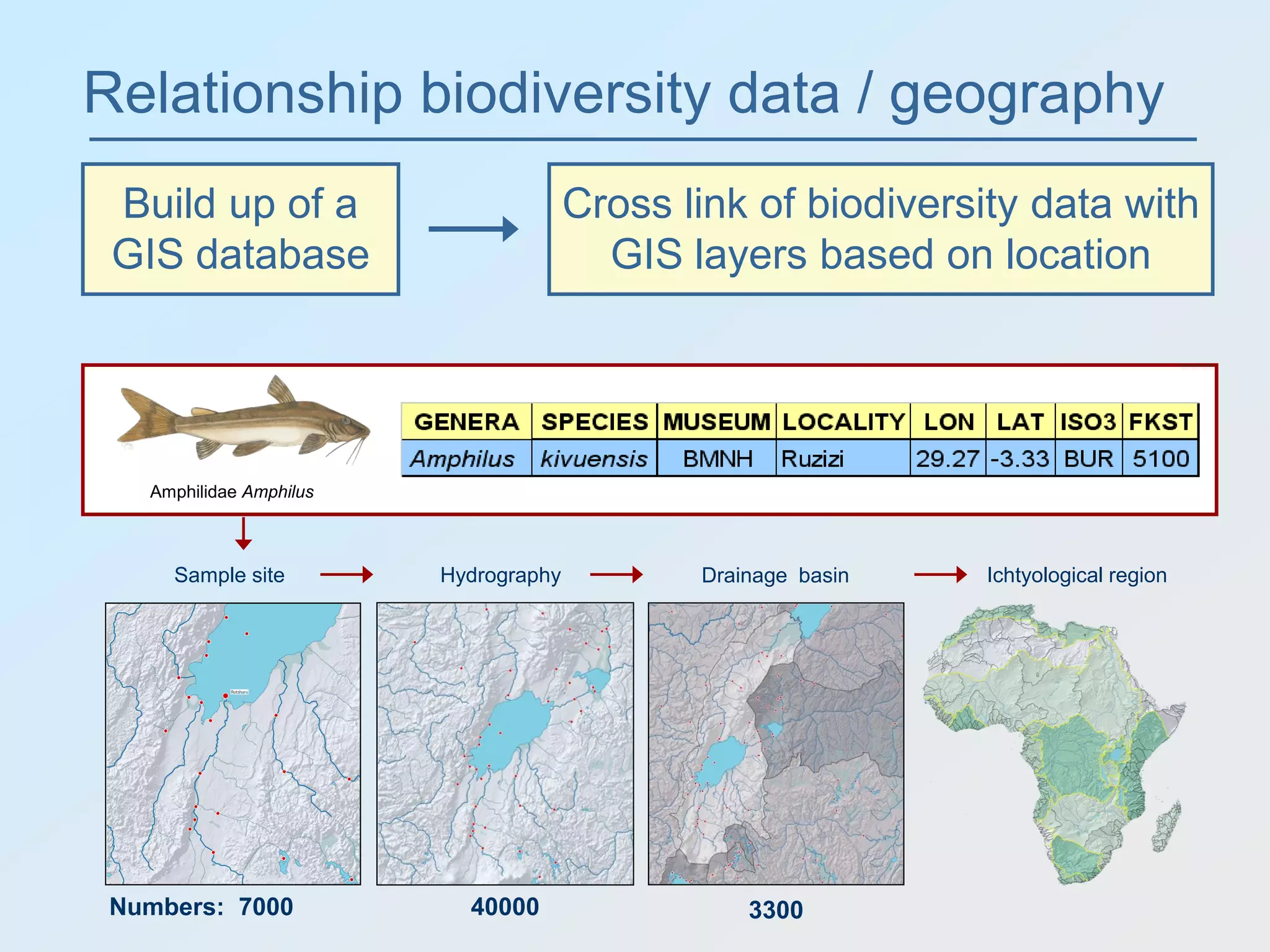
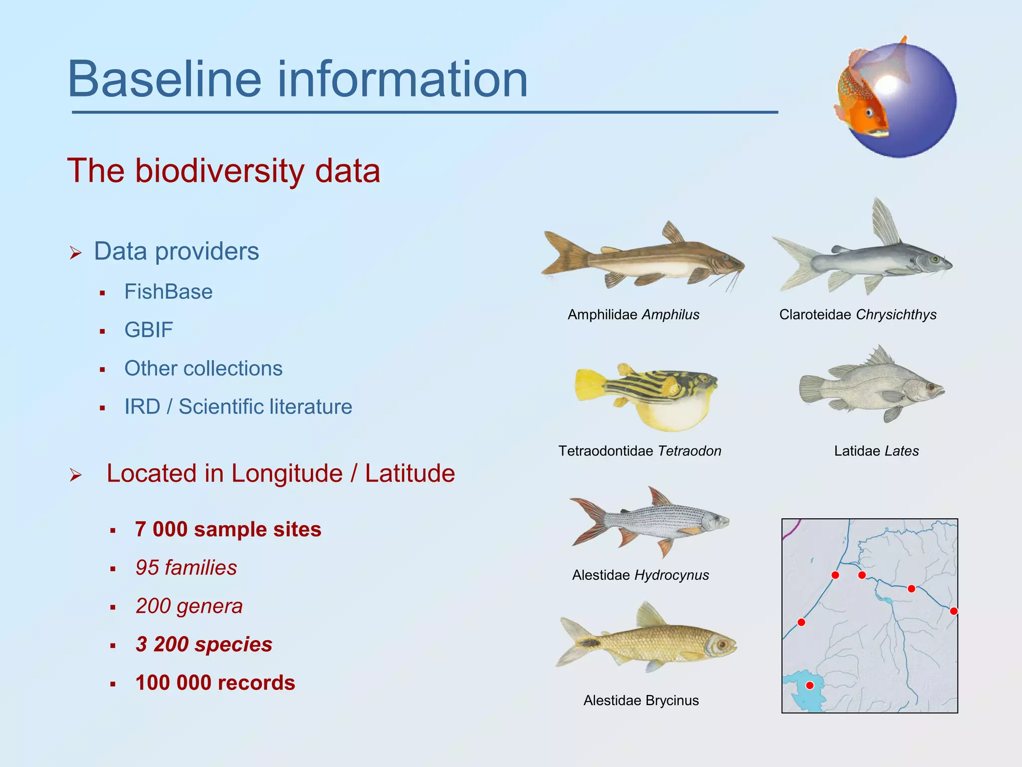
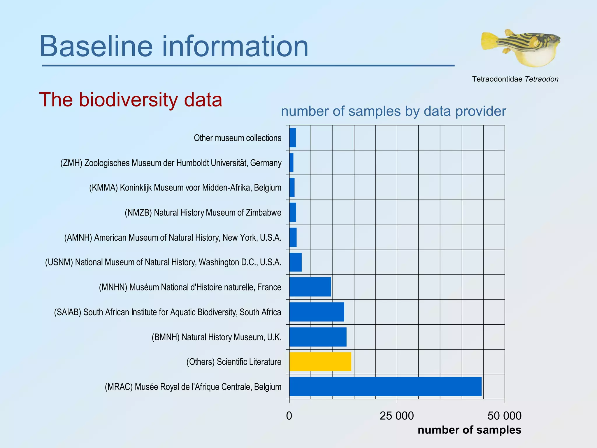
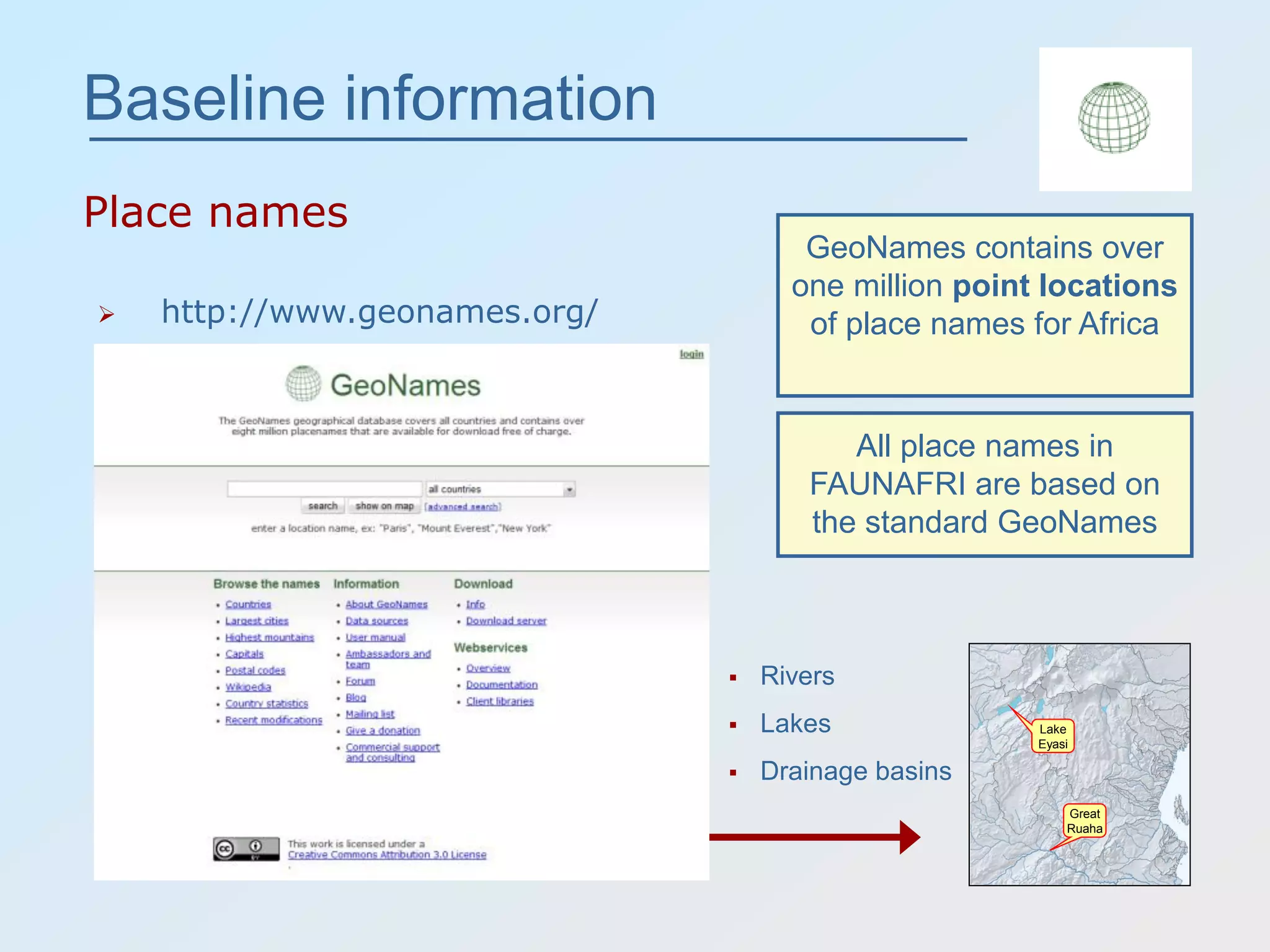
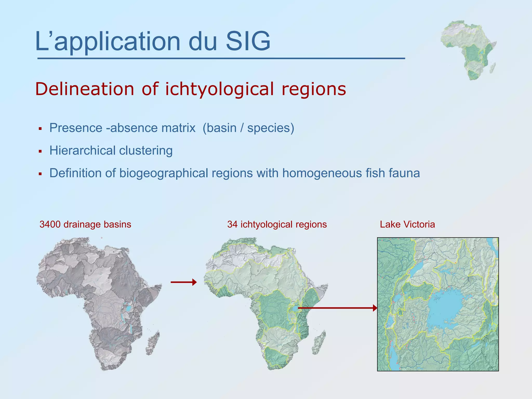
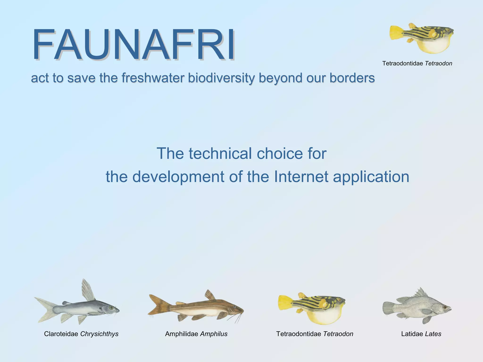
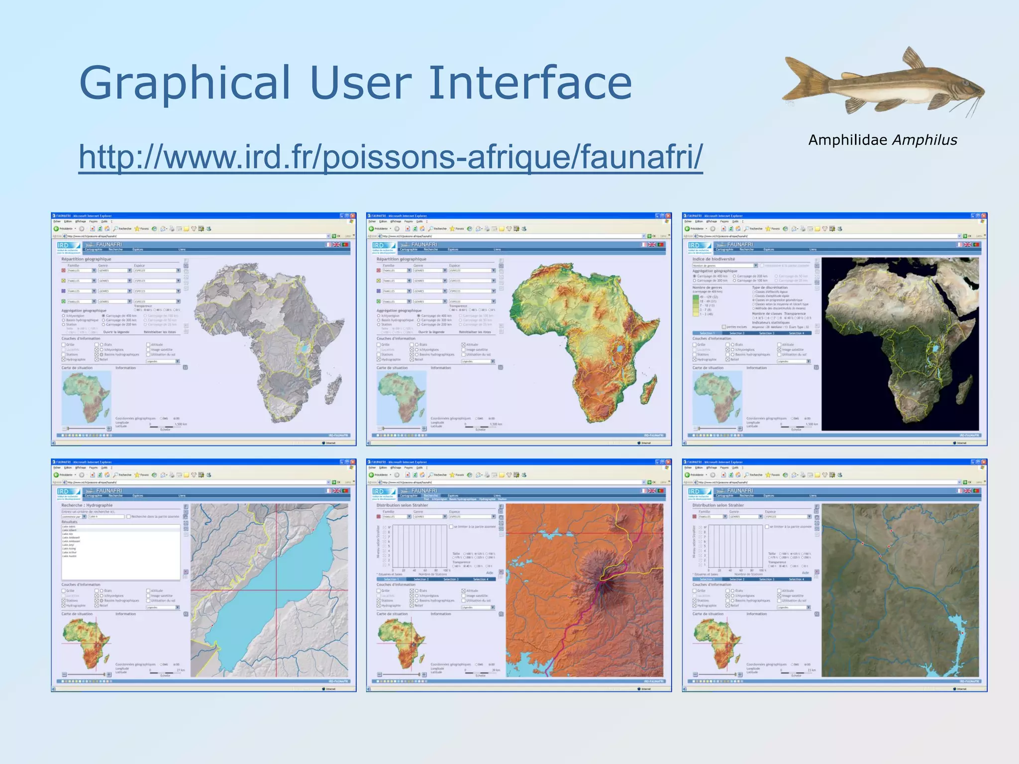
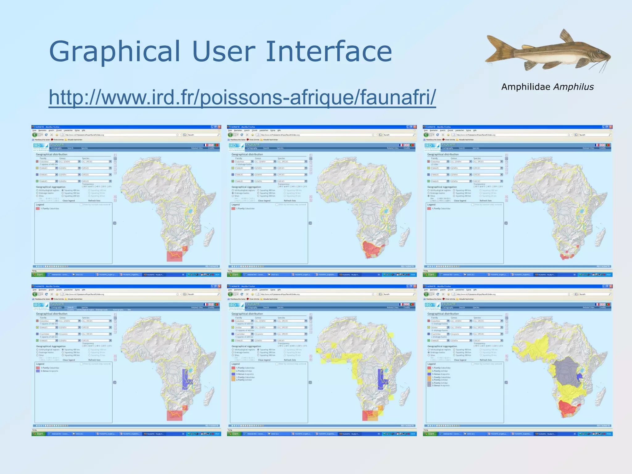
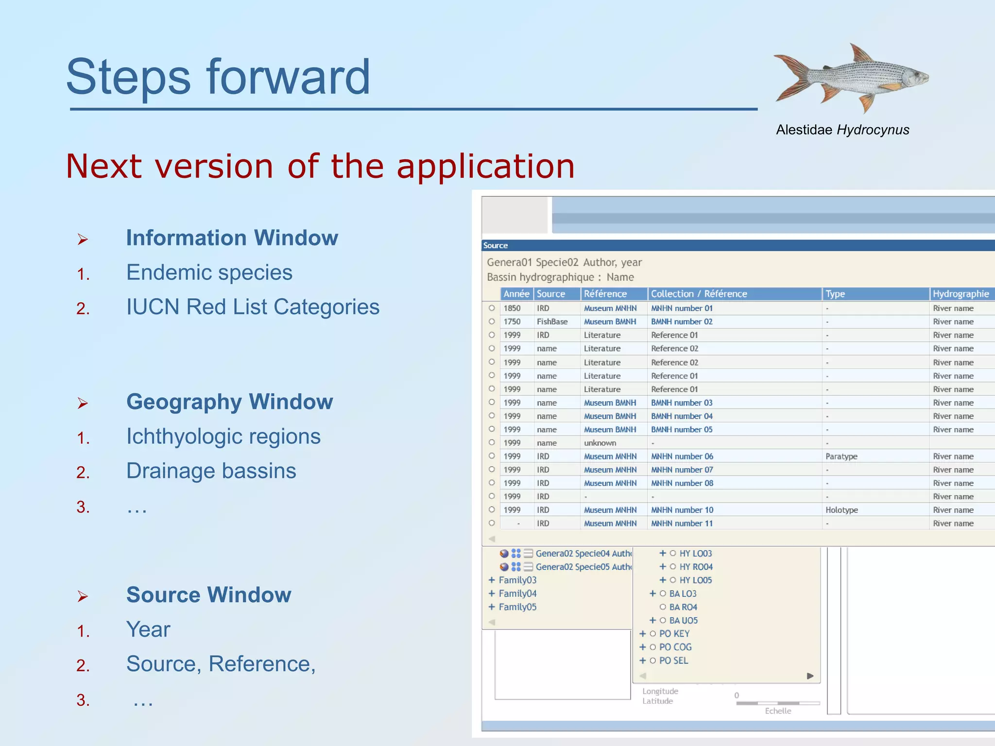
FAUNAFRIFAUNAFRI
act to save the freshwater biodiversity beyond our borders
Rainer Zaiss
IRD Secteur Cartographie
32, Avenue Henry Varagnat
9343 Bondy
Claroteidae ChrysichthysAlestidae Hydrocynus Aplocheilidae Aphyosemion Amphilidae Amphilus Tetraodontidae Tetraodon
act to save the freshwater biodiversity beyond our borders
The future of online natural resource
online mapping in
developing parts of the world
24th International Cartographic Conference
Commission Maps and the Internet
November 2009
Santiago de Chile
Institut de recherche
pour le développement
French public science and technology
research institute
IRD conducts scientific programs contributing to
the development of the countries of the South
with an emphasis on the relationship between
man and the environment
• 2 200 employees
• 30 centers around the world
• A budget of euros 220 million
• 66 research and service units
key figures
Claroteidae Chrysichthys
 Build up a centralized geographical
information system to compile,
conserve and share biodiversity data of
fresh and brackish waters fish species in
Africa.
 Develop a Graphical User Interface (GUI)
to map, analyze and compare the
distribution of families, genera and
species from the continental level down
to the sample site.
FAUNAFRIFAUNAFRI
Museum of Natural History
act to save the freshwater biodiversity beyond our bordersact to save the freshwater biodiversity beyond our borders
Fish collection
 High species richness (around 3500 species)
 High numbers of endemic species
 Africa’s freshwater systems are being degraded at an alarming rate
 IUCN Red List 2006 (79 species critically endangered , 116 endangered, 103
vulnerable)
 Many of Africa's fresh waters are yet to be explored
 Much taxonomic work remains to be completed
 According to IUCN, lack of basic information on species
distribution and threatened status is a key obstacle facing
freshwater ecosystem managers in Africa.
Some facts about the distribution of fresh
and brackish waters fish species in Africa
1. FishBase
 global relational database of information about fish
 first appeared on the World Wide Web in August 1996
2. The Global Biodiversity Information Facility (GBIF)
 International organization established by mid-2000
 make the world’s biodiversity data freely available via the Internet
Projects to make biodiversity data
widely available exist already
Main primary
data providers
Natural History Museums
around the world
FishBase : geographical distribution of Alestes baremoze
FishBase end GBIF use “mashups” to map
the geographical distribution of species
GBIF : geographical distribution of Alestes baremoze
FishBase end GBIF use “mashups” to map
the geographical distribution of species
1. Drainage basin
 Species diversity of the drainage basin “Bandama”, Côte d’Ivoire?
 Endangered species in drainage basin “Bandama”, Côte d’Ivoire?
2. Hydrography
 Species diversity of “Lake Albert”, Uganda?
 ….
3. Sample point
 Occurrences at Locality “Kolenté”, Guinea?
 …
the current major problem ?
No answers to questions related to geography
Hydrography
Sample site “Kolenté”, Guinea
Sample site
BMNH: Natural History Museum, U.K.
MNHN: Muséum National d'Histoire naturelle, France
MRAC: Musée Royal de l'Afrique Centrale, Belgium
Alternate names
The importance of standardization
…, Kolentang River, Kolenté, …Great Scarcies
Relationship biodiversity data / geography
Hydrography Ichtyological regionSample site Drainage basin
Amphilidae Amphilus
400007000 3300Numbers:
Build up of a
GIS database
Cross link of biodiversity data with
GIS layers based on location
Tetraodontidae Tetraodon
Baseline data
to put in place the GIS data base
FAUNAFRIFAUNAFRI
Claroteidae Chrysichthys Amphilidae Amphilus Tetraodontidae Tetraodon Latidae Lates
Baseline information
The biodiversity data
 Data providers
 Located in Longitude / Latitude
 FishBase
 GBIF
 Other collections
 IRD / Scientific literature
 7 000 sample sites
 95 families
 200 genera
 3 200 species
 100 000 records
Claroteidae Chrysichthys
Alestidae Hydrocynus
Amphilidae Amphilus
Tetraodontidae Tetraodon
Alestidae Brycinus
Latidae Lates
Baseline information
The biodiversity data
Tetraodontidae Tetraodon
0 25 000 50 000
(MRAC) Musée Royal de l'Afrique Centrale, Belgium
(Others) Scientific Literature
(BMNH) Natural History Museum, U.K.
(SAIAB) South African Institute for Aquatic Biodiversity, South Africa
(MNHN) Muséum National d'Histoire naturelle, France
(USNM) National Museum of Natural History, Washington D.C., U.S.A.
(AMNH) American Museum of Natural History, New York, U.S.A.
(NMZB) Natural History Museum of Zimbabwe
(KMMA) Koninklijk Museum voor Midden-Afrika, Belgium
(ZMH) Zoologisches Museum der Humboldt Universität, Germany
Other museum collections
number of samples
number of samples by data provider
Baseline information
The biodiversity data
Tetraodontidae Tetraodon
0
5 000
10 000
15 000
20 000
25 000
<19001900-19101910-19201920-19301930-19401940-19501950-19601960-19701970-19801980-19901990-20002000-2010
period
numberofsamples
number of samples by 10 year period
Baseline information
Vector layers
 Vector Smart Map (VMAP0)
 Rivers  Wetlands Lakes  Political
boundaries
 Vector layers digitized from NIMA - ONC maps
 Scale 1:1 000 000
 Levels of detail depending on the map scale
 Estuaries  Coastline
1 : 30 000 000 1 : 750 000
 http://www.geonames.org/
Great
Ruaha
Lake
Eyasi
Baseline information
Place names
 Rivers
 Lakes
 Drainage basins
GeoNames contains over
one million point locations
of place names for Africa
All place names in
FAUNAFRI are based on
the standard GeoNames
 Digital elevation model SRTM3
Baseline information
Topography
elevation hillshade topography
Baseline information
Delineation of drainage basins
SRTM30
DRLNs
Stream burning
« AGREE »
Drainage basins
L’application du SIG
Delineation of ichtyological regions
 Presence -absence matrix (basin / species)
 Hierarchical clustering
 Definition of biogeographical regions with homogeneous fish fauna
3400 drainage basins 34 ichtyological regions Lake Victoria
Baseline information
Land cover classification
 MODIS satellite image
Classification 14 land cover types (IGBP)
evergreen forest
deciduous forest
woody savannas
savannas
grasslands
closed shrubland
open shrublands
barren or sparsely vegetated
urban and built-up
croplands
cropland/natural vegetation mosaic
permanent wetlands
snow and ice
water
Tetraodontidae Tetraodon
The technical choice for
the development of the Internet application
FAUNAFRIFAUNAFRI
Claroteidae Chrysichthys Amphilidae Amphilus Tetraodontidae Tetraodon Latidae Lates
act to save the freshwater biodiversity beyond our bordersact to save the freshwater biodiversity beyond our borders
Architecture first version
Vector data Raster data
 Graphical User Interface (GUI) SVG Scalable Vector Graphics
Claroteidae Chrysichthys
XML /
JSON
Ajax png
Architecture next version
Vector data Raster data
 Graphical User Interface (GUI) SVG Scalable Vector Graphics
Claroteidae Chrysichthys
Client cache Server cache Client cache DOM
Client
DOM
TileCache
Graphical User Interface
Amphilidae Amphilus
http://www.ird.fr/poissons-afrique/faunafri/
Graphical User Interface
Amphilidae Amphilus
http://www.ird.fr/poissons-afrique/faunafri/
Alestidae Hydrocynus
Steps forward
Next version of the application
 Cross browser compatibility
(Firefox 3, Google Chrome 1, Apple Safari 3, Microsoft Internet Explorer)
 Endemic Species
Three geographical levels of aggregation
(ichthyologic region, drainage bassin, hydrography (river, lake))
 Neighborhood of drainage basins
Graphs theories
(neighborhood of drainage basins explains often the distribution of species)
2. Graphical user Interface (GUI)
1. Technical Issues
 …
Alestidae Hydrocynus
Steps forward
Next version of the application
 Information Window
1. Endemic species
2. IUCN Red List Categories
 Source Window
1. Year
2. Source, Reference,
3. …
 Geography Window
1. Ichthyologic regions
2. Drainage bassins
3. …
Alestidae Hydrocynus
Outlook
Biodiversity data
Claroteidae Chrysichthys
Verified set of
GIS layers
Content
Management
System
User
participation
WFS,
shapefiles ?
How to share the
GIS layers ?
FAUNAFRI
mapping
application
georeferencing
GIS database
Stake holders
All stake holders involved in the protection and
sustainable use of the fresh and brackish waters
biodiversity in Africa
Global Biodiversity Information Facility
World Wide Fund For Nature
International Union for Conservation of Nature
Food and Agriculture Organization of the United Nations
World Conservation Monitoring Centre
United Nations Environment Programme
Centropomidae Lates
FishBase
Claroteidae Chrysichthys Amphilidae Amphilus Tetraodontidae Tetraodon Latidae Lates
Thank you
Museum of Natural History Fish collection
The Graphical User Interface
to map, analyze and compare the distribution of fish species
from the continental level down to the sample site
FAUNAFRIFAUNAFRI
Claroteidae Chrysichthys Amphilidae Amphilus Tetraodontidae Tetraodon Latidae Lates
http://www.ird.fr/poissons-afrique/faunafri/
Aplocheilidae Aphyosemion
agir pour sauver la biodiversité planétaire au-delà de nos frontièresagir pour sauver la biodiversité planétaire au-delà de nos frontières
Tetraodontidae Tetraodon
I. Terms of references of the application FAUNAFRI
II. GBIF and Fishbase mapping with “mashups”
III. Relationship biodiversity data / geography
IV. The technical choice for the development of the Internet application
V. The Graphical User Interface (GUI)
VI. Main results / Steps forward
FAUNAFRIFAUNAFRI
act to save the freshwater biodiversity beyond our bordersact to save the freshwater biodiversity beyond our borders

Faunafri Santiago

  • 1.
    FAUNAFRIFAUNAFRI act to savethe freshwater biodiversity beyond our borders Rainer Zaiss IRD Secteur Cartographie 32, Avenue Henry Varagnat 9343 Bondy Claroteidae ChrysichthysAlestidae Hydrocynus Aplocheilidae Aphyosemion Amphilidae Amphilus Tetraodontidae Tetraodon act to save the freshwater biodiversity beyond our borders The future of online natural resource online mapping in developing parts of the world 24th International Cartographic Conference Commission Maps and the Internet November 2009 Santiago de Chile
  • 2.
    Institut de recherche pourle développement French public science and technology research institute IRD conducts scientific programs contributing to the development of the countries of the South with an emphasis on the relationship between man and the environment • 2 200 employees • 30 centers around the world • A budget of euros 220 million • 66 research and service units key figures
  • 3.
    Claroteidae Chrysichthys  Buildup a centralized geographical information system to compile, conserve and share biodiversity data of fresh and brackish waters fish species in Africa.  Develop a Graphical User Interface (GUI) to map, analyze and compare the distribution of families, genera and species from the continental level down to the sample site. FAUNAFRIFAUNAFRI Museum of Natural History act to save the freshwater biodiversity beyond our bordersact to save the freshwater biodiversity beyond our borders Fish collection
  • 4.
     High speciesrichness (around 3500 species)  High numbers of endemic species  Africa’s freshwater systems are being degraded at an alarming rate  IUCN Red List 2006 (79 species critically endangered , 116 endangered, 103 vulnerable)  Many of Africa's fresh waters are yet to be explored  Much taxonomic work remains to be completed  According to IUCN, lack of basic information on species distribution and threatened status is a key obstacle facing freshwater ecosystem managers in Africa. Some facts about the distribution of fresh and brackish waters fish species in Africa
  • 5.
    1. FishBase  globalrelational database of information about fish  first appeared on the World Wide Web in August 1996 2. The Global Biodiversity Information Facility (GBIF)  International organization established by mid-2000  make the world’s biodiversity data freely available via the Internet Projects to make biodiversity data widely available exist already Main primary data providers Natural History Museums around the world
  • 6.
    FishBase : geographicaldistribution of Alestes baremoze FishBase end GBIF use “mashups” to map the geographical distribution of species
  • 7.
    GBIF : geographicaldistribution of Alestes baremoze FishBase end GBIF use “mashups” to map the geographical distribution of species
  • 8.
    1. Drainage basin Species diversity of the drainage basin “Bandama”, Côte d’Ivoire?  Endangered species in drainage basin “Bandama”, Côte d’Ivoire? 2. Hydrography  Species diversity of “Lake Albert”, Uganda?  …. 3. Sample point  Occurrences at Locality “Kolenté”, Guinea?  … the current major problem ? No answers to questions related to geography
  • 9.
    Hydrography Sample site “Kolenté”,Guinea Sample site BMNH: Natural History Museum, U.K. MNHN: Muséum National d'Histoire naturelle, France MRAC: Musée Royal de l'Afrique Centrale, Belgium
  • 10.
    Alternate names The importanceof standardization …, Kolentang River, Kolenté, …Great Scarcies
  • 11.
    Relationship biodiversity data/ geography Hydrography Ichtyological regionSample site Drainage basin Amphilidae Amphilus 400007000 3300Numbers: Build up of a GIS database Cross link of biodiversity data with GIS layers based on location
  • 12.
    Tetraodontidae Tetraodon Baseline data toput in place the GIS data base FAUNAFRIFAUNAFRI Claroteidae Chrysichthys Amphilidae Amphilus Tetraodontidae Tetraodon Latidae Lates
  • 13.
    Baseline information The biodiversitydata  Data providers  Located in Longitude / Latitude  FishBase  GBIF  Other collections  IRD / Scientific literature  7 000 sample sites  95 families  200 genera  3 200 species  100 000 records Claroteidae Chrysichthys Alestidae Hydrocynus Amphilidae Amphilus Tetraodontidae Tetraodon Alestidae Brycinus Latidae Lates
  • 14.
    Baseline information The biodiversitydata Tetraodontidae Tetraodon 0 25 000 50 000 (MRAC) Musée Royal de l'Afrique Centrale, Belgium (Others) Scientific Literature (BMNH) Natural History Museum, U.K. (SAIAB) South African Institute for Aquatic Biodiversity, South Africa (MNHN) Muséum National d'Histoire naturelle, France (USNM) National Museum of Natural History, Washington D.C., U.S.A. (AMNH) American Museum of Natural History, New York, U.S.A. (NMZB) Natural History Museum of Zimbabwe (KMMA) Koninklijk Museum voor Midden-Afrika, Belgium (ZMH) Zoologisches Museum der Humboldt Universität, Germany Other museum collections number of samples number of samples by data provider
  • 15.
    Baseline information The biodiversitydata Tetraodontidae Tetraodon 0 5 000 10 000 15 000 20 000 25 000 <19001900-19101910-19201920-19301930-19401940-19501950-19601960-19701970-19801980-19901990-20002000-2010 period numberofsamples number of samples by 10 year period
  • 16.
    Baseline information Vector layers Vector Smart Map (VMAP0)  Rivers  Wetlands Lakes  Political boundaries  Vector layers digitized from NIMA - ONC maps  Scale 1:1 000 000  Levels of detail depending on the map scale  Estuaries  Coastline 1 : 30 000 000 1 : 750 000
  • 17.
     http://www.geonames.org/ Great Ruaha Lake Eyasi Baseline information Placenames  Rivers  Lakes  Drainage basins GeoNames contains over one million point locations of place names for Africa All place names in FAUNAFRI are based on the standard GeoNames
  • 18.
     Digital elevationmodel SRTM3 Baseline information Topography elevation hillshade topography
  • 19.
    Baseline information Delineation ofdrainage basins SRTM30 DRLNs Stream burning « AGREE » Drainage basins
  • 20.
    L’application du SIG Delineationof ichtyological regions  Presence -absence matrix (basin / species)  Hierarchical clustering  Definition of biogeographical regions with homogeneous fish fauna 3400 drainage basins 34 ichtyological regions Lake Victoria
  • 21.
    Baseline information Land coverclassification  MODIS satellite image Classification 14 land cover types (IGBP) evergreen forest deciduous forest woody savannas savannas grasslands closed shrubland open shrublands barren or sparsely vegetated urban and built-up croplands cropland/natural vegetation mosaic permanent wetlands snow and ice water
  • 22.
    Tetraodontidae Tetraodon The technicalchoice for the development of the Internet application FAUNAFRIFAUNAFRI Claroteidae Chrysichthys Amphilidae Amphilus Tetraodontidae Tetraodon Latidae Lates act to save the freshwater biodiversity beyond our bordersact to save the freshwater biodiversity beyond our borders
  • 23.
    Architecture first version Vectordata Raster data  Graphical User Interface (GUI) SVG Scalable Vector Graphics Claroteidae Chrysichthys XML / JSON Ajax png
  • 24.
    Architecture next version Vectordata Raster data  Graphical User Interface (GUI) SVG Scalable Vector Graphics Claroteidae Chrysichthys Client cache Server cache Client cache DOM Client DOM TileCache
  • 25.
    Graphical User Interface AmphilidaeAmphilus http://www.ird.fr/poissons-afrique/faunafri/
  • 26.
    Graphical User Interface AmphilidaeAmphilus http://www.ird.fr/poissons-afrique/faunafri/
  • 27.
    Alestidae Hydrocynus Steps forward Nextversion of the application  Cross browser compatibility (Firefox 3, Google Chrome 1, Apple Safari 3, Microsoft Internet Explorer)  Endemic Species Three geographical levels of aggregation (ichthyologic region, drainage bassin, hydrography (river, lake))  Neighborhood of drainage basins Graphs theories (neighborhood of drainage basins explains often the distribution of species) 2. Graphical user Interface (GUI) 1. Technical Issues  …
  • 28.
    Alestidae Hydrocynus Steps forward Nextversion of the application  Information Window 1. Endemic species 2. IUCN Red List Categories  Source Window 1. Year 2. Source, Reference, 3. …  Geography Window 1. Ichthyologic regions 2. Drainage bassins 3. …
  • 29.
    Alestidae Hydrocynus Outlook Biodiversity data ClaroteidaeChrysichthys Verified set of GIS layers Content Management System User participation WFS, shapefiles ? How to share the GIS layers ? FAUNAFRI mapping application georeferencing GIS database
  • 30.
    Stake holders All stakeholders involved in the protection and sustainable use of the fresh and brackish waters biodiversity in Africa Global Biodiversity Information Facility World Wide Fund For Nature International Union for Conservation of Nature Food and Agriculture Organization of the United Nations World Conservation Monitoring Centre United Nations Environment Programme Centropomidae Lates FishBase
  • 31.
    Claroteidae Chrysichthys AmphilidaeAmphilus Tetraodontidae Tetraodon Latidae Lates Thank you Museum of Natural History Fish collection
  • 32.
    The Graphical UserInterface to map, analyze and compare the distribution of fish species from the continental level down to the sample site FAUNAFRIFAUNAFRI Claroteidae Chrysichthys Amphilidae Amphilus Tetraodontidae Tetraodon Latidae Lates http://www.ird.fr/poissons-afrique/faunafri/ Aplocheilidae Aphyosemion agir pour sauver la biodiversité planétaire au-delà de nos frontièresagir pour sauver la biodiversité planétaire au-delà de nos frontières
  • 33.
    Tetraodontidae Tetraodon I. Termsof references of the application FAUNAFRI II. GBIF and Fishbase mapping with “mashups” III. Relationship biodiversity data / geography IV. The technical choice for the development of the Internet application V. The Graphical User Interface (GUI) VI. Main results / Steps forward FAUNAFRIFAUNAFRI act to save the freshwater biodiversity beyond our bordersact to save the freshwater biodiversity beyond our borders