
Recommended
Recommended
More Related Content
What's hot
What's hot (20)
Similar to Exploration Method’s in Archaeological Studies & Research
Similar to Exploration Method’s in Archaeological Studies & Research (20)
More from Prachya Adhyayan
More from Prachya Adhyayan (17)
Recently uploaded
Recently uploaded (20)
Exploration Method’s in Archaeological Studies & Research
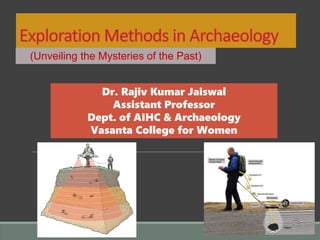
- 1. (Unveiling the Mysteries of the Past) Dr. Rajiv Kumar Jaiswal Assistant Professor Dept. of AIHC & Archaeology Vasanta College for Women
- 2. Exploration The principal concern of any archaeological fieldwork is to acquire new information within the context of a well-designed program of research. This program of research today ranges from goal-specific one day fieldwork to long term ventures covering many field seasons. In the field, one of the main concern of the archaeologist is the study of artifacts and features. Artifacts are the objects made or used or modified by the man such as stone tools, pottery and metal objects.
- 3. Type of Sites •Prehistoric open area sites like riverside terraces •Prehistoric caves like Bhimbetka •Neolithic sites like ashmounds •Habitation mounds, like Rajghat •Habitation-cum-burial sites like Brahmagiri •Monumental sites like, Mohenjodaro, Dhaulavira •Sacred sites like sarnath •Underwater sites like, Dwarka
- 4. Selection of a Site A site is selected on the basis of combination of several factors, such as the period of the site, the length of the occupation, the importance of the structures and the site uniqueness in the area. Further, the archaeological site is selected to address specific goal or goals. The goal covers in terms of time, space, subject matter and approach. The research is tailored made to solve specific problem(s).
- 5. Equipment's Required for Exploration Topo sheet/Map of the study area Site notebook Mtr/cm. and scales Camera Pencils, Eraser, Pen Carry Bag (cloth/paper/polythene) Site card Rope Rucksack
- 6. Archaeological Exploration Data Form 1. Name of the site, dist. And State 2. Location of the site (Longitude and Latitude) 3. Brief history of the archaeological site (Prehistoric, protohistoric, cave, mound etc. 4. Size & height of the site 5. Flora-fauna 6. Water body near site 7. Present situation of the site 8. Short description of the surface collection 9. Owner of the site 10. Name of the Explorer and date 11. Locat folk lore 12. And most important is Route and roads
- 7. Methods of Exploration TRADITIONAL Chance discovery Site surface survey/Field walking Literary account Map reading SCIENTIFIC Ariel photography Geophysical methods Resistivity Ground Penetrating radar Magnetometry Soil analysis Sea bed survey
- 8. Chance discovery Chance discoveries in archaeological exploration often play a significant role in uncovering new information about the past. These discoveries occur unexpectedly, often during routine excavation or construction activities. Here are a few examples of chance discoveries in archaeology: Pompeii and Herculaneum Tutankhamun's Tomb The Terracotta Army: In 1974, farmers digging a well near Xi'an, China, accidentally unearthed fragments of a terracotta statue.
- 9. Cont…. India, with its rich and diverse history, has witnessed several chance discoveries in archaeological exploration that have shed light on its ancient civilizations and cultures. Here are a few notable examples: Indus Valley Civilization Buddhist Monuments at Sanchi Ajanta and Ellora Caves: In the early 19th century, British officers John Smith and his assistant discovered the Ajanta Caves in Maharashtra while on a hunting expedition.
- 10. Site surface survey Site surface survey involves a simple walking over the surface of the site observe and collect the visible material remains of the site. It is a method of looking for artefacts on the ground from the ground. Field walking in dry season when the cultivation is absent would provide good amount of data on the site. Archaeologist should make inquiry with the farmers, as they would have good information about the earthworks and growth of vegetation pattern on the site and its surroundings.
- 11. Cont…. Collecting potsherds helps to identify the cultural affinity of many sites like pre-Harppan, Mature Harppan, BRW, BSW, PGW, NBPW, Iron age, Early historic and Historic. This method is the most cost - effective and it is still being followed in archaeological investigation.
- 12. Literary account Literary accounts play a crucial role in archaeological exploration in India by providing valuable clues, references, and descriptions of historical sites, events, and cultural practices. Here's how literary accounts contribute to archaeological exploration in India: Indica by Megasthenes: Megasthenes, wrote the book "Indica," which provides one of the earliest literary accounts of ancient India. His descriptions helped archaeologists identify and excavate sites associated with the Mauryan Empire, such as Pataliputra (modern-day Patna). Travel Accounts of Chinese Pilgrims: Accounts of Chinese pilgrims like Xuanzang (7th century CE) and Faxian (4th century CE) provide valuable descriptions of Indian society, religion, and pilgrimage sites during that period. These accounts have guided archaeological exploration and excavation at sites such as Nalanda, Sarnath, and Bodh Gaya, contributing to our understanding of ancient Buddhist monastic complexes and religious practices.
- 13. Map reading A map is a diagrammatic scaled symbolic representation of a segment of the earth’s surface as viewed from above. The archaeologist must have the basic knowledge of reading various maps. There are several types of maps like: topographical map, hydrographic map, soil map, river map, river map, historical map, political map and so on published by the Survey of India.
- 14. James Prinsep map of Bunarus (Banaras), 1822 Hydrographic map
- 15. Cont…. In recent years, digital maps like Google map, Google earth, Wiki map, Maps (iphone map) and many other specialized maps are launched on virtual map platform. These maps show elevation, vegetation, prominent, manmade constructions, boundaries of section and natural features such as mountains and rivers. These survey provide precise information on location and elevation, longitude, latitude and distance.
- 17. Aerial Photography Aerial photography is the earliest and perhaps still the most important remote sensing tool available to archaeologist searching for new archaeological sites. This airborne method of survey is still being used for discovering new sites and monitoring the known sites and landscapes. viz: one of the first ever aerial photograph for archaeology was Stonehenge taken from a balloon in 1906. The application of aerial photography to archaeology was born in World war I when an English pilot named O.G.S. Crawford observed, certain peculiar features on the ground.
- 21. Crop marks are an important phenomenon in archaeological exploration, particularly in regions where archaeological sites are covered by vegetation or buried beneath the earth. They occur due to differential growth or stress in crops or vegetation caused by underlying archaeological features or structures. Crop mark
- 23. “Bosing" technique, which is a method used in archaeological exploration for mapping and documenting archaeological features or sites. Bosing involves marking out the boundaries or outlines of an archaeological site or feature on the ground
- 24. Resistivity Resistivity survey is a geophysical method commonly used in archaeological exploration to detect and map subsurface features and structures without the need for excavation. It relies on measuring variations in electrical resistance within the ground, which can be indicative of buried archaeological remains.
- 25. Ground-Penetrating Radar (GPR) Ground-penetrating radar (GPR) is a geophysical method widely used in archaeological exploration. It works by emitting high- frequency electromagnetic pulses into the ground and measuring the reflected signals, allowing archaeologists to create detailed images of the subsurface without the need for excavation.
- 26. Magnetometry Magnetometry is a geophysical method commonly used in archaeological exploration to detect and map subsurface features and structures by measuring variations in the magnetic properties of the soil.
- 27. Magnetometry
- 28. Theodolites Theodolites are precision instruments used in surveying and mapping, including archaeological exploration. Here's how theodolites are used in archaeological exploration: Baseline Measurement Topographic Mapping Excavation Planning Documentation of Features
- 29. Conclusion In conclusion, archaeological exploration relies on a diverse array of methods and technologies to uncover and understand the material remains of past human societies. From traditional excavation techniques to advanced geophysical surveys, each approach contributes to our understanding of ancient civilizations and their cultural heritage. Through meticulous fieldwork, careful analysis, and interdisciplinary collaboration, archaeologists piece together the puzzle of history, revealing the stories of forgotten civilizations and shedding light on the origins of modern societies.