Download as PDF, PPTX


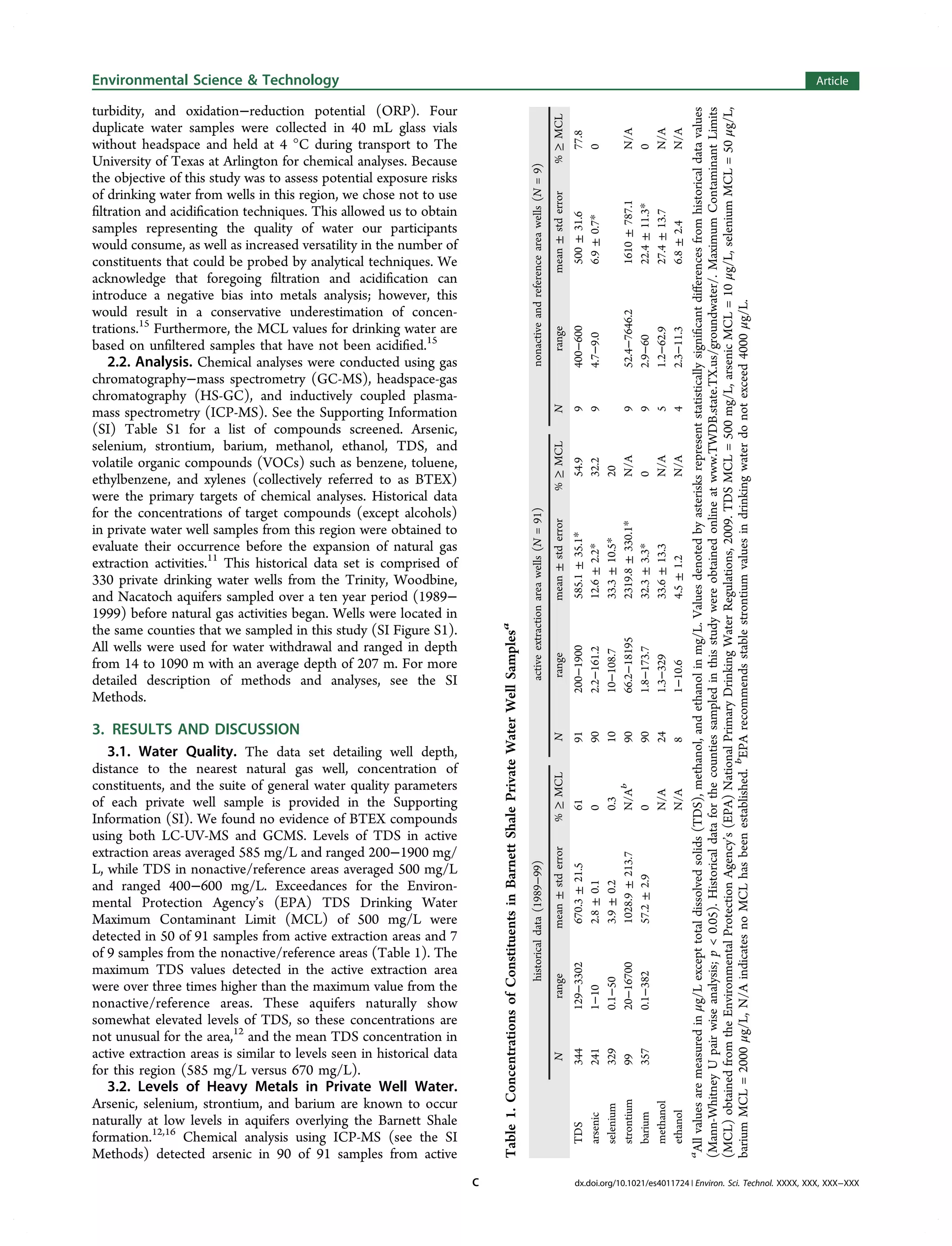
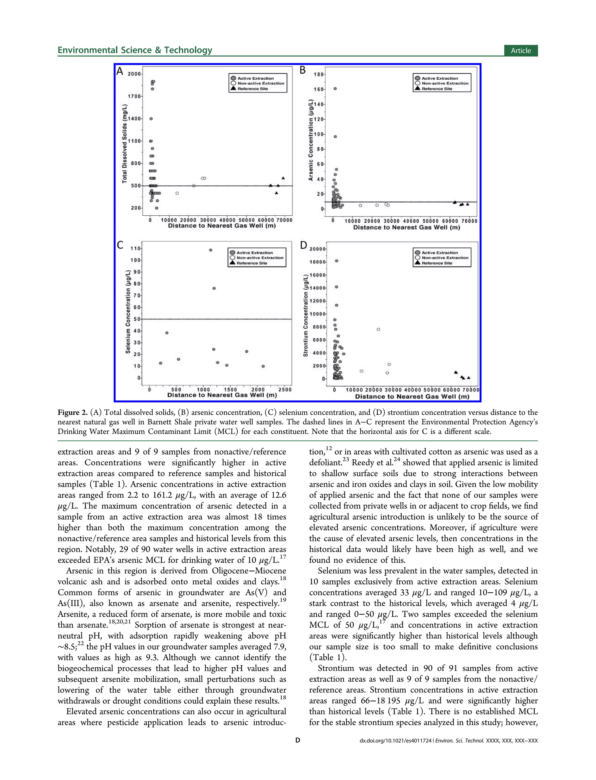
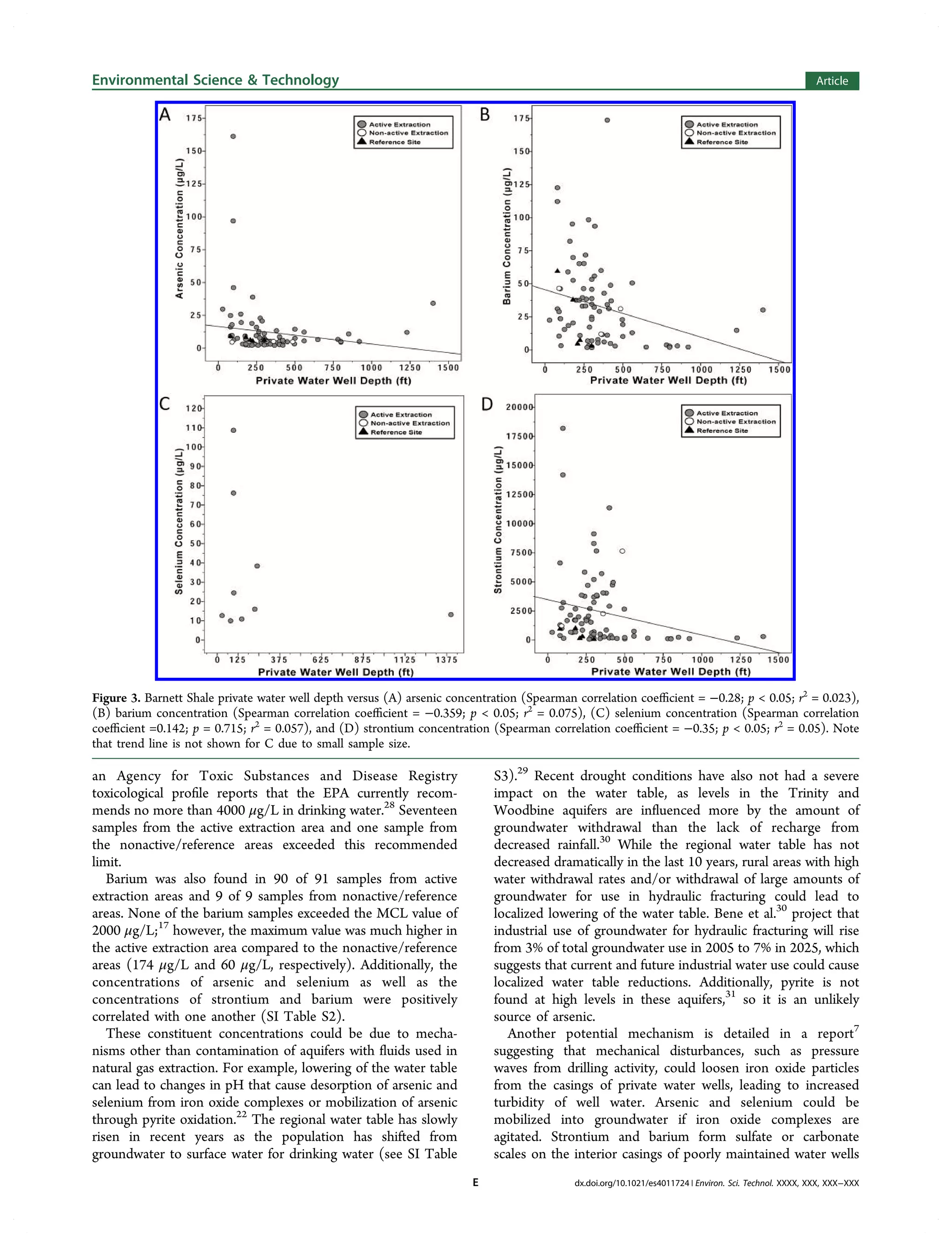


This study evaluates water quality in 100 private drinking water wells near natural gas extraction sites in the Barnett Shale formation, revealing that contaminants such as arsenic, selenium, and strontium occasionally exceed EPA's maximum contaminant limits. Notably, 29% of samples showed the presence of methanol and ethanol, and higher concentrations of metals were found in wells closer to active gas wells compared to reference areas. The findings suggest that the elevated contaminant levels may be attributed to natural processes, industrial activities, or contamination through faulty well casings.


![11.[40 51]correlates in groundwater quality parameters and textural classes o...](https://cdn.slidesharecdn.com/ss_thumbnails/11-40-51correlatesingroundwaterqualityparametersandtexturalclassesofsoilsinaperi-industrialdistrictofthenigeriandeltaregion-120512235818-phpapp02-thumbnail.jpg?width=640&height=640&fit=bounds)


![Coded Agents – with UiPath SDK + LangGraph [Virtual Hands-on Workshop]](https://cdn.slidesharecdn.com/ss_thumbnails/codedagentsdeck-251215155422-5497c599-thumbnail.jpg?width=640&height=640&fit=bounds)


