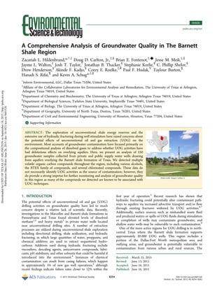
This study analyzed 550 groundwater samples from private and public water wells overlying the Barnett Shale formation in Texas where unconventional oil and gas extraction is occurring. The study detected multiple volatile organic compounds, including BTEX compounds, alcohols, chlorinated compounds, and others that have been associated with oil and gas activities. While the data do not prove that unconventional extraction caused the contamination, they indicate groundwater monitoring is needed as many compounds detected are known to be used in extraction techniques like hydraulic fracturing. The large sample size provides important data on groundwater quality in this shale region with extensive unconventional drilling.
Duke Study: Methane contamination of drinking water accompanying gas-well dri...Marcellus Drilling News
Study of 68 water wells in Pennsylvania and New York showing a link between shale gas drilling and higher levels of methane in nearby well water supplies.
A new study by a pair of researchers from Rice University (Houston, TX). The study looks in detail at the chemical compounds found in frack wastewater from shale plays in PA, TX and NM and finds, according to the researchers, that frack water "was not quite as bad as we thought."
Duke University & USGS Study: Shale Drilling in Arkansas Does Not Contaminate...Marcellus Drilling News
A research study conducted by Duke University and the U.S. Geological Survey which finds shale drilling (fracking) activities in Arkansas do not contaminate well water supplies in the state. The results of the research are published in an article titled "Geochemical and isotopic variations in shallow groundwater in areas of the Fayetteville shale development, north-central Arkansas" in the peer reviewed journal Applied Geochemistry.
The International Journal of Engineering and Science (The IJES)theijes
The International Journal of Engineering & Science is aimed at providing a platform for researchers, engineers, scientists, or educators to publish their original research results, to exchange new ideas, to disseminate information in innovative designs, engineering experiences and technological skills. It is also the Journal's objective to promote engineering and technology education. All papers submitted to the Journal will be blind peer-reviewed. Only original articles will be published.
The papers for publication in The International Journal of Engineering& Science are selected through rigorous peer reviews to ensure originality, timeliness, relevance, and readability.
In recent years, Westport residents noticed that the salt marsh islands in the Westport Rivers, particularly in the West Branch, were disappearing rapidly. In response, the Westport Fishermen’s Association, the Buzzards Bay Coalition, the Marine Biological Laboratory Ecosystems Center, and the Buzzards Bay National Estuary Program partnered to measure the rate of salt marsh loss in the Westport Rivers and try to identify causes of this erosion
Invited plenary talk (part one) given by Prof. Farid El-Daoushy at the Inter. Radiation Protection Congress, Afrirpa-2010, Sept. 2010, Nairobi, Kenya, It summarizes assessing large-scale and long-term transport and accumulation processes of radioactivity, anthropogenic and human waste. It compares the impacts of such processes on European and Nile Basin surface water systems. Utilization of these instruments for decision making and for sustainable water management policies are also explained.
The Impact of Marcellus Gas Drilling on Rural Drinking Water SuppliesMarcellus Drilling News
A multi-year study by the bipartisan Center for Rural Pennsylvania on the effects of Marcellus Shale gas drilling on rural water supplies. The study concludes that fracking does not lead to chemical contamination of water supplies, and likely does not affect methane migration into water supplies (although the authors recommend more study of the methane migration issue).
Modeling of Predictive interaction of Water Parameters in Groundwaterijtsrd
The assessment presented in this article is centred on investigating the interaction of turbidity, total suspended solids and total dissolved solids interaction within the water bearing aquifer of Obite to Oboburu communities of Ogba/ Egbema/ Ndoni local government area of Rivers State, Nigeria. Experimental and modeled turbidity, total suspended solids and total dissolved solids investigated are within recommended standard of World Health Organization revealing the reliability of model equation in predicting groundwater parameters distribution upon influence of time, recharge, flow rate. Ottos C. G | Isaac E. O"Modeling of Predictive interaction of Water Parameters in Groundwater" Published in International Journal of Trend in Scientific Research and Development (ijtsrd), ISSN: 2456-6470, Volume-2 | Issue-3 , April 2018, URL: http://www.ijtsrd.com/papers/ijtsrd11292.pdf http://www.ijtsrd.com/engineering/civil-engineering/11292/modeling-of-predictive-interaction-of-water-parameters-in-groundwater/ottos-c-g
Engineering analytics presented information on the groundwater modeling performed for the Rosemont Copper Project to a group of well owners. The presentation was given on April 3, 2012.
Research Inventy : International Journal of Engineering and Science is published by the group of young academic and industrial researchers with 12 Issues per year. It is an online as well as print version open access journal that provides rapid publication (monthly) of articles in all areas of the subject such as: civil, mechanical, chemical, electronic and computer engineering as well as production and information technology. The Journal welcomes the submission of manuscripts that meet the general criteria of significance and scientific excellence. Papers will be published by rapid process within 20 days after acceptance and peer review process takes only 7 days. All articles published in Research Inventy will be peer-reviewed.
Study: Evaluation of Methane Sources in Groundwater in Northeastern PennsylvaniaMarcellus Drilling News
A study published in the May-June 2013 issue of Groundwater, a peer-reviewed scientific journal. The study highlights the results of data from 1,701 water wells in Susquehanna County, PA to determine whether or not nearby shale drilling causes an increase in the presence of methane in water wells. The study proves conclusively that water wells near shale drilling had no higher presence of methane than those not near any kind of drilling and that drilling in the Dimock area had nothing to do with methane in nearby water wells. It further proves that Susquehanna County, PA has a tremdendous amount of naturally ocurring methane near the surface.
Delta del Po e cambiamento climatico, lo studio della RegioneAlessiaDeMarchi2
Nell'ambito del progetto europeo "Change we care", a cui ha partecipato la Regione Veneto sono stati raccolti documenti e mappe legate all'evoluzione, anche storica, del territorio del Delta del Po. Eccone una sintesi
Impact of the salinity gradient on the mollusc fauna in flooded mine subsiden...EdytaSierka
Archives of Environmental Protection, 2014
This paper presents the impact of salinisation on the aquatic mollusc fauna in fl ooded mine subsidences in the Karvina region (Czech Republic). The results of the previous research on salinity in fl ooded mine subsidences show that some of them contain a high content of dissolved inorganic substances (above 1000 mg•l-1). These substances can affect the vegetation and animals occurring in the water and the surrounding area. The phylum of Mollusca was selected as a model group for the fi eldwork as it includes species with the proven bioindication potential. The occurrence of aquatic mollusc species was studied at 10 sites. The sites were selected based on the content of dissolved substances (the salinity gradient from <500 to >1000 mg•l-1. A total of 12 aquatic mollusc species were found, including one species identifi ed as a potential bioindicator of the negative effect of salinisation on aquatic biota. The analysis showed statistically signifi cant positive correlations between the content of dissolved inorganic substances and the presence of alien species Potamopyrgus antipodarum (J.E. Gray, 1843). The gradient of salinity signifi cantly affects the species composition of the mollusc fauna in fl ooded mine subsidences and may affect the biodiversity of this group.
Dans le contexte de la santé publique, la prise de décisions fondée sur des données probantes (PDFDP) est le processus qui consiste à trouver, à extraire et à disséminer les meilleures données probantes issues de la recherche, du contexte et de l’expérience, et à utiliser ces données pour orienter et améliorer la pratique et les politiques en santé publique. Elle exige d’évaluer la qualité des données probantes issues de la recherche que vous trouvez, d’appliquer les meilleures à votre question, votre problème ou votre enjeu, et de déterminer leur effet sur la pratique.
Mise au point par Health EvidenceTM, la liste de contrôle de la prise de décisions fondée sur des données probantes permet aux professionnels de la santé publique de consigner succinctement la manière dont vous ou votre équipe avez suivi le processus de PDFDP afin de pouvoir partager l’information avec la haute direction. Disposer d’une liste de contrôle en dossier peut aider votre organisme à mettre en œuvre les résultats de vos données probantes.
Voici des éléments critiques pouvant figurer dans la liste de contrôle remplissable :
•Est-ce qu’une question claire et admettant une réponse a été formulée?
•Est-ce qu’une stratégie de recherche exhaustive a été employée pour trouver les meilleures données probantes qui soient pour aborder cette question?
•Les données pertinentes ont-elles fait l’objet d’une évaluation de la qualité?
•Qu’est-ce que l’examen des données probantes a donné comme résultats?
Le Centre de collaboration nationale des méthodes et outils est financé par l’Agence de la santé publique du Canada et affilié à l’Université McMaster. Les vues exprimées ici ne reflètent pas nécessairement la position officielle de l’Agence de la santé publique du Canada.
Le CCNMO est l’un des six centres de collaboration nationale en santé publique au Canada. Les Centres encouragent et améliorent l’utilisation des connaissances provenant de la recherche scientifique et des autres savoirs afin de renforcer la pratique et les politiques de santé publique au Canada.
Study: Elevated Levels of Arsenic in Water Wells Near Barnett Shale DrillingMarcellus Drilling News
A study of 100 private water wells in the Barnett Shale in Texas by University of Texas at Arlington researchers claims to have found that about 1/3 of the wells close to drilling activity have dangerously high levels of arsenic. Critics of the research point out the sample size is small and relies on "before" tests of 300 wells in the same general area, but not necessarily these 100 specific wells where arsenic has been found. The report is titled, "An evaluation of water quality in private drinking water wells near natural gas extraction sites in the Barnett Shale Formation" and is published in the journal Environmental Science & Technology.
Outline
1. Introduction
2. Physical Setting
a. Watershed, Airshed, Ocean Boundary
b. Estuary
c. Freshwater Inputs
3. Chemical Setting
a. Watershed, Airshed, Ocean Boundary
b. Estuary
c. Freshwater Inputs
4. Biological Setting
a. Watershed, Airshed, Ocean Boundary
b. Estuary
c. Freshwater Inputs
5. Anthropogenic Stresses (such as nutrient, contaminant, habitat
modification, harvesting of fish and shell fish, and corresponding
health of the estuary)
6. Economic Valuation of Ecosystem Services – Swartkops Estuary
7. Resource Governance – National Legal Framework
8. Sustainable Management Plan Outline
a. Programmatic Work Plan (Three Phases)
I. Phase I – Baseline Understanding
II. Phase II – Protective Regulatory Framework
III. Phase III – Monitoring, Reporting, and Monthly Estuary
Bibliography
A so-called "fact sheet" prepared for the FreshWater Accountability Project Ohio by Dr. Marvin Resnikoff that purports to show dangers from Utica Shale drilling waste (rock, soil, etc.) that may contain low levels of radioactivity. Resnikoff is a well-known anti-driller who uses the radioactivity issue to push his agenda to curtail drilling.
This slide show presentation was utilized at the Nov. 16, 2023 event "Think Science: Geoscience & Groundwater" and features contributions from:
Dr. Ben Surpless, Trinity University
Dr. Saugata Datta, UTSA
Dr. Brady Ziegler, Trinity University
Research Inventy : International Journal of Engineering and Science is published by the group of young academic and industrial researchers with 12 Issues per year. It is an online as well as print version open access journal that provides rapid publication (monthly) of articles in all areas of the subject such as: civil, mechanical, chemical, electronic and computer engineering as well as production and information technology. The Journal welcomes the submission of manuscripts that meet the general criteria of significance and scientific excellence. Papers will be published by rapid process within 20 days after acceptance and peer review process takes only 7 days. All articles published in Research Inventy will be peer-reviewed.
The International Journal of Engineering and Science (The IJES)theijes
The International Journal of Engineering & Science is aimed at providing a platform for researchers, engineers, scientists, or educators to publish their original research results, to exchange new ideas, to disseminate information in innovative designs, engineering experiences and technological skills. It is also the Journal's objective to promote engineering and technology education. All papers submitted to the Journal will be blind peer-reviewed. Only original articles will be published.
The papers for publication in The International Journal of Engineering& Science are selected through rigorous peer reviews to ensure originality, timeliness, relevance, and readability.
2. Trinity and Woodbine aquifers overlying the Barnett shale
formation have historically been described as good quality with
low levels of heavy metals such as arsenic, selenium, strontium,
and barium and naturally elevated levels of total dissolved solids
(TDS).9
However, recent research on groundwater quality near
Barnett shale UOG activities identified higher concentrations of
heavy metals compared to historical data for this region.3
For
more detailed information regarding historical water quality in
aquifers overlying the Barnett shale formation, we refer the
reader to Fontenot et al.3
Here, we present an updated analysis
of groundwater quality in aquifers overlying the Barnett shale
and adjacent areas of north-central Texas. The objectives of this
study are to assess whether or not UOG activity may have had
an impact on groundwater quality by screening for the presence
of elevated natural constituents and contaminants potentially
related to UOG activity, examining correlations among
groundwater constituents, and to identify changes in ground-
water quality since the previous study of Fontenot et al.3
A total
of 550 groundwater samples were screened for the presence of
chemical compounds used in hydraulic fracturing, as well as for
various metals and other dissolved ions. We detected elevated
levels of 10 different metals and the presence of 19 different
chemical compounds, including benzene, toluene, ethyl-
benzene, and xylene (BTEX). These results constitute the
largest analysis of groundwater quality in aquifers overlying a
shale formation associated with UOG activities.
2. MATERIALS AND METHODS
2.1. Hydrogeology. Groundwater samples (n = 550) were
collected from water wells that draw from the Trinity and
Woodbine aquifers overlying the Barnett shale formation of
Texas (Hereafter referred to as the “Barnett shale region”;
Figure 1). The Texas Water Development Board classifies the
Trinity and Woodbine aquifers as primary and secondary
aquifers, respectively. Regionally, groundwater in the study area
flows southeastward, although numerous groundwater produc-
tion wells in the area create localized cones of depression in the
water table potentiometric surface.
Cretaceous sand formations of the Trinity Group outcrop in
a north-trending band and dip underground to the east, where
the aquifer becomes confined. The Trinity Group consists of
three formations, from bottom to top: Twin Mountains, Glen
Rose, and Paluxy. The Twin Mountains formation includes
sand, shale, clay, and a basal gravel and conglomerate.10
Major
constituents of the Glen Rose formation, a confining unit,
include limestone, marl, shale, and anhydrite. Mainly sand and
shale make up the Paluxy Formation. The Glen Rose
Formation is absent north of central Wise County; here, the
Paluxy and Twin Mountains Formations merge together to
form the Antlers Formation. Precipitation and seepage from
reservoirs and streams recharge the unconfined Trinity outcrop
zone.11
Eastward, leakage through confining beds recharges the
aquifer.12
Annual recharge to the aquifer averages approx-
imately 2.5 cm.13
The Woodbine Aquifer consists of ferruginous sand and
sandstone interbedded with shale and clay of the Cretaceous
Figure 1. Sampled water wells (red) in relation to UOG wells (dark gray) throughout the Barnett shale region (gray).
Environmental Science & Technology Article
DOI: 10.1021/acs.est.5b01526
Environ. Sci. Technol. 2015, 49, 8254−8262
8255
DownloadedbyUNIVOFTEXASATARLINGTONonSeptember14,2015|http://pubs.acs.org
PublicationDate(Web):June26,2015|doi:10.1021/acs.est.5b01526
3. Woodbine Formation. Discontinuous seams of lignite, gypsum,
and volcanic ash are also present in the Woodbine Formation.10
Overlying the Trinity Group and intervening strata, the
Woodbine Formation also outcrops in the study area and
dips eastward. Unconfined conditions occur in the outcrop
zone, and artesian conditions prevail downdip.11
Precipitation
on the outcrop zone and seepage from lakes and streams
recharge the aquifer. Average annual recharge to the aquifer is
approximately 2 cm.13
2.2. Sample Collection. Private water well samples (n =
550) were collected from wells tapping the Trinity and
Woodbine aquifers. Of the 550 samples, 350 came from private
wells serving residential purposes, while 59 samples came from
agricultural water wells, and 141 samples came from municipal
or public water supply wells servicing communities throughout
the Dallas-Fort Worth Metroplex. Approximately 83% of the
samples were collected from wells tapping aquifers located
above the Barnett shale formation, a feature populated by more
than 20 000 UOG wells since the early 2000s. Samples were
collected without prior knowledge of the UOG activity in the
area and all geospatial analyses were performed ex post facto.
Samples were collected throughout Montague, Wise, Parker,
Hood, Tarrant, Somervell, Johnson, Hill, Ellis, Dallas, Denton,
Collin and Cooke counties (Figure 1). Water well depths
ranged from 10 to 1200 m according to wellowners, and well
depth tended to increase eastward in both aquifers, following
the slope of the principal water-bearing formations into the
subsurface. Sites were selected on the basis of well owner
participation and our ability to collect unfiltered/untreated
water that would be representative of the underlying aquifers, as
described previously.3
Measurements for basic water quality
parameters such as temperature, dissolved oxygen (DO),
conductivity, total dissolved solids (TDS), salinity, pH, and
oxidation−reduction potential (ORP) were performed with a
YSI Professional Plus multiparametric probe, and each water
well was purged until measurements for these parameters had
stabilized, indicating that samples were representative of fresh
groundwater from the underlying aquifer. Two duplicate
samples from each private water well were collected in
photoresistant HDPE bottles with no headspace. Samples for
metals analysis were filtered and preserved with nitric acid to a
pH less than 2 and stored at 4 °C until laboratory procedures
could be performed. Samples for anion analysis were preserved
with chloroform and frozen to reduce microbial degradation.
All laboratory measurements were made within 14 days, except
for the metal analysis, which was measured within 6 months of
collection, per suggested holding times from the Environmental
Protection Agency (EPA).14
Method blanks and random
analytical replicates were performed for each set of samples
collected across multiple trips from December 2013 to August
2014 (See Supporting Information for exact sampling dates).
2.3. Analysis. Chemical analyses included gas chromatog-
raphy−mass spectrometry (GC−MS), headspace−gas chroma-
tography (HS−GC), inductively coupled plasma−mass spec-
trometry and −optical emission spectroscopy (ICP−MS and
ICP−OES), and ion chromatography (IC). Specific organics
were selected from a 2011 Congressional Report on hydraulic
fracturing fluid ingredients15
as well as frequently listed
components of UOG fluids in the national hydraulic fracturing
chemical registry (www.fracfocus.org).16
These include metal
ions, alcohols, aromatic compounds, aldehydes, amines, and
others (See Supporting Information for a full list of screened
species). Whenever possible, we evaluated constituents in the
context of their respective primary or secondary maximum
contaminant limits (MCL), health advisory levels, or other
suggested levels as provided in the United States Environ-
mental Protection Agency’s (EPA) Drinking Water Stand-
ards.17
Information about UOG drilling activity in the region was
obtained from www.fracfocus.org16
and the Texas Railroad
Commission,18
the governing body for oil and gas drilling in
the state of Texas. Geospatial analyses were conducted using
ArcGIS 10.1.19
Because we obtained measurements of water
quality variables for nearly all sample wells, we evaluated the
relationship between measures of water quality and both
distance to nearest UOG well and depth of sample well using
multiple regression and model selection based on adjusted R2
values. We noted spurious positive relationships between
distance to nearest UOG well and some water quality variables,
and thus we elected to not use this predictor variable further
(Table 1; see Results and Discussion below). We evaluated
bivariate relationships for particular variables for which we had
a priori reason to assume they may be related, and derived a
composite variable for chloride, bromide, and nitrate using a
principal components analysis (PCA) of these three variables
based on the correlation matrix. Before all analyses, we log-
transformed both distance measures and log10-transformed
remaining variables to normalize distributions. To evaluate
geographic patterns at a coarse scale, we used Pearson’s chi-
squared tests of independence for frequency of water well
samples with either detection or EPA’s drinking water
maximum contaminant limit (MCL) exceedances of selected
Table 1. Measures of General Water Quality Variables As a Function of Distance from Nearest Gas Well (Log Meter) And
Depth of Sample Well (Log Meter), Using Multiple Regression and Model Selection (See Text for Details)a
variable best model slope P-value R2
adj
log10-temperature dist + depth + dist*depth +0.04* (interaction) <0.0001 0.463
log10-DO depth −0.13* <0.0001 0.220
log10-conductivity dist + depth dist = +0.03* <0.0001 0.125
depth = +0.05*
log10-TDS dist + depth dist = +0.05* <0.0001 0.127
depth = +0.03*
log10-salinity dist + depth dist = +0.02* dist =0.001 0.096
depth = +0.05* depth = <0.0001
log10-pHb
depth +0.03* <0.0001 0.307
ORP depth +20.07* <0.0001 0.024
a
Asterisks indicate that the 95% confidence interval for the slope parameter does not include zero. b
Relationship is nonlinear; low pH at shallow
depths, high pH at intermediate depths, and slight trend toward neutral pH at deepest depths (R2
adj is based on linear approximation).
Environmental Science & Technology Article
DOI: 10.1021/acs.est.5b01526
Environ. Sci. Technol. 2015, 49, 8254−8262
8256
DownloadedbyUNIVOFTEXASATARLINGTONonSeptember14,2015|http://pubs.acs.org
PublicationDate(Web):June26,2015|doi:10.1021/acs.est.5b01526
4. compounds for each county with ≥40 total samples. This
analysis allowed us to evaluate whether particular counties in
north-central Texas exhibited higher or lower than expected
frequencies of samples with particular compounds. All
regression, correlation, and principal component analyses
were performed in Systat 12.0220
and chi-squared tests were
performed in the software program R.21
3. RESULTS AND DISCUSSION
A total of 550 groundwater samples were collected from private
and public water supply wells throughout the Barnett shale
region. Sampled water wells ranged from 90 m away from the
nearest UOG well in areas of active UOG extraction to 47 220
m away from the nearest UOG well in areas outside of the
Barnett shale, with a median and mean distance of 807 and
2315 m, respectively. The large difference between median and
mean values reflects the influence of extreme outliers at the
higher end of this range. Of the 550 samples, 339 (61.6%) were
collected from water wells within 1 km of the nearest UOG
well, which likely reflects the increased willingness of well
owners to participate in this research in more heavily drilled
areas. Unfortunately, this opportunistic and necessarily biased
sampling hindered our ability to make meaningful inferences
regarding levels of contamination as a function of distance from
nearest UOG well for several reasons: (1) the expectation of no
detection of a given contaminant for a given sample well
assumes uniform and substantial sampling across a gradient of
distances from UOG wells, but the distribution of well samples
as a function of distance from UOG well was strongly right-
skewed; (2) the radius of 1 km for the majority of our
groundwater samples is not an adequate distance to detect
meaningful statistical patterns of contaminant diffusion from
the site of UOG wells; and (3) distance to nearest UOG well is
positively correlated with depth of groundwater well (r = 0.36,
p < 0.0001) (Supporting Information Figure 1), a potential
confounding variable (see Water Quality results below). Water
wells in the eastern part of the study area tend to be both
farther away from UOG wells (because the Barnett shale
formation is westward) and deeper (because the aquifers
deepen eastward); thus, explaining observation (3) above. We
observed some weak, positive correlations between UOG wells
and some analytes, but interpret these results as spurious for
the reasons mentioned above in conjunction with the following
additional considerations: (1) positive relationships between
analyte concentrations and distance from UOG well have no
reasonable causal basis, but are readily explained by the
correlation with depth of sample well, (2) explanatory power of
the correlations using distance from UOG well was consistently
lower than for correlations with depth of well, suggesting that
between these collinear factors, it is more parsimonious to
assume that relationships with distance from UOG well are
confounded.
3.1. Water Quality. Multiple regression analyses of basic
water quality parameters as a function of distance from nearest
UOG well (distance) and depth of groundwater well sample
(depth) revealed that depth is a substantially better predictor of
overall water quality than is distance, albeit most relationships
were weak (Table 1). In general, TDS concentrations tend to
increase eastward in the study area, as groundwater moves
along the principal water-bearing formations of the Trinity and
Woodbine aquifers. With travel, increased residence (contact)
time facilitates more dissolution of aquifer constituents. For
example, sodium, chloride, sulfate, and various other con-
stituents tend to increase eastward, as does water well depth.
All variables showed a positive relationship with depth except
for dissolved oxygen, which showed a negative relationship with
depth. Dissolved oxygen levels tend to be higher in shallower,
unconfined areas of the aquifer where groundwater mixes with
gases in the vadose zone. Values for pH exhibited a nonlinear
relationship with depth, with low values in shallow wells, high
values at intermediate depths, and a slight trend toward neutral
pH for the deepest wells. Values for pH also tend to be lower in
the unconfined outcrop zones, where slightly acidic rainwater
recharges the aquifers. Model selection indicated that for many
variables, an additive or interaction model best explained the
total variance in the data set; however, the low R2
adj values for
models including only UOG distance for each of these response
variables, and the collinearity between depth and UOG
distance, suggest that the inclusion of distance in these models
is spurious. Basic water quality analyses revealed the consistent
occurrence of elevated TDS throughout the 13 counties
sampled. Of the 550 samples, 344 exceeded the secondary
MCL of 500 mg/L suggested by the EPA. TDS values ranged
from 68.5 to 3328 mg/L with an average slightly above the
MCL (630.3 mg/L). Measurements also showed pH values
ranging from 5.3 to 9.4 with a mean value of 8.1. Collectively,
254 samples were outside of the range of 6.5−8.5 suggested by
the EPA MCL, with 15 samples having pH measurements
below 6.5 and 239 samples having pH measurements above 8.5.
Elevated TDS and pH measurements are not unusual for the
Trinity and Woodbine aquifers, as similar results have been
reported previously.3,22
3.2. Anions in Groundwater. Subsequent analyses using
ion chromatography (IC) were performed to assess the
prevalence of selected water quality anions in the Trinity and
Woodbine aquifers. Nitrate and fluoride were measured to
characterize the relative effect of agricultural surface activities
on the underlying groundwater. Nitrate was detected in 223 of
the 550 samples, and 2 samples were found to be elevated
above the 44.3 mg/L MCL, with a maximum value of 55.7 mg/
L. As a whole, nitrate values were higher (median = 0.95 mg/L)
than those previously reported in the Trinity and Woodbine
aquifers, each with median values of 0.4 mg/L.22
High levels of
nitrate in shallow groundwater often stem from agricultural
processes, such as the use of fertilizer and organic manures, as
well as septic systems and decaying vegetation. Nitrate values
tend to be higher in the outcrop zones of the aquifers, where
they are more vulnerable to contaminants originating from the
land surface. Generally, the outcrop zone of the Trinity aquifer
is more rural than that of the Woodbine aquifer, and
agricultural activity in the Trinity outcrop zone may account
for higher median nitrate values observed in that aquifer.
Fluoride was found to be elevated above its 4 mg/L MCL in 2
wells with a median value of 0.3 mg/L, less than previous
measurements collected in the 2000s (0.7 and 1.3 mg/L for the
Trinity and the Woodbine aquifers, respectively).22
Elevated
fluoride levels may originate from phosphate fertilizers and
mineral constituents in the aquifers, especially in the Woodbine
aquifer.23,24
For example, fluoride is known to occur at
relatively high levels in parts of the Woodbine aquifer,24
a
plausible source being volcanic ash deposits.
An overall prevalence of nitrate and the lack of covariation
between nitrate and fluoride (r = −0.05) suggest that they may
be coming from different sources, such as agricultural sources
for nitrate and natural sources for fluoride. Sulfate levels
(median value of 52.8 mg/L) were below those discovered in
Environmental Science & Technology Article
DOI: 10.1021/acs.est.5b01526
Environ. Sci. Technol. 2015, 49, 8254−8262
8257
DownloadedbyUNIVOFTEXASATARLINGTONonSeptember14,2015|http://pubs.acs.org
PublicationDate(Web):June26,2015|doi:10.1021/acs.est.5b01526
5. previous measurements; 79 and 114 mg/L for the Trinity and
Woodbine aquifers in samples collected in the 2000s.22
Chloride levels were also found to be consistent with historical
measurements with a median value of 25.4 mg/L compared to
35 and 36.3 mg/L discovered in samples previously collected
from the Trinity and Woodbine aquifers, respectively.22
However, chloride was found to be elevated above the 250
mg/L MCL threshold in 21 wells with a maximum value of
3373.8 mg/L, a value over 3 times greater than previously
observed.22
Formation water in general contains elevated concentrations
of chloride, bromide, sodium, and sulfate.25
Of these ions,
bromide has recently been used when attempting to identify
formation water intrusion with the aquifer because of its
naturally low abundance and conservative behavior in ground-
water. High levels of chloride and bromide can be an indication
of anthropogenic contamination, one possibility being UOG
activity,26
a result of groundwater mixing with produced water
from the shale formation.25
Bromide was detected in 170 water
wells ranging from 0.03 to 6.4 mg/L (Supporting Information
Descriptive Statistics Table). Previous groundwater monitoring
efforts within a few of the counties sampled in this study
showed bromide concentrations up to approximately 3.5 mg/L,
with an outlier of 8.4 mg/L; however, bromide was not
detected in the majority of samples.26,27
Overall, bromide showed a moderately high positive
correlation with chloride when both compounds occurred
together (r = 0.32, p < 0.0001), with a particularly strong log−
linear trend along a ratio within the ∼100−150 range (Figure
2). Additionally, a composite variable derived from a PCA of
chloride, bromide, and nitrate (all three compounds were
strongly positively correlated with the first principal component
axis, which had an eigenvalue of 1.351 and explained 45.1% of
the total variance in this combination of variables) was
negatively correlated with depth of groundwater well (r =
−0.34, p = 0.002), suggesting a surface source may contribute
to observed concentrations of these contaminants (SI Figure
2). It should be noted that denitrification and reducing
conditions at higher depths could also lead to this correlation.
Calculating the chloride/bromide mass ratio of groundwater
samples can be useful for sourcing contamination or mixing of
sources.28
Previous investigators used chloride/bromide ratios
to identify potential sources of groundwater contamination.29
Based upon several published studies, chloride/bromide ratios
generally range from 50 to 150 in atmospheric precipitation,
300−600 in domestic sewage, 1000−10 000 in dissolved
evaporites, and 100−200 in unimpaired, shallow ground-
water.30
In oilfield brine (formation water), chloride/bromide
ratios vary widely, but typically fall between 100 and 300. This
ratio can also be achieved by mixing unimpaired groundwater
with groundwater impaired by evaporites. Mixing of ground-
water from multiple sources leads to intermediate ratios of
these conservative ions. Of the 550 samples, 170 (30.9%) had
detectable amounts of bromide. The median chloride/bromide
ratio of all samples with detectable bromide was 239, with a
minimum of 3 and a maximum of 1465. Of the 170 wells with
bromide, 97 wells (57.1%) had a chloride/bromide ratio
between 100 and 300. Of the 550 well samples, 17.6% had a
chloride/bromide ratio between 100 and 300. A localized area
in southern Parker County showed the highest chloride/
bromide ratios, ranging from 725 to 1465. These relatively high
ratios may reflect dissolution of evaporites present in the
aquifers or confining formations. A less likely, though plausible
explanation is saline surface water (e.g., waters impacted by
road salt31
) mixing with relatively shallow groundwater in or
near the Trinity aquifer’s outcrop zone. Only eight samples had
a chloride/bromide ratio less than 10. In previous studies, such
extremely low ratios have been attributed to mixing of
groundwater with runoff impacted by brominated gasoline
additives.32,33
Five of the eight samples with chloride/bromide
ratios below 10 are located adjacent to a state highway or
interstate.
3.3. Metals Analysis. ICP-MS and ICP-OES analyses were
used to evaluate the concentrations of 15 different metal ions
that are good indicators of groundwater condition. Of the 550
collected samples, 10 were found to have arsenic levels above
the 10 μg/L MCL threshold, with a maximum value of 114 μg/
L. Similarly, strontium was found to be elevated above the 4.0
mg/L MCL threshold in nine wells with a maximum detection
of 8.9 mg/L. Selenium was detected more frequently than in
previous investigations3
(detected in 507 of the 550 samples),
but in much lower concentrations than the MCL. A prior
analysis of 100 private wells in the Barnett shale by Fontenot et
al. revealed higher levels of arsenic, barium, selenium, and
strontium than seen in this study.3
Fontenot et al. suggested
that these naturally occurring groundwater constituents could
concentrate in iron-oxide rust/scale formations that can build
up in water wells, which could then be liberated by mechanical
perturbances of private water wells such as those generated by
nearby UOG activities.3
While this remains a plausible
explanation for the elevated concentrations of heavy metals
observed by Fontenot et al.,3
decreased drilling activity and a
likely decrease in mechanical disturbances in 2014 compared to
2011 (1902 permits issued in 2013−2014 versus 4136 in
2010−2011), may explain the decreased levels of dissolved
metals compared to previous measurements.34
These ions can also originate from natural sources such as
the mineral constituents of the aquifers. Changes in oxygen-
reduction potential can also change valence states, which may
liberate or bind some of these species. As such, some
fluctuation is expected to occur naturally, as well as be induced
by changes in water levels and redox conditions caused by
Figure 2. Bromide concentrations relative to chloride concentrations
for samples with detectable levels of bromide (n = 170). The dashed
line is for visual purposes only, and indicates a log−linear trend
apparent in a subset of samples.
Environmental Science & Technology Article
DOI: 10.1021/acs.est.5b01526
Environ. Sci. Technol. 2015, 49, 8254−8262
8258
DownloadedbyUNIVOFTEXASATARLINGTONonSeptember14,2015|http://pubs.acs.org
PublicationDate(Web):June26,2015|doi:10.1021/acs.est.5b01526
6. pumping. Compared to the previous measurements collected
by Fontenot et al.,3
ORP values suggested a more oxidative
environment with a median value of 80.7 mV compared to a
previous median value of 28.6. Coupled with an increase in pH
from 7.69 to 8.30, the current conditions are less favorable for
dissolved metals compared to the conditions observed in 2011.
Additionally, the samples in Fontenot et al.3
were not acidified
and filtered as they were sampling for total metals, not
dissolved metals as in the current study. However, it should be
noted that this difference in sampling protocol likely cannot
account for the large variations in metals concentrations
between the two studies as total metals analysis usually leads to
a more conservative concentration estimate than dissolved
metals analysis.
Beryllium, iron, and molybdenum were also elevated in 75,
87, and 187 of the groundwater samples, respectively, with a
higher than expected frequency of MCL exceedances in
Montague County based on chi-squared tests (Table 2).
Beryllium exceedances (0.004 mg/L MCL) were also detected
at a higher than expected frequency in Parker and Tarrant
counties; whereas iron exceedances (0.3 mg/L MCL) were also
higher than expected in Cooke and Johnson counties, and
molybdenum exceedances (0.04 mg/L MCL) were more
frequent in Parker and Wise counties (Table 2). The
significance of these three ions remains to be determined, as
there is no historical precedent for reference. Other metal ions
found in excess of their respective MCL values include barium
(1 sample), chromium (1 sample), copper (1 sample), nickel
(16 samples), and zinc (1 sample).
3.4. Gas Chromatography Analyses. GC−MS and HS−
GC analyses revealed the most striking results of this study. Of
the 39 volatile and semivolatile compounds that were screened,
13 compounds were detected at least once. In particular,
methanol and/or ethanol were detected in 35 and 240 wells
respectively with average concentrations of 0.5 and 3.2 mg/L
and maximum concentrations of 44.6 and 394.2 mg/L,
respectively. Methanol and ethanol both are used extensively
in unconventional drilling as anticorrosive agents and gelling
agents (www.fracfocus.org);16
however, these two alcohols can
also be produced in situ. Methanol can be produced through
the digestion of methane by methanotrophic bacteria,35
whereas ethanol can be produced organically by thermophilic
bacteria,36
albeit typically in much smaller concentrations than
was observed here. Both methanol and ethanol were found in
19 wells from Denton, Parker, and Montague counties, in
localized areas similar to the areas exhibiting high bromide.
These two alcohols have been detected previously in this
region, but at that time, no conclusions could be made about
their origin.3
Propargyl alcohol and isopropyl alcohol were also
detected in 155 and 8 water wells, respectively, with maximum
concentrations of 26.4 and 9.4 mg/L, respectively. Moreover,
when present together, ethanol levels were correlated with
propargyl alcohol levels (r = 0.53, p < 0.0001), but not with
methanol levels (r = −0.13, p = 0.517). The source of these
alcohols remains to be determined; however, methanol,
ethanol, and propargyl alcohol were all detected at a greater
percentage within the Barnett shale (89, 92, and 90%,
respectively) than the percentage of total samples collected
within the producing region (83.1%). In particular, ethanol was
detected at a higher frequency than expected in Montague,
Parker, Tarrant, and Wise counties based on chi-squared
analysis; whereas propargyl alcohol was found at a higher
incidence in samples from Johnson, Parker, Tarrant and Wise
counties (Table 2). These counties comprise the most
productive subregion of the Barnett shale; 18 559 UOG well
stimulation events were recorded here since the year 2000, and
collectively, these species constitute a specific subset of
compounds commonly used in unconventional well stimulation
per the 2011 Congressional Report on hydraulic fracturing.15
Of the four alcohol species that were detected throughout the
study, only methanol showed a negative correlation with well
depth (r = −0.39, p = 0.034), suggesting the source of the
methanol originated from the surface, as could result from the
mishandling of waste solutions and/or fluid spills. The
correlations between well depth and ethanol and propargyl
alcohol were not significant (p > 0.05), and there were
insufficient detections of isopropyl alcohol to perform a
correlative analysis with well depth.
Dichloromethane (DCM) was detected in 122 samples, with
121 of these detections exceeding the suggested MCL of 0.005
mg/L, and 93% of the detections coming from samples
collected within the Barnett shale region. DCM had a mean
concentration of 0.08 mg/L across the data set, with a
maximum concentration of 2.9 mg/L. The source of this
industrial solvent remains to be determined; however, DCM
has been detected in a previous study of groundwater quality in
Table 2. Pearson’s Chi-Squared Tests of Independence for Frequency of Either Detection1
or MCL Exeedances2
of Select
Compounds for Counties with ≥40 Total Samplesa
X2
p
Cooke
n = 40
Denton
n = 82
Hood
n = 52
Johnson
n = 43
Montague
n = 66
Parker
n = 116
Tarrant
n = 47
Wise
n = 41
methanol1
2.75 0.908
ethanol1
80.1 <0.0001 − − − − + + + +
propargyl
alcohol1
43.4 <0.0001 − − − + − + + +
DCM2
93.3 <0.0001 − − + + − + − −
chloroform1
62.9 <0.0001 − − − − + + + +
benzene2
12.6 0.084
cyclohexane1
55.5 <0.0001 + + + + − − − +
bromide1
16.7 0.019 − − − − + + − +
beryllium2
57.4 <0.0001 − − − − + + + −
iron2
37.6 <0.0001 + − − + + − − −
molybdenum2
118.0 <0.0001 − − − − + + − +
a
For significant tests, + and − symbols indicate whether observed detection and/or exceedance frequencies occurred more or less frequently than
would be expected under the null hypothesis of dependence of observations. Compounds were selected based on whether expected frequencies were
>5 for most cells, as recommended for contingency table analysis.
Environmental Science & Technology Article
DOI: 10.1021/acs.est.5b01526
Environ. Sci. Technol. 2015, 49, 8254−8262
8259
DownloadedbyUNIVOFTEXASATARLINGTONonSeptember14,2015|http://pubs.acs.org
PublicationDate(Web):June26,2015|doi:10.1021/acs.est.5b01526
7. the Permian Basin, a region in western Texas that has recently
seen increased UOG activity (Hildenbrand et al., in review).
DCM has also been implicated in air quality contamination
events associated with unconventional drilling in Colorado37
and UOG flowback water.38
There is no known natural
occurrence of DCM except through the microbial degradation
of chlorinated solvents with higher degrees of chlorination like
chloroform.39
This explanation is plausible and could apply to
the data set given that chloroform was also detected in 330 of
the collected samples, and in 41 of the 122 samples where
DCM was detected. Consistent with this explanation, a
scatterplot of DCM levels as a function of chloroform levels
(when both compounds were present in a sample) revealed two
discrete clusters of samples with distinct, inverse ratios of these
compounds (Figure 3). For one cluster of samples, the ratio of
DCM/chloroform was ∼62:1, whereas in the other, the
dominant compound was chloroform with a DCM/chloroform
ratio of ∼1:32. These striking clusters may be the signatures of
two widespread and temporally distinct types of contamination
events. The cluster with the higher DCM/chloroform ratio may
represent an older contamination event, in which microbial
degradation of chloroform had progressed farther than in the
more recent event, which accordingly exhibits less degradation
of chloroform to DCM. Regardless, the consistent, but distinct,
ratios of these compounds for samples constituting those
clusters is striking. Alternatively, DCM may also have been
introduced from an exogenous source. DCM is a commonly
used degreasing agent,40
and raw use of large volumes of
concentrated DCM at the well pad could present a possible
pathway for contaminating nearby surface water and shallow
groundwater. A breach of flowback waste pits, whether from
overflow or faulty linings, can also introduce DCM and many
other species into the surface environment.41
A spill of the
solvent solution would account for DCM being present without
other chlorinated species. Additionally, trichloroethylene
(TCE) was detected in 14 samples at very low levels ranging
from 0 to 0.04 mg/L, and was detected exclusively from
samples collected within the Barnett shale region. Collectively,
a possible comigration of dichloromethane, chloroform, and
trichloroethylene is consistent with the previous detection of
these chlorinated compounds in flowback water from
unconventional drilling operations.42
At least one of the BTEX (benzene, toluene, ethylbenzene,
and xylene) class of compounds was detected in 381 of 550
collected samples, and 10 wells had detectable amounts of all
four BTEX compounds. These compounds collectively can be
found in hydrocarbon fuels, whether raw, processed, or waste,
and some individually as industrial solvents or as intermediates
in the chemical industry. Benzene was detected in 34 wells, 91%
of which were detected from samples collected within the
Barnett shale region. Benzene concentrations exceeded the
MCL guideline of 0.005 mg/L in all 34 of the detections and
reached a maximum concentration of 0.09 mg/L. Toluene,
ethylbenzene, and three xylene isomers were also found to be
prevalent throughout the Trinity and Woodbine aquifers, being
detected in 240, 22, and 240 wells respectively, although at
trace concentrations well below their individual MCL values.
Interestingly, 83% of samples within Montague County (55 of
66) contained a BTEX compound. This area houses under-
ground injection wells for drilling waste disposal across north-
central Texas and Oklahoma, thus it is exposed to the largest
volume of produced waters in the region through either trucked
or injected water, which must be disposed of with great care.41
Furthermore, this area is also vulnerable to contamination
because it occupies the unconfined outcrop zone of the Trinity
aquifer. Of the four BTEX compounds, toluene was the only
constituent to have a significant relationship with respect to
well depth (r = −0.20, p = 0.003). This observation is
consistent with that of methanol and well depth, suggesting that
the source of these two constituents originated from the
surface.
No research has been reported on organics leaching from
underground injection wells, but salt contamination has been
identified in association with injection wells and plugged oil and
gas wells in southeast Texas.43
Compared to equivalent studies,
the abundance of BTEX compounds in the Barnett shale region
is consistent with the characterization of produced water.
Previous findings have detected various BTEX compounds in
fracturing influents (mixed fluids before injection) across 22
drilling sites of the Marcellus and Barnett shales. The
concentration and occurrence of these BTEX compounds
increased in samples collected after multiple days of flowback
because of the influent’s extended contact with the shale
formation.42
Cyclohexane was also detected in 221 of the 550
collected samples with a maximum concentration of 1.3 mg/L.
Interestingly, 75% of the cyclohexane detections were observed
in samples collected within the Barnett shale, below the
percentage of water samples collected within the shale region
(83%). However, based on chi-squared analysis cyclohexane
was detected at higher than expected frequencies in Cooke,
Denton, Johnson and Hood counties, all of which are highly
productive areas with respect to UOG extraction, with the
exception of Cooke County (645 UOG stimulation events
since the year 2000; Table 2).
Collectively, these data constitute one of the largest studies
of groundwater quality in a shale formation associated with
UOG activities. The detection of numerous volatile organic
compounds in aquifers above the Barnett shale does not
necessarily implicate unconventional UOG extraction as the
source of contamination; however, it does provide an impetus
for further monitoring and analysis of groundwater quality in
this region.
Figure 3. Dichloromethane concentrations in relation to chloroform
concentrations in the samples where the two constituents were both
detected (n = 41).
Environmental Science & Technology Article
DOI: 10.1021/acs.est.5b01526
Environ. Sci. Technol. 2015, 49, 8254−8262
8260
DownloadedbyUNIVOFTEXASATARLINGTONonSeptember14,2015|http://pubs.acs.org
PublicationDate(Web):June26,2015|doi:10.1021/acs.est.5b01526
8. ■ ASSOCIATED CONTENT
*S Supporting Information
Additional materials and methods, figures, tables, and the
complete water quality data set referenced in the text. The
Supporting Information is available free of charge on the ACS
Publications website at DOI: 10.1021/acs.est.5b01526.
■ AUTHOR INFORMATION
Corresponding Authors
*(Z.L.H.) Phone: 915-694-7132; e-mail: zac@informenv.com.
*(K.A.S.) Phone: 817-272-3541; e-mail: kschug@uta.edu.
Present Address
◆
(B.E.F.) Water Quality Protection Division, United States
Environmental Protection Agency, Dallas, Texas 75202, United
States
Author Contributions
Z.L.H., D.D.C., B.E.F., and J.M.M. contributed equally to this
work. Z.L.H., D.D.C., B.E.F., J.M.M., C.P.S., and K.A.S.
designed research; Z.L.H., D.D.C., J.T.T., and C.E.R. recruited
volunteer study participants and collected samples; S.K., C.P.S.,
D.J.H., A.F.K., C.E.R., J.B.T., B.E.F., J.M.M., P.H., and J.L.W.
conducted analytical chemistry analyses, hydrogeology descrip-
tions, geospatial analyses, statistical analyses, and performed
quality checks and verification of all data collected; B.E.F.,
J.M.M., Z.L.H., D.D.C., and J.L.W. analyzed data and provided
conclusions for statistical analyses and geospatial relationships;
T.B. and H.R. analyzed UOG drilling localities and common
industrial practices; A.F.K., C.P.S., P.H., T.B., H.R., C.E.R., and
J.L.W. provided comments, conclusions, and corrections on
earlier versions of the manuscript; Z.L.H., B.E.F., D.D.C.,
J.M.M., P.H., and K.A.S wrote the paper.
Notes
This work is not a product of the United States Government or
the United States Environmental Protection Agency, and the
authors did not do this work in any governmental capacity. The
views expressed are those of the authors only and do not
necessarily represent those of the United States or the United
States Environmental Protection Agency.
The authors declare no competing financial interest.
■ ACKNOWLEDGMENTS
We thank the Shimadzu Institute for Research Technologies at
The University of Texas at Arlington for research funds and
instrumentation used in this study. We thank Geotech
Environmental Equipment of Carrolton, Texas, for their helpful
guidance with basic water quality measurements. We also thank
all of the participating well owners for their contribution to this
research, and to Drs. J.P. Nicot and Purnendu Dasgupta for all
of their support and comments on earlier versions of this
manuscript.
■ REFERENCES
(1) Jackson, R. B.; Vengosh, A.; Darrah, T. H.; Warner, N. R.; Down,
A.; Poreda, R. J.; Osborn, S. G.; Zhao, K.; Karr, J. D. Increased stray
gas abundance in a subset of drinking water wells near Marcellus shale
gas extraction. Proc. Natl. Acad. Sci. U.S.A. 2013, 110 (28), 11250−5.
(2) Osborn, S. G.; Vengosh, A.; Warner, N. R.; Jackson, R. B.
Methane contamination of drinking water accompanying gas-well
drilling and hydraulic fracturing. Proc. Natl. Acad. Sci. U.S.A. 2011, 108
(20), 8172−6.
(3) Fontenot, B. E.; Hunt, L. R.; Hildenbrand, Z. L.; Carlton, D. D.,
Jr.; Oka, H.; Walton, J. L.; Hopkins, D.; Osorio, A.; Bjorndal, B.; Hu,
Q. H.; Schug, K. A. An evaluation of water quality in private drinking
water wells near natural gas extraction sites in the barnett shale
formation. Environ. Sci. Technol. 2013, 47 (17), 10032−40.
(4) Vidic, R. D.; Brantley, S. L.; Vandenbossche, J. M.; Yoxtheimer,
D.; Abad, J. D. Impact of shale gas development on regional water
quality. Science 2013, 340 (6134), 1235009.
(5) Ingraffea, A. R.; Wells, M. T.; Santoro, R. L.; Shonkoff, S. B.
Assessment and risk analysis of casing and cement impairment in oil
and gas wells in Pennsylvania, 2000−2012. Proc. Natl. Acad. Sci. U.S.A.
2014, 111 (30), 10955−60.
(6) Saiers, J. E.; Barth, E. Potential contaminant pathways from
hydraulically fractured shale aquifers. Groundwater 2012, 50 (6), 826−
8 discussion 828−30..
(7) Darrah, T. H.; Vengosh, A.; Jackson, R. B.; Warner, N. R.;
Poreda, R. J. Noble gases identify the mechanisms of fugitive gas
contamination in drinking-water wells overlying the Marcellus and
Barnett Shales. Proc. Natl. Acad. Sci. U.S.A. 2014, 111 (39), 14076−81.
(8) Assessment of the Potential Impacts of Hydraulic Fracturing for Oil
and Gas on Drinking Water Resources; Environmental Protection
Agency: Washington, DC, May 2015.
(9) Reedy, R. C.; Scanlon, B. R.; Walden, S.; Strassberg. G. Naturally
Occurring Groundwater Contamination in Texas; Texas Water Develop-
ment Board, 2011.
(10) Peckman, R. C.; Sounders, V. I.; Dillard, J. W.; Baker, B.
Reconnaissance Investigation of the Ground-Water Resources of the Trinity
River Basin, Texas; Texas Water Commission: Austin, TX, 1963.
(11) Ground-Water Quality of Texas: An Overview of Natural and
Man-Affected Conditions; Texas Water Commission, 1989.
(12) Rapp, K. B. Groundwater recharge in the Trinity aquifer,
Central Texas. Baylor Geol. Stud., Bull. 1988, 46, 1−34.
(13) Baker, B.; Duffin, G.; Flores, R.; Lynch, T. Evaluation of Water
Resources in Part of Central Texas; Texas Water Development Board:
Austin, TX, 1990.
(14) Sampling Guidance for Unknown Contaminants in Drinking
Water; Environmental Protection Agency: Washington, DC, 2008.
(15) Chemicals Used in Hydraulic Fracturing; United States House of
Representative Committee on Energy and Commerce: Washington,
DC, 2011.
(16) FracFocus. Chemical Disclosure Registry. http://fracfocus.org
(accessed July 9, 2014).
(17) 2012 ed. of the Drinking Water Standards and Health Advisories;
Environmental Protection Agency: Washington, DC, 2012.
(18) Railroad Commission of Texas. http://www.rrc.state.tx.us
(accessed April 12, 2014).
(19) ArcGIS Desktop 10.1, Environmental Systems Research Institute:
Redlands, CA.
(20) Systat, Version 12.02, Cranes Software International: San Jose,
CA.
(21) Team, R. C. R: A Language and Environment for Statistical
Computing; R Foundation for Statistical Computing, 2014.
(22) Chaudhuri, S.; Ale, S. Characterization of groundwater resources
in the Trinity and Woodbine aquifers in Texas. Sci. Tot. Environ. 2013,
452−453, 333−48.
(23) Brindha, K.; Rajesh, R.; Murugan, R.; Elango, L. Fluoride
contamination in groundwater in parts of Nalgonda District, Andhra
Pradesh, India. Enviro. Monit. Assess. 2011, 172 (1−4), 481−92.
(24) Nolan, B. T.; Hitt, K. J.; Ruddy, B. C. Probability of nitrate
contamination of recently recharged groundwaters in the contermi-
nous United States. Environ. Sci. Technol. 2002, 36 (10), 2138−45.
(25) Warner, N. R.; Christie, C. A.; Jackson, R. B.; Vengosh, A.
Impacts of shale gas wastewater disposal on water quality in western
Pennsylvania. Environ. Sci. Technol. 2013, 47 (20), 11849−11857/.
(26) Hudak, P. F. Solutes and Potential Sources in a Portion of the
Trinity aquifer, Texas, USA. Carbonates Evaporites 2010, 25 (1), 15−
20.
(27) Hudak, P. F. Lane use and groundwater quality in the Trinity
Group outcrop of North-Central Texas, USA. Environ. Int. 1997, 23
(4), 507−517.
(28) Katz, B. G.; Eberts, S. M.; Kauffman, L. J. Using Cl/Br ratios and
other indicators to assess potential impacts on graoundwater quality
Environmental Science & Technology Article
DOI: 10.1021/acs.est.5b01526
Environ. Sci. Technol. 2015, 49, 8254−8262
8261
DownloadedbyUNIVOFTEXASATARLINGTONonSeptember14,2015|http://pubs.acs.org
PublicationDate(Web):June26,2015|doi:10.1021/acs.est.5b01526
9. from septics systems: A review and examples from principal aquifers in
the United States. J. Hydrol. 2011, 397 (3), 151−166.
(29) Whittemore, D. O. Geochemical differentiation of oil and gas
brine from other saltwater sources contamination water resources:
Case studies in Kansas and Oklahoma. Environ. Geosci. 1995, 2 (1),
15−31.
(30) Davis, S. N.; Whittemore, D. O.; Fabryka-Martin, J. Uses of
chloride/bromide ratios in studies of potable water. Groundwater
1998, 36 (2), 338−350.
(31) Richter, B. C.; Kreitler, C. W. Geochemical Techniques for
Identifying Sources of Ground-Water Salinization, 1st ed.; CRC Press,
1993.
(32) Flury, M.; Papritz, A. Bromide in the natural environment:
Occurrence and toxicity. J. Environ. Qual. 1993, 22 (4), 747−758.
(33) Vengosh, A.; Pankratov, I. Chloride/bromide and chloride/
fluoride rations of domestic sewage effluents and associated
contaminated ground water. Groundwater 1998, 36 (5), 815−824.
(34) Railroad Commssion of Texas. Barnett Shale drilling permits
i s s u e d . h t t p : / / w w w . r r c . s t a t e . t x . u s / m e d i a / 1 4 4 8 2 /
barnettshaledrillingpermitsissued.pdf (accessed March 12, 2014),.
(35) Corder, R. E.; Johnson, E. R.; Vega, J. L.; Clausen, E. C.; Gaddy,
J. L. Biological Production of Methanol from Methane. 1986. https://
web.anl.gov/PCS/acsfuel/preprint%20archive/Files/33_3_
LOS%20ANGELES_09-88_0469.pdf.
(36) Taylor, M. P.; Eley, K. L.; Martin, S.; Tuffin, M. I.; Burton, S. G.;
Cowan, D. A. Thermophilic ethanologenesis: Future prospects for
second-generation bioethanol production. Trends Biotechnol. 2009, 27
(7), 398−405.
(37) Colborn, T.; S, K.; Herrick, L.; Kwiatkowski. An exploratory
study of air quality near natural gas operations. Hum. Ecol. Risk Assess.
2014, 20 (1), 86−105.
(38) Maguire-Boyle, S. J.; Barron, A. R. Organic compounds in
produced waters from shale gas wells. Environ. Sci.: Processes Impacts
2014, 16 (10), 2237−48.
(39) Cappelletti, M.; Frascari, D.; Zannoni, D.; Fedi, S. Microbial
degradation of chloroform. Appl. Microbiol. Biotechnol. 2012, 96 (6),
1395−409.
(40) Dichloromethane in drinking-water. In Guidelines for Drinking-
Water Quality, 2nd ed.; World Health Organization: Geneva, 1996;
Vol. 2.
(41) Vengosh, A.; Jackson, R. B.; Warner, N.; Darrah, T. H.;
Kondash, A. A critical review of the risks to water resources from
unconventional shale gas development and hydraulic fracturing in the
United States. Environ. Sci. Technol. 2014, 48 (15), 8334−48.
(42) Hayes, T. D.; Severin, B. F. Characterization of Flowback Waters
from the Marcellus and Barnett; Gas Technology Institute: Des Plaines,
IL, 2012.
(43) Hudak, P. F.; Wachal, D. J. Effects of brine injection wells, dry
holes, and plugged oil/gas wells on chloride, bromide, and barium
concentrations in the Gulf Coast Aquifer, southeast Texas, USA.
Environ. Int. 2001, 26 (7−8), 497−503.
Environmental Science & Technology Article
DOI: 10.1021/acs.est.5b01526
Environ. Sci. Technol. 2015, 49, 8254−8262
8262
DownloadedbyUNIVOFTEXASATARLINGTONonSeptember14,2015|http://pubs.acs.org
PublicationDate(Web):June26,2015|doi:10.1021/acs.est.5b01526