
Recommended
Recommended
More Related Content
What's hot
What's hot (18)
Similar to EMSA - Simplifying access to maritime information
Similar to EMSA - Simplifying access to maritime information (20)
Recently uploaded
Recently uploaded (20)
EMSA - Simplifying access to maritime information
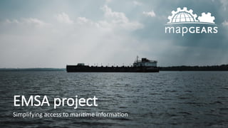
- 1. EMSA project Simplifying access to maritime information
- 2. Who is Mapgears? After several years of always encountering the same needs through various projects, we decided it was time to innovate Founded in 2006, Mapgears was initially creating mapping solutions built on tools from the open source project OSGeo (MapServer, OpenLayers, GDAL…) From there came eVouala, our own cloud-based geospatial intelligence platform
- 3. What is eVouala? eVouala is a platform built for non-technical users allowing them to centralize, view and analyze data in real-time, directly from the cloud. It facilitates decision-making and operations overview by interconnecting data coming from various sources (real-time data from IoT devices, GPS location, external web services, geospatial files) and by representing them visually in an easy-to-understand map format. Its core benefits are : Centralization all sources of data in the Cloud Intuitive access-management system through priviledges Available through any smart device, with the ability to go without Internet connection Sharing of maps and web applications in just a few clicks Unmatched compatibility with existing systems and files (+200 compatible formats)
- 4. Part of the National Oceans Protection Plan, inaugurated in 2016 by the federal government, whose main objectives are: Creating a world-leading marine safety system that improves responsible shipping and protects Canada’s waters, including new preventive and response measures; Restoring and protecting the marine ecosystems and habitats, using new tools and research, as well as taking measures to address abandoned boats and wrecks; Strengthening partnerships and launching co-management practices with Indigenous communities, including building local emergency response capacity; and, Investing in oil spill cleanup research and methods to ensure that decisions taken in emergencies are evidence based. What is the EMSA project?
- 6. EMSA is an acronym that stands for Enhanced Maritime Situational Awareness Its objective? Develop a web-based geographic information system built on Mapgears' technology dedicated to indigenous and coastal communities, allowing them to access and contribute to maritime information An agile-development project of $2.5M won by the Fujitsu/Mapgears alliance What is the EMSA project?
- 7. Communities participating in the project
- 8. EMSA AIS satellite feed AIS ground feed Web services (weather, tide) Static data (protected zones) Observations Observations Observations How does it work ?
- 9. Data and tracking of ships in near real time
- 10. History of ship movements
- 11. Access to navigation conditions (weather, tide, winds, etc.) using connected web services
- 12. Mapping of sensitive areas from an ecological and / or cultural standpoint
- 13. Collaboration between communities using an observation system
- 14. Access to the application on any type of device, with or without access to the Internet