Download as PDF, PPTX
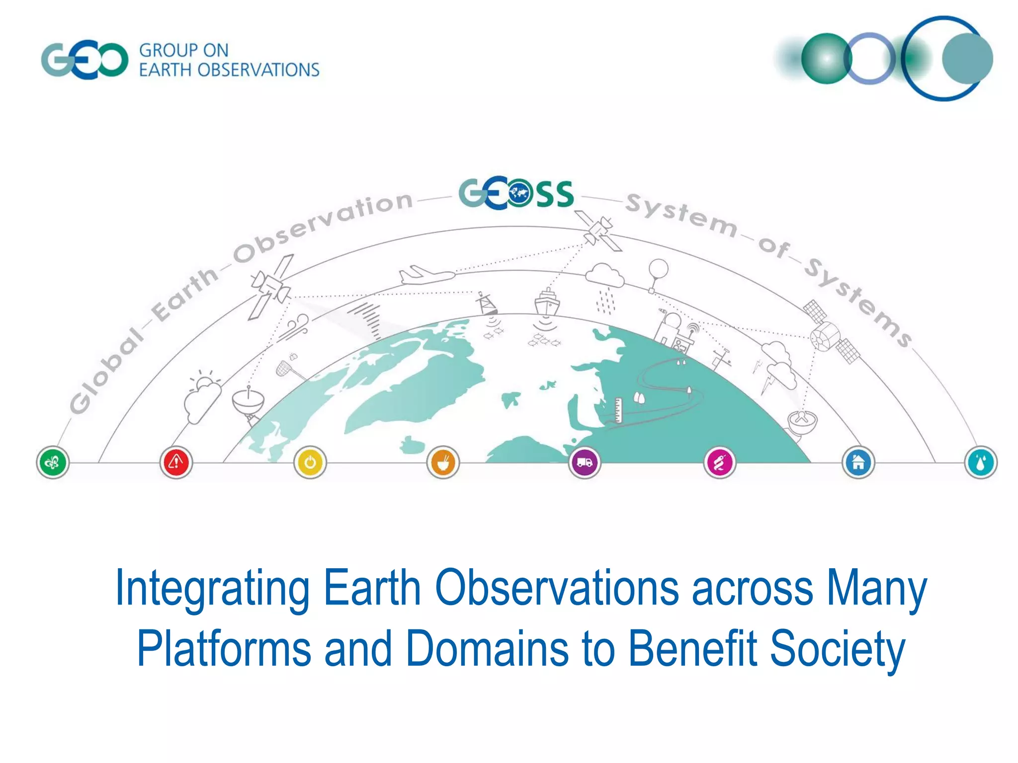
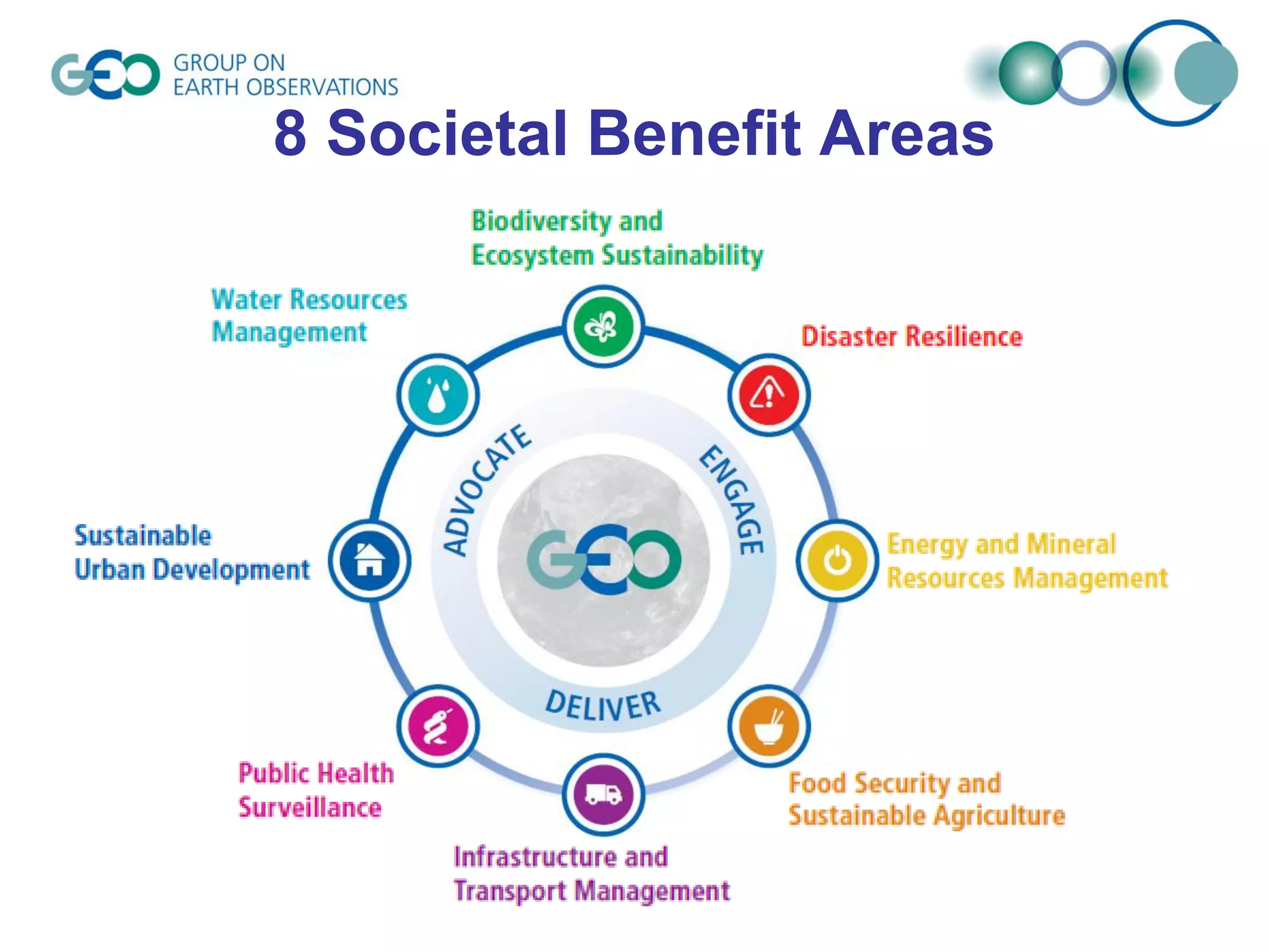
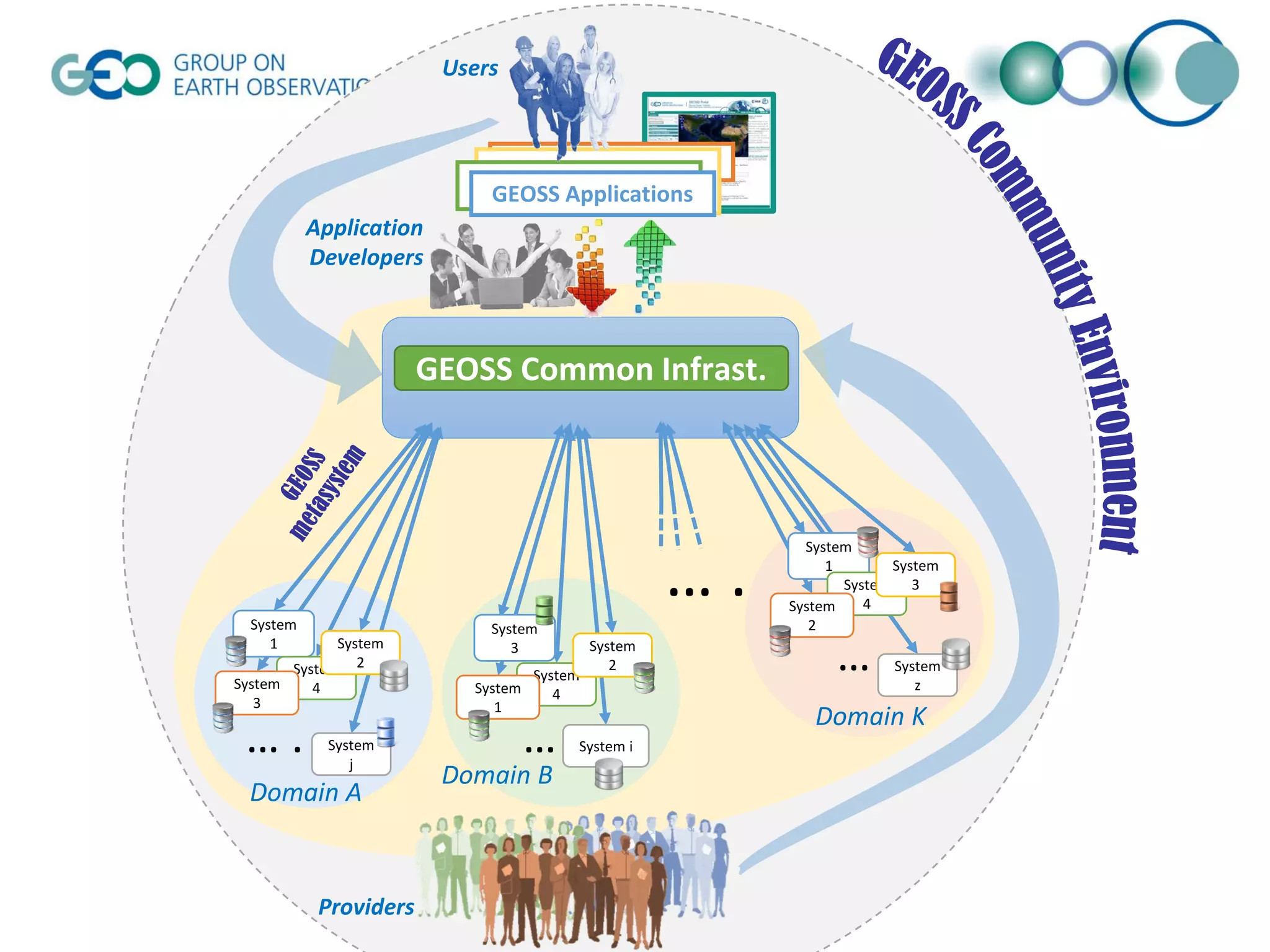
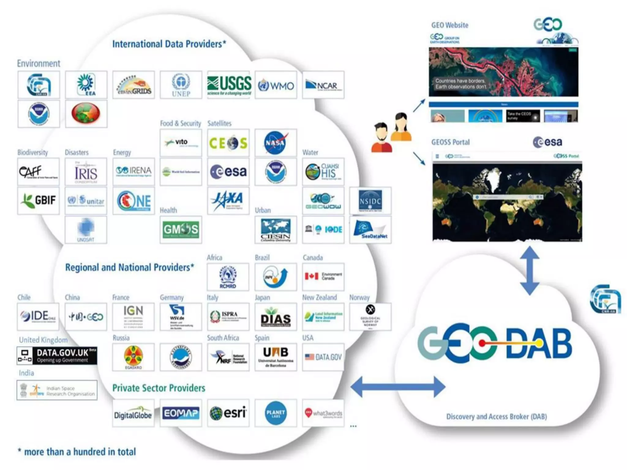
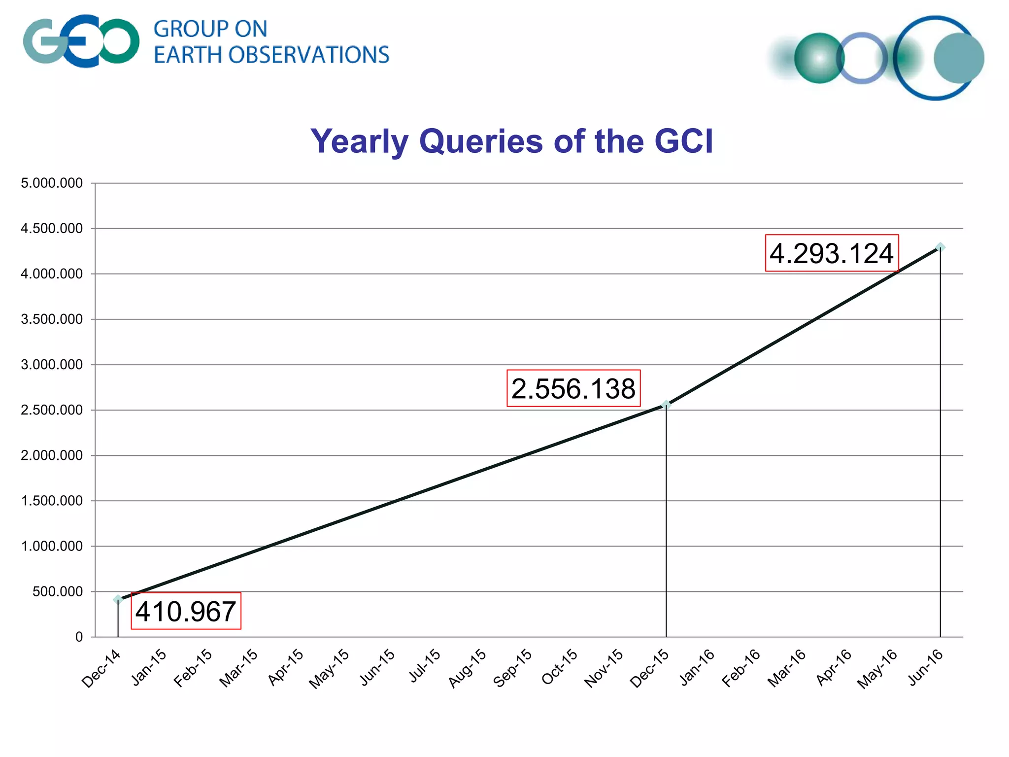
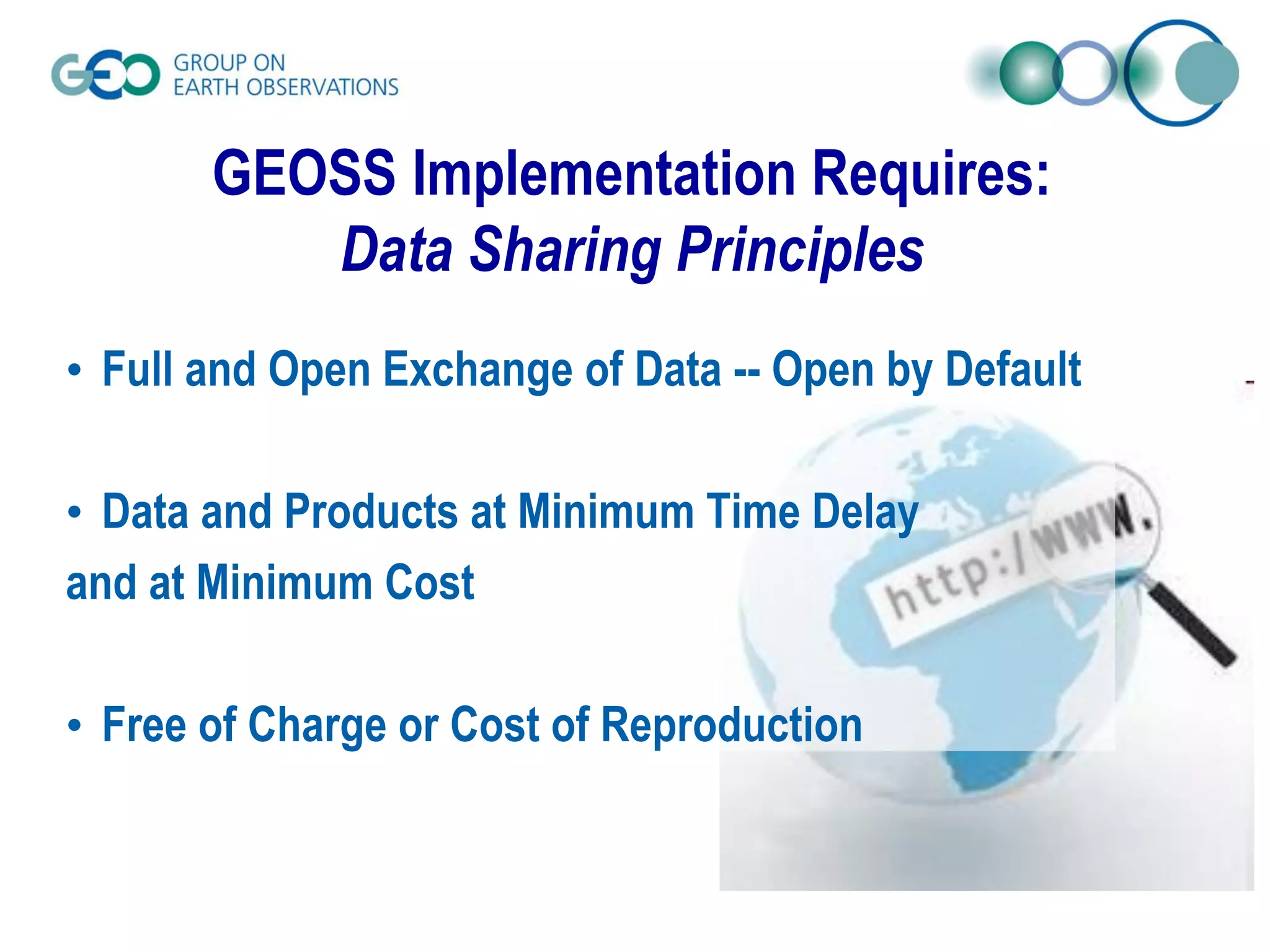
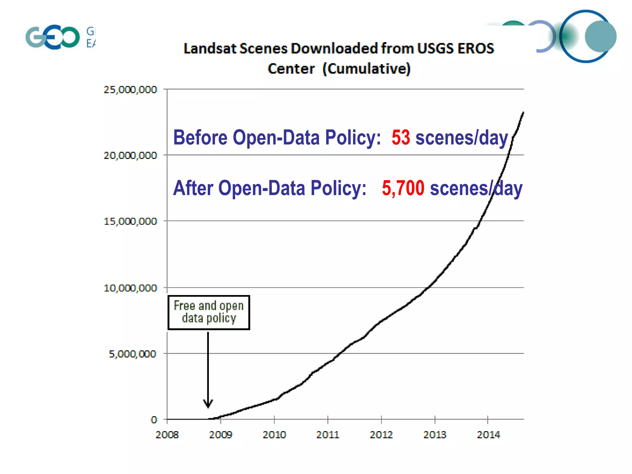

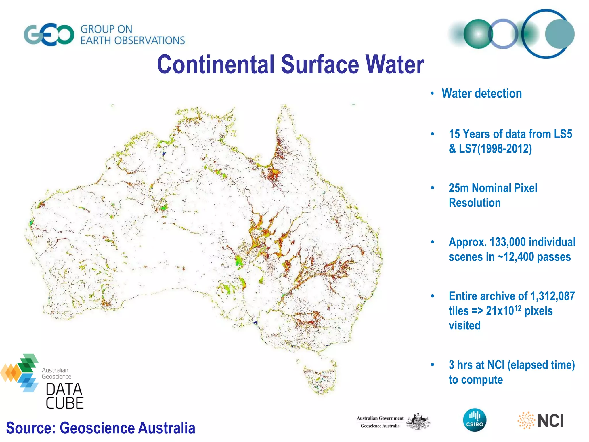
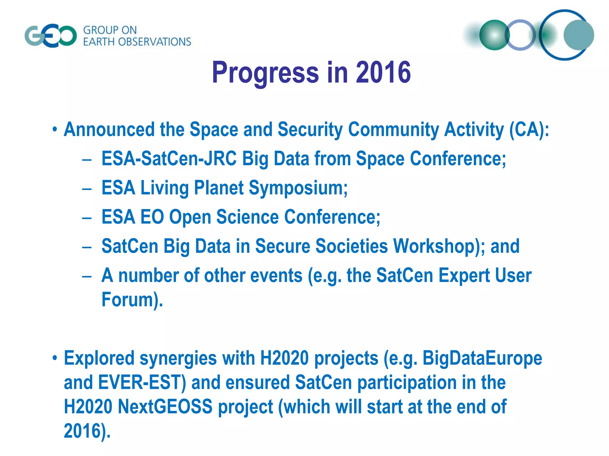
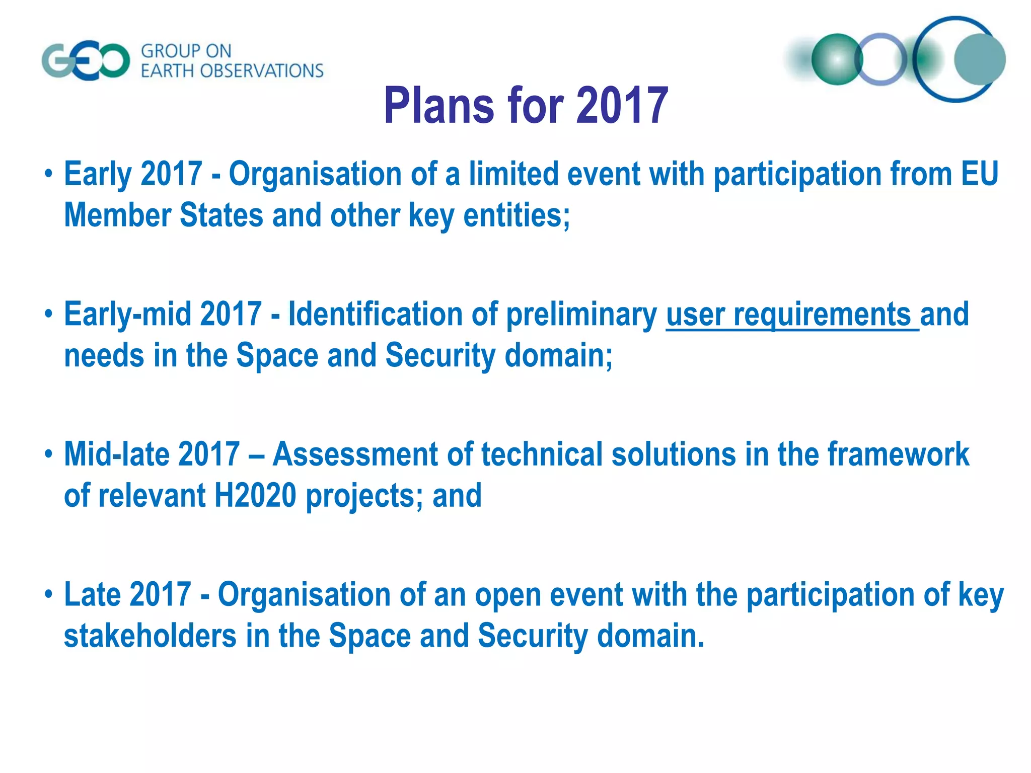

The document discusses the challenges of integrating big data in the Global Earth Observation System of Systems (GEOSS), highlighting the importance of data sharing principles for societal benefits. It presents economic benefits from open data policies and outlines plans for future activities related to space and security, including stakeholder engagement and technical assessments. The document emphasizes the need for coordinated earth observations to inform decision-making for disaster resilience and critical infrastructure protection.


![Vibe Coding vs. Spec-Driven Development [Free Meetup]](https://cdn.slidesharecdn.com/ss_thumbnails/vibecodingvsspecdrivendevelopment-251209105622-43f455e7-thumbnail.jpg?width=640&height=640&fit=bounds)


