Downloaded 11 times

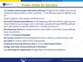
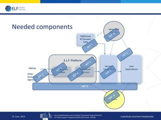
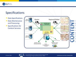
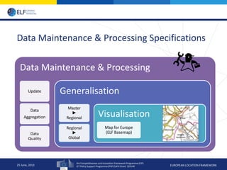
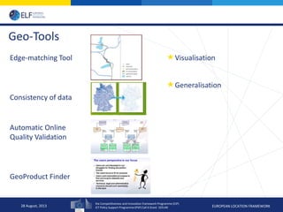
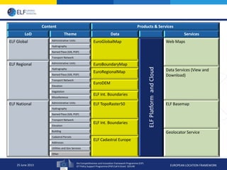


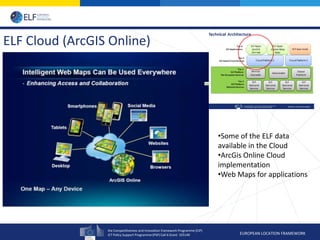


The European Location Framework (ELF) project aims to provide a single source of reference geospatial information for Europe. The 36-month project involves 30 partners, including national mapping agencies, service integrators, and application developers. The project will develop specifications and processes for maintaining and processing geospatial data. It will provide services, tools and maps through cloud platforms like ArcGIS Online and Oskari. These will include basemaps, administrative boundary data, and geocoding/search tools. The goal is to improve access to authoritative geospatial reference data across Europe in a cost-effective and interoperable way based on INSPIRE standards.


![5G Explained! A High Level Overview [Introduction]](https://cdn.slidesharecdn.com/ss_thumbnails/5gexplainedahighleveloverview-260119165306-cc137a3e-thumbnail.jpg?width=640&height=640&fit=bounds)


