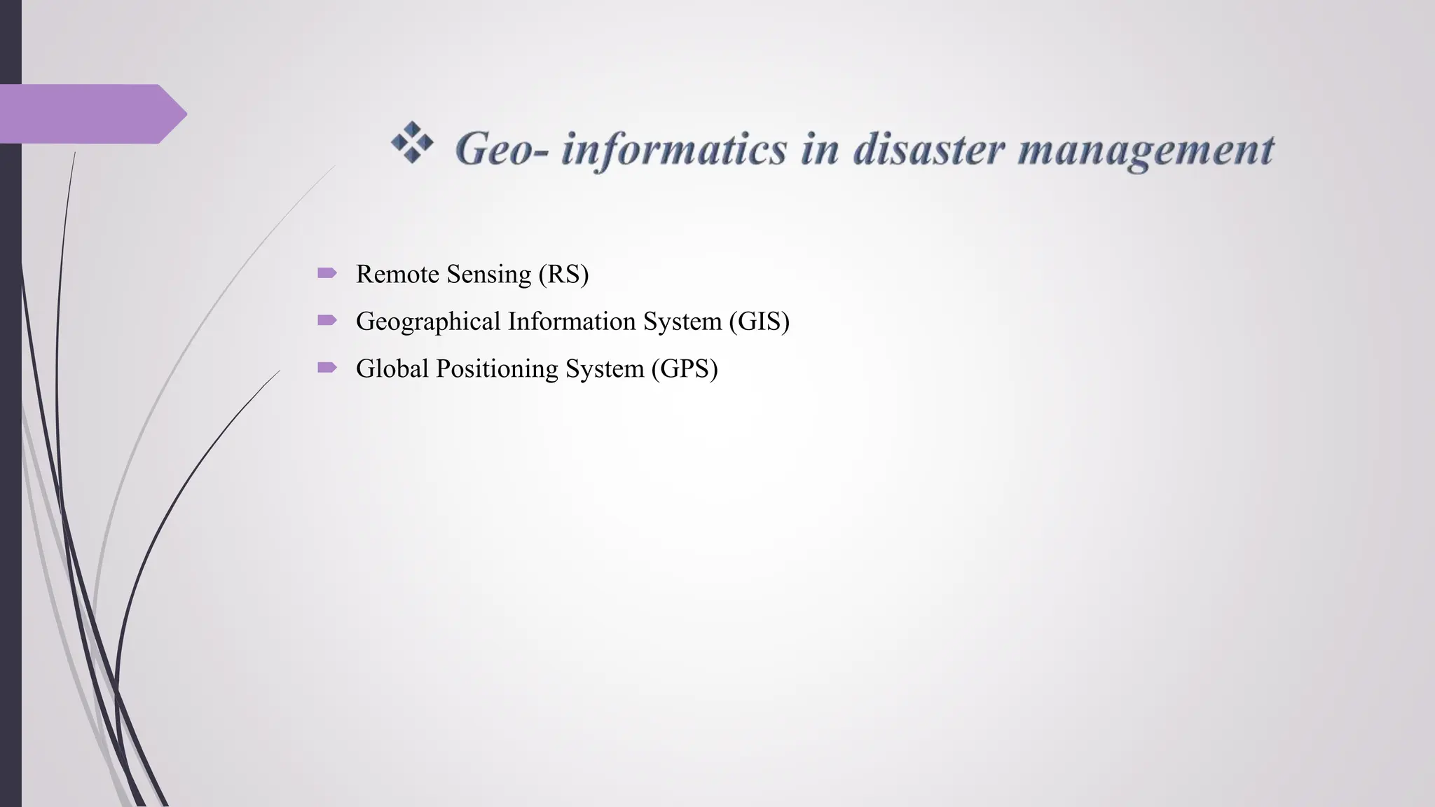
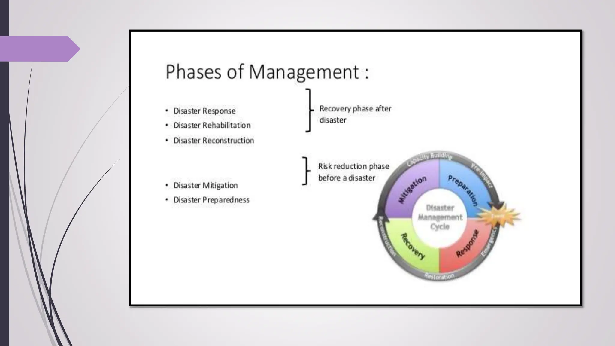
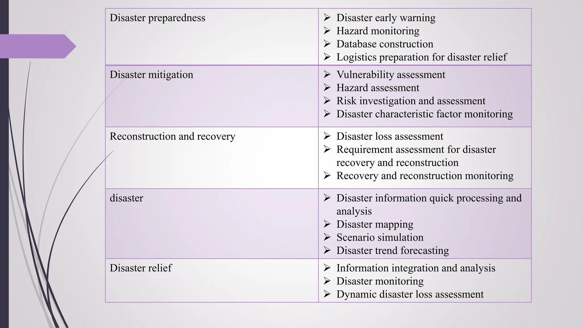
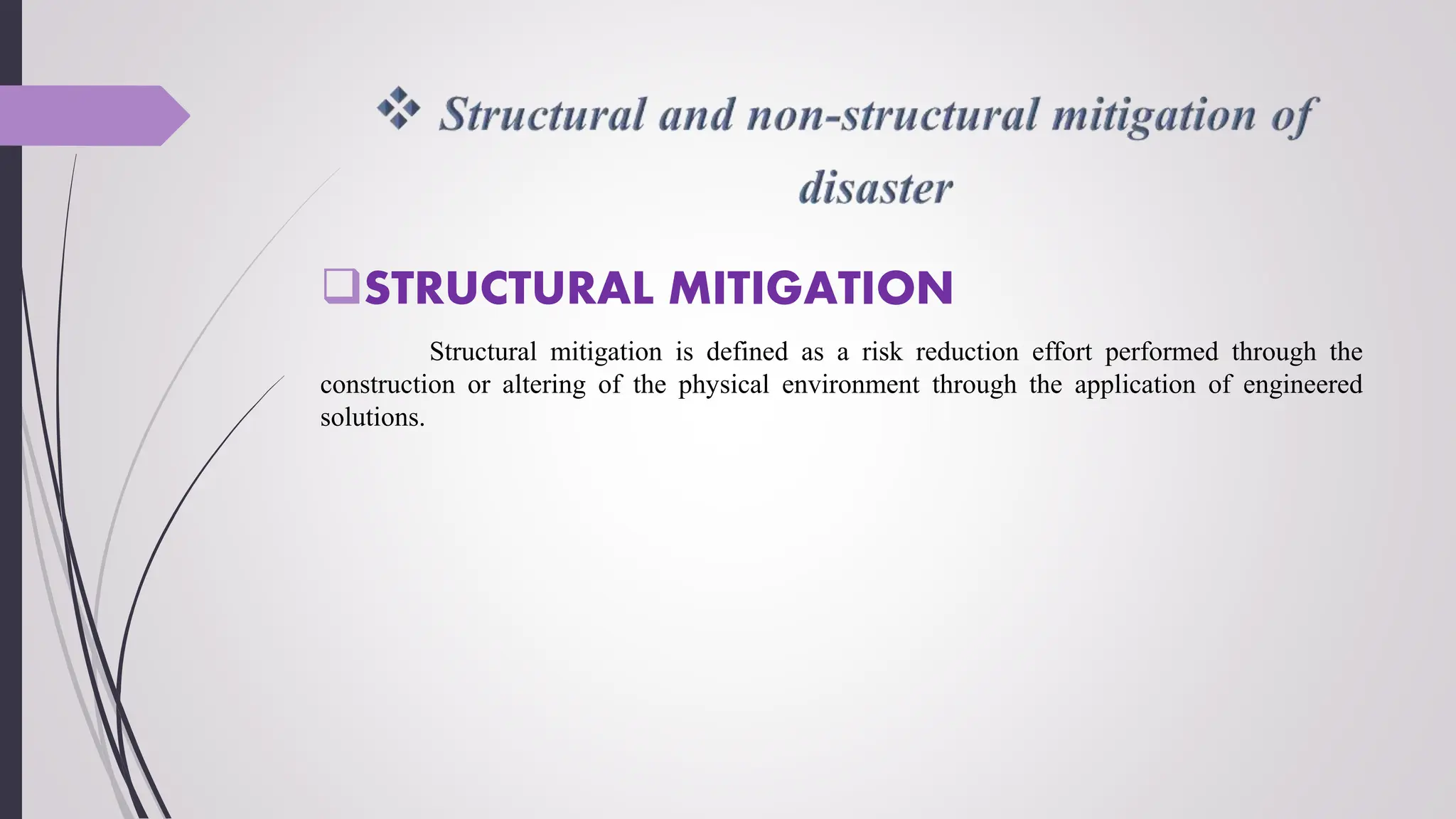
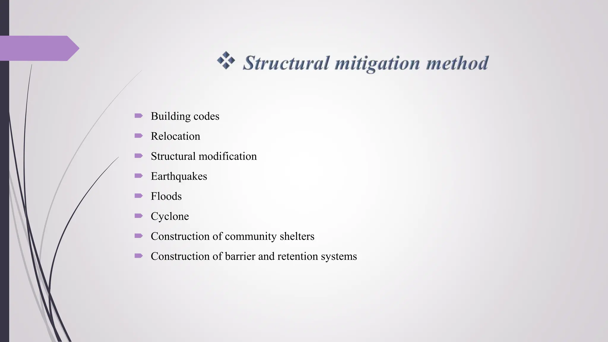
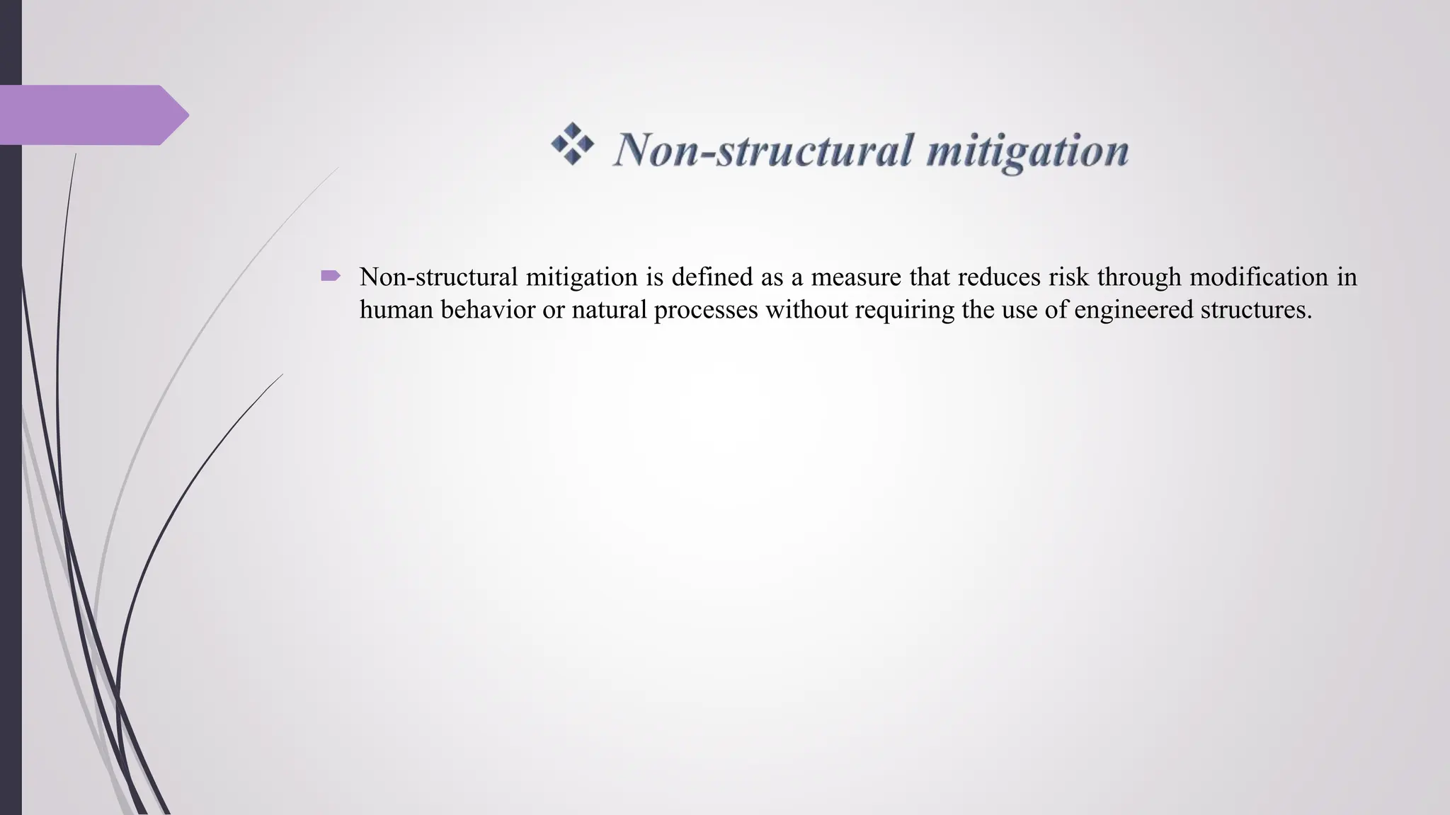
3. CONTENT
Geo- informatics in disaster management
Disaster communication system
Land use planning and Development regulations
Disaster safe designs and constructions
Structural and non structural mitigation of disaster
Science & technology institutions for disaster management in India
4. Remote Sensing (RS)
Geographical Information System (GIS)
Global Positioning System (GPS)
5. Remote sensing is an investigative technique
that uses a recording instrument or device to
measure or acquire information on a distant
object or phenomenon with which it is not in
physical or close contact.
The technique is used foe accumulating
important information of the environment.
Remote sensing can collect data much faster
than ground based observation, covering a
large spatial area at one time to give a
comprehensive view.
It has the capability of capturing images of
distant targets and in all weather conditions.
6. Using remote sensing data such as satellite imageries and aerial photos, to map the
variations in terrain properties such as vegetation, water and geology both in space and
time.
Helping to locate the area of a natural disaster and monitor its growing proportions
providing information on the disaster rapidly and reliably and thereby ensuring that extent
of damage is evaluated precisely.
Monitoring the disaster event which provides in turn a quantitative base for relief
operations.
7. Geographical information system can be defined as a system of hardware and software for
measuring, storing, retrieving, mapping, monitoring, modeling, and analyzing a variety of
data types related to geographic and natural phenomena.
8.
9. Disaster preparedness Disaster early warning
Hazard monitoring
Database construction
Logistics preparation for disaster relief
Disaster mitigation Vulnerability assessment
Hazard assessment
Risk investigation and assessment
Disaster characteristic factor monitoring
Reconstruction and recovery Disaster loss assessment
Requirement assessment for disaster
recovery and reconstruction
Recovery and reconstruction monitoring
disaster Disaster information quick processing and
analysis
Disaster mapping
Scenario simulation
Disaster trend forecasting
Disaster relief Information integration and analysis
Disaster monitoring
Dynamic disaster loss assessment
11. A critical component of any successful
rescue operation is time.
Prior knowledge of the precise location of
landmarks, streets, buildings, emergency
service resources, and disaster relief sites
saves time and lives.
The global positioning system serves as a
facilitating technology in addressing these
needs by helping the users at any point on or
near the earth’s surface to obtain
instantaneous three dimensional coordinates
of the their location.
12. Pinpointing the location of damage sites and floodplains.
Playing a significant role in helping scientists to predict earthquake in earthquake prone
areas.
Using the precise position information provided by GPS scientists can study how pressure
slowly builds up over time in an attempt to characterize and in the future perhaps predict
earthquakes.
Meteorologists responsible for storm tracking and flood predication also rely on GPS.
GPS give quick information in the efficient operation of their emergency response teams.
13. Early warning is the provision of timely and effective information through identified
institutions that allows individuals exposed to hazard to take action to avoid or reduce their
risk and prepare for effective response.
Early warning information suggest people to take action when disasters close to happening.
14. Risk knowledge
Monitoring and predicating
Disseminating information
Response
15. Land Use Planning is described as the process undertaken by public authorities to identify,
evaluate and describe different options for the use of land, including consideration of long
term economic, and enviournment objectives.
16. The main are as under:-
Selecting the safe site for the building structures.
Relocating a community outside the hazardous and disaster prone areas.
Formulation of land use policies for the long term sustainable development.
Measures to promote land use should include legal implementation of property insurance
against the damage of disaster evens and creation of public awareness for the proper land
use practices.
Appropriate land use in the disaster prone areas , by adjusting the land stability with
agricultural development strategies.
Long term land use planning by incorporating all geological related data available and
identifying for allocation of hazard free areas for industrial and urban development.
High investment industries, other important infrastructure should not be located in the
areas that are susceptible to damages.
17. Adoption of the culture of safety in construction to follow bye laws and codes and usage of
good quality material.
The government shall support these initiatives by providing technical guidance to rebuild
houses that can sustain against shaking of the earthquake.
Manuals need to be developed outlining methodologies for new constructions
identification of the vulnerable buildings in the state
Construction of emergency shelters, identification of the buildings that could act as a
shelters and strengthening existing one, also of the infrastructure, which are useful during
emergencies.
Building structures on the firmer ground or stiff soil because stiff soil loss their strength
with strong vibrations.
Help in purchasing of the safe sites for the construction.
Priority of buildings according to their importance.
18. Earthquake Safe Design
and Construction
The building should have a simple rectangular
plan.
Long walls should be supported by reinforced
concrete columns.
Door and window openings in walls should
preferably be small and more centrally located.
The location of the openings should not be too
close to the edge of the wall.
Vertical reinforcements should be provided at
corners and junctions of walls. It shall be
passing through the lintel bands and floor slabs.
19. Landslide Safe Design and
Construction
The potential for the landslides and development
erosion can be greatly reduced or prevented with
proper development, proper construction techniques,
seasonal inspections and regular maintenance of
drainage facilities.
Keep the surface drainage water away from vulnerable
areas, such as steep slopes, loose soils and non-
vegetated surfaces.
Collect and direct water from driveways, non-
vegetated surfaces, into catch basins, and confine water
flow in drainage pipe such as ditch, drywell, gutter,
natural drainage or holding pond.
Improve soil`s ability to resist erosion by stabilizing
slopes by increasing vegetation and tress.
20. Floods Safe Design and
Construction
Avoid residing on river banks and slopes on river
side`s.
Build at least 250meters away from the
seacoast/river banks.
Build proper drainage system in all flood prone
areas, so that the water can be drained off quickly
to prevent accumulation.
Construct the building with a plinth level higher
than the known high flood level.
Construct the whole village or settlement on a
raised platform higher than the high flood level.
Construct buildings on columns with wall-free
space at ground level permitting the free flow of
water, provided that columns are circular and
strong.
In dry weather condition the ground area could be
fenced.
21. Cyclones Safe Design and
Construction
In cyclonic regions, close to the coast, a site above the
likely inundation(more) level should be given preference.
For individual buildings, a circular or polygonal plan
shape is preferred over rectangular or square plans.
Where building is constructed on columns, it is necessary
that columns are properly braced on both the directions.
Doors and windows should have strong closing/locking
arrangements and glass/wooden panels be securely fixed.
Reduce the size of the panel and provide a metallic fabric
outside the panels.
Provide proper locking arrangements of shutters. Securely
fix the frames to walls.
The roof projections should be kept minimum (not
exceeding 500mm), or else, are tied down adequately.
22. STRUCTURAL MITIGATION
Structural mitigation is defined as a risk reduction effort performed through the
construction or altering of the physical environment through the application of engineered
solutions.
23. Building codes
Relocation
Structural modification
Earthquakes
Floods
Cyclone
Construction of community shelters
Construction of barrier and retention systems
24. Non-structural mitigation is defined as a measure that reduces risk through modification in
human behavior or natural processes without requiring the use of engineered structures.
25. Legal framework
Land use planning
Incentives and financial framework
Training and education
Public awareness
26. India meteorological department (IMD)
Central water commission (CWC)
Indian national center for oceanic information system (INCOIS)
Geological survey if India (GSI)
Defense research & development organization (DRDO)
Indian space research organization (ISRO)
Department od atomic energy (DAE)