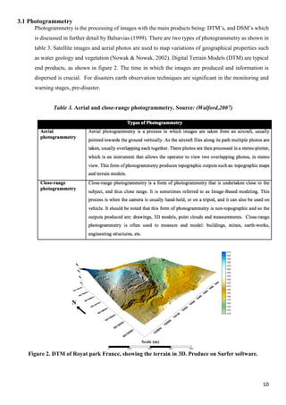
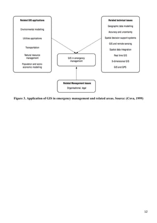
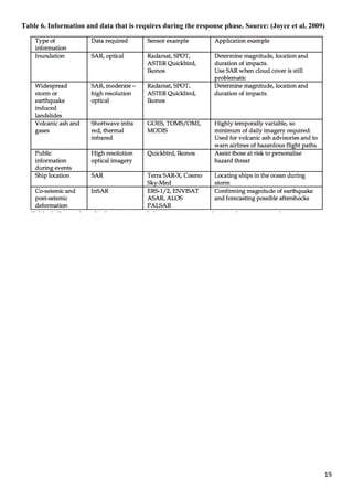
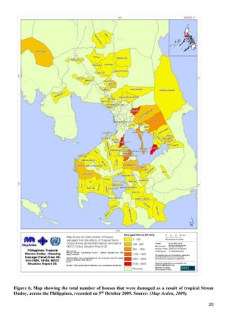
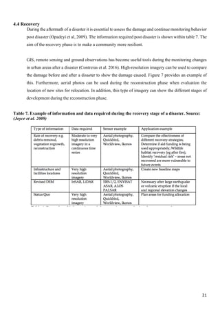
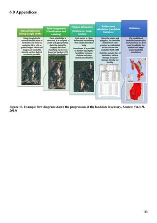
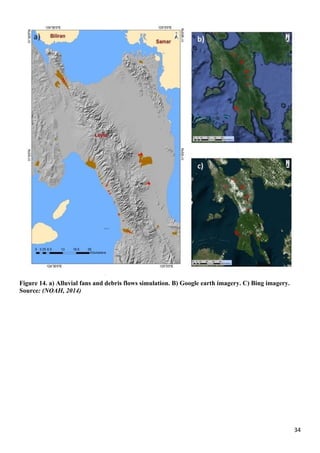
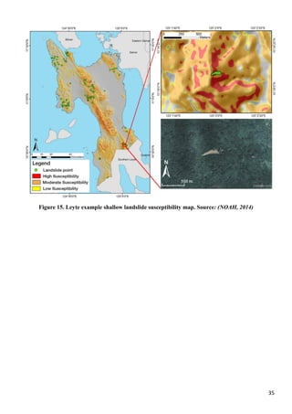
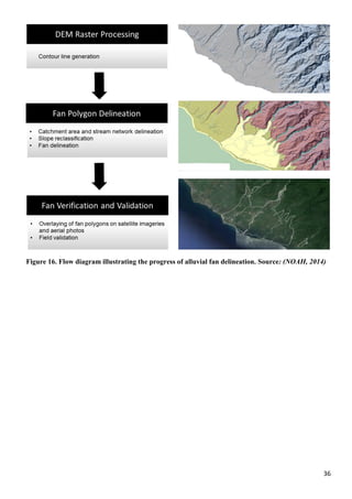
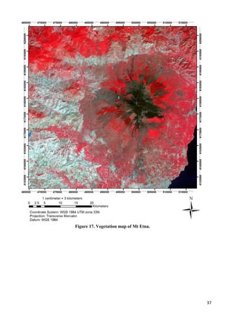
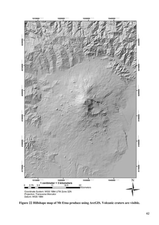
This document discusses the application of geoinformatics in disaster management. It begins by introducing the disaster management cycle of mitigation, preparedness, response and recovery. It then provides an overview of different geoinformatics tools and technologies like photogrammetry, remote sensing, spatial analysis and GIS software. The main body examines how each geoinformatics tool can be applied in the different phases of the disaster management cycle for tasks like hazard mapping, evacuation planning, damage assessment etc. Specific examples discussed include using remote sensing to monitor volcanoes and producing landslide susceptibility maps with GIS. Overall, the document illustrates how geoinformatics plays a crucial role in effective disaster risk reduction and response.