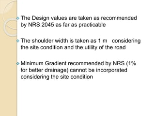
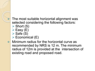
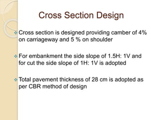
Call Girls Jalgaon Just Call 8617370543Top Class Call Girl Service Available
design.pptx
1. INTRODUCTION
A. Background
At present , there is no road that directly links
Badikhel - Bandegaun.
People are compelled to take the long alternative
routes to travel from one village to another.
2. C. Scope
To review the existing study reports, standards and
specifications.
Detailed engineering survey of alignment.
Preparation of topographical map.
Study for cross-drainage works and propose suitable drainage
structure.
3. Preparation of working drawings.
Preparation of quantity and cost estimate.
Preparation of survey and design report
4. D. Project location
The proposed road is located in the Lalitpur District,
Bagmati Zone, Central Region. The road starts from
Badikhel and ends at Badegaun.
The road runs along Karmanasha River corridor.
The latitude and the longitude of the starting point are
27057’07’’ and 85035’27’’ respectively.
5. F. Hydrology And Meteorology
Small temporary streams running only during monsoon crosses
the alignment with small discharge.
The project area experiences marked seasonal and specific
climate variation with moderately hot summer and relatively
cool winters. Average temperature is 25oC in summer and 10oC
in winter.
Almost 80% of the rainfall occurs during monsoon which starts
at the middle of the June and continues until the end of August.
7. DESK STUDY
The geographical and the topographical maps
were studied and the relevant information
regarding the alignment selection, cross drainage
structures, gradient of the road were discussed.
The strategy for the field study was made
accordingly.
The study team member discussed the related
matters of the project.
8. SOCIAL IMPACT ASSESMENT
The study identified the following key social issues
for investigation:
Loss of private property and other assets (land,
houses and trees) and compensation modalities
for these losses.
Population displacement.
12. Road Classification
As per the NRS 2045, the road project falls on the
category of District Roads.
13. A Design speed of 30 km/hr is taken for the
design of geometric parameters of the road.
Design Speed
14. The Design values are taken as recommended
by NRS 2045 as far as practicable
The shoulder width is taken as 1 m considering
the site condition and the utility of the road
Minimum Gradient recommended by NRS (1%
for better drainage) cannot be incorporated
considering the site condition
15. Horizontal Alignment
The most suitable horizontal alignment was
selected considering the following factors:
Short (S)
Easy (E)
Safe (S)
Economical (E)
Minimum radius for the horizontal curve as
recommended by NRS is 12 m. The minimum
radius of 12m is provided at the intersection of
existing road and proposed road.
16. The extrawidening and transition curves are not
provided owing to low design speed and simplicity
in construction
A maximum of 5 % super elevation is provided at
each horizontal curve.
Superelevation is provided by rotation of
pavement about the center line.
Transition length for super elevation is provided
as 5 m
17. Summit curves are designed considering stopping
sight distance.
Valley curves are designed on the basis of night
visibility
The radius of vertical curve is adopted as large as
possible so that all the factors are satisfied
The least vertical radius taken in design is 1000 m
18. Cross Section Design
Cross section is designed providing camber of 4%
on carriageway and 5 % on shoulder
For embankment the side slope of 1.5H: 1V and
for cut the side slope of 1H: 1V is adopted
Total pavement thickness of 28 cm is adopted as
per CBR method of design
19. Gravel is used as the sub-base course
Otta Seal is used as the surface course
20. Drainage
Longitudinal drain is provided on the cut slope side of
the road
The side slope is 1:1 and longitudinal slope is parallel to
the alignment
Earthen drain is provided from chainage 0+000 to the
chainage of 1+251.35
Stoned masonry drain of thickness 20 cm is provided
from the chainage of 1+309.82 to chainage 2+027.24
21. Pipe culverts of 60 cm in diameter and total length
of 7.5m are provided at 12 sections of the road
They are provided at the lowest point of the
vertical alignment
A minimum depth of 60 cm is provided between
the surface of the pavement and the crown of the
pipe
26. QUANTITY ESTIMATE
Earthwork Calculations:
Calculated at each cross-section
Separate calculation according to soil type
Total cut volume = 10283.57 m3
Total fill volume = 16052.44 m3
Balance (fill) = 5768.869 m3
Earthwork for drain = 768.129 m3
All the detailed calculation is shown in the tabular
form in the following slides:
27. Contd………
Necessary calculations:
i. For side drain:
Calculations were made taking the following design
considerations:
Section = trapezoidal
Depth: 0.3m
Base width: 0.3m
Side slope: 1:1
Unlined earthen canal(Ch. 0+000 to 1251.35)
Lined canal: (ch.1+309.82 to Ch. 2+027.24)
ii. Sub-grade calculations:
28. RATE ANALYSIS
Rate analysis was performed under the
following criteria:
The quantity of the materials, required labor
force and plants, machinery, tools and
equipments were taken from the work norms
provided by the DoR.
The rate for the materials, labors, plants and
machinery, tools and equipments was taken
from the district rates provided by the Lalitpur
DDC.
29. COST ESTIMATE
The BoQ was prepared on the basis of the
quantity of work calculated and rate analysis
done previously:
The cost estimate is as below: