The history of efforts to preserve and protect the Ash Creek tidal estuary which borders the city of Bridgeport and the town of Fairfield in Connecticut. The Ash Creek Conservation Association was formed in 2003 to continue the efforts of many to protect this rare healthy tidal estuary in an urban area.
The document discusses North Carolina's river basins and their importance. It explains that a river basin is the area of land that drains into a river system. It notes that there are 17 major river basins in North Carolina, with 5 draining into the Mississippi River and the rest draining into the Atlantic Ocean. The health of river systems is directly related to human activities on the surrounding land.
NC River Basin Scavenger Hunt with responsesDwayne Squires
The document summarizes responses to questions about river basins and watersheds. It describes how water moves through river basins and watersheds, collecting pollutants as it flows across land and underground. It also discusses issues like flooding, water quality, and citizen efforts to monitor and restore local rivers and streams. The French Broad River basin in North Carolina is used as an example, noting it is composed of several interconnected sub-basins that drain into the French Broad, Pigeon, and Nolichucky Rivers.
This document summarizes how natural coastal systems function to control pollution and prevent flooding and storm damage, and the effects of human alterations on these systems. It describes how features like salt marshes, beaches, wetlands and their vegetation naturally improve water quality, attenuate waves and floods, but that activities like coastal development, dams, pollution and draining/filling of habitats have degraded these ecosystem services. The Division of Ecological Restoration works to restore over 1,000 acres of coastal wetlands and 200 miles of streams to regain these lost benefits.
California has experienced several severe droughts in the last century, including ones from 1928-1935 and 1987-1992. Droughts are caused by a lack of precipitation and can be exacerbated by climate change. During droughts, groundwater supplies become increasingly important as surface water supplies decline. The state must prepare for droughts by promoting integrated water management, water conservation, and developing local and regional water supplies.
Estuaries are wetland areas where rivers meet the sea that contain brackish water, which is a mixture of fresh and salty water. They provide unique habitats for many plant and animal species that have adapted to the brackish environment. Estuaries and their surrounding wetlands are transitional zones between fresh water and salt water ecosystems. Desalination is a process that removes salt and minerals from water, such as seawater, to produce fresh water suitable for human use or agriculture. It is an important process for obtaining fresh water in dry regions and on ships. However, desalination is more expensive than other fresh water sources due to its high energy usage.
This document discusses policies that Iran could adopt to address water scarcity. It summarizes that Iran faces water scarcity due to factors like population growth, agricultural practices, and dams depleting groundwater. It recommends policies like improving water management through transparency, education, pricing water at real costs, limiting crops to suitable regions, and restoring traditional water harvesting methods. It also suggests international collaboration on studies of shared water resources and sharing experiences in water management.
This is an introduction to our Hydrology unit at International School Manila. It looks at how much water there is on our planet and tries to explain the astronomical figures in terms that the students (and teachers for that matter) understand.
Water is one of the prime elements responsible for life on earth.
Water sustains life and maintains ecological balance.
Water is the essential component of global life support system.
The Chesapeake Bay watershed covers 64,000 square miles across six states and supports over 3,600 plant and animal species. However, the bay is threatened by excessive nitrogen and phosphorus pollution which causes dead zones with low oxygen levels that can kill aquatic life. One of the leading causes of the problem is decomposition of algae blooms that deplete oxygen in bottom waters for up to 10 months each year. The Chesapeake Bay Foundation's Philip Merrill Environmental Center aims to set an example through practices like using recycled materials, waterless composting toilets, native landscaping requiring no water or fertilizer, and habitat restoration projects. Efforts are also underway to restore oyster and wetland
Jennifer Birchfield, Water Program Director with Save the Dunes, will update the group on several news items and initiatives.
Save the Dunes in partnership with the city of Valparaiso, was recently awarded a $607,000 EPA grant to improve a large detention area located at Evans & Roosevelt in Valparaiso. The basin feeds into the Salt Creek watershed and eventually into Lake Michigan.
Birchfield said more than 500 acres of developed land drains into the 2-acre Thorgren basin after a storm. That water contains pollutants, such as lawn chemicals, oil and animal feces. The grant money will spur efforts to naturalize the basin to mimic a wetland surrounding to filter pollutants. Concrete will be replaced by a meandering waterway. Turfgrass will be replaced with native plantings that have deep roots that absorb water and pollutants.
Save the Dunes officials hope the Thorgren basin will become a model for other basins in the Lake Michigan watershed.
Freshwater biomes include lakes, ponds, rivers and streams. They provide many benefits to humans like drinking water, transportation, recreation and jobs. Rivers originate in mountains and flow into oceans, carrying plants and animals. Many species live in freshwater ecosystems, some relying on moving water. To help these biomes, people should conserve water, avoid pollution, and get involved in conservation efforts.
The Yil-Me-Hu, the salmon recovery newsletter of the Nisqually Watershed, is produced annually by the Nisqually Indian Tribe and Nisqually River Council.
I designed a restoration and conservation plan to improve the island habitat and native special at the Cedar Creek/Lake Muhlenberg region of Allentown, PA. My research proposal was part of an interdisciplinary Sustainability Studies course where each student selected a real environmental issue facing the City of Allentown in which the Parks and Recreation Department desired to improve. My proposal was actually picked up, funded by, and put into action by various partners who contributed their expertise to the project, such as the Edge of the Woods Nursery in Allentown, a nonprofit organization Friends of the Allentown Parks, and the Lehigh Valley Chapter of the National Audubon Society
This document provides information about various sources of freshwater and drinking water sources. It discusses the water cycle and major reservoirs like groundwater, glaciers, rivers/lakes and the atmosphere. Students explore these sources through various websites and activities. They learn that local drinking water in Salt Lake City comes from rivers and snowmelt in the Wasatch Mountains that flow into reservoirs in the Jordan River and Great Salt Lake watershed. The document emphasizes the importance of protecting water sources and discusses actions individuals and society can take to better conserve freshwater.
Water is essential for life on Earth and makes up a large portion of the human body. It is part of a closed system through the hydrological cycle. Sydney's first European settlement was located near the Tank Stream due to its reliable water source, but it became polluted over time. Sydney now sources its water from several dams and reservoirs located far from the city, with the Prospect Water Filtration Plant treating 2,700 megalitres of water per day. Major pipelines and reservoirs distribute the treated water across Greater Sydney.
The document provides an overview of ecology, focusing on marine benthic environments and zonation of coral reefs. It defines key ecological terms like organism, population, community, ecosystem, and biosphere. It then describes the different zones of the marine benthic environment, including the littoral, sublittoral, bathyl, abyssal, and hadal zones. Finally, it discusses coral reefs, including the symbiotic relationship between corals and algae, types of corals, conditions required for coral reef growth, zonation patterns in coral reefs, and various human impacts.
Assessment Derived Conservation Strategies for Lakes in BangaloreEkonnect
The document summarizes a study conducted by the Centre for Lake Conservation and Environmental Management & Policy Research Institute (EMPRI) on the lakes in and around Bangalore. The study involved collecting comprehensive data on 117 water bodies, including their morphology, hydrology, land use, water quality, biodiversity, and threats. Issues like pollution, encroachment, excavation and religious activities impacting the lakes were documented. Based on the findings, strategies for conserving the lakes and a water management plan were proposed. The study helped increase awareness, remove encroachments from some lakes, and issue notices to polluting units.
This document is a research paper that explores the impacts of traditional stormwater management versus green infrastructure on the Chesapeake Bay watershed. It summarizes that water quality data shows lower nitrogen levels in Gunston Cove, which receives runoff from Fairfax County that uses green infrastructure, compared to the Upper Potomac River, which receives runoff from Montgomery County that uses traditional stormwater management. Fairfax County has implemented several green stormwater initiatives while Montgomery County was sued for not meeting water quality standards. The document provides background on threats to the Chesapeake Bay ecosystem and reviews literature on the water quality and stormwater management approaches of the different watersheds.
The Environmental Protection Agency's Office of Wetlands, Oceans and Watersheds works to protect the nation's marine and fresh water ecosystems. It develops cleanup plans for impaired waters, controls polluted runoff, and protects healthy waters through partnerships with states, tribes, and local groups. While America's water resources are abundant, around 40% are impaired and face threats from pollution, habitat loss, and hydrologic changes. Protecting water quality and restoring watersheds requires involvement from all levels of government as well as individual action within local communities.
The document discusses several ongoing salmon recovery efforts in the Nisqually watershed:
1) Phase III of the Ohop Valley restoration project has begun, continuing efforts to restore habitat for threatened Chinook, Coho, and steelhead salmon. Monitoring of Phases I and II shows native vegetation is establishing well.
2) Research on the Nisqually River estuary restoration found that restoring tidal flow is rapidly improving feeding and growth opportunities for juvenile Chinook salmon, though some attributes will take longer to achieve natural conditions.
3) A study placed identifying tags in over 800 juvenile Coho salmon to reveal preliminary results about their survival and migration in local creeks.
The document discusses the water cycle and distribution of water on Earth. Most (97%) of Earth's water is saltwater found in oceans. The remaining 3% is freshwater, with 76% bound up as ice in glaciers and ice sheets and less than 1% available for human use. Water is constantly circulated through the water cycle, driven by energy from the sun. In the cycle, water evaporates from oceans and land into the atmosphere, forms clouds, and falls back to the Earth's surface as precipitation like rain or snow.
This document discusses the challenges of environmental pollution and climate change, and proposes putting youth in charge as a solution. It summarizes the work done by the UMass Boston Nantucket Field Station and other field stations, including research on water quality, harmful algal blooms, fisheries, climate change impacts like rising seas and stronger storms. The document advocates for youth leadership on environmental data collection and policy changes to address issues like runoff, invasive species, and plastic pollution.
This document discusses challenges related to water resource management in Kenya, including deforestation, soil erosion, water scarcity, pollution, and conflicts over water usage. It notes issues such as the lack of water during dry seasons, encroachment into wetlands, inappropriate water utilization, and poor management of springs. The goal of integrated water resource management (IWRM) planning is outlined as changing lives by addressing priority water problems through a basin planning approach that takes all water-related activities and developments into account to achieve sustainable use. Opportunities for IWRM include managing watershed resources like agriculture land, wetlands, and forests.
Desalination of the Sea Around Us, Part ICarol Reeb
This is a talk on seawater desalination I gave in Seaside California on October 19th, 2010. It is divided in two parts.
Part I contains information on seawater desalination and how the process can impact the marine environment.
Part II provides specific examples of how brine discharged from these plants can affect species, especially eggs and developing young.
It ends with an illustration of how water recycling could be a better long-term solution to our looming water crisis on the Monterey Peninsula and in the State of California.
The Ash Creek Conservation Association aims to preserve and protect the Ash Creek tidal estuary, one of the few remaining in an urban area in the US. It provides habitat for migratory birds, oysters, and other wildlife. ACCA works to educate the public, advocate for protection from development, and encourage ecological uses like birdwatching. Through cleanups, restoration efforts, and preventing docks and fills, ACCA has helped Ash Creek avoid development and continue as an important natural area amid urban surroundings.
The document discusses the history of conservation efforts in Southwest Florida over the past 50 years led by the Conservancy of Southwest Florida. It summarizes that the Conservancy was founded in the 1960s to protect Rookery Bay from development, and has since expanded its work to include land acquisition, environmental research, education, and advocacy to promote balanced growth and water quality protection. The Conservancy has helped preserve over 100,000 acres and faces ongoing challenges around population growth and water pollution, but remains committed to conservation for future generations.
Andy Freifeld, Temple University, “Landscape Design and Reuse Planning in Min...Michael Hewitt, GISP
Funding for mine land reclamation is difficult to acquire and, while the environmental benefits of reclamation are fully understood, the economic benefits of reclamation are just beginning to be appreciated. Innovations in landscape design and reuse planning can attract partnerships with lenders and investors and spur the economic development associated with reuse of abandoned mine lands. Strategies like energy development, carbon sequestration, and wetland banking can address environmental concerns, but should also preserve historical and cultural legacies in order to maximize economic gain. These environmental strategies are now being encouraged by State and Federal agencies, while the cultural legacies are more universally overlooked. This presentation will discuss the ways in which environmental design of reclamation projects could benefit both economically and environmentally by the inclusion of preservation and consideration of historical and cultural legacies of the sites, while still utilizing core environmental strategies.
A presentation before the Coconino County Board of Supervisors (Arizona) by David McKee of the City of Flagstaff on November 16, 2010. A resolution in support of Picture Canyon was adopted by the the Board.
WATER (Wilderness Adventure Ecology and reasearch)Matthew Moritz
This document provides an overview of the Wilderness Adventure Team Ecology and Research (W.A.T.E.R.) project, which focuses on studying river degradation and preservation efforts. It discusses the history of river usage from ancient canoes to modern dams, and the impact of dams on river ecosystems. It also summarizes the National Wild and Scenic Rivers System and its role in protecting free-flowing rivers. Finally, it proposes applying modified Leave No Trace principles to canoeing to help preserve rivers.
This document summarizes the purchase of 4,500 acres of the Lacks Creek watershed in Redwood National and State Parks to protect salmon habitat and the park. It describes how Lacks Creek is important for spawning of chinook salmon but is prone to landslides. Logging had degraded the area. The Save-the-Redwoods League raised funds to allow the Bureau of Land Management to purchase the land from a timber company and private landowner to restore the area and protect the downstream park.
(See notes below) Four hundred years ago, the Chesapeake Bay that the English colonists found here was lined with huge oyster reefs that grew up from the bottom in waters both deep and shallow. Those reefs provided the base for much of the life in the Bay and its rivers, from worms and barnacles through mud crabs and tiny fish to big blue crabs and predators like sheepshead, drum, and rockfish (striped bass).
The oyster reefs weren’t as “pretty” (to us humans) as the coral reefs further south, but in terms of ecosystem richness, they were just as important. One key to their strength was their three-dimensional structure, which successive generations built gradually on the shells of their predecessors over several thousands of years. The structures placed the oysters up in the water column, away from gill-choking bottom sediments, where dissolved oxygen was plentiful and currents brought food in the form of algae cells seeking sunlight.
This PowerPoint presentation, developed by the Chesapeake Bay Foundation’s Fisheries Program Director Bill Goldsborough, tells the story of those reefs and what has happened to them over the past four hundred years. It is not a pretty story, but it offers a hopeful conclusion, as we learn more each year about how to restore these essential elements in the Chesapeake ecosystem.
Anglers have as much to gain as anyone in restoring the Chesapeake’s oysters. The presentation closes with suggestions for how to get involved in oyster restoration, and how to incorporate the restoration reefs into your 2015 angling season.
To participate in CBF’s oyster restoration programs in Virginia and Maryland, visit http://www.cbf.org/oysters.
Apes the clarence river estuary restoration project in australia[1]megangarrett
The Clarence River Estuary in Australia contains endangered ecological communities and species. In the 1920s, a causeway was built across the estuary that blocked tidal flows, causing a buildup of sediments and nutrients. This led to algae blooms, higher water temperatures, and the death of seagrass beds. In 2008, a double-cell box culvert was installed in the causeway to restore tidal exchange and fish passage. This $420,000 project has successfully improved conditions in the estuary by reducing nutrients and temperatures and allowing the recovery of seagrass and fish populations.
The document summarizes upcoming events celebrating Lake Superior Day and meetings of the Public Advisory Committee (PAC) working on the Thunder Bay Remedial Action Plan. Lake Superior Day on July 21st will include a visit from the tall ship Sorlandet where tours can be taken for $3. The September 11th PAC meeting will include tours of the Current River fish ladder, North Harbour mercury contamination site, and rehabilitation work at the Current River mouth to discuss environmental issues and remediation efforts. The public is welcome to attend the meeting and tours.
Follow the path of California's first major water project that stretched from Mono Lake to Southern California, delivering the Owens River to support the growth & population of Los Angeles.
The document summarizes the Kansas River Watershed Enhancement Initiative. It discusses the goals of building awareness of the cultural and natural resources of the Kansas River Valley through consensus building and grassroots partnerships. It highlights various projects and organizations working to improve water quality, including the Kaw Valley Heritage Alliance, stream teams, and efforts around the Wakarusa River and Clinton Lake watersheds.
This document provides a summary of the health of the Casperkill watershed in Dutchess County, New York. It finds that the health of the Casperkill has declined over time due to human impacts on the landscape including deforestation, development, dumping, stormwater runoff from parking lots, and degraded water quality. While the stream once supported a diversity of plant and animal life, many species have been lost or replaced. The document concludes that full recovery of the Casperkill is unlikely but efforts should be made to protect remaining natural areas to prevent further degradation.
Restoration experts from Ducks Unlimited, The Nature Conservancy, and the Lower Fox River/Green Bay Areas of Concern will discuss case studies of partnerships turning federal GLRI funding into successful on-the-ground habitat restoration projects that provide a variety of ecological and societal benefits that can be sustained well into the future. Featured case studies include successfully restoring coastal marsh for waterbirds and for northern pike, using watershed-based GIS planning tools to prioritize restoration projects, and the reestablishment of the Cat Island Chain of islands in lower Green Bay. This presentation was given by Janet Smith, Chair of the Biota and Habitat Work Group of the Science and Technical Advisory Committee for the Lower Fox River/Green Bay Area of Concern, Retired U.S. Fish and Wildlife Service.
1) The Snook Islands project reconstructed 10 acres of red mangroves, 2.8 acres of Spartina marsh, and 2.3 acres of oyster reef by transporting 1.2 million cubic yards of dredge spoil from Peanut Island over 1,560 barge loads to fill in areas of the Lake Worth Lagoon that had been dredged and bulkheaded.
2) The Lake Worth Lagoon had lost around 80% of its mangroves and shallow waters to dredging and filling over the past century. The Snook Islands project aimed to remediate this loss of habitat by reconstructing intertidal and shallow subtidal areas.
3) Spoil from
The document is a strategic implementation and marketing plan for the Long Island South Shore Bayway. It provides background on previous research and reports about the natural, cultural, and recreational resources of the south shore region. It then outlines components of the plan, including refining interpretive themes, identifying capital improvement projects, and developing a marketing strategy to create awareness of the Bayway network and effectively tell the story of the Long Island South Shore Estuary Reserve. The plan aims to develop the Bayway into a recognizable asset that encourages enjoyment of the reserve while promoting stewardship of resources.
Martin County Florida, Artificial Reef ProgramCindy Sullivan
The Martin County Artificial Reef Program aims to restore lost marine habitats and resources through the construction of various artificial reefs. Artificial reefs are constructed using materials like recycled concrete, bridge pilings, ships, and specialized engineered structures. These reefs provide hard substrate and shelter to attract fish and invertebrates. The program also includes monitoring of reef sites, education initiatives, and community involvement to support marine life and local fisheries. The goal is to enhance the environment while fueling sustainable economic and recreational opportunities.
The Matheson Hammock Tidal Creek Restoration project aimed to clear debris deposited by Hurricane Andrew in 1992 from mangrove tidal passageways in Biscayne Bay, Florida. The project cost $469,975 and was funded by non-profits. By clearing debris manually, tidal flow was restored and the mangrove forest and wildlife habitat recovered. Over time, the restoration expanded to clear a total of 3.9 miles of corridors, improving water quality and fish populations in the area.
FROM COMMERCE TO SUSTAINABILITY - THE C&O CANAL’S PASSAGE THROUGH TIMEcohenji
The 2030 Agenda for Sustainable Development, adopted by all United Nations Member States in 2015, provides a shared blueprint for people and the planet, now and into the future.
More recently, a new set of goals for the Global Biodiversity Framework have been adopted, specifically focused on the conservation, restoration and sustainable use of biodiversity.
These coincide with the efforts to retain 30 to 50% of the planet for conservation purposes.
Thus, each national park will also plan and prioritize its response to these new goals. This presentation focuses on biodiversity in this regard.
Similar to Conservation Efforts in the Ash Creek Tidal Estuary 2013 (20)
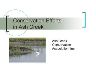
- The barrier spit at St. Mary's-by-the-Sea has been eroding, with a loss of 60 linear feet from 2006-2016. It is projected to disappear entirely by 2036 if changes are not made.
- Fairfield's jetty, marina, and dredging activities since the 1950s have disrupted sand deposits and contributed to erosion of the spit and marshlands.
- Rising sea levels from climate change are also a factor, as the marshland grows taller but cannot keep pace with rising waters. Restoration efforts have been ongoing but dredging activities continue to cause damage.
This document summarizes Gail Robinson's qualifications and marketing strategies for selling homes in Black Rock, Connecticut. Robinson has been the top listing agent in Black Rock since 2007, having sold over 200 homes and $60 million in properties. She uses a variety of online and social media marketing strategies to promote listings to local and outside buyers, including dedicated websites for Black Rock homes and events. Robinson also promotes the Black Rock neighborhood to help buyers understand its features. She provides examples of recent successful Black Rock listings that sold at or above asking price.
The restoration of the Preserve at St. Mary's park involved removing invasive species that comprised 95% of vegetation and planting over 60 native trees and shrubs to restore the park's coastal meadow and forest habitats. The multi-year restoration process was led by the community with support from the city and included extensive planning, fundraising, and volunteer efforts. While over $34,000 has been raised and spent so far, additional planned restoration phases are estimated to cost over $11,000 more than the remaining funds.
The restoration of the Preserve at St. Mary's park began as an effort to remove invasive species overtaking the area and threatening bird habitats. After several years of planning meetings and community involvement led by Pete Spain, the park underwent an organic invasive species management plan and redesign to include pollinator-friendly clover fields and over 60 trees and shrubs of coastal-tolerant species. However, initial plantings faced setbacks from storms and improper care, and future phases of the multi-year restoration plan are currently underfunded.
This document provides information about a real estate agent's expertise in marketing and selling homes in Black Rock, Connecticut. The agent has been the top listing agent in Black Rock since 2007, having listed and sold over 180 homes. The agent promotes listings through dedicated Black Rock real estate websites and social media platforms. High-quality photos and sign riders are also used to market listings. Testimonials are provided showing past Black Rock home sale successes, with many selling at or above list price.
The document is a master plan for the Ash Creek Estuary created by the Ash Creek Conservation Association. It provides an introduction and overview of the study areas within the estuary, describes the existing conditions through maps and images over time, and outlines the methodology used to create the master plan. The goal is to establish a framework to protect this rare urban estuary and the important ecological services it provides to the region.
Assessment and Planning in Educational technology.pptxKavitha Krishnan
In an education system, it is understood that assessment is only for the students, but on the other hand, the Assessment of teachers is also an important aspect of the education system that ensures teachers are providing high-quality instruction to students. The assessment process can be used to provide feedback and support for professional development, to inform decisions about teacher retention or promotion, or to evaluate teacher effectiveness for accountability purposes.
This slide is special for master students (MIBS & MIFB) in UUM. Also useful for readers who are interested in the topic of contemporary Islamic banking.
Strategies for Effective Upskilling is a presentation by Chinwendu Peace in a Your Skill Boost Masterclass organisation by the Excellence Foundation for South Sudan on 08th and 09th June 2024 from 1 PM to 3 PM on each day.
This presentation includes basic of PCOS their pathology and treatment and also Ayurveda correlation of PCOS and Ayurvedic line of treatment mentioned in classics.
Exploiting Artificial Intelligence for Empowering Researchers and Faculty, In...Dr. Vinod Kumar Kanvaria
Exploiting Artificial Intelligence for Empowering Researchers and Faculty,
International FDP on Fundamentals of Research in Social Sciences
at Integral University, Lucknow, 06.06.2024
By Dr. Vinod Kumar Kanvaria
हिंदी वर्णमाला पीपीटी, hindi alphabet PPT presentation, hindi varnamala PPT, Hindi Varnamala pdf, हिंदी स्वर, हिंदी व्यंजन, sikhiye hindi varnmala, dr. mulla adam ali, hindi language and literature, hindi alphabet with drawing, hindi alphabet pdf, hindi varnamala for childrens, hindi language, hindi varnamala practice for kids, https://www.drmullaadamali.com
বাংলাদেশের অর্থনৈতিক সমীক্ষা ২০২৪ [Bangladesh Economic Review 2024 Bangla.pdf] কম্পিউটার , ট্যাব ও স্মার্ট ফোন ভার্সন সহ সম্পূর্ণ বাংলা ই-বুক বা pdf বই " সুচিপত্র ...বুকমার্ক মেনু 🔖 ও হাইপার লিংক মেনু 📝👆 যুক্ত ..
আমাদের সবার জন্য খুব খুব গুরুত্বপূর্ণ একটি বই ..বিসিএস, ব্যাংক, ইউনিভার্সিটি ভর্তি ও যে কোন প্রতিযোগিতা মূলক পরীক্ষার জন্য এর খুব ইম্পরট্যান্ট একটি বিষয় ...তাছাড়া বাংলাদেশের সাম্প্রতিক যে কোন ডাটা বা তথ্য এই বইতে পাবেন ...
তাই একজন নাগরিক হিসাবে এই তথ্য গুলো আপনার জানা প্রয়োজন ...।
বিসিএস ও ব্যাংক এর লিখিত পরীক্ষা ...+এছাড়া মাধ্যমিক ও উচ্চমাধ্যমিকের স্টুডেন্টদের জন্য অনেক কাজে আসবে ...
2. Our Mission
To preserve and protect one of the few
remaining tidal estuaries in an urban area in
the United States that provides an important
habitat for migratory shorebirds, oysters and
other shellfish, and an opportunity to
educate the public about this amazing,
fragile, and extraordinarily beautiful
ecosystem which has been self restoring
itself for more than 50 years.
3. Our Objectives - #1
To educate the public and
Bridgeport/Fairfield residents of the
significance of tidal estuaries such as Ash
Creek in their crucial role as delicate
environments for the maintenance of bird,
fish, and plant life
4. Our Objectives - #2
To educate about the potential source of
pollutants whenever there is human activity
in the area. For example, marinas and boat
usage increase toxins, affect nutrients, and
have an impact on the ecology of the Creek.
5. Our Objectives - #3
To advocate for the restoration and
protection of the Ash Creek tidal estuary
from ill-planned encroachments and
development which could significantly harm
the ecological balance of nature in the area.
6. Our Objectives - #4
To work for identification and designation
of especially sensitive areas in the Ash
Creek tidal estuary for special protection.
7. Our Objectives - #5
Obtaining designation of the Ash Creek
estuary as an Important Birding Area
(IBA).
8. Our Objectives - #6
To develop sites and a trail along the Ash
Creek tidal estuary for visitor observations of
the variety of species of birds that visit and
nest there each year.
9. Our Objectives - #7
To encourage ecologically friendly uses of
Ash Creek and aesthetic enjoyment for the
people who live, work, and play in and
around it, including kayaking, canoeing, bird
watching, photography, painting, walking or
hiking and discourage destructive uses of
Ash Creek, including power boating and
docks.
10. History and Background
To understand our organization’s mission
and objectives, we need to take quick trip
back in time to the early 1900’s…
11. Ash Creek Wasn’t Valued in the Past
“Upriver to the Post Road bridge, is an
estuary-traversed marsh, of no good to
anyone. If this area could either be made
into a safe inland pond or a suitable yacht
basin, people innumerable, from both
neighboring communities would be
benefited.”
Bridgeport Telegram, 1952
12. Notice that the tidal wetlands have
been eradicated completely…
Great Marsh Island as a
“Rich Man’s Paradise”
15. First Ash Creek Association
Formed in 1967 to preserve natural
shoreline of Ash Creek and prevent fill and
water pollution, preserve the remaining
marshlands as a home for wildlife
They were catalyzed into action by a zoning
permit on Livingston Avenue to fill in part of
Ash Creek
Gathered the support of legislators and
conservation groups throughout state
16. The first Ash Creek clean up…
Removed 28 Tons of Trash from Ash Creek
18. We Owe a Lot to Their Efforts
Active for about 20 years (1967 to 1987)
Like us they…
Worked closely with the Connecticut Audubon
Society and CT Conservation Association
Fought long legal battles with state agencies
Without their efforts, we would not
have an Ash Creek to protect today
19. Thanks to Their Efforts
Ash Creek is one of the last healthy tidal
estuaries in an urban area in the United
States
It has been self-restoring itself for the
past 50 years because of the clean ups and
prevention of fills & development
Serves as a defacto wildlife sanctuary for
nesting and migratory birds, shellfish, and
finfish
20. Did You Know…
Ash Creek is one of the key stopover areas
on the Eastern seaboard for palearctic
shorebirds
Some migrate from the Arctic Circle to
Argentina
Mudflats provide the food
Natural surroundings provide rest – afraid of
docks and development
Ash Creek is one of the last 15 stopovers for
migratory shorebirds left in Connecticut
21. Did You Know…
Oysters have a high mortality rate – easily
smothered by silt stirred up by powerboats
Commercial oyster growers rely on Ash
Creek for seed oysters – very rare to find
shallow water oyster bed – Bureau of
Aquaculture considers Ash Creek to be a
precious resource for seed oysters
Lower part of Ash Creek is a
state designated natural oyster bed
22. Present Ash Creek Association
16 year interval between associations
April 2003, the Ash Creek Conservation
Association (ACCA) was formed
The group was catalyzed into organizing by
Ganim’s plan for a 50’ dock on Ash Creek
ACCA believed the delicate ecological balance that
exists in lower Ash Creek could be disrupted by the
presence of docks and powerboat activity
23. Why We Fight Docks in Ash Creek
Shoreline equivalent of urban sprawl –
development destroys the fringing tidal wetlands
and the natural beauty we all enjoy
Given the shallowness and small size of this tidal
estuary, the impact of powerboats have more
impact than in other settings
Presence of manmade structures along with noise
and motion from powerboats disturb migratory and
nesting birds
24. Dock Accomplishments
Reduced Ganim 50’ dock to 31’
Reduced Mears 85’ dock to 35’
DEP initially denied 60’ Toner dock and
made a historic ruling that the DEP must
now consider the use of docks in making its
decisions, i.e. powerboat usage
Update: after denying dock as a result of DEP
Adjudication Hearing process, DEP agreed to go to
mediation with Toner and allowed the 60’ dock
25. Other Accomplishments…
Great Marsh Island ownership transferred from
developers to land trust & open space
Prevented utility bridge across Ash Creek (cables
went underground)
Habitat repair of Ash Creek sand spit after dredging
destroyed vegetation, ACCA volunteers planted
32,000 beach grass plugs
Ash Creek Clean Ups – Spring & Fall since 2003
Appointed to Rooster River Watershed Steering
Committee (2013) & Fox Street Pedestrian Bridge
Committee (2013)
26. Ash Creek Master Plan…
86-page Ecological Master Plan developed for the Ash
Creek Tidal Estuary in 2012 by Steven Danzer, Ph.D., who
has his doctorate in Natural Resources and is also a Soil
Scientist as well as Professional Wetland Scientist and Bryan
Quinn, RLA of One Nature, LLC, ecological services and
design. Provides scientific data and ecological
recommendations. Funding for this project was provided by:
The Watershed Assistance Small Grants Program, conducted in association with
the Connecticut Department of Energy & Environmental Protection under
Section 319 of the Clean Water Act. The small grants program is administered by
Rivers Alliance of Connecticut.
The Fairfield County Community Foundation
In-kind donations from Dr. Steven Danzer and Bryan Quinn, RLA
27. Events Sponsored in 2013…
March 4 – Ecohistory of Ash Creek (using aerial
photos from 1938 to the present scientific investigators
will discuss the changes to Ash Creek over the years
based on historical records)
April 20 – Spring Clean Up of Ash Creek
September 21- Fall Clean Up at Ash Creek
October 6– Audubon Bird Walk at Ash Creek –
migratory shorebirds and birds of Ash Creek
28. Events Sponsored in 2012…
April 7– Spring Clean Up at Ash Creek
October 6– Fall Clean Up at Ash Creek
December 5– Ecological Master Plan for Ash Creek -
Two ecological consultants presented the their findings
and recommendations - Steven Danzer, Ph.D., a Soil
Scientist as well as Professional Wetland Scientist &
Bryan Quinn, RLA of One Nature, LLC, ecological
services and design. Funding for this project was
provided by:
The Watershed Assistance Small Grants Program, conducted in association with
the Connecticut Department of Energy & Environmental Protection under Section
319 of the Clean Water Act. The small grants program is administered by Rivers
Alliance of Connecticut.
The Fairfield County Community Foundation
In-kind donations from Dr. Steven Danzer and Bryan Quinn, RLA
29. Events Sponsored in 2011…
April 9 – Spring Clean Up at Ash Creek
September 17 – Fall Clean Up at Ash Creek
October 19 – Why Ash Creek Matters at
Fayerweather Yacht Club, discussion forum with Milan
Bull (Senior Director of Science & Conservation at
Connecticut Audubon), Dr. Jennifer Mattei (Professor of
Biology at Sacred Heart University), and Dr. Steve
Danzer (soil and wetlands scientist). Panel was
moderated by Dr. Kraig Steffen of Fairfield University
(Vice President of the Ash Creek Conservation
Association)
30. Events Sponsored in 2010…
February 28 – New Neighbors Social at the
Fayerweather Yacht Club, Speaker: Lisa Miro,
Conservation Director for City of Bridgeport
March 27– Spring Clean Up at Ash Creek
August 19 – Great Marsh Island Shorebird Hike at
Ash Creek (with Aspetuck Land Trust & led by Milan
Bull of CT Audubon)
September 25 – Fall Clean Up at Ash Creek
31. Events Sponsored in 2009…
March 15 – New Neighbors Social at the
Fayerweather Yacht Club
April 18 - Beach Grass Plantings at Ash Creek
May 12 – Audubon Bird Walk at Ash Creek with Milan
Bull
May 16 – Clean Up at Ash Creek
July 18 – Victory Party at Harborview Market
September 19 - Clean Up at Ash Creek
November 18 – Fall Event at Fayerweather Yacht Club
w. Prof. Mark Beekey, Sacred Heart University on
horseshoe crabs & migratory shorebirds
32. Events Sponsored in 2008…
February 2 – New Neighbors Social at the
Fayerweather Yacht Club featuring Charles Brilvitch on
the history of Black Rock
April 26 – Spring Clean Up at Ash Creek
May 15 – Audubon Bird Walk at Ash Creek with Milan
Bull
May 17 – Project Limulus at Ash Creek
September 20 – Fall Clean Up at Ash Creek
October 7 – Public Hearing on Toner Dock
October 25 – Beach Grass Plantings at sand spit
33. Events Sponsored in 2007…
March 19 – Ash Creek/Rooster River Watershed
seminar presented by Professor Kraig Steffen, Fairfield
University at Black Rock Arts Center
March 21 – Ash Creek/Rooster River Watershed
seminar presented by Professor Kraig Steffen, Fairfield
University at Connecticut Audubon Society in Fairfield
March 24 – New Neighbors Social at the Fayerweather
Yacht Club featuring Charles Brilvitch on the history of
Black Rock
May 5 – Spring Clean Up of Ash Creek
July 26 – Audubon Bird Walk with Milan Bull
34. Events Sponsored in 2006…
January 28 – New Neighbors Social at the Fayerweather Yacht
Club featuring Dr. Art Samuelson on the history of Black Rock.
March 27 – Backyard Birding & the Ash Creek Ecosystem by
Professor Tod Osier from Fairfield University
April 29 – Spring Clean Up of Ash Creek
June 17 – Great Marsh Island Celebration for the preservation of
Great Marsh Island by the Aspetuck Land Trust and Town of
Fairfield with refreshments and a walking tour of Ash Creek led by
Milan Bull.
October 6 – Utility Bridge public meeting with CL&P and Black
Rock/Fairfield community. Slide show and mock ups by CL&P.
Slide show by ACCA. Q&A followed.
September 16 – Fall Clean Up of Ash Creek
November 13 - DEP Public Hearing on Utility Bridge
December 5 – Victory Party at Harborview for Utility Bridge
35. Events Sponsored in 2005…
January 27 - Winged Migration large screen showing of DVD at
Connecticut Audubon Society Center in Fairfield – open to public
April 30 – Spring Clean Up of Ash Creek -for the first year the
clean up on both sides of Ash Creek was coordinated
September 7 – Bird Tour of Ash Creek was held at 7 PM along
Ash Creek by Professor Kraig Steffen
September 17 - Walking Tour of Historical Black Rock and
Black Rock's maritime past by Charles Brilvitch will be held at 1
PM this Saturday starting at Harborview Market
September 24 – Fall Clean Up of Ash Creek which we also
coordinated with Mill River Wetlands Committee
36. Events Sponsored in 2004…
January 23 – Coastal Habitat Restoration in Black Rock –
presentation by Charles Brilvitch at Burroughs Community Center
March 18– Establishing National Wildlife Refuges in
Connecticut presentation by William Kolodnicki, Refuge
Manager, Stewart B. McKinney National Wildlife Refuge
(USFWS) at Burrough Community Center
April 24 – Spring Clean Up of Ash Creek
September 18 – Fall Clean Up of Ash Creek
November 19 – Ash Creek’s Importance as a Migratory
Flyway presentation by Milan Bull of Connecticut Audubon
Society at Burroughs Community Center
37. Events Sponsored in 2003…
April 19 – Spring Clean Up of Ash Creek
June 10 – Ash Creek Tidal Estuary as a Habitat for Nesting
and Migratory Shorebird presentation by Milan Bull, CT
Audubon, and Ecological History of Ash Creek presentation by
Ed Jones, Fairfield Department of Conservation, at Burrough
Community Center
September 13 – Ash Creek Bird Walk led by Milan Bull, CT
Audubon
October 18 – Ash Creek Photography Exhibit & Sale -
fundraiser at Burroughs Community Center
38. Grants Received in 2012
2012 – $5,000 Fairfield County Community Foundation Grant for
Phase I of Ecological Master Plan for Ash Creek.
2012 – $5,000 The Watershed Assistance Small Grants Program,
conducted in association with the Connecticut Department of Energy
& Environmental Protection under Section 319 of the Clean Water
Act. The small grants program was administered by Rivers Alliance
of Connecticut. Grant for Phase I of Ecological Master Plan for Ash
Creek.
2012 - In-kind donations have also been provided by two ecological
consultants: Steve Danzer of Steven Danzer Ph.D. & Associates
LLC, a professional wetlands scientist, and Bryan Quinn, a
specialist in ecological habitat restoration for Phase I of Ecological
Master Plan for Ash Creek.
39. Grants Received in 2004
2004 – $5,000 The Watershed Assistance Small Grants
Program, conducted in association with the Connecticut
Department of Energy & Environmental Protection under
Section 319 of the Clean Water Act. The small grants
program was administered by Rivers Alliance of Connecticut.
Grant for public watershed education of Rooster River/Ash Creek
watershed
RESULT – Created public watershed education road show with
PowerPoint presentation and handouts, including information on
stormwater runoff and what residents can do to prevent further
pollution. Program was readapted for use at St. Ann’s School in Black
Rock.
40. Grants Received in 2003
2003 – $2,000 NE Grassroots Environmental Fund to organize
and participate in DEP hearings against the construction of a 50’
dock in the Ash Creek Tidal Estuary
RESULT – Precedent setting ruling by DEP to not only reduce size of
dock, but to allow window of time during high tide when boat is allowed
to access the dock
53. Click here to go to
Ash Creek YouTube videos
Ash Creek YouTube Videos
54. Click here to become a fan
Ash Creek FaceBook Page
55. Key ACCA Presentations…
Ecohistory of Ash Creek
Ash Creek Master Plan
It’s not too late to download the
presentations in video or PDF
format, see next two slides
56. Ecohistory of Ash Creek
Video of presentation Ecohistory of Ash Creek – Part I & Part II
57. Ash Creek Master Plan 2012
86-page scientific study of Ash Creek – 2012
(Available for download: Ash Creek Tidal Estuary Master Plan )