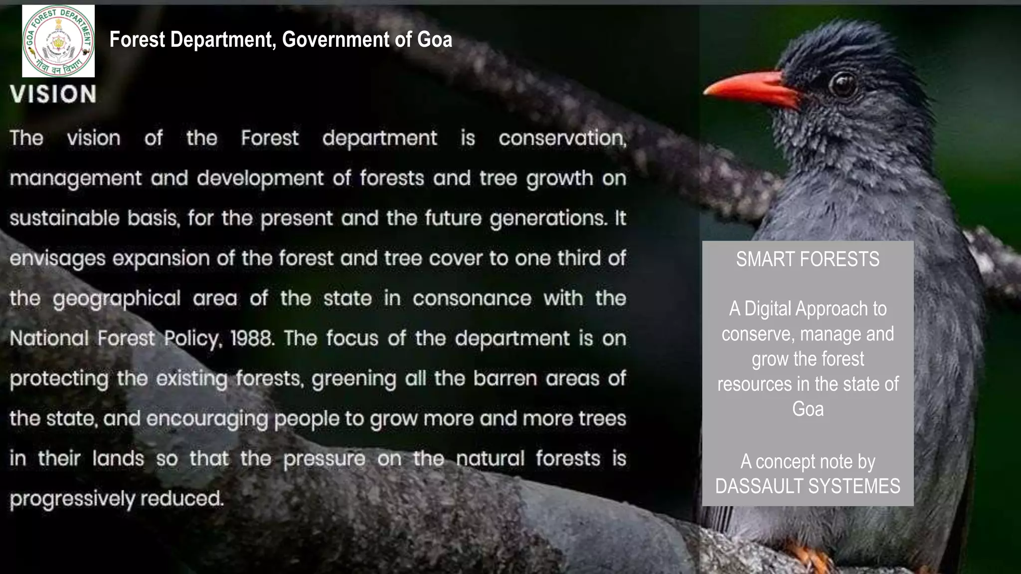
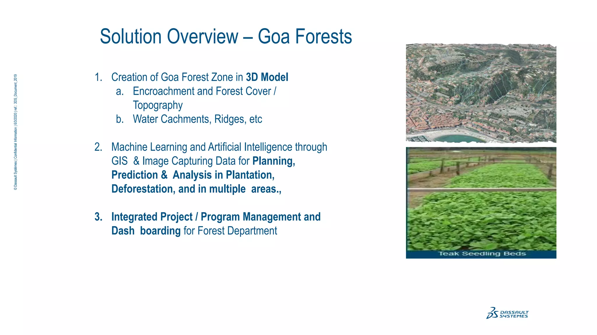
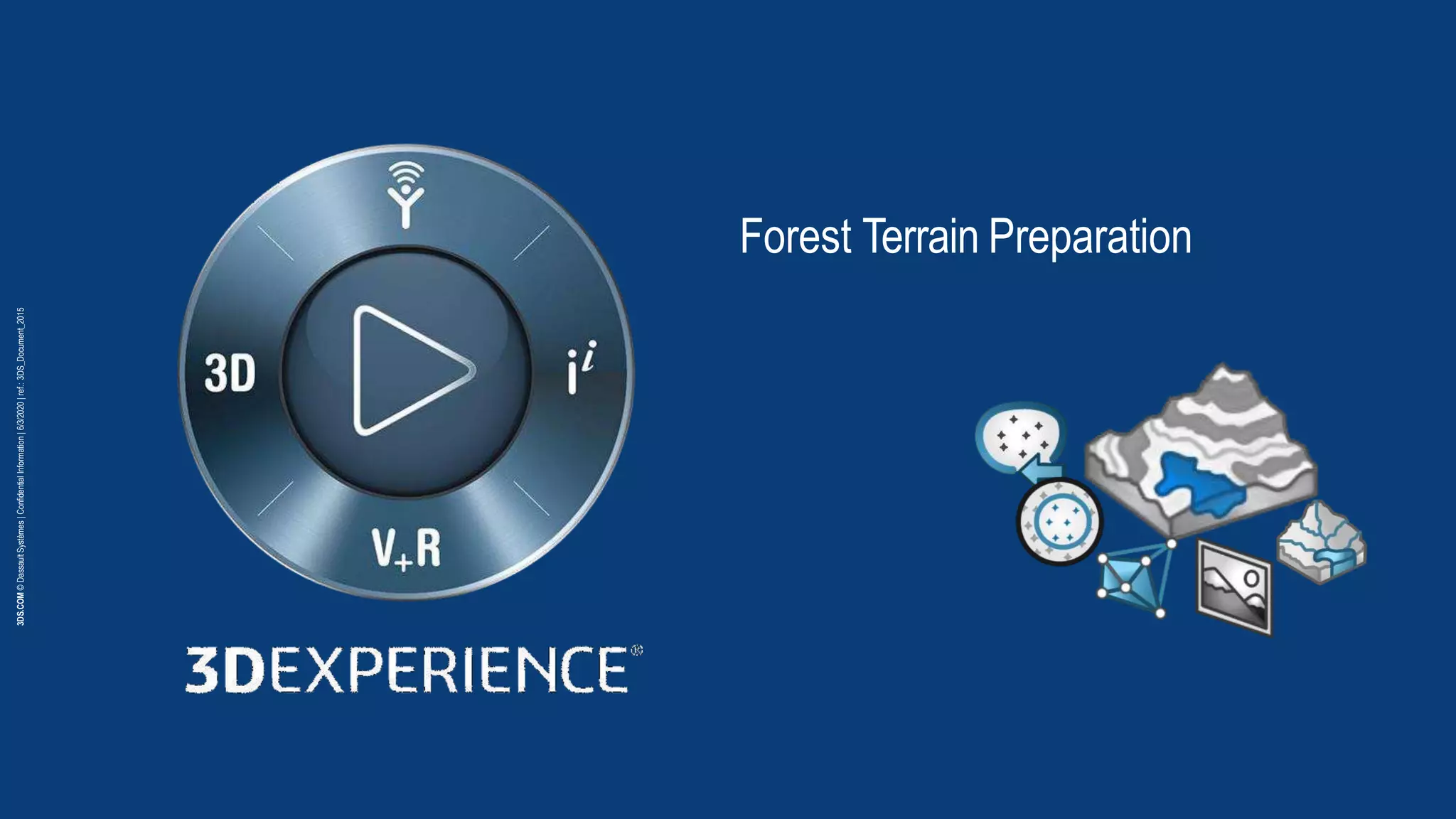
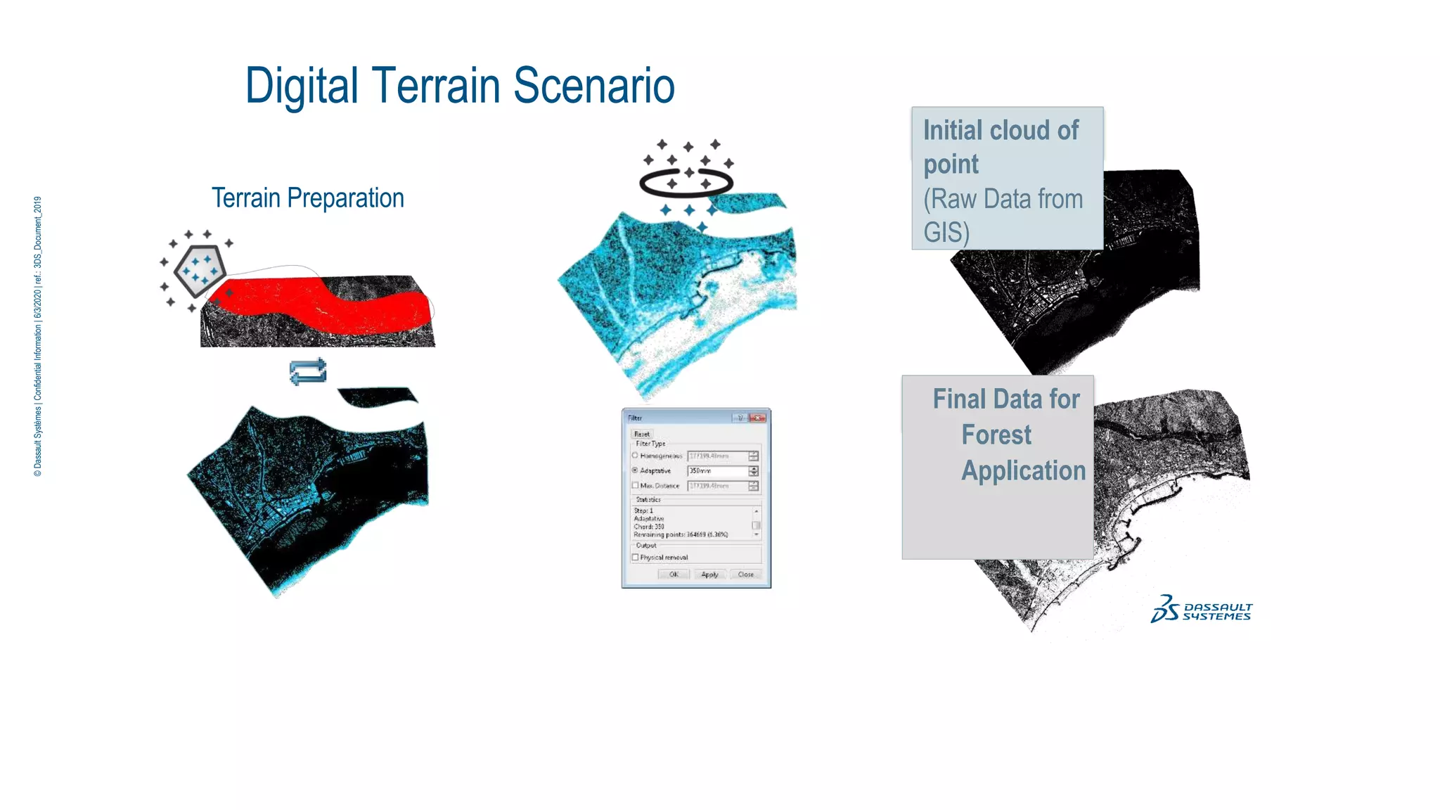
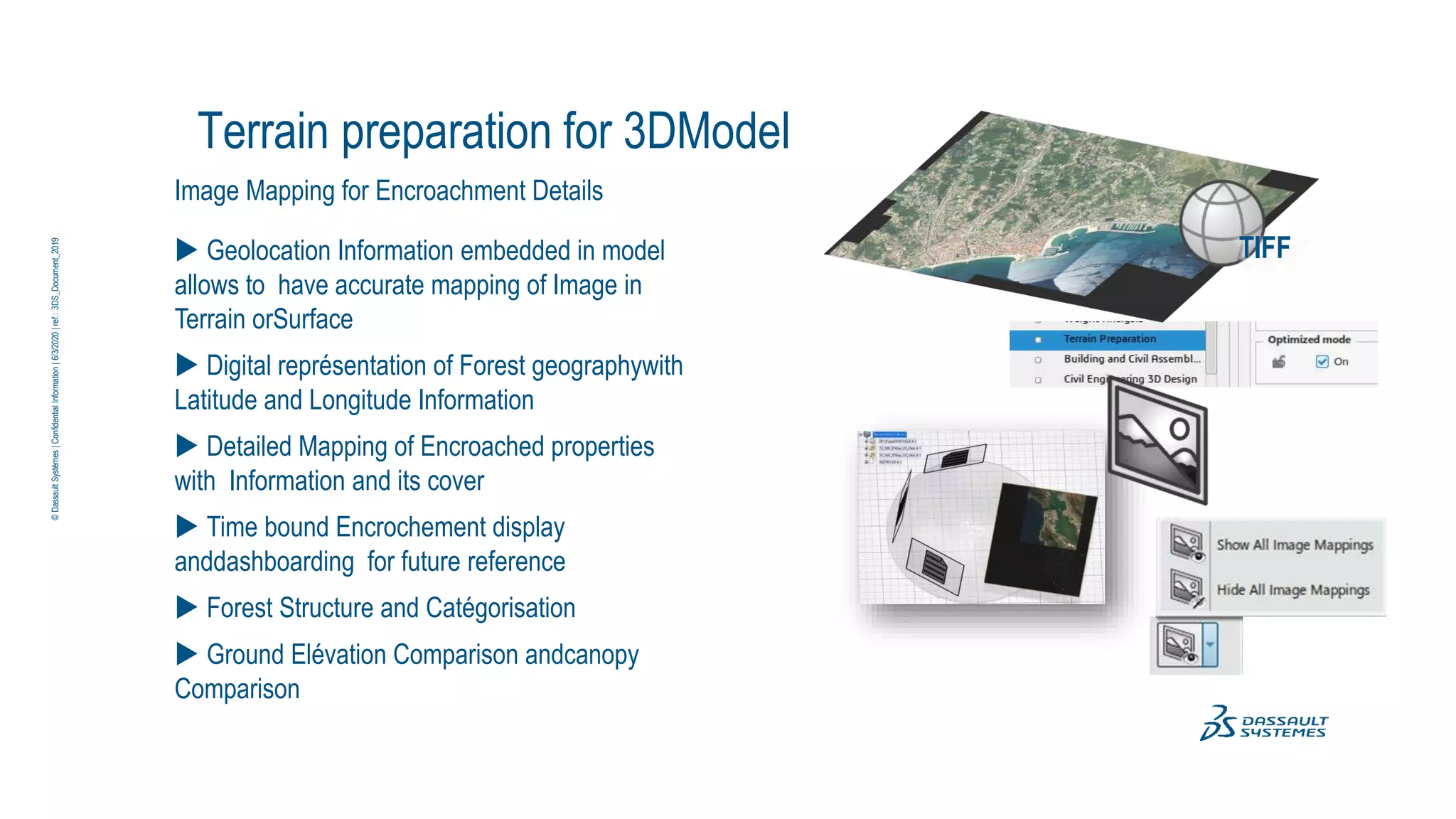
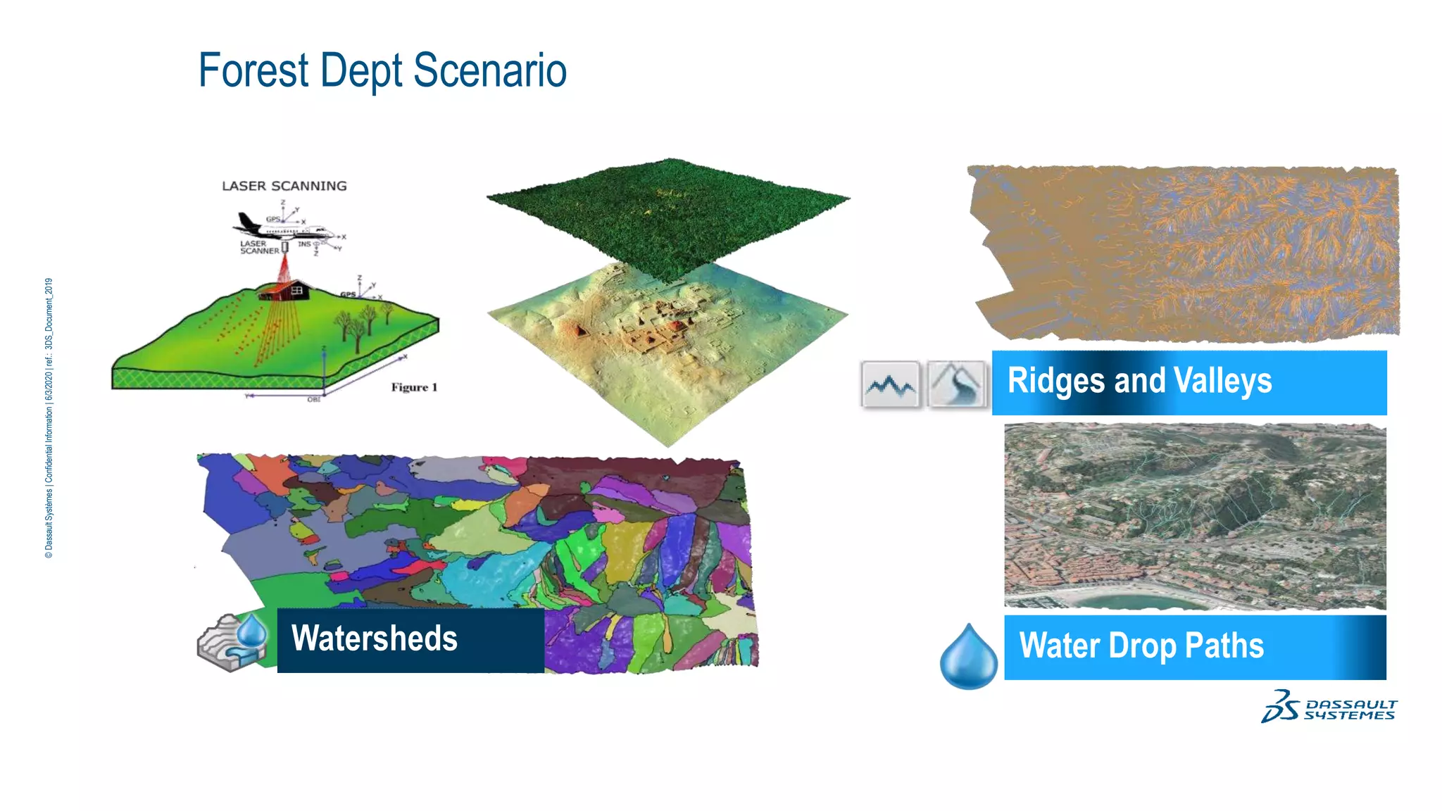
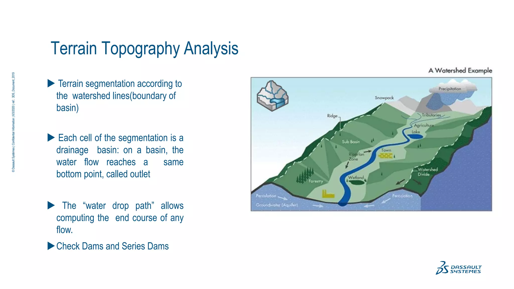
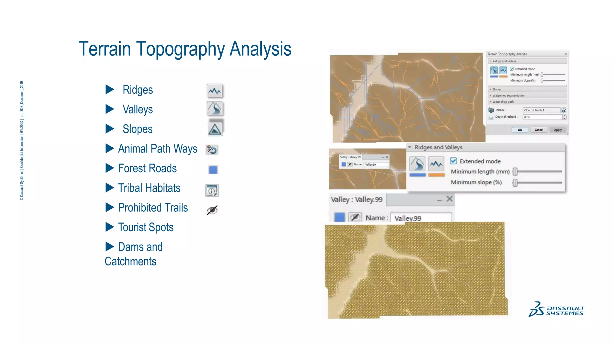
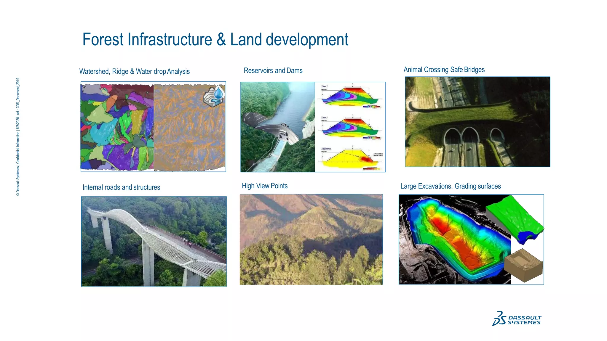
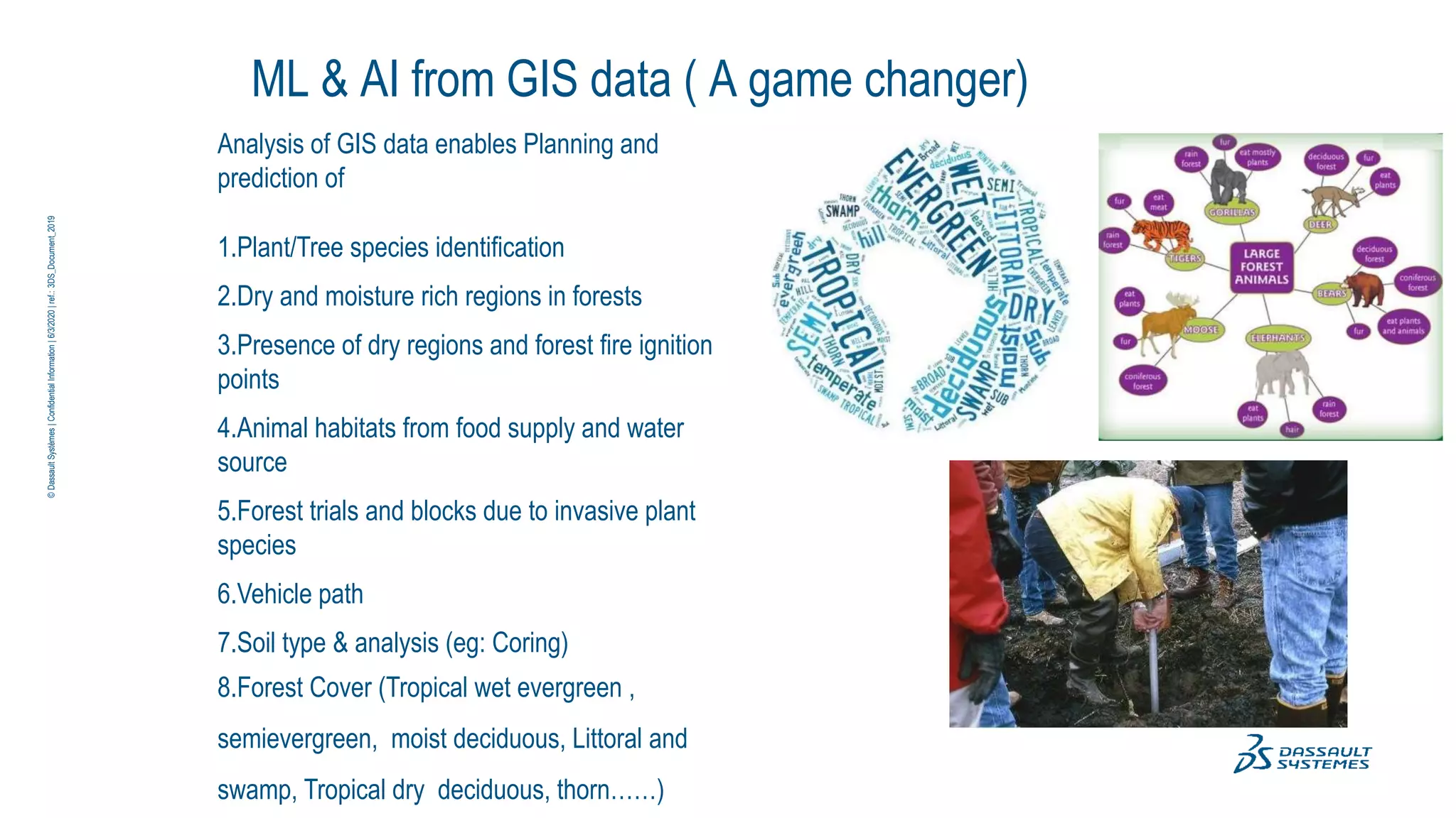
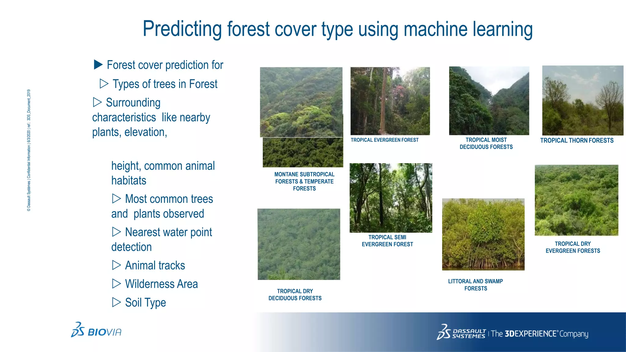
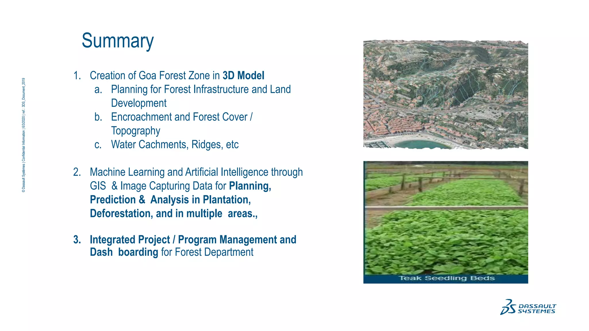
10
2
_t
n
e
m
uc
oD
_S
D3
:.
fe
r|
02
02
/3
/6
|io
n
ta
mr
of
nI
ita
l
n
ifd
e
no
C|
s
e
m
èt
sy
S
lut
as
sa
D
©
SMART FORESTS
A Digital Approach to
conserve, manage and
grow the forest
resources in the state of
Goa
A concept note by
DASSAULT SYSTEMES
Forest Department, Government of Goa
a Scientific
company
Combining
Science,
17,000
230,000 customers
•11 industries in 140 countries
•25 million users
Long-term
Technology and Art for a passionate people
sustainable society
•130 nationalities
•179 sites
•One global R&D / 64 labs
•Game changing
3DEXPERIENCE solutions
•
•
12,600
partners
•Software, Technology &
Architecture
•Content & Online Services
•Sales
•Consulting & SI
•Education Research
driven
•Majority shareholder control
•Revenue: €3,488 million*
•Operating margin: 31,8%*
* Figures as of FY 2018 /Non-IFRS
©
Dassault
Systèmes
|
Confidential
Information
|
6/3/2020
|
ref.:
3DS_Document_2019
Solution Overview – Goa Forests
1. Creation of Goa Forest Zone in 3D Model
a. Encroachment and Forest Cover /
Topography
b. Water Cachments, Ridges, etc
2. Machine Learning and Artificial Intelligence through
GIS & Image Capturing Data for Planning,
Prediction & Analysis in Plantation,
Deforestation, and in multiple areas.,
3. Integrated Project / Program Management and
Dash boarding for Forest Department
©
Dassault
Systèmes
|
Confidential
Information
|
6/3/2020
|
ref.:
3DS_Document_2019
3DS.COM
©
Dassault
Systèmes
|
Confidential
Information
|
6/3/2020
|
ref.:
3DS_Document_2015
Forest Terrain Preparation
Initial cloud of
point
(Raw Data from
GIS)
Digital Terrain Scenario
Terrain Preparation
Final Data for
Forest
Application
©
Dassault
Systèmes
|
Confidential
Information
|
6/3/2020
|
ref.:
3DS_Document_2019
Terrain preparation for 3DModel
Image Mapping for Encroachment Details
 Geolocation Information embedded in model
allows to have accurate mapping of Image in
Terrain orSurface
 Digital représentation of Forest geographywith
Latitude and Longitude Information
 Detailed Mapping of Encroached properties
with Information and its cover
 Time bound Encrochement display
anddashboarding for future reference
 Forest Structure and Catégorisation
 Ground Elévation Comparison andcanopy
Comparison
TIFF
©
Dassault
Systèmes
|
Confidential
Information
|
6/3/2020
|
ref.:
3DS_Document_2019
©
Dassault
Systèmes
|
Confidential
Information
|
6/3/2020
|
ref.:
3DS_Document_2019
Forest Dept Scenario
Ridges and Valleys
Watersheds Water Drop Paths
Terrain Topography Analysis
 Terrain segmentation according to
the watershed lines(boundary of
basin)
 Each cell of the segmentation is a
drainage basin: on a basin, the
water flow reaches a same
bottom point, called outlet
 The “water drop path” allows
computing the end course of any
flow.
Check Dams and Series Dams
©
Dassault
Systèmes
|
Confidential
Information
|
6/3/2020
|
ref.:
3DS_Document_2019
Terrain Topography Analysis
 Ridges
 Valleys
 Slopes
 Animal Path Ways
 Forest Roads
 Tribal Habitats
 Prohibited Trails
 Tourist Spots
 Dams and
Catchments
©
Dassault
Systèmes
|
Confidential
Information
|
6/3/2020
|
ref.:
3DS_Document_2019
Forest Infrastructure & Land development
Watershed, Ridge & Water dropAnalysis Reservoirs and Dams Animal Crossing Safe Bridges
Internal roads and structures High View Points Large Excavations, Grading surfaces
©
Dassault
Systèmes
|
Confidential
Information
|
6/3/2020
|
ref.:
3DS_Document_2019
ML & AI from GIS data ( A game changer)
Analysis of GIS data enables Planning and
prediction of
1.Plant/Tree species identification
2.Dry and moisture rich regions in forests
3.Presence of dry regions and forest fire ignition
points
4.Animal habitats from food supply and water
source
5.Forest trials and blocks due to invasive plant
species
6.Vehicle path
7.Soil type & analysis (eg: Coring)
8.Forest Cover (Tropical wet evergreen ,
semievergreen, moist deciduous, Littoral and
swamp, Tropical dry deciduous, thorn……)
©
Dassault
Systèmes
|
Confidential
Information
|
6/3/2020
|
ref.:
3DS_Document_2019
Predicting forest cover type using machine learning
 Forest cover prediction for
 Types of trees in Forest
 Surrounding
characteristics like nearby
plants, elevation,
height, common animal
habitats
 Most common trees
and plants observed
 Nearest water point
detection
 Animal tracks
 Wilderness Area
 Soil Type
MONTANE SUBTROPICAL
FORESTS & TEMPERATE
FORESTS
TROPICAL DRY
DECIDUOUS FORESTS
TROPICAL EVERGREEN FOREST
TROPICAL SEMI
EVERGREEN FOREST
TROPICAL MOIST
DECIDUOUS FORESTS
LITTORAL AND SWAMP
FORESTS
TROPICAL THORNFORESTS
TROPICAL DRY
EVERGREEN FORESTS
©
Dassault
Systèmes
|
Confidential
Information
|
6/3/2020
|
ref.:
3DS_Document_2019
Observing plant growth status
(Seed Variability & Sapling Analysis)
 Monitor plant growth status
 Monitor growth of plants/seedlings prior to transfer into
forest
 Nutrients and fertilizers effects on growth
 Predict growth with/out fertilizers and nutrients
 Monitor pest and disease attack
 Enhancing growth with distance monitoring
 Weed detection & control
 Test genetic variants to maximize productivity
©
Dassault
Systèmes
|
Confidential
Information
|
6/3/2020
|
ref.:
3DS_Document_2019
Plant/Tree yield predictions and analytics
• In India stem analysis has been done
extensively to study individual tree growth.
Stem and stump analysis conducted for an
average quality.
• Quality of teak and harvest
• Stem size and quality of wood
• Micro and macro nutrient for sustainable
growth
©
Dassault
Systèmes
|
Confidential
Information
|
6/3/2020
|
ref.:
3DS_Document_2019
Monitor and manage forest assets and operations
Zone Analysis , Change Detection & Manage
Forest Health
•Disease Impact Assessment in Forests.
• Beetles.
• Algedonia bambucivora Pupae on
bamboo leaves
• Stem Borer teak
•Detect and Analyze change Over Time on
yearly coverage.
•Disasters Impact Assessment (wildfires,
flooding, landslide, Tsunami (mangroves)…)
©
Dassault
Systèmes
|
Confidential
Information
|
6/3/2020
|
ref.:
3DS_Document_2019
Detect deforestation and changes in land use
• Deforestation Activity
• Track illegal events, such as large-
scale
deforestation
• Change in Land Cover
Periodically
• Identify Patterns of
Deforestation
Deforestation events greater than 1 hectare detected in
Pará Brazil from July to September, 2017
Deforestation events greater than 1 hectare detected in
Pará Brazil from July to September, 2017
Deforestation events greater than 1 hectare
detected in Pará Brazil from July to September,
2017
Selective logging and new roads detected in DRC in
2018.
©
Dassault
Systèmes
|
Confidential
Information
|
6/3/2020
|
ref.:
3DS_Document_2019
Early Forest Fire Detection and Verification using
Optical Smoke, Gas & Sensors
• Meteorology
• Prediction Of Forest Fire.
• Assessing Heat Waves
• Video and image Analysis
• Early Detection of Fires
• Precise Location of Fire Starts
• Transmission of Alerts AndImages
• Control System for Human Confirmation
on FireAlert
• security and system availability
©
Dassault
Systèmes
|
Confidential
Information
|
6/3/2020
|
ref.:
3DS_Document_2019
Invasive Plant Species Identification & Tracking
• Detect spread of the shrub in dense
thornythickets
• Remove choking of other plant species
• Clear obstruction of movement of wildlife
• Provide updated maps of the distribution of
invasive plants
• Identify and clear structural traits – such as
clumping
• Identify clumping image learning methods
©
Dassault
Systèmes
|
Confidential
Information
|
6/3/2020
|
ref.:
3DS_Document_2019
©
Dassault
Systèmes
|
Confidential
Information
|
6/3/2020
|
ref.:
3DS_Document_2019
Reporting & Dashboarding
©
Dassault
Systèmes
|
Confidential
Information
|
6/3/2020
|
ref.:
3DS_Document_2019
Data Capturing – GIS and Surveillance
GIS Capturing
• Satellite Image capturing to build the 3D model of Forest
 Stereo Satellite Imagery
 Multi Spectral / Hyper spectral Imagery
• Aerial LIDAR – 1500 Sq.Km
• Mobile Mapping – 1000 Linear Km
Surveillance Camera
• To identify high proximity zone - 2000
 Forest Fire
 Man Animal Conflict
 Plantation areas
©
Dassault
Systèmes
|
Confidential
Information
|
6/3/2020
|
ref.:
3DS_Document_2019
Summary
1. Creation of Goa Forest Zone in 3D Model
a. Planning for Forest Infrastructure and Land
Development
b. Encroachment and Forest Cover /
Topography
c. Water Cachments, Ridges, etc
2. Machine Learning and Artificial Intelligence through
GIS & Image Capturing Data for Planning,
Prediction & Analysis in Plantation,
Deforestation, and in multiple areas.,
3. Integrated Project / Program Management and
Dash boarding for Forest Department
Dassault
Systèmes
|
Confidential
Information
|
6/3/2020
|
ref.:
3DS_Document_2019

Concept Note_Forest Department_Goa_Dec 2020.pptx

  • 1.
    10 2 _t n e m uc oD _S D3 :. fe r| 02 02 /3 /6 |io n ta mr of nI ita l n ifd e no C| s e m èt sy S lut as sa D © SMART FORESTS A DigitalApproach to conserve, manage and grow the forest resources in the state of Goa A concept note by DASSAULT SYSTEMES Forest Department, Government of Goa
  • 2.
    a Scientific company Combining Science, 17,000 230,000 customers •11industries in 140 countries •25 million users Long-term Technology and Art for a passionate people sustainable society •130 nationalities •179 sites •One global R&D / 64 labs •Game changing 3DEXPERIENCE solutions • • 12,600 partners •Software, Technology & Architecture •Content & Online Services •Sales •Consulting & SI •Education Research driven •Majority shareholder control •Revenue: €3,488 million* •Operating margin: 31,8%* * Figures as of FY 2018 /Non-IFRS © Dassault Systèmes | Confidential Information | 6/3/2020 | ref.: 3DS_Document_2019
  • 3.
    Solution Overview –Goa Forests 1. Creation of Goa Forest Zone in 3D Model a. Encroachment and Forest Cover / Topography b. Water Cachments, Ridges, etc 2. Machine Learning and Artificial Intelligence through GIS & Image Capturing Data for Planning, Prediction & Analysis in Plantation, Deforestation, and in multiple areas., 3. Integrated Project / Program Management and Dash boarding for Forest Department © Dassault Systèmes | Confidential Information | 6/3/2020 | ref.: 3DS_Document_2019
  • 4.
  • 5.
    Initial cloud of point (RawData from GIS) Digital Terrain Scenario Terrain Preparation Final Data for Forest Application © Dassault Systèmes | Confidential Information | 6/3/2020 | ref.: 3DS_Document_2019
  • 6.
    Terrain preparation for3DModel Image Mapping for Encroachment Details  Geolocation Information embedded in model allows to have accurate mapping of Image in Terrain orSurface  Digital représentation of Forest geographywith Latitude and Longitude Information  Detailed Mapping of Encroached properties with Information and its cover  Time bound Encrochement display anddashboarding for future reference  Forest Structure and Catégorisation  Ground Elévation Comparison andcanopy Comparison TIFF © Dassault Systèmes | Confidential Information | 6/3/2020 | ref.: 3DS_Document_2019
  • 7.
  • 8.
    Terrain Topography Analysis Terrain segmentation according to the watershed lines(boundary of basin)  Each cell of the segmentation is a drainage basin: on a basin, the water flow reaches a same bottom point, called outlet  The “water drop path” allows computing the end course of any flow. Check Dams and Series Dams © Dassault Systèmes | Confidential Information | 6/3/2020 | ref.: 3DS_Document_2019
  • 9.
    Terrain Topography Analysis Ridges  Valleys  Slopes  Animal Path Ways  Forest Roads  Tribal Habitats  Prohibited Trails  Tourist Spots  Dams and Catchments © Dassault Systèmes | Confidential Information | 6/3/2020 | ref.: 3DS_Document_2019
  • 10.
    Forest Infrastructure &Land development Watershed, Ridge & Water dropAnalysis Reservoirs and Dams Animal Crossing Safe Bridges Internal roads and structures High View Points Large Excavations, Grading surfaces © Dassault Systèmes | Confidential Information | 6/3/2020 | ref.: 3DS_Document_2019
  • 11.
    ML & AIfrom GIS data ( A game changer) Analysis of GIS data enables Planning and prediction of 1.Plant/Tree species identification 2.Dry and moisture rich regions in forests 3.Presence of dry regions and forest fire ignition points 4.Animal habitats from food supply and water source 5.Forest trials and blocks due to invasive plant species 6.Vehicle path 7.Soil type & analysis (eg: Coring) 8.Forest Cover (Tropical wet evergreen , semievergreen, moist deciduous, Littoral and swamp, Tropical dry deciduous, thorn……) © Dassault Systèmes | Confidential Information | 6/3/2020 | ref.: 3DS_Document_2019
  • 12.
    Predicting forest covertype using machine learning  Forest cover prediction for  Types of trees in Forest  Surrounding characteristics like nearby plants, elevation, height, common animal habitats  Most common trees and plants observed  Nearest water point detection  Animal tracks  Wilderness Area  Soil Type MONTANE SUBTROPICAL FORESTS & TEMPERATE FORESTS TROPICAL DRY DECIDUOUS FORESTS TROPICAL EVERGREEN FOREST TROPICAL SEMI EVERGREEN FOREST TROPICAL MOIST DECIDUOUS FORESTS LITTORAL AND SWAMP FORESTS TROPICAL THORNFORESTS TROPICAL DRY EVERGREEN FORESTS © Dassault Systèmes | Confidential Information | 6/3/2020 | ref.: 3DS_Document_2019
  • 13.
    Observing plant growthstatus (Seed Variability & Sapling Analysis)  Monitor plant growth status  Monitor growth of plants/seedlings prior to transfer into forest  Nutrients and fertilizers effects on growth  Predict growth with/out fertilizers and nutrients  Monitor pest and disease attack  Enhancing growth with distance monitoring  Weed detection & control  Test genetic variants to maximize productivity © Dassault Systèmes | Confidential Information | 6/3/2020 | ref.: 3DS_Document_2019
  • 14.
    Plant/Tree yield predictionsand analytics • In India stem analysis has been done extensively to study individual tree growth. Stem and stump analysis conducted for an average quality. • Quality of teak and harvest • Stem size and quality of wood • Micro and macro nutrient for sustainable growth © Dassault Systèmes | Confidential Information | 6/3/2020 | ref.: 3DS_Document_2019
  • 15.
    Monitor and manageforest assets and operations Zone Analysis , Change Detection & Manage Forest Health •Disease Impact Assessment in Forests. • Beetles. • Algedonia bambucivora Pupae on bamboo leaves • Stem Borer teak •Detect and Analyze change Over Time on yearly coverage. •Disasters Impact Assessment (wildfires, flooding, landslide, Tsunami (mangroves)…) © Dassault Systèmes | Confidential Information | 6/3/2020 | ref.: 3DS_Document_2019
  • 16.
    Detect deforestation andchanges in land use • Deforestation Activity • Track illegal events, such as large- scale deforestation • Change in Land Cover Periodically • Identify Patterns of Deforestation Deforestation events greater than 1 hectare detected in Pará Brazil from July to September, 2017 Deforestation events greater than 1 hectare detected in Pará Brazil from July to September, 2017 Deforestation events greater than 1 hectare detected in Pará Brazil from July to September, 2017 Selective logging and new roads detected in DRC in 2018. © Dassault Systèmes | Confidential Information | 6/3/2020 | ref.: 3DS_Document_2019
  • 17.
    Early Forest FireDetection and Verification using Optical Smoke, Gas & Sensors • Meteorology • Prediction Of Forest Fire. • Assessing Heat Waves • Video and image Analysis • Early Detection of Fires • Precise Location of Fire Starts • Transmission of Alerts AndImages • Control System for Human Confirmation on FireAlert • security and system availability © Dassault Systèmes | Confidential Information | 6/3/2020 | ref.: 3DS_Document_2019
  • 18.
    Invasive Plant SpeciesIdentification & Tracking • Detect spread of the shrub in dense thornythickets • Remove choking of other plant species • Clear obstruction of movement of wildlife • Provide updated maps of the distribution of invasive plants • Identify and clear structural traits – such as clumping • Identify clumping image learning methods © Dassault Systèmes | Confidential Information | 6/3/2020 | ref.: 3DS_Document_2019
  • 19.
  • 20.
    © Dassault Systèmes | Confidential Information | 6/3/2020 | ref.: 3DS_Document_2019 Data Capturing –GIS and Surveillance GIS Capturing • Satellite Image capturing to build the 3D model of Forest  Stereo Satellite Imagery  Multi Spectral / Hyper spectral Imagery • Aerial LIDAR – 1500 Sq.Km • Mobile Mapping – 1000 Linear Km Surveillance Camera • To identify high proximity zone - 2000  Forest Fire  Man Animal Conflict  Plantation areas
  • 21.
    © Dassault Systèmes | Confidential Information | 6/3/2020 | ref.: 3DS_Document_2019 Summary 1. Creation ofGoa Forest Zone in 3D Model a. Planning for Forest Infrastructure and Land Development b. Encroachment and Forest Cover / Topography c. Water Cachments, Ridges, etc 2. Machine Learning and Artificial Intelligence through GIS & Image Capturing Data for Planning, Prediction & Analysis in Plantation, Deforestation, and in multiple areas., 3. Integrated Project / Program Management and Dash boarding for Forest Department
  • 22.