A presentation made in 2009 by Nicholas de Wolff, Chair of the subcommittee on Transportation and Urban Design, City of Burbank, California. (an abridged version (only 39 slides) has since been uploaded)
The document discusses Chicago's Complete Streets policy which aims to design roads to be safe and accessible for all users including pedestrians, bicyclists, transit riders and motorists. It found that pedestrian and bicyclist injuries were high and many trips were non-auto. The policy requires considering all users in transportation planning and projects. It led to improvements like wider sidewalks and crosswalks to create a more accessible transportation system for all.
This document discusses transportation policy issues for an aging population and strategies to address them. It notes that poor pedestrian infrastructure and subpar public transportation options mean that 47% of older adults cannot safely cross the road by their home. Complete Streets policies aim to make roads accessible for all users, including older travelers, but more needs to be done to plan for the aging population. Principles for road design for older adults include slowing traffic, making the system easy to maneuver, and ensuring clear visual cues. The document advocates for Complete Streets policies and highlights examples of successful policies around the country.
This document summarizes the many benefits of Complete Streets, which are streets designed to enable safe and convenient travel for all users, including pedestrians, bicyclists, transit riders and motorists of all ages and abilities. Complete Streets can benefit older adults and people with disabilities by improving accessibility, benefit children by encouraging physical activity and independence, improve safety for all users by reducing speeds and adding infrastructure like sidewalks and crosswalks, promote better health by facilitating active transportation, boost local economies through increased business and property values, and create more livable communities.
This presentation on Walkability is for a upcoming seminar/charrette hosted by the Town of Collierville, Tn. There is a particular focus on block design as one of the key components of a wlakable neighborhood.
Complete Streets are designed and operated to enable safe access for all users, including pedestrians, bicyclists, motorists and transit riders of all ages and abilities. Complete Streets policies ensure that transportation planners and engineers consistently design and construct the entire right-of-way to accommodate all anticipated users. Adopting a Complete Streets policy changes transportation decision-making processes to incrementally create a fully connected street network that meets the needs of all road users. Case studies show that Complete Streets projects have resulted in economic development, public health gains, and reduced crashes and congestion in various communities across the United States.
Urban squares have historically served as important public gathering spaces, often located at crossroads of trade routes. They function to provide shelter from traffic and represent psychological parking areas within cities. Factors that influence squares include surrounding buildings, proportions, entrance angles and central features. Squares can take different forms such as closed spaces enclosed by uniform buildings, dominated squares oriented around a focal point, nuclear squares with a central monument, grouped squares that combine into a whole, and amorphous squares without coherent shape. Over time, squares may evolve as new structures are added or old ones changed or destroyed.
The document discusses the history and purpose of Safe Routes to School (SRTS), a federal program established in 2005 to encourage children to safely walk and bike to school. It then focuses on Franklin's involvement with SRTS, including receiving grants to fund a walking workshop, planning assistance, and public information meetings to assess issues and develop a SRTS plan. The goal is to further engage the community and eventually apply for infrastructure grants to implement the plan.
Lesson 18 for Grad Course on CSS (from UTCM Report #08-14-03 "Making Mobility Improvements a Community Asset: Transportation Improvements Using Context-Sensitive Solutions")
Lesson 17 for Grad Course on CSS (from UTCM Report #08-14-03 "Making Mobility Improvements a Community Asset: Transportation Improvements Using Context-Sensitive Solutions")
Lesson 26 for Grad Course on CSS (from UTCM Report #08-14-03 "Making Mobility Improvements a Community Asset: Transportation Improvements Using Context-Sensitive Solutions")
Presentation of Matthew Crall, land use and transportation planner with Oregon's Department of Land Conservation and Development, at CNU's Emergency Response and Narrower Streets Workshop, Nov. 3, 2009, in Portland, Ore.
Interactive Design of Urban Spaces using Geometrical and Behavioral Modelingcvanegas
Presentation slides.
Carlos A. Vanegas, Daniel G. Aliaga, Bedrich Benes, Paul Waddell, “Interactive Design of Urban Spaces using Geometrical and Behavioral Modeling”, ACM Transactions on Graphics (Proceedings SIGGRAPH Asia), 28(5), 2009.
The document discusses street literature, also known as street fiction or urban fiction. It defines street literature as gritty stories set in dangerous urban environments that focus on themes of survival. These books are written in an authentic tone that reflects hip hop music and prioritize characters and plots centered around violence, drugs, sex and crime. The genre emerged from self-published authors selling books directly and has grown in popularity, especially among teen readers. While some argue these books glorify negative behaviors, others see value in readers relating to characters and exploring meaningful themes through an engaging format. The document provides resources for learning more about street literature.
Focus Lighting develops, manufactures, and tests their LED street and urban lighting fixtures at their factory in Denmark. They have supplied over 100,000 LED fixtures and work with Danish architects on Scandinavian design-focused products. Their lights are customizable in terms of colors, poles, lenses and control systems. All fixtures undergo assembly and quality control testing at the Danish factory to ensure long lifespans and low failure rates.
To promote walking, streets need to be interesting as well as physically accessible. This collection of examples illustrate different approaches to adding art and artistry to everyday walking experiences.
The Housing Development Board (HDB) is responsible for providing public housing in Singapore. It was established in 1960 to address the housing shortage, with over 90% of Singaporeans then living in slums. HDB develops new public housing estates, upgrading existing units, and redeveloping older apartments. It provides highly subsidized housing to Singaporeans based on eligibility criteria like citizenship, income limits, and not owning private property. While HDB operates at a net deficit covered by annual government grants, its public housing program has achieved a home ownership rate of 90.1%, the highest in the world, benefiting the Singaporean economy.
Optimizing The User Experience Through Integrated Information DesignScott Abel
Presented at DocTrain East 2007 Conference by Sowmini Sampath & Richard Ellis, MathWorks -- What roles do technical writers play when designing and implementing the user assistance for complex applications? In this session we discuss the development of an integrated system of user assistance for an application used by computational systems biologists. We found that the process required the technical writer to assume roles that ranged from Information Architect to Interaction Designer to Usability Specialist.
What You Will Learn in this Session
In this session, we share:
* An information architecture that delivers information in the context of the user’s task, even as users escalate their quest for information beyond context sensitive help
* An interaction model in which help responds to user action by providing a clear set of steps to follow from one state to another
* A process that technical writers can use to design integrated help solutions for their applications.
The document outlines New York City's sidewalk management policies and property owner responsibilities. It notes that the NYC Administrative Code requires property owners to maintain and repair sidewalks abutting their properties. If defects are found, the property owner will be notified and given time to make repairs before the city performs repairs and bills the owner. The document provides information on inspection procedures, permit requirements, and repair timelines.
The Government has asked the Productivity Commission to investigate ways to improve the way local authorities regulate to make land available for housing. The issues paper outlines areas on which the Commission is seeking feedback.
The Commission has been asked to examine and compare the rules and processes of local government to identify leading practices in planning and taking decisions about making land available for housing, and providing for necessary infrastructure. It has also been asked to look at models adopted by cities overseas that might provide valuable lessons for New Zealand.
This document discusses the classification of highways in India based on various factors such as weather conditions, carriageway type, traffic volume, location, and function. It outlines the different categories of national highways, state highways, major district roads, other district roads, and village roads. It also describes the classification of urban roads as expressways, arterial roads, sub-arterial roads, collector roads, and local streets. Common road design standards and specifications are provided for each type.
The poor quality of our streets causes over 160 deaths every year. There is a dire need for street design guidelines that ensure high quality streets through standardization of essential street elements
This presentation was delivered by Peter Jones from University College London on 2nd October 2015 and highlighted the importance of considering Link and Place when improving street design.
Unit 10.2 Housing Singaporeans in the 1960s and beyondIrving Quah
Before 1960, many Singaporeans lived in poor conditions with overcrowded housing and slums. The Housing Development Board (HDB) was established in 1960 to provide affordable public housing. By the 1970s, HDB had built over 100,000 flats, housing over one-third of Singaporeans. Today, over 80% of Singaporeans live in HDB flats, with facilities like schools, markets, and MRT stations in the housing estates. The success of HDB's public housing program improved living standards and helped develop a sense of nationhood among Singaporeans.
Context sensitive solutions aim to balance transportation safety, mobility, and environmental goals by involving stakeholders early and throughout the planning process. Transportation projects are designed to complement their surrounding communities and consider all users of the transportation system. Community and environmental concerns are addressed through collaborative decision making between transportation officials, residents, and interested parties.
This course focuses on context sensitive solutions (CSS) as applied to transportation planning, environmental analysis, and design. The course will cover CSS concepts and applications through lectures, discussions, readings and a class project. Students will learn how to build consensus and design transportation facilities that are compatible with their surrounding context. Grades will be based on assignments, class participation, exams, and a group class project applying CSS to a transportation design.
Css classes 27 28 - term project presentations 100410TTI-UTCM
Lessons 27-28 for Grad Course on CSS (from UTCM Report #08-14-03 "Making Mobility Improvements a Community Asset: Transportation Improvements Using Context-Sensitive Solutions")
Street Design guidelines UTTIPEC 2011-printer-friendlyuttipecDRAFT
The document provides street design guidelines for equitable distribution of road space in Delhi, India. It was originally called the Pedestrian Design Guidelines but was later renamed to Street Design Guidelines to incorporate additional design elements. The guidelines were created based on best practices from around the world and customized for India. They include 10 mandatory street design components and additional design guidelines.
Sustainable Urban Corridors in Khartoum Case of Mohammed Najeeb StreetDr. Amarjeet Singh
This article aims at measuring the sustainability of the streets of Khartoum using the Pedestrian Environmental Quality Index (P.E.Q.I.). This index has six categories: Intersection safety; traffic; street design; perceived safety; land use; and perceived walkability. Each category has several items. As a case study, Mohammed Najeeb main street is studied since it represents main streets in Khartoum. Results show that the sustainability standard of the studied street is below average (40%). Conclusions are written. And recommendations are drawn.
The document discusses road networks, including their functions and components. It reviews literature on road network concepts and Vision 2040, which outlines expectations for reliable, environmentally-friendly, and accessible road infrastructure. The document also examines road network operations, traffic management, and the role of road networks in social and economic development.
A presentation made by Nicholas de Wolff to Burbank City Council and fellow Sustainability Commissioners, outlining the benefits of Complete Streets, and new ways to consider the role of the streetscape in urban areas.
In 3 sentences:
The document discusses the key elements to consider when designing streets for livable cities, including pedestrians, vehicles, parking, and transportation options. It emphasizes the need for a comprehensive approach that considers all users and aspects, such as transportation, safety, the environment, and the economy. The goal is to create streets that are social spaces where people can easily and safely walk, bike, access transit, and spend time, rather than only focus on traffic flow.
Pedestrian priority in urban area and usefulness towards communityeSAT Journals
Abstract Transportation network has become nerve of any city, the paradox here is that though meant for human travel, these roads hardly provide any quality space for those who are without vehicles (well known as pedestrian). Due to the ambiguous position of non-motorized travel in an urban transportation system, the transportation conditions for non-motorized travel are getting worse in cities, which illustrate the urgent need for the improvement for same. There is a requirement of combining traffic issues with pedestrian in a comprehensive manner and will make it an important part of road design. Preservation of nature, opportunities for cultural interface, a resource conserving environment with workable public transit and more occasions for walking should be prime objectives of urban planners. For urban development, pedestrian system should be well designed, safe and convenient. The Pedestrian Zone is the primary component of every street in a city. It is not only a zone to ensure smooth, comfortable, conflict free movement of pedestrians and public transport users, but also an area which shapes social interactions, safety and quality of life of people in a city. Pedestrian priority thus becomes a major and a very important phenomenon for urban development which in a way helps quality of life in an urban area. With the increase in population and keeping in view the world pedestrian scenario, this paper will bring some notices to facilities required, mode of travels to be looked upon and other such major issues are discussed.
IJRET : International Journal of Research in Engineering and Technology is an international peer reviewed, online journal published by eSAT Publishing House for the enhancement of research in various disciplines of Engineering and Technology. The aim and scope of the journal is to provide an academic medium and an important reference for the advancement and dissemination of research results that support high-level learning, teaching and research in the fields of Engineering and Technology. We bring together Scientists, Academician, Field Engineers, Scholars and Students of related fields of Engineering and Technology
Chapter 3.pptx highway one civil engineeringabdi beder
The document discusses the elements of highway cross-sections and road safety. It describes typical cross-section elements such as the right of way, carriageway, shoulders, medians, footpaths, and barriers. It also discusses factors to consider when selecting cross-section elements like traffic volume, safety, and development along the highway. The document then covers road safety, defining it and providing accident statistics. It discusses factors that can contribute to crashes like driver actions, vehicle mechanical issues, road geometry, and environmental conditions.
The presentation discusses key aspects of road networks including:
1. A brief history of early road transport methods and the development of road networks in ancient empires and by the Romans.
2. The classification and hierarchy of road networks including motorways, trunk roads, and local roads.
3. Important considerations for road network design such as connectivity, capacity, and accessibility.
4. An overview of Nigeria's extensive network of federal, state, and local roads and some of the challenges faced.
The document discusses road networks, including their origins, patterns, hierarchy, design, control and analysis. It notes that road networks developed from the need for transportation and consist of nodes, links and control facilities. The hierarchy categorizes roads by function and includes arterial, collector and local roads. Modern techniques for analyzing networks include connectivity analysis and considering accessibility impacts on urban areas.
The document provides guidance for cities to promote traffic safety through urban and street design. It discusses how over 1 million traffic deaths occur globally each year, primarily in low- and middle-income countries, with the majority being vulnerable road users. The economic costs of traffic crashes can be significant for some countries. The document outlines design principles for cities to improve safety, including reducing the need for vehicle travel through urban design, implementing traffic calming measures to reduce speeds, designing safer arterial corridors, and establishing connected bicycle networks. Specific design elements and measures are described that can help implement these principles, drawn from examples in cities around the world.
Transportation engineering deals with planning, designing, operating, and maintaining transportation systems through the application of scientific principles. The main purpose of transportation is to enable the exchange of goods, people, and information to support economic and social activities. The various transportation systems and their characteristics are described, including highways, rail, air, water, and pipelines. Each system has different modes of transport and services passengers and freight differently depending on distances and cargo types.
Highway and railway geometric design-Revised.pptxkiranmaqsood5
It the presentation about highway and railway geometric design. It describes the complete criteria for designing project. It about design streets and railways. how much carriageway is required for new road
This document discusses road networks, including their historical development, hierarchy, analysis, and future. It begins with an overview of early roads dating back thousands of years and the first professional road network created by the Romans. It then describes the typical hierarchy of road networks from arterial roads and sub-arterial roads to collector roads and local roads. The document outlines techniques for analyzing road network patterns and operations. It concludes by discussing how future road networks will be transformed by connected and autonomous vehicles using advanced technologies.
Academic Presentation On Review Of Road NetworkKamal Rumah
This document discusses road networks and their analysis. It begins with an introduction and historical overview of roads. It then describes the hierarchy of road networks, including arterial, collector and local roads. The document analyzes road network patterns using techniques like graph theory. It also discusses the current and future operation of road networks, including the potential for connected and autonomous vehicles. It concludes that advanced technologies will deliver benefits by managing road networks better to support economic growth and innovation.
The document discusses smart city scenarios developed by a project consortium including INFOTEC, CICESE, ITESM, CENIDET, INAOE, and UBIWHERE. It describes a "Green Route" application that helps users determine the best route to their destination based on their profile, preferences, and environmental factors. It also describes a smart security prototype installed at INAOE's campus that uses cameras and processing equipment to monitor the site. The document includes architecture diagrams and links to demonstrations of the smart city applications.
This document discusses complete streets and their benefits. It defines complete streets as those designed and operated to be safe and accessible for all users, including pedestrians, transit riders, bicyclists, and drivers of all ages and abilities. Complete streets typically include sidewalks, safe crossings, and bike lanes. They provide benefits such as improved safety, health, accessibility, and economic development. The document advocates for complete streets policies to integrate the needs of all road users into transportation planning and design. It outlines steps communities can take to establish complete streets policies and ensure effective implementation and practice.
MEASURE EFFECTIVENESS OF ROUNDABOUTS IN URBAN AREAS AND THEIR COMPARISON WITH...IRJET Journal
This document discusses measuring the effectiveness of roundabouts in urban areas compared to signalized intersections. It presents research that was conducted on various roundabouts and intersections in Ahmedabad, India. Traffic volume counts were taken during peak and off-peak hours at a single lane roundabout, three signalized roundabouts, and two signalized intersections. Data on delay, queue length, and level of service were analyzed using the SIDRA software to compare the operational capacity between roundabout and signalized intersection types. The results of this study are intended to help urban planning bodies make informed decisions about intersection control designs.
Transportation Planning for Car Free Living: The Evolution of Zurich, Switzer...TheLastMile
This is the story of the development of an alternative approach to transportation planning and how it has transformed the city. We start the story in the 1960s when the government plans for moving trams from the surface to underground was rejected in a referendum. In 1973, a similar plan was rejected. As part of this fight the activists developed a 'People's Plan for Prioritizing Transit' which still serves as the conceptual underpinning of transportation planning in Zurich to this day.
Transportation myths and sacred cows restoring our citiesTheLastMile
This document discusses several transportation myths and "sacred cows" that have negatively impacted cities and towns. It debunks the myths that traditional cities are obsolete, that networks are no longer important, and that good transportation means fast transportation. It argues that providing excessive parking and prioritizing traffic growth over all else has not led to more prosperous cities. Some international examples show how developing transportation systems that serve cities, rather than prioritizing cars, has been more successful.
transportation and the health and wealth of citiesTheLastMile
Since 1950, conventional urban transportation planning has been largely directed at providing fast and efficient mobility for private travel – freeways were built, streets were widened and buildings were razed for parking. Most cities went along with the program and suffered tremendously, but there have been a handful of cities that resisted the status quo and developed an alternative city friendly approach to transportation. These cities focused on transportation solutions that were compatible with, and enhanced their urban fabric, life and character.
Transportation planners have largely overlooked the story of how and why these trailblazing cities forged a different approach. But the transportation policies that these cities adopted contain important lessons about the path forward for creating sustainable places. The success of these cities has spurred a growing number of municipalities to adopt their own versions of city friendly transportation planning. They are now also beginning to reap the benefits that come from reducing car dependency. In this presentation I will tell the story of some of the places that pioneered city friendly transportation planning and how this approach can help to rein in sprawl and help to revitalize traditional urban centers.
Smart growth 2011 street network and safetyTheLastMile
The document discusses how street network design can impact traffic safety and smart growth. It finds that street networks with higher intersection densities and better connectivity between neighborhoods promote walking, biking, and transit use, and are associated with lower road fatality rates. Well-connected, fine-grained street grids with shorter block lengths support traffic safety, active transportation, and smart growth goals like reduced vehicle travel.
The document discusses the concept of "shared space" in urban design as proposed by Hans Monderman, which aims to prioritize social behavior over traffic regulation. Monderman believed the best public spaces are ones where human behavior, not signs and rules, govern how the space is used. He advocated for a context-time approach focused on diversity and culture rather than a system-time approach that treats streets primarily for vehicle throughput. Case studies in the Netherlands found that shared spaces led to reduced congestion, slower traffic speeds as vehicles yielded to others, and fewer accidents.
The document discusses how the level of biking in a city can indicate its health and vibrancy. Cities with high biking levels tend to have the lowest traffic fatality rates and most pedestrian and bike traffic. Graphs show traffic deaths and non-motorized traffic have decreased in Portland, Oregon as biking increased over time. The document concludes that streets with higher biking shares also tend to be safer.
My Three Favorite Transit Oriented DevelopmentsTheLastMile
The document discusses the history and benefits of transit-oriented developments (TODs) using examples from Connecticut and other places. It notes that in 1950, 70% of Connecticut's population lived in areas that would now be considered TODs, but many are no longer optimized for transit. Well-designed TODs like examples in Urdorf, Switzerland and Dupont Circle, Washington D.C. offer residents transportation options beyond private vehicles, have a mix of housing and jobs near transit stations, and are designed at a human scale. The document argues that reforms around zoning, parking, and streets could help make TODs more successful in Connecticut.
বাংলাদেশের অর্থনৈতিক সমীক্ষা ২০২৪ [Bangladesh Economic Review 2024 Bangla.pdf] কম্পিউটার , ট্যাব ও স্মার্ট ফোন ভার্সন সহ সম্পূর্ণ বাংলা ই-বুক বা pdf বই " সুচিপত্র ...বুকমার্ক মেনু 🔖 ও হাইপার লিংক মেনু 📝👆 যুক্ত ..
আমাদের সবার জন্য খুব খুব গুরুত্বপূর্ণ একটি বই ..বিসিএস, ব্যাংক, ইউনিভার্সিটি ভর্তি ও যে কোন প্রতিযোগিতা মূলক পরীক্ষার জন্য এর খুব ইম্পরট্যান্ট একটি বিষয় ...তাছাড়া বাংলাদেশের সাম্প্রতিক যে কোন ডাটা বা তথ্য এই বইতে পাবেন ...
তাই একজন নাগরিক হিসাবে এই তথ্য গুলো আপনার জানা প্রয়োজন ...।
বিসিএস ও ব্যাংক এর লিখিত পরীক্ষা ...+এছাড়া মাধ্যমিক ও উচ্চমাধ্যমিকের স্টুডেন্টদের জন্য অনেক কাজে আসবে ...
Reimagining Your Library Space: How to Increase the Vibes in Your Library No ...Diana Rendina
Librarians are leading the way in creating future-ready citizens – now we need to update our spaces to match. In this session, attendees will get inspiration for transforming their library spaces. You’ll learn how to survey students and patrons, create a focus group, and use design thinking to brainstorm ideas for your space. We’ll discuss budget friendly ways to change your space as well as how to find funding. No matter where you’re at, you’ll find ideas for reimagining your space in this session.
Beyond Degrees - Empowering the Workforce in the Context of Skills-First.pptxEduSkills OECD
Iván Bornacelly, Policy Analyst at the OECD Centre for Skills, OECD, presents at the webinar 'Tackling job market gaps with a skills-first approach' on 12 June 2024
A workshop hosted by the South African Journal of Science aimed at postgraduate students and early career researchers with little or no experience in writing and publishing journal articles.
Chapter wise All Notes of First year Basic Civil Engineering.pptxDenish Jangid
Chapter wise All Notes of First year Basic Civil Engineering
Syllabus
Chapter-1
Introduction to objective, scope and outcome the subject
Chapter 2
Introduction: Scope and Specialization of Civil Engineering, Role of civil Engineer in Society, Impact of infrastructural development on economy of country.
Chapter 3
Surveying: Object Principles & Types of Surveying; Site Plans, Plans & Maps; Scales & Unit of different Measurements.
Linear Measurements: Instruments used. Linear Measurement by Tape, Ranging out Survey Lines and overcoming Obstructions; Measurements on sloping ground; Tape corrections, conventional symbols. Angular Measurements: Instruments used; Introduction to Compass Surveying, Bearings and Longitude & Latitude of a Line, Introduction to total station.
Levelling: Instrument used Object of levelling, Methods of levelling in brief, and Contour maps.
Chapter 4
Buildings: Selection of site for Buildings, Layout of Building Plan, Types of buildings, Plinth area, carpet area, floor space index, Introduction to building byelaws, concept of sun light & ventilation. Components of Buildings & their functions, Basic concept of R.C.C., Introduction to types of foundation
Chapter 5
Transportation: Introduction to Transportation Engineering; Traffic and Road Safety: Types and Characteristics of Various Modes of Transportation; Various Road Traffic Signs, Causes of Accidents and Road Safety Measures.
Chapter 6
Environmental Engineering: Environmental Pollution, Environmental Acts and Regulations, Functional Concepts of Ecology, Basics of Species, Biodiversity, Ecosystem, Hydrological Cycle; Chemical Cycles: Carbon, Nitrogen & Phosphorus; Energy Flow in Ecosystems.
Water Pollution: Water Quality standards, Introduction to Treatment & Disposal of Waste Water. Reuse and Saving of Water, Rain Water Harvesting. Solid Waste Management: Classification of Solid Waste, Collection, Transportation and Disposal of Solid. Recycling of Solid Waste: Energy Recovery, Sanitary Landfill, On-Site Sanitation. Air & Noise Pollution: Primary and Secondary air pollutants, Harmful effects of Air Pollution, Control of Air Pollution. . Noise Pollution Harmful Effects of noise pollution, control of noise pollution, Global warming & Climate Change, Ozone depletion, Greenhouse effect
Text Books:
1. Palancharmy, Basic Civil Engineering, McGraw Hill publishers.
2. Satheesh Gopi, Basic Civil Engineering, Pearson Publishers.
3. Ketki Rangwala Dalal, Essentials of Civil Engineering, Charotar Publishing House.
4. BCP, Surveying volume 1
How to Fix the Import Error in the Odoo 17Celine George
An import error occurs when a program fails to import a module or library, disrupting its execution. In languages like Python, this issue arises when the specified module cannot be found or accessed, hindering the program's functionality. Resolving import errors is crucial for maintaining smooth software operation and uninterrupted development processes.
How to Manage Your Lost Opportunities in Odoo 17 CRMCeline George
Odoo 17 CRM allows us to track why we lose sales opportunities with "Lost Reasons." This helps analyze our sales process and identify areas for improvement. Here's how to configure lost reasons in Odoo 17 CRM
How to Setup Warehouse & Location in Odoo 17 InventoryCeline George
In this slide, we'll explore how to set up warehouses and locations in Odoo 17 Inventory. This will help us manage our stock effectively, track inventory levels, and streamline warehouse operations.
हिंदी वर्णमाला पीपीटी, hindi alphabet PPT presentation, hindi varnamala PPT, Hindi Varnamala pdf, हिंदी स्वर, हिंदी व्यंजन, sikhiye hindi varnmala, dr. mulla adam ali, hindi language and literature, hindi alphabet with drawing, hindi alphabet pdf, hindi varnamala for childrens, hindi language, hindi varnamala practice for kids, https://www.drmullaadamali.com
3. Chicagoans experience city life through its streets.
We must build and maintain our roads
for healthy business districts, vibrant neighborhoods, and high quality of life
– and move away from the narrow perspectives of the past.
We must measure success on safety, choices, and livability.
Gabe Klein, Commissioner, CDOT
http://www.cityofchicago.org/content/dam/city/depts/cdot/Complete%20Streets/CompleteStreetsGuidelines.pdf
Released
April 2013
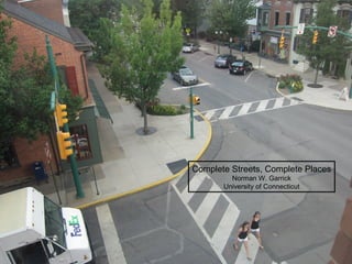
11. Why do we need Complete Streets?
Economic vitality and viability
Traffic safety
Travel choices
Sustainable access and travel
12. Three Patterns for Complete Streets
1. Connected and Complete Street Network
Complete streets function as part of a connected and complete street
network with different types of streets serving different functions
2. Convenience, Comfort and Safety for Vulnerable
Road Users
Complete streets are convenient, safe and comfortable for all, but especially
for vulnerable road users
3. Sense of Place
Complete streets are places. Never just conduits for travel
15. versus
Risk of Severe Injury or Fatality*
Chance of being Severely Injured
30% Higher
Chance of being Killed
50% Higher
*Given that an injury occurred
16. Odds of Dying in a Road Accident
based on Intersection Density*
1 in 200
1 in 500
*Given that an injury occurred
20. Characteristics
of a Complete Street Network
1. High Level of Connectivity at
Neighborhood
City-wide
Regional Scale
1. Frequent Intersections
2. All streets are walkable and Crossable
3. Wide variety of street types (Boulevard, Avenues, Streets, Lanes)
24. Vulnerability of Different Types of Road Users
Chance of Dying if Injured in Road Accident
Source: Bicycle Safety and Mode Choice (Garrick 2008)
Based on 24 California Cities
25. Chance of Pedestrian Fatality vs. Impact Speed
http://webarchive.nationalarchives.gov.uk/+/http://www.dft.gov.uk/foi/responses/2005/nov/203040message/paperaboutthedepartments20302445
26.
27.
28.
29.
30. Street Design Factors affecting Speed
Street cross-section Design
Intersection and Crossing Design
Relationship to Land and Building
33. Context Sensitive Solutions in Designing Major Urban Thoroughfares for Walkable
Communities
Typical Width on Urban Thoroughfares
9 to 12 ft
Width of All
Elements vary
depending on
Context
7 to 8 ft Next to Parking
We Need > 5 feet
> 7 is probably too much
To tame the street so all street users can share in its function for their specific needs, We have to reduce the vehicle operating speeds.
A schematic diagram of some of the components of an urban thoroughfare design. Point out a few of the components. Explain the complexity of integrating the components, particularly in constrained right-of-way.