SlideShare a Scribd company logo
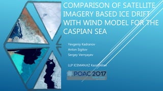
COMPARISON OF SATELLITE
IMAGERY BASED ICE DRIFT
WITH WIND MODEL FOR THE
CASPIAN SEA
Yevgeniy Kadranov
Anton Sigitov
Sergey Vernyayev
LLP ICEMAN.KZ Kazakhstan
ABOUT US
 LLP ICEMAN.KZ - Private entity (three
specialists with diverse background) since
2012
 Operational support (ice charting and
forecast) for navigation in the Caspian and
seismic operations in NE Greenland
 Seal avoidance programs for vessel traffic
 Software development and database
management (sea ice monitoring programs)
 Design criteria development and engineering
INTRODUCTION
 Northern Caspian 44N- 47N
 Seasonal (November- March) ice cover
 Mainly shallow 3-8 m (specific ultra-shallow
ice class vessels for marine traffic - ACV)
 Significant O&G activities (Kazakh sector:
Kashagan, Pearls; Russian Sector: Filanovsky,
Korchagin)
 Fragile environment (including endangered
fish and seals species)
NORTHERN CASPIAN ICE REGIME (LAST 10 YEARS)
 Seasonal variability of ice
extent and thickness
depending on winter severity
 60 cm max observed ice
thickness of thermally grown
ice
 Extensive stable / landfast
area during severe winters –
Mainly mobile during mild
winters
 Grounded deformed ice
features as anchor points
 2016 is used in the study
(mainly mobile conditions)
ICE DRIFT EVENTS
 Ice drift happens
 Needs forecasting
 manage hazards
 excess loads on structures
 pressure on vessels
 pile-ups and ride-ups
 facilitate marine and ACV traffic
 Monitoring drift of floes with seal
pups
 Big gaps between available images -
needs modeling in-between to
maintain full awareness
PROCESSING WORKFLOW
 Extracted ice displacement from
satellite images
 Assigned modelled wind data to
ice drift
 Calculated wind-drift
dependency
JANUARY – MARCH 2016 IMAGERY
 Optical MODIS images (unique season
with less cloudy images)
 SAR (TerraSAR-X, Radarsat-2, Risat-1)
provided by KSAT to close Gaps
 First experience with Sentinel-1 that was
rare (only one)
ICE DRIFT DATA FROM SATELLITE IMAGES
 QGIS plugin
 Identifying and polygonising the same floes
in consequent images
 Calculating vector parameters between
centroids of polygons
 Displacement
 Direction
 Duration
 Ice conditions description (concentration
mainly)
GFS WIND DATA
GFS set of wind data is averaged
within drift interval
Average wind vector assigned to
the nearest centroid of drift vector
Ice conditions data assigned to the
Start and End of the drift vector
OBTAINED WIND-DRIFT DATA
 Database record:
 Drift (displacement, direction, duration)
 Wind (speed, direction, deviation)
 Ice condition (start-end concentration, stage of
development, floe size)
 Data filtering (records excluded)
 Short Duration (<4 h)
 Wind spread during averaging (> 60º)
 Wind speed (< 5 knots)
 Events with the clear obstacles observed
 Strange drift-wind behavior
WIND DRIFT
WIND DRIFT RATIOS
 Good relation for wind-drift directions
 Big spread for wind-drift speed data (invalid direct
calculation of drift speed)
 Expected drift-wind ratio distribution (2-3% - most
frequent)
 Segregation on concentration: ration coefficients tends
to increase with lowering concentrations
DRIFT MODEL
 Regression analysis has been used to describe drift-wind dependency
 Regression coefficients were calculated for different sets of data
 A12,A21 smaller than A11,A22
 Residual drift variations are significant for low wind speed for MM,HH category
 A21 > A12: drift to the left from wind
 Drift response ellipse used for visualisation
 Higher drift speed (NE-SW direction) for same wind speed
MODEL RESULTS AND
UNCERTAINTIES
 Comparison of measured
and modelled data based on
regression analysis
 Modelled results sometimes
are very close to observed
 Obstacles are the main
drawback of modelling
performance
DISCUSSION
RESULTS
 Data on drift events in North Caspian for
2015-2016 was compiled together
 Drift-wind dependencies were analyzed
 Concentration, anchor points, and borders of
shores and immobile ice
 Model was built based on regression
analysis
IMPROVEMENTS
 Enhance model with more historical data
 Enhance accuracy with wind data from more
accurate ECMWF
 Develop mechanism to incorporate
obstacles into drift analysis
 Provide comparison with field data
THANK YOU FOR
ATTENTION

More Related Content

What's hot

DSD-INT 2017 Water level predictions for the German North Sea coast - Stockmann
DSD-INT 2017 Water level predictions for the German North Sea coast - StockmannDSD-INT 2017 Water level predictions for the German North Sea coast - Stockmann
DSD-INT 2017 Water level predictions for the German North Sea coast - Stockmann
Deltares
 
DSD-INT 2017 WFlow - MODFLOW and Reservoirs - Van Verseveld
DSD-INT 2017 WFlow - MODFLOW and Reservoirs - Van VerseveldDSD-INT 2017 WFlow - MODFLOW and Reservoirs - Van Verseveld
DSD-INT 2017 WFlow - MODFLOW and Reservoirs - Van Verseveld
Deltares
 
Monitoring Changes in Antarctic Sea Ice Phenology: 1990-2015
Monitoring Changes in Antarctic Sea Ice Phenology: 1990-2015Monitoring Changes in Antarctic Sea Ice Phenology: 1990-2015
Monitoring Changes in Antarctic Sea Ice Phenology: 1990-2015
priscillaahn
 
DSD-INT 2017 Pre-operational probabilistic water-level forecasting with FEWS-...
DSD-INT 2017 Pre-operational probabilistic water-level forecasting with FEWS-...DSD-INT 2017 Pre-operational probabilistic water-level forecasting with FEWS-...
DSD-INT 2017 Pre-operational probabilistic water-level forecasting with FEWS-...
Deltares
 
Poster
PosterPoster
Poster
Jan Lopez
 
DSD-INT 2016 Regional groundwater flow systems in the Kenya Rift Valley - Mur...
DSD-INT 2016 Regional groundwater flow systems in the Kenya Rift Valley - Mur...DSD-INT 2016 Regional groundwater flow systems in the Kenya Rift Valley - Mur...
DSD-INT 2016 Regional groundwater flow systems in the Kenya Rift Valley - Mur...
Deltares
 
CAMS GA Validation by Eskes
CAMS GA Validation by EskesCAMS GA Validation by Eskes
CAMS GA Validation by Eskes
Copernicus ECMWF
 
Empirical equations for flood analysis in arid zones
Empirical equations for flood analysis in arid zonesEmpirical equations for flood analysis in arid zones
Empirical equations for flood analysis in arid zones
Amro Elfeki
 
WATER RESOURCES MODELING OF THE GANGES-BRAHMAPUTRA-MEGHNA RIVER BASINS USING ...
WATER RESOURCES MODELING OF THE GANGES-BRAHMAPUTRA-MEGHNA RIVER BASINS USING ...WATER RESOURCES MODELING OF THE GANGES-BRAHMAPUTRA-MEGHNA RIVER BASINS USING ...
WATER RESOURCES MODELING OF THE GANGES-BRAHMAPUTRA-MEGHNA RIVER BASINS USING ...
Moudud Hasan
 
DSD-INT 2016 Yellow River - Schuurman
DSD-INT 2016 Yellow River - SchuurmanDSD-INT 2016 Yellow River - Schuurman
DSD-INT 2016 Yellow River - Schuurman
Deltares
 
Flood Mapping via HEC-RAS Model and ArcGIS
Flood Mapping via HEC-RAS Model and ArcGISFlood Mapping via HEC-RAS Model and ArcGIS
Flood Mapping via HEC-RAS Model and ArcGIS
Lengthong KIM
 
FCP Schedule
FCP ScheduleFCP Schedule
FCP Schedule
Amy Lin
 
snow runoff model
snow runoff modelsnow runoff model
snow runoff model
kailash patel
 
SWAT Toulouse 2013 Presentation
SWAT Toulouse 2013 PresentationSWAT Toulouse 2013 Presentation
SWAT Toulouse 2013 Presentation
Budi
 
Predictive Analysis with SAS
Predictive Analysis with SAS Predictive Analysis with SAS
Predictive Analysis with SAS
ewcho
 
TGS GPS- DSDP Deepwater Borehole Data
TGS GPS-  DSDP Deepwater Borehole Data TGS GPS-  DSDP Deepwater Borehole Data
TGS GPS- DSDP Deepwater Borehole Data
TGS
 
HECRAS Bridge Scour Analysis
HECRAS Bridge Scour AnalysisHECRAS Bridge Scour Analysis
HECRAS Bridge Scour Analysis
Christopher L Chatfield, P.E.
 
Climate Change Impact Assessment on Hydrological Regime of Kali Gandaki Basin
Climate Change Impact Assessment on Hydrological Regime of Kali Gandaki BasinClimate Change Impact Assessment on Hydrological Regime of Kali Gandaki Basin
Climate Change Impact Assessment on Hydrological Regime of Kali Gandaki Basin
HI-AWARE
 
20150414_Bartholomeus_EGU2015_5354_Groundwaterforcrop
20150414_Bartholomeus_EGU2015_5354_Groundwaterforcrop20150414_Bartholomeus_EGU2015_5354_Groundwaterforcrop
20150414_Bartholomeus_EGU2015_5354_Groundwaterforcrop
Ruud Bartholomeus
 
DSD-INT 2015 - Developing an operational hydrologic forecast system using EPS...
DSD-INT 2015 - Developing an operational hydrologic forecast system using EPS...DSD-INT 2015 - Developing an operational hydrologic forecast system using EPS...
DSD-INT 2015 - Developing an operational hydrologic forecast system using EPS...
Deltares
 

What's hot (20)

DSD-INT 2017 Water level predictions for the German North Sea coast - Stockmann
DSD-INT 2017 Water level predictions for the German North Sea coast - StockmannDSD-INT 2017 Water level predictions for the German North Sea coast - Stockmann
DSD-INT 2017 Water level predictions for the German North Sea coast - Stockmann
 
DSD-INT 2017 WFlow - MODFLOW and Reservoirs - Van Verseveld
DSD-INT 2017 WFlow - MODFLOW and Reservoirs - Van VerseveldDSD-INT 2017 WFlow - MODFLOW and Reservoirs - Van Verseveld
DSD-INT 2017 WFlow - MODFLOW and Reservoirs - Van Verseveld
 
Monitoring Changes in Antarctic Sea Ice Phenology: 1990-2015
Monitoring Changes in Antarctic Sea Ice Phenology: 1990-2015Monitoring Changes in Antarctic Sea Ice Phenology: 1990-2015
Monitoring Changes in Antarctic Sea Ice Phenology: 1990-2015
 
DSD-INT 2017 Pre-operational probabilistic water-level forecasting with FEWS-...
DSD-INT 2017 Pre-operational probabilistic water-level forecasting with FEWS-...DSD-INT 2017 Pre-operational probabilistic water-level forecasting with FEWS-...
DSD-INT 2017 Pre-operational probabilistic water-level forecasting with FEWS-...
 
Poster
PosterPoster
Poster
 
DSD-INT 2016 Regional groundwater flow systems in the Kenya Rift Valley - Mur...
DSD-INT 2016 Regional groundwater flow systems in the Kenya Rift Valley - Mur...DSD-INT 2016 Regional groundwater flow systems in the Kenya Rift Valley - Mur...
DSD-INT 2016 Regional groundwater flow systems in the Kenya Rift Valley - Mur...
 
CAMS GA Validation by Eskes
CAMS GA Validation by EskesCAMS GA Validation by Eskes
CAMS GA Validation by Eskes
 
Empirical equations for flood analysis in arid zones
Empirical equations for flood analysis in arid zonesEmpirical equations for flood analysis in arid zones
Empirical equations for flood analysis in arid zones
 
WATER RESOURCES MODELING OF THE GANGES-BRAHMAPUTRA-MEGHNA RIVER BASINS USING ...
WATER RESOURCES MODELING OF THE GANGES-BRAHMAPUTRA-MEGHNA RIVER BASINS USING ...WATER RESOURCES MODELING OF THE GANGES-BRAHMAPUTRA-MEGHNA RIVER BASINS USING ...
WATER RESOURCES MODELING OF THE GANGES-BRAHMAPUTRA-MEGHNA RIVER BASINS USING ...
 
DSD-INT 2016 Yellow River - Schuurman
DSD-INT 2016 Yellow River - SchuurmanDSD-INT 2016 Yellow River - Schuurman
DSD-INT 2016 Yellow River - Schuurman
 
Flood Mapping via HEC-RAS Model and ArcGIS
Flood Mapping via HEC-RAS Model and ArcGISFlood Mapping via HEC-RAS Model and ArcGIS
Flood Mapping via HEC-RAS Model and ArcGIS
 
FCP Schedule
FCP ScheduleFCP Schedule
FCP Schedule
 
snow runoff model
snow runoff modelsnow runoff model
snow runoff model
 
SWAT Toulouse 2013 Presentation
SWAT Toulouse 2013 PresentationSWAT Toulouse 2013 Presentation
SWAT Toulouse 2013 Presentation
 
Predictive Analysis with SAS
Predictive Analysis with SAS Predictive Analysis with SAS
Predictive Analysis with SAS
 
TGS GPS- DSDP Deepwater Borehole Data
TGS GPS-  DSDP Deepwater Borehole Data TGS GPS-  DSDP Deepwater Borehole Data
TGS GPS- DSDP Deepwater Borehole Data
 
HECRAS Bridge Scour Analysis
HECRAS Bridge Scour AnalysisHECRAS Bridge Scour Analysis
HECRAS Bridge Scour Analysis
 
Climate Change Impact Assessment on Hydrological Regime of Kali Gandaki Basin
Climate Change Impact Assessment on Hydrological Regime of Kali Gandaki BasinClimate Change Impact Assessment on Hydrological Regime of Kali Gandaki Basin
Climate Change Impact Assessment on Hydrological Regime of Kali Gandaki Basin
 
20150414_Bartholomeus_EGU2015_5354_Groundwaterforcrop
20150414_Bartholomeus_EGU2015_5354_Groundwaterforcrop20150414_Bartholomeus_EGU2015_5354_Groundwaterforcrop
20150414_Bartholomeus_EGU2015_5354_Groundwaterforcrop
 
DSD-INT 2015 - Developing an operational hydrologic forecast system using EPS...
DSD-INT 2015 - Developing an operational hydrologic forecast system using EPS...DSD-INT 2015 - Developing an operational hydrologic forecast system using EPS...
DSD-INT 2015 - Developing an operational hydrologic forecast system using EPS...
 

Similar to Comparison of satellite imagery based ice drift with wind model for the Caspian Sea

Simulated versus Satellite Retrieval Distribution Patterns of the Snow Water ...
Simulated versus Satellite Retrieval Distribution Patterns of the Snow Water ...Simulated versus Satellite Retrieval Distribution Patterns of the Snow Water ...
Simulated versus Satellite Retrieval Distribution Patterns of the Snow Water ...
Agriculture Journal IJOEAR
 
IGARSS2011presen_final.ppt
IGARSS2011presen_final.pptIGARSS2011presen_final.ppt
IGARSS2011presen_final.ppt
grssieee
 
Science 2011-rignot-science.1208336
Science 2011-rignot-science.1208336Science 2011-rignot-science.1208336
Science 2011-rignot-science.1208336
Sérgio Sacani
 
Glacial Lake Mapping with Very High Resolution Space-borne SAR
Glacial Lake Mapping with Very High Resolution Space-borne SARGlacial Lake Mapping with Very High Resolution Space-borne SAR
Glacial Lake Mapping with Very High Resolution Space-borne SAR
Global Risk Forum GRFDavos
 
Notarnicola_TH2_TO4.2.ppt
Notarnicola_TH2_TO4.2.pptNotarnicola_TH2_TO4.2.ppt
Notarnicola_TH2_TO4.2.ppt
grssieee
 
WE2.L09 - Integrated SAR and lidar observations of the sea ice cover: Resolvi...
WE2.L09 - Integrated SAR and lidar observations of the sea ice cover: Resolvi...WE2.L09 - Integrated SAR and lidar observations of the sea ice cover: Resolvi...
WE2.L09 - Integrated SAR and lidar observations of the sea ice cover: Resolvi...
grssieee
 
Applications of remote sensing in glaciology
Applications of remote sensing in glaciologyApplications of remote sensing in glaciology
Applications of remote sensing in glaciology
Amenu
 
TU2.T10.1.pptx
TU2.T10.1.pptxTU2.T10.1.pptx
TU2.T10.1.pptx
grssieee
 
WE1.L10 - USE OF NASA DATA IN THE JOINT CENTER FOR SATELLITE DATA ASSIMILATION
WE1.L10 - USE OF NASA DATA IN THE JOINT CENTER FOR SATELLITE DATA ASSIMILATIONWE1.L10 - USE OF NASA DATA IN THE JOINT CENTER FOR SATELLITE DATA ASSIMILATION
WE1.L10 - USE OF NASA DATA IN THE JOINT CENTER FOR SATELLITE DATA ASSIMILATION
grssieee
 
Program on Mathematical and Statistical Methods for Climate and the Earth Sys...
Program on Mathematical and Statistical Methods for Climate and the Earth Sys...Program on Mathematical and Statistical Methods for Climate and the Earth Sys...
Program on Mathematical and Statistical Methods for Climate and the Earth Sys...
The Statistical and Applied Mathematical Sciences Institute
 
TH4.TO4.4.ppt
TH4.TO4.4.pptTH4.TO4.4.ppt
TH4.TO4.4.ppt
grssieee
 
1_Arslan_Igarss2011.ppt
1_Arslan_Igarss2011.ppt1_Arslan_Igarss2011.ppt
1_Arslan_Igarss2011.ppt
grssieee
 
TU2.T10.2.ppt
TU2.T10.2.pptTU2.T10.2.ppt
TU2.T10.2.ppt
grssieee
 
Recognition by Using Image Processing for Different Size Distribution Schemes
Recognition by Using Image Processing for Different Size Distribution SchemesRecognition by Using Image Processing for Different Size Distribution Schemes
Recognition by Using Image Processing for Different Size Distribution Schemes
IJMTST Journal
 
igarss11swot-vadon-callahan-psc-s3.110725.pptx
igarss11swot-vadon-callahan-psc-s3.110725.pptxigarss11swot-vadon-callahan-psc-s3.110725.pptx
igarss11swot-vadon-callahan-psc-s3.110725.pptx
grssieee
 
Peter romanov
Peter romanovPeter romanov
Peter romanov
ClimDev15
 
WE2.L10.4: OPERATION ICEBRIDGE: USING INSTRUMENTED AIRCRAFT TO BRIDGE THE OBS...
WE2.L10.4: OPERATION ICEBRIDGE: USING INSTRUMENTED AIRCRAFT TO BRIDGE THE OBS...WE2.L10.4: OPERATION ICEBRIDGE: USING INSTRUMENTED AIRCRAFT TO BRIDGE THE OBS...
WE2.L10.4: OPERATION ICEBRIDGE: USING INSTRUMENTED AIRCRAFT TO BRIDGE THE OBS...
grssieee
 
EVALUATIONS OF WIND VECTORS OBSERVED BY ASCAT USING STATISTICAL DISTRIBUTIONS
EVALUATIONS OF WIND VECTORS OBSERVED BY ASCAT USING STATISTICAL DISTRIBUTIONSEVALUATIONS OF WIND VECTORS OBSERVED BY ASCAT USING STATISTICAL DISTRIBUTIONS
EVALUATIONS OF WIND VECTORS OBSERVED BY ASCAT USING STATISTICAL DISTRIBUTIONS
grssieee
 
DSD-INT 2016 Keynote Lecture 2016: From global to local: the latest developme...
DSD-INT 2016 Keynote Lecture 2016: From global to local: the latest developme...DSD-INT 2016 Keynote Lecture 2016: From global to local: the latest developme...
DSD-INT 2016 Keynote Lecture 2016: From global to local: the latest developme...
Deltares
 
CLIMATE CHANGE IMPACT ASSESSMENT ON MELTING GLACIERS USING RS & GIS
CLIMATE CHANGE IMPACT ASSESSMENT ON MELTING GLACIERS USING RS & GISCLIMATE CHANGE IMPACT ASSESSMENT ON MELTING GLACIERS USING RS & GIS
CLIMATE CHANGE IMPACT ASSESSMENT ON MELTING GLACIERS USING RS & GIS
Abhiram Kanigolla
 

Similar to Comparison of satellite imagery based ice drift with wind model for the Caspian Sea (20)

Simulated versus Satellite Retrieval Distribution Patterns of the Snow Water ...
Simulated versus Satellite Retrieval Distribution Patterns of the Snow Water ...Simulated versus Satellite Retrieval Distribution Patterns of the Snow Water ...
Simulated versus Satellite Retrieval Distribution Patterns of the Snow Water ...
 
IGARSS2011presen_final.ppt
IGARSS2011presen_final.pptIGARSS2011presen_final.ppt
IGARSS2011presen_final.ppt
 
Science 2011-rignot-science.1208336
Science 2011-rignot-science.1208336Science 2011-rignot-science.1208336
Science 2011-rignot-science.1208336
 
Glacial Lake Mapping with Very High Resolution Space-borne SAR
Glacial Lake Mapping with Very High Resolution Space-borne SARGlacial Lake Mapping with Very High Resolution Space-borne SAR
Glacial Lake Mapping with Very High Resolution Space-borne SAR
 
Notarnicola_TH2_TO4.2.ppt
Notarnicola_TH2_TO4.2.pptNotarnicola_TH2_TO4.2.ppt
Notarnicola_TH2_TO4.2.ppt
 
WE2.L09 - Integrated SAR and lidar observations of the sea ice cover: Resolvi...
WE2.L09 - Integrated SAR and lidar observations of the sea ice cover: Resolvi...WE2.L09 - Integrated SAR and lidar observations of the sea ice cover: Resolvi...
WE2.L09 - Integrated SAR and lidar observations of the sea ice cover: Resolvi...
 
Applications of remote sensing in glaciology
Applications of remote sensing in glaciologyApplications of remote sensing in glaciology
Applications of remote sensing in glaciology
 
TU2.T10.1.pptx
TU2.T10.1.pptxTU2.T10.1.pptx
TU2.T10.1.pptx
 
WE1.L10 - USE OF NASA DATA IN THE JOINT CENTER FOR SATELLITE DATA ASSIMILATION
WE1.L10 - USE OF NASA DATA IN THE JOINT CENTER FOR SATELLITE DATA ASSIMILATIONWE1.L10 - USE OF NASA DATA IN THE JOINT CENTER FOR SATELLITE DATA ASSIMILATION
WE1.L10 - USE OF NASA DATA IN THE JOINT CENTER FOR SATELLITE DATA ASSIMILATION
 
Program on Mathematical and Statistical Methods for Climate and the Earth Sys...
Program on Mathematical and Statistical Methods for Climate and the Earth Sys...Program on Mathematical and Statistical Methods for Climate and the Earth Sys...
Program on Mathematical and Statistical Methods for Climate and the Earth Sys...
 
TH4.TO4.4.ppt
TH4.TO4.4.pptTH4.TO4.4.ppt
TH4.TO4.4.ppt
 
1_Arslan_Igarss2011.ppt
1_Arslan_Igarss2011.ppt1_Arslan_Igarss2011.ppt
1_Arslan_Igarss2011.ppt
 
TU2.T10.2.ppt
TU2.T10.2.pptTU2.T10.2.ppt
TU2.T10.2.ppt
 
Recognition by Using Image Processing for Different Size Distribution Schemes
Recognition by Using Image Processing for Different Size Distribution SchemesRecognition by Using Image Processing for Different Size Distribution Schemes
Recognition by Using Image Processing for Different Size Distribution Schemes
 
igarss11swot-vadon-callahan-psc-s3.110725.pptx
igarss11swot-vadon-callahan-psc-s3.110725.pptxigarss11swot-vadon-callahan-psc-s3.110725.pptx
igarss11swot-vadon-callahan-psc-s3.110725.pptx
 
Peter romanov
Peter romanovPeter romanov
Peter romanov
 
WE2.L10.4: OPERATION ICEBRIDGE: USING INSTRUMENTED AIRCRAFT TO BRIDGE THE OBS...
WE2.L10.4: OPERATION ICEBRIDGE: USING INSTRUMENTED AIRCRAFT TO BRIDGE THE OBS...WE2.L10.4: OPERATION ICEBRIDGE: USING INSTRUMENTED AIRCRAFT TO BRIDGE THE OBS...
WE2.L10.4: OPERATION ICEBRIDGE: USING INSTRUMENTED AIRCRAFT TO BRIDGE THE OBS...
 
EVALUATIONS OF WIND VECTORS OBSERVED BY ASCAT USING STATISTICAL DISTRIBUTIONS
EVALUATIONS OF WIND VECTORS OBSERVED BY ASCAT USING STATISTICAL DISTRIBUTIONSEVALUATIONS OF WIND VECTORS OBSERVED BY ASCAT USING STATISTICAL DISTRIBUTIONS
EVALUATIONS OF WIND VECTORS OBSERVED BY ASCAT USING STATISTICAL DISTRIBUTIONS
 
DSD-INT 2016 Keynote Lecture 2016: From global to local: the latest developme...
DSD-INT 2016 Keynote Lecture 2016: From global to local: the latest developme...DSD-INT 2016 Keynote Lecture 2016: From global to local: the latest developme...
DSD-INT 2016 Keynote Lecture 2016: From global to local: the latest developme...
 
CLIMATE CHANGE IMPACT ASSESSMENT ON MELTING GLACIERS USING RS & GIS
CLIMATE CHANGE IMPACT ASSESSMENT ON MELTING GLACIERS USING RS & GISCLIMATE CHANGE IMPACT ASSESSMENT ON MELTING GLACIERS USING RS & GIS
CLIMATE CHANGE IMPACT ASSESSMENT ON MELTING GLACIERS USING RS & GIS
 

Recently uploaded

DATA COMMS-NETWORKS YR2 lecture 08 NAT & CLOUD.docx
DATA COMMS-NETWORKS YR2 lecture 08 NAT & CLOUD.docxDATA COMMS-NETWORKS YR2 lecture 08 NAT & CLOUD.docx
DATA COMMS-NETWORKS YR2 lecture 08 NAT & CLOUD.docx
SaffaIbrahim1
 
The Ipsos - AI - Monitor 2024 Report.pdf
The  Ipsos - AI - Monitor 2024 Report.pdfThe  Ipsos - AI - Monitor 2024 Report.pdf
The Ipsos - AI - Monitor 2024 Report.pdf
Social Samosa
 
办(uts毕业证书)悉尼科技大学毕业证学历证书原版一模一样
办(uts毕业证书)悉尼科技大学毕业证学历证书原版一模一样办(uts毕业证书)悉尼科技大学毕业证学历证书原版一模一样
办(uts毕业证书)悉尼科技大学毕业证学历证书原版一模一样
apvysm8
 
University of New South Wales degree offer diploma Transcript
University of New South Wales degree offer diploma TranscriptUniversity of New South Wales degree offer diploma Transcript
University of New South Wales degree offer diploma Transcript
soxrziqu
 
在线办理(英国UCA毕业证书)创意艺术大学毕业证在读证明一模一样
在线办理(英国UCA毕业证书)创意艺术大学毕业证在读证明一模一样在线办理(英国UCA毕业证书)创意艺术大学毕业证在读证明一模一样
在线办理(英国UCA毕业证书)创意艺术大学毕业证在读证明一模一样
v7oacc3l
 
一比一原版巴斯大学毕业证(Bath毕业证书)学历如何办理
一比一原版巴斯大学毕业证(Bath毕业证书)学历如何办理一比一原版巴斯大学毕业证(Bath毕业证书)学历如何办理
一比一原版巴斯大学毕业证(Bath毕业证书)学历如何办理
y3i0qsdzb
 
一比一原版英属哥伦比亚大学毕业证(UBC毕业证书)学历如何办理
一比一原版英属哥伦比亚大学毕业证(UBC毕业证书)学历如何办理一比一原版英属哥伦比亚大学毕业证(UBC毕业证书)学历如何办理
一比一原版英属哥伦比亚大学毕业证(UBC毕业证书)学历如何办理
z6osjkqvd
 
一比一原版(UMN文凭证书)明尼苏达大学毕业证如何办理
一比一原版(UMN文凭证书)明尼苏达大学毕业证如何办理一比一原版(UMN文凭证书)明尼苏达大学毕业证如何办理
一比一原版(UMN文凭证书)明尼苏达大学毕业证如何办理
nyfuhyz
 
Intelligence supported media monitoring in veterinary medicine
Intelligence supported media monitoring in veterinary medicineIntelligence supported media monitoring in veterinary medicine
Intelligence supported media monitoring in veterinary medicine
AndrzejJarynowski
 
Challenges of Nation Building-1.pptx with more important
Challenges of Nation Building-1.pptx with more importantChallenges of Nation Building-1.pptx with more important
Challenges of Nation Building-1.pptx with more important
Sm321
 
ViewShift: Hassle-free Dynamic Policy Enforcement for Every Data Lake
ViewShift: Hassle-free Dynamic Policy Enforcement for Every Data LakeViewShift: Hassle-free Dynamic Policy Enforcement for Every Data Lake
ViewShift: Hassle-free Dynamic Policy Enforcement for Every Data Lake
Walaa Eldin Moustafa
 
STATATHON: Unleashing the Power of Statistics in a 48-Hour Knowledge Extravag...
STATATHON: Unleashing the Power of Statistics in a 48-Hour Knowledge Extravag...STATATHON: Unleashing the Power of Statistics in a 48-Hour Knowledge Extravag...
STATATHON: Unleashing the Power of Statistics in a 48-Hour Knowledge Extravag...
sameer shah
 
原版制作(unimelb毕业证书)墨尔本大学毕业证Offer一模一样
原版制作(unimelb毕业证书)墨尔本大学毕业证Offer一模一样原版制作(unimelb毕业证书)墨尔本大学毕业证Offer一模一样
原版制作(unimelb毕业证书)墨尔本大学毕业证Offer一模一样
ihavuls
 
06-12-2024-BudapestDataForum-BuildingReal-timePipelineswithFLaNK AIM
06-12-2024-BudapestDataForum-BuildingReal-timePipelineswithFLaNK AIM06-12-2024-BudapestDataForum-BuildingReal-timePipelineswithFLaNK AIM
06-12-2024-BudapestDataForum-BuildingReal-timePipelineswithFLaNK AIM
Timothy Spann
 
Beyond the Basics of A/B Tests: Highly Innovative Experimentation Tactics You...
Beyond the Basics of A/B Tests: Highly Innovative Experimentation Tactics You...Beyond the Basics of A/B Tests: Highly Innovative Experimentation Tactics You...
Beyond the Basics of A/B Tests: Highly Innovative Experimentation Tactics You...
Aggregage
 
一比一原版(harvard毕业证书)哈佛大学毕业证如何办理
一比一原版(harvard毕业证书)哈佛大学毕业证如何办理一比一原版(harvard毕业证书)哈佛大学毕业证如何办理
一比一原版(harvard毕业证书)哈佛大学毕业证如何办理
taqyea
 
原版一比一多伦多大学毕业证(UofT毕业证书)如何办理
原版一比一多伦多大学毕业证(UofT毕业证书)如何办理原版一比一多伦多大学毕业证(UofT毕业证书)如何办理
原版一比一多伦多大学毕业证(UofT毕业证书)如何办理
mkkikqvo
 
Palo Alto Cortex XDR presentation .......
Palo Alto Cortex XDR presentation .......Palo Alto Cortex XDR presentation .......
Palo Alto Cortex XDR presentation .......
Sachin Paul
 
UofT毕业证如何办理
UofT毕业证如何办理UofT毕业证如何办理
UofT毕业证如何办理
exukyp
 
Experts live - Improving user adoption with AI
Experts live - Improving user adoption with AIExperts live - Improving user adoption with AI
Experts live - Improving user adoption with AI
jitskeb
 

Recently uploaded (20)

DATA COMMS-NETWORKS YR2 lecture 08 NAT & CLOUD.docx
DATA COMMS-NETWORKS YR2 lecture 08 NAT & CLOUD.docxDATA COMMS-NETWORKS YR2 lecture 08 NAT & CLOUD.docx
DATA COMMS-NETWORKS YR2 lecture 08 NAT & CLOUD.docx
 
The Ipsos - AI - Monitor 2024 Report.pdf
The  Ipsos - AI - Monitor 2024 Report.pdfThe  Ipsos - AI - Monitor 2024 Report.pdf
The Ipsos - AI - Monitor 2024 Report.pdf
 
办(uts毕业证书)悉尼科技大学毕业证学历证书原版一模一样
办(uts毕业证书)悉尼科技大学毕业证学历证书原版一模一样办(uts毕业证书)悉尼科技大学毕业证学历证书原版一模一样
办(uts毕业证书)悉尼科技大学毕业证学历证书原版一模一样
 
University of New South Wales degree offer diploma Transcript
University of New South Wales degree offer diploma TranscriptUniversity of New South Wales degree offer diploma Transcript
University of New South Wales degree offer diploma Transcript
 
在线办理(英国UCA毕业证书)创意艺术大学毕业证在读证明一模一样
在线办理(英国UCA毕业证书)创意艺术大学毕业证在读证明一模一样在线办理(英国UCA毕业证书)创意艺术大学毕业证在读证明一模一样
在线办理(英国UCA毕业证书)创意艺术大学毕业证在读证明一模一样
 
一比一原版巴斯大学毕业证(Bath毕业证书)学历如何办理
一比一原版巴斯大学毕业证(Bath毕业证书)学历如何办理一比一原版巴斯大学毕业证(Bath毕业证书)学历如何办理
一比一原版巴斯大学毕业证(Bath毕业证书)学历如何办理
 
一比一原版英属哥伦比亚大学毕业证(UBC毕业证书)学历如何办理
一比一原版英属哥伦比亚大学毕业证(UBC毕业证书)学历如何办理一比一原版英属哥伦比亚大学毕业证(UBC毕业证书)学历如何办理
一比一原版英属哥伦比亚大学毕业证(UBC毕业证书)学历如何办理
 
一比一原版(UMN文凭证书)明尼苏达大学毕业证如何办理
一比一原版(UMN文凭证书)明尼苏达大学毕业证如何办理一比一原版(UMN文凭证书)明尼苏达大学毕业证如何办理
一比一原版(UMN文凭证书)明尼苏达大学毕业证如何办理
 
Intelligence supported media monitoring in veterinary medicine
Intelligence supported media monitoring in veterinary medicineIntelligence supported media monitoring in veterinary medicine
Intelligence supported media monitoring in veterinary medicine
 
Challenges of Nation Building-1.pptx with more important
Challenges of Nation Building-1.pptx with more importantChallenges of Nation Building-1.pptx with more important
Challenges of Nation Building-1.pptx with more important
 
ViewShift: Hassle-free Dynamic Policy Enforcement for Every Data Lake
ViewShift: Hassle-free Dynamic Policy Enforcement for Every Data LakeViewShift: Hassle-free Dynamic Policy Enforcement for Every Data Lake
ViewShift: Hassle-free Dynamic Policy Enforcement for Every Data Lake
 
STATATHON: Unleashing the Power of Statistics in a 48-Hour Knowledge Extravag...
STATATHON: Unleashing the Power of Statistics in a 48-Hour Knowledge Extravag...STATATHON: Unleashing the Power of Statistics in a 48-Hour Knowledge Extravag...
STATATHON: Unleashing the Power of Statistics in a 48-Hour Knowledge Extravag...
 
原版制作(unimelb毕业证书)墨尔本大学毕业证Offer一模一样
原版制作(unimelb毕业证书)墨尔本大学毕业证Offer一模一样原版制作(unimelb毕业证书)墨尔本大学毕业证Offer一模一样
原版制作(unimelb毕业证书)墨尔本大学毕业证Offer一模一样
 
06-12-2024-BudapestDataForum-BuildingReal-timePipelineswithFLaNK AIM
06-12-2024-BudapestDataForum-BuildingReal-timePipelineswithFLaNK AIM06-12-2024-BudapestDataForum-BuildingReal-timePipelineswithFLaNK AIM
06-12-2024-BudapestDataForum-BuildingReal-timePipelineswithFLaNK AIM
 
Beyond the Basics of A/B Tests: Highly Innovative Experimentation Tactics You...
Beyond the Basics of A/B Tests: Highly Innovative Experimentation Tactics You...Beyond the Basics of A/B Tests: Highly Innovative Experimentation Tactics You...
Beyond the Basics of A/B Tests: Highly Innovative Experimentation Tactics You...
 
一比一原版(harvard毕业证书)哈佛大学毕业证如何办理
一比一原版(harvard毕业证书)哈佛大学毕业证如何办理一比一原版(harvard毕业证书)哈佛大学毕业证如何办理
一比一原版(harvard毕业证书)哈佛大学毕业证如何办理
 
原版一比一多伦多大学毕业证(UofT毕业证书)如何办理
原版一比一多伦多大学毕业证(UofT毕业证书)如何办理原版一比一多伦多大学毕业证(UofT毕业证书)如何办理
原版一比一多伦多大学毕业证(UofT毕业证书)如何办理
 
Palo Alto Cortex XDR presentation .......
Palo Alto Cortex XDR presentation .......Palo Alto Cortex XDR presentation .......
Palo Alto Cortex XDR presentation .......
 
UofT毕业证如何办理
UofT毕业证如何办理UofT毕业证如何办理
UofT毕业证如何办理
 
Experts live - Improving user adoption with AI
Experts live - Improving user adoption with AIExperts live - Improving user adoption with AI
Experts live - Improving user adoption with AI
 

Comparison of satellite imagery based ice drift with wind model for the Caspian Sea

  • 1. COMPARISON OF SATELLITE IMAGERY BASED ICE DRIFT WITH WIND MODEL FOR THE CASPIAN SEA Yevgeniy Kadranov Anton Sigitov Sergey Vernyayev LLP ICEMAN.KZ Kazakhstan
  • 2. ABOUT US  LLP ICEMAN.KZ - Private entity (three specialists with diverse background) since 2012  Operational support (ice charting and forecast) for navigation in the Caspian and seismic operations in NE Greenland  Seal avoidance programs for vessel traffic  Software development and database management (sea ice monitoring programs)  Design criteria development and engineering
  • 3. INTRODUCTION  Northern Caspian 44N- 47N  Seasonal (November- March) ice cover  Mainly shallow 3-8 m (specific ultra-shallow ice class vessels for marine traffic - ACV)  Significant O&G activities (Kazakh sector: Kashagan, Pearls; Russian Sector: Filanovsky, Korchagin)  Fragile environment (including endangered fish and seals species)
  • 4. NORTHERN CASPIAN ICE REGIME (LAST 10 YEARS)  Seasonal variability of ice extent and thickness depending on winter severity  60 cm max observed ice thickness of thermally grown ice  Extensive stable / landfast area during severe winters – Mainly mobile during mild winters  Grounded deformed ice features as anchor points  2016 is used in the study (mainly mobile conditions)
  • 5. ICE DRIFT EVENTS  Ice drift happens  Needs forecasting  manage hazards  excess loads on structures  pressure on vessels  pile-ups and ride-ups  facilitate marine and ACV traffic  Monitoring drift of floes with seal pups  Big gaps between available images - needs modeling in-between to maintain full awareness
  • 6. PROCESSING WORKFLOW  Extracted ice displacement from satellite images  Assigned modelled wind data to ice drift  Calculated wind-drift dependency
  • 7. JANUARY – MARCH 2016 IMAGERY  Optical MODIS images (unique season with less cloudy images)  SAR (TerraSAR-X, Radarsat-2, Risat-1) provided by KSAT to close Gaps  First experience with Sentinel-1 that was rare (only one)
  • 8. ICE DRIFT DATA FROM SATELLITE IMAGES  QGIS plugin  Identifying and polygonising the same floes in consequent images  Calculating vector parameters between centroids of polygons  Displacement  Direction  Duration  Ice conditions description (concentration mainly)
  • 9. GFS WIND DATA GFS set of wind data is averaged within drift interval Average wind vector assigned to the nearest centroid of drift vector Ice conditions data assigned to the Start and End of the drift vector
  • 10. OBTAINED WIND-DRIFT DATA  Database record:  Drift (displacement, direction, duration)  Wind (speed, direction, deviation)  Ice condition (start-end concentration, stage of development, floe size)  Data filtering (records excluded)  Short Duration (<4 h)  Wind spread during averaging (> 60º)  Wind speed (< 5 knots)  Events with the clear obstacles observed  Strange drift-wind behavior WIND DRIFT
  • 11. WIND DRIFT RATIOS  Good relation for wind-drift directions  Big spread for wind-drift speed data (invalid direct calculation of drift speed)  Expected drift-wind ratio distribution (2-3% - most frequent)  Segregation on concentration: ration coefficients tends to increase with lowering concentrations
  • 12. DRIFT MODEL  Regression analysis has been used to describe drift-wind dependency  Regression coefficients were calculated for different sets of data  A12,A21 smaller than A11,A22  Residual drift variations are significant for low wind speed for MM,HH category  A21 > A12: drift to the left from wind  Drift response ellipse used for visualisation  Higher drift speed (NE-SW direction) for same wind speed
  • 13. MODEL RESULTS AND UNCERTAINTIES  Comparison of measured and modelled data based on regression analysis  Modelled results sometimes are very close to observed  Obstacles are the main drawback of modelling performance
  • 14. DISCUSSION RESULTS  Data on drift events in North Caspian for 2015-2016 was compiled together  Drift-wind dependencies were analyzed  Concentration, anchor points, and borders of shores and immobile ice  Model was built based on regression analysis IMPROVEMENTS  Enhance model with more historical data  Enhance accuracy with wind data from more accurate ECMWF  Develop mechanism to incorporate obstacles into drift analysis  Provide comparison with field data

Editor's Notes

  1. Describe shortly our activities and where we are from
  2. 44-47 although south has seasonal ice cover, all major SAR satellites attend only once in three days 3-8 m – ultrashallow requiring specific fleet and operations set-up with decreasing water level potential introduction of ACVs