SlideShare a Scribd company logo
1 | P a g e
VOCATIONAL TRAINING ON
COMMUNICATION, NAVIGATION AND
SURVEILLANCE (CNS) REPORT
REGIONAL TRAINING CENTRE
AIRPORTS AUTHORITY OF INDIA
PANTNAGAR AIRPORT
UTTARAKHAND
Duration of Training: Submitted by:
PRAJJWAL ROHELA
Department of Electronics and Communication Engineering
School of Engineering and Technology
H.N.B. Garhwal Central University, Srinagar Garhwal.
2 | P a g e
CERTIFICATE
This is to certify that Mr. Prajjwal Rohela has undergone Vocational Training at the Regional
Training Centre Airports Authority of India PANTNAGAR Airport, UTTARAKHAND. To the
best of my knowledge, this Project Report has not been submitted for any other examination and
does not form a part of any other course undergone by the candidate.
Signature (Course Coordinator)
Dated:
Place: Pantnagar
Remarks:
3 | P a g e
STUDENT DECLARATION
I hereby declare that vocational training report on:
COMMUNICATION, NAVIGATION AND SURVEILLANCE (CNS)
is submitted to
Regional Training Centre, Airports Authority of India PANTNAGAR Airport
on the completion of Vocational Training at the Regional Training Centre, Airports Authority of
India PANTNAGAR Airport from
Pantnagar
Dated: Prajjwal Rohela.
4 | P a g e
INDEX
TOPIC PAGE NO.
❖ ACKNOWLEDGEMENT 5
❖ ABOUT AAI 6
❖ CNS 10
❖ VHF 11
❖ RADAR 16
❖ DME 20
❖ ILS 22
❖ NDB 25
❖ SECURITY EQUIPMENTS 26
❖ HF (SELCAL) 32
❖ AMSS 33
❖ MET 37
❖ ATM 39
❖ GPS 41
❖ CONCLUSION 43
❖ BIBLOGRAPHY 44
❖ APPENDIX 45
5 | P a g e
ACKNOWLEDGEMENT
I would like to express my heartfelt gratitude to all the officers of Airports Authority of India
PANTNAGAR Airport, UTTRAKHAND who gave me the opportunity to learn and interact with their
extremely competent Officers, Engineers and Staff and learn about the wonderful and diverse world of
Communication, Navigation and Surveillance (CNS). The experience was extremely enriching and
inspirational.
In my opinion the Communication, Navigation and Surveillance (CNS) division of Airport Authority of
India provides best facility and opportunity for training and internship in the field of Electronics and
Communication Engineering (ECE). No other industry has such extensive use of ECE engineering
equipment. I therefore am overjoyed that I got an opportunity to undergo this extremely informative and
educational training in the CNS division of AAI, PANTNAGAR for a period of 4 weeks which enabled
me to get hands on experience in the field of aeronautics telecommunication operation, equipment used
and maintenance.
Besides the aspects of Communication Engineering, the training also gave me an opportunity to
experience the industry environment and the dedication and hard work it demands from an individual. I
would once again like to thank everyone at Airport Authority of India Pantnagar, Uttarakhand especially
who undertook our training sessions, by taking precious time out for us despite their busy schedule.
6 | P a g e
ABOUT- AIRPORTS AUTHORITY OF INDIA (AAI)
Fig: Emblem of the AAI.
Mission: ''To achieve highest standards of safety and quality in air traffic services
and airport management by providing state-of-the-art infrastructure for total
customer satisfaction, contributing to economic growth and prosperity of the
nation.''
Vision : ''To be a world-class organization providing leadership in air traffic
services and airport management & making India a major hub in Asia Pacific
region by 2016''.
Airports Authority of India (AAI) was constituted by an Act of Parliament and came into being
on 1st April 1995 by merging erstwhile National Airports Authority and International Airports
Authority of India. The merger brought into existence a single Organization entrusted with the
responsibility of creating, upgrading, maintaining and managing civil aviation infrastructure both
on the ground and air space in the country. Dr. Guruprasad Mohapatra is the current chairman of
the AAI.
The airport in India falls in the one or more of the following categories which is under the AAI:
• Domestic - They handle domestic fights.
• International - They handle international flights.
• Defence - They are handled by the armed forces.
• Private - They are for specific purpose.
At present, 64 airports have Domestic status and 22 others have International status. 32 airports
are Defence airports and 16 airports are privately authorized. Thus, we have a total of 134
airports. AAI provides air navigation services over 2.8 million square nautical miles of air space.
7 | P a g e
During the year 2008- 09, AAI handled aircraft movement of 1306532 Nos. [International
270345 & Domestic 1036187], Passengers handled 44262137 Nos. [International 1047614 &
Domestic 33785990] and the cargo handled 499418 tons [International 318242 & Domestic
181176].
Pantnagar Airport is a Domestic Airport located in Pantnagar of Udham Singh Nagar district in
the Indian state of Uttarakhand. It is operated by the Airport Authority of India. It is the nearest
airport to the Kumaon hill station of Nainital (65 km). The airport was able to accommodate only
small aircrafts until 2008, when the length of runway was increased to 4,500 feet to
accommodate larger turboprop aircraft at a cost of 75 crores.
In August 2015, Airport Advisory Committee said that the Airport will be developed in cargo
hub and the length of the runway will be increased from its present length of 1,372m to 1,865m.
1. Passenger Facilities
The main functions of AAI inter-alia include construction, modification & management of
passenger terminals, development & management of cargo terminals, development &
maintenance of apron infrastructure including runways, parallel taxiways, apron etc., Provision
of Communication, Navigation and Surveillance which includes provision of DVOR / DME,
ILS, ATC radars, visual aids etc., provision of air traffic services, provision of passenger
facilities and related amenities at its terminals thereby ensuring safe and secure operations of
aircraft, passenger and cargo in the country.
2. Air Navigation Services
In tune with global approach to modernization of Air Navigation infrastructure for seamless
navigation across state and regional boundaries, AAI has been going ahead with its plans for
transition to satellite based Communication, Navigation, Surveillance and Air Traffic
Management. A number of co-operation agreements and memoranda of co-operation have been
signed with US Federal Aviation Administration, US Trade & Development Agency, European
Union, Air Services Australia and the French Government Co-operative Projects and Studies
initiated to gain from their experience. Through these activities more and more executives of
AAI are being exposed to the latest technology, modern practices & procedures being adopted to
improve the overall performance of Airports and Air Navigation Services. Induction of latest
state-of-the-art equipment, both as replacement and old equipment and also as new facilities to
improve standards of safety of airports in the air is a continuous process. Adoptions of new and
improved procedure go hand in hand with induction of new equipment. Some of the major
initiatives in this direction are introduction of Reduced Vertical Separation Minima (RVSM) in
India air space to increase airspace capacity and reduce congestion in the air; implementation of
8 | P a g e
GPS And Geo Augmented Navigation (GAGAN) jointly with ISRO which when put to operation
would be one of the four such systems in the world.
3. Security
The continuing security environment has brought into focus the need for strengthening security
of vital installations. There was thus an urgent need to revamp the security at airports not only to
thwart any misadventure but also to restore confidence of traveling public in the security of air
travel as a whole, which was shaken after 9/11 tragedy. With this in view, a number of steps
were taken including deployment of CISF for airport security, CCTV surveillance system at
sensitive airports, latest and state-of-the-art X-ray baggage inspection systems, premier security
& surveillance systems. Smart Cards for access control to vital installations at airports are also
being considered to supplement the efforts of security personnel at sensitive airports.
4. Aerodrome Facilities
In Airports Authority of India, the basic approach to planning of airport facilities has been
adopted to create capacity ahead of demand in our efforts. Towards implementation of this
strategy, a number of projects for extension and strengthening of runway, taxi track and aprons at
different airports has been taken up. Extension of runway to 7500 ft. has been taken up to
support operation for Airbus-320/Boeing 737-800 categories of aircrafts at all airports.
5. HRD Training
A large pool of trained and highly skilled manpower is one of the major assets of Airports
Authority of India. Development and Technological enhancements and consequent refinement of
operating standards and procedures, new standards of safety and security and improvements in
management techniques call for continuing training to update the knowledge and skill of officers
and staff. For this purpose AAI has a number of training establishments, viz. NIAMAR in Delhi,
CATC in Allahabad, Fire Training Centers at Delhi & Kolkata for in-house training of its
engineers, Air Traffic Controllers, Rescue & Fire Fighting personnel etc. NIAMAR & CATC are
members of ICAO TRAINER programme under which they share Standard Training Packages
(STP) from a central pool for imparting training on various subjects. Both CATC & NIAMAR
have also contributed a number of STPs to the Central pool under ICAO TRAINER programme.
Foreign students have also been participating in the training programme being conducted by
these institutions.
9 | P a g e
6. IT Implementation
Information Technology holds the key to operational and managerial efficiency, transparency
and employee productivity. AAI initiated a programme to indoctrinate IT culture among its
employees and this is most powerful tool to enhance efficiency in the organization. AAI website
with domain namewww.airportsindia.org.in or www.aai.aero is a popular website giving a host
of information about the organization besides domestic and international flight information of
interest to the public in general and passengers in particular.
Functions of AAI
Fig: Steward guiding an aircraft after landing.
The functions of AAI are as follows:
1. Design, Development, Operation and Maintenance of International and Domestic Airports and
Civil Enclaves.
2. Control and Management of the Indian airspace extending beyond the territorial limits of the
country, as accepted by ICAO.
3. Construction, Modification and Management of passenger terminals.
4. Development and Management of Cargo terminals at International and Domestic airports.
5. Provision of passengers Facilities and information system at the passenger terminals at
airports.
6. Expansion and strengthening of operation area, viz. Runways, Aprons, Taxiway etc.
7. Provision of visual aids.
8. Provision of Communication and Navigation aids viz. ILS, DVOR, DME, and RADAR etc.
10 | P a g e
CNS DEPARTMENT
(COMMUNICATION, NAVIGATION & SURVEILLANCE)
❖ Overall in charge of CNS wing
❖ Responsible for technical, operational & administrative nature of services related to CNS
wing.
❖ Responsible for procurement of technical spares, award of AMC within Delegation of
Financial Authority, coordination with external agencies like DoT, Airlines, WPC etc.
❖ To provide assistance in the implementation of contingency plan in case of emergencies like
Anti hijacking etc.
❖ Supervise the maintenance and operation of aeronautical Telecommunication equipment and
systems for the Air Traffic Control as well as electronic navigational aids (NDB).
❖ Assesses training and development needs of personnel required for the maintenance of the
aeronautical communication and navigational equipment’s. Plans and implements special
training programme to bridge identified performance gaps to ensure that international
standards are maintained.
❖ Coordinates telephone requirements of all sections in AAI, Pantnagar and Liaise with
telephone service providers to determine their configuration and provision.
❖ Acts as the guide for all ATS units for any clarification regarding provision of ATS services.
11 | P a g e
VHF
(Frequency range 30-300 MHz)
Radio spectrum refers to the part of the electromagnetic spectrum corresponding to radio
frequencies – that is, frequencies lower than around 300 GHz (or, equivalently, wavelengths
longer than about 1 mm). Different parts of the radio spectrum are used for different radio
transmission technologies and applications.
This radio spectrum is divided into many frequency bands based on frequency ranges. Some of
them are –
Band Name Abbr. Frequency Range
Low Frequency LF 30 – 300 kHz
Medium Frequency MF 300 – 3000 kHz
High Frequency HF 3 -30 MHz
Very High Frequency VHF 30 – 300 MHz
Ultra High Frequency UHF 300 – 3000 MHz
Very high frequency (VHF) is the radio frequency range from 30 MHz to 300 MHz Common
uses for VHF are FM radio broadcast, television broadcast, land mobile stations (emergency,
business, private use and military), long range data communication with radio modems, amateur
radio, marine communications, air traffic control communications and air navigation systems
(e.g. VOR, DME & ILS). It is a line of sight communication system; hence it is not so suitable
for very long-distance communication. In Airports Authority of India, VHF communication is
mainly used in SMC, DVOR, DME, ILS, Approach control, Tower Control and Area Control.
In the VHF band:
• 108-156 MHz – Communication band
• 118-137 MHz – Aeronautical band
• 137-156 MHz – Upper Military band
Modes of VHF communication are as follows:
1. Broadcast
2. Point to point
12 | P a g e
The VHF frequency present at Pantnagar Airport is 119.5 MHz for Control Tower and for
Walkie Talkie it is 161.525 MHz (MOTOROLA and VERTEX).
VHF Transmitter
• Oscillator is required for generating frequency
• Synthesizer is required to generate a range of frequencies
• PLL is used for synthesizing
PLL for generating 120 MHz frequency
VHF AM Transmitter
13 | P a g e
Receiver Properties
• Sensitivity – Ability to receive the weakest signal
• Selectivity – Ability to reject the adjacent channel
• Fidelity – Reproduction of quality
Formula for calculating total power:
Pt = Pc (1+m^2/2)
Where Pt is total power, Pc is carrier power, m is percentage of modulation.
VHF AM Receiver
Other information:
• Use of 1st IF (21.4 MHz) is image frequency rejection and use of 2nd IF (0.455 MHz) is
adjacent channel rejection.
• In order to tune to 120.7 MHz, 1st LO freq. will be 120.7+21.4 MHz = 142.1 MHz, 2nd
LO freq. will always be 21.4+0.455 MHz = 21.855 MHz.
• Straight dipole impedance is 70-72 ohms.
• Folded dipole impedance is 70*n2, where n is the number of folds.
• In VHF folded dipole with n=2 is used because its impedance is 70*4= 280 ohms and
space impedance is also 300 ohms. This provides impedance matching.
• In case of NDBs ground reflection is required, so straight dipole with 50 ohm impedance
is used.
• Gain of dipole antenna is unity.
14 | P a g e
• In the receiver two dipoles are staged together to increase the gain by 3dB. The distance
between the two dipoles is to be maintained between 1 lambda to 0.7 lambda.
• Dipole is mounted vertically because the polarization is vertical.
Radio Propagation
Radio Frequencies and their mode of propagation
Band Frequency Wavelength Propagation via
ELF Extremely Low
Frequency
3-300 Hz 1000-100,000
km
VLF Very Low
Frequency
3-30 kHz 100-10 km Guided between the earth and
the ionosphere.
LF Low Frequency 30-300 kHz 10-1 km Guided between the earth and
the D layer of the ionosphere
and Surface waves.
MF Medium Frequency 300-3000 kHz 1000-100 m Surface waves and E, F layer
ionosphere refraction at night,
when D layer absorption
weakens.
HF High Frequency
(Short Wave)
3-30 MHz 100-10 m E layer ionospheric refraction.
And F1, F2 layer ionospheric
refraction.
VHF Very High
Frequency
30-300 MHz 10-1 m Generally direct wave.
Infrequent E ionospheric
refraction. Extremely rare F1,F2
layer ionospheric refraction
during high sunspot activity up
to 80 MHz . Sometimes
tropospheric ducting.
UHF Ultra High
Frequency
300-3000
MHz
100-10 cm Direct wave. Sometimes
tropospheric ducting
SHF Super High
Frequency
3-30 GHz 10-1 cm Direct Wave.
EHF Extremely High
Frequency
30-3000 GHz 10-1 mm Direct wave limited by
absorption.
15 | P a g e
Surface modes
Lower frequencies (between 30 and 3,000 kHz) have the property of following the curvature of
the earth via ground wave propagation in the majority of occurrences.
In this mode the radio wave propagates by interacting with the semi-conductive surface of the
earth. The wave "clings" to the surface and thus follows the curvature of the earth. Vertical
polarization is used to alleviate short circuiting the electric field through the conductivity of the
ground. Since the ground is not a perfect electrical conductor, ground waves are attenuated
rapidly as they follow the earth ‘s surface. Attenuation is proportional to the frequency making
this mode mainly useful for LF and VLF frequencies. Today LF and VLF are mostly used for
time signals, and for military communications, especially with ships and submarines, although
radio amateurs have an allocation at 137 KHz in some parts of the world.
Direct modes (line-of-sight)
Line-of-sight is the direct propagation of radio waves between antennas that are visible to each
other. This is probably the most common of the radio propagation modes at VHF and higher
frequencies. Because radio signals can travel through many non-metallic objects, radio can be
picked up through walls. This is still line-of-sight propagation. Examples would include
propagation between a satellite and a ground antenna or reception of television signals from a
local TV transmitter. Ground plane reflection effects are an important factor in VHF line of sight
propagation. The interference between the direct beam line-of-sight and the ground reflected
beam often leads to an effective inverse-fourth-power i.e. (1/distance) ^4 law for ground-plane
limited radiation.
Ionospheric modes (sky wave)
Sky wave propagation, also referred to as skip, is any of the modes that rely on refraction of
radio waves in the ionosphere, which is made up of one or more ionized layers in the upper
atmosphere. F2-layer is the most important ionospheric layer for long-distance, multiple-hop HF
propagation, though F1, E, and D-layers also play significant roles. The D-layer, when present
during sunlight periods, causes significant amount of signal loss, as does the E-layer whose
maximum usable frequency can rise to 4 MHz and above and thus block higher frequency
signals from reaching the F2-layer.
16 | P a g e
RADAR
Radar is an object-detection system which uses radio waves to determine the range, altitude,
direction, or speed of objects. Radar stands for RAdio Detection And Ranging. It can be used to
detect aircraft, ships, spacecraft, guided missiles, motor vehicles, weather formations, and
terrain. The radar dish or antenna transmits pulses of radio waves or microwaves which bounce
off any object in their path. The object returns a tiny part of the wave's energy to a dish or
antenna which is usually located at the same site as the transmitter.
Classification: -
Based on operation:
1. Primary Radar = Co-operation of targets is not required for detection. It works on “echo”
technology.
2. Secondary Radar = Active co-operation of targets is required for finding range and other
details of target.
Based on waveform:
1. CW Radar = can detect moving target and its velocity.
2. CWFM Radar = can detect range using FM signals.
3. Pulsed Radar = uses pulse modulated microwave signals for detecting range & velocity.
Based on services:
1. Search Radar = also known as surveillance radar. Uses continuously rotating antenna.
Covers large volume of space.
2. Tracking Radar = gives accurate angular position, range and radial velocity of targets
with precision. If used for tracking it must first be co-located with search radar for 1st
acquiring the target.
Applications: -
1. Air Traffic Control
2. Aircraft Navigation
3. Maritime Navigation
4. Meteorological Applications
17 | P a g e
5. Space Applications
6. Military Applications
7. Law Enforcement Applications
Radars used in ATC
1. Airport Surveillance Radar (ASR)
2. Air Route Surveillance Radar (SSR)
3. Airport Surface Movement Detection Equipment (ASDE)
4. Precision Approach Radar (PAR)
5. Monopulse Secondary Surveillance Radar (MSSR)
Maximum range of RADAR depends on: -
a) Peak transmission power (4th root)
b) Minimum detectable signal (MDS)
c) Antenna Gain
d) Radar Cross Section of the target
e) Atmospheric Attenuation
Primary Radar
Primary Radar works on the principle of reflection or ―echo‖. Primary radar antennae
continuously send pulses in all possible directions. When these pulses hit some moving or still
objects, the pulse is reflected back to the antenna. Generally, the radar transmitter and receiver
are located at the same located. The radar processes the information and confirms the presence of
an object. If the object is moving either closer or farther away, there is a slight change in the
frequency of the radio waves, caused by the Doppler effect.
Secondary Radar
Secondary radar works target specific. An interrogation pulse is sent from the radar transmitter.
The target, on receiving the signal, replies back with another signal. The radar then processes the
18 | P a g e
distance covered by the signal and the time taken for the operation and calculates the position of
the target accordingly.
One kind of secondary radar used by ATC is MSSR or Monopulse Secondary Surveillance
Radar.
MSSR Interrogation
1. The interrogator transmits a pair of pulses at 1030 MHz.
2. Each pulse has the same duration, shape and amplitude.
3. Their spacing distinguishes various modes of interrogation.
4. P2 pulse is used for control
Transponder Reply
1. F1 and F2 are always present (―framing pulses‖).
2. The 12 binary data pulses in four groups of 3 bits: A, B, C, D.
3. 2048 permutations (D1 omitted) of altitude code (Mode C reply) indicating heights.
4. SPI (Special Position Indicator) pulse is used upon request by ground control.
19 | P a g e
Difference between Primary & Secondary Radar
Primary
1. Co-operation of target not required
2. High power
3. No Code/Altitude information
4. No Saturation
5. Can detect Weather
6. Clutter Problem
7. Any Target
Secondary
1. Co-operation of target required
2. Low Power
3. Code & Altitude information available
4. Subject to Saturation
5. No Weather detection
6. No Clutter
7. Friendly Targets
20 | P a g e
DME
(DISTANCE MEASURING EQUIPMENT)
Distance measuring equipment (DME) is a transponder-based radio navigation technology that
measures slant range distance by timing the propagation delay of VHF or UHF radio signals.
DME is similar to secondary radar, except in reverse. The system was a post-war development of
the IFF (identification friend or foe) systems of World War II.
Aircrafts use DME to determine their distance from a land-based transponder by sending and
receiving pulse pairs. The ground stations are typically co-located with VORs. A typical DME
ground transponder system for en-route or terminal navigation will have a 1 kW peak pulse
output on the assigned UHF channel. A low-power DME can also be co-located with an ILS
glide slope antenna installation where it provides an accurate distance to touchdown function,
similar to that otherwise provided by ILS Marker Beacons. The DME system is composed of a
UHF transmitter/receiver (interrogator) in the aircraft and a UHF receiver/transmitter
(transponder) on the ground.
The operation is performed by sending and receiving two pulses of fixed duration and separation.
The two pulses are known as interrogation pulse and reply pulse. The first one is sent by the pilot
to ground station, and the second one is replied back to the pilot. The aircraft interrogates the
ground transponder with a series of pulse-pairs (interrogations). The ground station responds
after a precise time delay, called the threshold time. The threshold time for India is 50μs. If the
processing time is less than 50μs, a delay counters delays the operational time to the threshold
time. The ground station replies with an identical sequence of reply pulse-pairs. To differentiate
one aircraft ‘s signal from other, special coding is applied for the signal. Each aircraft has its own
coding format. The reply signal is sent using the same coding.
The very first process that takes place after interrogation is pulse verification. To differentiate
between a valid signal and other signals this pulse verification process is necessary. A valid
signal is recognized by its duration. A valid signal has pulse duration of 12μs and has only two
pulses.
12µs
The permissible frequency range is 962-1215 MHz. Different airports select their transmitting
and frequencies among this range. The constraint is that the difference between the receiving and
Valid dual pulse signal
21 | P a g e
transmitting frequencies must be 63 MHz. For Pantnagar, the frequencies are 1020 MHz and
1083 MHz.
A radio pulse takes around 12.36 microseconds to travel 1 nautical mile (1,852 m) to and from;
this is also referred to as a radar-mile. The time difference between interrogation and reply 1
nautical mile (1,852 m) minus the 50-microsecond ground transponder delay is measured by the
interrogator's timing circuitry and translated into a distance measurement (slant range), stated in
nautical miles, and then displayed on the cockpit DME display.
The distance formula, distance = rate * time, is used by the DME receiver to calculate its
distance from the DME ground station. The rate in the calculation is the velocity of the radio
pulse, which is the speed of light (roughly 300,000,000 m/s or 186,000 mi/s). The time in the
calculation is (total time - 50μs)/2.
A typical DME transponder can provide distance information to 100 aircraft at a time. Above
this limit the transponder avoids overload by limiting the gain of the receiver. Replies to weaker
more distant interrogations are ignored to lower the transponder load. The technical term for
overload of a DME station caused by large numbers of aircraft is station saturation.
The accuracy of DME ground stations is 185 m (±0.1 NMI). It's important to understand that
DME provides the physical distance from the aircraft to the DME transponder. This distance is
often referred to as 'slant range' and depends trigonometrically upon both the altitude above the
transponder and the ground distance from it. For example, an aircraft directly above the DME
station at 6076 ft. (1 NMI) altitude would still show 1.0 NMI (1.9 km) on the DME readout. The
aircraft is technically a mile away, just a mile straight up. Slant range error is most pronounced at
high altitudes when close to the DME station.
ICAO recommends accuracy of 0.25 NMI plus 1.25% of the distance measured.
22 | P a g e
ILS
(INSTRUMENT LANDING SYSTEM)
An instrument landing system or ILS is a ground-based instrument approach system that
provides precision guidance to an aircraft approaching and landing on a runway, using a
combination of radio signals and, in many cases, high-intensity lighting arrays to enable a safe
landing during instrument meteorological conditions (IMC), such as low ceilings or reduced
visibility due to fog, rain, or blowing snow.
Instrument approach procedure charts (or approach plates) are published for each ILS approach,
providing pilots with the needed information to fly an ILS approach during instrument flight
rules (IFR) operations, including the radio frequencies used by the ILS components or Nav-Aids
and the minimum visibility requirements prescribed for the specific approach.
Radio-navigation aids must keep a certain degree of accuracy (set by international standards of
ICAO); to assure this is the case, flight inspection organizations periodically check critical
parameters with properly equipped aircraft to calibrate and certify ILS precision.
An ILS consists of two independent sub-systems, one providing lateral guidance (localizer), the
other vertical guidance (glide slope or glide path) to aircraft approaching a runway. Aircraft
guidance is provided by the ILS receivers in the aircraft by performing a modulation depth
comparison.
A localizer (or LLZ) antenna array is normally located beyond the departure end of the runway
and generally consists of several pairs of directional antennas. Two signals are transmitted on
one out of 40 ILS channels in the carrier frequency range between 108.10 MHz and 111.95 MHz
(with the 100 kHz first decimal digit always odd, so 108.10, 108.15, 108.30, and so on are LLZ
frequencies but 108.20, 108.25, 108.40, and so on are not). One is modulated at 90 Hz, the other
at 150 Hz and these are transmitted from separate but co-located antennas. Each antenna
transmits a narrow beam, one slightly to the left of the runway centerline, the other to the right.
A glide slope (GS) or glide path (GP) antenna array is sited to one side of the runway touchdown
zone. The GP signal is transmitted on a carrier frequency between 328.6 and 335.4 MHz using a
technique similar to that of the localizer. The centerline of the glide slope signal is arranged to
define a glide slope of approximately 3° above horizontal (ground level). These signals are
displayed on an indicator in the instrument panel. This instrument is generally called the Omni-
bearing indicator or Nav-Indicator. The pilot controls the aircraft so that the indications on the
instrument (i.e., the course deviation indicator) remain centered on the display. This ensures the
aircraft is following the ILS centerline (i.e., it provides lateral guidance). Vertical guidance,
shown on the instrument by the glideslope indicator, aids the pilot in reaching the runway at the
proper touchdown point. Many aircraft possess the ability to route signals into the autopilot,
allowing the approach to be flown automatically by the autopilot.
23 | P a g e
Localizer backcourse
Modern localizer antennas are highly directional. However, usage of older, less directional
antennas allows a runway to have a non-precision approach called a localizer backcourse. This
lets aircraft land using the signal transmitted from the back of the localizer array. A pilot may
have to fly opposite the needle indication, due to reverse sensing.
Marker beacons
On some installations, marker beacons operating at a carrier frequency of 75 MHz are provided.
When the transmission from a marker beacon is received it activates an indicator on the pilot's
instrument panel and the tone of the beacon is audible to the pilot.
Outer marker
The outer marker is normally located 7.2 km (3.9 NM; 4.5 mi) from the threshold except that,
where this distance is not practical, the outer marker may be located between 6.5 to 11.1 km (3.5
to 6.0 NM; 4.0 to 6.9 mi) from the threshold.
Middle marker
The middle marker should be located so as to indicate, in low visibility conditions, the missed
approach point, and the point that visual contact with the runway is imminent, ideally at a
distance of approximately 3,500 ft. (1,100 m) from the threshold.
Inner marker
The inner marker, when installed, shall be located so as to indicate in low visibility conditions
the imminence of arrival at the runway threshold. This is typically the position of an aircraft on
the ILS as it reaches Category II minima, ideally at a distance of approximately 1,000 ft. (300 m)
from the threshold.
ILS Categories
There are three categories of ILS which support similarly named categories of operation.
Information below is based on ICAO.
1. Category I (CAT I) – A precision instrument approach and landing with a decision
height not lower than 200 feet (61 m) above touchdown zone elevation and with either a
visibility not less than 800 meters or 2400 ft. or a runway visual range not less than 550
meters (1,800 ft.) on a runway with touchdown zone and runway centerline lighting.
24 | P a g e
2. Category II (CAT II) – A precision instrument approach and landing with a decision
height lower than 200 feet (61 m) above touchdown zone elevation but not lower than
100 feet (30 m), and a runway visual range not less than 350 meters (1,150 ft.).
3. Category III (CAT III) is subdivided into three sections:
a. Category III A – A precision instrument approach and landing with:
i. a decision height lower than 100 feet (30 m) above touchdown zone
elevation, or no decision height (alert height); and
ii. a runway visual range not less than 200 meters (660 ft.).
b. Category III B – A precision instrument approach and landing with:
i. a decision height lower than 50 feet (15 m) above touchdown zone
elevation, or no decision height (alert height); and
ii. a runway visual range less than 200 meters (660 ft.) but not less than 50
meters (160 ft.).
c. Category III C – A precision instrument approach and landing with no decision
height and no runway visual range limitations. This category is not yet in
operation anywhere in the world, as it requires guidance to taxi in zero visibility
as well. "Category III C" is not mentioned in EU-OPS. Category III B is currently
the best available system.
25 | P a g e
NON-DIRECTIONAL BEACONS
(Frequency: 400 KHz)
A non-directional (radio) beacon (NDB) is a radio transmitter at a known location, used as an
aviation or marine navigational aid. As the name implies, the signal transmitted does not include
inherent directional information, in contrast to other navigational aids such as low frequency
radio range, VHF Omni directional range (VOR) and TACAN. NDB signals follow the curvature
of the earth, so they can be received at much greater distances at lower altitudes, a major
advantage over VOR. However, NDB signals are also affected more by atmospheric conditions,
mountainous terrain, coastal refraction and electrical storms, particularly at long range.
NDBs used for aviation are standardized by ICAO Annex 10 which specifies that NDBs be
operated on a frequency between 190 kHz and 1750 kHz, although normally all NDBs in North
America operate between 190 kHz and 535 kHz. Each NDB is identified by a one, two, or three-
letter Morse code call sign North American NDBs are categorized by power output, with low
power rated at less than 50 watts, medium from 50 W to 2,000 W and high being over 2,000 W.
A bearing is a line passing through the station that point in a specific direction, such as 270
degrees (due West). NDB bearings provide a charted, consistent method for defining paths
aircraft can fly. In this fashion, NDBs can, like VORs, define "airways" in the sky. Aircraft
follow these pre-defined routes to complete a flight plan. Airways are numbered and
standardized on charts; colored airways are used for low to medium frequency stations like the
NDB and are charted in brown on sectional charts. Green and red airways are plotted east and
west while amber and blue airways are plotted north and south. While most airways in the
United States are based on VORs, NDB airways are common elsewhere, especially in the
developing world like India and in lightly populated areas of developed countries, like the
Canadian Arctic, since they can have a long range and are much less expensive to operate than
VORs.
Other information:
1. NDBs operate in Medium frequency range.
2. NDB provides magnetic bearing and DVOR provides relative bearing.
3. Bearing is always measured from Magnetic North.
4. True North is fixed and magnetic North varies, In India variation is about 2-6 degrees.
26 | P a g e
SECURITY EQUIPMENTS
Security equipment’s are used to secure our flights from various harmful situations which will
after that helps us to maintain the privacy level of the airport. Security equipment covers a wide
assortment of protection, identification, surveillance and detection devices, such as cameras,
alarm systems, scanners, closed-circuit televisions, x-ray machines and much more. It also
includes a number of more basic items, such as tags, cases, access cards, gates, locks and
mirrors, as well as complete security systems for homes, businesses and other facilities.
Virtually any level of security can be achieved, from the simple deterrence afforded by fake
cameras, proximity switches and similar devices, to the high-level protection offered by include
blast-proof doors, hidden cameras and metal detectors. For larger facilities and homes,
identification systems ensure that all visitors, guests and employees have proper clearance, and
supply complete onsite tracking functions. Labeling and scanning systems allow business owners
to monitor stock, log shipments and keep track of permanent equipment. Automatic gates,
electronic locks and heavy-duty doors provide a means to further secure offices, inventory and
personnel.
Security equipment manufacturers produce a complete range of standard and custom alarm
systems. These systems, which are designed to respond to proximity, movement, temperature
change, and/or a multitude of other environmental triggers, can be engineered to protect virtually
any object, individual, vehicle or location. Portable security systems are also available, allowing
users to protect themselves or their products while on the move. For additional home security,
manufacturers produce various types of surveillance equipment and supplies, including night
vision goggles, bug detectors, and audio and video recording devices.
Home and facility security systems generally operate in tandem with a security agency
contracted to respond to alarms and other disturbances, as well as with local law enforcement
officials. These security personnel can be on location or off-site, depending on services
employed; large facilities generally utilize on-site personnel for after-hours security and day-to-
day operational control, while small homes and businesses often use a combination of alarms and
patrols.
Security equipment’s used in Airports are of various types are:-
1. X-Ray Baggage System.
2. Metal Detectors.
3. Explosive Trace Detectors.
27 | P a g e
• X-Ray Baggage System
The existing X-Ray machines installed at check in area to screen registered baggage are in stand-
alone mode and not capable of detecting 100% explosives. Stand-alone machines occupy space
at departure lounges and also cause big queues, which disrupt passenger flow during peak hours.
Keeping in view the security threat, it is desirable that multi-level in-line detection system is
installed at major airports. The multi-level X-Ray screening system has already been installed at
various international airports abroad. The online hold baggage handling system (HBS) shall be
integrated with airport baggage handling in order to provide complete hold baggage processing
and screening system. It is recommended that installation of hold baggage screening system and
X-ray BIS conveyer belt may be integrated and the work awarded as turn key project. Depending
upon the passengers’ peak hour density the level may be varied from three to four. Initially on-
line hold baggage screening system shall be introduced at Delhi, Mumbai, Chennai, Kolkata,
Ahmadabad, Calicut, Varanasi, Amritsar, Vizag and Srinagar airports. All new terminals and
airports constructed in future will have only HBS. The priority of installation of HBS shall be
decided by AAI in consultation with BCAS. There are mainly three components of an X-Ray
generator tube Cathode, Anode and glass envelop. Cathode acts to excite electrons, so that they
become free from their parent atom, when heated. Anode is supplied with +HV, which attracts
the electrons emitted from the cathode.
The above components are sealed in a glass envelop so that by means of evacuation the life of X-
generation tube is increased and there is no obstruction in the path of electrons, due to foreign
particles.
MAS – miliampere second is a function of amps applied (mA) and amount of time the amps are
applied in a second.
KVP – kilo volt peak is a measurement of energy applied to the electrons which accelerate them
through the high voltage field that exists between the cathode and anode.
Collimator is made of highly absorbing material such as lead which selects X-rays along a
particular direction.
If an X-Ray machine is not used from more than last six months regeneration of the X-Ray tube
must be done.
Detection of X-Rays is done by a low detectors and high detectors separated by a Cu filter. Each
detector (low & high) contains scintillator crystals, photo diodes and voltage amplifiers. The
detector modules provide the conversion of X-radiation in to process able voltage values.
A conveyor belt is driven through a single or three phase motors (depends on machine), the
speed of the belt is kept constant at correct speed to avoid distorted picture.
To detect the baggage on the conveyor belt two sets of light barriers are used.
28 | P a g e
Light barrier set contains one infrared Tx and Rx pair.
There are total 9 exchangeable modules in detector line. All are positioned in L shape. Each
module contains both low and high detector. And each module (low &
high) has 64 scintillator crystals and 64 photo diodes. Total 576 voltage values
from low detectors and 576 voltage values from high detectors are used to
represent a slice of 1 mm thickness.
• ETD (Explosive Trace Detector)
The Explosive Trace Detectors are designed to detect nanogram (ng) level of explosive traces.
The swipe or vapor mode may be used for collection of samples and analysis.
The equipment selected for airport environment shall meet the minimum specifications as given
below:
The specifications are applicable for both marked and unmarked explosives. The buyer may opt
for a better technology and equipment as per their requirement.
Smith’s Detection’s IONSCAN 500DT (Dual Tube) is a reliable, highly sensitive instrument
using Ion Mobility Spectrometry (IMS) technology. It has been optimized for the detection of
illicit drugs and explosives.
Identification of substances by IMS technology is made possible by a few basic principles:
a. Many chemical substances give off vapors or particles that are absorbed by the surface.
These traces can be collected by wiping the surfaces.
b. When these particles came in contact with the heat, microscopic traces of such chemicals
can be desorbed. These vaporized substances enter the IMS where it ionized.
c. When these ions are allowed to drift in a controlled electric field, they move at different
speeds, depending on their size and structure. The characteristic speed at which an ion
moves is a distinct that identifies the original substance.
The IONSCAN 500DT sample collection system uses a sampling wand. The sampling wand
features a detachable sampling frame containing a sampling swab. The graphical user interface
has been designed for ease of use. Using touch screen technology, operators can easily access the
menus and screen for operational of informational purposes.
The test shall be conducted in different stages starting from checking configuration data on
technical parameters, system calibration, data collection etc. The proper record of details should
be maintained.
29 | P a g e
These stages are: -
➢ Configuration details – checking of technical parameters.
➢ Operational and environment data
➢ System calibration
➢ Threshold verification
➢ Test article selection
➢ Pretest activities
➢ Data collection
➢ Problem reporting
➢ Posttest activities.
The test team will check the details of technical parameters claimed by suppliers are in
conformity with the specification issued by the BCAS. The equipment shall meet the
specification as given below.
1. Explosives detected i.e. RDX, PETN, TNT, PEK, Sheet explosives, LTPE, Ammonium
Nitrate, Gelatin etc.
2. Susceptibility to interference (i.e. including specific interference’s tending to mask the
explosive): minimum
3. Sensitivity/ sensitivity loss: Nanogram level of explosive
4. Response(s) time to the explosives: 6 seconds
5. Sampling methods: swipe and vapor mode
6. False alarm rate: less than 2 %
7. Time taken for recalibration: not more than 2 minutes
8. Warm up time: 20 to 30 minutes
9. Environmental limits: operating temperature – 20 to +50oC, relative humidity 95% non-
condensing.
10. Safety factors and regulations: should meet National Safety regulations
11. Human intervention requirements: minimum
12. System design overview: as per specification.
13. Response time and processing rate of the equipment: 10 sec.
14. Physical requirements; and weight less than 40 kg/ portable. Functional and performance
capabilities: detect service and
15. commercial explosives as given in the specifications.
16. Supporting data regarding training, maintenance and availability of spares
Instruction manuals, operation manuals, circuit diagram, and the engineering documents must be
included to assist the test and evaluation team in its evaluation of the equipment.
30 | P a g e
• Metal Detectors
Old metal detectors worked on energy absorption principle used two coils as search coils, these
were forming two loops of a blocking oscillator. When any person carrying a metallic object or a
weapon stepped through the door carrying coils, some energy was absorbed and the equilibrium
of the blocking oscillator got disrupted. This change was converted into audio and visual
indications. Size and weight of the metallic object was determined by proper sensitivity settings.
The hand-held metal detectors used the same technique. These type of metal detectors carried
various shortcomings and they have been superseded by new generation multi zone equipment’s
working on PI technology
TYPES- The metal detectors, used in aviation sector are generally of two types
.
1. HAND HELD METAL DETECTORS(HHMD).
2. DOOR FRAME METAL DETECTORS(DFMD).
• HHMD (Hand Held Metal Detector)
The coil is the part of the oscillating circuit frequency is 23.5 kHz. When the metal object is
inside the sensing area of the coil, it will affect to amplitude of the oscillating signal. After a
while the integrating control will set the amplitude a constant value.
Output of an oscillator is rectified and it is connected through the filter section to comparator.
When the signal is lower than the adjusted references level (sensitivity setting) comparator
generates an alarm signal. It activates the alarm oscillator and the audible alarm/the red alarm
light.
Battery voltage is controlled with a low voltage circuit and constant alarm is activated when the
battery voltage is under 7 volts.
The connector in the rear of the until operates as headphones and charger connections. The
charger idle voltage is between 14 and 24 VDC. During charging the green light is plinking and
with full battery it lights constantly. If headphones are connected, audible alarm is not
operational.
• DFMD (Door Frame Metal Detector)
The transmitter coil generates a pulsed magnetic field around them. Metal objects taken through
the detector generate a secondary magnetic field, which is converted into the voltage level by the
receiver coil. Metor 200 consist of eight separate overlapping transmitter and receiver coil pairs.
The signals received from each receiver coil are processed individually thus the transmitter and
receiver coil pair form eight individual metal detectors.
31 | P a g e
The operation is based on electromagnetic pulsed field technology as below in addition to the
above explanation:
1. Transmitter pulse cause Decaying eddy currents in metal objects insight the sensing area
of the WTMD.
2. The signal induced to the receiver by the eddy currents is sampled and processed in the
electronic unit Moving metal objects are detected when the signal exceeds the alarm
threshold
Fig: DFMD
Metor 200 DFMD works on PI technology. Pulses are supplied to eight Tx coils sequentially.
Transmitter pulses causes decaying eddy current in the metal object inside the sensing area of the
DFMD. The signal induced in the Rx by the eddy current is sampled and produced in the
electronic unit. Moving metal object is detected when the signal exceeds the alarm, threshold.
The user controls the function of the metal detectors with a remote-control unit. PI technology is
used in latest metal detectors (DFMD) of AAI. In this technique a train of pulses are used to
generate electromagnetic field, when a metal object is detected the decay time of the reflected
pulse (echo) is increased which causes detection of metal.
32 | P a g e
HF (SELCAL)
SELCAL is a signaling method which can alert an individual aircraft that a ground station wishes
to communicate with it. SELCAL signals can be transmitted over either HF or VHF RTF. A
SELCAL transmission consists of a combination of four preselected audio tones which takes
approximately two seconds to transmit. The tones are generated by a SELCAL encoder at the
ground stations and received by a decoder connected to the audio output of the aircraft receiver.
SELCAL can relieve a flight crew from maintaining a listening watch on assigned frequencies,
which can be especially helpful where ATC RTF still relies upon noisy HF channels.
Receipt of an assigned SELCAL code activates a flight deck call system which may be a light, an
audible chime or both. On aircraft equipped with SELCAL, the flight crew can maintain a
listening watch using either headsets or flight deck speaker.
HF SSB suppressed carrier mode is not used to transmit SELCAL signals so many aircraft HF
SSB transceivers are designed to detect SELCAL signals transmitted in the full carrier mode
even though the transceiver mode selector switch is selected to the suppressed carrier mode.
Transceivers which do not have this feature must have the selector switch in the full carrier mode
of operation to reliably detect a SELCAL signal but the mode selector switch must be returned to
the suppressed carrier mode before aircraft voice transmissions are made.
SELCAL codes are assigned to aircraft operators and not to individual aircraft. Aviation
Spectrum Resources (ASRI) is the registrar of SELCAL codes worldwide.
Older SELCAL units are based on 12 tones and are shared with other aircraft. ASRI, as the
SELCAL registrar, has historically tried to minimize assignment of potentially conflicting
duplicate SELCAL codes by relating code assignment to geographical area of aircraft operation.
This has been increasingly less successful and it is now not unusual to have more than one
aircraft with the same SELCAL identification operating in the same geographical area at the
same time. Operators using these 12 tone codes are recommended to advise ASR of changes to
the geographical areas of operation of their aircraft.
Newer SELCAL units are predicated on 16 tones and are also assigned on a shared basis since
very few available SELCAL codes remain unassigned. There are currently no plans by ICAO to
increase the number of available tones.
Flight crews of aircraft with SELCAL equipment are advised to be alert to the potential for
duplicated SELCAL codes and to listen closely to the Flight Identification (ID), as well as
SELCAL, to avoid taking a clearance meant for another flight.
33 | P a g e
AMSS
(AUTOMATIC MESSAGE SWITCHING SYSTEM)
Introduction
The AMSS is a computer-based system, centered on the Aeronautical Fixed
Telecommunication Network (AFTN) for exchange of Aeronautical messages by means of
auto-switching for distribution of messages to its destination(s). This system works on store and
forward principle.
AMSS is an acronym for Automatic Message Switching System. It has four major areas:
- System
- Switching
- Messages
- Automation
1. System: AMSS is a dual architecture computer-based system which consists of few servers and
workstations which are linked to each other over a local area network as well as other
equipment/devices for data communication.
2. Messages: AMSS is mainly for exchange of AFTN messages, but at the same time AMSS can
handle some non-AFTN messages like AMS messages (formally known as HFRT/Radio
messages).
3. Switching: AMSS receives the messages from the terminals connected via other switches, and
after analyzing, stores the messages as well as automatically retransmits the messages to their
destination. During the above process it uses switching system, which allows on demand basis
the connection of any combination of source and sink stations. AFTN switching system can be
classified into three major categories:
a. Line Switching
b. Message Switching
c. Packet Switching
4. Automation: So far as automation is considered for any system, it could be achieved by means
of mechanical devices like relay etc. and/or application software design as per requirement. In
Electronics Corporation of India Limited (ECIL) AMSS, maximum features of automation like
34 | P a g e
message switching, analyzing, storing, periodical statistics etc. are taken care of by AMSS
software and few means of mechanical system.
Hardware Configuration
AMSS consists of three major components:
- Core System
- Recording System
- User ‘s Terminal
1. Core System: It incorporates communication adapters, protocols/suites, routing and gateway
facilities. The core system is composed of two identical computer machines (known as AMSS
main servers) which run in an operational/hot standby combination. Both units supervise each
other ‘s software and hardware. In case of software/hardware failure of the operational unit, the
hot standby unit is activated automatically so that it can take over immediately without loss of
data. The core system also includes remote communication adaptors, multiplexers and one/two
computer(s), known as communication servers, to avail the communication gateway facilities (if
any).
2. Recording System: It has two identical mass data storage devices for storing of all incoming
and outgoing AFTN messages. It also has two identical mirrored Database servers which are
operated in parallel. The mirroring between the two database servers is performed in the
background to store specified type messages like NOTAM, MET, ATC, HFRT, with no effect on
the regular operation.
3. User’s Terminals: It is the interface between user and the system with capability for uniform
administration and monitoring facilities for all system components, networks and data as well as
exchange of data as per requirement of users vide different type application software. Any
number of user terminals (maximum 60) can be installed and used simultaneously.
35 | P a g e
Other information:
1. The Ethernet port is known as RJ-45. (Register Jack-45)
2. The serial port which uses RS-232 protocol and is used to connect printers to computers
can be used to connect two computers and exchange data.
3. Switches work on the physical address and Routers work on IP addresses.
4. To reach a particular user in a LAN network Media Access Control (MAC) address is
required, this cannot be achieved using IP address.
5. Length of IP address- 32 bits and MAC address is 48 bits.
36 | P a g e
6. MLLN- Managed Leased Line Network
7. Windows NT or Windows XP Operating System (OS) is used at Work Stations and Unix
based OS is used for the Server.
8. All software is provided by ECIL and software used at Server end is called Backend
Software and is written in C language whereas software used at Work Station end is
called Frontend Software and is written in Visual C.
9. There are 4 layers in TCP/IP protocol stack as compared to 7 layers in OSI model. The
layers are shown below:
10. In TCP/IP protocol there is no error checking in Internet layer but in X.25 protocol there
is error checking in the Internet layer. This makes X.25 very efficient and robust but
makes it slow which is the reason it is getting obsolete.
11. Difference between Switch and HUB: In a HUB a message is broadcast with its MAC
address and is transmitted to all the receiving ports and collisions occur. In a Switch the
MAC address is matched with the PC name and sent only to that particular port, thus
reducing collision.
12. In Dual Architecture the storage device (hard-disk) is connected using Daisy Chain
connectivity. In such systems SCSI platform hard-disks are used.
37 | P a g e
MET
(METEOROLOGICAL TERMINAL)
VOLMET or meteorological information for aircraft in flight, is a worldwide network of
radio stations that broadcast TAF, SIGMET and METAR reports on shortwave frequencies, and
in some countries on VHF too. Reports are sent in upper sideband mode, using automated voice
transmissions.
Pilots on international routes, such as North Atlantic Tracks, use these transmissions to avoid
storms and turbulence, and to determine which procedures to use for descent, approach, and
landing.
The VOLMET network divides the world into specific regions, and individual VOLMET
stations in each region broadcast weather reports for specific groups of air terminals in their
region at specific times, coordinating their transmission schedules so as not to interfere with one
another. Schedules are determined in intervals of five minutes, with one VOLMET station in
each region broadcasting reports for a fixed list of cities in each interval. These schedules repeat
every hour.
OLMET, or meteorological information for aircraft in flight, is the term applied to a
worldwide network of radio stations that broadcast TAF (Terminal Area Forecast).
TAF is a format for reporting weather forecast information relating to aviation
applying to five statute mile radius from the center of the airport runway complex),
SIGMET (Significant Meteorological Information, is a weather advisory that
contains meteorological information concerning the safety of all aircraft) and
METAR (format for reporting weather information) reports on shortwave
frequencies. In some countries, VOLMET stations broadcast on VHF frequencies
too.
A listing of VOLMET broadcasts by provider, inclusive of broadcast time, frequency(s) and a
list of aerodromes for which information is provided, can be found in the appropriate enroute
supplements for the region in question.
With the ever-increasing availability of SATCOM and Data Link equipment such as ACARS,
the reliance on VOLMET is diminishing. None the less, it is anticipated that VOLMET stations
will continue to broadcast in-flight weather information in the coming years.
With the selective calling system known as SELCAL, the voice call is replaced by the
transmission of coded tones to the aircraft over the radiotelephony channels. A single
selective call consists of a combination of four pre-selected audio tones whose transmission
requires approximately two seconds. The tones are generated in the aeronautical station
coder and are received by a decoder connected to the audio output of the airborne receiver.
38 | P a g e
Receipt of the assigned tone code activates a cockpit call system in the form of light and/or
chime signals
ICAO Selcal (also known as AVCALL, ANNEX 10, or just SELCAL) is a HF/VHF aviation
selective calling system used by ground stations to initiate radio communications with
aircraft.
Recommendation. — Where a SELCAL system is installed, the following system
characteristics should be applied:
a) Transmitted code. Each transmitted code should be made up of two consecutive tone
pulses, with each pulse containing two simultaneously transmitted tones. The pulses
should be of 1.0 plus or minus 0.25 seconds duration, separated by an interval of 0.2 plus or
minus 0.1 second.
b) Stability. The frequency of transmitted tones should be held to plus or minus 0.15 per
cent tolerance to ensure proper operation of the airborne decoder.
c) Distortion. The overall audio distortion present on the transmitted RF signal should not
exceed 15 per cent.
d) Per cent modulation. The RF signal transmitted by the ground radio station should
contain, within 3 dB, equal amounts of the two modulating tones. The combination of tones
should result in a modulation envelope having a nominal modulation percentage as high as
possible and in no case less than 60 per cent.
39 | P a g e
ATM
(AIR TRAFFIC MANAGEMENT)
It provides the Air Traffic Services over the Indian airspace and adjoining oceanic
areas in accordance with the ICAO Standards and Recommended Practices.
Airspace sectorization, Upper airspace harmonization, complete ATM automation
of all airports with conflict management and decision-making tools for controllers
have been taken up and are in various stages of implementation. This will lead to
flexible and dynamic management of airspace contributing to safe and efficient
flow of en route traffic. In addition, improvement in Air Space Management
procedures, implementation of ATFM, establishment of in-house R&D capability
And improvement in Training infrastructure are being implemented which will
lead to enhanced Safety, Efficiency and Capacity of aircraft operations. Latest Air
Space management procedures have already been implemented leading to
considerable increase in airspace capacity
In near future, New CNS/ATM systems will be introduced on priority in terms of
the AAI's plan as well as the ICAO's Regional Plan. These will ensure a total
coverage of the airspace in India. There will be greater civil-military liaison for
joint surveillance of Indian airspace. Integration of Civil/Military Air Traffic
Services will be developed to ensure uniformity in air-traffic control services at
civilian and Defence airports. To achieve air safety of the highest order,
unidirectional air corridor concept shall be introduced, wherever traffic so
justifies in close liaison with the Defence authorities. Maximum use will be made
of radars and other navigational aids available with civil and Defence airport
authorities thus enhancing the overall route navigation and surveillance facilities.
A Central Control Unit will be established very soon in order to monitor all flights
in the country from the security point of view. In airports now owned or operated
by AAI, air traffic control equipment may be installed either by AAI or the
concerned airport operator. Air Traffic Control (ATC) services will normally be
provided by AAI, except for approach and aerodrome control services, which may
be provided by licensed ATCs engaged by the airport operator.
Tower
Remote Tower solutions provide a smarter approach to air traffic control by digitizing and
integrating airport functions. Whether that airport is an international hub, a small regional airport
or a new airport, we offer effective solutions that improve safety and operational efficiency.
The air traffic control officer (ATCO) or aerodrome flight information services officer (AFISO)
will be re-located to a remote tower center (RTC) from where they will provide the ATS.
40 | P a g e
The RVT concept is aiming at providing:
• Remote tower services at small and medium size airports, by personnel located at a remote
tower Centre somewhere else.
• Contingency services at major airports, in the case of fire or other events which could take
place at the control tower building. The contingency facility should be at safe, nearby, but
different physical location.
• Synthetic augmentation of vision to increase situational awareness at airports during poor
visibility conditions at the local airport control tower facilities.
The airspace users should be provided with the appropriate level of services as if the ATS were
provided locally at the airport.
The SESAR Joint Undertaking projects are looking at RVT concepts, based on either one person
controlling one airport, or one person controlling multiple airports.
Air Traffic Control Service: give landing and take-off clearance and entering runway clearances.
Traffic Information Service: traffic information between VFR/VFR and IFR/VFR as appropriate
Alerting Service in the control Zone.
41 | P a g e
GPS
(GLOBAL POSITIONING SYSTEM)
The Global Positioning System (GPS), originally Navstar GPS, is a satellite-based radio
navigation system owned by the United States government and operated by the United States Air
Force. It is a global navigation satellite system that provides geolocation and time information to
a GPS receiver anywhere on or near the Earth where there is an unobstructed line of sight to four
or more GPS satellites. [
Obstacles such as mountains and buildings block the relatively
weak GPS signals.
The GPS does not require the user to transmit any data, and it operates independently of any
telephonic or internet reception, though these technologies can enhance the usefulness of the
GPS positioning information. The GPS provides critical positioning capabilities to military, civil,
and commercial users around the world. The United States government created the system,
maintains it, and makes it freely accessible to anyone with a GPS receiver.
The GPS project was launched by the U.S. Department of Defense in 1973 for use by the United
States military and became fully operational in 1995. It was allowed for civilian use in the 1980s.
Advances in technology and new demands on the existing system have now led to efforts to
modernize the GPS and implement the next generation of GPS Block IIIA satellites and Next
Generation Operational Control System (OCX). Announcements from Vice President Al
Gore and the White House in 1998 initiated these changes. In 2000, the U.S.
Congress authorized the modernization effort, GPS III. During the 1990s, GPS quality was
degraded by the United States government in a program called "Selective Availability"; this was
discontinued in May 2000 by a law signed by President Bill Clinton.
The GPS service is provided by the United States government, which can selectively deny access
to the system, as happened to the Indian military in 1999 during the Kargil War or degrade the
service at any time. As a result, several countries have developed or are in the process of setting
up other global or regional satellite navigation systems. The Russian Global Navigation Satellite
System (GLONASS) was developed contemporaneously with GPS but suffered from incomplete
coverage of the globe until the mid-2000s. GLONASS can be added to GPS devices, making
more satellites available and enabling positions to be fixed more quickly and accurately, to
within two meters (6.6 ft). China's BeiDou Navigation Satellite System is due to achieve global
reach in 2020. There is also the European Union Galileo positioning system, and India's NAVIC.
Japan's Quasi-Zenith Satellite System (QZSS) is a GPS satellite-based augmentation system to
enhance GPS's accuracy.
When selective availability was lifted in 2000, GPS had about a five-meter (16 ft) accuracy. The
latest stage of accuracy enhancement uses the L5 band and is now fully deployed. GPS receivers
released in 2018 that use the L5 band can have much higher accuracy, pinpointing to within 30
centimetres or 11.8 inches.
42 | P a g e
GPS type navigation was first used in war in the 1991 Persian Gulf War, before GPS was fully
developed in 1995, to assist Coalition Forces to navigate and perform maneuvers in the war. The
war also demonstrated the vulnerability of GPS to being jammed, when Iraqi forces installed
jamming devices on likely targets that emitted radio noise, disrupting reception of the weak GPS
signal.
GPS's vulnerability to jamming is a threat that continues to grow as jamming equipment and
experience grows. GPS signals have been reported to have been jammed many times over the
years for military purposes. Russia seems to have several objectives for this behavior, such as
intimidating neighbors while undermining confidence in their reliance on American systems,
promoting their GLONASS alternative, disrupting Western military exercises, and protecting
assets from drones. China uses jamming to discourage US surveillance aircraft near the
contested Spratly Islands. North Korea has mounted several major jamming operations near its
border with South Korea and offshore, disrupting flights, shipping and fishing operations.
43 | P a g e
CONCLUSION
You are the wind beneath my wings‖, this quote has a more literal meaning in the aviation
industry for the pilots and all aboard any aircraft soaring high in the firmaments amidst
picturesque cloud formations. The wind is in fact the Airport Authority of India and its
meticulous, gifted and punctilious officers who toil every day to make the flying experience of
every single passenger seamless, enjoyable and on the dot. Seeing them work and imbibing from
the very erudite engineers about the various equipment, techniques, protocols, technologies,
machinery, skill and other appurtenances that they use was no less than bliss for me. Learning
the modus operandi of the airport was one of my long-time desires and through this training it
was possible to fulfill this yearning completely. This training also acquainted me to the practical
applications of numerous topics which have been covered in the university curriculum but only
in theory. Being exposed to these real-world applications cleared several doubts of mine and
improved several concepts relating to communication engineering. For this and everything else, I
am eternally indebted to all the officers and staff of AAI Airport Pantnagar.
Thank you.
44 | P a g e
BIBLIOGRAPHY
Books:
1. Electronic Communication Systems, Kennedy and Davis, Fourth Edition
Tata McGraw Hill
2. Communication Systems (Analog and Digital), Sanjay Sharma
3. Principles of Communication Systems, Taub, Schilling, Tata McGraw Hill
Websites:
1. Wikipedia – www.wikipedia.org
2. https://www.aai.aero
3. http://www.thomasnet.com
45 | P a g e
Appendix: Abbreviations
1. AAI – AIRPORT AUTHORITY OF INDIA
2. AMSS – AUTOMATIC MESSEGE SWITCHING SYSTEM
3. ATC – AIR TRAFFIC CONTROL
4. ATM – AIR TRAFFIC MANAGEMENT
5. CNS – COMMUNICATION NAVIGATION AND SURVEILLANCE
6. DHMD – DOOR FRAME METAL DETECTOR
7. DME – DISTANCE MEASURING EQUIPMENT
8. ETD – EXPLOSIVE TRACE DETECTOR
9. GAGAN – GEO AUGMENTED NAVIGATION
10. GPS – GOBAL POSITINING SYSTEM
11. HHMD – HAND HELD METAL DETECTOR
12. ILS – INSTRUMENT LANDING SYSTEM
13. MAC – MEDIA ACCESS CONTROL
14. MET – METEOROLOGICAL TERMINAL
15. NDB – NONDIRECTIONAL BEACONS
16. RADAR – RADIO DETECTION AND RANGING
17. VHF- VERY HIGH FREQUENCY

More Related Content

What's hot

Airport.handling
Airport.handlingAirport.handling
Airport.handling
anjali-pandey
 
Airport Authority of India
Airport Authority of IndiaAirport Authority of India
Airport Authority of India
Uma Mahesh
 
Presentation on CNS (AAI)
Presentation on CNS (AAI)Presentation on CNS (AAI)
Presentation on CNS (AAI)Abhishek Raj
 
Airport authority of India summer training ppt
Airport authority of India summer training pptAirport authority of India summer training ppt
Airport authority of India summer training ppt
Dinesh Bansal
 
Training report on airport authority of india(a
Training report on airport authority of india(aTraining report on airport authority of india(a
Training report on airport authority of india(aUtkarshSingh UT
 
Lecture+3 air+traffic+control+(atc)+tower
Lecture+3 air+traffic+control+(atc)+towerLecture+3 air+traffic+control+(atc)+tower
Lecture+3 air+traffic+control+(atc)+tower
titu11
 
Final report on CNS
Final report on CNSFinal report on CNS
Final report on CNS
Piyush Thakur
 
Seminar Report on Airport Authority of India [AAI]
Seminar Report on Airport Authority of India [AAI]Seminar Report on Airport Authority of India [AAI]
Seminar Report on Airport Authority of India [AAI]
Aditya Gupta
 
Summer project at AAI
Summer project at AAISummer project at AAI
Summer project at AAIsanjay singh
 
Presentation on AAI, Jaipur
Presentation on AAI, JaipurPresentation on AAI, Jaipur
Presentation on AAI, Jaipur
Khushboo Goyal
 
Cat iii presentation
Cat iii presentationCat iii presentation
Cat iii presentation
Amit Kumar
 
Atc unit 1
Atc unit 1Atc unit 1
Atc unit 1
Dinesh Babu
 
AIRPORT SECURITY
AIRPORT SECURITYAIRPORT SECURITY
AIRPORT SECURITY
Hafiz M. Hassan Ali
 
AAI NSCBI Electrical Vocational Training Report
AAI NSCBI Electrical Vocational Training ReportAAI NSCBI Electrical Vocational Training Report
AAI NSCBI Electrical Vocational Training Report
ju_ee_19
 
PPt Presentation on CNS (AAI)
PPt Presentation on CNS (AAI)PPt Presentation on CNS (AAI)
PPt Presentation on CNS (AAI)
Abhishek Raj
 
Civil aviation 07_15_18_32_53
Civil aviation 07_15_18_32_53Civil aviation 07_15_18_32_53
Civil aviation 07_15_18_32_53domsr
 
Air traffic services
Air traffic servicesAir traffic services
Air traffic services
Arvind Kumar
 
101 of International Civil Aviation Organizations (ICAO)
101 of International Civil Aviation Organizations (ICAO)101 of International Civil Aviation Organizations (ICAO)
101 of International Civil Aviation Organizations (ICAO)
KuainaEzanie
 
CNS, Airport Authority of India(AAI)
CNS, Airport Authority of India(AAI)CNS, Airport Authority of India(AAI)
CNS, Airport Authority of India(AAI)
Vipul Tripathi
 

What's hot (20)

Airport.handling
Airport.handlingAirport.handling
Airport.handling
 
Airport Authority of India
Airport Authority of IndiaAirport Authority of India
Airport Authority of India
 
Presentation on CNS (AAI)
Presentation on CNS (AAI)Presentation on CNS (AAI)
Presentation on CNS (AAI)
 
Airport authority of India summer training ppt
Airport authority of India summer training pptAirport authority of India summer training ppt
Airport authority of India summer training ppt
 
Training report on airport authority of india(a
Training report on airport authority of india(aTraining report on airport authority of india(a
Training report on airport authority of india(a
 
Lecture+3 air+traffic+control+(atc)+tower
Lecture+3 air+traffic+control+(atc)+towerLecture+3 air+traffic+control+(atc)+tower
Lecture+3 air+traffic+control+(atc)+tower
 
Final report on CNS
Final report on CNSFinal report on CNS
Final report on CNS
 
Seminar Report on Airport Authority of India [AAI]
Seminar Report on Airport Authority of India [AAI]Seminar Report on Airport Authority of India [AAI]
Seminar Report on Airport Authority of India [AAI]
 
Summer project at AAI
Summer project at AAISummer project at AAI
Summer project at AAI
 
Presentation on AAI, Jaipur
Presentation on AAI, JaipurPresentation on AAI, Jaipur
Presentation on AAI, Jaipur
 
Cat iii presentation
Cat iii presentationCat iii presentation
Cat iii presentation
 
Atc unit 1
Atc unit 1Atc unit 1
Atc unit 1
 
AIRPORT SECURITY
AIRPORT SECURITYAIRPORT SECURITY
AIRPORT SECURITY
 
AAI NSCBI Electrical Vocational Training Report
AAI NSCBI Electrical Vocational Training ReportAAI NSCBI Electrical Vocational Training Report
AAI NSCBI Electrical Vocational Training Report
 
PPt Presentation on CNS (AAI)
PPt Presentation on CNS (AAI)PPt Presentation on CNS (AAI)
PPt Presentation on CNS (AAI)
 
Civil aviation 07_15_18_32_53
Civil aviation 07_15_18_32_53Civil aviation 07_15_18_32_53
Civil aviation 07_15_18_32_53
 
Air traffic services
Air traffic servicesAir traffic services
Air traffic services
 
PPt on AAI
PPt on AAIPPt on AAI
PPt on AAI
 
101 of International Civil Aviation Organizations (ICAO)
101 of International Civil Aviation Organizations (ICAO)101 of International Civil Aviation Organizations (ICAO)
101 of International Civil Aviation Organizations (ICAO)
 
CNS, Airport Authority of India(AAI)
CNS, Airport Authority of India(AAI)CNS, Airport Authority of India(AAI)
CNS, Airport Authority of India(AAI)
 

Similar to CNS department industrial training report

Airports authority of india
Airports authority of indiaAirports authority of india
Airports authority of indiaFreelancer
 
Railtel
RailtelRailtel
Railtel
Peeyush Verma
 
AIRPORT OPERATIONS.pptx
AIRPORT OPERATIONS.pptxAIRPORT OPERATIONS.pptx
AIRPORT OPERATIONS.pptx
GAUTAMHALDAR6
 
Asia Aviation Associates -Airfreight Stations Summit - Ludhiana Punjab,India
Asia Aviation Associates -Airfreight Stations Summit - Ludhiana Punjab,IndiaAsia Aviation Associates -Airfreight Stations Summit - Ludhiana Punjab,India
Asia Aviation Associates -Airfreight Stations Summit - Ludhiana Punjab,IndiaDinesh Kumar
 
CV_BRETON_Stephane_March 2016
CV_BRETON_Stephane_March 2016CV_BRETON_Stephane_March 2016
CV_BRETON_Stephane_March 2016Stephan Breton
 
AAI Report NSCBI Airport Kolkata
AAI Report NSCBI Airport KolkataAAI Report NSCBI Airport Kolkata
AAI Report NSCBI Airport Kolkata
Aliah University
 
Icao doc 9995 manual of evidence based training
Icao doc 9995 manual of evidence based trainingIcao doc 9995 manual of evidence based training
Icao doc 9995 manual of evidence based training
Santiago Hidalgo
 
Asia Aviation Associates-Airfreight stations summit, Ludhiana Punjab,India
Asia Aviation Associates-Airfreight stations summit, Ludhiana Punjab,IndiaAsia Aviation Associates-Airfreight stations summit, Ludhiana Punjab,India
Asia Aviation Associates-Airfreight stations summit, Ludhiana Punjab,IndiaDinesh Kumar
 
Few Words to Parents Of Hindustan Aerospace and Engineering Students in Pune,...
Few Words to Parents Of Hindustan Aerospace and Engineering Students in Pune,...Few Words to Parents Of Hindustan Aerospace and Engineering Students in Pune,...
Few Words to Parents Of Hindustan Aerospace and Engineering Students in Pune,...
smee25
 
Job Prospects Of Sha-shib Group Of Institution Pune, Maharashtra, India
Job Prospects Of Sha-shib Group Of Institution Pune, Maharashtra, IndiaJob Prospects Of Sha-shib Group Of Institution Pune, Maharashtra, India
Job Prospects Of Sha-shib Group Of Institution Pune, Maharashtra, India
smee25
 
Airports Authority of Indai
Airports Authority of IndaiAirports Authority of Indai
Airports Authority of Indai
Ojes Sai Pogiri
 
Pia security
Pia securityPia security
Pia security
Maria meryum
 
PIA security
PIA securityPIA security
PIA security
Maria meryum
 
PIA security
PIA securityPIA security
PIA security
Maria meryum
 
India Aviation ICT Forum - P.S. Nair, CEO, Corporate, Airport Sector, GMR Air...
India Aviation ICT Forum - P.S. Nair, CEO, Corporate, Airport Sector, GMR Air...India Aviation ICT Forum - P.S. Nair, CEO, Corporate, Airport Sector, GMR Air...
India Aviation ICT Forum - P.S. Nair, CEO, Corporate, Airport Sector, GMR Air...
SITA
 
India Aviation ICT Forum - P.S. Nair, CEO - Corporate, Airport Sector, GMR Ai...
India Aviation ICT Forum - P.S. Nair, CEO - Corporate, Airport Sector, GMR Ai...India Aviation ICT Forum - P.S. Nair, CEO - Corporate, Airport Sector, GMR Ai...
India Aviation ICT Forum - P.S. Nair, CEO - Corporate, Airport Sector, GMR Ai...
SITA
 
A roadmap towards an integrated regional airspace management
A roadmap towards an integrated regional airspace managementA roadmap towards an integrated regional airspace management
A roadmap towards an integrated regional airspace managementDan Odido
 

Similar to CNS department industrial training report (20)

Training Report
Training ReportTraining Report
Training Report
 
Airports authority of india
Airports authority of indiaAirports authority of india
Airports authority of india
 
Railtel
RailtelRailtel
Railtel
 
AIRPORT OPERATIONS.pptx
AIRPORT OPERATIONS.pptxAIRPORT OPERATIONS.pptx
AIRPORT OPERATIONS.pptx
 
Asia Aviation Associates -Airfreight Stations Summit - Ludhiana Punjab,India
Asia Aviation Associates -Airfreight Stations Summit - Ludhiana Punjab,IndiaAsia Aviation Associates -Airfreight Stations Summit - Ludhiana Punjab,India
Asia Aviation Associates -Airfreight Stations Summit - Ludhiana Punjab,India
 
CV_BRETON_Stephane_March 2016
CV_BRETON_Stephane_March 2016CV_BRETON_Stephane_March 2016
CV_BRETON_Stephane_March 2016
 
AAI Report NSCBI Airport Kolkata
AAI Report NSCBI Airport KolkataAAI Report NSCBI Airport Kolkata
AAI Report NSCBI Airport Kolkata
 
Jaipur report
Jaipur reportJaipur report
Jaipur report
 
Icao doc 9995 manual of evidence based training
Icao doc 9995 manual of evidence based trainingIcao doc 9995 manual of evidence based training
Icao doc 9995 manual of evidence based training
 
Asia Aviation Associates-Airfreight stations summit, Ludhiana Punjab,India
Asia Aviation Associates-Airfreight stations summit, Ludhiana Punjab,IndiaAsia Aviation Associates-Airfreight stations summit, Ludhiana Punjab,India
Asia Aviation Associates-Airfreight stations summit, Ludhiana Punjab,India
 
Few Words to Parents Of Hindustan Aerospace and Engineering Students in Pune,...
Few Words to Parents Of Hindustan Aerospace and Engineering Students in Pune,...Few Words to Parents Of Hindustan Aerospace and Engineering Students in Pune,...
Few Words to Parents Of Hindustan Aerospace and Engineering Students in Pune,...
 
Job Prospects Of Sha-shib Group Of Institution Pune, Maharashtra, India
Job Prospects Of Sha-shib Group Of Institution Pune, Maharashtra, IndiaJob Prospects Of Sha-shib Group Of Institution Pune, Maharashtra, India
Job Prospects Of Sha-shib Group Of Institution Pune, Maharashtra, India
 
Airports Authority of Indai
Airports Authority of IndaiAirports Authority of Indai
Airports Authority of Indai
 
Airfields World_ARIES (SPEX)
Airfields World_ARIES (SPEX)Airfields World_ARIES (SPEX)
Airfields World_ARIES (SPEX)
 
Pia security
Pia securityPia security
Pia security
 
PIA security
PIA securityPIA security
PIA security
 
PIA security
PIA securityPIA security
PIA security
 
India Aviation ICT Forum - P.S. Nair, CEO, Corporate, Airport Sector, GMR Air...
India Aviation ICT Forum - P.S. Nair, CEO, Corporate, Airport Sector, GMR Air...India Aviation ICT Forum - P.S. Nair, CEO, Corporate, Airport Sector, GMR Air...
India Aviation ICT Forum - P.S. Nair, CEO, Corporate, Airport Sector, GMR Air...
 
India Aviation ICT Forum - P.S. Nair, CEO - Corporate, Airport Sector, GMR Ai...
India Aviation ICT Forum - P.S. Nair, CEO - Corporate, Airport Sector, GMR Ai...India Aviation ICT Forum - P.S. Nair, CEO - Corporate, Airport Sector, GMR Ai...
India Aviation ICT Forum - P.S. Nair, CEO - Corporate, Airport Sector, GMR Ai...
 
A roadmap towards an integrated regional airspace management
A roadmap towards an integrated regional airspace managementA roadmap towards an integrated regional airspace management
A roadmap towards an integrated regional airspace management
 

Recently uploaded

Immunizing Image Classifiers Against Localized Adversary Attacks
Immunizing Image Classifiers Against Localized Adversary AttacksImmunizing Image Classifiers Against Localized Adversary Attacks
Immunizing Image Classifiers Against Localized Adversary Attacks
gerogepatton
 
Architectural Portfolio Sean Lockwood
Architectural Portfolio Sean LockwoodArchitectural Portfolio Sean Lockwood
Architectural Portfolio Sean Lockwood
seandesed
 
Hybrid optimization of pumped hydro system and solar- Engr. Abdul-Azeez.pdf
Hybrid optimization of pumped hydro system and solar- Engr. Abdul-Azeez.pdfHybrid optimization of pumped hydro system and solar- Engr. Abdul-Azeez.pdf
Hybrid optimization of pumped hydro system and solar- Engr. Abdul-Azeez.pdf
fxintegritypublishin
 
ethical hacking in wireless-hacking1.ppt
ethical hacking in wireless-hacking1.pptethical hacking in wireless-hacking1.ppt
ethical hacking in wireless-hacking1.ppt
Jayaprasanna4
 
Sachpazis:Terzaghi Bearing Capacity Estimation in simple terms with Calculati...
Sachpazis:Terzaghi Bearing Capacity Estimation in simple terms with Calculati...Sachpazis:Terzaghi Bearing Capacity Estimation in simple terms with Calculati...
Sachpazis:Terzaghi Bearing Capacity Estimation in simple terms with Calculati...
Dr.Costas Sachpazis
 
block diagram and signal flow graph representation
block diagram and signal flow graph representationblock diagram and signal flow graph representation
block diagram and signal flow graph representation
Divya Somashekar
 
ethical hacking-mobile hacking methods.ppt
ethical hacking-mobile hacking methods.pptethical hacking-mobile hacking methods.ppt
ethical hacking-mobile hacking methods.ppt
Jayaprasanna4
 
Industrial Training at Shahjalal Fertilizer Company Limited (SFCL)
Industrial Training at Shahjalal Fertilizer Company Limited (SFCL)Industrial Training at Shahjalal Fertilizer Company Limited (SFCL)
Industrial Training at Shahjalal Fertilizer Company Limited (SFCL)
MdTanvirMahtab2
 
CFD Simulation of By-pass Flow in a HRSG module by R&R Consult.pptx
CFD Simulation of By-pass Flow in a HRSG module by R&R Consult.pptxCFD Simulation of By-pass Flow in a HRSG module by R&R Consult.pptx
CFD Simulation of By-pass Flow in a HRSG module by R&R Consult.pptx
R&R Consult
 
Planning Of Procurement o different goods and services
Planning Of Procurement o different goods and servicesPlanning Of Procurement o different goods and services
Planning Of Procurement o different goods and services
JoytuBarua2
 
Gen AI Study Jams _ For the GDSC Leads in India.pdf
Gen AI Study Jams _ For the GDSC Leads in India.pdfGen AI Study Jams _ For the GDSC Leads in India.pdf
Gen AI Study Jams _ For the GDSC Leads in India.pdf
gdsczhcet
 
power quality voltage fluctuation UNIT - I.pptx
power quality voltage fluctuation UNIT - I.pptxpower quality voltage fluctuation UNIT - I.pptx
power quality voltage fluctuation UNIT - I.pptx
ViniHema
 
WATER CRISIS and its solutions-pptx 1234
WATER CRISIS and its solutions-pptx 1234WATER CRISIS and its solutions-pptx 1234
WATER CRISIS and its solutions-pptx 1234
AafreenAbuthahir2
 
Event Management System Vb Net Project Report.pdf
Event Management System Vb Net  Project Report.pdfEvent Management System Vb Net  Project Report.pdf
Event Management System Vb Net Project Report.pdf
Kamal Acharya
 
在线办理(ANU毕业证书)澳洲国立大学毕业证录取通知书一模一样
在线办理(ANU毕业证书)澳洲国立大学毕业证录取通知书一模一样在线办理(ANU毕业证书)澳洲国立大学毕业证录取通知书一模一样
在线办理(ANU毕业证书)澳洲国立大学毕业证录取通知书一模一样
obonagu
 
Cosmetic shop management system project report.pdf
Cosmetic shop management system project report.pdfCosmetic shop management system project report.pdf
Cosmetic shop management system project report.pdf
Kamal Acharya
 
The role of big data in decision making.
The role of big data in decision making.The role of big data in decision making.
The role of big data in decision making.
ankuprajapati0525
 
一比一原版(SFU毕业证)西蒙菲莎大学毕业证成绩单如何办理
一比一原版(SFU毕业证)西蒙菲莎大学毕业证成绩单如何办理一比一原版(SFU毕业证)西蒙菲莎大学毕业证成绩单如何办理
一比一原版(SFU毕业证)西蒙菲莎大学毕业证成绩单如何办理
bakpo1
 
Automobile Management System Project Report.pdf
Automobile Management System Project Report.pdfAutomobile Management System Project Report.pdf
Automobile Management System Project Report.pdf
Kamal Acharya
 
H.Seo, ICLR 2024, MLILAB, KAIST AI.pdf
H.Seo,  ICLR 2024, MLILAB,  KAIST AI.pdfH.Seo,  ICLR 2024, MLILAB,  KAIST AI.pdf
H.Seo, ICLR 2024, MLILAB, KAIST AI.pdf
MLILAB
 

Recently uploaded (20)

Immunizing Image Classifiers Against Localized Adversary Attacks
Immunizing Image Classifiers Against Localized Adversary AttacksImmunizing Image Classifiers Against Localized Adversary Attacks
Immunizing Image Classifiers Against Localized Adversary Attacks
 
Architectural Portfolio Sean Lockwood
Architectural Portfolio Sean LockwoodArchitectural Portfolio Sean Lockwood
Architectural Portfolio Sean Lockwood
 
Hybrid optimization of pumped hydro system and solar- Engr. Abdul-Azeez.pdf
Hybrid optimization of pumped hydro system and solar- Engr. Abdul-Azeez.pdfHybrid optimization of pumped hydro system and solar- Engr. Abdul-Azeez.pdf
Hybrid optimization of pumped hydro system and solar- Engr. Abdul-Azeez.pdf
 
ethical hacking in wireless-hacking1.ppt
ethical hacking in wireless-hacking1.pptethical hacking in wireless-hacking1.ppt
ethical hacking in wireless-hacking1.ppt
 
Sachpazis:Terzaghi Bearing Capacity Estimation in simple terms with Calculati...
Sachpazis:Terzaghi Bearing Capacity Estimation in simple terms with Calculati...Sachpazis:Terzaghi Bearing Capacity Estimation in simple terms with Calculati...
Sachpazis:Terzaghi Bearing Capacity Estimation in simple terms with Calculati...
 
block diagram and signal flow graph representation
block diagram and signal flow graph representationblock diagram and signal flow graph representation
block diagram and signal flow graph representation
 
ethical hacking-mobile hacking methods.ppt
ethical hacking-mobile hacking methods.pptethical hacking-mobile hacking methods.ppt
ethical hacking-mobile hacking methods.ppt
 
Industrial Training at Shahjalal Fertilizer Company Limited (SFCL)
Industrial Training at Shahjalal Fertilizer Company Limited (SFCL)Industrial Training at Shahjalal Fertilizer Company Limited (SFCL)
Industrial Training at Shahjalal Fertilizer Company Limited (SFCL)
 
CFD Simulation of By-pass Flow in a HRSG module by R&R Consult.pptx
CFD Simulation of By-pass Flow in a HRSG module by R&R Consult.pptxCFD Simulation of By-pass Flow in a HRSG module by R&R Consult.pptx
CFD Simulation of By-pass Flow in a HRSG module by R&R Consult.pptx
 
Planning Of Procurement o different goods and services
Planning Of Procurement o different goods and servicesPlanning Of Procurement o different goods and services
Planning Of Procurement o different goods and services
 
Gen AI Study Jams _ For the GDSC Leads in India.pdf
Gen AI Study Jams _ For the GDSC Leads in India.pdfGen AI Study Jams _ For the GDSC Leads in India.pdf
Gen AI Study Jams _ For the GDSC Leads in India.pdf
 
power quality voltage fluctuation UNIT - I.pptx
power quality voltage fluctuation UNIT - I.pptxpower quality voltage fluctuation UNIT - I.pptx
power quality voltage fluctuation UNIT - I.pptx
 
WATER CRISIS and its solutions-pptx 1234
WATER CRISIS and its solutions-pptx 1234WATER CRISIS and its solutions-pptx 1234
WATER CRISIS and its solutions-pptx 1234
 
Event Management System Vb Net Project Report.pdf
Event Management System Vb Net  Project Report.pdfEvent Management System Vb Net  Project Report.pdf
Event Management System Vb Net Project Report.pdf
 
在线办理(ANU毕业证书)澳洲国立大学毕业证录取通知书一模一样
在线办理(ANU毕业证书)澳洲国立大学毕业证录取通知书一模一样在线办理(ANU毕业证书)澳洲国立大学毕业证录取通知书一模一样
在线办理(ANU毕业证书)澳洲国立大学毕业证录取通知书一模一样
 
Cosmetic shop management system project report.pdf
Cosmetic shop management system project report.pdfCosmetic shop management system project report.pdf
Cosmetic shop management system project report.pdf
 
The role of big data in decision making.
The role of big data in decision making.The role of big data in decision making.
The role of big data in decision making.
 
一比一原版(SFU毕业证)西蒙菲莎大学毕业证成绩单如何办理
一比一原版(SFU毕业证)西蒙菲莎大学毕业证成绩单如何办理一比一原版(SFU毕业证)西蒙菲莎大学毕业证成绩单如何办理
一比一原版(SFU毕业证)西蒙菲莎大学毕业证成绩单如何办理
 
Automobile Management System Project Report.pdf
Automobile Management System Project Report.pdfAutomobile Management System Project Report.pdf
Automobile Management System Project Report.pdf
 
H.Seo, ICLR 2024, MLILAB, KAIST AI.pdf
H.Seo,  ICLR 2024, MLILAB,  KAIST AI.pdfH.Seo,  ICLR 2024, MLILAB,  KAIST AI.pdf
H.Seo, ICLR 2024, MLILAB, KAIST AI.pdf
 

CNS department industrial training report

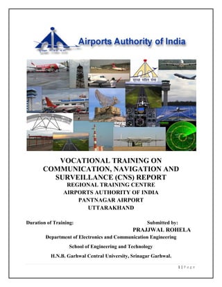
  • 1. 1 | P a g e VOCATIONAL TRAINING ON COMMUNICATION, NAVIGATION AND SURVEILLANCE (CNS) REPORT REGIONAL TRAINING CENTRE AIRPORTS AUTHORITY OF INDIA PANTNAGAR AIRPORT UTTARAKHAND Duration of Training: Submitted by: PRAJJWAL ROHELA Department of Electronics and Communication Engineering School of Engineering and Technology H.N.B. Garhwal Central University, Srinagar Garhwal.
  • 2. 2 | P a g e CERTIFICATE This is to certify that Mr. Prajjwal Rohela has undergone Vocational Training at the Regional Training Centre Airports Authority of India PANTNAGAR Airport, UTTARAKHAND. To the best of my knowledge, this Project Report has not been submitted for any other examination and does not form a part of any other course undergone by the candidate. Signature (Course Coordinator) Dated: Place: Pantnagar Remarks:
  • 3. 3 | P a g e STUDENT DECLARATION I hereby declare that vocational training report on: COMMUNICATION, NAVIGATION AND SURVEILLANCE (CNS) is submitted to Regional Training Centre, Airports Authority of India PANTNAGAR Airport on the completion of Vocational Training at the Regional Training Centre, Airports Authority of India PANTNAGAR Airport from Pantnagar Dated: Prajjwal Rohela.
  • 4. 4 | P a g e INDEX TOPIC PAGE NO. ❖ ACKNOWLEDGEMENT 5 ❖ ABOUT AAI 6 ❖ CNS 10 ❖ VHF 11 ❖ RADAR 16 ❖ DME 20 ❖ ILS 22 ❖ NDB 25 ❖ SECURITY EQUIPMENTS 26 ❖ HF (SELCAL) 32 ❖ AMSS 33 ❖ MET 37 ❖ ATM 39 ❖ GPS 41 ❖ CONCLUSION 43 ❖ BIBLOGRAPHY 44 ❖ APPENDIX 45
  • 5. 5 | P a g e ACKNOWLEDGEMENT I would like to express my heartfelt gratitude to all the officers of Airports Authority of India PANTNAGAR Airport, UTTRAKHAND who gave me the opportunity to learn and interact with their extremely competent Officers, Engineers and Staff and learn about the wonderful and diverse world of Communication, Navigation and Surveillance (CNS). The experience was extremely enriching and inspirational. In my opinion the Communication, Navigation and Surveillance (CNS) division of Airport Authority of India provides best facility and opportunity for training and internship in the field of Electronics and Communication Engineering (ECE). No other industry has such extensive use of ECE engineering equipment. I therefore am overjoyed that I got an opportunity to undergo this extremely informative and educational training in the CNS division of AAI, PANTNAGAR for a period of 4 weeks which enabled me to get hands on experience in the field of aeronautics telecommunication operation, equipment used and maintenance. Besides the aspects of Communication Engineering, the training also gave me an opportunity to experience the industry environment and the dedication and hard work it demands from an individual. I would once again like to thank everyone at Airport Authority of India Pantnagar, Uttarakhand especially who undertook our training sessions, by taking precious time out for us despite their busy schedule.
  • 6. 6 | P a g e ABOUT- AIRPORTS AUTHORITY OF INDIA (AAI) Fig: Emblem of the AAI. Mission: ''To achieve highest standards of safety and quality in air traffic services and airport management by providing state-of-the-art infrastructure for total customer satisfaction, contributing to economic growth and prosperity of the nation.'' Vision : ''To be a world-class organization providing leadership in air traffic services and airport management & making India a major hub in Asia Pacific region by 2016''. Airports Authority of India (AAI) was constituted by an Act of Parliament and came into being on 1st April 1995 by merging erstwhile National Airports Authority and International Airports Authority of India. The merger brought into existence a single Organization entrusted with the responsibility of creating, upgrading, maintaining and managing civil aviation infrastructure both on the ground and air space in the country. Dr. Guruprasad Mohapatra is the current chairman of the AAI. The airport in India falls in the one or more of the following categories which is under the AAI: • Domestic - They handle domestic fights. • International - They handle international flights. • Defence - They are handled by the armed forces. • Private - They are for specific purpose. At present, 64 airports have Domestic status and 22 others have International status. 32 airports are Defence airports and 16 airports are privately authorized. Thus, we have a total of 134 airports. AAI provides air navigation services over 2.8 million square nautical miles of air space.
  • 7. 7 | P a g e During the year 2008- 09, AAI handled aircraft movement of 1306532 Nos. [International 270345 & Domestic 1036187], Passengers handled 44262137 Nos. [International 1047614 & Domestic 33785990] and the cargo handled 499418 tons [International 318242 & Domestic 181176]. Pantnagar Airport is a Domestic Airport located in Pantnagar of Udham Singh Nagar district in the Indian state of Uttarakhand. It is operated by the Airport Authority of India. It is the nearest airport to the Kumaon hill station of Nainital (65 km). The airport was able to accommodate only small aircrafts until 2008, when the length of runway was increased to 4,500 feet to accommodate larger turboprop aircraft at a cost of 75 crores. In August 2015, Airport Advisory Committee said that the Airport will be developed in cargo hub and the length of the runway will be increased from its present length of 1,372m to 1,865m. 1. Passenger Facilities The main functions of AAI inter-alia include construction, modification & management of passenger terminals, development & management of cargo terminals, development & maintenance of apron infrastructure including runways, parallel taxiways, apron etc., Provision of Communication, Navigation and Surveillance which includes provision of DVOR / DME, ILS, ATC radars, visual aids etc., provision of air traffic services, provision of passenger facilities and related amenities at its terminals thereby ensuring safe and secure operations of aircraft, passenger and cargo in the country. 2. Air Navigation Services In tune with global approach to modernization of Air Navigation infrastructure for seamless navigation across state and regional boundaries, AAI has been going ahead with its plans for transition to satellite based Communication, Navigation, Surveillance and Air Traffic Management. A number of co-operation agreements and memoranda of co-operation have been signed with US Federal Aviation Administration, US Trade & Development Agency, European Union, Air Services Australia and the French Government Co-operative Projects and Studies initiated to gain from their experience. Through these activities more and more executives of AAI are being exposed to the latest technology, modern practices & procedures being adopted to improve the overall performance of Airports and Air Navigation Services. Induction of latest state-of-the-art equipment, both as replacement and old equipment and also as new facilities to improve standards of safety of airports in the air is a continuous process. Adoptions of new and improved procedure go hand in hand with induction of new equipment. Some of the major initiatives in this direction are introduction of Reduced Vertical Separation Minima (RVSM) in India air space to increase airspace capacity and reduce congestion in the air; implementation of
  • 8. 8 | P a g e GPS And Geo Augmented Navigation (GAGAN) jointly with ISRO which when put to operation would be one of the four such systems in the world. 3. Security The continuing security environment has brought into focus the need for strengthening security of vital installations. There was thus an urgent need to revamp the security at airports not only to thwart any misadventure but also to restore confidence of traveling public in the security of air travel as a whole, which was shaken after 9/11 tragedy. With this in view, a number of steps were taken including deployment of CISF for airport security, CCTV surveillance system at sensitive airports, latest and state-of-the-art X-ray baggage inspection systems, premier security & surveillance systems. Smart Cards for access control to vital installations at airports are also being considered to supplement the efforts of security personnel at sensitive airports. 4. Aerodrome Facilities In Airports Authority of India, the basic approach to planning of airport facilities has been adopted to create capacity ahead of demand in our efforts. Towards implementation of this strategy, a number of projects for extension and strengthening of runway, taxi track and aprons at different airports has been taken up. Extension of runway to 7500 ft. has been taken up to support operation for Airbus-320/Boeing 737-800 categories of aircrafts at all airports. 5. HRD Training A large pool of trained and highly skilled manpower is one of the major assets of Airports Authority of India. Development and Technological enhancements and consequent refinement of operating standards and procedures, new standards of safety and security and improvements in management techniques call for continuing training to update the knowledge and skill of officers and staff. For this purpose AAI has a number of training establishments, viz. NIAMAR in Delhi, CATC in Allahabad, Fire Training Centers at Delhi & Kolkata for in-house training of its engineers, Air Traffic Controllers, Rescue & Fire Fighting personnel etc. NIAMAR & CATC are members of ICAO TRAINER programme under which they share Standard Training Packages (STP) from a central pool for imparting training on various subjects. Both CATC & NIAMAR have also contributed a number of STPs to the Central pool under ICAO TRAINER programme. Foreign students have also been participating in the training programme being conducted by these institutions.
  • 9. 9 | P a g e 6. IT Implementation Information Technology holds the key to operational and managerial efficiency, transparency and employee productivity. AAI initiated a programme to indoctrinate IT culture among its employees and this is most powerful tool to enhance efficiency in the organization. AAI website with domain namewww.airportsindia.org.in or www.aai.aero is a popular website giving a host of information about the organization besides domestic and international flight information of interest to the public in general and passengers in particular. Functions of AAI Fig: Steward guiding an aircraft after landing. The functions of AAI are as follows: 1. Design, Development, Operation and Maintenance of International and Domestic Airports and Civil Enclaves. 2. Control and Management of the Indian airspace extending beyond the territorial limits of the country, as accepted by ICAO. 3. Construction, Modification and Management of passenger terminals. 4. Development and Management of Cargo terminals at International and Domestic airports. 5. Provision of passengers Facilities and information system at the passenger terminals at airports. 6. Expansion and strengthening of operation area, viz. Runways, Aprons, Taxiway etc. 7. Provision of visual aids. 8. Provision of Communication and Navigation aids viz. ILS, DVOR, DME, and RADAR etc.
  • 10. 10 | P a g e CNS DEPARTMENT (COMMUNICATION, NAVIGATION & SURVEILLANCE) ❖ Overall in charge of CNS wing ❖ Responsible for technical, operational & administrative nature of services related to CNS wing. ❖ Responsible for procurement of technical spares, award of AMC within Delegation of Financial Authority, coordination with external agencies like DoT, Airlines, WPC etc. ❖ To provide assistance in the implementation of contingency plan in case of emergencies like Anti hijacking etc. ❖ Supervise the maintenance and operation of aeronautical Telecommunication equipment and systems for the Air Traffic Control as well as electronic navigational aids (NDB). ❖ Assesses training and development needs of personnel required for the maintenance of the aeronautical communication and navigational equipment’s. Plans and implements special training programme to bridge identified performance gaps to ensure that international standards are maintained. ❖ Coordinates telephone requirements of all sections in AAI, Pantnagar and Liaise with telephone service providers to determine their configuration and provision. ❖ Acts as the guide for all ATS units for any clarification regarding provision of ATS services.
  • 11. 11 | P a g e VHF (Frequency range 30-300 MHz) Radio spectrum refers to the part of the electromagnetic spectrum corresponding to radio frequencies – that is, frequencies lower than around 300 GHz (or, equivalently, wavelengths longer than about 1 mm). Different parts of the radio spectrum are used for different radio transmission technologies and applications. This radio spectrum is divided into many frequency bands based on frequency ranges. Some of them are – Band Name Abbr. Frequency Range Low Frequency LF 30 – 300 kHz Medium Frequency MF 300 – 3000 kHz High Frequency HF 3 -30 MHz Very High Frequency VHF 30 – 300 MHz Ultra High Frequency UHF 300 – 3000 MHz Very high frequency (VHF) is the radio frequency range from 30 MHz to 300 MHz Common uses for VHF are FM radio broadcast, television broadcast, land mobile stations (emergency, business, private use and military), long range data communication with radio modems, amateur radio, marine communications, air traffic control communications and air navigation systems (e.g. VOR, DME & ILS). It is a line of sight communication system; hence it is not so suitable for very long-distance communication. In Airports Authority of India, VHF communication is mainly used in SMC, DVOR, DME, ILS, Approach control, Tower Control and Area Control. In the VHF band: • 108-156 MHz – Communication band • 118-137 MHz – Aeronautical band • 137-156 MHz – Upper Military band Modes of VHF communication are as follows: 1. Broadcast 2. Point to point
  • 12. 12 | P a g e The VHF frequency present at Pantnagar Airport is 119.5 MHz for Control Tower and for Walkie Talkie it is 161.525 MHz (MOTOROLA and VERTEX). VHF Transmitter • Oscillator is required for generating frequency • Synthesizer is required to generate a range of frequencies • PLL is used for synthesizing PLL for generating 120 MHz frequency VHF AM Transmitter
  • 13. 13 | P a g e Receiver Properties • Sensitivity – Ability to receive the weakest signal • Selectivity – Ability to reject the adjacent channel • Fidelity – Reproduction of quality Formula for calculating total power: Pt = Pc (1+m^2/2) Where Pt is total power, Pc is carrier power, m is percentage of modulation. VHF AM Receiver Other information: • Use of 1st IF (21.4 MHz) is image frequency rejection and use of 2nd IF (0.455 MHz) is adjacent channel rejection. • In order to tune to 120.7 MHz, 1st LO freq. will be 120.7+21.4 MHz = 142.1 MHz, 2nd LO freq. will always be 21.4+0.455 MHz = 21.855 MHz. • Straight dipole impedance is 70-72 ohms. • Folded dipole impedance is 70*n2, where n is the number of folds. • In VHF folded dipole with n=2 is used because its impedance is 70*4= 280 ohms and space impedance is also 300 ohms. This provides impedance matching. • In case of NDBs ground reflection is required, so straight dipole with 50 ohm impedance is used. • Gain of dipole antenna is unity.
  • 14. 14 | P a g e • In the receiver two dipoles are staged together to increase the gain by 3dB. The distance between the two dipoles is to be maintained between 1 lambda to 0.7 lambda. • Dipole is mounted vertically because the polarization is vertical. Radio Propagation Radio Frequencies and their mode of propagation Band Frequency Wavelength Propagation via ELF Extremely Low Frequency 3-300 Hz 1000-100,000 km VLF Very Low Frequency 3-30 kHz 100-10 km Guided between the earth and the ionosphere. LF Low Frequency 30-300 kHz 10-1 km Guided between the earth and the D layer of the ionosphere and Surface waves. MF Medium Frequency 300-3000 kHz 1000-100 m Surface waves and E, F layer ionosphere refraction at night, when D layer absorption weakens. HF High Frequency (Short Wave) 3-30 MHz 100-10 m E layer ionospheric refraction. And F1, F2 layer ionospheric refraction. VHF Very High Frequency 30-300 MHz 10-1 m Generally direct wave. Infrequent E ionospheric refraction. Extremely rare F1,F2 layer ionospheric refraction during high sunspot activity up to 80 MHz . Sometimes tropospheric ducting. UHF Ultra High Frequency 300-3000 MHz 100-10 cm Direct wave. Sometimes tropospheric ducting SHF Super High Frequency 3-30 GHz 10-1 cm Direct Wave. EHF Extremely High Frequency 30-3000 GHz 10-1 mm Direct wave limited by absorption.
  • 15. 15 | P a g e Surface modes Lower frequencies (between 30 and 3,000 kHz) have the property of following the curvature of the earth via ground wave propagation in the majority of occurrences. In this mode the radio wave propagates by interacting with the semi-conductive surface of the earth. The wave "clings" to the surface and thus follows the curvature of the earth. Vertical polarization is used to alleviate short circuiting the electric field through the conductivity of the ground. Since the ground is not a perfect electrical conductor, ground waves are attenuated rapidly as they follow the earth ‘s surface. Attenuation is proportional to the frequency making this mode mainly useful for LF and VLF frequencies. Today LF and VLF are mostly used for time signals, and for military communications, especially with ships and submarines, although radio amateurs have an allocation at 137 KHz in some parts of the world. Direct modes (line-of-sight) Line-of-sight is the direct propagation of radio waves between antennas that are visible to each other. This is probably the most common of the radio propagation modes at VHF and higher frequencies. Because radio signals can travel through many non-metallic objects, radio can be picked up through walls. This is still line-of-sight propagation. Examples would include propagation between a satellite and a ground antenna or reception of television signals from a local TV transmitter. Ground plane reflection effects are an important factor in VHF line of sight propagation. The interference between the direct beam line-of-sight and the ground reflected beam often leads to an effective inverse-fourth-power i.e. (1/distance) ^4 law for ground-plane limited radiation. Ionospheric modes (sky wave) Sky wave propagation, also referred to as skip, is any of the modes that rely on refraction of radio waves in the ionosphere, which is made up of one or more ionized layers in the upper atmosphere. F2-layer is the most important ionospheric layer for long-distance, multiple-hop HF propagation, though F1, E, and D-layers also play significant roles. The D-layer, when present during sunlight periods, causes significant amount of signal loss, as does the E-layer whose maximum usable frequency can rise to 4 MHz and above and thus block higher frequency signals from reaching the F2-layer.
  • 16. 16 | P a g e RADAR Radar is an object-detection system which uses radio waves to determine the range, altitude, direction, or speed of objects. Radar stands for RAdio Detection And Ranging. It can be used to detect aircraft, ships, spacecraft, guided missiles, motor vehicles, weather formations, and terrain. The radar dish or antenna transmits pulses of radio waves or microwaves which bounce off any object in their path. The object returns a tiny part of the wave's energy to a dish or antenna which is usually located at the same site as the transmitter. Classification: - Based on operation: 1. Primary Radar = Co-operation of targets is not required for detection. It works on “echo” technology. 2. Secondary Radar = Active co-operation of targets is required for finding range and other details of target. Based on waveform: 1. CW Radar = can detect moving target and its velocity. 2. CWFM Radar = can detect range using FM signals. 3. Pulsed Radar = uses pulse modulated microwave signals for detecting range & velocity. Based on services: 1. Search Radar = also known as surveillance radar. Uses continuously rotating antenna. Covers large volume of space. 2. Tracking Radar = gives accurate angular position, range and radial velocity of targets with precision. If used for tracking it must first be co-located with search radar for 1st acquiring the target. Applications: - 1. Air Traffic Control 2. Aircraft Navigation 3. Maritime Navigation 4. Meteorological Applications
  • 17. 17 | P a g e 5. Space Applications 6. Military Applications 7. Law Enforcement Applications Radars used in ATC 1. Airport Surveillance Radar (ASR) 2. Air Route Surveillance Radar (SSR) 3. Airport Surface Movement Detection Equipment (ASDE) 4. Precision Approach Radar (PAR) 5. Monopulse Secondary Surveillance Radar (MSSR) Maximum range of RADAR depends on: - a) Peak transmission power (4th root) b) Minimum detectable signal (MDS) c) Antenna Gain d) Radar Cross Section of the target e) Atmospheric Attenuation Primary Radar Primary Radar works on the principle of reflection or ―echo‖. Primary radar antennae continuously send pulses in all possible directions. When these pulses hit some moving or still objects, the pulse is reflected back to the antenna. Generally, the radar transmitter and receiver are located at the same located. The radar processes the information and confirms the presence of an object. If the object is moving either closer or farther away, there is a slight change in the frequency of the radio waves, caused by the Doppler effect. Secondary Radar Secondary radar works target specific. An interrogation pulse is sent from the radar transmitter. The target, on receiving the signal, replies back with another signal. The radar then processes the
  • 18. 18 | P a g e distance covered by the signal and the time taken for the operation and calculates the position of the target accordingly. One kind of secondary radar used by ATC is MSSR or Monopulse Secondary Surveillance Radar. MSSR Interrogation 1. The interrogator transmits a pair of pulses at 1030 MHz. 2. Each pulse has the same duration, shape and amplitude. 3. Their spacing distinguishes various modes of interrogation. 4. P2 pulse is used for control Transponder Reply 1. F1 and F2 are always present (―framing pulses‖). 2. The 12 binary data pulses in four groups of 3 bits: A, B, C, D. 3. 2048 permutations (D1 omitted) of altitude code (Mode C reply) indicating heights. 4. SPI (Special Position Indicator) pulse is used upon request by ground control.
  • 19. 19 | P a g e Difference between Primary & Secondary Radar Primary 1. Co-operation of target not required 2. High power 3. No Code/Altitude information 4. No Saturation 5. Can detect Weather 6. Clutter Problem 7. Any Target Secondary 1. Co-operation of target required 2. Low Power 3. Code & Altitude information available 4. Subject to Saturation 5. No Weather detection 6. No Clutter 7. Friendly Targets
  • 20. 20 | P a g e DME (DISTANCE MEASURING EQUIPMENT) Distance measuring equipment (DME) is a transponder-based radio navigation technology that measures slant range distance by timing the propagation delay of VHF or UHF radio signals. DME is similar to secondary radar, except in reverse. The system was a post-war development of the IFF (identification friend or foe) systems of World War II. Aircrafts use DME to determine their distance from a land-based transponder by sending and receiving pulse pairs. The ground stations are typically co-located with VORs. A typical DME ground transponder system for en-route or terminal navigation will have a 1 kW peak pulse output on the assigned UHF channel. A low-power DME can also be co-located with an ILS glide slope antenna installation where it provides an accurate distance to touchdown function, similar to that otherwise provided by ILS Marker Beacons. The DME system is composed of a UHF transmitter/receiver (interrogator) in the aircraft and a UHF receiver/transmitter (transponder) on the ground. The operation is performed by sending and receiving two pulses of fixed duration and separation. The two pulses are known as interrogation pulse and reply pulse. The first one is sent by the pilot to ground station, and the second one is replied back to the pilot. The aircraft interrogates the ground transponder with a series of pulse-pairs (interrogations). The ground station responds after a precise time delay, called the threshold time. The threshold time for India is 50μs. If the processing time is less than 50μs, a delay counters delays the operational time to the threshold time. The ground station replies with an identical sequence of reply pulse-pairs. To differentiate one aircraft ‘s signal from other, special coding is applied for the signal. Each aircraft has its own coding format. The reply signal is sent using the same coding. The very first process that takes place after interrogation is pulse verification. To differentiate between a valid signal and other signals this pulse verification process is necessary. A valid signal is recognized by its duration. A valid signal has pulse duration of 12μs and has only two pulses. 12µs The permissible frequency range is 962-1215 MHz. Different airports select their transmitting and frequencies among this range. The constraint is that the difference between the receiving and Valid dual pulse signal
  • 21. 21 | P a g e transmitting frequencies must be 63 MHz. For Pantnagar, the frequencies are 1020 MHz and 1083 MHz. A radio pulse takes around 12.36 microseconds to travel 1 nautical mile (1,852 m) to and from; this is also referred to as a radar-mile. The time difference between interrogation and reply 1 nautical mile (1,852 m) minus the 50-microsecond ground transponder delay is measured by the interrogator's timing circuitry and translated into a distance measurement (slant range), stated in nautical miles, and then displayed on the cockpit DME display. The distance formula, distance = rate * time, is used by the DME receiver to calculate its distance from the DME ground station. The rate in the calculation is the velocity of the radio pulse, which is the speed of light (roughly 300,000,000 m/s or 186,000 mi/s). The time in the calculation is (total time - 50μs)/2. A typical DME transponder can provide distance information to 100 aircraft at a time. Above this limit the transponder avoids overload by limiting the gain of the receiver. Replies to weaker more distant interrogations are ignored to lower the transponder load. The technical term for overload of a DME station caused by large numbers of aircraft is station saturation. The accuracy of DME ground stations is 185 m (±0.1 NMI). It's important to understand that DME provides the physical distance from the aircraft to the DME transponder. This distance is often referred to as 'slant range' and depends trigonometrically upon both the altitude above the transponder and the ground distance from it. For example, an aircraft directly above the DME station at 6076 ft. (1 NMI) altitude would still show 1.0 NMI (1.9 km) on the DME readout. The aircraft is technically a mile away, just a mile straight up. Slant range error is most pronounced at high altitudes when close to the DME station. ICAO recommends accuracy of 0.25 NMI plus 1.25% of the distance measured.
  • 22. 22 | P a g e ILS (INSTRUMENT LANDING SYSTEM) An instrument landing system or ILS is a ground-based instrument approach system that provides precision guidance to an aircraft approaching and landing on a runway, using a combination of radio signals and, in many cases, high-intensity lighting arrays to enable a safe landing during instrument meteorological conditions (IMC), such as low ceilings or reduced visibility due to fog, rain, or blowing snow. Instrument approach procedure charts (or approach plates) are published for each ILS approach, providing pilots with the needed information to fly an ILS approach during instrument flight rules (IFR) operations, including the radio frequencies used by the ILS components or Nav-Aids and the minimum visibility requirements prescribed for the specific approach. Radio-navigation aids must keep a certain degree of accuracy (set by international standards of ICAO); to assure this is the case, flight inspection organizations periodically check critical parameters with properly equipped aircraft to calibrate and certify ILS precision. An ILS consists of two independent sub-systems, one providing lateral guidance (localizer), the other vertical guidance (glide slope or glide path) to aircraft approaching a runway. Aircraft guidance is provided by the ILS receivers in the aircraft by performing a modulation depth comparison. A localizer (or LLZ) antenna array is normally located beyond the departure end of the runway and generally consists of several pairs of directional antennas. Two signals are transmitted on one out of 40 ILS channels in the carrier frequency range between 108.10 MHz and 111.95 MHz (with the 100 kHz first decimal digit always odd, so 108.10, 108.15, 108.30, and so on are LLZ frequencies but 108.20, 108.25, 108.40, and so on are not). One is modulated at 90 Hz, the other at 150 Hz and these are transmitted from separate but co-located antennas. Each antenna transmits a narrow beam, one slightly to the left of the runway centerline, the other to the right. A glide slope (GS) or glide path (GP) antenna array is sited to one side of the runway touchdown zone. The GP signal is transmitted on a carrier frequency between 328.6 and 335.4 MHz using a technique similar to that of the localizer. The centerline of the glide slope signal is arranged to define a glide slope of approximately 3° above horizontal (ground level). These signals are displayed on an indicator in the instrument panel. This instrument is generally called the Omni- bearing indicator or Nav-Indicator. The pilot controls the aircraft so that the indications on the instrument (i.e., the course deviation indicator) remain centered on the display. This ensures the aircraft is following the ILS centerline (i.e., it provides lateral guidance). Vertical guidance, shown on the instrument by the glideslope indicator, aids the pilot in reaching the runway at the proper touchdown point. Many aircraft possess the ability to route signals into the autopilot, allowing the approach to be flown automatically by the autopilot.
  • 23. 23 | P a g e Localizer backcourse Modern localizer antennas are highly directional. However, usage of older, less directional antennas allows a runway to have a non-precision approach called a localizer backcourse. This lets aircraft land using the signal transmitted from the back of the localizer array. A pilot may have to fly opposite the needle indication, due to reverse sensing. Marker beacons On some installations, marker beacons operating at a carrier frequency of 75 MHz are provided. When the transmission from a marker beacon is received it activates an indicator on the pilot's instrument panel and the tone of the beacon is audible to the pilot. Outer marker The outer marker is normally located 7.2 km (3.9 NM; 4.5 mi) from the threshold except that, where this distance is not practical, the outer marker may be located between 6.5 to 11.1 km (3.5 to 6.0 NM; 4.0 to 6.9 mi) from the threshold. Middle marker The middle marker should be located so as to indicate, in low visibility conditions, the missed approach point, and the point that visual contact with the runway is imminent, ideally at a distance of approximately 3,500 ft. (1,100 m) from the threshold. Inner marker The inner marker, when installed, shall be located so as to indicate in low visibility conditions the imminence of arrival at the runway threshold. This is typically the position of an aircraft on the ILS as it reaches Category II minima, ideally at a distance of approximately 1,000 ft. (300 m) from the threshold. ILS Categories There are three categories of ILS which support similarly named categories of operation. Information below is based on ICAO. 1. Category I (CAT I) – A precision instrument approach and landing with a decision height not lower than 200 feet (61 m) above touchdown zone elevation and with either a visibility not less than 800 meters or 2400 ft. or a runway visual range not less than 550 meters (1,800 ft.) on a runway with touchdown zone and runway centerline lighting.
  • 24. 24 | P a g e 2. Category II (CAT II) – A precision instrument approach and landing with a decision height lower than 200 feet (61 m) above touchdown zone elevation but not lower than 100 feet (30 m), and a runway visual range not less than 350 meters (1,150 ft.). 3. Category III (CAT III) is subdivided into three sections: a. Category III A – A precision instrument approach and landing with: i. a decision height lower than 100 feet (30 m) above touchdown zone elevation, or no decision height (alert height); and ii. a runway visual range not less than 200 meters (660 ft.). b. Category III B – A precision instrument approach and landing with: i. a decision height lower than 50 feet (15 m) above touchdown zone elevation, or no decision height (alert height); and ii. a runway visual range less than 200 meters (660 ft.) but not less than 50 meters (160 ft.). c. Category III C – A precision instrument approach and landing with no decision height and no runway visual range limitations. This category is not yet in operation anywhere in the world, as it requires guidance to taxi in zero visibility as well. "Category III C" is not mentioned in EU-OPS. Category III B is currently the best available system.
  • 25. 25 | P a g e NON-DIRECTIONAL BEACONS (Frequency: 400 KHz) A non-directional (radio) beacon (NDB) is a radio transmitter at a known location, used as an aviation or marine navigational aid. As the name implies, the signal transmitted does not include inherent directional information, in contrast to other navigational aids such as low frequency radio range, VHF Omni directional range (VOR) and TACAN. NDB signals follow the curvature of the earth, so they can be received at much greater distances at lower altitudes, a major advantage over VOR. However, NDB signals are also affected more by atmospheric conditions, mountainous terrain, coastal refraction and electrical storms, particularly at long range. NDBs used for aviation are standardized by ICAO Annex 10 which specifies that NDBs be operated on a frequency between 190 kHz and 1750 kHz, although normally all NDBs in North America operate between 190 kHz and 535 kHz. Each NDB is identified by a one, two, or three- letter Morse code call sign North American NDBs are categorized by power output, with low power rated at less than 50 watts, medium from 50 W to 2,000 W and high being over 2,000 W. A bearing is a line passing through the station that point in a specific direction, such as 270 degrees (due West). NDB bearings provide a charted, consistent method for defining paths aircraft can fly. In this fashion, NDBs can, like VORs, define "airways" in the sky. Aircraft follow these pre-defined routes to complete a flight plan. Airways are numbered and standardized on charts; colored airways are used for low to medium frequency stations like the NDB and are charted in brown on sectional charts. Green and red airways are plotted east and west while amber and blue airways are plotted north and south. While most airways in the United States are based on VORs, NDB airways are common elsewhere, especially in the developing world like India and in lightly populated areas of developed countries, like the Canadian Arctic, since they can have a long range and are much less expensive to operate than VORs. Other information: 1. NDBs operate in Medium frequency range. 2. NDB provides magnetic bearing and DVOR provides relative bearing. 3. Bearing is always measured from Magnetic North. 4. True North is fixed and magnetic North varies, In India variation is about 2-6 degrees.
  • 26. 26 | P a g e SECURITY EQUIPMENTS Security equipment’s are used to secure our flights from various harmful situations which will after that helps us to maintain the privacy level of the airport. Security equipment covers a wide assortment of protection, identification, surveillance and detection devices, such as cameras, alarm systems, scanners, closed-circuit televisions, x-ray machines and much more. It also includes a number of more basic items, such as tags, cases, access cards, gates, locks and mirrors, as well as complete security systems for homes, businesses and other facilities. Virtually any level of security can be achieved, from the simple deterrence afforded by fake cameras, proximity switches and similar devices, to the high-level protection offered by include blast-proof doors, hidden cameras and metal detectors. For larger facilities and homes, identification systems ensure that all visitors, guests and employees have proper clearance, and supply complete onsite tracking functions. Labeling and scanning systems allow business owners to monitor stock, log shipments and keep track of permanent equipment. Automatic gates, electronic locks and heavy-duty doors provide a means to further secure offices, inventory and personnel. Security equipment manufacturers produce a complete range of standard and custom alarm systems. These systems, which are designed to respond to proximity, movement, temperature change, and/or a multitude of other environmental triggers, can be engineered to protect virtually any object, individual, vehicle or location. Portable security systems are also available, allowing users to protect themselves or their products while on the move. For additional home security, manufacturers produce various types of surveillance equipment and supplies, including night vision goggles, bug detectors, and audio and video recording devices. Home and facility security systems generally operate in tandem with a security agency contracted to respond to alarms and other disturbances, as well as with local law enforcement officials. These security personnel can be on location or off-site, depending on services employed; large facilities generally utilize on-site personnel for after-hours security and day-to- day operational control, while small homes and businesses often use a combination of alarms and patrols. Security equipment’s used in Airports are of various types are:- 1. X-Ray Baggage System. 2. Metal Detectors. 3. Explosive Trace Detectors.
  • 27. 27 | P a g e • X-Ray Baggage System The existing X-Ray machines installed at check in area to screen registered baggage are in stand- alone mode and not capable of detecting 100% explosives. Stand-alone machines occupy space at departure lounges and also cause big queues, which disrupt passenger flow during peak hours. Keeping in view the security threat, it is desirable that multi-level in-line detection system is installed at major airports. The multi-level X-Ray screening system has already been installed at various international airports abroad. The online hold baggage handling system (HBS) shall be integrated with airport baggage handling in order to provide complete hold baggage processing and screening system. It is recommended that installation of hold baggage screening system and X-ray BIS conveyer belt may be integrated and the work awarded as turn key project. Depending upon the passengers’ peak hour density the level may be varied from three to four. Initially on- line hold baggage screening system shall be introduced at Delhi, Mumbai, Chennai, Kolkata, Ahmadabad, Calicut, Varanasi, Amritsar, Vizag and Srinagar airports. All new terminals and airports constructed in future will have only HBS. The priority of installation of HBS shall be decided by AAI in consultation with BCAS. There are mainly three components of an X-Ray generator tube Cathode, Anode and glass envelop. Cathode acts to excite electrons, so that they become free from their parent atom, when heated. Anode is supplied with +HV, which attracts the electrons emitted from the cathode. The above components are sealed in a glass envelop so that by means of evacuation the life of X- generation tube is increased and there is no obstruction in the path of electrons, due to foreign particles. MAS – miliampere second is a function of amps applied (mA) and amount of time the amps are applied in a second. KVP – kilo volt peak is a measurement of energy applied to the electrons which accelerate them through the high voltage field that exists between the cathode and anode. Collimator is made of highly absorbing material such as lead which selects X-rays along a particular direction. If an X-Ray machine is not used from more than last six months regeneration of the X-Ray tube must be done. Detection of X-Rays is done by a low detectors and high detectors separated by a Cu filter. Each detector (low & high) contains scintillator crystals, photo diodes and voltage amplifiers. The detector modules provide the conversion of X-radiation in to process able voltage values. A conveyor belt is driven through a single or three phase motors (depends on machine), the speed of the belt is kept constant at correct speed to avoid distorted picture. To detect the baggage on the conveyor belt two sets of light barriers are used.
  • 28. 28 | P a g e Light barrier set contains one infrared Tx and Rx pair. There are total 9 exchangeable modules in detector line. All are positioned in L shape. Each module contains both low and high detector. And each module (low & high) has 64 scintillator crystals and 64 photo diodes. Total 576 voltage values from low detectors and 576 voltage values from high detectors are used to represent a slice of 1 mm thickness. • ETD (Explosive Trace Detector) The Explosive Trace Detectors are designed to detect nanogram (ng) level of explosive traces. The swipe or vapor mode may be used for collection of samples and analysis. The equipment selected for airport environment shall meet the minimum specifications as given below: The specifications are applicable for both marked and unmarked explosives. The buyer may opt for a better technology and equipment as per their requirement. Smith’s Detection’s IONSCAN 500DT (Dual Tube) is a reliable, highly sensitive instrument using Ion Mobility Spectrometry (IMS) technology. It has been optimized for the detection of illicit drugs and explosives. Identification of substances by IMS technology is made possible by a few basic principles: a. Many chemical substances give off vapors or particles that are absorbed by the surface. These traces can be collected by wiping the surfaces. b. When these particles came in contact with the heat, microscopic traces of such chemicals can be desorbed. These vaporized substances enter the IMS where it ionized. c. When these ions are allowed to drift in a controlled electric field, they move at different speeds, depending on their size and structure. The characteristic speed at which an ion moves is a distinct that identifies the original substance. The IONSCAN 500DT sample collection system uses a sampling wand. The sampling wand features a detachable sampling frame containing a sampling swab. The graphical user interface has been designed for ease of use. Using touch screen technology, operators can easily access the menus and screen for operational of informational purposes. The test shall be conducted in different stages starting from checking configuration data on technical parameters, system calibration, data collection etc. The proper record of details should be maintained.
  • 29. 29 | P a g e These stages are: - ➢ Configuration details – checking of technical parameters. ➢ Operational and environment data ➢ System calibration ➢ Threshold verification ➢ Test article selection ➢ Pretest activities ➢ Data collection ➢ Problem reporting ➢ Posttest activities. The test team will check the details of technical parameters claimed by suppliers are in conformity with the specification issued by the BCAS. The equipment shall meet the specification as given below. 1. Explosives detected i.e. RDX, PETN, TNT, PEK, Sheet explosives, LTPE, Ammonium Nitrate, Gelatin etc. 2. Susceptibility to interference (i.e. including specific interference’s tending to mask the explosive): minimum 3. Sensitivity/ sensitivity loss: Nanogram level of explosive 4. Response(s) time to the explosives: 6 seconds 5. Sampling methods: swipe and vapor mode 6. False alarm rate: less than 2 % 7. Time taken for recalibration: not more than 2 minutes 8. Warm up time: 20 to 30 minutes 9. Environmental limits: operating temperature – 20 to +50oC, relative humidity 95% non- condensing. 10. Safety factors and regulations: should meet National Safety regulations 11. Human intervention requirements: minimum 12. System design overview: as per specification. 13. Response time and processing rate of the equipment: 10 sec. 14. Physical requirements; and weight less than 40 kg/ portable. Functional and performance capabilities: detect service and 15. commercial explosives as given in the specifications. 16. Supporting data regarding training, maintenance and availability of spares Instruction manuals, operation manuals, circuit diagram, and the engineering documents must be included to assist the test and evaluation team in its evaluation of the equipment.
  • 30. 30 | P a g e • Metal Detectors Old metal detectors worked on energy absorption principle used two coils as search coils, these were forming two loops of a blocking oscillator. When any person carrying a metallic object or a weapon stepped through the door carrying coils, some energy was absorbed and the equilibrium of the blocking oscillator got disrupted. This change was converted into audio and visual indications. Size and weight of the metallic object was determined by proper sensitivity settings. The hand-held metal detectors used the same technique. These type of metal detectors carried various shortcomings and they have been superseded by new generation multi zone equipment’s working on PI technology TYPES- The metal detectors, used in aviation sector are generally of two types . 1. HAND HELD METAL DETECTORS(HHMD). 2. DOOR FRAME METAL DETECTORS(DFMD). • HHMD (Hand Held Metal Detector) The coil is the part of the oscillating circuit frequency is 23.5 kHz. When the metal object is inside the sensing area of the coil, it will affect to amplitude of the oscillating signal. After a while the integrating control will set the amplitude a constant value. Output of an oscillator is rectified and it is connected through the filter section to comparator. When the signal is lower than the adjusted references level (sensitivity setting) comparator generates an alarm signal. It activates the alarm oscillator and the audible alarm/the red alarm light. Battery voltage is controlled with a low voltage circuit and constant alarm is activated when the battery voltage is under 7 volts. The connector in the rear of the until operates as headphones and charger connections. The charger idle voltage is between 14 and 24 VDC. During charging the green light is plinking and with full battery it lights constantly. If headphones are connected, audible alarm is not operational. • DFMD (Door Frame Metal Detector) The transmitter coil generates a pulsed magnetic field around them. Metal objects taken through the detector generate a secondary magnetic field, which is converted into the voltage level by the receiver coil. Metor 200 consist of eight separate overlapping transmitter and receiver coil pairs. The signals received from each receiver coil are processed individually thus the transmitter and receiver coil pair form eight individual metal detectors.
  • 31. 31 | P a g e The operation is based on electromagnetic pulsed field technology as below in addition to the above explanation: 1. Transmitter pulse cause Decaying eddy currents in metal objects insight the sensing area of the WTMD. 2. The signal induced to the receiver by the eddy currents is sampled and processed in the electronic unit Moving metal objects are detected when the signal exceeds the alarm threshold Fig: DFMD Metor 200 DFMD works on PI technology. Pulses are supplied to eight Tx coils sequentially. Transmitter pulses causes decaying eddy current in the metal object inside the sensing area of the DFMD. The signal induced in the Rx by the eddy current is sampled and produced in the electronic unit. Moving metal object is detected when the signal exceeds the alarm, threshold. The user controls the function of the metal detectors with a remote-control unit. PI technology is used in latest metal detectors (DFMD) of AAI. In this technique a train of pulses are used to generate electromagnetic field, when a metal object is detected the decay time of the reflected pulse (echo) is increased which causes detection of metal.
  • 32. 32 | P a g e HF (SELCAL) SELCAL is a signaling method which can alert an individual aircraft that a ground station wishes to communicate with it. SELCAL signals can be transmitted over either HF or VHF RTF. A SELCAL transmission consists of a combination of four preselected audio tones which takes approximately two seconds to transmit. The tones are generated by a SELCAL encoder at the ground stations and received by a decoder connected to the audio output of the aircraft receiver. SELCAL can relieve a flight crew from maintaining a listening watch on assigned frequencies, which can be especially helpful where ATC RTF still relies upon noisy HF channels. Receipt of an assigned SELCAL code activates a flight deck call system which may be a light, an audible chime or both. On aircraft equipped with SELCAL, the flight crew can maintain a listening watch using either headsets or flight deck speaker. HF SSB suppressed carrier mode is not used to transmit SELCAL signals so many aircraft HF SSB transceivers are designed to detect SELCAL signals transmitted in the full carrier mode even though the transceiver mode selector switch is selected to the suppressed carrier mode. Transceivers which do not have this feature must have the selector switch in the full carrier mode of operation to reliably detect a SELCAL signal but the mode selector switch must be returned to the suppressed carrier mode before aircraft voice transmissions are made. SELCAL codes are assigned to aircraft operators and not to individual aircraft. Aviation Spectrum Resources (ASRI) is the registrar of SELCAL codes worldwide. Older SELCAL units are based on 12 tones and are shared with other aircraft. ASRI, as the SELCAL registrar, has historically tried to minimize assignment of potentially conflicting duplicate SELCAL codes by relating code assignment to geographical area of aircraft operation. This has been increasingly less successful and it is now not unusual to have more than one aircraft with the same SELCAL identification operating in the same geographical area at the same time. Operators using these 12 tone codes are recommended to advise ASR of changes to the geographical areas of operation of their aircraft. Newer SELCAL units are predicated on 16 tones and are also assigned on a shared basis since very few available SELCAL codes remain unassigned. There are currently no plans by ICAO to increase the number of available tones. Flight crews of aircraft with SELCAL equipment are advised to be alert to the potential for duplicated SELCAL codes and to listen closely to the Flight Identification (ID), as well as SELCAL, to avoid taking a clearance meant for another flight.
  • 33. 33 | P a g e AMSS (AUTOMATIC MESSAGE SWITCHING SYSTEM) Introduction The AMSS is a computer-based system, centered on the Aeronautical Fixed Telecommunication Network (AFTN) for exchange of Aeronautical messages by means of auto-switching for distribution of messages to its destination(s). This system works on store and forward principle. AMSS is an acronym for Automatic Message Switching System. It has four major areas: - System - Switching - Messages - Automation 1. System: AMSS is a dual architecture computer-based system which consists of few servers and workstations which are linked to each other over a local area network as well as other equipment/devices for data communication. 2. Messages: AMSS is mainly for exchange of AFTN messages, but at the same time AMSS can handle some non-AFTN messages like AMS messages (formally known as HFRT/Radio messages). 3. Switching: AMSS receives the messages from the terminals connected via other switches, and after analyzing, stores the messages as well as automatically retransmits the messages to their destination. During the above process it uses switching system, which allows on demand basis the connection of any combination of source and sink stations. AFTN switching system can be classified into three major categories: a. Line Switching b. Message Switching c. Packet Switching 4. Automation: So far as automation is considered for any system, it could be achieved by means of mechanical devices like relay etc. and/or application software design as per requirement. In Electronics Corporation of India Limited (ECIL) AMSS, maximum features of automation like
  • 34. 34 | P a g e message switching, analyzing, storing, periodical statistics etc. are taken care of by AMSS software and few means of mechanical system. Hardware Configuration AMSS consists of three major components: - Core System - Recording System - User ‘s Terminal 1. Core System: It incorporates communication adapters, protocols/suites, routing and gateway facilities. The core system is composed of two identical computer machines (known as AMSS main servers) which run in an operational/hot standby combination. Both units supervise each other ‘s software and hardware. In case of software/hardware failure of the operational unit, the hot standby unit is activated automatically so that it can take over immediately without loss of data. The core system also includes remote communication adaptors, multiplexers and one/two computer(s), known as communication servers, to avail the communication gateway facilities (if any). 2. Recording System: It has two identical mass data storage devices for storing of all incoming and outgoing AFTN messages. It also has two identical mirrored Database servers which are operated in parallel. The mirroring between the two database servers is performed in the background to store specified type messages like NOTAM, MET, ATC, HFRT, with no effect on the regular operation. 3. User’s Terminals: It is the interface between user and the system with capability for uniform administration and monitoring facilities for all system components, networks and data as well as exchange of data as per requirement of users vide different type application software. Any number of user terminals (maximum 60) can be installed and used simultaneously.
  • 35. 35 | P a g e Other information: 1. The Ethernet port is known as RJ-45. (Register Jack-45) 2. The serial port which uses RS-232 protocol and is used to connect printers to computers can be used to connect two computers and exchange data. 3. Switches work on the physical address and Routers work on IP addresses. 4. To reach a particular user in a LAN network Media Access Control (MAC) address is required, this cannot be achieved using IP address. 5. Length of IP address- 32 bits and MAC address is 48 bits.
  • 36. 36 | P a g e 6. MLLN- Managed Leased Line Network 7. Windows NT or Windows XP Operating System (OS) is used at Work Stations and Unix based OS is used for the Server. 8. All software is provided by ECIL and software used at Server end is called Backend Software and is written in C language whereas software used at Work Station end is called Frontend Software and is written in Visual C. 9. There are 4 layers in TCP/IP protocol stack as compared to 7 layers in OSI model. The layers are shown below: 10. In TCP/IP protocol there is no error checking in Internet layer but in X.25 protocol there is error checking in the Internet layer. This makes X.25 very efficient and robust but makes it slow which is the reason it is getting obsolete. 11. Difference between Switch and HUB: In a HUB a message is broadcast with its MAC address and is transmitted to all the receiving ports and collisions occur. In a Switch the MAC address is matched with the PC name and sent only to that particular port, thus reducing collision. 12. In Dual Architecture the storage device (hard-disk) is connected using Daisy Chain connectivity. In such systems SCSI platform hard-disks are used.
  • 37. 37 | P a g e MET (METEOROLOGICAL TERMINAL) VOLMET or meteorological information for aircraft in flight, is a worldwide network of radio stations that broadcast TAF, SIGMET and METAR reports on shortwave frequencies, and in some countries on VHF too. Reports are sent in upper sideband mode, using automated voice transmissions. Pilots on international routes, such as North Atlantic Tracks, use these transmissions to avoid storms and turbulence, and to determine which procedures to use for descent, approach, and landing. The VOLMET network divides the world into specific regions, and individual VOLMET stations in each region broadcast weather reports for specific groups of air terminals in their region at specific times, coordinating their transmission schedules so as not to interfere with one another. Schedules are determined in intervals of five minutes, with one VOLMET station in each region broadcasting reports for a fixed list of cities in each interval. These schedules repeat every hour. OLMET, or meteorological information for aircraft in flight, is the term applied to a worldwide network of radio stations that broadcast TAF (Terminal Area Forecast). TAF is a format for reporting weather forecast information relating to aviation applying to five statute mile radius from the center of the airport runway complex), SIGMET (Significant Meteorological Information, is a weather advisory that contains meteorological information concerning the safety of all aircraft) and METAR (format for reporting weather information) reports on shortwave frequencies. In some countries, VOLMET stations broadcast on VHF frequencies too. A listing of VOLMET broadcasts by provider, inclusive of broadcast time, frequency(s) and a list of aerodromes for which information is provided, can be found in the appropriate enroute supplements for the region in question. With the ever-increasing availability of SATCOM and Data Link equipment such as ACARS, the reliance on VOLMET is diminishing. None the less, it is anticipated that VOLMET stations will continue to broadcast in-flight weather information in the coming years. With the selective calling system known as SELCAL, the voice call is replaced by the transmission of coded tones to the aircraft over the radiotelephony channels. A single selective call consists of a combination of four pre-selected audio tones whose transmission requires approximately two seconds. The tones are generated in the aeronautical station coder and are received by a decoder connected to the audio output of the airborne receiver.
  • 38. 38 | P a g e Receipt of the assigned tone code activates a cockpit call system in the form of light and/or chime signals ICAO Selcal (also known as AVCALL, ANNEX 10, or just SELCAL) is a HF/VHF aviation selective calling system used by ground stations to initiate radio communications with aircraft. Recommendation. — Where a SELCAL system is installed, the following system characteristics should be applied: a) Transmitted code. Each transmitted code should be made up of two consecutive tone pulses, with each pulse containing two simultaneously transmitted tones. The pulses should be of 1.0 plus or minus 0.25 seconds duration, separated by an interval of 0.2 plus or minus 0.1 second. b) Stability. The frequency of transmitted tones should be held to plus or minus 0.15 per cent tolerance to ensure proper operation of the airborne decoder. c) Distortion. The overall audio distortion present on the transmitted RF signal should not exceed 15 per cent. d) Per cent modulation. The RF signal transmitted by the ground radio station should contain, within 3 dB, equal amounts of the two modulating tones. The combination of tones should result in a modulation envelope having a nominal modulation percentage as high as possible and in no case less than 60 per cent.
  • 39. 39 | P a g e ATM (AIR TRAFFIC MANAGEMENT) It provides the Air Traffic Services over the Indian airspace and adjoining oceanic areas in accordance with the ICAO Standards and Recommended Practices. Airspace sectorization, Upper airspace harmonization, complete ATM automation of all airports with conflict management and decision-making tools for controllers have been taken up and are in various stages of implementation. This will lead to flexible and dynamic management of airspace contributing to safe and efficient flow of en route traffic. In addition, improvement in Air Space Management procedures, implementation of ATFM, establishment of in-house R&D capability And improvement in Training infrastructure are being implemented which will lead to enhanced Safety, Efficiency and Capacity of aircraft operations. Latest Air Space management procedures have already been implemented leading to considerable increase in airspace capacity In near future, New CNS/ATM systems will be introduced on priority in terms of the AAI's plan as well as the ICAO's Regional Plan. These will ensure a total coverage of the airspace in India. There will be greater civil-military liaison for joint surveillance of Indian airspace. Integration of Civil/Military Air Traffic Services will be developed to ensure uniformity in air-traffic control services at civilian and Defence airports. To achieve air safety of the highest order, unidirectional air corridor concept shall be introduced, wherever traffic so justifies in close liaison with the Defence authorities. Maximum use will be made of radars and other navigational aids available with civil and Defence airport authorities thus enhancing the overall route navigation and surveillance facilities. A Central Control Unit will be established very soon in order to monitor all flights in the country from the security point of view. In airports now owned or operated by AAI, air traffic control equipment may be installed either by AAI or the concerned airport operator. Air Traffic Control (ATC) services will normally be provided by AAI, except for approach and aerodrome control services, which may be provided by licensed ATCs engaged by the airport operator. Tower Remote Tower solutions provide a smarter approach to air traffic control by digitizing and integrating airport functions. Whether that airport is an international hub, a small regional airport or a new airport, we offer effective solutions that improve safety and operational efficiency. The air traffic control officer (ATCO) or aerodrome flight information services officer (AFISO) will be re-located to a remote tower center (RTC) from where they will provide the ATS.
  • 40. 40 | P a g e The RVT concept is aiming at providing: • Remote tower services at small and medium size airports, by personnel located at a remote tower Centre somewhere else. • Contingency services at major airports, in the case of fire or other events which could take place at the control tower building. The contingency facility should be at safe, nearby, but different physical location. • Synthetic augmentation of vision to increase situational awareness at airports during poor visibility conditions at the local airport control tower facilities. The airspace users should be provided with the appropriate level of services as if the ATS were provided locally at the airport. The SESAR Joint Undertaking projects are looking at RVT concepts, based on either one person controlling one airport, or one person controlling multiple airports. Air Traffic Control Service: give landing and take-off clearance and entering runway clearances. Traffic Information Service: traffic information between VFR/VFR and IFR/VFR as appropriate Alerting Service in the control Zone.
  • 41. 41 | P a g e GPS (GLOBAL POSITIONING SYSTEM) The Global Positioning System (GPS), originally Navstar GPS, is a satellite-based radio navigation system owned by the United States government and operated by the United States Air Force. It is a global navigation satellite system that provides geolocation and time information to a GPS receiver anywhere on or near the Earth where there is an unobstructed line of sight to four or more GPS satellites. [ Obstacles such as mountains and buildings block the relatively weak GPS signals. The GPS does not require the user to transmit any data, and it operates independently of any telephonic or internet reception, though these technologies can enhance the usefulness of the GPS positioning information. The GPS provides critical positioning capabilities to military, civil, and commercial users around the world. The United States government created the system, maintains it, and makes it freely accessible to anyone with a GPS receiver. The GPS project was launched by the U.S. Department of Defense in 1973 for use by the United States military and became fully operational in 1995. It was allowed for civilian use in the 1980s. Advances in technology and new demands on the existing system have now led to efforts to modernize the GPS and implement the next generation of GPS Block IIIA satellites and Next Generation Operational Control System (OCX). Announcements from Vice President Al Gore and the White House in 1998 initiated these changes. In 2000, the U.S. Congress authorized the modernization effort, GPS III. During the 1990s, GPS quality was degraded by the United States government in a program called "Selective Availability"; this was discontinued in May 2000 by a law signed by President Bill Clinton. The GPS service is provided by the United States government, which can selectively deny access to the system, as happened to the Indian military in 1999 during the Kargil War or degrade the service at any time. As a result, several countries have developed or are in the process of setting up other global or regional satellite navigation systems. The Russian Global Navigation Satellite System (GLONASS) was developed contemporaneously with GPS but suffered from incomplete coverage of the globe until the mid-2000s. GLONASS can be added to GPS devices, making more satellites available and enabling positions to be fixed more quickly and accurately, to within two meters (6.6 ft). China's BeiDou Navigation Satellite System is due to achieve global reach in 2020. There is also the European Union Galileo positioning system, and India's NAVIC. Japan's Quasi-Zenith Satellite System (QZSS) is a GPS satellite-based augmentation system to enhance GPS's accuracy. When selective availability was lifted in 2000, GPS had about a five-meter (16 ft) accuracy. The latest stage of accuracy enhancement uses the L5 band and is now fully deployed. GPS receivers released in 2018 that use the L5 band can have much higher accuracy, pinpointing to within 30 centimetres or 11.8 inches.
  • 42. 42 | P a g e GPS type navigation was first used in war in the 1991 Persian Gulf War, before GPS was fully developed in 1995, to assist Coalition Forces to navigate and perform maneuvers in the war. The war also demonstrated the vulnerability of GPS to being jammed, when Iraqi forces installed jamming devices on likely targets that emitted radio noise, disrupting reception of the weak GPS signal. GPS's vulnerability to jamming is a threat that continues to grow as jamming equipment and experience grows. GPS signals have been reported to have been jammed many times over the years for military purposes. Russia seems to have several objectives for this behavior, such as intimidating neighbors while undermining confidence in their reliance on American systems, promoting their GLONASS alternative, disrupting Western military exercises, and protecting assets from drones. China uses jamming to discourage US surveillance aircraft near the contested Spratly Islands. North Korea has mounted several major jamming operations near its border with South Korea and offshore, disrupting flights, shipping and fishing operations.
  • 43. 43 | P a g e CONCLUSION You are the wind beneath my wings‖, this quote has a more literal meaning in the aviation industry for the pilots and all aboard any aircraft soaring high in the firmaments amidst picturesque cloud formations. The wind is in fact the Airport Authority of India and its meticulous, gifted and punctilious officers who toil every day to make the flying experience of every single passenger seamless, enjoyable and on the dot. Seeing them work and imbibing from the very erudite engineers about the various equipment, techniques, protocols, technologies, machinery, skill and other appurtenances that they use was no less than bliss for me. Learning the modus operandi of the airport was one of my long-time desires and through this training it was possible to fulfill this yearning completely. This training also acquainted me to the practical applications of numerous topics which have been covered in the university curriculum but only in theory. Being exposed to these real-world applications cleared several doubts of mine and improved several concepts relating to communication engineering. For this and everything else, I am eternally indebted to all the officers and staff of AAI Airport Pantnagar. Thank you.
  • 44. 44 | P a g e BIBLIOGRAPHY Books: 1. Electronic Communication Systems, Kennedy and Davis, Fourth Edition Tata McGraw Hill 2. Communication Systems (Analog and Digital), Sanjay Sharma 3. Principles of Communication Systems, Taub, Schilling, Tata McGraw Hill Websites: 1. Wikipedia – www.wikipedia.org 2. https://www.aai.aero 3. http://www.thomasnet.com
  • 45. 45 | P a g e Appendix: Abbreviations 1. AAI – AIRPORT AUTHORITY OF INDIA 2. AMSS – AUTOMATIC MESSEGE SWITCHING SYSTEM 3. ATC – AIR TRAFFIC CONTROL 4. ATM – AIR TRAFFIC MANAGEMENT 5. CNS – COMMUNICATION NAVIGATION AND SURVEILLANCE 6. DHMD – DOOR FRAME METAL DETECTOR 7. DME – DISTANCE MEASURING EQUIPMENT 8. ETD – EXPLOSIVE TRACE DETECTOR 9. GAGAN – GEO AUGMENTED NAVIGATION 10. GPS – GOBAL POSITINING SYSTEM 11. HHMD – HAND HELD METAL DETECTOR 12. ILS – INSTRUMENT LANDING SYSTEM 13. MAC – MEDIA ACCESS CONTROL 14. MET – METEOROLOGICAL TERMINAL 15. NDB – NONDIRECTIONAL BEACONS 16. RADAR – RADIO DETECTION AND RANGING 17. VHF- VERY HIGH FREQUENCY