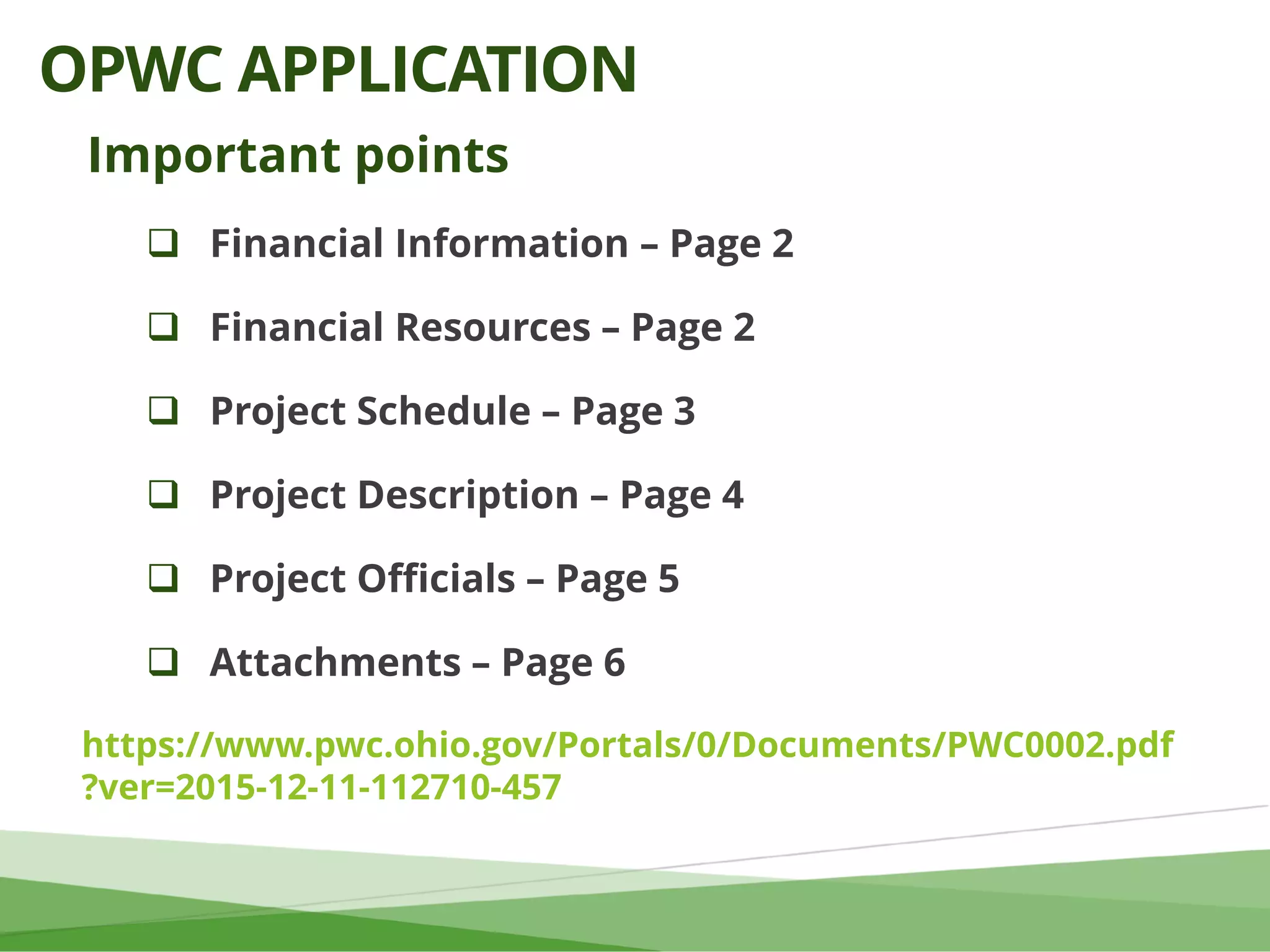
Download as PDF, PPTX
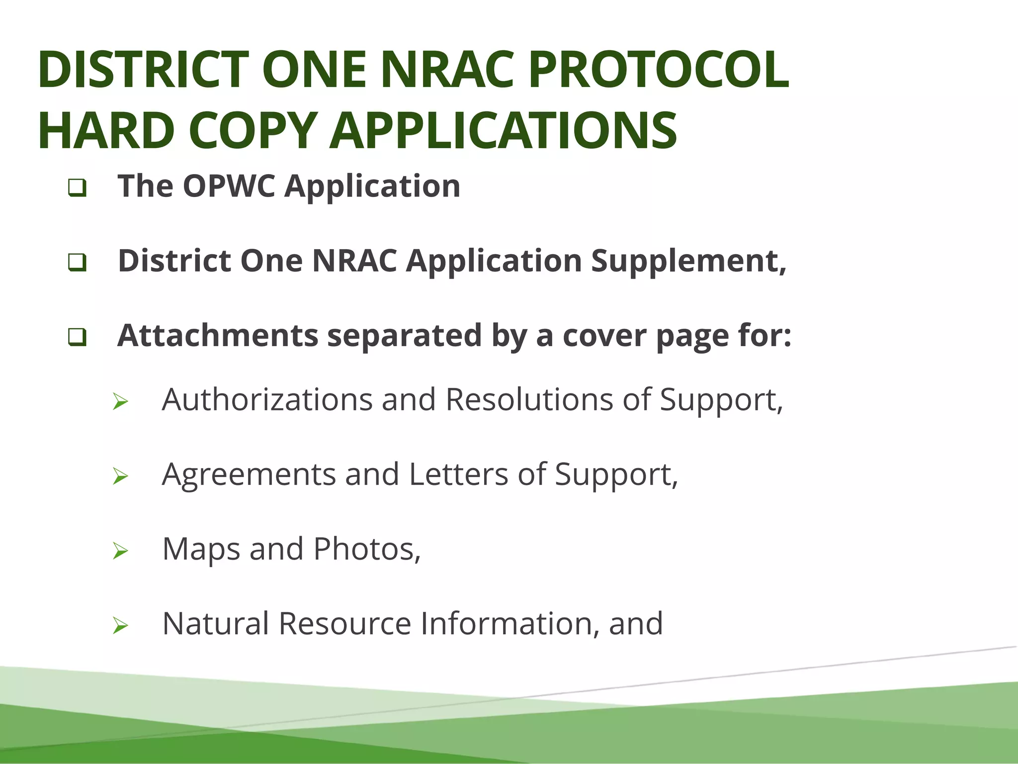
![1. [Org name] _Application.pdf
2. [Org name] _Supplement.pdf
3. [Org name] _Attachment_Authorizations.pdf
4. [Org name]_Attachment_AgreementsLOS.pdf
5. [Org name]_Attachment_MapsPhotos.pdf
6. [Org name]_Attachment_NaturalResource.pdf
7. [Org name]_Attachment[Parcel #]_PropertyInfo.pdf
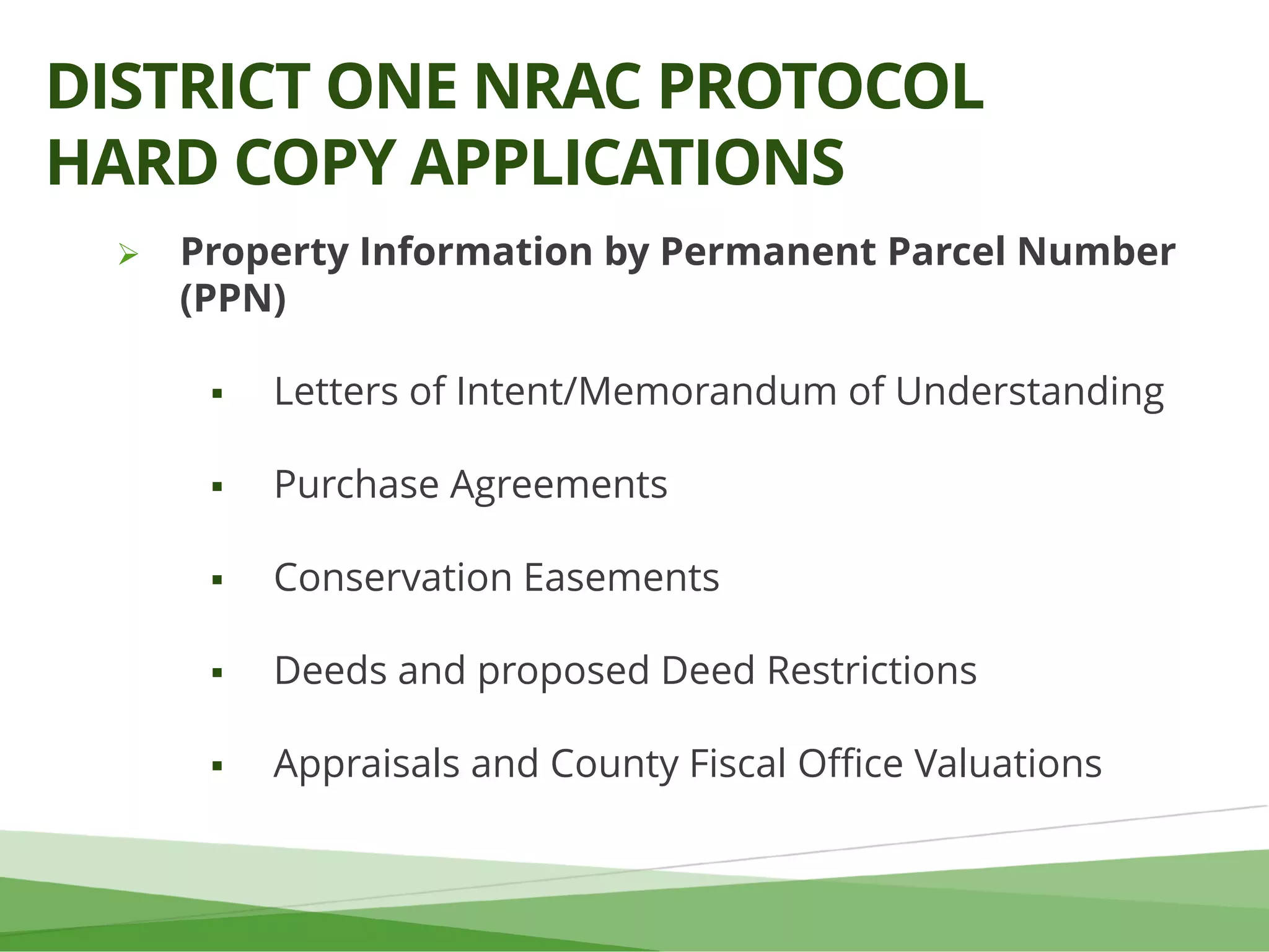
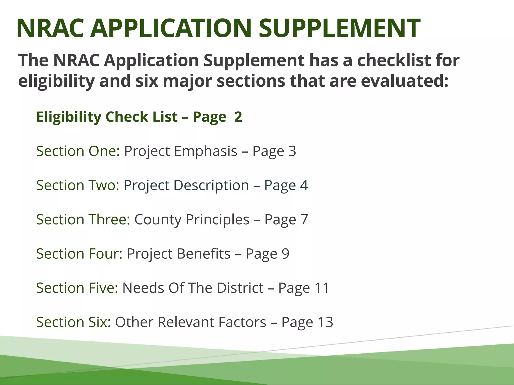
DISTRICT ONE NRAC PROTOCOL
FILE NAMING CONVENTION](https://image.slidesharecdn.com/nracapplicantworkshoppy2020final-7-17-19-190821145012/75/Clean-Ohio-Program-Year-2020-Applicant-Workshop-30-2048.jpg)
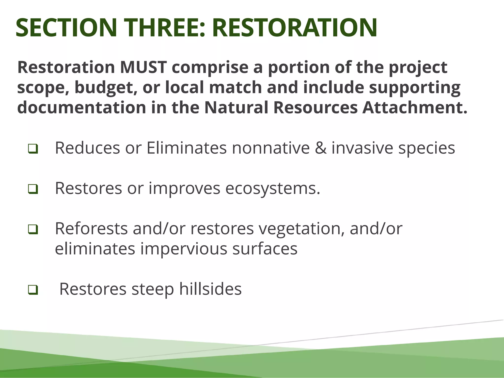
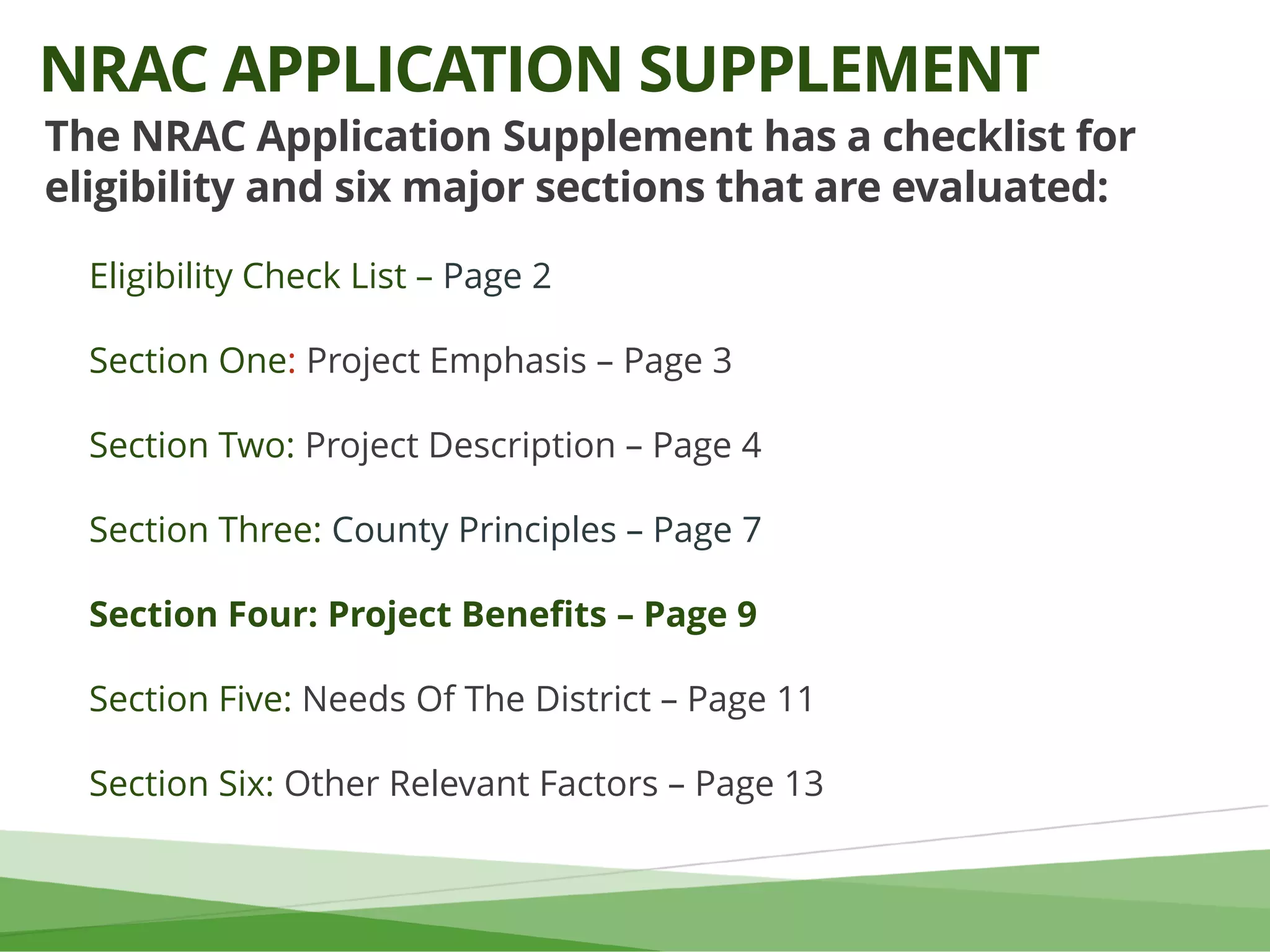
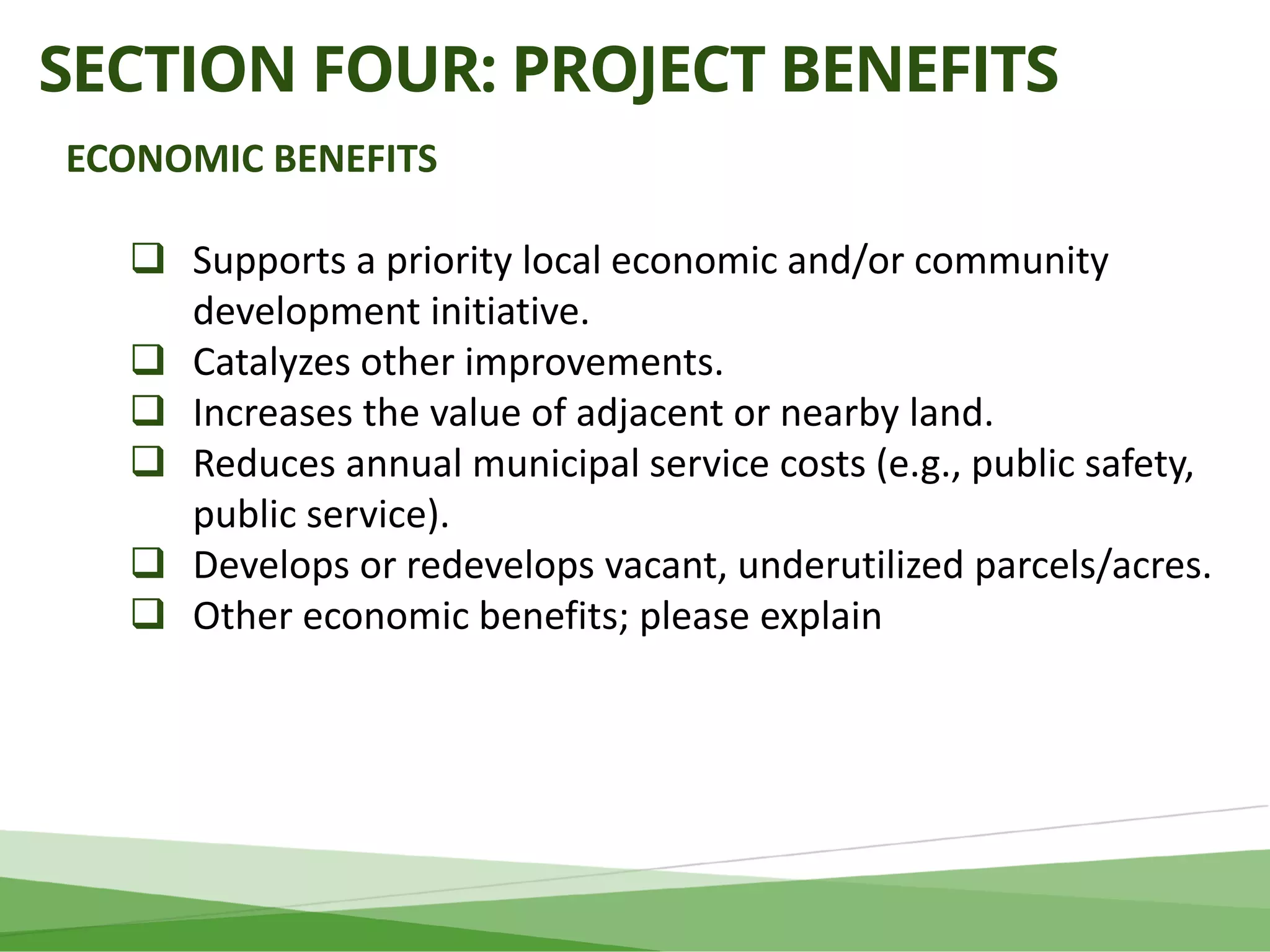
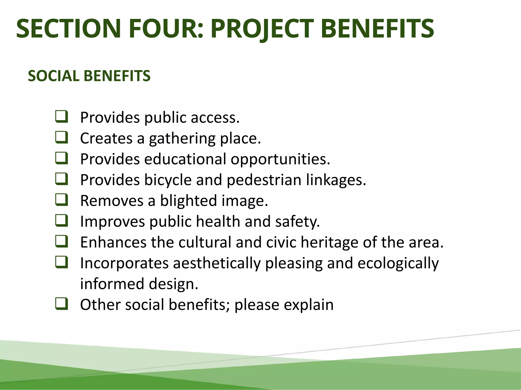


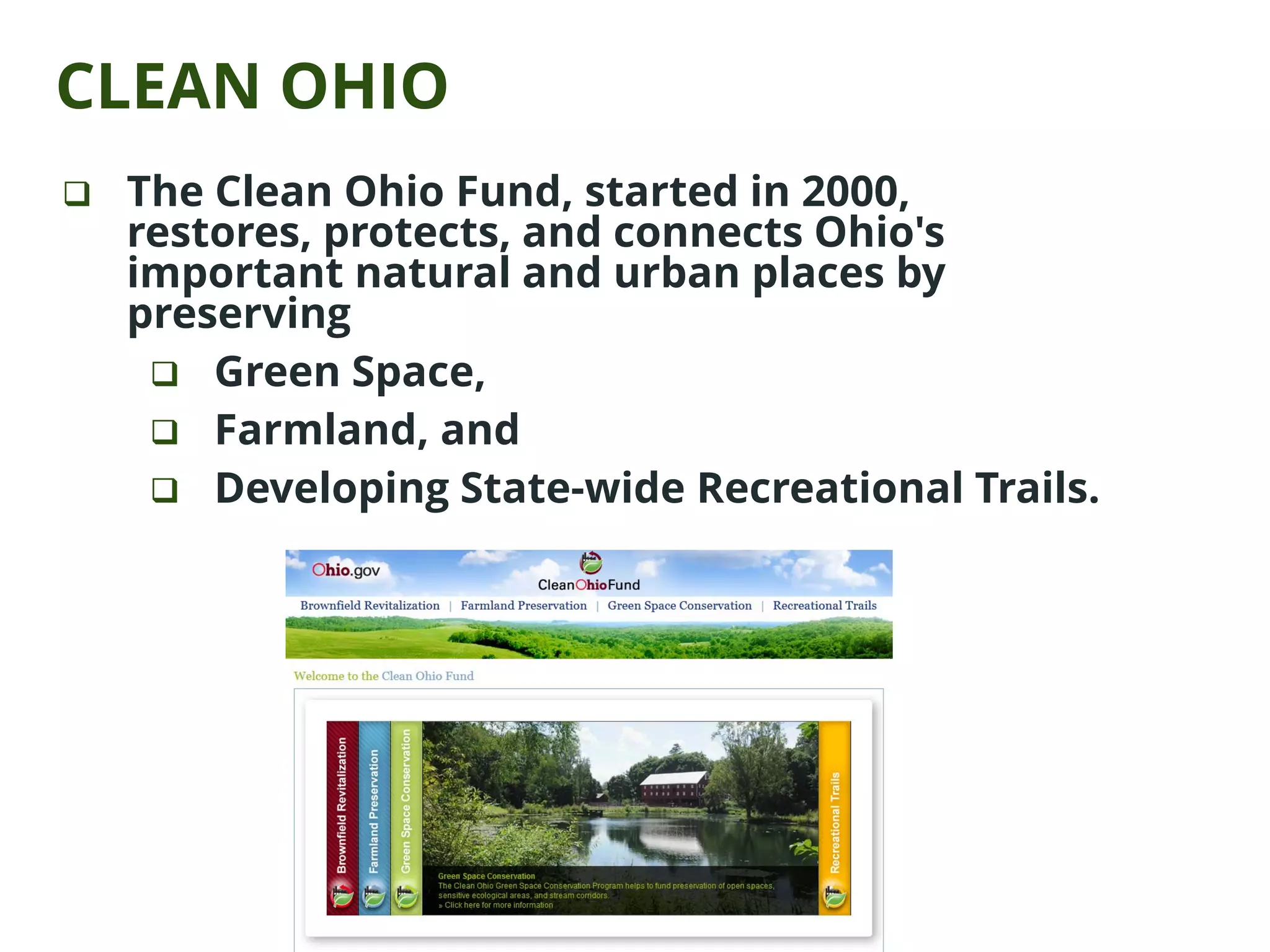
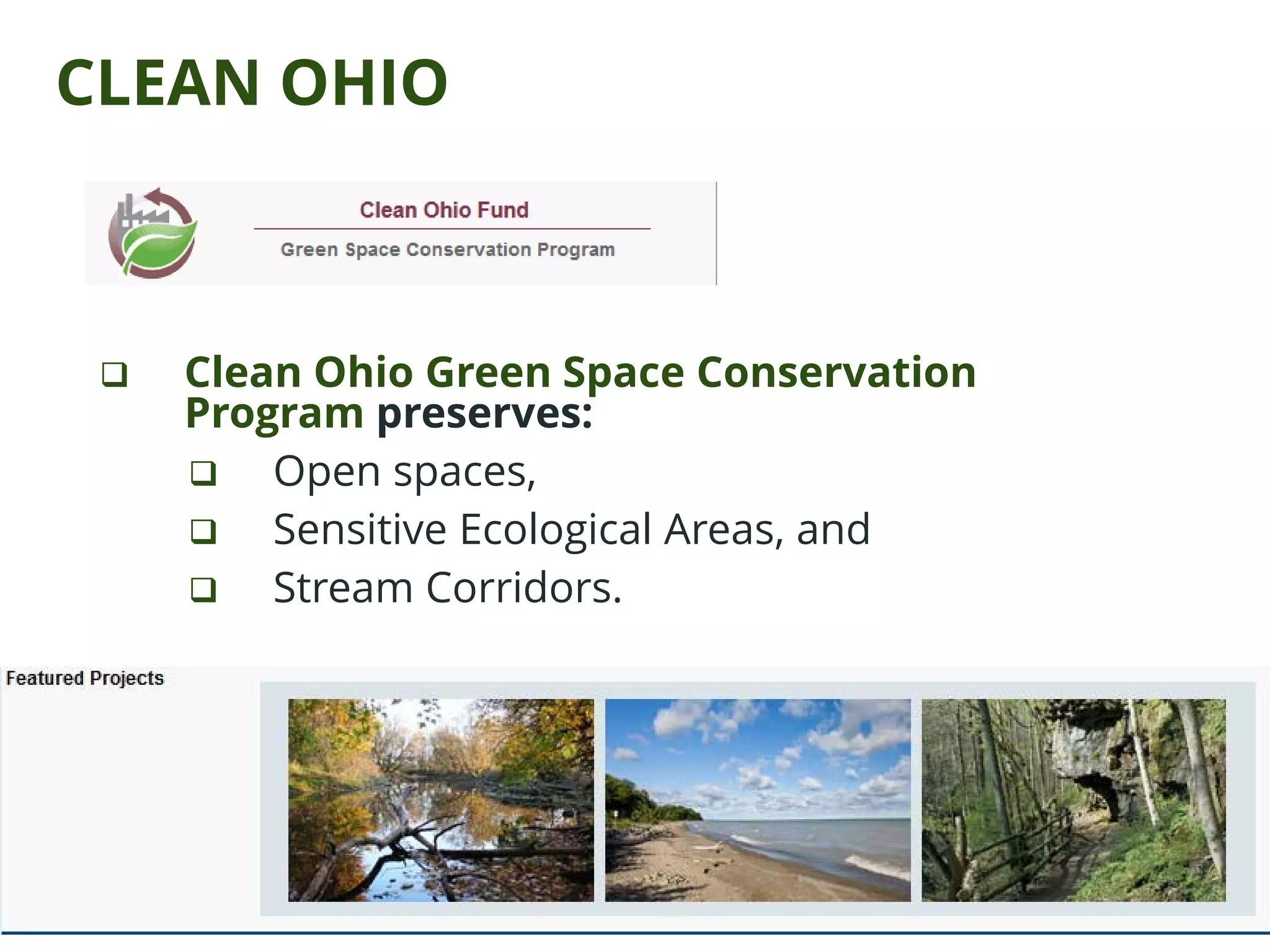
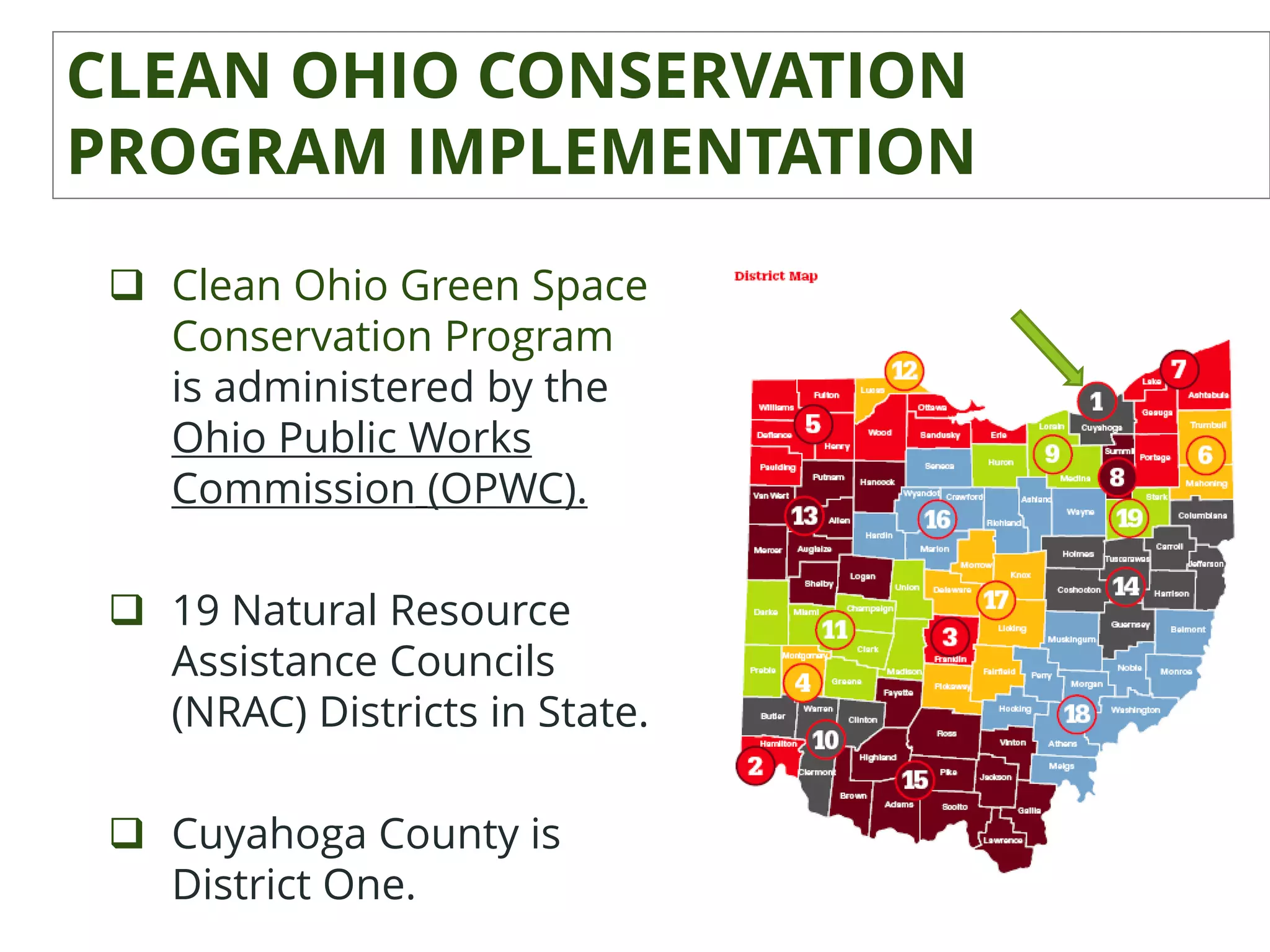
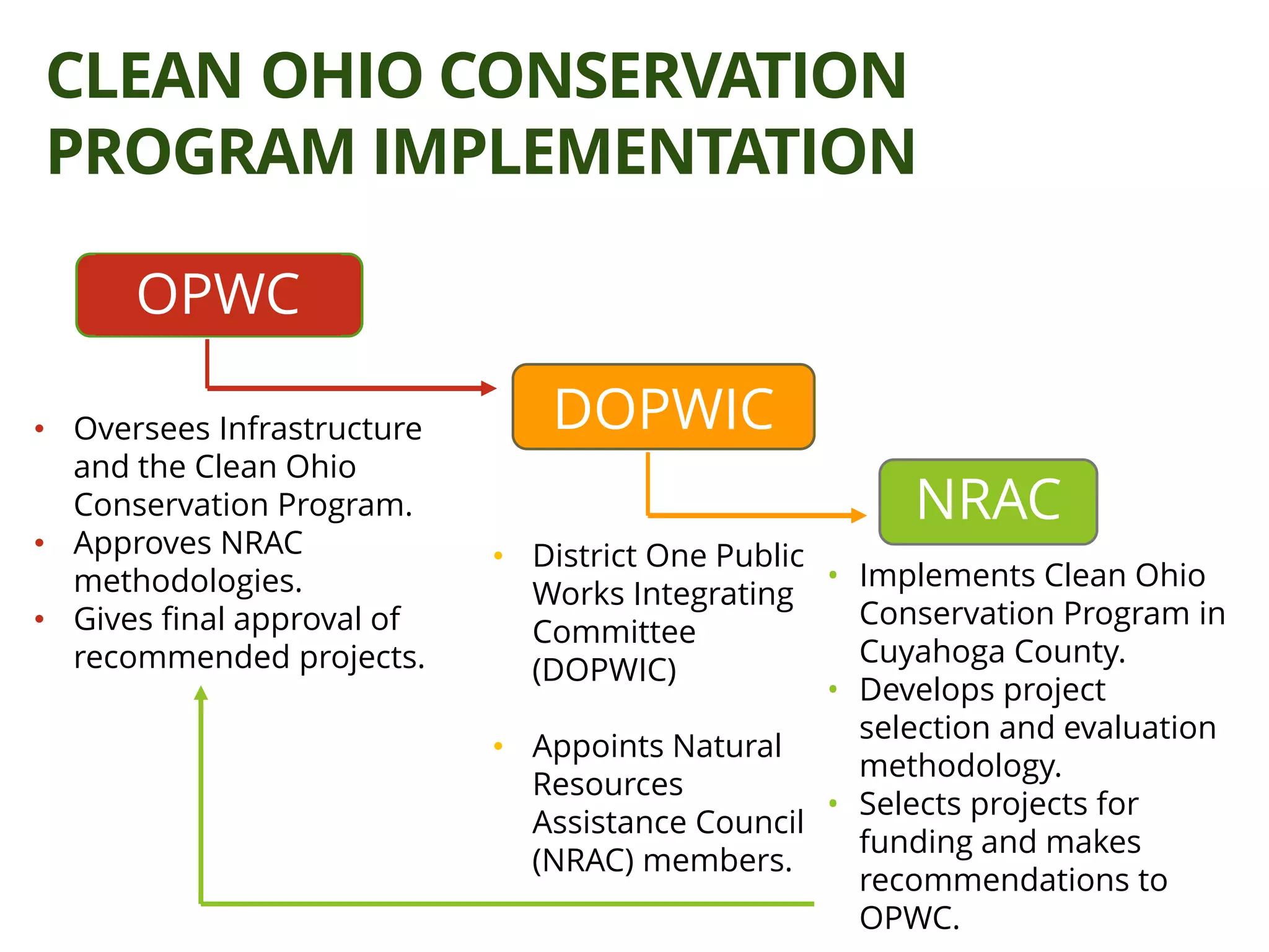
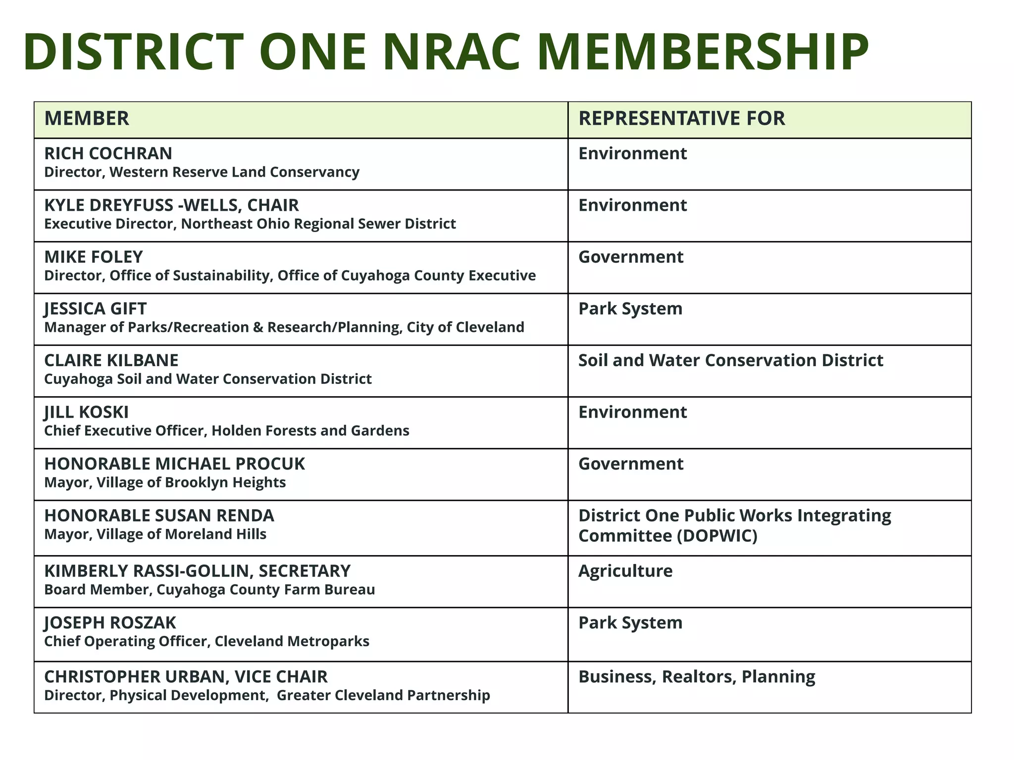
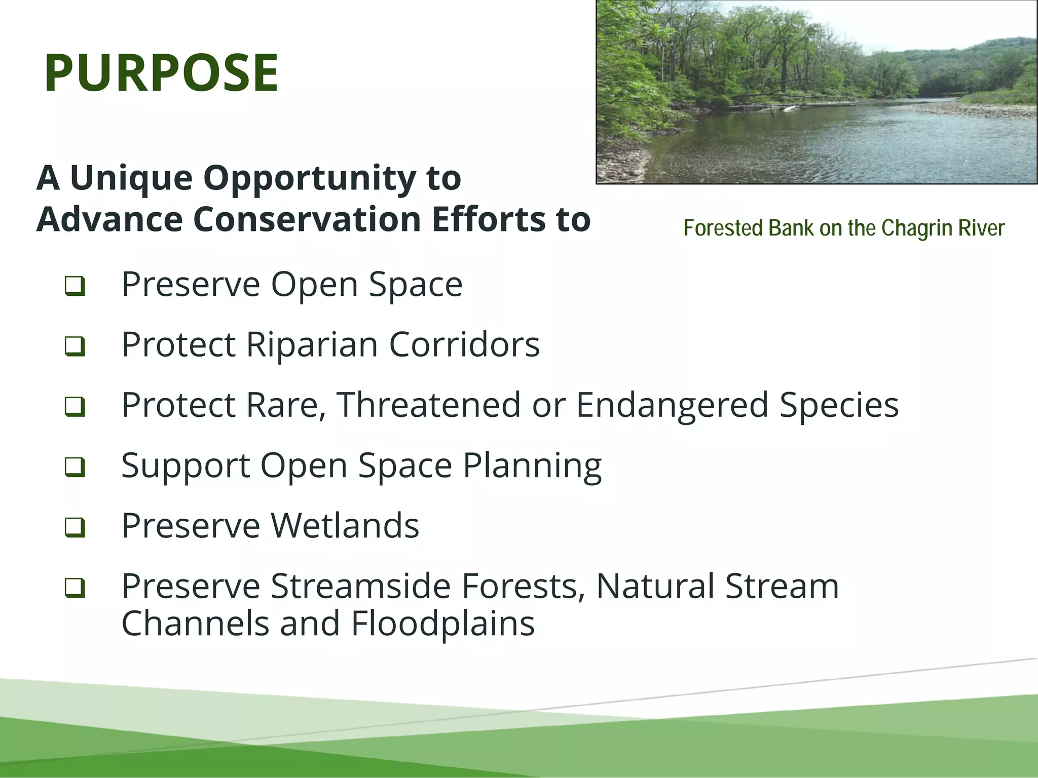
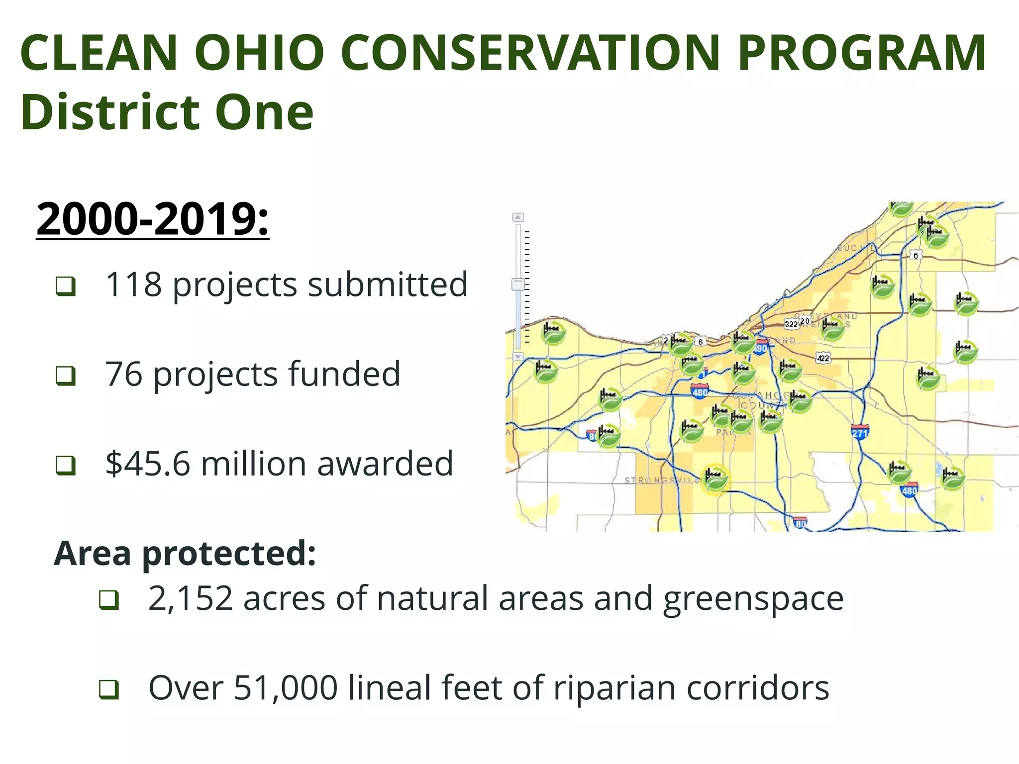
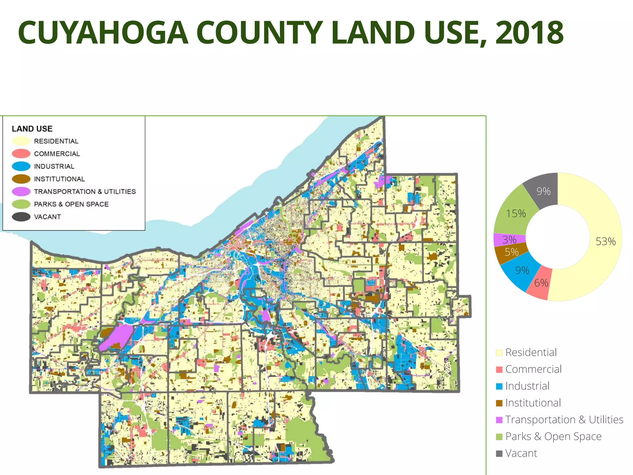
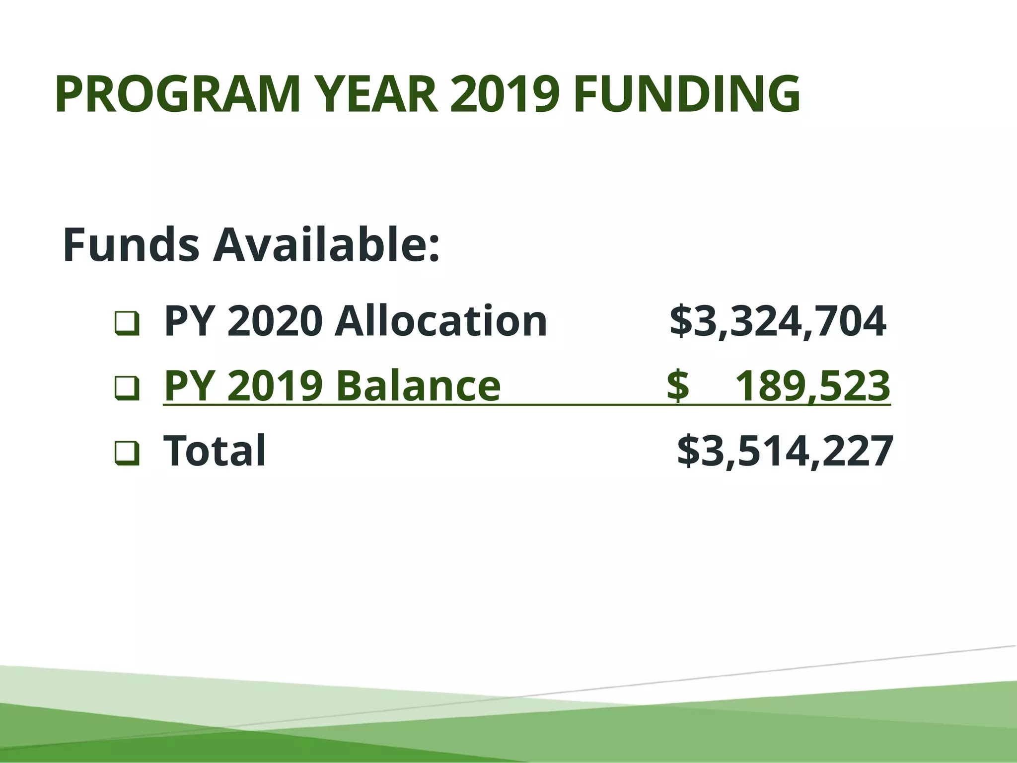
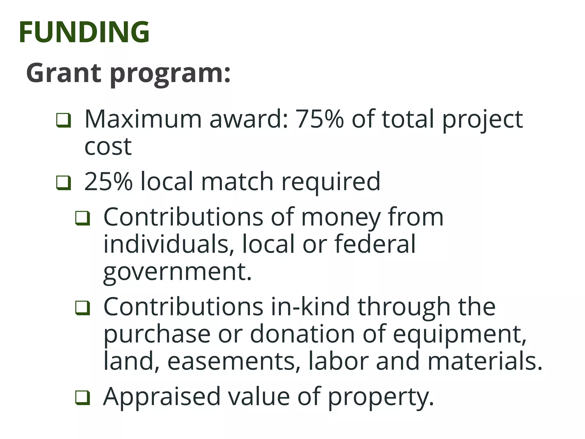
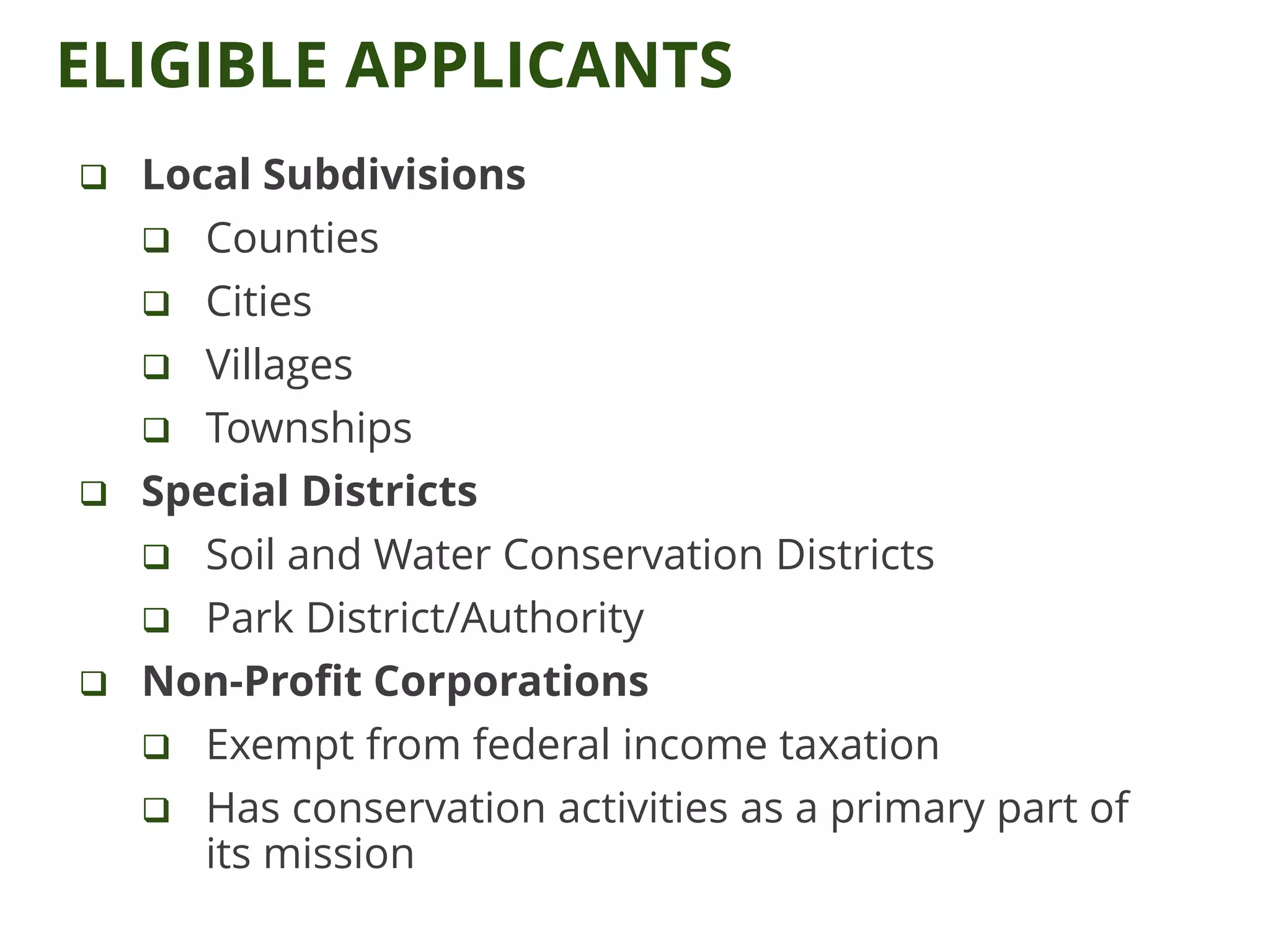
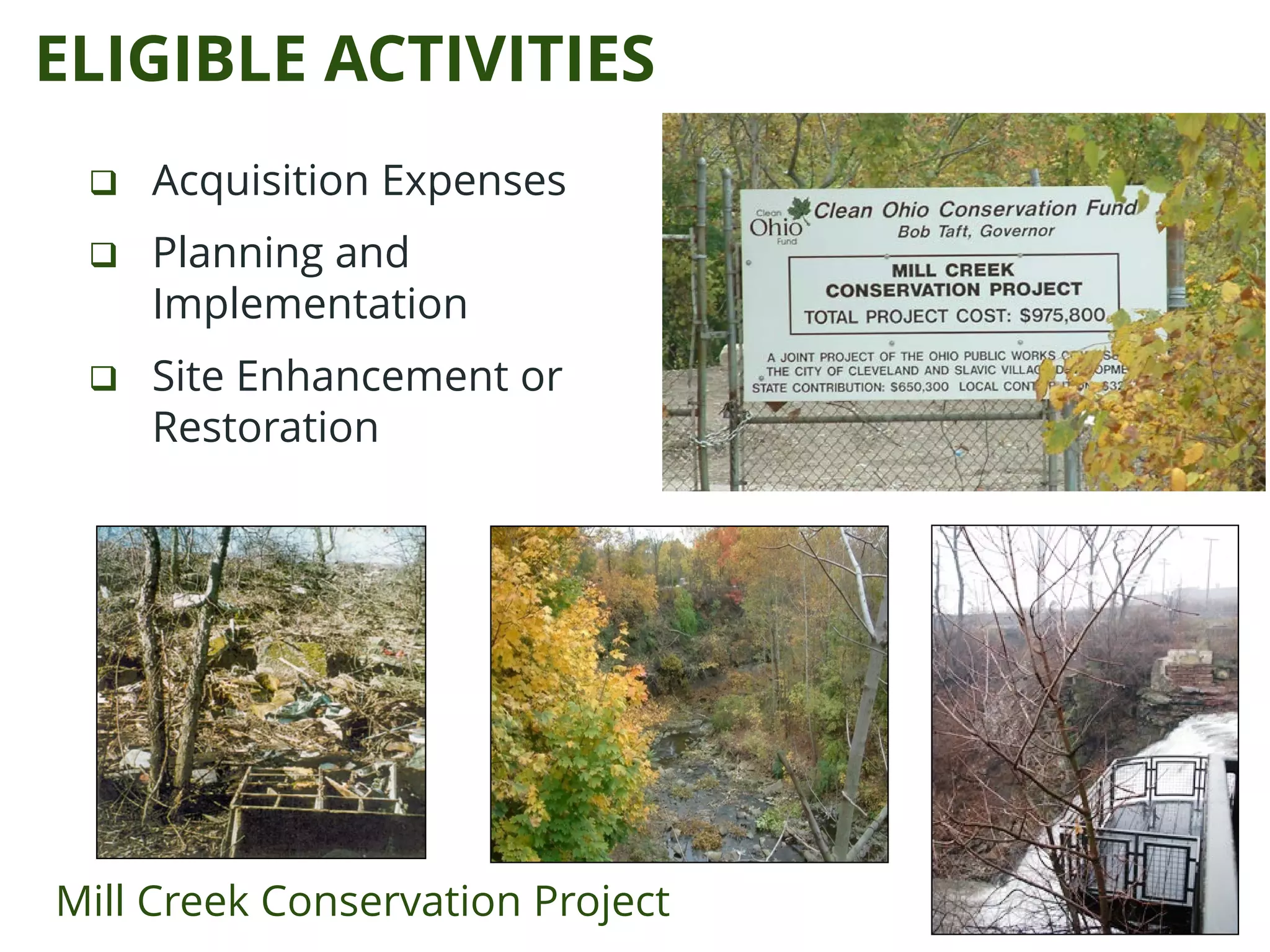
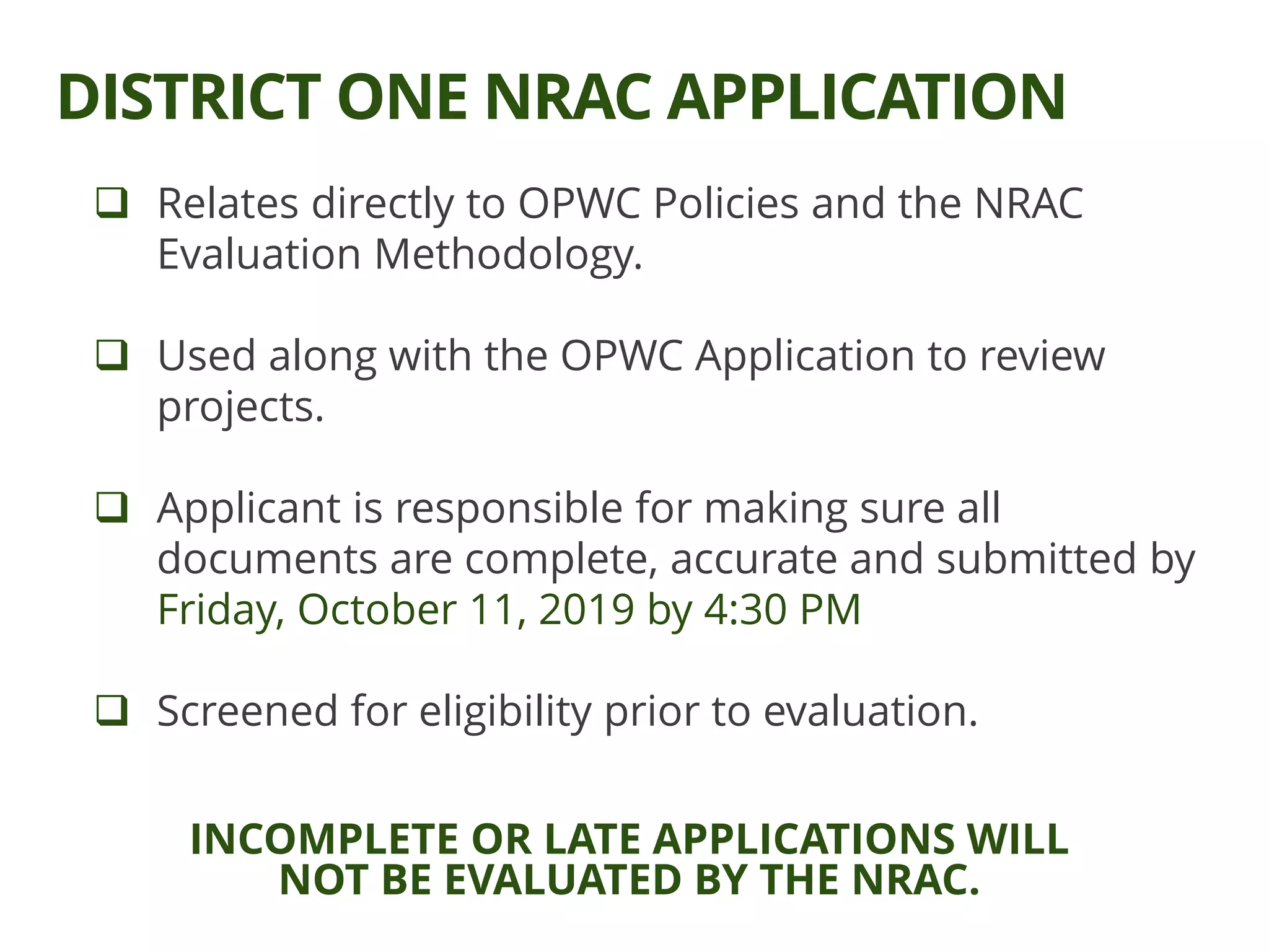
The Clean Ohio Green Space Conservation Program for program year 2020 includes workshops to educate applicants about project funding and evaluation methodology. The program aims to preserve open spaces, protect sensitive ecological areas, and enhance recreational opportunities in Ohio, specifically through the efforts of district one in Cuyahoga County. Applications are due by October 11, 2019, with funding opportunities for eligible applicants totaling over $3.5 million, and specific project types outlined for preservation and enhancement of natural resources.


