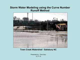
This document summarizes a storm water modeling project for the Town Creek Watershed in Salisbury, NC that analyzed changes in land use and storm water runoff between 1978 and 2009. Digital elevation data, soil data, and aerial/satellite imagery from 1978 and 2009 were used to create land cover maps and calculate storm water runoff for each time period using the Curve Number runoff method. The results showed increases in urban area and storm water runoff over time, reinforcing the impact of urbanization. Issues included limitations of the Curve Number method for less elevated, more urbanized areas.
New Measurement and Mapping of SOC in Australia supports national carbon acco...ExternalEvents
This presentation was presented during the 3 Parallel session on Theme 1, Monitoring, mapping, measuring, reporting and verification (MRV) of SOC, of the Global Symposium on Soil Organic Carbon that took place in Rome 21-23 March 2017. The presentation was made by Mr. Raphael Viscarra-Rossel from CSIRO - Australia, in FAO Hq, Rome
The performance of portable mid-infrared spectroscopy for the prediction of s...ExternalEvents
This presentation was presented during the 3 Parallel session on Theme 1, Monitoring, mapping, measuring, reporting and verification (MRV) of SOC, of the Global Symposium on Soil Organic Carbon that took place in Rome 21-23 March 2017. The presentation was made by Mr. Martin Soriano-Disla, CSIRO Land and Water - Australia, in FAO Hq, Rome
Towards a Tier 3 approach to estimate SOC stocks at sub-regional scale in Sou...ExternalEvents
This presentation was presented during the 2 Parallel session on Theme 1, Monitoring, mapping, measuring, reporting and verification (MRV) of SOC, of the Global Symposium on Soil Organic Carbon that took place in Rome 21-23 March 2017. The presentation was made by Ms. Roberta Farina, from CREA - Italy, in FAO Hq, Rome
2018 ASPRS: Big Data: What Do You Do with a Bunch of LiDAR?GIS in the Rockies
Interested in exploring the use and potential of 3D Lidar data? If you’re interested lidar data and you’d like to
get ideas on how to take advantage of it, this is for you! This presentation introduces several examples of lidar
in real world projects, the potential value of lidar to various types of work, and key resources for locating quality
data (free!).
Soil carbon models for carbon stock estimation – where do we fail?ExternalEvents
This presentation was presented during the 2 Parallel session on Theme 1, Monitoring, mapping, measuring, reporting and verification (MRV) of SOC, of the Global Symposium on Soil Organic Carbon that took place in Rome 21-23 March 2017. The presentation was made by Mr. Aleksi Lethonen, from Natural Resources Institute - Finland, in FAO Hq, Rome
Evaluation of Standar & Regional Satellite Chlorophyll-a Algorithms for MODIS...Anisa Aulia Sabilah
Review Jurnal Penginderaan Jauh Sinar Tampak "Evaluation of Standar & Regional Satellite Chlorophyll-a Algorithms for MODIS in the Bohai & Yellow Seas, China" oleh Wang et al. (2019)
Modeling the Effects of Land Use Change on FloodingAdam Nayak
Due to population growth, urban areas in Oregon have been expanding, leading to increases in impervious surfaces and net losses in wetlands, riparian vegetation, and forestation in the Northwest. Utilizing ArcGIS and NOAA’s C-CAP imagery, this study classifies and analyzes urban land use changes between 1996 and 2010. These findings shed light on the importance of land use management in urban settings and are being used by local watershed councils to advocate for changes within their stream basins.
Use of Satellite Data for Feasibility Study And Preliminary Design Project Re...IJERDJOURNAL
ABSTRACT: In the developing countries like India, need of infrastructure is very high as compared to the available resources. The various organizations put their demands to state and center government for sanction of their project, government depends upon its various department to provide an approximate cost so that priorities can be assigned. The conventional procedure depends upon the land surveying, collection of data from various departments resulting in delay in necessary decision making or some time shelving due to unreasonable cost estimate due to field data being very old. Survey of India, The National Survey and Mapping Organization single handily taking this responsibility thus up gradation of data is far behind the actual development. From the satellite data, which is available in the form of images and terrains (even in 3d LiDAR points for some areas) is very useful for Feasibility Study, and Preliminary Project Report. In the present study natural drain named „Chai Nala‟ meanders through the prime property of Greater Mohali Area Development Authority (GMADA) thus making a big chunk of commercial land inoperative. It was proposed to straighten and channelize to reclaim the land from drain regime. Being the precious land department wanted the most economical and technically sound design without taking any risk. It was decided to counter check the hydraulic data, ground profile, acquired from the Punjab Irrigation Department with the satellite data and Differential Global Positioning System (DGPS). The data from the Google Earth was acquired using Cad Earth software and water shed analysis was carried out using Autodesk Civil 3D software. Comparison of results shows that this technique is quite useful and can be for preliminary feasibility and project preparation. Thus saving huge money and time.
Flooding areas of Ofanto river using advanced topographic and hydraulic appro...Lia Romano
6th International Symposium on Geo-information for Disaster Management (Turin)
POSTER
ABSTRACT
Apulia Basin Authority (AdBP) is actually carrying out an advanced and complex study for evaluating flooding areas
of downstream reach of Ofanto, one of the most important river in Southern Italy. The performed analysis is strictly
related to a reliable definition of the hydraulic risk map in order to plan efficient hazard management actions. Due
to the geo-morphological characteristics of the selected river branch – that presents a length of about 36 km from
the Roman bridge, close to Canosa city, to the sea outfall –- this activity represents an interesting case study for
the contextual use of modern technologies in topographic data management and hydraulic computation. The
geometrical model used for the hydraulic simulation was created using input data coming from airborne laser
scanning (LIDAR), which generates 1 m cell-size Digital Surface Model (DSM) and Digital Terrain Model (DTM), that
were integrated with high-resolution digital orthophotos. The hydraulic simulation was developed adopting a mixed
1D/2D scheme, where one-dimensional model within the levees and two-dimensional model outside were used.
Simplified model for estimating friction factor distribution within the floodplain area was adopted.
A GIS-Based Framework to Identify Opportunities to Use Surface Water to Offse...ASADULISLAMSORIF
The state of Louisiana (Fig. 1) is
characterized by a humid subtropical
climate and receives about 150 cm of
rain per year.
Louisiana hosts about 40% of the
freshwater wetlands in the U.S. is a hub
for the petroleum industry and the third
leading producer of rice in the U.S. Louisiana is also a leading exporter of
aquaculture products
Streamflow simulation using radar-based precipitation applied to the Illinois...Alireza Safari
This paper describes the application of a spatially distributed hydrological model WetSpa (Water and Energy Transfer between Soil, Plants and Atmosphere) using radar-based rainfall data provide by the United States Hydrology Laboratory of NOAA's National Weather Service for a distributed model intercomparison project. The model is applied to the
river basin above Tahlequah hydrometry station with 30-m spatial resolution and one hour time--step for a total simulation period of 6 years. Rainfall inputs are derived from radar. The distributed model parameters are based on an extensive database of watershed characteristics available for the region, including digital maps of DEM, soil type, and land use. The model is calibrated and validated on part of the river flow records. The simulated hydrograph shows a good correspondence with observation (Nash efficiency coeffiecient >80%, indicating that the model is able to simulate the relevant hydrologic processes in the basin accurately.
Robert Muir Level of Service Upgrades and Climate Change Adaptation NRC Works...Robert Muir
Workshop on adaptation to climate change impact on
Urban / rural storm flooding
February 27, 2018
Changes in catchment characteristics
and remediation priorities due to climate change and
level of service upgrades
Robert J. Muir, M.A.Sc., P.Eng.
Manager, Stormwater, City of Markham
Runoff is one of the most significant hydrological variables used in most of the water resources applications. Physiographically the area is characterized by undulating topography with plains and valleys. The Soil Conservation Service Curve Numbers also known as hydrologic soil group method were used in this study. This method is adaptable and suitable approach for quick runoff estimation and is approximately easy to use with minimum data and it gives good result. From the study yearly rainfall and runoff were estimated easily. The study area covers an area of 466.02 km2, having maximum length of 36.5 km. The maximum and minimum elevation of the basin is 569 m and 341 m above MSL, respectively.
A study confined to the lower tapi basin in Gujarat, India to find out the primary causes for 2006 floods in Surat city. The study involves collection of topographical data from the local geological survey organization, rainfall data from meteorological department of india and the application of HEC-HMS software from US Army corps of engineers to identify the primary cause of the runoff.
Two Dimensional Flood Inundation Modelling In Urban Area Using WMS, HEC-RAS a...Amro Elfeki
This research presents a two-dimensional flood inundation modelling in urbanized areas when some features such as roads, buildings, and fences have great effect on flood propagation. Wadi Qows located in Jeddah City, Saudi Arabia was chosen as case study area because of the flood occurrence of 2009 causing lots of losses either economic or loss of life. The WMS and HEC-RAS program were used for a hydraulic simulation based on channel geometry built by incorporating urban features into DEM using GIS effectively. A resampling method of DEM 90 × 90 m become 10 × 10 m grid cell sizes was conducted to produce a higher resolution DEM suitable for urban flood inundation modelling. The results show that a higher resolution leads to increasing the average flood depth and decreasing the flood extent. Although the change of the grid cell sizes does not affect its elevation values, this approach is helpful to perform flood simulations in urban areas when high resolution DEM availability is limited. In addition, the integration of WMS, HEC-RAS and GIS are powerful tools for flood modelling in rural, mountainous and urban areas.
https://www.researchgate.net/publication/330004725_Two_Dimensional_Flood_Inundation_Modelling_in_Urban_Areas_Using_WMS_HEC-RAS_and_GIS_Case_Study_in_Jeddah_City_Saudi_Arabia_IEREK_Interdisciplinary_Series_for_Sustainable_Development
Hydrological Risk Assessment at Praia, Cape VerdeIJEAB
Hydrology modeling became a relevant topic for the Cidade da Praia, Cabo Verde, Africa, due to negative impact risk to local population and its assets. The modeling via Geographical Information Systems (GIS) can help the decision-making process of space occupation and characterization for this type of risk. Under the municipalities of Praia, the phenomenon of flash flood is common, causing soil erosion and landslide. This constitutes a risk for the local habitat, particularly in districts with a lack of strong human infrastructures. To simulate, analyze and generate risk maps using GIS to help this county governance authorities for decision-making, thus, becomes the main aim of this article.
GDG Cloud Southlake #33: Boule & Rebala: Effective AppSec in SDLC using Deplo...James Anderson
Effective Application Security in Software Delivery lifecycle using Deployment Firewall and DBOM
The modern software delivery process (or the CI/CD process) includes many tools, distributed teams, open-source code, and cloud platforms. Constant focus on speed to release software to market, along with the traditional slow and manual security checks has caused gaps in continuous security as an important piece in the software supply chain. Today organizations feel more susceptible to external and internal cyber threats due to the vast attack surface in their applications supply chain and the lack of end-to-end governance and risk management.
The software team must secure its software delivery process to avoid vulnerability and security breaches. This needs to be achieved with existing tool chains and without extensive rework of the delivery processes. This talk will present strategies and techniques for providing visibility into the true risk of the existing vulnerabilities, preventing the introduction of security issues in the software, resolving vulnerabilities in production environments quickly, and capturing the deployment bill of materials (DBOM).
Speakers:
Bob Boule
Robert Boule is a technology enthusiast with PASSION for technology and making things work along with a knack for helping others understand how things work. He comes with around 20 years of solution engineering experience in application security, software continuous delivery, and SaaS platforms. He is known for his dynamic presentations in CI/CD and application security integrated in software delivery lifecycle.
Gopinath Rebala
Gopinath Rebala is the CTO of OpsMx, where he has overall responsibility for the machine learning and data processing architectures for Secure Software Delivery. Gopi also has a strong connection with our customers, leading design and architecture for strategic implementations. Gopi is a frequent speaker and well-known leader in continuous delivery and integrating security into software delivery.
Neuro-symbolic is not enough, we need neuro-*semantic*Frank van Harmelen
Neuro-symbolic (NeSy) AI is on the rise. However, simply machine learning on just any symbolic structure is not sufficient to really harvest the gains of NeSy. These will only be gained when the symbolic structures have an actual semantics. I give an operational definition of semantics as “predictable inference”.
All of this illustrated with link prediction over knowledge graphs, but the argument is general.
Kubernetes & AI - Beauty and the Beast !?! @KCD Istanbul 2024Tobias Schneck
As AI technology is pushing into IT I was wondering myself, as an “infrastructure container kubernetes guy”, how get this fancy AI technology get managed from an infrastructure operational view? Is it possible to apply our lovely cloud native principals as well? What benefit’s both technologies could bring to each other?
Let me take this questions and provide you a short journey through existing deployment models and use cases for AI software. On practical examples, we discuss what cloud/on-premise strategy we may need for applying it to our own infrastructure to get it to work from an enterprise perspective. I want to give an overview about infrastructure requirements and technologies, what could be beneficial or limiting your AI use cases in an enterprise environment. An interactive Demo will give you some insides, what approaches I got already working for real.
JMeter webinar - integration with InfluxDB and GrafanaRTTS
Watch this recorded webinar about real-time monitoring of application performance. See how to integrate Apache JMeter, the open-source leader in performance testing, with InfluxDB, the open-source time-series database, and Grafana, the open-source analytics and visualization application.
In this webinar, we will review the benefits of leveraging InfluxDB and Grafana when executing load tests and demonstrate how these tools are used to visualize performance metrics.
Length: 30 minutes
Session Overview
-------------------------------------------
During this webinar, we will cover the following topics while demonstrating the integrations of JMeter, InfluxDB and Grafana:
- What out-of-the-box solutions are available for real-time monitoring JMeter tests?
- What are the benefits of integrating InfluxDB and Grafana into the load testing stack?
- Which features are provided by Grafana?
- Demonstration of InfluxDB and Grafana using a practice web application
To view the webinar recording, go to:
https://www.rttsweb.com/jmeter-integration-webinar
Search and Society: Reimagining Information Access for Radical FuturesBhaskar Mitra
The field of Information retrieval (IR) is currently undergoing a transformative shift, at least partly due to the emerging applications of generative AI to information access. In this talk, we will deliberate on the sociotechnical implications of generative AI for information access. We will argue that there is both a critical necessity and an exciting opportunity for the IR community to re-center our research agendas on societal needs while dismantling the artificial separation between the work on fairness, accountability, transparency, and ethics in IR and the rest of IR research. Instead of adopting a reactionary strategy of trying to mitigate potential social harms from emerging technologies, the community should aim to proactively set the research agenda for the kinds of systems we should build inspired by diverse explicitly stated sociotechnical imaginaries. The sociotechnical imaginaries that underpin the design and development of information access technologies needs to be explicitly articulated, and we need to develop theories of change in context of these diverse perspectives. Our guiding future imaginaries must be informed by other academic fields, such as democratic theory and critical theory, and should be co-developed with social science scholars, legal scholars, civil rights and social justice activists, and artists, among others.
UiPath Test Automation using UiPath Test Suite series, part 4DianaGray10
Welcome to UiPath Test Automation using UiPath Test Suite series part 4. In this session, we will cover Test Manager overview along with SAP heatmap.
The UiPath Test Manager overview with SAP heatmap webinar offers a concise yet comprehensive exploration of the role of a Test Manager within SAP environments, coupled with the utilization of heatmaps for effective testing strategies.
Participants will gain insights into the responsibilities, challenges, and best practices associated with test management in SAP projects. Additionally, the webinar delves into the significance of heatmaps as a visual aid for identifying testing priorities, areas of risk, and resource allocation within SAP landscapes. Through this session, attendees can expect to enhance their understanding of test management principles while learning practical approaches to optimize testing processes in SAP environments using heatmap visualization techniques
What will you get from this session?
1. Insights into SAP testing best practices
2. Heatmap utilization for testing
3. Optimization of testing processes
4. Demo
Topics covered:
Execution from the test manager
Orchestrator execution result
Defect reporting
SAP heatmap example with demo
Speaker:
Deepak Rai, Automation Practice Lead, Boundaryless Group and UiPath MVP
Epistemic Interaction - tuning interfaces to provide information for AI supportAlan Dix
Paper presented at SYNERGY workshop at AVI 2024, Genoa, Italy. 3rd June 2024
https://alandix.com/academic/papers/synergy2024-epistemic/
As machine learning integrates deeper into human-computer interactions, the concept of epistemic interaction emerges, aiming to refine these interactions to enhance system adaptability. This approach encourages minor, intentional adjustments in user behaviour to enrich the data available for system learning. This paper introduces epistemic interaction within the context of human-system communication, illustrating how deliberate interaction design can improve system understanding and adaptation. Through concrete examples, we demonstrate the potential of epistemic interaction to significantly advance human-computer interaction by leveraging intuitive human communication strategies to inform system design and functionality, offering a novel pathway for enriching user-system engagements.
Software Delivery At the Speed of AI: Inflectra Invests In AI-Powered QualityInflectra
In this insightful webinar, Inflectra explores how artificial intelligence (AI) is transforming software development and testing. Discover how AI-powered tools are revolutionizing every stage of the software development lifecycle (SDLC), from design and prototyping to testing, deployment, and monitoring.
Learn about:
• The Future of Testing: How AI is shifting testing towards verification, analysis, and higher-level skills, while reducing repetitive tasks.
• Test Automation: How AI-powered test case generation, optimization, and self-healing tests are making testing more efficient and effective.
• Visual Testing: Explore the emerging capabilities of AI in visual testing and how it's set to revolutionize UI verification.
• Inflectra's AI Solutions: See demonstrations of Inflectra's cutting-edge AI tools like the ChatGPT plugin and Azure Open AI platform, designed to streamline your testing process.
Whether you're a developer, tester, or QA professional, this webinar will give you valuable insights into how AI is shaping the future of software delivery.
Key Trends Shaping the Future of Infrastructure.pdfCheryl Hung
Keynote at DIGIT West Expo, Glasgow on 29 May 2024.
Cheryl Hung, ochery.com
Sr Director, Infrastructure Ecosystem, Arm.
The key trends across hardware, cloud and open-source; exploring how these areas are likely to mature and develop over the short and long-term, and then considering how organisations can position themselves to adapt and thrive.
PHP Frameworks: I want to break free (IPC Berlin 2024)Ralf Eggert
In this presentation, we examine the challenges and limitations of relying too heavily on PHP frameworks in web development. We discuss the history of PHP and its frameworks to understand how this dependence has evolved. The focus will be on providing concrete tips and strategies to reduce reliance on these frameworks, based on real-world examples and practical considerations. The goal is to equip developers with the skills and knowledge to create more flexible and future-proof web applications. We'll explore the importance of maintaining autonomy in a rapidly changing tech landscape and how to make informed decisions in PHP development.
This talk is aimed at encouraging a more independent approach to using PHP frameworks, moving towards a more flexible and future-proof approach to PHP development.
GraphRAG is All You need? LLM & Knowledge GraphGuy Korland
Guy Korland, CEO and Co-founder of FalkorDB, will review two articles on the integration of language models with knowledge graphs.
1. Unifying Large Language Models and Knowledge Graphs: A Roadmap.
https://arxiv.org/abs/2306.08302
2. Microsoft Research's GraphRAG paper and a review paper on various uses of knowledge graphs:
https://www.microsoft.com/en-us/research/blog/graphrag-unlocking-llm-discovery-on-narrative-private-data/
Let's dive deeper into the world of ODC! Ricardo Alves (OutSystems) will join us to tell all about the new Data Fabric. After that, Sezen de Bruijn (OutSystems) will get into the details on how to best design a sturdy architecture within ODC.
10. Results Land Use Statistics for the year (1978) Forest = 53% Open Space = 40% Urban = 7% Flow Accumulation at Innes St. point from a 4 inch rainfall: 78,592 Land Use Statistics for the year (2009) Forest = 50 % Open Space = 35% Urban = 15% Flow Accumulation at Innes St. point from a 4 inch rainfall: 92,131 Land Use Change between 1978 and 2009 Forest = -3% Open Space = - 5% Urban = +8%
![Context of Problem ,[object Object],[object Object],[object Object],[object Object]](data:image/gif;base64,R0lGODlhAQABAIAAAAAAAP///yH5BAEAAAAALAAAAAABAAEAAAIBRAA7)