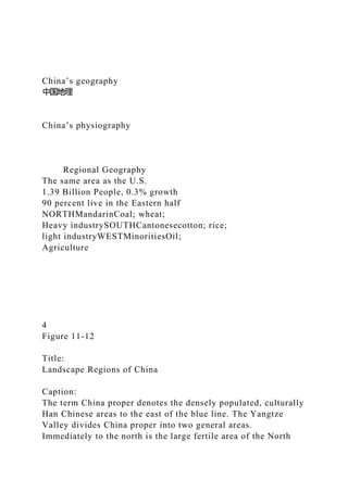
China’s geography
中国地理
China’s physiography
Regional Geography
The same area as the U.S.
1.39 Billion People, 0.3% growth
90 percent live in the Eastern half
NORTHMandarinCoal; wheat;
Heavy industrySOUTHCantonesecotton; rice;
light industryWESTMinoritiesOil;
Agriculture
4
Figure 11-12
Title:
Landscape Regions of China
Caption:
The term China proper denotes the densely populated, culturally Han Chinese areas to the east of the blue line. The Yangtze Valley divides China proper into two general areas. Immediately to the north is the large fertile area of the North China Plain, bisected by the Huang He (or Yellow) River. To the west is the Loess Plateau, an upland area of soil derived from wind-deposited silt after the prehistoric glacial period, about 15,000 years ago.
China/USA
What are the characteristics of China’s territory?
Size of US 9,600,000 sq km
1.39 billion people
mid latitude
Continental
West dry, mountainous
East coastal humid
Vast in territory, rich in resources
Land is scarce, people are many
How do the mountains, rivers and basins combine in China?
Three tiers
SW mountains Tibetan Plateau >3000m
Himalayas, Kun Lun, Karakoram, Tian Shan
Basins and Plateaus 1000-3000m
Tarim Basin, Junggar Basin, Mongolian Plateau (Ordos),
Great Xingan, Chang Bai
Loess Plateau, Sichuan Basin, Yunnan Plateau
South China Hills (Wuyi)
Lowlands <500m
North China Plain, Northeast Plain, Deltas
Karakoram mountains
Tibetan plateau
Everest Chomolongma
Sichuan
Loess plateau
Guangdong
North China
South China
SW - Yunnan
Yellow River - West
Yellow River - East
Yangzi Basin
Yangzi River
Three Gorges Dam
Electrical power
Flood control?
Earthquake
Silt in lake
Aquatic habitat
2 million people moved
Physical environment
Climate
11_04.JPG
18
Figure 11-04
Title:
Flooding on the North China Plain
Caption:
Major flooding, sometimes inundating large sections of the North China Plain, has been a historical problem with the Huang He River. Severe droughts can also plague the same region. Extensive dikes have been built along much of the river to protect the countryside from flooding, as seen in this photo taken near the historical city of Kaifeng. (Yang Xiuyun/ChinaStock Photo Library)
11_05.JPG
19
Figure 11-05
Title:
Denuded Hillslopes in China
Caption:
Because of the need to clear forests for wood products and agricultural lands, China's mountain slopes have long been deforested. Without forest cover, soil erosion is a serious issue. (Bob Sacha/Corbis)
11_07.JPG
20
Figure 11-07
Title:
Coal-Fired Power Plant in China
Caption:
A coal-fired power plant emits large quantities of pollution in northwestern China. As China industrializes, it is building many such plants, damaging local air quality and contributing to global warming. (Natalie Behring/OnAsia.com)
Environmental Challenges
21
China’s population
中国人口
Current stats
http://www.prb.org/
Population Reference Bureau ...
1. China’s geography
中国地理
China’s physiography
Regional Geography
The same area as the U.S.
1.39 Billion People, 0.3% growth
90 percent live in the Eastern half
NORTHMandarinCoal; wheat;
Heavy industrySOUTHCantonesecotton; rice;
light industryWESTMinoritiesOil;
Agriculture
4
Figure 11-12
Title:
Landscape Regions of China
Caption:
The term China proper denotes the densely populated, culturally
Han Chinese areas to the east of the blue line. The Yangtze
Valley divides China proper into two general areas.
Immediately to the north is the large fertile area of the North
2. China Plain, bisected by the Huang He (or Yellow) River. To
the west is the Loess Plateau, an upland area of soil derived
from wind-deposited silt after the prehistoric glacial period,
about 15,000 years ago.
China/USA
What are the characteristics of China’s territory?
Size of US 9,600,000 sq km
1.39 billion people
mid latitude
Continental
West dry, mountainous
East coastal humid
Vast in territory, rich in resources
Land is scarce, people are many
How do the mountains, rivers and basins combine in China?
Three tiers
SW mountains Tibetan Plateau >3000m
Himalayas, Kun Lun, Karakoram, Tian Shan
Basins and Plateaus 1000-3000m
Tarim Basin, Junggar Basin, Mongolian Plateau (Ordos),
Great Xingan, Chang Bai
Loess Plateau, Sichuan Basin, Yunnan Plateau
South China Hills (Wuyi)
Lowlands <500m
North China Plain, Northeast Plain, Deltas
Karakoram mountains
4. Yangzi Basin
Yangzi River
Three Gorges Dam
Electrical power
Flood control?
Earthquake
Silt in lake
Aquatic habitat
2 million people moved
Physical environment
Climate
11_04.JPG
18
Figure 11-04
Title:
Flooding on the North China Plain
5. Caption:
Major flooding, sometimes inundating large sections of the
North China Plain, has been a historical problem with the
Huang He River. Severe droughts can also plague the same
region. Extensive dikes have been built along much of the river
to protect the countryside from flooding, as seen in this photo
taken near the historical city of Kaifeng. (Yang
Xiuyun/ChinaStock Photo Library)
11_05.JPG
19
Figure 11-05
Title:
Denuded Hillslopes in China
Caption:
Because of the need to clear forests for wood products and
agricultural lands, China's mountain slopes have long been
deforested. Without forest cover, soil erosion is a serious issue.
(Bob Sacha/Corbis)
11_07.JPG
20
Figure 11-07
Title:
6. Coal-Fired Power Plant in China
Caption:
A coal-fired power plant emits large quantities of pollution in
northwestern China. As China industrializes, it is building many
such plants, damaging local air quality and contributing to
global warming. (Natalie Behring/OnAsia.com)
Environmental Challenges
21
China’s population
中国人口
Current stats
http://www.prb.org/
Population Reference Bureau
1.398 billion 2019
CBR 11/1000
CDR 7/1000
RNI 0.4%
IMR 10/1000
TFR 1.6
<15 18%, >65 12%
2010 Provincial densities
8. One Child
11_44.JPG
31
Figure 11-44
Title:
China's Population Policies
Caption:
One aspect of China's population policy is the expansion of
child-care facilities so that mothers can be near their children
while at work. This enables women to resume participating in
the workforce soon after giving birth. This photo shows a
typical day-care center attached to an industrial plant in
Guangdon province in coastal China. (Xinhua/Getty Images,
Inc.—Liaison)
What are the cultural regions of China?
9. Language
North, Southwest Mandarin
South Wu (Shanghai), Min (Fujian), Gan (Jiangxi), Xiang
(Hunan), Kejia (Hakka) , Yue (Cantonese)
Minority
Mongol, Uyghur, Tibetan, Zhuang, Korean
Food
Cantonese, Sichuan, Hunan, Shanghai, Beijing
Languages
Peoples
China’s environment questions
Ch 9 China’s environmental problems
Post a short paragraph (200 words) on issues in China's society
answering at least one of the questions.
1. What are the historic strains on China’s environment?
2. What are current issues with water?
3. What are the issues with forest loss?
4. What are the issues with soils?
5. What are the issues with desertification?
6. What are the issues with pollution?
7. What are the issues with conservation?
8. What are the issues with the Three Gorges Dam?
China
’
s