Downloaded 115 times


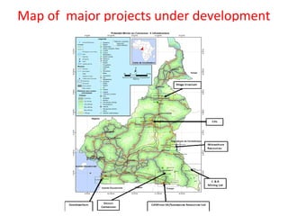
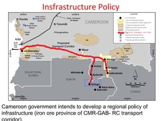
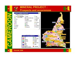

The document presents an overview of Cameroon as a mining destination, detailing its geographical location, population, and significant mineral resources. It outlines the government's infrastructure policies aimed at supporting mining operations, including electricity generation and transportation development. Additionally, it highlights the mineral potential of various regions in Cameroon and summarizes the current major mining projects and exploration activities, such as nickel-cobalt, bauxite, iron ore, and diamonds.


