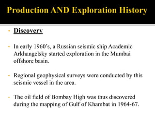
The document discusses the Bombay High oilfield located offshore of Mumbai, India in the Arabian Sea. It describes how the oilfield was discovered in 1964-1967 by a joint Russian-Indian exploration team mapping the area. The Bombay High field supplied 14% of India's oil needs and accounted for 38% of domestic production, with operations run by India's Oil and Natural Gas Corporation (ONGC) exploiting reservoirs ranging from fractured basement to middle Miocene carbonates.
The process of transportation of petroleum from its place of origin, the source rock, to its place of accumulation into the reservoir up to the trap is termed as Migration.
Metallogenic Epoch and Province
Metallogenetic Epochs
Metallogenetic epochs, as defined above, are specific periods characterised by formation of large number of mineral deposits. It does not mean that all the mineral deposits formed during a definite metallogenetic epochs. In India the chief metallogenetic epochs were:
1. Precambrian
2. Late Palaeozoic
3. Late Mesozoic to Early Tertiary
Sedimentary basins are the depressions in the earth's crust where loose particles accumulate and finally lithified to form sedimentary rocks. Basins are particularly attractive to geoscientists from time immemorial due to the wealth hidden here in the form of oil, gas, coal etc. In this document you will find the types of basins, basin-fill types, methods of basin analysis and so on.
Minerals are formed by changes in chemical energy in systems which contain one fluid or vapor phase. In nature, minerals are formed by crystallisation or precipitation from concentrated solutions. These solutions are called as ore-bearing fluids. Ore-bearing fluids are characterised by high concentration of certain metallic or other elements.
Fluids are the most effective agents for the transport of material in the mantle and the Earth's crust.
Information about these fluids is an invaluable aid in mineral exploration.
Conventional academic methods of analysing fluid inclusions are too slow and tedious to be of practical application in typical mineral exploration activities.
However, the academic data from numerous studies does show that CO2 is an exceptionally important indicator when exploring for most types of gold deposit.
Because the baro-acoustic decrepitation method is a rapid and reliable method to measure CO2 contents in fluids, it can be used to study a spatial array of data and it is an invaluable and practical exploration method.
Measurements of temperatures of fluid inclusions does not usually help in mineral exploration as hydrothermal minerals deposit over a wide temperature range and there is no specific temperature which is indicative of mineralisation. However, if temperatures are available on a large spatial array of samples, then temperature trends may be a useful exploration method to find the hottest part of the system, which is presumably the location of the best economic mineralisation. Baro-acoustic decrepitation is the most practical method to determine temperatures of the large numbers of samples required.
Salinities of fluid inclusions are of limited use in exploration and are difficult to measure. However, they can be used to recognise intrusion related hydrothermal systems.
Introduction
Petrophysic of the rocks
It is the study of the physical and chemical properties of the rocks related to the pores and fluid distribution
Porosity, is ratio between volume of void to the total voids of the rock.
Permeability, is ability of a porous material to allow fluids to pass through it.
Electric, most of the sedimentary rocks don’t have conductivity.
Radiation, clay rocks have 40K, radiate alpha ray.
Hardness, it depends on the cementing material and thickness of the sediments.
WELL LOGGING
The systematic recording of rock properties and it’s fluid contents in wells being drilled or produced to obtain various petrophysical parameters and characteristics of down hole sequences (G.E Archie 1950).
The measurement versus depth or time, or both, of one or more physical properties in a well.
These methods are particularly good when surface outcrops are not available, but a direct sample of the rock is needed to be sure of the lithology.
A wide range of physical parameters can be measured.
In some cases, the measurements are not direct, it require interpretation by analogy or by correlating values between two or more logs run in the same hole.
Provide information on lithology, boundaries of formations and stratigraphic correlation.
Determine Porosity, Permeability, water, oil and gas saturation.
Reservoir modeling and Structural studies… etc.
Types of Well Logging
Logs can be classified into several types under different category
Permeability and lithology Logs
Gamma Ray log
Self Potential [SP] log
Caliber log
Porosity Logs
Density log
Sonic log
Neutron log
Electrical Logs
Resistivity Log
For contact : omerupto3@gmail.com
Hazard Communication is one of the most frequently violated OSHA standards and with the agency getting tougher on enforcement, compliance is crucial. This presentation provides a brief overview of the regulation, touches on the impact of the proposed alignment with GHS and shares some easy-to-implement best practices for helping your organization meet OSHA's HazCom requirements, including best practices for managing your written plan, providing proper employee training and utilizing efficient MSDS management systems.
reef
2_Shallow offshore ocean floor
3_Reef - any up thrusting substrate in the ocean
4_Organism which form reefs
5_Coral reefs: Environmental conditions
6_Coral reef zonation
7_Reef settings : Types of Coral Reefs
8_ How are reefs formed?
9_ Reef structures
10_ Reef characteristics
11_ Economic geology of anciant reefs
Reporte del accidente que sufrió un buceador de saturación por un fallo en el sistema de posicionamiento dinámico del buque "Bibby Topaz". Finalmente y gracias a su destreza y sangre fría, la de sus compañeros y la tripulación del buque, pudo ser recuperado con vida.
During the July OFFSHC, we were presented a great overview of the final rule published by OSHA to align the OSHA Hazard Communication Standard (HCS) with the Globally Harmonized System (GHS). Jorge Delucca, OSHA CAS, provided the OSHA GHS Overview (click the link to view). He discussed the implementation dates, GHS Hazard Classifications, Safety Data Sheet changes and GHS labeling. Mr. Delucca also discussed the other standards that will be affected and current litigation related to the ruling. More information is available at http://www.osha.gov/dsg/hazcom/index.html.
Khatatba Formation
• Geological formation in the Shoushan
Basin, North Western Desert, Egypt
• Middle Jurassic formation, dating back
approximately 174 to 163 million years ago
• Contains organic
-rich shale and coaly shale
• Important source rocks for hydrocarbons • Significant target for oil and gas exploration
in the region
• Extensively studied with organic
geochemical, petrographic, and
petrophysical analyses
• Studies helped identify essential elements
of the petroleum system in the area.
THE PRESENTATION OF MY GRADUATION PROJECT MetwallyHamza1
This is a presentation for my graduation project, which had been written by me, as a fulfillment of my B. Sc. in Geology and Chemistry, from Geology Department, Faculty of Science, Benha University, Egypt. Proudly I got (+A) in such a paper. These projects equipped me with perfect research and communication skills, as I had to present and defend in English in front of specialists.
The San Sai oil field is an important oil field in the Fang Basin. The sedimentary facies and basin
evolution have been interpreted using well data incorporated with 2D seismic profiles. The study indicates that
the Fang Basin was subsided as a half-graben in the Late Eocene by regional plate tectonism. The deposit is
thicker westward toward the major fault. The sedimentary sequence of the Fang Basin can be subdivided into
two formations which comprise five associated depositional environments. The results of total organic carbon
content (TOC), vitrinnite reflectance (%Ro), Rock-Eval pyrolysis and headspace gas analyses and the study of
basin modeling using PetroMod1D software are compiled and interpreted. They indicate that source rocks of
kerogen type II and III with 1.78 – 3.13%wt. TOC were mature and generated mainly oil at 5,600 – 6,700 feet
deep (Middle Mae Sod Formation). Source rocks of kerogen type II and III with 2.07 – 39.07%wt. TOC
locating deeper than 6,700 feet (Lower Mae Sod Formation) were mature to late mature and generated mainly
gas at this level. According to TTI (Time Temperature Index) modeling using PetroMod11.1D software,
hydrocarbon generation took place in the Middle Miocene and the generated oil and gas migrated through
fractures and faults to accumulate in traps at 2,900-4,000 feet deep (Upper Mae Sod Formation).
Pyrolusite of Umm Bogma, South Sinai, EgyptMostafa Masoud
Presentation on Pyrolusite of Umm Bogma
Reference
Khalifa, I. H., & Seif, R. A. (2014). Geochemistry of manganese-iron ores at Um Bogma area, west central Sinai, Egypt. International Journal of Advanced Scientific and Technical Research, 6, 258-283.
New trends in earth sciences- Exploration of energy resourcesSwapnil Pal
A presentation on an article "strategies in geophysics: estimation of conventional and unconventional resources". Also a catchy analogy of a story "Nimboo pani" with role of a geologist in the current energy scenario.
1. Siddharth K.
Smruti S.R.
Sudhanshu G.
Swapnil Pal
Tarun K.
Yash V.
2. Bombay High is an offshore oilfield 160 kilometres
(99 miles) off the coast of Mumbai, India. The oil
operations are run by India's Oil and Natural Gas
Corporation (ONGC).
Bombay Bombay High field was discovered by a
Russian and Indian oil exploration team during
mapping of the Gulf of Khambhat (earlier Cambay)
in 1964-67.
It supplied 14% of India's oil requirement and
accounted for about 38% of all domestic production
as per data available till 2004.
3.
4. A Russian and Indian oil exploration team that was mapping the Gulf of
Cambay in 1965 in a seismic exploration vessel called "Academic
Arkhangelsky" discovered the Bombay High oilfield.
ONGC geophysicist M Krishnamurthy headed the Indian team which was
attached with the Russian Offshore seismic expedition.
ONGC had a contract with "Technoexport" of the then-USSR for seismic
support.
5. The first ever momentous application of velocity analysis was on Bombay
high. In 1971-72, interval velocity studies indicated presence of limestone
reservoir in the structure.
In 1982, a small group of geophysicists was asked to work for the first
time in the Development Geology group (Bombay Offshore) to help solve
the geologic problems associated with field development and production.
A few wells drilled later on confirmed the seismic predictions of the
synergist group and this resulted in significant upward estimate of in-place
reserves and in suitable modification of the injection wells locations.
In 1997, acquisition of seismic data in Bombay offshore through Ocean
Bottom Cable (OBC) with dual sensors was the watershed in the use of
latest tools in ONGC.
6. Here, gamma-ray, resistivity, neutron porosity, and velocity (Vp) well-log
data sets from three vertical wells, viz. Well-A, Well-B, and Well-C are
shown in the figures. The wells, located in the Bombay High oilfield in the
western offshore basin (Fig. 1) are separated by a distance of
approximately 10 km.
Logs of all three wells represent subsurface sections of approximately 500
m below the sea floor. Velocity log data (in units of m/s) were generated
from the sonic log.
Data were sampled at 0.15 m and a total of 3280 data points in each log of
all three wells were obtained.
7.
8. Figure 2: gamma-ray log, well-a1, well-a2, well-a3, repectively
Shale (sand) formations show high (low) gamma-ray intensity. Since we are
interested in identifying reservoir rocks (which are non-shaly), identification of
boundaries between different subsurface formations in well-log data becomes
necessary.
9. Figure 3: resistivity log, well-b1, b2, b3 respectively.
Hydrocarbon-bearing formations are characterized with high resistivity compared to
those of non-hydrocarbon bearing formations which is represented by scalograms of the
resistivity logs
10. Figure 4: neutron porosity logs. well-c1, c2, c3 respectively.
Study of the scalograms of the neutron porosity logs of Well-A (Fig. 4c1), Well-B (Fig.
4c2) and Well-C (Fig. 4c3) show high positive coefficients at different depths
corresponding to the decrease in neutron porosity.
11. Figure 5: velocity logs, well-d1,d2,d3
Velocity logs generated from sonic logs measure the interval transit time of sound
waves in the formations. As expected, velocities are usually low for the reservoir rocks
(lime stone and sand stone) when compared to shaly formations.
12. Bombay High is One of the six sedimentary
basins on Western Continental Margin , i.e.
I. Kutch
II. Saurashtra
III. Bombay offshore
IV. Konkan
V. Lakshadweep
VI. Kerala
Bombay offshore basin is the largest with an
arial extent of 120,000 km2 .
13. An intra cratonic basin.
southern extension of Cambay basin and encompasses the
Gulf of Cambay and adjacent shelf part of the Arabian sea.
result of faulting in the Deccan trap basement during Upper
Cretaceous.
This basin is divided into several tectonic units such as - -
Cambay Gulf Shelf to the north
- Dahanu depression to the south
- Bombay Ratnagiri shelf occupying
central and southern part of
14. developed on divergent passive continental margin
Three-structural units of carbonate dominant stratigraphy with three
contiguous major depressions.
clastic domain follows from Mumbai coast towards Arabian Sea:
Shelfal horst-graben structure
Kon-comoria depression
kon comaria ridge
Lakshmi Laccadive depression
Lakshmi Laccadive ridge
Arabian sea
16. A hiatus is present between the formation of Metamorphosed
basement –Deccan trap, Deccan trap Jafrabad, Jafrabad-
Pipavav, Pipavav Mahuva and Mahuva- Mahim.
part of Mahuva formation of Miocene age.
consists of few meters thick limestone formations separating
from each other by thin layers of shale formations.
NNW-SSE trending doubly plunging anticline with a faulted
eastern limb having a throw of about 100 Meters.
17. Mumbai high is divided into two blocks.
1.Mumbai High North (MHN)
2.Mumbai High South (MHS)
The low permeability zone divides the Mumbai high north and
south.
There is a 15 meters wide fault between north and south
The estimated initial oil-in-place (OIIP) in Mumbai high north
and south is 1659 MMt
18. The L-III limestone is the major reservoir in the field, which
contains 94% of the proved reserves
Other hydrocarbon producing reservoirs are L-I, L-II and S1.
Oil and gas accumulation is found in Basal Clastics and
fractured Basement also.
19. Petroleum System
Introduction Bombay offshore basin accounts for nearly
two thirds of the annual petroleum
production of India. The mature source
rocks are present in the lower Eocene
Paleocene Panna formation. Further,
marginally mature potential source rocks
are within the Oligocene in Tapti- Daman
and within Neogene in Deep Continental
shelf and deeper part of the basin also
exist. Hydrocarbons have been discovered
in multiple reservoirs in this basin, ranging
from fractured basement to middle
Miocene.
21. Total Composite
Petroleum System
Important elements Source Rock
which constitutes
Panna formation of Palaeocene-Early
Petroleum System
Eocene is main source rock of crude oil
formation. Panna formation spread over the
entire Mumbai offshore basin. Besides
Panna formation, coral reefs are the source
rocks as well as reservoirs.
Panna formation Total Organic Carbons
(TOC): 0.5- 20.4 %
Thermal gradient is 3 degree per 100 feet.
The source rocks contain mixed type-II and
type-III kerogens.
22. Total Composite
Petroleum System
Important elements Reservoir rock
which constitutes Limestone is the main reservoir. Limestone is
Petroleum System basically Micrite, Biomicrite and chalky type.
They posses mainly primary and secondary
porosity.
Average Porosity range: 15- 35%
Average Permeability: 10 mD to 1 Darcy
In the Bombay-High area, oil and gas is
produced from fractured basement through
middle Miocene reservoirs, with the most
prolific being the platform carbonates such as
the lower Miocene L-III limestone.
Other rocks are of Mukta, Baseein, Daman,
Panna and Mahuva formation in Tapti Daman
block.
23. Total Composite
Petroleum System
Important elements
which constitutes
Cap rock
Petroleum System Shale is mainly cap rock in Mumbai high.
But somewhere carbonates are also present
as cap rocks wherever tight limestone is
formed. E.g.: Bassein Reservoir.
24. Total Composite
Petroleum System
Important elements
which constitutes
Seal
Petroleum System In the Bombay offshore and Kutch areas,
the most likely seals are an extensive series
of thick middle to upper Miocene shales. In
the Cambay Graben, interbedded Paleocene
through middle Miocene shales provides
seals for the various reservoirs.
26. Total Composite
Petroleum System
Important processes
which constitutes
Trap formation
Petroleum System Anticlinal reversal & fault closures are
mainly trap. Structure within anticlinal
reverse is mostly developed by drape
sandstone. Trend of fault closures are ENE-
WSW.
27. Total Composite
Petroleum System
Important processes
which constitutes
Generation-Migration-Accumulation
Petroleum System Generation and expulsion adjacent to the
Bombay-High area may have occurred as
early as middle Miocene and continued, or
began again, in the Pliocene.
Burial-history data indicate peak generation
most likely occurred during the late Miocene
and early Pliocene.
29. • Discovery
• In early 1960’s, a Russian seismic ship Academic
Arkhangelsky started exploration in the Mumbai
offshore basin.
• Regional geophysical surveys were conducted by this
seismic vessel in the area.
• The oil field of Bombay High was thus discovered
during the mapping of Gulf of Khambat in 1964-67.
30. • ONGC first started drilling in Bombay High with the
drillship Sagar Samrat in 1973.
• First offshore well was sunk in Feburary 1974.
• The field was put on production in May 1976.
• Production from this field was responsible for rapid
growth of the country’s total crude oil production in
1970’s and 1980’s.
31. • Cumulative production from the Bombay High field has
exceeded 2 billion barrels of Oil (BBO) and 3 trillion
cubic feet of Gas (TCFG).
• Estimated Initial oil-in-place (OIIP) in Mumbai High
North and South is 1659 MMT.
• Up till 2004, Oil field of Bombay High accounted for
about 38% of the entire domestic production and
supplied 14% of the oil requirement.
32. • A major fire on 27th July, 2005 destroyed the Mumbai
High North platform.
• The north platform used to produce 110,000 barrels of
oil every day ( a seventh of the country’s oil).
• Rebuilding the platform cost an estimated amount of Rs
1200 crore.
33. • The Bombay High oil field reached its peak production
level in 1998 with 20 MMT an year.
• The quantity of oil produced at Bombay High has been
on the decline since 1990’s due to field GOR and water
cut.
• 1.6 billion $ programme is planned by ONGC to
improve the oil recovery from the field.
34. • Intense exploration and development activities in the
basin have resulted in significant discoveries of several
oil and gas fields:
Heera
Panna
Bassein
Neelam
Mukta
Ratna
35. • ONGC envisages a total crude oil production of 202.42
MMT by 2030.
• It aims to improve the recovery rate by 40% by 2040.
• ONGC has floated a tender for the acquisition,
processing and interpretation of 1975 sq km or 4C-3D
seismic data in the Mumbai High area.
1. 1600 sq km in Mumbai High field
2. 375 sq km in Heera field.
36. The study of Geology gives an idea about the
formation, stratigraphic sequence and present
condition of the Bombay High oilfield.
Study of petroleum system also provides
information about generation and expulsion
adjacent to the Bombay-High area which may
have occurred as early as middle Miocene and
continued, or began again, in the Pliocene.
Burial-history data indicate peak generation
most likely occurred during the late Miocene
and early Pliocene.
37. During the years, with the development of
geophysics, ONGC has used modern
methodologies like synergists approach and
acquisition through ocean bottom cables
resulting in a clearer subsurface image and
better estimate of in-place reserve
38. CHANDRASEKHAR, E. AND RAO, E.V., 2012, Wavelet Analysis
of Geophysical Well-log Data of Bombay Offshore
Basin, India, Mathematical Geosciences, Springer-Verlag
NANDA, N.C., 2002, Petroleum Geophysics in ONGC, India - A
memoir, Geohorizon, SPG India
Directorate General of Hydrocarbons - Mumbai Offshore Basin
(http://www.dghindia.org)
Wikipedia – Bombay High
(http://en.wikipedia.org/wiki/Bombay_High)
www.onepetro.org
www.offshore-technology.com/projects/mumbai-high
http://www.ongcindia.com/specrep1.asp?fold=special&file=special1.
txt
http://www.upstreamonline.com/hardcopy/news/article1263483.ece
Panna formation which is a Thick deltaic clay and shale facies of…
The rifting event in the Cambay and Kutch areas may be related to the extensional faulting and shear zone that was developing in the Indus Basin area.In the Cambay Graben and southward to the Bombay High, trap deposits lie on basement.The Surat and Panna Depressions (Panna Formation) were filled with trap wash overlain by carbonates, shales, and interbedded siltstones from fluvial to transitional environments.Lower to middle Eocene rocks are absent from most of the offshore area, and an erosional unconformity that extends over most of the offshore area truncates the Panna.Middle to late Eocene time in the shelf margin or outershelf, Bombay High, and Panna-Bassein areas is represented by shallow-marine shales and shelf carbonates of the Belapur and Bassein Formations.