Download to read offline


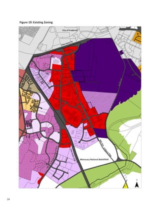


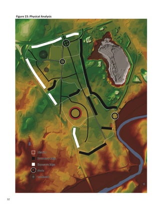


This document provides an introduction and overview of the Southeast Corridor planning process. It describes the study area location along MD 85 and MD 355 south of Frederick City. The document notes that redevelopment is a priority in this area to leverage existing infrastructure and accommodate growth. It identifies opportunities for redevelopment through infill development and increasing density on parking lots. Figures and tables provide information on land use, zoning, transportation infrastructure and a physical analysis of the study area.


