
Recommended
More Related Content
Similar to Atlas scavenger hunt
Similar to Atlas scavenger hunt (20)
More from Mark Blackwell
Recently uploaded
Recently uploaded (20)
Atlas scavenger hunt
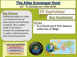
- 1. Is a Greek word that means a collection of Maps. Displaying heights on maps is an important way of showing how the landscape is shaped. This is called relief. It can help us visualise the landscape and is useful in planning routes and interpreting terrain. Learning Capabilities Determined learner Adaptable learner Self-reliant learner 25 September 2017 LO: To develop our atlas skills.
- 2. You can recognise the purpose of an atlas. You use a limited range of specialist geography words. You have a reasonable accuracy in the use of spelling, punctuation and grammar. You can use an atlas to find Geographical information. You use a good range of specialist geography words. You have a considerable accuracy in spelling, punctuation and grammar. You can consider how an atlas will be used in the study of Geography. You can efficiently use an atlas to find Geographical information. You use a wide range of specialist terms where appropriate. Accurate use of spelling, punctuation and grammar. Learning Outcomes – Success Criteria LO: To know how height can be represented on maps.
- 3. Learning objectives All: To recognise the purpose of an atlas Most: To use an atlas to find Geographical information Some: To consider how an atlas will be used in the study of Geography An atlas is a collection of maps. The word atlas dates back to Greek Mythology, however the first atlas wasn’t created until 1570. The first atlas wasn’t called an atlas, it was named the Theatre of the Round World. It was a way of creating maps in a user friendly form so that everyone could enjoy them. What do you think people used an atlas for in the past? Do we still use an atlas for the same purpose? Task 2. Look through your atlas, in pairs write a list of the different information you can find in a modern atlas. Can you give suggestions for how we might use an atlas in Geography lessons.
- 4. In groups of 3 use your atlas to answer the question sheet. The first letter of each word creates a phrase, can you work it out correctly? LO: To develop our atlas skills.