Acqua suolo foreste
•
0 likes•523 views

This is the talk I gave at the Forest day, March 21 2016, at MUSE in Trento. I talked about the interaction between the water cycle, vegetation and climate. As a modeller, I conclude talking about the challenge of modelling all of this complexity at various spatial and temporal scales.

Recommended
More Related Content
What's hot
What's hot (20)
Viewers also liked
Viewers also liked (20)
Similar to Acqua suolo foreste
Similar to Acqua suolo foreste (20)
More from Riccardo Rigon
More from Riccardo Rigon (20)
Recently uploaded
Recently uploaded (20)
Acqua suolo foreste
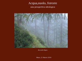
- 1. Acqua,suolo, foreste una prospettiva idrologica Riccardo Rigon Muse, 21 Marzo 2016
- 2. !2 Il buon vecchio ciclo idrologico lo conosciamo tutti R. Rigon Le basi
- 5. !5 +P Q ET R. Rigon Evaporazioni e Traspirazioni
- 6. !6 (P Q ET) t R. Rigon Il tempo !
- 7. !7 (P Q ET) t(P Q ET) t = S R. Rigon Le riserve nel suolo e nelle falde
- 8. !8 Supponiamo che la nostra superficie sia così, senza vegetazione S = (P Q ET) t e, naturalmente, inclinata, come si conviene in montagna ~ 1 km R. Rigon Un versante liscio liscio
- 9. !9 Cosa cambia se aggiungiamo un bosco ? S = (P Q ET) t Se il clima non cambia, P rimane uguale, ET aumenta, Q diminuisce. Ma ? questo ce lo dicono vari esperimenti in cui interi bacini sono stati disboscati S ~ 1 km R. Rigon Add a forest
- 10. !10 P Q S = 0 t ⇠ 10 anni R. Rigon Cambia i flussi
- 11. !11 Se guardiamo a tempi abbastanza lunghi la portata alla chiusura dei bacini diminuisce A ben guardare (e c’è chi ha misurato) questo è l’effetto di due situazioni, la diminuzione del livello della falda, che poi produrrebbe deflusso, e la diminuzione del deflusso superficiale per se. (In verità si è osservato che …) Ma tutto dipende anche da quanta è P R. Rigon Cambia i deflussi
- 12. !12 ns of endmembers to streamflow. a–c, Contributions of rain (navy), snow (cyan) and groundwater (orange) to streamflow h Inlet, 2012 (b); and Big Thompson, 1994 (c). d, Groundwater contributions (orange lines) with propagated uncertainty Groundwater contributions are greatest in the most actively impacted watershed case, in a. The Big Thompson 2012 use the time-varying groundwater endmember and the dashed line represents the constant groundwater endmember. The with the dashed line of the 2012 Big Thompson study, and the solid line is consistent with the North Inlet study. n the Big Thompson than in the North was less widespread and less recent. endmembers identified two methods water endmember that provided the roundwater contributions, including s collected biweekly (that is, the time- ember) and average pre-melt baseflow nt groundwater endmember). On the 2012 Big Thompson mean fractional ranged from 0.47 to 0.56 ± 0.11, 8 in 1994 and 0.30 ± 0.04 in the constant groundwater endmember the 1994 study methodology and is comparisons unless otherwise noted. l analyses found greater fractional to streams in watersheds where MPB member compositions naturally vary atial characteristics such as elevation ity or isotopic processes related to (Supplementary Table 3). Despite h uncertainty analysis described in reveals that significant di erences still observed by the end of July ry Fig. 14a), when the signal from ted to increase relative to that from Jul. Aug. Sep. Oct. Dailydischarge(mm) 0.0 0.5 1.0 1.5 2.0 2.5 1994 net streamflow 2012 net streamflow 1994 groundwater 2012 groundwater Figure 4 | Hydrograph separations presented as partitioning of the total daily stream discharge (in mm; full bar height) for the 1994 (blue) and 2012 (orange) seasons. Groundwater discharges to streamflow were determined using the constant groundwater endmember. Overlapped shading in 2012 depicts the additional contribution determined from the sensitivity analysis and the time-varying groundwater endmember. Total annual flow partitioning indicates increased groundwater discharge to streams in 2012 despite higher total flows in 1994. Column spacing is based on stream sampling frequency. | JUNE 2014 | www.nature.com/natureclimatechange 483 Bearup et al., 2014 R. Rigon Il contributo delle acque sotterranee
- 13. !13 Di solito si è guardato cosa è successo dopo il taglio del bosco Risultati in Australia*, dopo il taglio del 10% della foresta: * Brown et al., 2005 • nelle foreste di conifere, il deflusso medio annuale è aumentato di 20-25 mm** • nelle foreste di eucalipto + 6 mm • il taglio degli arbusti, + 5 mm • altre piante, decidue, +17-20 mm Risultati similari sono stati ottenuti in Sud Africa, dove però le conifere abbassano il deflusso più che gli eucalipti. ** su circa 1000 mm annui R. Rigon Statistiche
- 14. !14 Fig. 11 depicts the response to conversion of native forest to pasture in the Wights catchment in south Western Australia. As discussed in Section 4 the Wights catchment is part of a series on paired catchment studies in south Western Australia. In these catchments, the interplay between the local groundwater flow system and vegetation plays an important role in the hydrological response. The replacement of native forests by pastures in these catchments has lead to a rapid increase in groundwater discharge area (Schofield, 1996), resulting in large increases in low flows. As with Fig. 10, it can be seen that all sections of the flow regime are affected by the change in vegetation. Comparing the FDC for native vegetation (1974– 1976) with a period of similar climatic conditions of Fig. 10. Flow duration curves for the Red Hill catchment, near Tumut, New South Wales, Australia. One year old pines and 8 year old pines (after Vertessy, 2000). A.E. Brown et al. / Journal of Hydrology 310 (2005) 28–61 43 Un grafico significativo Brownetal.,2005 R. Rigon Curve di durata
- 15. !15 Fig. 11 depicts the response to conversion of native forest to pasture in the Wights catchment in south Western Australia. As discussed in Section 4 the Wights catchment is part of a series on paired catchment studies in south Western Australia. In these catchments, the interplay between the local groundwater flow system and vegetation plays an important role in the hydrological response. The replacement of native forests by pastures in these catchments has lead to a rapid increase in groundwater discharge area (Schofield, 1996), resulting in large increases in low flows. As with Fig. 10, it can be seen that all sections of the flow regime are affected by the change in vegetation. Comparing the FDC for native vegetation (1974– 1976) with a period of similar climatic conditions of Fig. 10. Flow duration curves for the Red Hill catchment, near Tumut, New South Wales, Australia. One year old pines and 8 year old pines (after Vertessy, 2000). A.E. Brown et al. / Journal of Hydrology 310 (2005) 28–61 43 Un grafico significativo Brownetal.,2005 R. Rigon Curve di durata
- 16. !16 Altri effetti: Il bosco: • difende dall’erosione • difende dal franamento* *Ma quando il versante diventa instabile … R. Rigon Il dissesto (idrogeologico)
- 17. !17 • Perchè il suolo è più secco e perché le radici aumentano. • Perche le radici aumentano la coesione del terreno R. Rigon Frane
- 18. !18 We measured characteristics of all roots with diameters ³1 mm in regions with differing vegetation communities. Field-measured root attributes included species, diameter (measured with micrometer), vertical depth relative to the ground surface, whether the root was alive or decaying, whether the root was broken or intact, and cross-sectional area of colluvium over which roots act. The root attribute in- understory roots in clearcuts had no root cohesion because we do not know the timing of plant mortality and hence the relative decrease in thread strength. Consequently, calcu- lated root cohesion is conservative on the low side because decaying roots continue to contribute a finite amount of co- hesion. We did not systematically characterize the decay function of all the species in the area. Instead we uniformly Schmidt et al. 1005 Fig. 4. Photograph of broken roots (highlighted) in landslide scarp within Elliot State Forest. Roots did not simply pull out of soil ma- trix, but broke during the landslide. Note 2 m tall person for scale in center (in center of annotated circle) and absence of roots on the basal surface of the landslide. •Schmidtetal.,2001 R. Rigon Frane e Radici
- 19. !19 https://www.ieca.org/photogallery/haymanfire.asp Il fuoco altera la struttura del suolo Incendi R. Rigon Si vede ciò che manca, quando manca
- 20. !20 •Benavidesetal.,2005 R. Rigon Trasporto di sedimento
- 22. !22 E’ importante notare che la grandezza dei cambiamenti annuali non racconta l’intera storia dell’impatto che la vegetazione ha sulla produzione del deflusso. Gli effetti sono diversi nelle diverse stagioni.maximum evapotranspiration and periods of minimum evapotranspiration. Hornbeck et al. (1997) observed that most of the increase in annual yield occurred during the growing season as shown in Fig. 13. They concluded that water yield increases were a result of decreased transpiration and primarily occurred as The difference in the results between Hornbeck et al. (1997), who found notable seasonal differences, and McLean (2001), who could not detect seasonal changes, can be attributed to the deciduous nature of the vegetation in the USA compared with the evergreen vegetation of the pine plantations in New Zealand. The Fig. 13. Flow duration curves for the first year after the clear-felling treatment—Hubbard Brook experimental forest (after Hornbeck et al., 1997). A.E. Brown et al. / Journal of Hydrology 310 (2005) 28–61 45 R. Rigon Non solo alla scala annuale
- 23. !23 Ma i cambiamenti stagionali, a causa della variabilità del meteo e delle precipitazioni, sono più difficilmente osservabili. Si devono fare delle congetture e supportarle con modellazione matematica. R. Rigon Modelli fisico-matematici-numerici
- 24. !24 computationally demanding. Therefore, several eco- hydrological models still use simplified solutions of carbon285 ) concepts that empirically link carbon assimilation to the transpired water or intercepted Energy exchanges Longwave radiation incoming Longwave radiation outgoing Shortwave radiation Latent heat Latent heat Sensible heat Soil heat flux Geothermal heat gain Bedrock Bedrock Bedrock Bedrock Momentum transfer Rain Snow Photosynthesis Phenology Disturbances Atmospheric deposition Fertilization Nutrient resorption Nutrient uptake Nutrients in SOM Mineral nutrients in solution Mineralization and immobilizationOccluded or not available nutrients Primary mineral weathering Biological fixation (N) Tectonic uplift Denitrification (N) Volatilization Growth respiration Maintenance respiration Fruits/flowers production Heterotrophic respiration Wood turnover Litter Litter Litterfall nutrient flux DecompositionMycorrhizal symbiosis Microbial and soil fauna activity SOM DOC leaching Leaching Fine and coarse root turnover Carbon allocation and translocation Carbon reserves (NSC) Leaf turnover Transpiration Evaporation from interception Evaporation/ sublimation from snow Evaporation Throughfall/dripping Snow melting Infiltration Leakage Root water uptake Lateral subsurface flow Base flow Deep recharge Runoff Sensible heat Albedo Energy absorbed by photosynthesis Water cycle Carbon cycle Nutrient cycle FIGURE 6 | Ecohydrological and terrestrial biosphere models have components and parameterizations to simulate the (1) surface energy exchanges, (2) the water cycle, (3) the carbon cycle, and (4) soil biogeochemistry and nutrient cycles. Many models do not include all the components presented in the figure. WIREs Water Modeling plant–water interactions La complessità di una singola pianta Non solo l’acquaafterFatichi,PappasandIvanov,2015 R. RigonR. Rigon
- 25. !25 Vegetazione - Suolo il tempo si allunga Jenny,RoleofthePlantFactorinthePedogenicFunctions,Ecology,Vol.39,No.1 Hubble, G. D. 1954. Some soils of the coastal low- Wood, J. G. 1956. Personal co ROLE OF THE PLANT FACTOR IN THE PEDOGENIC FUNC HANS JENNY Universityof California,Berkeley INTRODUCTION The interplayofclimate,soil,and vegetationis oftenrepresentedby a triangle: climate vegetation= soil It impliesthatclimateaffectssoil and vegeta- tionindependently,thatsoil influencesvegetation, and thatvegetationreactsupon soil. While at firstsightappealingthe triangleis actuallybesetwithlogicalpitfallsand frustrations. It has even led to the negativisticview thatthe soil-plantcontractcannotbe interpreted. This paper presentsa formalisticmethodfor evaluatingthevariousinteractions.Assessingthe rolesofclimateand vegetationin soil genesiswill be emphasized. To do so,theconceptofthebiotic factormustbe clearlydelineatedand given pre- cision. The writerfollowsa typeofpresentationwhich he has offeredfora numberof yearsto his stu- is plant and animal life abo constitutesa threedimensio scape, an arbitraryelement open system;matteris cont removedfromit. The entirelandscapecan b composedofsuchsmalllands pictureis comparableto the signs on the walls of Byzan are made up of littlecubes called tesseras. We shall u tessera,fora smalllandscap The "thickness"of a tess heightofvegetationplusthed area ofa tesserais determin siderations. It is a convenie ing,a specifiedarea. A qua one square meterin a stan vegetationtessera. A soil m sera. A "soil profile"colle soiltessera,usuallyofill-def Strictlyspeaking,a soilprof a soiltessera. Table I illustratesthe tot Kjeldahl analysis,ofan alpin “L’interconnessione tra clima soli e vegetazione è spesso rappresentata da un triangolo. Esso implica che il clima comanda lo sviluppo dei suoli e della vegetazione; che il suolo influenza e la vegetazione e la vegetazione modifica il suolo.” R. Rigon Il suolo
- 26. !26 Vegetazione - Suolo - Topografia sulla scala più lunga ~ 2 km R. Rigon Feedbacks
- 27. !27 Cunningham/Saigo,EnvironmentalScience,1999 Vegetazione - Suolo - Topografia una complessità ancora da conoscere bene R. Rigon Il suolo da solo
- 28. !28 TagueandDugger,2010 transizione neve-pioggia ~ 3 km R. Rigon Cambiamenti Climatici
- 29. !29 TagueandDugger,2010 transizione neve-pioggia Aumenta il deflusso invernale, diminuisce il deflusso estivo Il cambiamento climatico sposta la transizione tra precipitazioni nevose e piovose verso le alte quote R. Rigon Cambiamenti Climatici
- 30. !30 limitata dall’energia: la foresta è probabile cresca: fintantoché anche l’acqua non diventa limitante limitata dall’acqua: è probabile che la foresta diminuisca, anche se l’aumento di CO2 potrebbe favorirne la crescita Intermedio: la crescita può essere positiva o negativa dipende dal tipo di pianta e dalle risorse locali Bosco a crescita: modificato da Tague and Dugger, 2010 Nell’ovest degli USA R. Rigon Cambiamenti Climatici
- 31. !31 Cambiamenti Climatici R. Rigon Shift degli ecotoni
- 32. !32 influencing a bark beetle outbreak vary depending on the species, host tree, local ecosystem, and geographical region, there is no single management action that is appropriate across all affected forests. A whitebark pine forest in Yellowstone National Park. The red trees were attacked and killed by mountain pine beetles the year before the photo was taken in July 2007. PHOTO BY JANE PARGITER, ECOFLIGHT, ASPEN CO Effetti che magari non si erano considerati si veda, per esempio Bearup et al., 2014 R. Rigon Insetti
- 33. !33 the potential for cumulus convective rainfall. Therefore vertical radiosonde soundings over adjacent locations that have different surface conditions offer opportuni- ties to assess alterations in thunderstorm potential. This influence of surface conditions on cumulus cloud and thunderstorm development has been discussed, for ex- Pielke and Zeng, 1989]. The soundings were made prior to significant cloud development. The radiosonde sounding over an irrigated location had a slightly cooler but moister lower troposphere than the sounding over the natural, short-grass prairie location. Aircraft flights at several levels between these two locations on July 28, Figure 5. Same as Figure 4 except between a forest and cropland. Adapted from P. Kabat (personal communication, 1999). Reprinted with permission. Pielke,2001 Feedbacks - Retroazioni sull’atmosfera ~ 10 km R. Rigon Cambia il cielo
- 34. !34 Precipitation recycling ~ 100 - 1000 km Bruskeretal,1993 R. Rigon Cambiano le precipitazioni
- 35. !35 MAY 1999 1379T R E N B E R T H Trenberth, 1998 R. Rigon Cambiano le precipitazioni
- 36. !36 Così siamo pronti a scale temporali ancora più grandi Brovkin, 2002 Clima (radiazione, precipitazioni, temperatura) Vegetazione Composizione dei gas dell’atmosfera 78 % N2, 31% O2 R. Rigon E’ un tutt’uno
- 37. !37 B. influence the summer climate in subtropical deserts: Hadley circulation, zonal wind, monsoon-type circulation, and convection. The vegetation model is similar to the one in the CLIMBER-2 model. The dynamics of box model solutions in terms of precipitation from the early Holocene to the present day are presented in Fig. 8,A. The two stable branches of the solution, the green branch with relatively high precipitation and the desert branch with low precipitation, are separated by the unstable branch. In the early Holocene, some 10 kyr ago, only the green equilibrium existed in the area with annual precipitation of about 600 mm/yr. Owing to decreased summer insolation, the precipitation declined to 400 mm/yr at the end of mid-Holocene, and the stable desert equilibrium appeared about 6 kyr B.P. Figure 8. Summary of results of a box model for the western Sahara region for the Holocene [77]. A. Dynamics of system solution in terms of precipitation during the last 10,000 yr. The upper and lower curves are the green and desert solutions, respectively. The dashed line in the middle represents the unstable solution. B. Multiple steady states, desert and ‘green’, are shown in a form of Lyapunov potential for vegetation cover. Potential minima, marked by balls, correspond to equilibria that are stable in absence of perturbations. Black and grey balls indicate dominant and minor states, respectively. 8,000 yr BP. The system has only one steady state, green Sahara. 4,000 yr BP. System underwent bifurcation; desert state appeared and became stable. The depths of the well for the two states are approximately equal. 0 yr BP. Both states remain stable but desert has a deeper well. Desert became dominant state as precipitation fluctuations shifted the system towards desert. Year, kyr BP A. green desert Fig. 8,B is a simplified cartoon of the system stability under changes in the orbital forcing. The equilibria are shown in a form of the minima of potential function (Lyapunov functional). For 8 kyr BP, there is the single minimum that corresponds to the green equilibrium. For the present day, there are two minima: the desert equilibrium is at an absolute minimum (dominant state) and the green equilibrium is at a relative minimum (minor state). At some 4 kyr BP both equilibria have the same values of the potential. In this sense, the green equilibrium became less stable than the desert equilibrium after 4 kyr BP. More precisely, the switch from one solution to another depends on the possibility for the system to ``jump'' Brovkin, 2002 R. Rigon Fondato su equilibri che possono variare
- 38. !38 A qualsiasi scala spaziale e temporale Come si partizionano evaporazione e deflussi a diverse scale spaziali e temporali ? 45.75 45.80 45.85 11.20 11.25 11.30 11.35 Long Lat Posina basin and the HRU partition used for simulation. The triangle points are the discharge measurement stations. The location and of the basin is described in Abera et alXXX. stem JGrass-NewAge (from now on, simply NewAge), ↵ers a set of model components built accordingly to the Modelling System version 3 (OMS) framework (David 13). OMS, modelling framework based on component- ftware engineering, uses classes as fundamental model blocks (components) and uses a standardized inter- pporting component communication. In OMS3, the in- of each component is based on the use of annotations. ble model connectivity, coupling and maintaining easy (David et al., 2013). Age covers most of the processes involved in the wa- et and its components were discussed with detail in: a et al. (2011, 2013a); Formetta (2013); Formetta et al. 2014b), and they are not fully re-discussed here. Com- and comparing appropriate measured and simulated data; • Validate the models using various goodness of fit methods (GoFs) to assess the model performances. • Estimate the outputs of the budgets’ terms i.e. discharge, actual evapotranspiration, and storage and thier errors 1.3. Paper organization The paper is organized as follows: section 2 provides methodologies of modeling the ”output” terms of the water balance equation, particularly rainfall-runo↵ modeling and dis- charge estimation (subsection 2.3) and evapotranspiration and water balance residual estimations (section 2.4). Brief descrip- ~ 10 km ~ 100 km ~ 500 km Posina Adige Nilo Blu R. Rigon ] La sfida della modellazione
- 39. !39 term monthly means, of course it oo as each month is sampled from ion of water budget components nfirms the monthly analysis given trend in precipitation, but actually d have been deduced from the data ith the other budget components he interactions actually in place. J 80 120 160 200 Q 40 80 160 ET 20 40 60 S JanAprJulOct −150 −100 −50 0 50 Figure 13: The spatial variability of the long term mean monthly water budget components (J, ET, Q, S). For reason of visibility, the color scale is for each component separately. 5. Conclusions After Abera et al., in preparation, 2016a Il bilancio del Posina R. Rigon La sfida della modellazione
- 40. !40 2005−01−01 2005−04−06 2005−07−03 2005−11−08 8 9 10 11 12 8 9 10 11 12 MODISETNewAgeET 35 36 37 38 39 40 35 36 37 38 39 40 35 36 37 38 39 40 35 36 37 38 39 40 long lat 25 50 75 ET (mm/8-days) Figure 6: The Spatial and temporal variability of ET in 8-day intervals for in the study area. After Abera et al., in preparation, 2016b Nilo Blu R. Rigon La sfida della modellazione
- 41. !41 0.25 0.50 0.75 1.00 Gen 1994 Apr 1994 Lug 1994 Ott 1994 Gen 1995 Time [h] Θ January February March April May June July August September October November Partitioning coefficient Θ After Rigon et al., in preparation, 2016 ⇥ := Q(t) ET (t) + Q(t) R. Rigon La sfida della modellazione
- 42. !42 Find this presentation at http://abouthydrology.blogspot.com Ulrici,2000 Other material at Domande ? R. Rigon http://www.slideshare.net/GEOFRAMEcafe/acqua-suolo-foreste-59814511 or http://abouthydrology.blogspot.it/2016/03/water-soil-forests-man-who-planted.html
- 43. !43 Bearup, L. A., Maxwell, R. M., Clow, D. W., & McCray, J. E. (2014). Hydrological effects of forest transpiration loss in bark beetle-impacted watersheds. Nature Climate Change, 4(6), 481–486. http:// doi.org/10.1038/nclimate2198 Benavides-Solorio, J. de D., & MacDonald, L. H. (2005). Measurement and prediction of post-fire erosion at the hillslope scale, Colorado Front Range. International Journal of Wildland Fire, 14(4), 457–18. http:// doi.org/10.1071/WF05042 Bentz, B., Logan, J., MacMahon, J., Allen, C. D., Ayres, M., Berg, E., et al. (2013). Bark beetle outbreaks in western North America: Causes and consequences, 1–46. Brovkin, V. (2002). Microsoft Word - brov_er5.doc. Journ. Phys. IV France, (12), 57–72. Blöschl, G., Ardoin-Bardin, S., Bonell, M., Dorninger, M., Goodrich, D., Gutknecht, D., et al. (2007). At what scales do climate variability and land cover change impact on flooding and low flows? Hydrological Processes, 21(9), 1241–1247. http://doi.org/10.1002/hyp.6669 Brown, A. E., Zhang, L., McMahon, T. A., Western, A. W., & Vertessy, R. A. (2005). A review of paired catchment studies for determining changes in water yield resulting from alterations in vegetation. Journal of Hydrology, 310(1-4), 28–61. http://doi.org/10.1016/j.jhydrol.2004.12.010 Brown, A. E. (2008, March 10). Predicting the effect of forest cover changes on flow duration curves. (L. Zhang, A. Western, & T. A. McMahon, Eds.). Brubaker, K., Entekhabi, D., & Eagleson, P. S. (1993). Estimation of Continental Precipitation Recycling. Water Resources Res., 6(6), 1077–1089. Eltahir, A. B., & Bras, R. L. (1994). Precipitation Recycling in the Amazon Basin. Quarterly Journal of the Royal Meteorological Society, 120, 861–880. Alcune buone letture R. Rigon
- 44. !44 Entekhabi, D., Rodriguez-Iturbe, & Bras, R. L. (1992). Variability in Large-Scale Water Balance with Land Surface- Atmosphere Interaction. Journal of Climate, 5, 798–813. Fatichi, S., Pappas, C., & Ivanov, V. Y. (2015). Modeling plant-water interactions: an ecohydrological overview from the cell to the global scale. Wiley Interdisciplinary Reviews: Water, n/a–n/a. http://doi.org/10.1002/wat2.1125 Jenny, H. (1958). Role of the plant factor in the pedogenic functions. Ecology, 39(1), 5–16. Johansen, M. P., Hakonson, T. E., & Breshears, D. D. (2001). Post-fire runoff and erosion from rainfall simulation: contrasting forests with shrublands and grasslands. Hydrological Processes, 15(15), 2953–2965. http://doi.org/ 10.1002/hyp.384 Johnson, D. L., Keller, E. A., & Rockwell, T. K. (1990). Dynamic pedogenesis: New views on some key soil concepts, and a model for interpreting quaternary soils. Quaternary Research, 33(3), 306–319. http://doi.org/ 10.1016/0033-5894(90)90058-S Miles, J. (1985). The pedogenic effects of different species and vegetation types and the implications. Journal of Soil Science, 36, 371–384. Pielke, R. A., Sr. (2001). Influence of the spatial distribution of vegetation and soils on the prediction of cumulus convective rainfall, 1–28. Tague, C., & Dugger, A. L. (2010). Ecohydrology and Climate Change in the Mountains of the Western USA - A Review of Research and Opportunities. Geography Compass, 4(11), 1648–1663. http://doi.org/10.1111/j. 1749-8198.2010.00400. Trenberth, K. E. (1999). Atmospheric Moisture Recycling: Role of Advection and Local Evaporation. Journal of Climate, 12, 1368–1381. Alcune buone letture R. Rigon