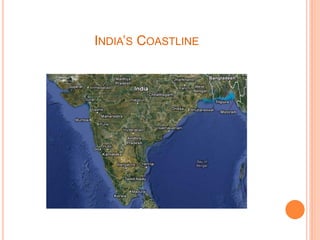
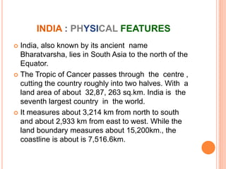
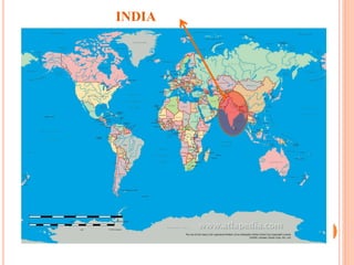
The document provides information about the location, size, and physical features of India. It states that India lies in South Asia north of the equator, with the Tropic of Cancer passing through the center. India has a total land area of about 3.2 million square kilometers and measures over 3,000 kilometers from north to south and east to west. It also shares land borders with Pakistan, Afghanistan, China, Nepal, Bhutan, Myanmar, and Bangladesh and is separated from Sri Lanka by the Palk Strait and Gulf of Mannar.

![LOCATION
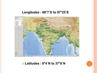
India is a vast country . Lying entirely in the
Northern hemisphere the main land extends
between latitudes 8°4´ N and 37°6´N and
longitudes 68°7´E and 97°25´E.
The Tropic of Cancer [23°30´N] divides the country
into almost two equal parts.
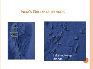
To the southeast and southwest of the mainland, lie
the Andaman and Nicobar islands and the
Lakshadweep islands in Bay of Bengal and
Arabian Sea respectively.](https://image.slidesharecdn.com/97327458-sst-project-on-india-size-and-location-240418021152-9892cb7b/85/97327458-Sst-project-on-india-size-and-location-pdf-5-320.jpg)
![OUR NEIGHBORS
India shares its land boundary with
Pakistan and Afghanistan in the
northwest ,China[Tibet] , Nepal
and Bhutan in the north and
Myanmar and Bangladesh in the
east .
Our southern neighbours across
the sea consists of the two island
countries , namely Sri Lanka and
Maldives .
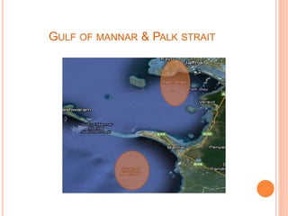
Sri Lanka is separated from India
by a narrow channel of sea
formed by the Palk Strait and the
Gulf of Mannar while Maldives
islands are situated to the south of
the Lakshadweep Islands.](https://image.slidesharecdn.com/97327458-sst-project-on-india-size-and-location-240418021152-9892cb7b/85/97327458-Sst-project-on-india-size-and-location-pdf-8-320.jpg)
![INDIAN STANDARD TIME
India has only one
standard time. India is
5.5 hours ahead of
GMT/UTC.
The Standard Meridian
of India [82°30´E]
passing through
MIRZAPUR [in UTTAR
PRADESH].](https://image.slidesharecdn.com/97327458-sst-project-on-india-size-and-location-240418021152-9892cb7b/85/97327458-Sst-project-on-india-size-and-location-pdf-10-320.jpg)