Narrow Pavement Widening - Waco District
•Download as PPTX, PDF•
1 like•556 views

This presentation highlights highway pavement widening practices in the Waco District. Prepared by Don Miller and John Jasek. Please remember to cite this research if the information you find here is used.
Report
Share
Report
Share

Recommended
Two-Lift Paving - Contractor's Viewpoints
A Two-Lift concrete Paving (2LCP) workshop was organized as a part of the Texas Department of Transportation (TxDOT) project 0-6749: Feasibility Study of Two-Lift Concrete Paving (2LCP). This workshop was conducted at the J. J. Pickle Research Campus (PRC), The University of Texas at Austin, Austin, TX on May 23rd, 2013. Dr. Jiong Hu, Texas State University, Research Supervisor, and Dr. David Fowler, The University of Texas at Austin, Co-Research Supervisor, co-chaired the workshop. The workshop offered the option of attending in person or remotely through webinar. Fifty-one attendees were present remotely or in person; 28 in person and 23 persons remotely.
Two-Lift Paving - Introduction
A Two-Lift concrete Paving (2LCP) workshop was organized as a part of the Texas Department of Transportation (TxDOT) project 0-6749: Feasibility Study of Two-Lift Concrete Paving (2LCP). This workshop was conducted at the J. J. Pickle Research Campus (PRC), The University of Texas at Austin, Austin, TX on May 23rd, 2013. Dr. Jiong Hu, Texas State University, Research Supervisor, and Dr. David Fowler, The University of Texas at Austin, Co-Research Supervisor, co-chaired the workshop. The workshop offered the option of attending in person or remotely through webinar. Fifty-one attendees were present remotely or in person; 28 in person and 23 persons remotely.
Two-Lift Paving - TxDOT Perspective
A Two-Lift concrete Paving (2LCP) workshop was organized as a part of the Texas Department of Transportation (TxDOT) project 0-6749: Feasibility Study of Two-Lift Concrete Paving (2LCP). This workshop was conducted at the J. J. Pickle Research Campus (PRC), The University of Texas at Austin, Austin, TX on May 23rd, 2013. Dr. Jiong Hu, Texas State University, Research Supervisor, and Dr. David Fowler, The University of Texas at Austin, Co-Research Supervisor, co-chaired the workshop. The workshop offered the option of attending in person or remotely through webinar. Fifty-one attendees were present remotely or in person; 28 in person and 23 persons remotely.
Flying with SAVES
Updates provided to the D-STOP Business Advisory Council at the 2017 Symposium and Board Meeting: https://ctr.utexas.edu/2018/04/12/d-stop-2017-symposium-archive/
Regret of Queueing Bandits
Updates provided to the D-STOP Business Advisory Council at the 2017 Symposium and Board Meeting: https://ctr.utexas.edu/2018/04/12/d-stop-2017-symposium-archive/
Advances in Millimeter Wave for V2X
Updates provided to the D-STOP Business Advisory Council at the 2017 Symposium and Board Meeting: https://ctr.utexas.edu/2018/04/12/d-stop-2017-symposium-archive/
Collaborative Sensing and Heterogeneous Networking Leveraging Vehicular Fleets
Collaborative Sensing and Heterogeneous Networking Leveraging Vehicular FleetsCenter for Transportation Research - UT Austin
This document discusses ongoing research projects related to collaborative sensing and heterogeneous networking leveraging vehicular fleets. Specifically, it discusses:
1) How increased cluster density of vehicles improves overall data rates and reduces variability in individual user rates.
2) Modeling what collaborative sensing systems can "see" or be aware of in obstructed environments and how coverage benefits scale with increased penetration of collaborative vehicles.
3) Developing optimal information sharing policies to maximize situational awareness for autonomous nodes in resource-constrained network environments.Collaborative Sensing for Automated Vehicles
Updates provided to the D-STOP Business Advisory Council at the 2017 Symposium and Board Meeting: https://ctr.utexas.edu/2018/04/12/d-stop-2017-symposium-archive/
Statistical Inference Using Stochastic Gradient Descent
Statistical Inference Using Stochastic Gradient DescentCenter for Transportation Research - UT Austin
Updates provided to the D-STOP Business Advisory Council at the 2017 Symposium and Board Meeting: https://ctr.utexas.edu/2018/04/12/d-stop-2017-symposium-archive/CAV/Mixed Transportation Modeling
Updates provided to the D-STOP Business Advisory Council at the 2017 Symposium and Board Meeting: https://ctr.utexas.edu/2018/04/12/d-stop-2017-symposium-archive/
Real-time Signal Control and Traffic Stability / Improved Models for Managed ...
Real-time Signal Control and Traffic Stability / Improved Models for Managed ...Center for Transportation Research - UT Austin
Updates provided to the D-STOP Business Advisory Council at the 2017 Symposium and Board Meeting: https://ctr.utexas.edu/2018/04/12/d-stop-2017-symposium-archive/Sharing Novel Data Sources to Promote Innovation Through Collaboration: Case ...
Sharing Novel Data Sources to Promote Innovation Through Collaboration: Case ...Center for Transportation Research - UT Austin
Updates provided to the D-STOP Business Advisory Council at the 2017 Symposium and Board Meeting: https://ctr.utexas.edu/2018/04/12/d-stop-2017-symposium-archive/UT SAVES: Situation Aware Vehicular Engineering Systems
UT SAVES: Situation Aware Vehicular Engineering SystemsCenter for Transportation Research - UT Austin
Updates provided to the D-STOP Business Advisory Council at the 2017 Symposium and Board Meeting: https://ctr.utexas.edu/2018/04/12/d-stop-2017-symposium-archive/Regret of Queueing Bandits
Online platforms are emerging as a powerful mechanism for matching resources to requests. In the setting of freight, the requests arrive from shippers, who have a diverse collection of goods. The resources are supplied by shippers (trucks), and have various physical constraints (driver’s route preferences, carrying capacity, geographic preferences, etc.). Online platforms are emerging that (a) learn the characteristics of shippers and carriers, and (b) efficiently match goods to trucks based on such learning.
Our project will develop algorithms for such online resource allocation. This is a challenging problem, due to the complexity of the learning tasks. Such algorithms can have considerable impact on efficiently using trucking resources.
Sharing Novel Data Sources to Promote Innovation through Collaboration: Case ...
Sharing Novel Data Sources to Promote Innovation through Collaboration: Case ...Center for Transportation Research - UT Austin
Through this project, the research team will leverage the computing resources and expertise at UT to develop a “data discovery environment” for transportation data to aid decision-making. Many efforts focus on leveraging transportation data to help travelers make decisions, but less thought has gone into a framework for using big data to help transportation agency staff and decision makers. The team will start by building the DDE for the Central Texas region, in collaboration with the local MPO, the City of Austin, and the local transit agency. Initially, the project will focus on creating more meaning from existing data sources, and as the project progresses, it will grow to include more novel data sources and methods. The data platform will be web-based and part of the research includes not only building the tool but developing appropriate protocols for access and governance.CAV/Mixed Transportation Modeling
This document discusses modeling strategies for autonomous and connected vehicles. It proposes modifying traditional four-step transportation models to account for autonomous vehicle adoption rates and different trip types. Autonomous vehicle passenger car equivalents and flow ratios are modeled based on vehicle speed, market penetration, and other factors. The document also describes plans for a 4G deployment test bed to demonstrate connected vehicle technologies on managed lanes in Dallas-Fort Worth and Virginia.
Collaborative Sensing for Automated Vehicles
Advanced driver assistance systems (ADAS) are a key technology for improving road safety. But both current and proposed ADAS are limited in important ways. Vision- and lidar-based ADAS performs poorly in heavy rain, snow, or fog. Lack of vehicle situational awareness due to these sensing limitations will unfortunately be the cause of many accidents, including fatalities, for connected and automated vehicles in the years to come. The goal of this research is to develop and test a sensing strategy with robust perception: No blind spots, applicable to all driveable environments, and available in all weather conditions. We believe there are three key requirements for collaborative all-weather sensing:
– Precise vehicle positioning within a common reference frame
– Decimeter-accurate vision and radar mapping
– A means of quantifying the benefits of collaborative sensing
Advances in Millimeter Wave for V2X
Vehicular radar and communication are the two primary means of using radio frequency (RF) signals in transportation systems. Automotive radars provide high-resolution sensing using proprietary waveforms in millimeter wave (mmWave) bands and vehicular communications allow vehicles to exchange safety messages or raw sensor data. Both the techniques can be used for applications such as forward collision warning, cooperative adaptive cruise control, and pre-crash applications.
Statistical Inference Using Stochastic Gradient Descent
Statistical Inference Using Stochastic Gradient DescentCenter for Transportation Research - UT Austin
Many areas of machine learning and data mining focus on point estimates of key parameters. In transportation, however, the inherent variance, and, critically, the need to understand the limits of that variance and the impact it may have, have long been understood to be important. Indeed, variance and other risk measures that capture the cost of the spread around the mean, are critical factors in understanding how people act. Thus they are critical for prediction, as well as for purposes of long term planning, where controlling risk may be equally important to controlling the mean (the point estimate).
There has been tremendous progress on large scale optimization techniques to enable the solution of large scale machine learning and data analytics problems. Stochastic Gradient Descent and its variants is probably the most-used large-scale optimization technique for learning. This has not yet seen an impact on the problem of statistical inference — namely, obtaining distributional information that might allow us to control the variance and hence the risk of certain solutions.Status of two projects: Real-time Signal Control and Traffic Stability; Impro...
Status of two projects: Real-time Signal Control and Traffic Stability; Impro...Center for Transportation Research - UT Austin
Investigation and findings on reservation-based intersections and managed lanes
Real-Time Signal Control and Traffic Stability
Congestion on urban arterials is largely centered around intersection control. Traditional traffic signal schemes are limited in their ability to adapt in real time to traffic conditions or by their ability to coordinate with each other to ensure adequate performance. Specifically, there is a tension between adaptivity (as with actuated signals) and coordination through pre-timed signals (signal progression). We propose to investigate whether routing protocols in telecommunications networks can be applied to resolve these problems. Specifically, the backpressure algorithm of Tassiulas & Emphremides (1992) can ensure system stability through decentralized control under relatively weak regularity conditions. It is as yet unknown whether this algorithm can be adapted to traffic signal systems, and if so, what modifications are needed. Traffic systems differ in several significant ways from telecommunication networks: each intersection approach has relatively few queues (lanes) that must be shared among traffic to various definitions. First-in, first-out constraints lead to head-of-line blocking effects, traffic waves move at a much slower speed than data packets, and traffic queues are tightly limited by physical space (finite buffers). Determining whether (and how) the backpressure concept can be adapted to traffic networks requires significant research, and has the potential to dramatically improve signal performance.
Improved Models for Managed Lane Operations
Managed lanes (ML) are increasingly being considered as a tool to mitigate congestion on highways with limited areas for capacity expansion. Managed lanes are dynamically priced based on the congestion level, and can be set either with the objective of maximum utilization (e.g., a public operator) or profit maximization (e.g., a private operator). Optimization models for determining these pricing policies make restrictive assumptions about the layout of these corridors (often a single entrance and exit) or knowledge of traveler characteristics on behalf of the modeler (e.g., distribution of willingness to pay). Developing new models to address these issues would allow for better utilization of these facilities.SAVES general overview
Professor Robert W. Heath Jr. is the director of UT SAVES (Situation-Aware Vehicular Engineering Systems), which combines expertise in wireless communications, signal processing, and transportation research. UT SAVES collaborates with automotive companies like Honda R&D Americas on projects involving sensing, communication, and analytics for applications such as automated driving. Membership provides access to UT SAVES research and facilities, including graduate research assistants and experimental capabilities in areas like millimeter wave communication and sensor fusion. Current research projects focus on cooperative sensing, vehicle-to-everything communication, and applying 5G cellular networks to driving assistance technologies.
D-STOP Overview April 2018
The Business Advisory Council meeting covered the following topics in 3 sentences or less:
The meeting covered updates on education and workforce development programs at the Engineering Education and Research Center including summer internships and distinguished lectures. Research updates were provided on 30 completed projects and 18 ongoing projects covering topics like connected corridors and autonomous vehicles. New proposed research was presented on topics such as video data analytics, traffic signal optimization, and modeling willingness to share trips in autonomous vehicles.
Managing Mobility during Design-Build Highway Construction: Successes and Les...
Managing Mobility during Design-Build Highway Construction: Successes and Les...Center for Transportation Research - UT Austin
The document discusses managing mobility during the design-build reconstruction of the Dallas Horseshoe highway interchange project. It describes the project's high traffic volumes and constraints. It highlights the contractor's successes in maintaining access and maximizing work during limited closures. It stresses the importance of collaboration between the agency and contractor in developing traffic control plans and finding solutions to difficult situations.The Future of Fly Ash in Texas Concrete
The document summarizes research on the use of natural pozzolans and reclaimed/remediated fly ashes in concrete. Key findings include:
1) Natural pozzolans like pumice and metakaolin reduced heat of hydration and provided good strength and ASR resistance, while zeolites and shale also performed well.
2) Reclaimed and remediated fly ashes reduced heat of hydration and met ASTM standards, with fineness impacting performance.
3) Future research will assess blended fly ashes and develop rapid screening tests for supplementary cementitious materials.
Fatigue Resistance and Reliability of High Mast Illumination Poles (HMIPs) wi...
Fatigue Resistance and Reliability of High Mast Illumination Poles (HMIPs) wi...Center for Transportation Research - UT Austin
1) Laboratory fatigue tests and field monitoring of in-service high mast illumination poles (HMIPs) in Texas found that pre-existing cracks at the base of galvanized steel poles can grow over time due to wind-induced vibration.
2) A reliability analysis estimated the expected fatigue life of HMIPs with cracks ranges from 30 to 400 years depending on location, though some poles may need repair or replacement sooner.
3) While there is no widespread safety concern, more inspections are needed to identify the most vulnerable poles for repair or replacement given the variability in expected fatigue lives across different wind conditions in Texas.Planning for a World of Connected and Automated Vehicles
Planning for a World of Connected and Automated VehiclesCenter for Transportation Research - UT Austin
This document summarizes a presentation about planning for a world with connected and automated vehicles. Some key points include:
- Automated vehicles will have major impacts on traffic such as increased road capacity through platooning and new traffic control strategies.
- Models are needed to simulate these impacts at large regional scales given technological and regulatory uncertainties.
- Reservation-based intersections show potential to dramatically reduce delays, but their impacts depend on factors like route choice and asymmetric demand.
- Allowing empty automated vehicles to reposition could smooth traffic flows compared to not repositioning empty vehicles.Texas Ports and the Panama Canal: presentation to the Azerbaijani delegation
Texas Ports and the Panama Canal: presentation to the Azerbaijani delegationCenter for Transportation Research - UT Austin
The document summarizes presentations made to the Texas Department of Transportation regarding the expansion of the Panama Canal and its effects on Texas ports and industries. It finds that the expanded canal will benefit Texas exports of liquefied natural gas, plastics, and grains to Asia due to reduced transit times and ability to accommodate larger vessels. It also notes the canal expansion could increase containerized imports to Houston ports from Asia and facilitate more transshipment cargo through Gulf ports.Writing Technical Papers
Presented by the UT student chapter of the Institute of Transportation Engineers, this 3-hour workshop featured a presentation by D-STOP’s Dr. Stephen Boyles.
Wound healing PPT
This document provides an overview of wound healing, its functions, stages, mechanisms, factors affecting it, and complications.
A wound is a break in the integrity of the skin or tissues, which may be associated with disruption of the structure and function.
Healing is the body’s response to injury in an attempt to restore normal structure and functions.
Healing can occur in two ways: Regeneration and Repair
There are 4 phases of wound healing: hemostasis, inflammation, proliferation, and remodeling. This document also describes the mechanism of wound healing. Factors that affect healing include infection, uncontrolled diabetes, poor nutrition, age, anemia, the presence of foreign bodies, etc.
Complications of wound healing like infection, hyperpigmentation of scar, contractures, and keloid formation.
More Related Content
More from Center for Transportation Research - UT Austin
Statistical Inference Using Stochastic Gradient Descent
Statistical Inference Using Stochastic Gradient DescentCenter for Transportation Research - UT Austin
Updates provided to the D-STOP Business Advisory Council at the 2017 Symposium and Board Meeting: https://ctr.utexas.edu/2018/04/12/d-stop-2017-symposium-archive/CAV/Mixed Transportation Modeling
Updates provided to the D-STOP Business Advisory Council at the 2017 Symposium and Board Meeting: https://ctr.utexas.edu/2018/04/12/d-stop-2017-symposium-archive/
Real-time Signal Control and Traffic Stability / Improved Models for Managed ...
Real-time Signal Control and Traffic Stability / Improved Models for Managed ...Center for Transportation Research - UT Austin
Updates provided to the D-STOP Business Advisory Council at the 2017 Symposium and Board Meeting: https://ctr.utexas.edu/2018/04/12/d-stop-2017-symposium-archive/Sharing Novel Data Sources to Promote Innovation Through Collaboration: Case ...
Sharing Novel Data Sources to Promote Innovation Through Collaboration: Case ...Center for Transportation Research - UT Austin
Updates provided to the D-STOP Business Advisory Council at the 2017 Symposium and Board Meeting: https://ctr.utexas.edu/2018/04/12/d-stop-2017-symposium-archive/UT SAVES: Situation Aware Vehicular Engineering Systems
UT SAVES: Situation Aware Vehicular Engineering SystemsCenter for Transportation Research - UT Austin
Updates provided to the D-STOP Business Advisory Council at the 2017 Symposium and Board Meeting: https://ctr.utexas.edu/2018/04/12/d-stop-2017-symposium-archive/Regret of Queueing Bandits
Online platforms are emerging as a powerful mechanism for matching resources to requests. In the setting of freight, the requests arrive from shippers, who have a diverse collection of goods. The resources are supplied by shippers (trucks), and have various physical constraints (driver’s route preferences, carrying capacity, geographic preferences, etc.). Online platforms are emerging that (a) learn the characteristics of shippers and carriers, and (b) efficiently match goods to trucks based on such learning.
Our project will develop algorithms for such online resource allocation. This is a challenging problem, due to the complexity of the learning tasks. Such algorithms can have considerable impact on efficiently using trucking resources.
Sharing Novel Data Sources to Promote Innovation through Collaboration: Case ...
Sharing Novel Data Sources to Promote Innovation through Collaboration: Case ...Center for Transportation Research - UT Austin
Through this project, the research team will leverage the computing resources and expertise at UT to develop a “data discovery environment” for transportation data to aid decision-making. Many efforts focus on leveraging transportation data to help travelers make decisions, but less thought has gone into a framework for using big data to help transportation agency staff and decision makers. The team will start by building the DDE for the Central Texas region, in collaboration with the local MPO, the City of Austin, and the local transit agency. Initially, the project will focus on creating more meaning from existing data sources, and as the project progresses, it will grow to include more novel data sources and methods. The data platform will be web-based and part of the research includes not only building the tool but developing appropriate protocols for access and governance.CAV/Mixed Transportation Modeling
This document discusses modeling strategies for autonomous and connected vehicles. It proposes modifying traditional four-step transportation models to account for autonomous vehicle adoption rates and different trip types. Autonomous vehicle passenger car equivalents and flow ratios are modeled based on vehicle speed, market penetration, and other factors. The document also describes plans for a 4G deployment test bed to demonstrate connected vehicle technologies on managed lanes in Dallas-Fort Worth and Virginia.
Collaborative Sensing for Automated Vehicles
Advanced driver assistance systems (ADAS) are a key technology for improving road safety. But both current and proposed ADAS are limited in important ways. Vision- and lidar-based ADAS performs poorly in heavy rain, snow, or fog. Lack of vehicle situational awareness due to these sensing limitations will unfortunately be the cause of many accidents, including fatalities, for connected and automated vehicles in the years to come. The goal of this research is to develop and test a sensing strategy with robust perception: No blind spots, applicable to all driveable environments, and available in all weather conditions. We believe there are three key requirements for collaborative all-weather sensing:
– Precise vehicle positioning within a common reference frame
– Decimeter-accurate vision and radar mapping
– A means of quantifying the benefits of collaborative sensing
Advances in Millimeter Wave for V2X
Vehicular radar and communication are the two primary means of using radio frequency (RF) signals in transportation systems. Automotive radars provide high-resolution sensing using proprietary waveforms in millimeter wave (mmWave) bands and vehicular communications allow vehicles to exchange safety messages or raw sensor data. Both the techniques can be used for applications such as forward collision warning, cooperative adaptive cruise control, and pre-crash applications.
Statistical Inference Using Stochastic Gradient Descent
Statistical Inference Using Stochastic Gradient DescentCenter for Transportation Research - UT Austin
Many areas of machine learning and data mining focus on point estimates of key parameters. In transportation, however, the inherent variance, and, critically, the need to understand the limits of that variance and the impact it may have, have long been understood to be important. Indeed, variance and other risk measures that capture the cost of the spread around the mean, are critical factors in understanding how people act. Thus they are critical for prediction, as well as for purposes of long term planning, where controlling risk may be equally important to controlling the mean (the point estimate).
There has been tremendous progress on large scale optimization techniques to enable the solution of large scale machine learning and data analytics problems. Stochastic Gradient Descent and its variants is probably the most-used large-scale optimization technique for learning. This has not yet seen an impact on the problem of statistical inference — namely, obtaining distributional information that might allow us to control the variance and hence the risk of certain solutions.Status of two projects: Real-time Signal Control and Traffic Stability; Impro...
Status of two projects: Real-time Signal Control and Traffic Stability; Impro...Center for Transportation Research - UT Austin
Investigation and findings on reservation-based intersections and managed lanes
Real-Time Signal Control and Traffic Stability
Congestion on urban arterials is largely centered around intersection control. Traditional traffic signal schemes are limited in their ability to adapt in real time to traffic conditions or by their ability to coordinate with each other to ensure adequate performance. Specifically, there is a tension between adaptivity (as with actuated signals) and coordination through pre-timed signals (signal progression). We propose to investigate whether routing protocols in telecommunications networks can be applied to resolve these problems. Specifically, the backpressure algorithm of Tassiulas & Emphremides (1992) can ensure system stability through decentralized control under relatively weak regularity conditions. It is as yet unknown whether this algorithm can be adapted to traffic signal systems, and if so, what modifications are needed. Traffic systems differ in several significant ways from telecommunication networks: each intersection approach has relatively few queues (lanes) that must be shared among traffic to various definitions. First-in, first-out constraints lead to head-of-line blocking effects, traffic waves move at a much slower speed than data packets, and traffic queues are tightly limited by physical space (finite buffers). Determining whether (and how) the backpressure concept can be adapted to traffic networks requires significant research, and has the potential to dramatically improve signal performance.
Improved Models for Managed Lane Operations
Managed lanes (ML) are increasingly being considered as a tool to mitigate congestion on highways with limited areas for capacity expansion. Managed lanes are dynamically priced based on the congestion level, and can be set either with the objective of maximum utilization (e.g., a public operator) or profit maximization (e.g., a private operator). Optimization models for determining these pricing policies make restrictive assumptions about the layout of these corridors (often a single entrance and exit) or knowledge of traveler characteristics on behalf of the modeler (e.g., distribution of willingness to pay). Developing new models to address these issues would allow for better utilization of these facilities.SAVES general overview
Professor Robert W. Heath Jr. is the director of UT SAVES (Situation-Aware Vehicular Engineering Systems), which combines expertise in wireless communications, signal processing, and transportation research. UT SAVES collaborates with automotive companies like Honda R&D Americas on projects involving sensing, communication, and analytics for applications such as automated driving. Membership provides access to UT SAVES research and facilities, including graduate research assistants and experimental capabilities in areas like millimeter wave communication and sensor fusion. Current research projects focus on cooperative sensing, vehicle-to-everything communication, and applying 5G cellular networks to driving assistance technologies.
D-STOP Overview April 2018
The Business Advisory Council meeting covered the following topics in 3 sentences or less:
The meeting covered updates on education and workforce development programs at the Engineering Education and Research Center including summer internships and distinguished lectures. Research updates were provided on 30 completed projects and 18 ongoing projects covering topics like connected corridors and autonomous vehicles. New proposed research was presented on topics such as video data analytics, traffic signal optimization, and modeling willingness to share trips in autonomous vehicles.
Managing Mobility during Design-Build Highway Construction: Successes and Les...
Managing Mobility during Design-Build Highway Construction: Successes and Les...Center for Transportation Research - UT Austin
The document discusses managing mobility during the design-build reconstruction of the Dallas Horseshoe highway interchange project. It describes the project's high traffic volumes and constraints. It highlights the contractor's successes in maintaining access and maximizing work during limited closures. It stresses the importance of collaboration between the agency and contractor in developing traffic control plans and finding solutions to difficult situations.The Future of Fly Ash in Texas Concrete
The document summarizes research on the use of natural pozzolans and reclaimed/remediated fly ashes in concrete. Key findings include:
1) Natural pozzolans like pumice and metakaolin reduced heat of hydration and provided good strength and ASR resistance, while zeolites and shale also performed well.
2) Reclaimed and remediated fly ashes reduced heat of hydration and met ASTM standards, with fineness impacting performance.
3) Future research will assess blended fly ashes and develop rapid screening tests for supplementary cementitious materials.
Fatigue Resistance and Reliability of High Mast Illumination Poles (HMIPs) wi...
Fatigue Resistance and Reliability of High Mast Illumination Poles (HMIPs) wi...Center for Transportation Research - UT Austin
1) Laboratory fatigue tests and field monitoring of in-service high mast illumination poles (HMIPs) in Texas found that pre-existing cracks at the base of galvanized steel poles can grow over time due to wind-induced vibration.
2) A reliability analysis estimated the expected fatigue life of HMIPs with cracks ranges from 30 to 400 years depending on location, though some poles may need repair or replacement sooner.
3) While there is no widespread safety concern, more inspections are needed to identify the most vulnerable poles for repair or replacement given the variability in expected fatigue lives across different wind conditions in Texas.Planning for a World of Connected and Automated Vehicles
Planning for a World of Connected and Automated VehiclesCenter for Transportation Research - UT Austin
This document summarizes a presentation about planning for a world with connected and automated vehicles. Some key points include:
- Automated vehicles will have major impacts on traffic such as increased road capacity through platooning and new traffic control strategies.
- Models are needed to simulate these impacts at large regional scales given technological and regulatory uncertainties.
- Reservation-based intersections show potential to dramatically reduce delays, but their impacts depend on factors like route choice and asymmetric demand.
- Allowing empty automated vehicles to reposition could smooth traffic flows compared to not repositioning empty vehicles.Texas Ports and the Panama Canal: presentation to the Azerbaijani delegation
Texas Ports and the Panama Canal: presentation to the Azerbaijani delegationCenter for Transportation Research - UT Austin
The document summarizes presentations made to the Texas Department of Transportation regarding the expansion of the Panama Canal and its effects on Texas ports and industries. It finds that the expanded canal will benefit Texas exports of liquefied natural gas, plastics, and grains to Asia due to reduced transit times and ability to accommodate larger vessels. It also notes the canal expansion could increase containerized imports to Houston ports from Asia and facilitate more transshipment cargo through Gulf ports.Writing Technical Papers
Presented by the UT student chapter of the Institute of Transportation Engineers, this 3-hour workshop featured a presentation by D-STOP’s Dr. Stephen Boyles.
More from Center for Transportation Research - UT Austin (20)
Statistical Inference Using Stochastic Gradient Descent
Statistical Inference Using Stochastic Gradient Descent
Real-time Signal Control and Traffic Stability / Improved Models for Managed ...
Real-time Signal Control and Traffic Stability / Improved Models for Managed ...
Sharing Novel Data Sources to Promote Innovation Through Collaboration: Case ...
Sharing Novel Data Sources to Promote Innovation Through Collaboration: Case ...
UT SAVES: Situation Aware Vehicular Engineering Systems
UT SAVES: Situation Aware Vehicular Engineering Systems
Sharing Novel Data Sources to Promote Innovation through Collaboration: Case ...
Sharing Novel Data Sources to Promote Innovation through Collaboration: Case ...
Statistical Inference Using Stochastic Gradient Descent
Statistical Inference Using Stochastic Gradient Descent
Status of two projects: Real-time Signal Control and Traffic Stability; Impro...
Status of two projects: Real-time Signal Control and Traffic Stability; Impro...
Managing Mobility during Design-Build Highway Construction: Successes and Les...
Managing Mobility during Design-Build Highway Construction: Successes and Les...
Fatigue Resistance and Reliability of High Mast Illumination Poles (HMIPs) wi...
Fatigue Resistance and Reliability of High Mast Illumination Poles (HMIPs) wi...
Planning for a World of Connected and Automated Vehicles
Planning for a World of Connected and Automated Vehicles
Texas Ports and the Panama Canal: presentation to the Azerbaijani delegation
Texas Ports and the Panama Canal: presentation to the Azerbaijani delegation
Recently uploaded
Wound healing PPT
This document provides an overview of wound healing, its functions, stages, mechanisms, factors affecting it, and complications.
A wound is a break in the integrity of the skin or tissues, which may be associated with disruption of the structure and function.
Healing is the body’s response to injury in an attempt to restore normal structure and functions.
Healing can occur in two ways: Regeneration and Repair
There are 4 phases of wound healing: hemostasis, inflammation, proliferation, and remodeling. This document also describes the mechanism of wound healing. Factors that affect healing include infection, uncontrolled diabetes, poor nutrition, age, anemia, the presence of foreign bodies, etc.
Complications of wound healing like infection, hyperpigmentation of scar, contractures, and keloid formation.
Natural birth techniques - Mrs.Akanksha Trivedi Rama University
Natural birth techniques - Mrs.Akanksha Trivedi Rama UniversityAkanksha trivedi rama nursing college kanpur.
Natural birth techniques are various type such as/ water birth , alexender method, hypnosis, bradley method, lamaze method etcবাংলাদেশ অর্থনৈতিক সমীক্ষা (Economic Review) ২০২৪ UJS App.pdf
বাংলাদেশের অর্থনৈতিক সমীক্ষা ২০২৪ [Bangladesh Economic Review 2024 Bangla.pdf] কম্পিউটার , ট্যাব ও স্মার্ট ফোন ভার্সন সহ সম্পূর্ণ বাংলা ই-বুক বা pdf বই " সুচিপত্র ...বুকমার্ক মেনু 🔖 ও হাইপার লিংক মেনু 📝👆 যুক্ত ..
আমাদের সবার জন্য খুব খুব গুরুত্বপূর্ণ একটি বই ..বিসিএস, ব্যাংক, ইউনিভার্সিটি ভর্তি ও যে কোন প্রতিযোগিতা মূলক পরীক্ষার জন্য এর খুব ইম্পরট্যান্ট একটি বিষয় ...তাছাড়া বাংলাদেশের সাম্প্রতিক যে কোন ডাটা বা তথ্য এই বইতে পাবেন ...
তাই একজন নাগরিক হিসাবে এই তথ্য গুলো আপনার জানা প্রয়োজন ...।
বিসিএস ও ব্যাংক এর লিখিত পরীক্ষা ...+এছাড়া মাধ্যমিক ও উচ্চমাধ্যমিকের স্টুডেন্টদের জন্য অনেক কাজে আসবে ...
How to Create a More Engaging and Human Online Learning Experience
How to Create a More Engaging and Human Online Learning Experience Wahiba Chair Training & Consulting
Wahiba Chair's Talk at the 2024 Learning Ideas Conference. Hindi varnamala | hindi alphabet PPT.pdf
हिंदी वर्णमाला पीपीटी, hindi alphabet PPT presentation, hindi varnamala PPT, Hindi Varnamala pdf, हिंदी स्वर, हिंदी व्यंजन, sikhiye hindi varnmala, dr. mulla adam ali, hindi language and literature, hindi alphabet with drawing, hindi alphabet pdf, hindi varnamala for childrens, hindi language, hindi varnamala practice for kids, https://www.drmullaadamali.com
Exploiting Artificial Intelligence for Empowering Researchers and Faculty, In...
Exploiting Artificial Intelligence for Empowering Researchers and Faculty, In...Dr. Vinod Kumar Kanvaria
Exploiting Artificial Intelligence for Empowering Researchers and Faculty,
International FDP on Fundamentals of Research in Social Sciences
at Integral University, Lucknow, 06.06.2024
By Dr. Vinod Kumar KanvariaMain Java[All of the Base Concepts}.docx
This is part 1 of my Java Learning Journey. This Contains Custom methods, classes, constructors, packages, multithreading , try- catch block, finally block and more.
BÀI TẬP BỔ TRỢ TIẾNG ANH LỚP 9 CẢ NĂM - GLOBAL SUCCESS - NĂM HỌC 2024-2025 - ...
BÀI TẬP BỔ TRỢ TIẾNG ANH LỚP 9 CẢ NĂM - GLOBAL SUCCESS - NĂM HỌC 2024-2025 - ...Nguyen Thanh Tu Collection
https://app.box.com/s/tacvl9ekroe9hqupdnjruiypvm9rdaneHow to Setup Warehouse & Location in Odoo 17 Inventory
In this slide, we'll explore how to set up warehouses and locations in Odoo 17 Inventory. This will help us manage our stock effectively, track inventory levels, and streamline warehouse operations.
clinical examination of hip joint (1).pdf
described clinical examination all orthopeadic conditions .
South African Journal of Science: Writing with integrity workshop (2024)
South African Journal of Science: Writing with integrity workshop (2024)Academy of Science of South Africa
A workshop hosted by the South African Journal of Science aimed at postgraduate students and early career researchers with little or no experience in writing and publishing journal articles.LAND USE LAND COVER AND NDVI OF MIRZAPUR DISTRICT, UP
This Dissertation explores the particular circumstances of Mirzapur, a region located in the
core of India. Mirzapur, with its varied terrains and abundant biodiversity, offers an optimal
environment for investigating the changes in vegetation cover dynamics. Our study utilizes
advanced technologies such as GIS (Geographic Information Systems) and Remote sensing to
analyze the transformations that have taken place over the course of a decade.
The complex relationship between human activities and the environment has been the focus
of extensive research and worry. As the global community grapples with swift urbanization,
population expansion, and economic progress, the effects on natural ecosystems are becoming
more evident. A crucial element of this impact is the alteration of vegetation cover, which plays a
significant role in maintaining the ecological equilibrium of our planet.Land serves as the foundation for all human activities and provides the necessary materials for
these activities. As the most crucial natural resource, its utilization by humans results in different
'Land uses,' which are determined by both human activities and the physical characteristics of the
land.
The utilization of land is impacted by human needs and environmental factors. In countries
like India, rapid population growth and the emphasis on extensive resource exploitation can lead
to significant land degradation, adversely affecting the region's land cover.
Therefore, human intervention has significantly influenced land use patterns over many
centuries, evolving its structure over time and space. In the present era, these changes have
accelerated due to factors such as agriculture and urbanization. Information regarding land use and
cover is essential for various planning and management tasks related to the Earth's surface,
providing crucial environmental data for scientific, resource management, policy purposes, and
diverse human activities.
Accurate understanding of land use and cover is imperative for the development planning
of any area. Consequently, a wide range of professionals, including earth system scientists, land
and water managers, and urban planners, are interested in obtaining data on land use and cover
changes, conversion trends, and other related patterns. The spatial dimensions of land use and
cover support policymakers and scientists in making well-informed decisions, as alterations in
these patterns indicate shifts in economic and social conditions. Monitoring such changes with the
help of Advanced technologies like Remote Sensing and Geographic Information Systems is
crucial for coordinated efforts across different administrative levels. Advanced technologies like
Remote Sensing and Geographic Information Systems
9
Changes in vegetation cover refer to variations in the distribution, composition, and overall
structure of plant communities across different temporal and spatial scales. These changes can
occur natural.
BBR 2024 Summer Sessions Interview Training
Qualitative research interview training by Professor Katrina Pritchard and Dr Helen Williams
Recently uploaded (20)
Natural birth techniques - Mrs.Akanksha Trivedi Rama University
Natural birth techniques - Mrs.Akanksha Trivedi Rama University
Digital Artefact 1 - Tiny Home Environmental Design
Digital Artefact 1 - Tiny Home Environmental Design
বাংলাদেশ অর্থনৈতিক সমীক্ষা (Economic Review) ২০২৪ UJS App.pdf
বাংলাদেশ অর্থনৈতিক সমীক্ষা (Economic Review) ২০২৪ UJS App.pdf
How to Create a More Engaging and Human Online Learning Experience
How to Create a More Engaging and Human Online Learning Experience
Exploiting Artificial Intelligence for Empowering Researchers and Faculty, In...
Exploiting Artificial Intelligence for Empowering Researchers and Faculty, In...
Liberal Approach to the Study of Indian Politics.pdf
Liberal Approach to the Study of Indian Politics.pdf
BÀI TẬP BỔ TRỢ TIẾNG ANH LỚP 9 CẢ NĂM - GLOBAL SUCCESS - NĂM HỌC 2024-2025 - ...
BÀI TẬP BỔ TRỢ TIẾNG ANH LỚP 9 CẢ NĂM - GLOBAL SUCCESS - NĂM HỌC 2024-2025 - ...
How to Setup Warehouse & Location in Odoo 17 Inventory
How to Setup Warehouse & Location in Odoo 17 Inventory
South African Journal of Science: Writing with integrity workshop (2024)
South African Journal of Science: Writing with integrity workshop (2024)
LAND USE LAND COVER AND NDVI OF MIRZAPUR DISTRICT, UP
LAND USE LAND COVER AND NDVI OF MIRZAPUR DISTRICT, UP
Film vocab for eal 3 students: Australia the movie
Film vocab for eal 3 students: Australia the movie
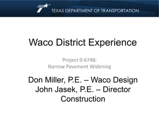
Narrow Pavement Widening - Waco District
- 1. Waco District Experience Project 0-6748: Narrow Pavement Widening Don Miller, P.E. – Waco Design John Jasek, P.E. – Director Construction
- 2. Waco District ‘Mixed Climate’ 30 – 35 inches rain (when not in drought) Hot in summer Cold in winter Some sulfate soils Heavy clays Heavy trucks
- 3. FM 56 Bosque County
- 6. FM 56 Before Widening
- 7. FM 56 Before Widening
- 8. FM 56 Before Widening
- 9. FM 56 During Construction
- 10. FM 56 During Construction
- 11. FM 56 During Construction
- 12. FM 56 During Construction
- 13. FM 56 During Construction
- 14. FM 56 During Construction
- 15. After level-up
- 16. After Seal Coat
- 17. FM 56 Finished Product
- 18. FM 56 Finished Product
- 19. Have Experienced Problems with pavement failures
- 21. FM 309 Hill County
- 24. FM 309 Finished Product
- 25. FM 309 Finished Product
- 26. FM 309 Experiencing joint cracking due to drought
- 27. FM 309 Experiencing joint cracking due to drought
- 28. Questions ???