Downloaded 23 times

![Level of Detail (LOD) definition for 3D city models [aus: Gröger, Kolbe & al.] More resolution, details cadastre, airborne LiDAR laser / LiDAR airborne LiDAR, photogrammetry Photogrammetry and ground LiDAR (building façades), hybrid methods ground LiDAR LIDAR: airborne LIght Detection And Ranging](https://image.slidesharecdn.com/3d-lidarepfliccsa08-1215624855827247-9/85/3-D-Lidar-Epfl-Iccsa-08-17-320.jpg)

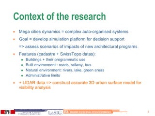
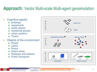
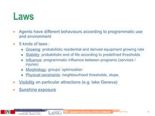
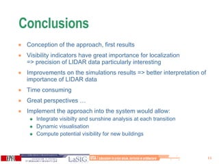
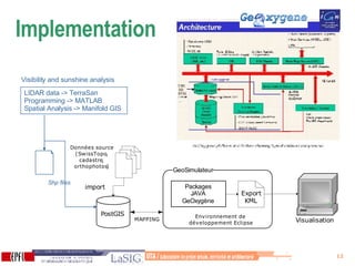
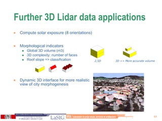
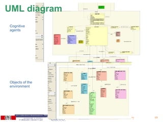
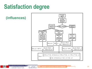
The document discusses using 3D LIDAR data and multi-agent geosimulation to model urban morphogenesis and assess the impacts of new development scenarios. Key aspects include developing an accurate 3D surface model from LIDAR and cadaster data to analyze visibility and sunlight exposure. Agents representing buildings and urban elements interact based on programmed behaviors and environmental factors. Preliminary results show visibility is an important parameter and LIDAR data provides precision, though computations are time-consuming. Further applications of high-resolution 3D LIDAR data could improve simulation accuracy and dynamic visualization.