3 4 land management_giz
•Download as PPTX, PDF•
1 like•349 views

1. The document summarizes a presentation on land issues and management in Laos from the perspectives of government planners and GIZ land programs. 2. It discusses the challenges of balancing economic development, social development, and environmental protection in land use planning. 3. It also introduces tools to identify and assess "land issues hotspots", including the Area Physical Framework and Land Issues and Conflict Identification and Assessment methodology supported by GIZ programs.

Recommended
Recommended
More Related Content
What's hot
What's hot (20)
Similar to 3 4 land management_giz
Similar to 3 4 land management_giz (20)
More from mrlgregion
More from mrlgregion (20)
Recently uploaded
Recently uploaded (20)
3 4 land management_giz
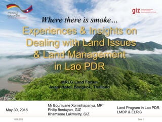
- 1. Seite 1 Where there is smoke… Experiences & Insights on Dealing with Land Issues & Land Management in Lao PDR MRLG Land Forum Avani Hotel, Bangkok, Thailand 14.06.2018 May 30, 2018 Mr Bounluane Xomsihapanya, MPI Philip Bontuyan, GIZ Khamsone Lakmaitry, GIZ Land Program in Lao PDR LMDP & ELTeS
- 2. Seite 2 Outline 14.06.2018 1. Land Management: from a Government Planner’s perspective 2. GIZ Land Program: support to improving land management in Laos 3. Experiences in Land Issues & Conflict Hotspot Identification and Assessment (LICHIA) 4. Results and recommendations
- 3. Seite 3 Mr Bounluane Xomsihapanya Director, PDPI Sayaboury Province Lao PDR Management of Land & Monitoring of Land Issues in Sayaboury Province: a Government Planner’s Perspective 14.06.2018 May 30, 2018
- 4. Seite 4
- 5. Seite 5
- 6. Seite 6 Good Land Management, Land Rights & Land Tenure Security are important & serious concerns of the Lao Government
- 7. Seite 7 Development Planners’ Triangle: 3 Competing Priorities & Conflicts The key task of the Planning Department is enable the govt to strike a balance between the competing priorities and achieve our development goals. Social Development Economic Development Environment Conservation Resource Conflict Sustainable Growth & Development Example: Swidden farming or forest protection Example: Mining, Hydropower, Factories & Agri Plantations Example: land concessions. Resettlement & mega-projects
- 8. Seite 8 Key Challenges in Land Management & Development 14.06.2018 1. Achievement of our SEDP 2015-2020 Goals of balanced sustainable growth - to promote high and sustainable growth whilst ensuring equitable benefits, especially for the poor and rural populations & ensuring environmental conservation. 2. Effective and proactive promotion, monitoring and management of investment on land by the private sector to ensure quality and optimum benefit to our people and economy. 3. Strategic land use planning that considers best and optimum use of landscapes and resources, considering the following: • Limited capacity development of local authorities and agencies (e.g. spatial planning, GIS & mapping, investment monitoring • Lack of proper tools and methodology to do better land planning, monitoring & overall land management 4. Ensure active and meaningful participation of local communities and groups in matters related to land management, land allocation, investment monitoring and land governance.
- 9. Seite 9 State Institutions & Mechanisms that deal with Land Issues and Disputes 6/14/2018 Channels Village District Province National Judicial Village Mediation Committee (quasi-judicial) District People’s Court District Prosecutor Provincial People’s Court Provincial Prosecutor People’s Supreme Court General Prosecutor Executive/ Political Village Chief (Naiban) District Governor Provincial Governor Prime Minister Executive/ Administrative Village Administrative Committee District Office of Natural Resources & Environment (DONRE) Provincial Office of Natural Resources & Environment (PONRE) Line Ministries Department of Land (DOL) Ad hoc Committees/ Bodies Village Committee for Settlement of Land Conflicts District Committee for Settlement of Land Conflicts Provincial Committee for Settlement of Land Conflicts Legislative Provincial People’s Council Complaints Division of the National Assembly - Hotline Party Mechanisms Village Party Committee Village Inspection Committee Grassroots Party Building Committee District Party Committee District Inspection Committee District Committee for Protection of Law Provincial Party Committee Provincial Inspection Committee Central Committee National Inspection Committee
- 10. Seite 10 Responding to the call of the Lao government to improve land management and land governance in Lao PDR The GIZ Land Program 14.06.2018 May 30, 2018 Philip Bontuyan, GIZ Khamsone Lakmaitry, GIZ Land Program in Lao PDR LMDP & ELTeS
- 11. Seite 11 Integrated Land Management Interventions in Lao PDR Systematic Land Registration Village Land Use Planning SEDP & District Area Physical Framework National Land Policy Macro Meso Micro Improving & Linking Government Land Management Policy, Planning & Tools in Lao PDR VGGT General Principles 3A 3.1.1 Recognize & respect tenure rights 3.1.2 Safeguard against infringement 3.1.5 Prevent disputes & conflict VGGT Implementation Principles 3B 3.4 Gender equality 3.5 Holistic & sustainable approaches 3.6 Consultation & participation 3.7 Rule of law 3.8 Transparency 3.10 Continuous improvement AIM: To develop & pilot Systematic Improvements to Land Management systems In Lao PDR for better land tenure security and land rights protection Investment Monitoring & Planning
- 12. Seite 1214.06.2018 Area Physical Framework What and Why?
- 13. Seite 1314.06.2018 Area Physical Framework What and Why? Conservation Forest (NBCA) Protection Forest Production Forest Agriculture & Built Up Areas Military Land
- 14. Seite 1414.06.2018 Area Physical Framework What and Why? Protection Forest Production Forest Military Land Agriculture & Built Up Areas Conservation Forest (NBCA)
- 15. Seite 1514.06.2018 Area Physical Framework: A Strategic Land Management Tool for Local Authorities
- 16. Seite 16 59,163 Area Physical Framework: A Strategic Land Management Tool for Local Authorities
- 17. Seite 1714.06.2018 Using UAS to support Identification of Land Issues & Hotspots 14.06.2018 Phiang District HOTSPOT #02 Phiang District HOTSPOT #01 Phiang District HOTSPOT #03 (Phiang District COLDSPOT #01)
- 18. Seite 18 What is a Land Issues HOTSPOT? 14.06.2018 1. There is prevalence of land-related issues or disputes between claimants especially affecting specific vulnerable populations such as ethnic groups and small landholders. 2. The land issue is causing significant harm to the environment 3. People’s livelihood are affected or hampered due to competing claims and their land tenure is insecure. 4. Disputes trigger conflicts, violence and disharmony in the community.
- 19. Seite 19 Logging & Livestock Farming Siltation & clogging of rivers and irrigation canals Public Infrastructure Investment affected Siltation & clogging of rivers and irrigation canals Food Production Target unreachable Siltation & clogging of rivers and irrigation canals Rice production decrease. Irrigation available in rainy season only Siltation & clogging of rivers and irrigation canals Siltation & clogging of rivers and irrigation canals PLUP & Land Registration (LR) Activities in 6 villages Using APF in Identifying Land Issues Hotspots
- 20. Seite 20 Namtarn Irrigation Scheme, Phieng District, Sayaboury Province
- 21. Seite 21 Orthomosaic & elevation analysis: Namtan Irrigation Image Resolution 2.35 cm/pixel
- 22. Seite 22 Social Development Economic Development Environmental Protection Resource Conflict Sustainable Development Phiang District HOTSPOT #02 Identifying Land Issues & Hotspots
- 23. Seite 23 Using APF in Identifying Land Issues & Hotspots Google Earth Satellite Image Identifying Land Issues & Hotspots
- 24. Seite 2414.06.2018 Navaene Village, Phieng District, Sayaboury Province Identifying Land Issues & Hotspots
- 25. Seite 25 Identifying Land Issues & Hotspots Navaene Village, Phieng District, Sayaboury Province
- 26. Seite 26 Identifying Land Issues & Hotspots Phiang District HOTSPOT #02 Yeenong Banana Plantation, Phieng District, Sayaboury Province
- 27. Seite 27 Identifying Land Issues & Hotspots Yeenong Banana Plantation, Phieng District, Sayaboury Province
- 28. Seite 28 Where are the Hotspot Areas? 14.06.2018 • Hotspots that deal with land tenure in protected areas: 2 • Navene, Phiang District, Sayaboury • Khaen, Thongmixay District, Sayaboury • Hotspots that deal with private investment: 3 • Xaghi-Kalang, Long District, Sayaboury • Thongkap, Xienghone District, Sayaboury • Mom, Sing District, Luangnamtha • Hotspots that deal with environmental issues: 1 • Kiewkham, Phiang District, Sayaboury • Hotspots that deal with resettled populations: 2 • Namphieng, Boten District, Sayaboury • Phouluang, Nalae District, Luangnamtha
- 29. Seite 29 Final Words… 14.06.2018 • APF & LICHIA – has been useful in moving towards a more rational and systematic land planning, and land issues management. It complements well with LUP, Land Registration and SEDP. • Improvement to Land Management system is a work-in-progress which shall be: • Driven by policy and strategy – SDG, SEDP and various laws and policies related to land • Transparent, Inclusive, Participatory (TIP) – involving stakeholders, especially parties to land disputes • Landscape & Reality-Based - using reliable data on objective land conditions and landscape characteristics on the ground. • Optimal use of appropriate technology and tools – for better informed decision- making • Practical System design – within level of capacity. Growing the sophistication & complexity as capacity and application intensity increases. • Lao Government, especially the provincial & district authorities have been instrumental in pushing & championing the development and application of these land management tool.
- 30. Seite 30 Thank you for your attention. Kopchai lalai 14.06.2018
- 31. Seite 3114.06.2018 As a federal enterprise, GIZ supports the German Government in achieving its objectives in the field of international cooperation for sustainable development. Published by Deutsche Gesellschaft für Internationale Zusammenarbeit (GIZ) GmbH Registered offices, Bonn and Eschborn, Germany Integrated Rural Development in Poverty Regions of Laos (NU-IRDP) c/o Lao-German House Vientiane Capital Lao PDR T +856 21 313716 E giz-laos@giz.de I www.giz.de Responsible Dr. Dietmar Herbon Author(s) Philip Bontuyan Bounluane Xomsihapanya Khamsone Lakmaitry Photo credits © GIZ Thank you for your attention! BMZ Delegation Briefing Nov 2016
Editor's Notes
- Good morning everybody. I’m here to present our Concepts and Experiences in the LMDP and ELTeS Programs in Lao PDR. This will be a 2 part presentation. I will provide more context of our programs and show some of the activities that we do, some of which we believe are innovations in land management and land governance.
- Laos has plenty of land and natural resources. Perhaps it is this bounty that makes our people feel that there is more than enough land for everybody. There is not such phenomenon of “landlessness” in my country.
- Village Inspection Committee (Kana Kuat Kar Kan Ban) District Committee for Protection of Law (Kana Pok Pong Kot May) Village Grassroots Party Building Committee (Kana Ko Saang Harktarn)
- Province: Sayaboury Land Area: 16,389 km2 Population: 384,000 Density: 23 per km2
- PIP Monitoring - Irrigation system – This Production Forest according to We flu the drone to see the problem: Conflict Reservation VS Production Identify land Issues - Navaene: Land use inside the NBCA – Actual image from aerial photo Banana: Large plantation of 500 ha. Use of area along the river bank
- Not entirely “objective”.
- LICHIA = Land Issues & Conflicts Hotspots Identification & Analysis UAS = Unmanned Aerial System (or “drones”)